Volume 4 — CHAPTER II—SYRIA AT THE BEGINNING OF THE EGYPTIAN CONQUEST
M. L. McClure translation
Nineveh and the first Cossæan kings—The peoples of Syria, their towns, their civilization, their religion—Phoenicia.
The world beyond the Arabian desert presented to the eyes of the enterprising Pharaohs an active and bustling scene. Babylonian civilization still maintained its hold there without a rival, but Babylonian rule had ceased to exercise any longer a direct control, having probably disappeared with the sovereigns who had introduced it. When Ammisatana died, about the year 2099, the line of Khammurabi became extinct, and a family from the Sea-lands came into power.*
* The origin of this second dynasty and the reading of its name still afford matter for discussion. Amid the many conflicting opinions, it behoves us to remember that Gulkishar, the only prince of this dynasty whose title we possess, calls himself King of the Country of the Sea, that is to say, of the marshy country at the mouth of the Euphrates: this simple fact directs us to seek the cradle of the family in those districts of Southern Chaldæa. Sayce rejects this identification on philological and chronological grounds, and sees in Gulkishar, “King of the Sea-lands,” a vassal Kaldâ prince.
This unexpected revolution of affairs did not by any means restore to the cities of Lower Chaldæa the supreme authority which they once possessed. Babylon had made such good use of its centuries of rule that it had gained upon its rivals, and was not likely now to fall back into a secondary place. Henceforward, no matter what dynasty came into power, as soon as the fortune of war had placed it upon the throne, Babylon succeeded in adopting it, and at once made it its own. The new lord of the country, Ilumaîlu, having abandoned his patrimonial inheritance, came to reside near to Merodach.*
* The name has been read An-ma-an or Anman by Pinches, subsequently Ilumaîlu, Mailu, finally Anumaîlu and perhaps Humaîlu. The true reading of it is still unknown. Hommel believed he had discovered in Hilprecht’s book an inscription belonging to the reign of this prince; but Hilprecht has shown that it belonged to a king of Erech, An-a-an, anterior to the time of An-ma-an.
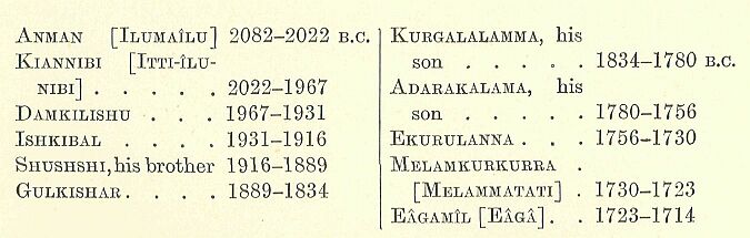
He was followed during the four next centuries by a dynasty of ten princes, in uninterrupted succession. Their rule was introduced and maintained without serious opposition. The small principalities of the south were theirs by right, and the only town which might have caused them any trouble—Assur—was dependent on them, being satisfied with the title of vicegerents for its princes,—Khallu, Irishum, Ismidagan and his son Sarnsiramman I., Igurkapkapu and his son Sarnsiramman II.* As to the course of events beyond the Khabur, and any efforts Ilumaîlu’s descendants may have made to establish their authority in the direction of the Mediterranean, we have no inscriptions to inform us, and must be content to remain in ignorance. The last two of these princes, Melamkurkurra and Eâgamîl, were not connected with each other, and had no direct relationship with their predecessors.** The shortness of their reigns presents a striking contrast with the length of those preceding them, and probably indicates a period of war or revolution. When these princes disappeared, we know not how or why, about the year 1714 B.C., they were succeeded by a king of foreign extraction; and one of the semi-barbarous race of Kashshu ascended the throne which had been occupied since the days of Khammurabi by Chaldæans of ancient stock.***
* Inscription of Irishum, son of Khallu, on a brick found at Kalah-Shergat, and an inscription of Sarnsiramman II., son of Igurkapkapu, on another brick from the same place. Sarnsiramman I. and his father Ismidagan are mentioned in the great inscription of Tiglath-pileser II., as having lived 641 years before King Assurdân, who himself had preceded Tiglath-pileser by sixty years: they thus reigned between 1900 and 1800 years before our era, according to tradition, whose authenticity we have no other means of verifying. ** The name of the last is read Eâgamîl, for want of anything better: Oppert makes it Eâgâ, simply transcribing the signs; and Hilprecht, who took up the question again after him, has no reading to propose. *** I give here the list of the kings of the second dynasty, from the documents discovered by Pinches: No monument remains of any of these princes, and even the reading of their names is merely provisional: those placed between brackets represent Delitzsch’s readings. A Gulkishar is mentioned in an inscription of Belnadiuabal; but Jensen is doubtful if the Gulkishar mentioned in this place is identical with the one in the lists.
These Kashshu, who spring up suddenly out of obscurity, had from the earliest times inhabited the mountainous districts of Zagros, on the confines of Elymai’s and Media, where the Cossæans of the classical historians flourished in the time of Alexander.*
* The Kashshu are identified with the Cossæans by Sayce, by Schrader, by Fr. Delitzsch, by Halévy, by Tiele, by Hommel, and by Jensen. Oppert maintains that they answer to the Kissians of Herodotus, that is to say, to the inhabitants of the district of which Susa is the capital. Lehmann supports this opinion. Winckler gives none, and several Assyriologists incline to that of Kiepert, according to which the Kissians are identical with the Cossæans.
It was a rugged and unattractive country, protected by nature and easy to defend, made up as it was of narrow tortuous valleys, of plains of moderate extent but of rare fertility, of mountain chains whose grim sides were covered with forests, and whose peaks were snow-crowned during half the year, and of rivers, or, more correctly speaking, torrents, for the rains and the melting of the snow rendered them impassable in spring and autumn. The entrance to this region was by two or three well-fortified passes: if an enemy were unwilling to incur the loss of time and men needed to carry these by main force, he had to make a detour by narrow goat-tracks, along which the assailants were obliged to advance in single file, as best they could, exposed to the assaults of a foe concealed among the rocks and trees. The tribes who were entrenched behind this natural rampart made frequent and unexpected raids upon the marshy meadows and fat pastures of Chaldæa: they dashed through the country, pillaging and burning all that came in their way, and then, quickly regaining their hiding-places, were able to place their booty in safety before the frontier garrisons had recovered from the first alarm.* These tribes were governed by numerous chiefs acknowledging a single king—ianzi—whose will was supreme over nearly the whole country:** some of them had a slight veneer of Chaldæan civilization, while among the rest almost every stage of barbarism might be found. The remains of their language show that it was remotely allied to the dialect of Susa, and contained many Semitic words.*** What is recorded of their religion reaches us merely at second hand, and the groundwork of it has doubtless been modified by the Babylonian scribes who have transmitted it to us.****
* It was thus in the time of Alexander and his successors, and the information given by the classical historians about this period is equally applicable to earlier times, as we may conclude from the numerous passages from Assyrian inscriptions which have been collected by Fr. Delitzsch. ** Delitzsch conjectures that Ianzi, or Ianzu, had become a kind of proper name, analogous to the term Pharaoh employed by the Egyptians. *** A certain number of Cossæan words has been preserved and translated, some in one of the royal Babylonian lists, and some on a tablet in the British Museum, discovered and interpreted by Fr. Delitzsch. Several Assyriologists think that they showed a marked affinity with the idiom of the Susa inscriptions, and with that of the Achæmenian inscriptions of the second type; others deny the proposed connection, or suggest that the Cossæan language was a Semitic dialect, related to the Chaldæo-Assyrian. Oppert, who was the first to point out the existence of this dialect, thirty years ago, believed it to be the Elamite; he still persists in his opinion, and has published several notes in defence of it. **** It has been studied by Pr. Delitzsch, who insists on the influence which daily intercourse with the Chaldæans had on it after the conquest; Halévy, in most of the names of the gods given as Cossæan, sees merely the names of Chaldæan divinities slightly disguised in the writing.
They worshipped twelve great gods, of whom the chief—Kashshu, the lord of heaven-gave his name to the principal tribe, and possibly to the whole race:* Shûmalia, queen of the snowy heights, was enthroned beside him,** and the divinities next in order were, as in the cities of the Euphrates, the Moon, the Sun (Sakh or Shuriash), the air or the tempest (Ubriash), and Khudkha.*** Then followed the stellar deities or secondary incarnations of the sun,—Mirizir, who represented both Istar and Beltis; and Khala, answering to Gula.****
* The existence of Kashshu is proved by the name of Kashshunadinakhé: Ashshur also bore a name identical with that of his worshippers. ** She is mentioned in a rescript of Nebuchadrezzar I., at the head of the gods of Namar, that is to say, the Cossæan deities, as “the lady of the shining mountains, the inhabitants of the summits, the frequenter of peaks.” She is called Shimalia in Rawlinson, but Delitzsch has restored her name which was slightly mutilated; one of her statues was taken by Samsirammân III., King of Assyria, in one of that sovereign’s campaigns against Chaldæa. *** All these identifications are furnished by the glossary of Delitzsch. Ubriash, under the form of Buriash, is met with in a large number of proper names, Burnaburiash, Shagashaltiburiash, Ulamburiash, Kadashmanburiash, where the Assyrian scribe translates it Bel-matâti, lord of the world: Buriash is, therefore, an epithet of the god who was called Rammân in Chaldæa. The name of the moon-god is mutilated, and only the initial syllable Shi... remains, followed by an indistinct sign: it has not yet been restored. **** Halévy considers Khala, or Khali, as a harsh form of Gula: if this is the case, the Cossæans must have borrowed the name, and perhaps the goddess herself, from their Chaldæan neighbours.
The Chaldæan Ninip corresponded both to Gidar and Maruttash, Bel to Kharbe and Turgu, Merodach to Shipak, Nergal to Shugab.* The Cossæan kings, already enriched by the spoils of their neighbours, and supported by a warlike youth, eager to enlist under their banner at the first call,** must have been often tempted to quit their barren domains and to swoop down on the rich country which lay at their feet. We are ignorant of the course of events which, towards the close of the XVIIIth century B.C., led to their gaining possession of it. The Cossæan king who seized on Babylon was named Gandish, and the few inscriptions we possess of his reign are cut with a clumsiness that betrays the barbarism of the conqueror. They cover the pivot stones on which Sargon of Agadê or one of the Bursins had hung the doors of the temple of Nippur, but which Gandish dedicated afresh in order to win for himself, in the eyes of posterity, the credit of the work of these sovereigns.***
* Hilprecht has established the identity of Turgu with Bel of Nippur. ** Strabo relates, from some forgotten historian of Alexander, that the Cossæans “had formerly been able to place as many as thirteen thousand archers in line, in the wars which they waged with the help of the Elymæans against the inhabitants of Susa and Babylon.” *** The full name of this king, Gandish or Gandash, which is furnished by the royal lists, is written Gaddash on a monument in the British Museum discovered by Pinches, whose conclusions have been erroneously denied by Winckler. A process of abbreviation, of which there are examples in the names of other kings of the same dynasty, reduced the name to Gandê in the current language.
Bel found favour in the eyes of the Cossæans who saw in him Kharbê or Turgu, the recognised patron of their royal family: for this reason Gandish and his successors regarded Bel with peculiar devotion. These kings did all they could for the decoration and endowment of the ancient temple of Ekur, which had been somewhat neglected by the sovereigns of purely Babylonian extraction, and this devotion to one of the most venerated Chaldæan sanctuaries contributed largely towards their winning the hearts of the conquered people.*
* Hilpreoht calls attention on this point to the fact that no one has yet discovered at Nippur a single ex-voto consecrated by any king of the two first Babylonian dynasties.
The Cossæan rule over the countries of the Euphrates was doubtless similar in its beginnings to that which the Hyksôs exercised at first over the nomes of Egypt. The Cossæan kings did not merely bring with them an army to protect their persons, or to occupy a small number of important posts; they were followed by the whole nation, and spread themselves over the entire country. The bulk of the invaders instinctively betook themselves to districts where, if they could not resume the kind of life to which they were accustomed in their own land, they could, at least give full rein to their love of a free and wild existence. As there were no mountains in the country, they turned to the marshes, and, like the Hyksôs in Egypt, made themselves at home about the mouths of the rivers, on the half-submerged low lands, and on the sandy islets of the lagoons which formed an undefined borderland between the alluvial region and the Persian Gulf. The covert afforded, by the thickets furnished scope for the chase which these hunters had been accustomed to pursue in the depths of their native forests, while fishing, on the other hand, supplied them with an additional element of food. When their depredations drew down upon them reprisals from their neighbours, the mounds occupied, by their fortresses, and surrounded by muddy swamps, offered them almost as secure retreats as their former strongholds on the lofty sides of the Zagros. They made alliances with the native Aramæans—with those Kashdi, properly called Chaldæans, whose name we have imposed upon all the nations who, from a very early date, bore rule on the banks of the Lower Euphrates. Here they formed themselves into a State—Karduniash—whose princes at times rebelled, against all external authority, and at other times acknowledged the sovereignty of the Babylonian monarchs.*
* The state of Karduniash, whose name appears for the first time on the monuments of the Cossæan period, has been localised in a somewhat vague manner, in the south of Babylonia, in the country of the Kashdi, and afterwards formally identified with the Countries of the Sea, and with the principality which was called Bît-Yâkin in the Assyrian period. In the Tel-el-Amarna tablets the name is already applied to the entire country occupied by the Cossæan kings or their descendants, that is to say, to the whole of Babylonia. Sargon II. at that time distinguishes between an Upper and a Lower Karduniash; and in consequence the earliest Assyriologists considered it as an Assyrian designation of Babylon, or of the district surrounding it, an opinion which was opposed by Delitzsch, as he believed it to be an indigenous term which at first indicated the district round Babylon, and afterwards the whole of Babylonia. From one frequent spelling of the name, the meaning appears to have been Fortress of Duniash; to this Delitzsch preferred the translation Garden of Duniash, from an erroneous different reading—Ganduniash: Duniash, at first derived from a Chaldæan God Dun, whose name may exist in Dunghi, is a Cossæan name, which the Assyrians translated, as they did Buriash, Belmatâti, lord of the country. Winckler rejects the ancient etymology, and proposes to divide the word as Kardu-niash and to see in it a Cossæan translation of the expression mât-kaldi, country of the Caldæans: Hommel on his side, as well as Delitzsch, had thought of seeking in the Chaldæans proper—Kaldi for Kashdi, or Kash-da, “domain of the Cossæans “—the descendants of the Cossæans of Karduniash, at least as far as race is concerned. In the cuneiform texts the name is written Kara—D. P. Duniyas, “the Wall of the god Duniyas” (cf. the Median Wall or Wall of Semiramis which defended Babylonia on the north).
The people of Sumir and Akkad, already a composite of many different races, absorbed thus another foreign element, which, while modifying its homogeneity, did not destroy its natural character. Those Cossæan tribes who had not quitted their own country retained their original barbarism, but the hope of plunder constantly drew them from their haunts, and they attacked and devastated the cities of the plain unhindered by the thought that they were now inhabited by their fellow-countrymen. The raid once over, many of them did not return home, but took service under some distant foreign ruler—the Syrian princes attracting many, who subsequently became the backbone of their armies,* while others remained at Babylon and enrolled themselves in the body-guard of the kings.
* Halévy has at least proved that the Khabiri mentioned in. the Tel el-Amarna tablets were Cossæans, contrary to the opinion of Sayce, who makes them tribes grouped round Hebron, which W. Max Müller seems to accept; Winckler, returning to an old opinion, believes them to have been Hebrews.
To the last they were an undisciplined militia, dangerous, and difficult to please: one day they would hail their chiefs with acclamations, to kill them the next in one of those sudden outbreaks in which they were accustomed to make and unmake their kings.* The first invaders were not long in acquiring, by means of daily intercourse with the old inhabitants, the new civilization: sooner or later they became blended with the natives, losing all their own peculiarities, with the exception of their outlandish names, a few heroic legends,** and the worship of two or three gods—Shûmalia, Shugab, and Shukamuna.
* This is the opinion of Hommel, supported by the testimony of the Synchronous Hist.: in this latter document the Cossæans are found revolting against King Kadashmankharbé, and replacing him on the throne by a certain Nazibugash, who was of obscure origin. ** Pr. Delitzsch and Schrader compare their name with that of Kush, who appears in the Bible as the father of Nimrod (Gen. x. 8-12); Hommel and Sayce think that the history of Nimrod is a reminiscence of the Cossæan rule. Jensen is alone in his attempt to attribute to the Cossæans the first idea of the epic of Gilgames.
As in the case of the Hyksôs in Africa, the barbarian conquerors thus became merged in the more civilized people which they had subdued. This work of assimilation seems at first to have occupied the whole attention of both races, for the immediate successors of Gandish were unable to retain under their rule all the provinces of which the empire was formerly composed. They continued to possess the territory situated on the middle course of the Euphrates as far as the mouth of the Balikh, but they lost the region extending to the east of the Khabur, at the foot of the Masios, and in the upper basin of the Tigris: the vicegerents of Assur also withdrew from them, and, declaring that they owed no obedience excepting to the god of their city, assumed the royal dignity. The first four of these kings whose names have come down to us, Sulili, Belkapkapu, Adasi, and Belbâni,* appear to have been but indifferent rulers, but they knew bow to hold their own against the attacks of their neighbours, and when, after a century of weakness and inactivity, Babylon reasserted herself, and endeavoured to recover her lost territory, they had so completely established their independence that every attack on it was unsuccessful. The Cossæan king at that time—an active and enterprising prince, whose name was held in honour up to the days of the Ninevite supremacy—was Agumkakrimê, the son of Tassigurumash.**
* These four names do not so much represent four consecutive reigns as two separate traditions which were current respecting the beginnings of Assyrian royalty. The most ancient of them gives the chief place to two personages named Belkapkapu and Sulili; this tradition has been transmitted to us by Rammânnirâri III., because it connected the origin of his race with these kings. The second tradition placed a certain Belbâni, the son of Adasi, in the room of Belkapkapu and Sulili: Esarhaddon made use of it in order to ascribe to his own family an antiquity at least equal to that of the family to which Rammânnirâri III. belonged. Each king appropriated from the ancient popular traditions those names which seemed to him best calculated to enhance the prestige of his dynasty, but we cannot tell how far the personages selected enjoyed an authentic historical existence: it is best to admit them at least provisionally into the royal series, without trusting too much to what is related of them. ** The tablet discovered by Pinches is broken after the fifth king of the dynasty. The inscription of Agumkakrimê, containing a genealogy of this prince which goes back as far as the fifth generation, has led to the restoration of the earlier part of the list as follows: Gandish, Gaddash, Adumitasii .... 1655-? B.C. Gandê ........................... 1714-1707 B.C. Tassigurumash.................... ? Agumrabi, his son................ 1707-1685 Agumkakrimê ..................... ? [A]guyashi ...................... 1685-1663 Ushshi, his son.................. 1663-1655
This “brilliant scion of Shukamuna” entitled himself lord of the Kashshu and of Akkad, of Babylon the widespread, of Padan, of Alman, and of the swarthy Guti.* Ashnunak had been devastated; he repeopled it, and the four “houses of the world” rendered him obedience; on the other hand, Elam revolted from its allegiance, Assur resisted him, and if he still exercised some semblance of authority over Northern Syria, it was owing to a traditional respect which the towns of that country voluntarily rendered to him, but which did not involve either subjection or control. The people of Khâni still retained possession of the statues of Merodach and of his consort Zarpanit, which had been stolen, we know not how, some time previously from Chaldæa.** Agumkakrimê recovered them and replaced them in their proper temple. This was an important event, and earned him the good will of the priests.
* The translation black-headed, i.e. dark-haired and complexioned, Guti, is uncertain; Jensen interprets the epithet nishi saldati to mean “the Guti, stupid (foolish? culpable?) people.” The Guti held both banks of the lower Zab, in the mountains on the east of Assyria. Delitzsch has placed Padan and Alman in the mountains to the east of the Diyâleh; Jensen places them in the chain of the Khamrîn, and Winckler compares Alman or Halman with the Holwân of the present day. ** The Khâni have been placed by Delitzsch in the neighbourhood of Mount Khâna, mentioned in the accounts of the Assyrian campaigns, that is to say, in the Amanos, between the Euphrates and the bay of Alexandretta: he is inclined to regard the name as a form of that of the Khâti.
The king reorganised public worship; he caused new fittings for the temples to be made to take the place of those which had disappeared, and the inscription which records this work enumerates with satisfaction the large quantities of crystal, jasper, and lapis-lazuli which he lavished on the sanctuary, the utensils of silver and gold which he dedicated, together with the “seas” of wrought bronze decorated with monsters and religious emblems.* This restoration of the statues, so flattering to the national pride and piety, would have been exacted and insisted upon by a Khammurabi at the point of the sword, but Agumkakrimê doubtless felt that he was not strong enough to run the risk of war; he therefore sent an embassy to the Khâni, and such was the prestige which the name of Babylon still possessed, from the deserts of the Caspian to the shores of the Mediterranean, that he was able to obtain a concession from that people which he would probably have been powerless to extort by force of arms.**
* We do not possess the original of the inscription which tells us of these facts, but merely an early copy. ** Strictly speaking, one might suppose that a war took place; but most Assyriologists declare unhesitatingly that there was merely an embassy and a diplomatic negotiation.
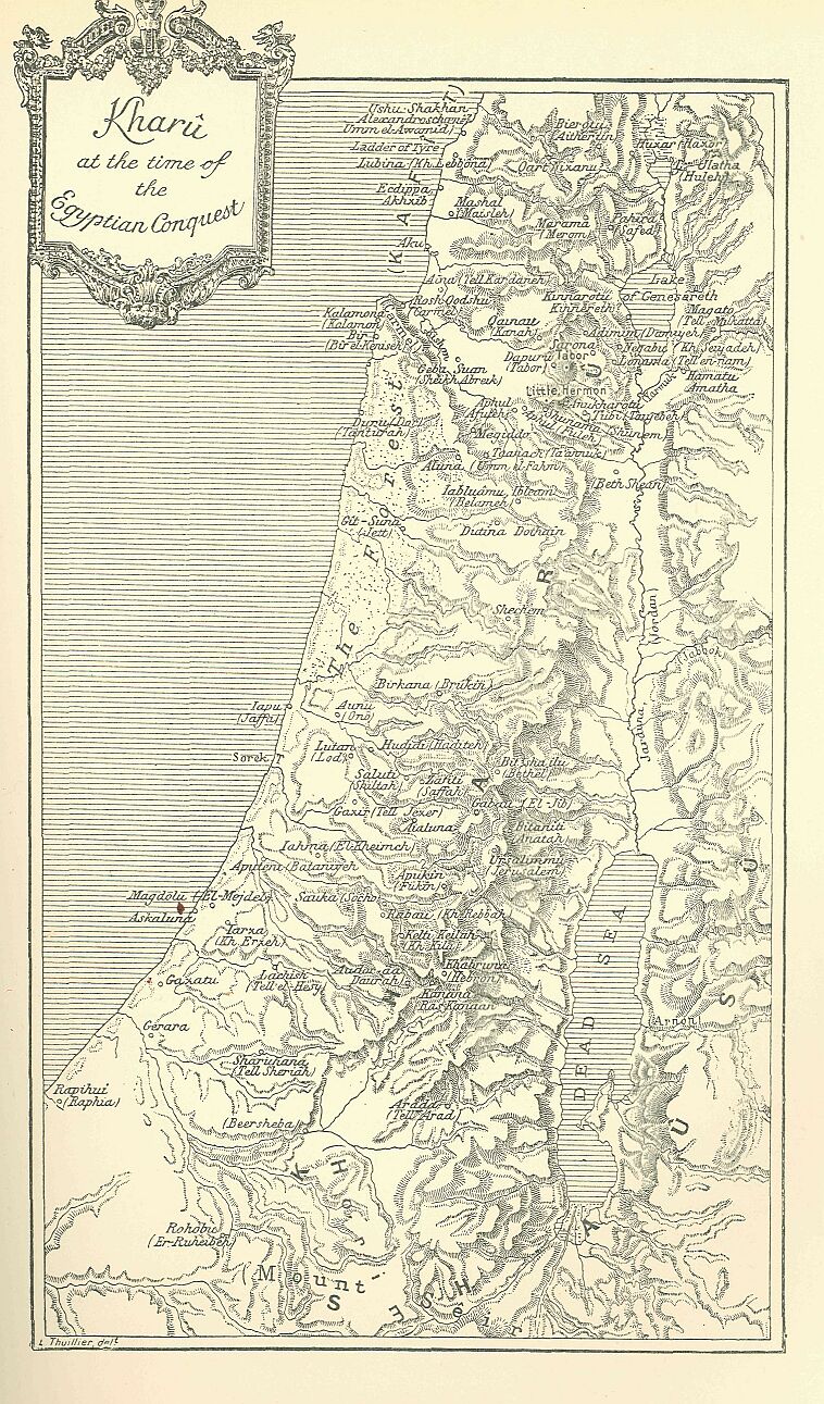
The Egyptians had, therefore, no need to anticipate Chaldæan interference when, forsaking their ancient traditions, they penetrated for the first time into the heart of Syria. Not only was Babylon no longer supreme there, but the coalition of those cities on which she had depended for help in subduing the West was partially dissolved, and the foreign princes who had succeeded to her patrimony were so far conscious of their weakness, that they voluntarily kept aloof from the countries in which, previous to their advent, Babylon had held undivided sway. The Egyptian conquest of Syria had already begun in the days of Agumkakrimê, and it is possible that dread of the Pharaoh was one of the chief causes which influenced the Cossæans to return a favourable answer to the Khâni. Thûtmosis I., on entering Syria, encountered therefore only the native levies, and it must be admitted that, in spite of their renowned courage, they were not likely to prove formidable adversaries in Egyptian estimation. Not one of the local Syrian dynasties was sufficiently powerful to collect all the forces of the country around its chief, so as to oppose a compact body of troops to the attack of the African armies. The whole country consisted of a collection of petty states, a complex group of peoples and territories which even the Egyptians themselves never completely succeeded in disentangling. They classed the inhabitants, however, under three or four very comprehensive names—Kharû, Zahi, Lotanû, and Kefâtiû—all of which frequently recur in the inscriptions, but without having always that exactness of meaning we look for in geographical terms. As was often the case in similar circumstances, these names were used at first to denote the districts close to the Egyptian frontier with which the inhabitants of the Delta had constant intercourse. The Kefâtiû seem to have been at the outset the people of the sea-coast, more especially of the region occupied later by the Phoenicians, but all the tribes with whom the Phoenicians came in contact on the Asiatic and European border were before long included under the same name.*
* The Kefâtiû, whose name was first read Kefa, and later Kefto, were originally identified with the inhabitants of Cyprus or Crete, and subsequently with those of Cilicia, although the decree of Canopus locates them in Phoenicia.
Zahi originally comprised that portion of the desert and of the maritime plain on the north-east of Egypt which was coasted by the fleets, or traversed by the armies of Egypt, as they passed to and fro between Syria and the banks of the Nile. This region had been ravaged by Ahmosis during his raid upon Sharuhana, the year after the fall of Avaris. To the south-east of Zahi lay Kharû; it included the greater part of Mount Seir, whose wadys, thinly dotted over with oases, were inhabited by tribes of more or less stationary habits. The approaches to it were protected by a few towns, or rather fortified villages, built in the neighbourhood of springs, and surrounded by cultivated fields and poverty-stricken gardens; but the bulk of the people lived in tents or in caves on the mountain-sides. The Egyptians constantly confounded those Khauri, whom the Hebrews in after-times found scattered among the children of Edom, with the other tribes of Bedouin marauders, and designated them vaguely as Shaûsû. Lotanû lay beyond, to the north of Kharû and to the north-east of Zahi, among the hills which separate the “Shephelah” from the Jordan.*
* The name of Lotanû or Rotanû has been assigned by Brugsch to the Assyrians, but subsequently, by connecting it, more ingeniously than plausibly, with the Assyrian iltânu, he extended it to all the peoples of the north; we now know that in the texts it denotes the whole of Syria, and, more generally, all the peoples dwelling in the basins of the Orontes and the Euphrates. The attempt to connect the name Rotanû or Lotanû with that of the Edomite tribe of Lotan (Gen. xxxvi. 20, 22) was first made by P. de Saulcy; it was afterwards taken up by Haigh and adopted by Renan.
Drawn by Faucher-Gudin, from a photograph by Insinger.
As it was more remote from the isthmus, and formed the Egyptian horizon in that direction, all the new countries with which the Egyptians became acquainted beyond its northern limits were by degrees included under the one name of Lotanû, and this term was extended to comprise successively the entire valley of the Jordan, then that of the Orontes, and finally even that of the Euphrates. Lotanû became thenceforth a vague and fluctuating term, which the Egyptians applied indiscriminately to widely differing Asiatic nations, and to which they added another indefinite epithet when they desired to use it in a more limited sense: that part of Syria nearest to Egypt being in this case qualified as Upper Lotanû, while the towns and kingdoms further north were described as being in Lower Lotanû. In the same way the terms Zahi and Kharû were extended to cover other and more northerly regions. Zahi was applied to the coast as far as the mouth of the Nahr el-Kebir and to the country of the Lebanon which lay between the Mediterranean and the middle course of the Orontes. Kharû ran parallel to Zahi, but comprised the mountain district, and came to include most of the countries which were at first ranged under Upper Lotanû; it was never applied to the region beyond the neighbourhood of Mount Tabor, nor to the trans-Jordanie provinces. The three names in their wider sense preserved the same relation to each other as before, Zahi lying to the west and north-west of Kharû, and Lower Lotanû to the north of Kharû and north-east of Zahi, but the extension of meaning did not abolish the old conception of their position, and hence arose confusion in the minds of those who employed them; the scribes, for instance, who registered in some far-off Theban temple the victories of the Pharaoh would sometimes write Zahi where they should have inscribed Kharû, and it is a difficult matter for us always to detect their mistakes. It would be unjust to blame them too severely for their inaccuracies, for what means had they of determining the relative positions of that confusing collection of states with which the Egyptians came in contact as soon as they had set foot on Syrian soil?
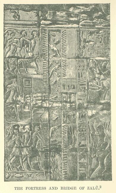
A choice of several routes into Asia, possessing unequal advantages, was open to the traveller, but the most direct of them passed through the town of Zalû. The old entrenchments running from the Ked Sea to the marshes of the Pelusiac branch still protected the isthmus, and beyond these, forming an additional defence, was a canal on the banks of which a fortress was constructed. This was occupied by the troops who guarded the frontier, and no traveller was allowed to pass without having declared his name and rank, signified the business which took him into Syria or Egypt, and shown the letters with which he was entrusted.*
* The notes of an official living at Zalu in the time of Mîneptah are preserved on the back of pls. v., vi. of the Anastasi Papyrus III,; his business was to keep a register of the movements of the comers and goers between Egypt and Syria during a few days of the month Pakhons, in the year III.
It was from Zalû that the Pharaohs set out with their troops, when summoned to Kharû by a hostile confederacy; it was to Zalû they returned triumphant after the campaign, and there, at the gates of the town, they were welcomed by the magnates of the kingdom. The road ran for some distance over a region which was covered by the inundation of the Nile during six months of the year; it then turned eastward, and for some distance skirted the sea-shore, passing between the Mediterranean and the swamp which writers of the Greek period called the Lake of Sirbonis.*
* The Sirbonian Lake is sometimes half full of water, sometimes almost entirely dry; at the present time it bears the name of Sebkhat Berdawil, from King Baldwin I. of Jerusalem, who on his return from his Egyptian campaign died on its shores, in 1148, before he could reach El-Artsh.
This stage of the journey was beset with difficulties, for the Sirbonian Lake did not always present the same aspect, and its margins were constantly shifting. When the canals which connected it with the open sea happened to become obstructed, the sheet of water subsided from evaporation, leaving in many places merely an expanse of shifting mud, often concealed under the sand which the wind brought up from the desert. Travellers ran imminent risk of sinking in this quagmire, and the Greek historians tell of large armies being almost entirely swallowed up in it. About halfway along the length of the lake rose the solitary hill of Mount Casios; beyond this the sea-coast widened till it became a vast slightly undulating plain, covered with scanty herbage, and dotted over with wells containing an abundant supply of water, which, however, was brackish and disagreeable to drink.
Beyond these lay a grove of palms, a brick prison, and a cluster of miserable houses, bounded by a broad wady, usually dry. The bed of the torrent often served as the boundary between Africa and Asia, and the town was for many years merely a convict prison, where ordinary criminals, condemned to mutilation and exile, were confined; indeed, the Greeks assure us that it owed its name of Rhinocolûra to the number of noseless convicts who were to be seen there.*
* The ruins of the ancient town, which were of considerable extent, are half buried under the sand, out of which an Egyptian naos of the Ptolemaic period has been dug, and placed near the well which supplies the fort, where it serves as a drinking trough for the horses. Brugsch believed he could identify its site with that of the Syrian town Hurnikheri, which he erroneously reads Harinkola; the ancient form of the name is unknown, the Greek form varies between Rhinocorûra and Rhinocolûra. The story of the mutilated convicts is to be found in Diodorus Siculus, as well as in Strabo; it rests on a historical fact. Under the XVIIIth dynasty Zalû was used as a place of confinement for dishonest officials. For this purpose it was probably replaced by Rhinocolûra, when the Egyptian frontier was removed from the neighbourhood of Selle to that of El-Arîsh.
At this point the coast turns in a north-easterly direction, and is flanked with high sand-hills, behind which the caravans pursue their way, obtaining merely occasional glimpses of the sea. Here and there, under the shelter of a tower or a half-ruined fortress, the traveller would have found wells of indifferent water, till on reaching the confines of Syria he arrived at the fortified village of Raphia, standing like a sentinel to guard the approach to Egypt. Beyond Raphia vegetation becomes more abundant, groups of sycamores and mimosas and clusters of date-palms appear on the horizon, villages surrounded with fields and orchards are seen on all sides, while the bed of a river, blocked with gravel and fallen rocks, winds its way between the last fringes of the desert and the fruitful Shephelah;* on the further bank of the river lay the suburbs of Gaza, and, but a few hundred yards beyond, Gaza itself came into view among the trees standing on its wall-crowned hill.**
* The term Shephelah signifies the plain; it is applied by the Biblical writers to the plain bordering the coast, from the heights of Gaza to those of Joppa, which were inhabited at a later period by the Philistines (Josh. xi. 16; Jer. xxxii. 44 and xxxiii. 13). ** Guérin describes at length the road from Gaza to Raphia. The only town of importance between them in the Greek period was Iênysos, the ruins of which are to be found near Khan Yunes, but the Egyptian name for this locality is unknown: Aunaugasa, the name of which Brugsch thought he could identify with it, should be placed much farther away, in Northern or in Coele-Syria.
The Egyptians, on their march from the Nile valley, were wont to stop at this spot to recover from their fatigues; it was their first halting-place beyond the frontier, and the news which would reach them here prepared them in some measure for what awaited them further on. The army itself, the “troop of Râ,” was drawn from four great races, the most distinguished of which came, of course, from the banks of the Nile: the Amû, born of Sokhît, the lioness-headed goddess, were classed in the second rank; the Nahsi, or negroes of Ethiopia, were placed in the third; while the Timihû, or Libyans, with the white tribes of the north, brought up the rear. The Syrians belonged to the second of these families, that next in order to the Egyptians, and the name of Amu, which for centuries had been given them, met so satisfactorily all political, literary, or commercial requirements, that the administrators of the Pharaohs never troubled themselves to discover the various elements concealed beneath the term. We are, however, able at the present time to distinguish among them several groups of peoples and languages, all belonging to the same family, but possessing distinctive characteristics. The kinsfolk of the Hebrews, the children of Ishmael and Edom, the Moabites and Ammonites, who were all qualified as Shaûsû, had spread over the region to the south and east of the Dead Sea, partly in the desert, and partly on the confines of the cultivated land. The Canaanites were not only in possession of the coast from Gaza to a point beyond the Nahr el-Kebir, but they also occupied almost the whole valley of the Jordan, besides that of the Litâny, and perhaps that of the Upper Orontes.* There were Aramaean settlements at Damascus, in the plains of the Lower Orontes, and in Naharaim.**
* I use the term Canaanite with the meaning most frequently attached to it, according to the Hebrew use (Gen. x. 15- 19). This word is found several times in the Egyptian texts under the forms Kinakhna, Kinakhkhi, and probably Kûnakhaîû, in the cuneiform texts of Tel el-Amarna. ** As far as I know, the term Aramæan is not to be found in any Egyptian text of the time of the Pharaohs: the only known example of it is a writer’s error corrected by Chabas. W. Max Müller very justly observes that the mistake is itself a proof of the existence of the name and of the acquaintance of the Egyptians with it.
The country beyond the Aramaean territory, including the slopes of the Amanos and the deep valleys of the Taurus, was inhabited by peoples of various origin; the most powerful of these, the Khâti, were at this time slowly forsaking the mountain region, and spreading by degrees over the country between the Afrîn and the Euphrates.*
The Canaanites were the most numerous of all these groups, and had they been able to amalgamate under a single king, or even to organize a lasting confederacy, it would have been impossible for the Egyptian armies to have broken through the barrier thus raised between them and the rest of Asia; but, unfortunately, so far from showing the slightest tendency towards unity or concentration, the Canaanites were more hopelessly divided than any of the surrounding nations. Their mountains contained nearly as many states as there were valleys, while in the plains each town represented a separate government, and was built on a spot carefully selected for purposes of defence. The land, indeed, was chequered with these petty states, and so closely were they crowded together, that a horseman, travelling at leisure, could easily pass through two or three of them in a day’s journey.**
* Thûtmosis III. shows that, at any rate, they were established in these regions about the XVIth century B.C. The Egyptian pronunciation of their name is Khîti, with the feminine Khîtaît, Khîtit; but the Tel el-Amarna texts employ the vocalisation Khâti, Khâte, which must be more correct than that of the Egyptians, The form Khîti seems to me to be explicable by an error of popular etymology. Egyptian ethnical appellations in îti formed their plural by -âtiû, -âteê, -âti, -âte, so that if Khâte, Khâti, were taken for a plural, it would naturally have suggested to the scribes the form Khîti for the singular. ** Thûtmosis III., speaking to his soldiers, tells them that all the chiefs the projecting spur of some mountain, or on a solitary and more or less irregularly shaped eminence in the midst of a plain, and the means of defence in the country are shut up in Megiddo, so that “to take it is to take a thousand cities:” this is evidently a hyperbole in the mouth of the conqueror, but the exaggeration itself shows how numerous were the chiefs and consequently the small states in Central and Southern Syria.
Not only were the royal cities fenced with walls, but many of the surrounding villages were fortified, while the watch-towers, or migdols* built at the bends of the roads, at the fords over the rivers, and at the openings of the ravines, all testified to the insecurity of the times and the aptitude for self-defence shown by the inhabitants.
* This Canaanite word was borrowed by the Egyptians from the Syrians at the beginning of their Asiatic wars; they employed it in forming the names of the military posts which they established on the eastern frontier of the Delta: it appears for the first time among Syrian places in the list of cities conquered by Thûtmosis III.
Drawn by Faucher-Gudin, from a photograph by Beato.
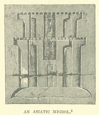
The aspect of these migdols, or forts, must have appeared strange to the first Egyptians who beheld them. These strongholds bore no resemblance to the large square or oblong enclosures to which they were accustomed, and which in their eyes represented the highest skill of the engineer. In Syria, however, the positions suitable for the construction of fortresses hardly ever lent themselves to a symmetrical plan. The usual sites had to be adapted in each case to suit the particular configuration of the ground.
Drawn by Faucher-Gudin, from a photograph taken at Karnak by Beato.
It was usually a mere wall of stone or dried brick, with towers at intervals; the wall measuring from nine to twelve feet thick at the base, and from thirty to thirty-six feet high, thus rendering an assault by means of portable ladders, nearly impracticable.*
* This is, at least, the result of investigations made by modern engineers who have studied these questions of military archæology.
The gateway had the appearance of a fortress in itself. It was composed of three large blocks of masonry, forming a re-entering face, considerably higher than the adjacent curtains, and pierced near the top with square openings furnished with mantlets, so as to give both a front and flank view of the assailants. The wooden doors in the receded face were covered with metal and raw hides, thus affording a protection against axe or fire.*
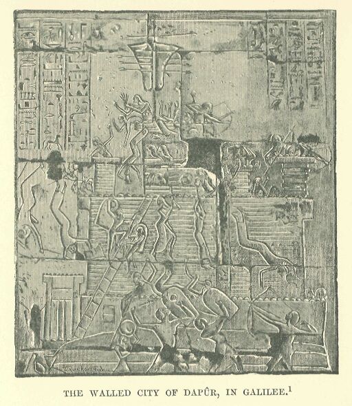
* Most of the Canaanite towns, taken by Ramses II. in the campaign of his VIIIth year were fortified in this manner. It must have been the usual method of fortification, as it seems to have served as a type for conventional representation, and was sometimes used to denote cities which had fortifications of another kind. For instance, Dapûr-Tabor is represented in this way, while a picture on another monument, which is reproduced in the illustration on page 185, represents what seems to have been the particular form of its encompassing walls.
The building was strong enough not only to defy the bands of adventurers who roamed the country, but was able to resist for an indefinite time the operations of a regular siege. Sometimes, however, the inhabitants when constructing their defences did not confine themselves to this rudimentary plan, but threw up earthworks round the selected site. On the most exposed side they raised an advance wall, not exceeding twelve or fifteen feet in height, at the left extremity of which the entrance was so placed that the assailants, in endeavouring to force their way through, were obliged to expose an unprotected flank to the defenders. By this arrangement it was necessary to break through two lines of fortification before the place could be entered. Supposing the enemy to have overcome these first obstacles, they would find themselves at their next point of attack confronted with a citadel which contained, in addition to the sanctuary of the principal god, the palace of the sovereign himself. This also had a double enclosing wall and massively built gates, which could be forced only at the expense of fresh losses, unless the cowardice or treason of the garrison made the assault an easy one.*
* The type of town described in the text is based on a representation on the walls of Karnak, where the siege of Dapûr-Tabor by Ramses II. is depicted. Another type is given in the case of Ascalon.
Drawn by Faucher-Gudin, from a photograph taken by Dévéria in 1865.
Of these bulwarks of Canaanite civilization, which had been thrown up by hundreds on the route of the invading hosts, not a trace is to be seen to-day. They may have been razed to the ground during one of those destructive revolutions to which the country was often exposed, or their remains may lie hidden underneath the heaps of ruins which thirty centuries of change have raised over them.*
* The only remains of a Canaanite fortification which can be assigned to the Egyptian period are those which Professor F. I. Petrie brought to light in the ruins of Tell el-Hesy, and in which he rightly recognised the remains of Lachish.
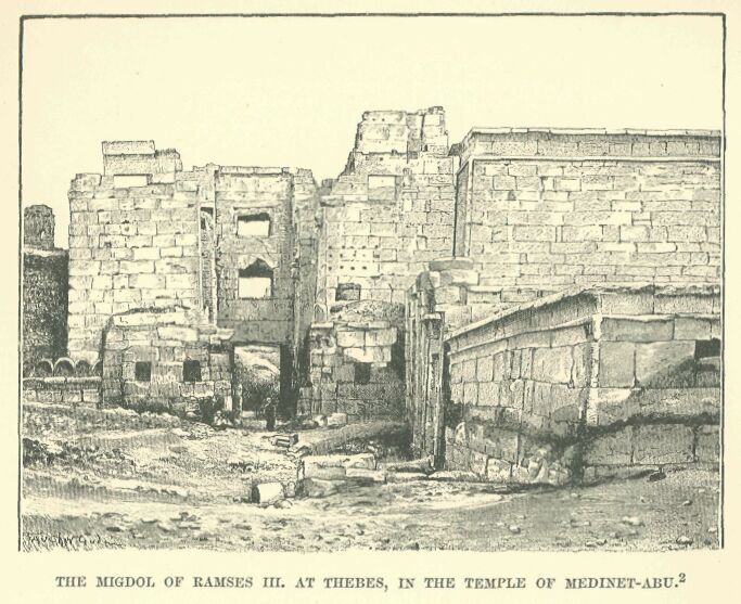
The records of victories graven on the walls of the Theban temples furnish, it is true, a general conception of their appearance, but the notions of them which we should obtain from this source would be of a very confused character had not one of the last of the conquering Pharaohs, Ramses III., taken it into his head to have one built at Thebes itself, to contain within it, in addition to his funerary chapel, accommodation for the attendants assigned to the conduct of his worship. In the Greek and Roman period a portion of this fortress was demolished, but the external wall of defence still exists on the eastern side, together with the gate, which is commanded on the right by a projection of the enclosing-wall, and flanked by two guard-houses, rectangular in shape, and having roofs which jut out about a yard beyond the wall of support. Having passed through these obstacles, we find ourselves face to face with a migdol of cut stone, nearly square in form, with two projecting wings, the court between their loop-holed walls being made to contract gradually from the point of approach by a series of abutments. A careful examination of the place, indeed, reveals more than one arrangement which the limited knowledge of the Egyptians would hardly permit us to expect. We discover, for instance, that the main body of the building is made to rest upon a sloping sub-structure which rises to a height of some sixteen feet.
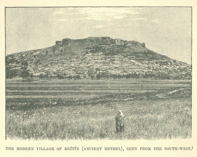
This served two purposes: it increased, in the first place, the strength of the defence against sapping; and in the second, it caused the weapons launched by the enemy to rebound with violence from its inclined surface, thus serving to keep the assailants at a distance. The whole structure has an imposing look, and it must be admitted that the royal architects charged with carrying out their sovereign’s idea brought to their task an attention to detail for which the people from whom the plan was borrowed had no capacity, and at the same time preserved the arrangements of their model so faithfully that we can readily realise what it must have been. Transport this migdol of Ramses III. into Asia, plant it upon one of those hills which the Canaanites were accustomed to select as a site for their fortifications, spread out at its base some score of low and miserable hovels, and we have before us an improvised pattern of a village which recalls in a striking manner Zerîn or Beîtîn, or any other small modern town which gathers the dwellings of its fellahin round some central stone building—whether it be a hostelry for benighted travellers, or an ancient castle of the Crusading age.
Drawn by Boudier, from a photograph.
There were on the littoral, to the north of Gaza, two large walled towns, Ascalon and Joppa, in whose roadsteads merchant vessels were accustomed to take hasty refuge in tempestuous weather.* There were to be found on the plains also, and on the lower slopes of the mountains, a number of similar fortresses and villages, such as Iurza, Migdol, Lachish, Ajalon, Shocho, Adora, Aphukîn, Keilah, Gezer, and Ono; and, in the neighbourhood of the roads which led to the fords of the Jordan, Gibeah, Beth-Anoth, and finally Urusalim, our Jerusalem.** A tolerably dense population of active and industrious husbandmen maintained themselves upon the soil.
* Ascalon was not actually on the sea. Its port, “Maiumas Ascalonis,” was probably merely a narrow bay or creek, now, for a long period, filled up by the sand. Neither the site nor the remains of the port have been discovered. The name of the town is always spelled in Egyptian with an “s “— Askaluna, which gives us the pronunciation of the time. The name of Joppa is written Yapu, Yaphu, and the gardens which then surrounded the town are mentioned in the Anastasi Papyrus I. ** Urusalim is mentioned only in the Tel el-Amarna tablets, alongside of Kilti or Keilah, Ajalon, and Lachish. The remaining towns are noticed in the great lists of Thûtmosis III.
The plough which they employed was like that used by the Egyptians and Babylonians, being nothing but a large hoe to which a couple of oxen were harnessed.* The scarcity of rain, except in certain seasons, and the tendency of the rivers to run low, contributed to make the cultivators of the soil experts in irrigation and agriculture. Almost the only remains of these people which have come down ti us consist of indestructible wells and cisterns, or wine and oil presses hollowed out of the rock.**
* This is the form of plough still employed by the Syrians in some places. ** Monuments of this kind are encountered at every step in Judaea, but it is very difficult to date them. The aqueduct of Siloam, which goes back perhaps to the time of Hezekiah.
Fields of wheat and barley extended along the flats of the valleys, broken in upon here and there by orchards, in which the white and pink almond, the apple, the fig, the pomegranate, and the olive flourished side by side.
Drawn by Boudier, from a plate in Chesney.
Jerusalem, possibly in part to be attributed to the reign of Solomon, are the only instances to which anything like a certain date may be assigned. But these are long posterior to the XVIIIth dynasty. Good judges, however, attribute some of these monuments to a very distant period: the masonry of the wells of Beersheba is very ancient, if not as it is at present, at least as it was when it was repaired in the time of the Cæsars; the olive and wine presses hewn in the rock do not all date back to the Roman empire, but many belong to a still earlier period, and modern descriptions correspond with what we know of such presses from the Bible.
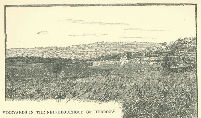
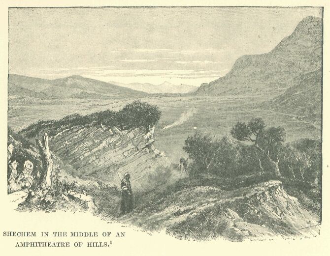
If the slopes of the valley rose too precipitously for cultivation, stone dykes were employed to collect the falling earth, and thus to transform the sides of the hills into a series of terraces rising one above the other. Here the vines, planted in lines or in trellises, blended their clusters with the fruits of the orchard-trees. It was, indeed, a land of milk and honey, and its topographical nomenclature in the Egyptian geographical lists reflects as in a mirror the agricultural pursuits of its ancient inhabitants: one village, for instance, is called Aubila, “the meadow;” while others bear such names as Ganutu, “the gardens;” Magraphut, “the mounds;” and Karman, “the vineyard.” The further we proceed towards the north, we find, with a diminishing aridity, the hillsides covered with richer crops, and the valleys decked out with a more luxuriant and warmly coloured vegetation. Shechem lies in an actual amphitheatre of verdure, which is irrigated by countless unfailing streams; rushing brooks babble on every side, and the vapour given off by them morning and evening covers the entire landscape with a luminous haze, where the outline of each object becomes blurred, and quivers in a manner to which we are accustomed in our Western lands.* Towns grew and multiplied upon this rich and loamy soil, but as these lay outside the usual track of the invading hosts—which preferred to follow the more rugged but shorter route leading straight to Carmel across the plain—the records of the conquerors only casually mention a few of them, such as Bîtshaîlu, Birkana, and Dutîna.**
* Shechem is not mentioned in the Egyptian geographical lists, but Max Müller thinks he has discovered it in the name of the mountain of Sikima which figures in the Anastasi Papyrus, No. 1. ** Bîtshaîlu, identified by Chabas with Bethshan, and with Shiloh by Mariette and Maspero, is more probably Bethel, written Bît-sha-îlu, either with sh, the old relative pronoun of the Phoenician, or with the Assyrian sha; on the latter supposition one must suppose, as Sayce does, that the compiler of the Egyptian lists had before him sources of information in the cuneiform character. Birkana appears to be the modern Brukin, and Dutîna is certainly Dothain, now Tell-Dothân.
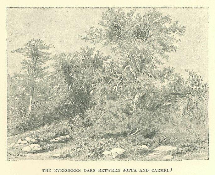
Beyond Ono reddish-coloured sandy clay took the place of the dark and compact loam: oaks began to appear, sparsely at first, but afterwards forming vast forests, which the peasants of our own days have thinned and reduced to a considerable extent. The stunted trunks of these trees are knotted and twisted, and the tallest of them do not exceed some thirty feet in height, while many of them may be regarded as nothing more imposing than large bushes.* Muddy rivers, infested with crocodiles, flowed slowly through the shady woods, spreading out their waters here and there in pestilential swamps. On reaching the seaboard, their exit was impeded by the sands which they brought down with them, and the banks which were thus formed caused the waters to accumulate in lagoons extending behind the dunes. For miles the road led through thickets, interrupted here and there by marshy places and clumps of thorny shrubs. Bands of Shaûsû were accustomed to make this route dangerous, and even the bravest heroes shrank from venturing alone along this route. Towards Aluna the way began to ascend Mount Carmel by a narrow and giddy track cut in the rocky side of the precipice.**
* The forest was well known to the geographers of the Græco- Roman period, and was still in existence at the time of the Crusades. ** This defile is described at length in the Anastasi Papyrus, No. 1, and the terms used by the writer are in themselves sufficient evidence of the terror with which the place inspired the Egyptians. The annals of Thûtmosis III. are equally explicit as to the difficulties which an army had to encounter here. I have placed this defile near the point which is now called Umm-el-Fahm, and this site seems to me to agree better with the account of the expedition of Thûtmosis III. than that of Arraneh proposed by Conder.
Beyond the Mount, it led by a rapid descent into a plain covered with corn and verdure, and extending in a width of some thirty miles, by a series of undulations, to the foot of Tabor, where it came to an end. Two side ranges running almost parallel—little Hermon and Glilboa—disposed in a line from east to west, and united by an almost imperceptibly rising ground, serve rather to connect the plain of Megiddo with the valley of the Jordan than to separate them. A single river, the Kishon, cuts the route diagonally—or, to speak more correctly, a single river-bed, which is almost waterless for nine months of the year, and becomes swollen only during the winter rains with the numerous torrents bursting from the hillsides. As the flood approaches the sea it becomes of more manageable proportions, and finally distributes its waters among the desolate lagoons formed behind the sand-banks of the open and wind-swept bay, towered over by the sacred summit of Carmel.*
* In the lists of Thûtmosis III. we find under No. 48 the town of Rosh-Qodshu, the “Sacred Cape,” which was evidently situated at the end of the mountain range, or probably on the site of Haifah; the name itself suggests the veneration with which Carmel was invested from the earliest times.
No corner of the world has been the scene of more sanguinary engagements, or has witnessed century after century so many armies crossing its borders and coming into conflict with one another. Every military leader who, after leaving Africa, was able to seize Gaza and Ascalon, became at once master of Southern Syria. He might, it is true, experience some local resistance, and come into conflict with bands or isolated outposts of the enemy, but as a rule he had no need to anticipate a battle before he reached the banks of the Kishon.
Drawn by Boudier, from a pencil sketch by Lortet.
Here, behind a screen of woods and mountain, the enemy would concentrate his forces and prepare resolutely to meet the attack. If the invader succeeded in overcoming resistance at this point, the country lay open to him as far as the Orontes; nay, often even to the Euphrates. The position was too important for its defence to have been neglected. A range of forts, Ibleâm, Taanach, and Megiddo,* drawn like a barrier across the line of advance, protected its southern face, and beyond these a series of strongholds and villages followed one another at intervals in the bends of the valleys or on the heights, such as Shunem, Kasuna, Anaharath, the two Aphuls, Cana, and other places which we find mentioned on the triumphal lists, but of which, up to the present, the sites have not been fixed.
* Megiddo, the “Legio” of the Roman period, has been identified since Robinson’s time with Khurbet-Lejûn, and more especially with the little mound known by the name of Tell-el-Mutesallim. Conder proposed to place its site more to the east, in the valley of the Jordan, at Khurbet-el- Mujeddah.
Drawn by Faucher-Gudin, from a photograph by Lortet.
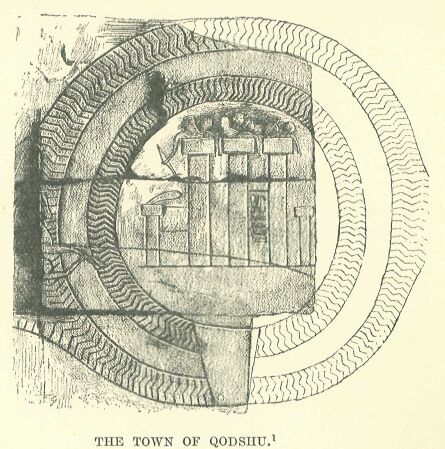
From this point the conqueror had a choice of three routes. One ran in an oblique direction to the west, and struck the Mediterranean near Acre, leaving on the left the promontory of Carmel, with the sacred town, Rosh-Qodshu, planted on its slope.
Drawn by Faucher-Gudin, from a photograph by Beato.
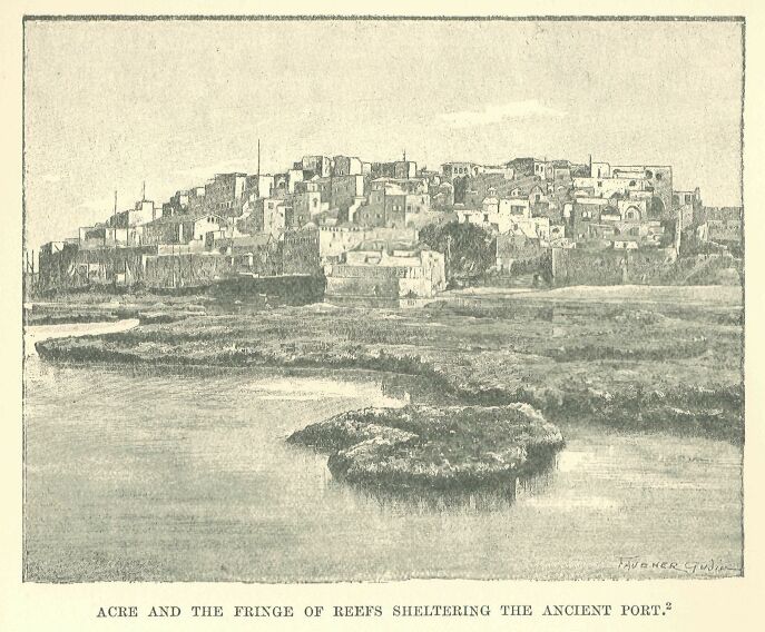
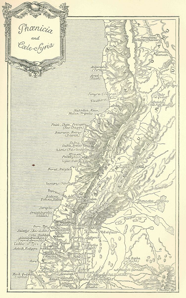
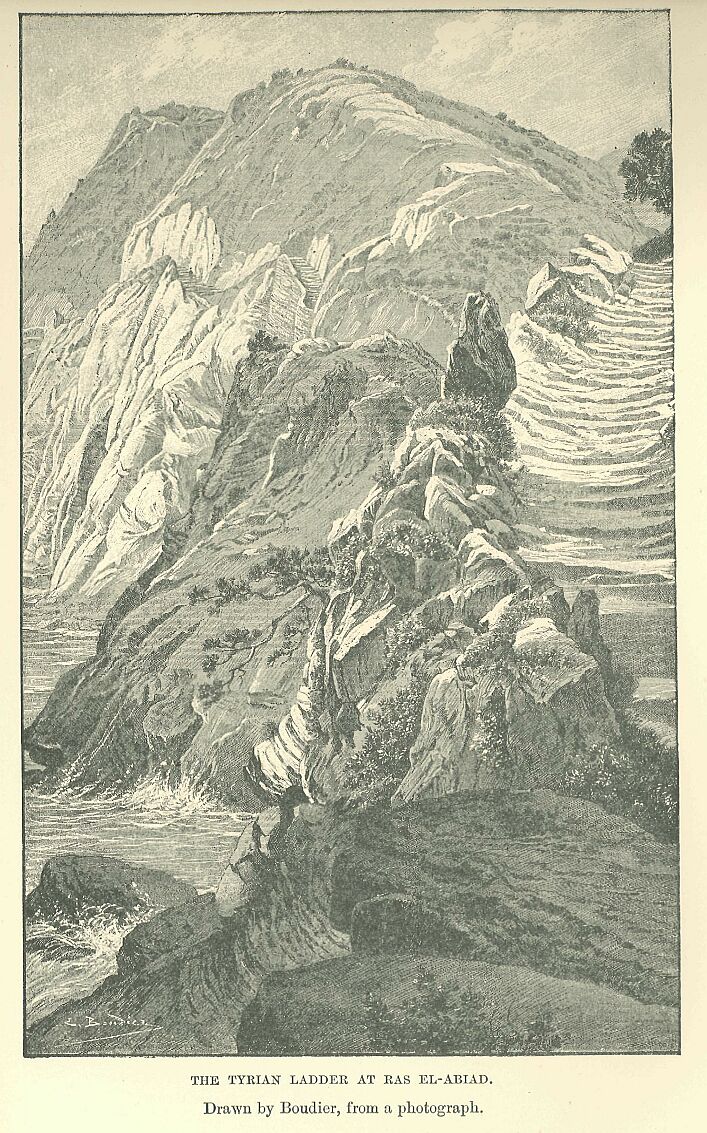
Acre was the first port where a fleet could find safe anchorage after leaving the mouths of the Nile, and whoever was able to make himself master of it had in his hands the key of Syria, for it stood in the same commanding position with regard to the coast as that held by Megiddo in respect of the interior. Its houses were built closely together on a spit of rock which projected boldly into the sea, while fringes of reefs formed for it a kind of natural breakwater, behind which ships could find a safe harbourage from the attacks of pirates or the perils of bad weather. From this point the hills come so near the shore that one is sometimes obliged to wade along the beach to avoid a projecting spur, and sometimes to climb a zig-zag path in order to cross a headland. In more than one place the rock has been hollowed into a series of rough steps, giving it the appearance of a vast ladder.* Below this precipitous path the waves dash with fury, and when the wind sets towards the land every thud causes the rocky wall to tremble, and detaches fragments from its surface. The majority of the towns, such as Aksapu (Ecdippa), Mashal, Lubina, Ushu-Shakhan, lay back from the sea on the mountain ridges, out of the reach of pirates; several, however, were built on the shore, under the shelter of some promontory, and the inhabitants of these derived a miserable subsistence from fishing and the chase. Beyond the Tyrian Ladder Phoenician territory began. The country was served throughout its entire length, from town to town, by the coast road, which turning at length to the right, and passing through the defile formed by the Nahr-el-Kebîr, entered the region of the middle Orontes.
* Hence the name Tyrian Ladder, which is applied to one of these passes, either Ras-en-Nakurah or Ras-el-Abiad.
The second of the roads leading from Megiddo described an almost symmetrical curve eastwards, crossing the Jordan at Beth-shan, then the Jab-bok, and finally reaching Damascus after having skirted at some distance the last of the basaltic ramparts of the Haurân. Here extended a vast but badly watered pasture-land, which attracted the Bedouin from every side, and scattered over it were a number of walled towns, such as Hamath, Magato, Ashtaroth, and Ono-Eepha.*
* Proof that the Egyptians knew this route, followed even to this day in certain circumstances, is furnished by the lists of Thûtmosis III., in which the principal stations which it comprises are enumerated among the towns given up after the victory of Megiddo. Dimasqu was identified with Damascus by E. de Rougé, and Astarotu with Ashtarôth-Qarnaim. Hamatu is probably Hamath of the Gadarenes; Magato, the Maged of the Maccabees, is possibly the present Mukatta; and Ono-Repha, Raphôn, Raphana, Arpha of Decapolis, is the modern Er-Rafeh.
Probably Damascus was already at this period the dominant authority over the region watered by these two rivers, as well as over the villages nestling in the gorges of Hermon,—Abila, Helbôn of the vineyards, and Tabrûd,—but it had not yet acquired its renown for riches and power. Protected by the Anti-Lebanon range from its turbulent neighbours, it led a sort of vegetative existence apart from invading hosts, forgotten and hushed to sleep, as it were, in the shade of its gardens.
The third road from Megiddo took the shortest way possible. After crossing the Kishon almost at right angles to its course, it ascended by a series of steep inclines to arid plains, fringed or intersected by green and flourishing valleys, which afforded sites for numerous towns,—Pahira, Merom near Lake Huleh, Qart-Nizanu, Beerotu, and Lauîsa, situated in the marshy district at the head-waters of the Jordan.* From this point forward the land begins to fall, and taking a hollow shape, is known as Coele-Syria, with its luxuriant vegetation spread between the two ranges of the Lebanon. It was inhabited then, as at the time of the Babylonian conquest, by the Amorites, who probably included Damascus also in their domain.**
* Pahira is probably Safed; Qart-Nizanu, the “flowery city,” the Kartha of Zabulon; and Bcerôt, the Berotha of Josephus, near Merom. Maroma and Lauîsa, Laisa, have been identified with Merom and Laish. ** The identification of the country of Amâuru with that of the Amorites was admitted from the first. The only doubt was as to the locality occupied by these Amorites: the mention of Qodshu on the Orontes, in the country of the Amurru, showed that Coele-Syria was the region in question. In the Tel el-Amarna tablets the name Amurru is applied also to the country east of the Phoenician coast, and we have seen that there is reason to believe that it was used by the Babylonians to denote all Syria. If the name given by the cuneiform inscriptions to Damascus and its neighbourhood, “Gar-Imirîshu,” “Imirîshu,” “Imirîsh,” really means “the Fortress of the Amorites,” we should have in this fact a proof that this people were in actual possession of the Damascene Syria. This must have been taken from them by the Hittites towards the XXth century before our era, according to Hommel; about the end of the XVIIIth dynasty, according to Lenormant. If, on the other hand, the Assyrians read the name “Sha-imiri-shu,” with the signification, “the town of its asses,” it is simply a play upon words, and has no bearing upon the primitive meaning of the name.
Drawn by Boudier, from a photograph.
Their capital, the sacred Qodshu, was situated on the left bank of the Orontes, about five miles from the lake which for a long time bore its name, Bahr-el-Kades.* It crowned one of those barren oblong eminences which are so frequently met with in Syria. A muddy stream, the Tannur, flowed, at some distance away, around its base, and, emptying itself into the Orontes at a point a little to the north, formed a natural defence for the town on the west. Its encompassing walls, slightly elliptic in form, were strengthened by towers, and surrounded by two concentric ditches which kept the sapper at a distance.
* The name Qodshu-Kadesh was for a long time read Uatesh, Badesh, Atesh, and, owing to a confusion with Qodi, Ati, or Atet. The town was identified by Champollion with Bactria, then transferred to Mesopotamia by Bosollini, in the land of Omira, which, according to Pliny, was close to the Taurus, not far from the Khabur or from the province of Aleppo: Osburn tried to connect it with Hadashah (Josh. xv. 21), an Amorite town in the southern part of the tribe of Judah; while Hincks placed it in Edessa. The reading Kedesh, Kadesh, Qodshu, the result of the observations of Lepsius, has finally prevailed. Brugsch connected this name with that of Bahr el-Kades, a designation attached in the Middle Ages to the lake through which the Orontes flows, and placed the town on its shores or on a small island on the lake. Thomson pointed out Tell Neby-Mendeh, the ancient Laodicea of the Lebanon, as satisfying the requirements of the site. Conder developed this idea, and showed that all the conditions prescribed by the Egyptian texts in regard to Qodshu find here, and here alone, their application. The description given in the text is based on Conder’s observations.
Drawn by Boudier, from a photograph.
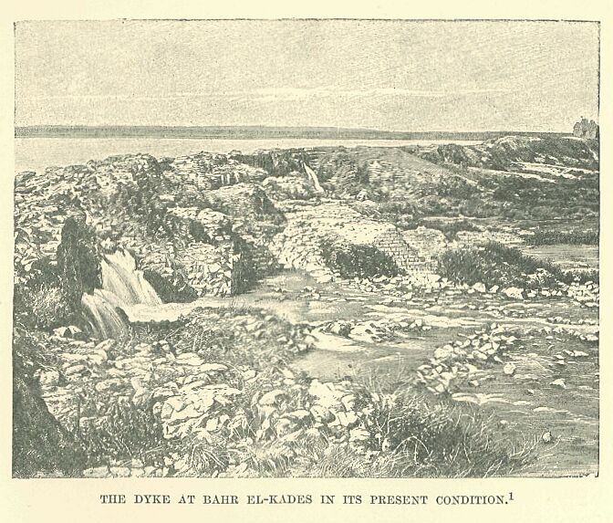
A dyke running across the Orontes above the town caused the waters to rise and to overflow in a northern direction, so as to form a shallow lake, which acted as an additional protection from the enemy. Qodshu was thus a kind of artificial island, connected with the surrounding country by two flying bridges, which could be opened or shut at pleasure. Once the bridges were raised and the gates closed, the boldest enemy had no resource left but to arm himself with patience and settle down to a lengthened siege. The invader, fresh from a victory at Megiddo, and following up his good fortune in a forward movement, had to reckon upon further and serious resistance at this point, and to prepare himself for a second conflict. The Amorite chiefs and their allies had the advantage of a level and firm ground for the evolutions of their chariots during the attack, while, if they were beaten, the citadel afforded them a secure rallying-place, whence, having gathered their shattered troops, they could regain their respective countries, or enter, with the help of a few devoted men, upon a species of guerilla warfare in which they excelled.
The road from Damascus led to a point south of Quodshu, while that from Phonicia came right up to the town itself or to its immediate neighbourhood. The dyke of Bahr el-Kades served to keep the plain in a dry condition, and thus secured for numerous towns, among which Hamath stood out pre-eminently, a prosperous existence. Beyond Hamath, and to the left, between the Orontes and the sea, lay the commercial kingdom of Alasia, protected from the invader by bleak mountains.*
* The site of Alasia, Alashia, was determined from the Tel el-Amarna tablets by Maspero. Niebuhr had placed it to the west of Cilicia, opposite the island of Eleousa mentioned by Strabo. Conder connected it with the scriptural Elishah, and W. Max Millier confounds it with Asi or Cyprus.
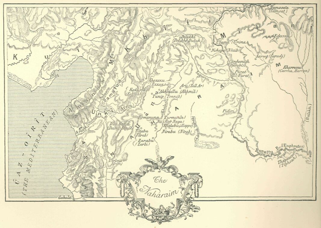
On the right, between the Orontes and the Balikh, extended the land of rivers, Naharaim. Towns had grown up here thickly,—on the sides of the torrents from the Amanos, along the banks of rivers, near springs or wells—wherever, in fact, the presence of water made culture possible. The fragments of the Egyptian chronicles which have come down to us number these towns by the hundred,* and yet of how many more must the records have perished with the crumbling Theban walls upon which the Pharaohs had their names incised! Khalabu was the Aleppo of our own day,** and grouped around it lay Turmanuna, Tunipa, Zarabu, Nîi, Durbaniti, Nirabu, Sarmata,*** and a score of others which depended upon it, or upon one of its rivals. The boundaries of this portion of the Lower Lotanû have come down to us in a singularly indefinite form, and they must also, moreover, have been subject to continual modifications from the results of tribal conflicts.
* Two hundred and thirty names belonging to Naharaim are still legible on the lists of Thûtmosis III., and a hundred others have been effaced from the monument. ** Khalabu was identified by Chabas with Khalybôn, the modern Aleppo, and his opinion has been adopted by most Egyptologists. *** Tunipa has been found in Tennib, Tinnab, by Noldoke; Zarabu in Zarbi, and Sarmata in Sarmeda, by Tomkins; Durbaniti in Deîr el-Banât, the Castrum Puellarum of the chroniclers of the Crusades; Nirabu in Nirab, and Tirabu in Tereb, now el-Athrib. Nirab is mentioned by Nicholas of Damascus. Nîi, long confounded with Nineveh, was identified by Lenormant with Ninus Vetus, Membidj, and by Max Millier with Balis on the Euphrates: I am inclined to make it Kefer- Naya, between Aleppo and Turmanin.
We are at a loss to know whether the various principalities were accustomed to submit to the leadership of a single individual, or whether we are to relegate to the region of popular fancy that Lord of Naharaim of whom the Egyptian scribes made such a hero in their fantastic narratives.*
* In the “Story of the Predestined Prince” the heroine is daughter of the Prince of Naharaim, who seems to exercise authority over all the chiefs of the country; as the manuscript does not date back further than the XXth dynasty, we are justified in supposing that the Egyptian writer had a knowledge of the Hittite domination, during which the King of the Khâti was actually the ruler of all Naharaim.
Carchemish represented in this region the position occupied by Megiddo in relation to Kharû, and by Qodshu among the Amorites; that is to say, it was the citadel and sanctuary of the surrounding country. Whoever could make himself master of it would have the whole country at his feet.
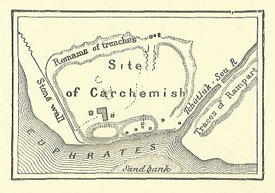
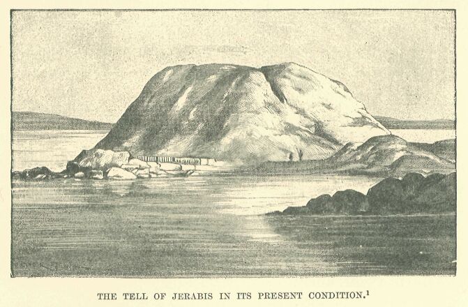
It lay upon the Euphrates, the winding of the river protecting it on its southern and south-eastern sides, while around its northern front ran a deep stream, its defence being further completed by a double ditch across the intervening region. Like Qodshu, it was thus situated in the midst of an artificial island beyond the reach of the battering-ram or the sapper. The encompassing wall, which tended to describe an ellipse, hardly measured two miles in circumference; but the suburbs extending, in the midst of villas and gardens, along the river-banks furnished in time of peace an abode for the surplus population. The wall still rises some five and twenty to thirty feet above the plain. Two mounds divided by a ravine command its north-western side, their summits being occupied by the ruins of two fine buildings—a temple and a palace.* Carchemish was the last stage in a conqueror’s march coming from the south.
* Karkamisha, Gargamish, was from the beginning associated with the Carchemish of the Bible; but as the latter was wrongly identified with Circesium, it was naturally located at the confluence of the Khabur with the Euphrates. Hincks fixed the site at Rum-Kaleh. G. Rawlinson referred it cursorily to Hierapolis-Mabog, which position Maspero endeavoured to confirm. Finzi, and after him G. Smith, thought to find the site at Jerabis, the ancient Europos, and excavations carried on there by the English have brought to light in this place Hittite monuments which go back in part to the Assyrian epoch. This identification is now generally accepted, although there is still no direct proof attainable, and competent judges continue to prefer the site of Membij. I fall in with the current view, but with all reserve.
Reproduced by Faucher-Gudin, from a cut in the Graphic.
For an invader approaching from the east or north it formed his first station. He had before him, in fact, a choice of the three chief fords for crossing the Euphrates. That of Thapsacus, at the bend of the river where it turns eastward to the Arabian plain, lay too far to the south, and it could be reached only after a march through a parched and desolate region where the army would run the risk of perishing from thirst.
Drawn by Faucher-Gudin, from a photograph.
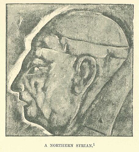
For an invader proceeding from Asia Minor, or intending to make his way through the defiles of the Taurus, Samosata offered a convenient fording-place; but this route would compel the general, who had Naharaim or the kingdoms of Chaldæa in view, to make a long detour, and although the Assyrians used it at a later period, at the time of their expeditions to the valleys of the Halys, the Egyptians do not seem ever to have travelled by this road. Carchemish, the place of the third ford, was about equally distant from Thapsacus and Samosata, and lay in a rich and fertile province, which was so well watered that a drought or a famine would not be likely to enter into the expectations of its inhabitants. Hither pilgrims, merchants, soldiers, and all the wandering denizens of the world were accustomed to direct their steps, and the habit once established was perpetuated for centuries. On the left bank of the river, and almost opposite Carchemish, lay the region of Mitânni,* which was already occupied by a people of a different race, who used a language cognate, it would seem, with the imperfectly classified dialects spoken by the tribes of the Upper Tigris and Upper Euphrates.** Harran bordered on Mitânni, and beyond Harran one may recognise, in the vaguely defined Singar, Assur, Arrapkha, and Babel, states that arose out of the dismemberment of the ancient Chaldæan Empire.***
* Mitânni is mentioned on several Egyptian monuments; but its importance was not recognised until after the discovery of the Tel el-Amarna tablets and of its situation. The fact that a letter from the Prince of Mitânni is stated in a Hieratic docket to have come from Naharaim has been used as a proof that the countries were identical; I have shown that the docket proves only that Mitânni formed a part of Naharaim. It extended over the province of Edessa and Harran, stretching out towards the sources of the Tigris. Niebuhr places it on the southern slope of the Masios, in Mygdonia; Th. Reinach connects it with the Matiôni, and asks whether this was not the region occupied by this people before their emigration towards the Caspian. ** Several of the Tel el-Amarna tablets are couched in this language. *** These names were recognised from the first in the inscriptions of Thûtmosis III. and in those of other Pharaohs of the XVIIIth and XIXth dynasties.
The Carchemish route was, of course, well known to caravans, but armed bodies had rarely occasion to make use of it. It was a far cry from Memphis to Carchemish, and for the Egyptians this town continued to be a limit which they never passed, except incidentally, when they had to chastise some turbulent tribe, or to give some ill-guarded town to the flames.*
* A certain number of towns mentioned in the lists of Thûtmosis III. were situated beyond the Euphrates, and they belonged some to Mitânni and some to the regions further away.
Drawn by Faucher-Gudin, from a photograph.
It would be a difficult task to define with any approach to accuracy the distribution of the Canaanites, Amorites, and Aramæans, and to indicate the precise points where they came into contact with their rivals of non-Semitic stock. Frontiers between races and languages can never be very easily determined, and this is especially true of the peoples of Syria. They are so broken up and mixed in this region, that even in neighbourhoods where one predominant tribe is concentrated, it is easy to find at every step representatives of all the others. Four or five townships, singled out at random from the middle of a province, would often be found to belong to as many different races, and their respective inhabitants, while living within a distance of a mile or two, would be as great strangers to each other as if they were separated by the breadth of a continent.
Drawn by Faucher-Gudin, from a photograph.
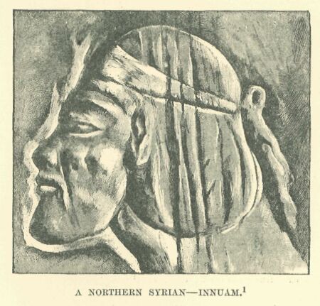
It would appear that the breaking up of these populations had not been carried so far in ancient as in modern times, but the confusion must already have been great if we are to judge from the number of different sites where we encounter evidences of people of the same language and blood. The bulk of the Khâti had not yet departed from the Taurus region, but some stray bands of them, carried away by the movement which led to the invasion of the Hyksôs, had settled around Hebron, where the rugged nature of the country served to protect them from their neighbours.*
* In very early times they are described as dwelling near Hebron or in the mountains of Judah. Since we have learned from the Egyptian and Assyrian monuments that the Khâti dwelt in Northern Syria, the majority of commentators have been indisposed to admit the existence of southern Hittites; this name, it is alleged, having been introduced into the Biblical around text through a misconception of the original documents, where the term Hittite was the equivalent of Canaanite.
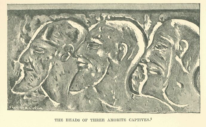
The Amorites* had their head-quarters Qodshul in Coele-Syria, but one section of them had taken up a position on the shores of the Lake of Tiberias in Galilee, others had established themselves within a short distance of Jaffa** on the Mediterranean, while others had settled in the neighbourhood of the southern Hittites in such numbers that their name in the Hebrew Scriptures was at times employed to designate the western mountainous region about the Dead Sea and the valley of the Jordan. Their presence was also indicated on the table-lands bordering the desert of Damascus, in the districts frequented by Bedouin of the tribe of Terah, Ammon and Moab, on the rivers Yarmuk and Jabbok, and at Edrei and Heshbon.***
* Ed. Meyer has established the fact that the term Amorite, as well as the parallel word Canaanite, was the designation of the inhabitants of Palestine before the arrival of the Hebrews: the former belonged to the prevailing tradition in the kingdom of Israel, the latter to that which was current in Judah. This view confirms the conclusion which may be drawn from the Egyptian monuments as to the power of expansion and the diffusion of the people. ** These were the Amorites which the tribe of Dan at a later period could not dislodge from the lands which had been allotted to them. *** This was afterwards the domain of Sihon, King of the Amorites, and that of Og.
The fuller, indeed, our knowledge is of the condition of Syria at the time of the Egyptian conquest, the more we are forced to recognise the mixture of races therein, and their almost infinite subdivisions. The mutual jealousies, however, of these elements of various origin were not so inveterate as to put an obstacle in the way, I will not say of political alliances, but of daily intercourse and frequent contracts. Owing to intermarriages between the tribes, and the continual crossing of the results of such unions, peculiar characteristics were at length eliminated, and a uniform type of face was the result. From north to south one special form of countenance, that which we usually call Semitic, prevailed among them.
Drawn by Faucher-Gudin, from a photograph.
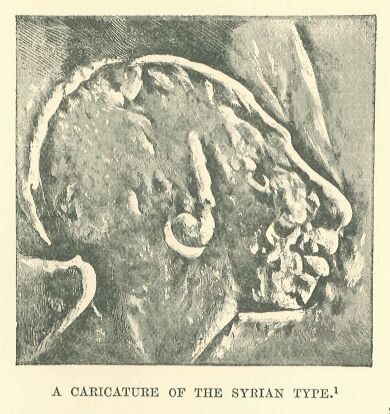
The Syrian and Egyptian monuments furnish us everywhere, under different ethnical names, with representations of a broad-shouldered people of high stature, slender-figured in youth, but with a fatal tendency to obesity in old age. Their heads are large, somewhat narrow, and artificially flattened or deformed, like those of several modern tribes in the Lebanon. Their high cheek-bones stand out from their hollow cheeks, and their blue or black eyes are buried under their enormous eyebrows. The lower part of the face is square and somewhat heavy, but it is often concealed by a thick and curly beard. The forehead is rather low and retreating, while the nose has a distinctly aquiline curve. The type is not on the whole so fine as the Egyptian, but it is not so heavy as that of the Chaldæans in the time of Gudea. The Theban artists have represented it in their battle-scenes, and while individualising every soldier or Asiatic prisoner with a happy knack so as to avoid monotony, they have with much intelligence impressed upon all of them the marks of a common parentage.
Drawn by Faucher-Gudin, from the original wooden object.
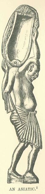
One feels that the artists must have recognised them as belonging to one common family. They associated with their efforts after true and exact representation a certain caustic humour, which impelled them often to substitute for a portrait a more or less jocose caricature of their adversaries. On the walls of the Pylons, and in places where the majesty of a god restrained them from departing too openly from their official gravity, they contented themselves with exaggerating from panel to panel the contortions and pitiable expressions of the captive chiefs as they followed behind the triumphal chariot of the Pharaoh on his return from his Syrian campaigns.*
* An illustration of this will be found in the line of prisoners, brought by Seti I. from his great Asiatic campaign, which is depicted on the outer face of the north wall of the hypostyle at Karnak.
Where religious scruples offered no obstacle they abandoned themselves to the inspiration of the moment, and gave themselves freely up to caricature. It is an Amorite or Canaanite—that thick-lipped, flat-nosed slave, with his brutal lower jaw and smooth conical skull—who serves for the handle of a spoon in the museum of the Louvre. The stupefied air with which he trudges under his burden is rendered in the most natural manner, and the flattening to which his forehead had been subjected in infancy is unfeelingly accentuated. The model which served for this object must have been intentionally brutalised and disfigured in order to excite the laughter of Pharaoh’s subjects.*
* Dr. Regnault thinks that the head was artificially deformed in infancy: the bandage necessary to effect it must have been applied very low on the forehead in front, and to the whole occiput behind. If this is the case, the instance is not an isolated one, for a deformation of a similar character is found in the case of the numerous Semites represented on the tomb of Rakhmiri: a similar practice still obtains in certain parts of modern Syria.
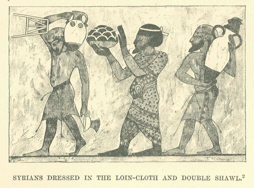
Drawn by Faucher-Gudin, from a photograph by Insinger.
The idea of uniformity with which we are impressed when examining the faces of these people is confirmed and extended when we come to study their costumes. Men and women—we may say all Syrians according to their condition of life—had a choice between only two or three modes of dress, which, whatever the locality, or whatever the period, seemed never to change. On closer examination slight shades of difference in cut and arrangement may, however, be detected, and it may be affirmed that fashion ran even in ancient Syria through as many capricious evolutions as with ourselves; but these variations, which were evident to the eyes of the people of the time, are not sufficiently striking to enable us to classify the people, or to fix their date. The peasants and the lower class of citizens required no other clothing than a loin-cloth similar to that of the Egyptians,* or a shirt of a yellow or white colour, extending below the knees, and furnished with short sleeves. The opening for the neck was cruciform, and the hem was usually ornamented with coloured needlework or embroidery. The burghers and nobles wore over this a long strip of cloth, which, after passing closely round the hips and chest, was brought up and spread over the shoulders as a sort of cloak. This was not made of the light material used in Egypt, which offered no protection from cold or rain, but was composed of a thick, rough wool, like that employed in Chaldæa, and was commonly adorned with stripes or bands of colour, in addition to spots and other conspicuous designs.
* The Asiatic loin-cloth differs from the Egyptian in having pendent cords; the Syrian fellahin still wear it when at work.
Rich and fashionable folk substituted for this cloth two large shawls—one red and the other blue—in which they dexterously arrayed themselves so as to alternate the colours: a belt of soft leather gathered the folds around the figure. Red morocco buskins, a soft cap, a handkerchief, a kejfîyeh confined by a fillet, and sometimes a wig after the Egyptian fashion, completed the dress.
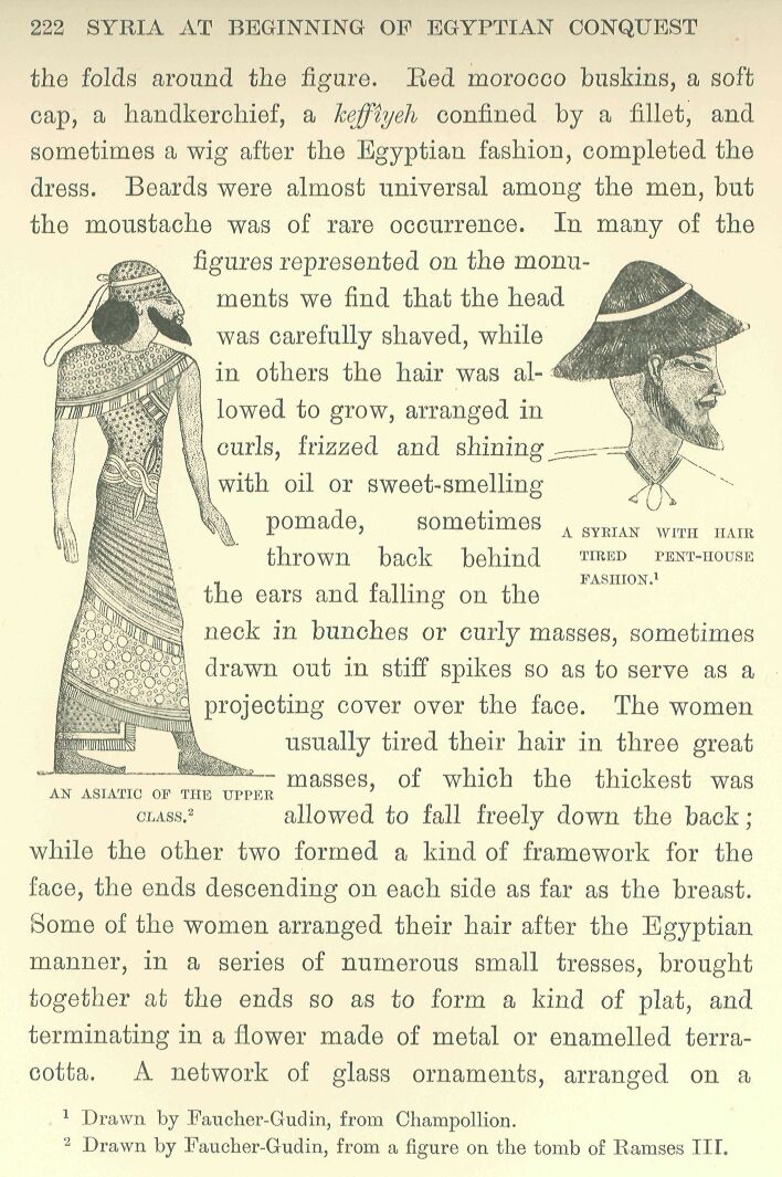
Drawn by Faucher-Gudin, from a figure on the tomb of Ramses III.
Beards were almost universal among the men, but the moustache was of rare occurrence. In many of the figures represented on the monuments we find that the head was carefully shaved, while in others the hair was allowed to grow, arranged in curls, frizzed and shining with oil or sweet-smelling pomade, sometimes thrown back behind the ears and falling on the neck in bunches or curly masses, sometimes drawn out in stiff spikes so as to serve as a projecting cover over the face.
The women usually tired their hair in three great masses, of which the thickest was allowed to fall freely down the back; while the other two formed a kind of framework for the face, the ends descending on each side as far as the breast. Some of the women arranged their hair after the Egyptian manner, in a series of numerous small tresses, brought together at the ends so as to form a kind of plat, and terminating in a flower made of metal or enamelled terracotta. A network of glass ornaments, arranged on a semicircle of beads, or on a background of embroidered stuff, was frequently used as a covering for the top of the head.*
* Examples of Syrian feminine costume are somewhat rare on the Egyptian monuments. In the scenes of the capturing of towns we see a few. Here the women are represented on the walls imploring the mercy of the besieger. Other figures are those of prisoners being led captive into Egypt.
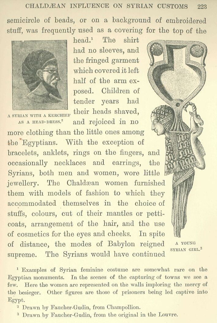
The shirt had no sleeves, and the fringed garment which covered it left half of the arm exposed. Children of tender years had their heads shaved, as a head-dress, and rejoiced in no more clothing than the little ones among the Egyptians. With the exception of bracelets, anklets, rings on the fingers, and occasionally necklaces and earrings, the Syrians, both men and women, wore little jewellery. The Chaldæa women furnished them with models of fashion to which they accommodated themselves in the choice of stuffs, colours, cut of their mantles or petticoats, arrangement of the hair, and the use of cosmetics for the eyes and cheeks. In spite of distance, the modes of Babylon reigned supreme. The Syrians would have continued to expose their right shoulder to the weather as long as it pleased the people of the Lower Euphrates to do the same; but as soon as the fashion changed in the latter region, and it became customary to cover the shoulder, and to wrap the upper part of the person in two or three thicknesses of heavy wool, they at once accommodated themselves to the new mode, although it served to restrain the free motion of the body. Among the upper classes, at least, domestic arrangements were modelled upon the fashions observed in the palaces of the nobles of Car-chemish or Assur: the same articles of toilet, the same ranks of servants and scribes, the same luxurious habits, and the same use of perfumes were to be found among both.*
* An example of the fashion of leaving the shoulder bare is found even in the XXth dynasty. The Tel el-Amarna tablets prove that, as far as the scribes were concerned, the customs and training of Syria and Chaldæa were identical. The Syrian princes are there represented as employing the cuneiform character in their correspondence, being accompanied by scribes brought up after the Chaldæan manner. We shall see later on that the king of the Khati, who represented in the time of Ramses II. the type of an accomplished Syrian, had attendants similar to those of the Chaldæan kings.
From all that we can gather, in short, from the silence as well as from the misunderstandings of the Egyptian chroniclers, Syria stands before us as a fruitful and civilized country, of which one might be thankful to be a native, in spite of continual wars and frequent revolutions.
The religion of the Syrians was subject to the same influences as their customs; we are, as yet, far from being able to draw a complete picture of their theology, but such knowledge as we do possess recalls the same names and the same elements as are found in the religious systems of Chaldæa. The myths, it is true, are still vague and misty, at least to our modern ideas: the general characteristics of the principal divinities alone stand out, and seem fairly well defined. As with the other Semitic races, the deity in a general sense, the primordial type of the godhead, was called El or Ilû, and his feminine counterpart Ilât, but we find comparatively few cities in which these nearly abstract beings enjoyed the veneration of the faithful.* The gods of Syria, like those of Egypt and of the countries watered by the Euphrates, were feudal princes distributed over the surface of the earth, their number corresponding with that of the independent states. Each nation, each tribe, each city, worshipped its own lord—Adoni** —or its master—Baal*** —and each of these was designated by a special title to distinguish him from neighbouring Baalîm, or masters.
* The frequent occurrence of the term Ilû or El in names of towns in Southern Syria seems to indicate pretty conclusively that the inhabitants of these countries used this term by preference to designate their supreme god. Similarly we meet with it in Aramaic names, and later on among the Nabathseans; it predominates at Byblos and Berytus in Phoenicia and among the Aramaic peoples of North Syria; in the Samalla country, for instance, during the VIIIth century B.C. ** The extension of this term to Syrian countries is proved in the Israelitish epoch by Canaanitish names, such as Adonizedek and Adonibezek, or Jewish names such as Adonijah, Adonikam, Adoniram-Adoram. *** Movers tried to prove that there was one particular god named Baal, and his ideas, popularised in Prance by M. de Vogiié, prevailed for some time: since then scholars have gone back to the view of Münter and of the writers at the beginning of this century, who regarded the term Baal as a common epithet applicable to all gods.
The Baal who ruled at Zebub was styled “Master of Zebub,” or Baal-Zebub;* and the Baal of Hermon, who was an ally of Gad, goddess of fortune, was sometimes called Baal-Hermon, or “Master of Hermon,” sometimes Baal-G-ad, or “Master of Gad;” ** the Baal of Shechem, at the time of the Israelite invasion, was “Master of the Covenant”—Baal-Berîth—doubtless in memory of some agreement which he had concluded with his worshippers in regard to the conditions of their allegiance.***
* Baal-Zebub was worshipped at Ekxon during the Philistine supremacy. ** The mountain of Baal-Hermon is the mountain of Baniâs, where the Jordan has one of its sources, and the town of Baal-Hermon is Baniâs itself. The variant Baal-Gad occurs several times in the Biblical books. *** Baal-Berith, like Baal-Zebub, only occurs, so far as we know at present, in the Hebrew Scriptures, where, by the way, the first element, Baal, is changed to El, El-Berith.
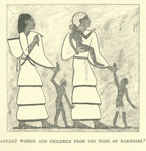
Drawn by Faucher-Gudin, from coloured sketches by Prisse d’Avennes.
The prevalent conception of the essence and attributes of these deities was not the same in all their sanctuaries, but the more exalted among them were regarded as personifying the sky in the daytime or at night, the atmosphere, the light,* or the sun, Shamash, as creator and prime mover of the universe; and each declared himself to be king—melek—over the other gods.** Bashuf represented the lightning and the thunderbolt;*** Shalmân, Hadad, and his double Bimmôn held sway over the air like the Babylonian.
* This appears under the name Or or Ur in the Samalla inscriptions of the VIIIth century B.C.; it is, so far, a unique instance among the Semites. ** We find the term applied in the Bible to the national god of the Ammonites, under the forms Moloch, Molech, Mikôm, Milkâm, and especially with the article, Ham-molek; the real name hidden beneath this epithet was probably Amnôn or Ammân, and, strictly speaking, the God Moloch only exists in the imagination of scholars. The epithet was used among the Oanaanites in the name Melchizedek, a similar form to Adonizedek, Abimelech, Ahimelech; it was in current use among the Phoenicians, in reference to the god of Tyre, Melek-Karta or Melkarth, and in many proper names, such as Melekiathon, Baalmelek, Bodmalek, etc., not to mention the god Milichus worshipped in Spain, who was really none other than Melkarth. *** Resheph has been vocalised Rashuf in deference to the Egyptian orthography Rashupu. It was a name common to a whole family of lightning and storm-gods, and M. de Rougé pointed out long ago the passage in the Great Inscription of Ramses III. at Medinet-Habu, in which the soldiers who man the chariots are compared to the Rashupu; the Rabbinic Hebrew still employs this plural form in the sense of “demons.” The Phoenician inscriptions contain references to several local Rashufs; the way in which this god is coupled with the goddess Qodshu on the Egyptian stelæ leads me to think that, at the epoch now under consideration, he was specially worshipped by the Amorites, just as his equivalent Hadad was by the inhabitants of Damascus, neighbours of the Amorites, and perhaps themselves Amorites.