Chapter IV · STAFFORD TO WHITMORE, Fourteen Miles.
Reading edition
In leaving Stafford station, the Castle appears to the W. and the Town, E. of the line. Beacon Hill is seen immediately over the latter. On proceeding a short distance through a flat country, the little village of Aston is passed on the W., and Creswell Hall, (Rev. T. Whitley,) on the E., which, encompassed by richly wooded grounds, and overlooking the meanderings of the little river Sow, forms a fine object in the general landscape. The house is a plain, neat structure. Much of the ground here is marshy, and abounds with willows, whose light silvery foliage agreeably diversifies the meadow and woodland scenery; amid which, on the W., peeps the pretty tower of Seighford Church.
Passing two successive cuttings of no great depth, and through a marshy district adorned by poplar and willow trees, we arrive at
Bridgeford Station.
Distance to Birmingham, 32¾—Liverpool and Manchester, 64¾ miles.
DISTANCES BY ROADS FROM THIS STATION TO THE FOLLOWING PLACES:—
Places W. of Station.
Seighford 1 mile.
Ranton 2¾ miles.
Ellenhall 3 —
Norbury 7½ —
On the E. is Bridgeford Hall, the estate of J. Reynolds, Esq., formerly a Convent. Some remains of the ancient buildings still exist in different parts of the hall and garden.
A story of a subterranean passage also belongs to this relic of olden times, which passage, says tradition, leads to Ellenhall, about two miles distant; and we have been told that in digging a well a few years since the passage was discovered.
A picturesque Mill stands near the Hall. Passing Chebsey W., and Whitgreave on the E., we reach Shallowford, where a few scattered cottages represent the honours of the Village, and the Sow, which almost emulates the winding propensities of the fair river Wye, meanders quietly among the meadows. At Shallowford Bridge, which is chiefly built for the convenience of farmers, whose cattle and teams are constantly traversing it, a person is generally stationed with a red flag to give a signal for trains to slacken their speed at this part, if cattle are passing at the time.
A pleasant but not very interesting portion of the line brings us to
Norton Bridge Station.
Distance to Birmingham, 35—Liverpool and Manchester, 62½ miles.
DISTANCES BY ROADS FROM THIS STATION TO THE FOLLOWING PLACES:—
Places W. of Station. Places E. of Station.
Chebsey 1¼ mile. Stone 3 miles.
Eccleshall 2½ miles. Swinnerton 4½ —
Standon 5 — Hilderston 6¼ —
High Oftley 6½ — Barlaston 6½ —
Adbaston 6½ — Fulford 7½ —
Cheswardine 9½ — Trentham 8 —
Hinstock 13 — Draycott 9½ —
Lane End 10 —
Cheadle 14 —
Two miles and a half W. of this station lies the small town of Eccleshall, which at the time of the Conquest belonged to the See of Lichfield. In 1200, Bishop Muschamp obtained a licence from King John, to embattle the episcopal residence; which was much repaired, or rebuilt, by Bishop Langton in 1310. During the parliamentary war it was so much damaged in a siege, previously to being taken by the parliamentarians, as to be unfit for the further residence of the church-militant commanders-in-chief, until Bishop Lloyd rebuilt it in 1695; since which time it has continued to be the episcopal palace of the See of Lichfield and Coventry. The grounds and woods belonging to the palace are pleasant and extensive. The church was the sanctuary of Queen Margaret, after Lord Audley’s defeat by the Earl of Salisbury, at Blore Heath. It is a spacious structure, in the ancient English style of architecture, and contains several monuments.
The town of Stone lies three miles E. of the line, and is not seen from it; the name is traditionally derived from a monumental heap of stones, which, according to the custom of the Saxons had been placed over the bodies of the princes Wulford and Rufinus, who were here slain by their father king Wulphere, on account of their conversion to Christianity. [See page 20.] The king himself becoming subsequently a convert, founded, in 670, a college of Secular Canons, dedicating it to his children, in expiation of his crime: and to this establishment the town is supposed to owe its origin. The prevailing manufacture is that of shoes. Population, 7,808.
Although none of the towns in the great district called the Potteries, are upon or even seen from the line of route, yet they lie so near, that it would scarcely be well to omit all mention of this great manufacturing neighbourhood, which encloses about ten square miles of country, covered with scattered villages, and containing about 20,000 inhabitants. Although the making of articles of pottery has been carried on here from a remote period, yet the manufacture was of inferior importance, until the great improvements effected by Mr. Wedgewood in the latter part of the last century; since which time the excellence and beauty of the wares, have produced a most extensive traffic both in England and abroad. The exports of earthenware and china to the United States alone, amount to 60,000 packages annually. The several species of ware invented by Mr. Wedgewood, varied by the industry and ingenuity of the manufacturers into an infinity of forms, and differently painted and embellished, constitute nearly the whole of the fine earthenwares at present manufactured in England, which are the object of a very extensive trade. The chief towns and villages in the Pottery district are, Stoke-upon-Trent, Hanley, Burslem, Lane End, Shelton, Etruria, Tunstall, Lane Delph, and others.
Proceeding from Norton Bridge, through some pretty, common-place country, we pass Baddenhall, Field Cross, and Brockton-house on the W., and Coldmese on the E., and soon gain a view of Swinnerton Park and Hall, seat of T. Fitzherbert, Esq., which, with the small grove-like woods scattered through the landscape, forms, as the quaint Dugdale would say, “a verye faire prospect.” The next small representation of a village is Mill Meese, with its old Hall standing close beside the line; the water-mill wheel, formerly accustomed to have no rival sound interrupt its rumbling, splashing solo, now seems wofully outdone by the rapidly rolling trains, and lifts up its unheard voice in vain. The river Sow still flows close to the line. Westward lie the villages of Walford and Aspley, but too much concealed by wood to be discovered in passing. Trentham Park, seat of the Marquis of Sutherland, is perceived on the N.E. The mansion is a modern structure; the surrounding grounds are very extensive, abound with fine timber, and greatly adorned by lakes, formed by the river Trent, which flows through the park.
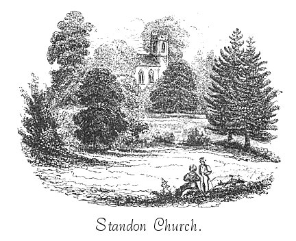
Standon Church, with the richly wooded country round, forms a pleasing object W. of the line.
Passing on, another Swinnerton Park appears on the E., there being two of that name. Hill Chorlton and Chapel Chorlton, with the picturesque church tower of the latter, appears W. of the traveller. A short distance of pretty wooded scenery intervenes, and then a shallow cutting, passing which, Maer Wood is seen on the W. Maer Hall, seat of J. Wedgewood, Esq.
Shortly after, the line enters a deep cutting, which ends at
WHITMORE STATION.
Distance to Birmingham, 43¼—Liverpool and Manchester, 54¼ miles.
DISTANCES BY ROADS FROM THIS STATION TO THE FOLLOWING PLACES:—
Places W. of Station. Places E. of Station.
Maer 1¾ mile. Newcastle-under-Lyme 5 miles.
Chapel Chorlton 3 miles. Trentham 5 —
Ashley 3½ — Wolstanton 6½ —
Standon 5 — Shelton 7 —
Broughton 5½ — Stoke 7 —
Mucklestone or Muxton 6 — Burslem 7½ —
Norton 7½ — Hanley 7½ —
Market Drayton 10 — Tunstall 8½ —
Lane End 8½ —
Norton-on-the-Moor 9 —
Leek 16 —