The Geological Story of Crater Lake
Reading edition
Origin of the Mountain.
The slope, which you ascend to view the lake, and the caldera wall rising 500 to 2,000 feet above the water, are remnants of Mount Mazama.
In comparatively recent geologic time, numerous volcanic peaks were formed near the western edge of a vast lava plateau covering parts of Oregon, Washington, Idaho, Montana, Nevada, and California. These are the Cascade Range, of which Mount Mazama was one of the commanding peaks. It was built by successive lava flows with some accumulation of volcanic ash. The cone thus formed was modified by streams and glaciers which carved valleys in its sides and deposited rock debris on its flanks. The layered character and different formations of the mountain are now clearly exposed in numerous places within the caldera wall.
Forming of Dikes.
In addition to broad surface flows, it is common for molten lava to be squeezed into cracks, or fissures, that develop in a volcano. Such filling results in dikes, or walls, frequently harder than the enclosing rock. At Crater Lake the destruction of the mountain and subsequent erosion have exposed numerous dikes in the wall, of which the Devil’s Backbone on the west wall is an outstanding example.
Action of Streams and Glaciers.
In the layers forming the crater wall there is evidence of the action of water. In some places this is shown by the cutting of valleys; in others, by the accumulation of water-carried gravel and boulders.
5
Glacial ice, carrying sand, pebbles, and boulders, scratches and polishes rock surfaces over which it moves. Glacial polish and thick beds of glacial debris are common around the mountain. They occur on the surface rock and between earlier layers, showing that glaciers existed at various stages in the history of the mountain.
U-shaped valleys, such as Kerr Notch, Sun Notch, and Munson Valley on the southeast slope of Mount Mazama, are evidence of glaciation. The lava flow which formed Llao Rock filled an ancient glacial notch.
Forming of the Caldera.
Many geologists have concluded that the basin occupied by the lake resulted from the collapse and subsidence of the volcanic cone of Mount Mazama. This explanation was first proposed by J. S. Diller, of the United States Geological Survey, who considered that the support of the summit was weakened by drainage of great quantities of molten rock through subterranean cracks. The pit thus formed grew progressively larger in all directions, as is indicated by the broken edges exposed around its rim today. Extensive study by Prof. Howel Williams, of the University of California, led him to practically the same conclusion.
In his delightful, popular, and scientifically accurate book, Crater Lake, The Story of Its Origin, Williams describes great quantities of pumice extending more than 80 miles northeast of Mount Mazama. This pumice was blown from the mountain in a catastrophic event and carried northeastward by the prevailing winds. Analysis shows that this is material derived from the heart of the volcano and not finely divided fragments of the original mountain walls.
Following this eruption, the crater is believed literally to have boiled over, pouring out great quantities of frothy material as a series of glowing avalanches. These avalanches must have traveled at a terrific speed down the valleys, for those to the south and west did not begin to deposit their load until they had reached a distance of 4 to 5 miles. The greater quantity flowed down the mountain to the south and southwest for distances up to 35 miles from the source. The total volume of the ejected lava was about 5 cubic miles. It is believed that an additional 1.5 cubic miles of old rock were carried away at the same time.
Accompanying these eruptions, which occurred within the past 7,000 years, cracks developed in the flanks of the mountain so that the top collapsed, being engulfed in the void produced by the ejection of the pumice and lava and the withdrawal of 10 cubic miles of molten rock into swarms of cracks that probably opened parallel to the axis of the Cascade Range. Thus was formed the great pit that was to become Crater Lake.
By projecting the slopes of the mountain remnant upward, conforming to the slopes of similar volcanoes, it has been estimated that approximately 17 cubic miles of the upper part of ancient Mount Mazama was destroyed by the collapse.
The Growth of Wizard Island.
After the destruction of the peak, volcanic activity within the caldera produced Wizard Island and perhaps other cones. These cones rise above a relatively flat floor, the lowest part of which is almost 2,000 feet below the surface of the present lake.
6
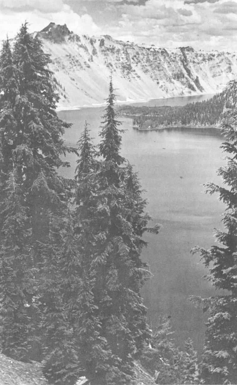
Hillman Peak—Highest Point on Rim of Crater Lake
7
Origin of the Lake.
The water of Crater Lake comes from rain and snow. The average annual precipitation is 69 inches. The lake has no inlet and no outlet, except seepage. Evaporation, seepage, and precipitation are in a state of relative balance which maintains an approximately constant water level. In 1957, the lake level was the highest recorded since 1908. There is an annual variation of from 1 to 3 feet, the level being highest in spring and lowest in autumn.
Color of the Lake.
The deep blue of the lake is believed to be caused chiefly by the scattering of sunlight in water of exceptional depth and clearness, the blue rays of sunlight being bent back upward, rays of other colors being absorbed.