Chapter III
Reading edition
Xanthus—Sir Charles Fellows—Telmessus—Patara—Pinara—Myra—Tlos and Antiphellus—Attalia—Perge—Eurymedon—Aspendus—Side—Termessus—Cremna—Sagalassus—Selge—Antioch of Pisidia—Tarsus—Coracesium—Laertes—Selinus—Anemurium—Celenderis—Seleuceia—Corycus—Soli—Adana—Mallus—Mopsuestia—Anazarbus—Issus.
We come now to Lycia, of which many of the most important monuments are now in the Lycian room at the British Museum—for the most part the records of its chief town, Xanthus—and all procured by Sir Charles Fellows. A few less valuable remains, were, at the same time, obtained from other Lycian towns.
The chief value of the monuments from Lycia lies in this, that, while they exhibit many well-executed pieces of sculpture, interesting as a local or provincial rendering of Greek work of the middle of the fourth century B.C., they comprise, also, a few slabs, as, for instance, those from the Harpy tomb, of a genuine Archaic type.
Xanthus, the town from which the greater part of the monuments about to be described have been secured, underwent remarkable vicissitudes of fortune, some of which, it has been thought, are indicated on its sculptures. Originally, it was a Cretan colony settled at or near Xanthus; hence we read, in the Iliad, of Sarpedon and Glaucus, as the leaders of the Lycians in the Trojan army, and of the body of the 87former being carried back by Sleep and Death to Lycia to be honoured with a stele and tomb. Pandarus, too, the celebrated archer, is also a Lycian. On the overthrow of Crœsus, Harpagus, Cyrus’s general, was sent to reduce Lycia with a mixed force of Persians, Dorians, and Ionians; the Glaucidæ, or royal family of Lycia, having vigorously supported the Ionians in their resistance to Cyrus.
On this occasion Xanthus made a memorable defence. It is said that, when driven from the plain by the united forces of the Persian and confederate army, its people took refuge in their citadel, and, collecting therein their wives, children, and treasures, burnt them, at the same time falling to a man in a furious sally upon their enemies (Herod, i. 176). That the Persian success was complete, we know from the fact, that, sixty years later, the then Xanthians sent fifty ships to the aid of Xerxes, and continued, subsequently, to pay an annual tax to the Persian monarchs.[57] Yet their courage was not subdued; for when Alexander, after his victory over the Persians at the Graneicus, descended into Lycia, at Xanthus, and there alone, he met with an obstinate resistance.
In the subsequent war, the Xanthians supported 88Antigonus; hence the assault and capture of the town by Ptolemy; and, during the war between Brutus and the Triumvirs, the former entered Lycia, and a bloody attack on, and siege of, Xanthus were the natural results. We are told, that on this occasion, the people of the town did as they had done before when assaulted by Harpagus, destroying themselves, their wives, and their children, in a similar holocaust. Subsequently, we hear little of Xanthus, except that it suffered severely from the two great earthquakes in the days of Tiberius and Antoninus Pius. The town of Xanthus was situated on the left bank of the Sirbes[58] or Sirbus, called Xanthus or the Yellow by the Greeks; at a distance of between 6 and 7 miles from the sea. On the highest point was the Acropolis, a Roman work, built chiefly out of the ruins of the older town. On the brow of the hill stood what has been called the Harpy tomb.
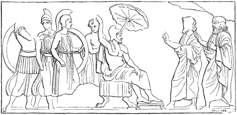
PERSIAN SATRAP SEATED.
The monuments found at Xanthus may be arranged under the head of (1) the so-called Ionic trophy monument,[59] (2) Miscellaneous reliefs, (3) Tombs. 89The first stands on the east side of the city, and was constructed of white marble on a basement of grey Lycian stone. Two or more friezes had once surrounded it, representing contests between warriors fully armed after the Greek fashion, or more lightly clad in tunics or naked, and wearing helmets. Sir C. Fellows imagines he can recognize, in some cases, the loose-robed bearded Lycians, with their peculiar arms and curtained shields,[60] the battle being that in the plains recorded by Herodotus.[61] Asiatics are certainly represented on some of the slabs with the pointed cap or cydaris, while, on other slabs is an attack on the main gate of a strongly-fortified town. On another relief is a Persian satrap seated, with the umbrella, or symbol of sovereignty, over his head, and on other slabs, are indications of a sortie from the city and of its repulse. The city may or may not be Xanthus itself, but, within the walls, are well-known monuments of that town, upright square 90pillars or stelæ, four of which are represented.[62] The “Trophy monument,” which has been cleverly restored 91by Sir Charles Fellows, as a peripteral tetrastyle temple, may be seen in the Lycian room in the British Museum. We regret, however, we cannot accept his view, that the subject of these sculptures is the capture of Xanthus by Harpagus, as this event took place in B.C. 545; while none of these reliefs can be as early as B.C. 400.[63]
2. The Miscellaneous reliefs found in and about the Acropolis are chiefly relics of much older buildings; they are generally in the rough, gritty stone of the country, and have some resemblance to early Greek work, especially to the sculptures from Assos. Their chief subjects are a lion devouring a deer, and a satyr, the size of life, running along the ground.
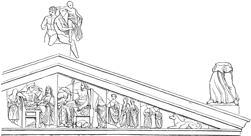
IONIC TROPHY MONUMENT.
3. The Tombs. The tomb-system, so to speak, as developed in Lycia, is a striking characteristic of that province, and has been, therefore, carefully studied by Sir Charles Fellows, who has classed them, according to their forms, under the heads of Obelisk, Gothic, and Elizabethan. The first, as the name implies, is simply a square block surmounted by a cap and cornice; the second and third have lancet-head tops or deep mullioned recesses, respectively. Of the two first the British Museum has excellent specimens; the third was chiefly used for carvings on the face of solid rocks. All alike exhibit imitations of wooden structures with panelled doors, bossed nails, and knockers suspended from lions’ mouths. One of these tombs, the so-called Harpy tomb, from its great curiosity, we 93must notice somewhat fully. It consists of a square column about 17½ feet high, in one piece of stone, surmounted by a series of bas-reliefs, forming the walls of a square chamber, seven feet each way, and having a small door on its west side. On these walls are representations of Harpies, between whom, in each case, is a group consisting of one seated and one standing figure. There is reason to suppose the subject of these reliefs a local myth, and, as the daughters of a Lycian hero, Pandarus, are said to have been carried off by Harpies, this is not improbably the subject here. Harpies are usually, as here, indicated with the faces, breasts, and hands of women, and with bodies and feet of vultures. It is possible that this stele may have been the tomb of some prince of the royal family of Lycia, who claimed descent from the mythical hero, Pandarus. No certain date can be assigned to it; but, had it been executed in Attica instead of Lycia, B.C. 530 would not have been too early for it. In any case, its execution must have preceded the Persian conquest of Lycia.
One of the most interesting of the Gothic tombs is that of a man whose name has been read Paiafa, and who was, probably a satrap of Lycia. The top of this structure much resembles an inverted boat, with a high ridge running along it, like a keel. On each side of the roof is an armed figure in a quadriga;[64] on the 94north side, below the tympanum, the Satrap is seated as a judge, his dress and general appearance being the same as that of the Persian on the Trophy monument.
In concluding these notes on Xanthus, we may allude to some casts from a tomb at Pinara, hard by, carved on the face of the solid rock. Sir Charles Fellows states that, in the centre of this city, there rises a round rocky cliff, speckled all over with tombs, many of them being only oblong holes, and quite inaccessible. One cast gives the representation of a walled city with tombs, towers, gates, and walls; the battlements, on the whole, much resembling the town shown on the “Trophy monument.” Another cast gives the interior of the portico of a rock tomb at Tlos, with Bellerophon, one of the heroes of Lycia, triumphing over the Chimæra.
It only remains for us to notice the famous Inscribed Stele, the longest inscription yet met with in the Lycian character, and containing a notice of a son of Harpagus, and the names of several Lycian towns. On the north side, between the lines of Lycian characters, is a Greek inscription in twelve hexameter lines,[65] the first from an epigram of Simonides 95(B.C. 556), and a notice of the achievements of this son of Harpagus. The whole inscription consists of about 250 lines.
Over the other towns of Lycia, Telmessus, Patara, Pinara, Myra, Tlos, and Antiphellus, it is not necessary for us to dwell at any great length, the more so that they were not, historically, of great importance, and are to us only interesting for the remains of art still visible on the spot.
Telmessus was on the coast, and is now represented by the village of Makri.[66] In ancient times it was famous for the skill of its augurs. Herodotus tells us they were often consulted by the kings of Lydia, and especially by Crœsus; and Arrian ascribes to them a remote antiquity. Their reputation long survived; for Cicero speaks of the town thus:—“Telmessus in Caria est quâ in urbe excellit haruspicum disciplina” (De Divin. i. 41). In early Christian times it had a bishop. Telmessus has been fully described by Dr. Clarke and Sir Charles Fellows. Its monumental remains are almost wholly tombs; but these are, many of them, remarkable for their beauty, as also for the extraordinary labour bestowed on them in cutting them out of the face of the rock. Sir Charles Fellows makes the curious remark, that, though the Greek population of Lycia were mainly Dorians, he did not meet with any tombs or other monuments unquestionably of the Doric order.
Patara, on the left bank of the river Xanthus, 96was chiefly celebrated for its worship and temples of the Lycian Apollo, known by the appellation of Patareus.[67] According to Herodotus (i. 182), the priestess who delivered it was shut up in the temple every night, but the oracular responses were only occasional. The Pataræan oracle was very ancient, and considered scarcely inferior to that of Delphi. Captain Beaufort, in his account of Karamania, places the remains of Patara[68] near the shore, and notices “a deep circular pit of singular appearance, which may have been the seat of the oracle.” Fellows alludes to “a beautiful small temple about the centre of the ruined city,” with a doorway “of beautiful Greek workmanship, ornamented in the Corinthian style, and in fine proportion and scale.” The port of Patara, which was too small to contain the combined fleet of the Romans and Rhodians under Regillus in the war with Antiochus (Liv. xxxvii. 17) is now completely overgrown with brushwood, &c. The theatre is shown by an inscription to have been built (more 97probably rebuilt) in the fourth consulate of Antoninus Pius, A.D. 145.
Pinara, at the foot of Mount Cragus, was another of the six Lycian towns in which divine honours were paid to the hero Pandarus, Homer’s celebrated archer: its name is said to be a Lycian word for a round hill (v. Ἀρτύμνησος, ap. Ptol.; Plin. v. 28; Hierocl. p. 684); and such a hill, pierced everywhere for tombs, Fellows found, as we have stated, in the very centre of it. Such a physical feature would not have been overlooked by any Greeks. He adds that “the whole city appears to be of one date and people,” the inscriptions being generally in the Lycian character.[69] The carvings on the rock-tombs here, judging from the drawing he gives (p. 141), are of much interest and beauty.
Myra, sometimes called Andriace (whence the modern Andraki), was, according to Appian, a place of some note, and it is still remarkable for the beauty and richness of its rock-cut tombs (Pullan). The Sacred historian of St. Paul’s journeyings writes that, after quitting Sidon and Cyprus, “when we had sailed over the Sea of Cilicia and Pamphylia, we came to Myra, a city of Lycia; and there the centurion found a ship of Alexandria sailing into Italy, and he put us therein” (Acts xxvii. 5, 6). Myra, at a late period, seems to have been the metropolis of the province (Malala, Chron. xiv.; Hierocl. p. 684). A Nicholas, Bishop of Myra, is also mentioned (Const. Porphyr. Themist. 14). Colonel Leake observes 98that, on the banks of the river by which Lucullus ascended to Myra, are the ruins of a large building, which, from an inscription, appears to have been a granary, erected in the time of Hadrian;[70] and Fellows adds that “the tombs are generally very large, and all appear to have been for families, some having small chambers, one leading to the other, and some highly interesting from their interior peculiarities of arrangement.” Many bas-reliefs within the porticos of the tombs still retain their original colour, as may be seen on the casts from them in the British Museum.
Tlos and Antiphellus, though occasionally mentioned in ancient times, had been well-nigh forgotten till these and other sites were diligently sought out by modern travellers. Leake speaks of the latter as containing a theatre nearly complete, with many catacombs and sarkophagi, some very large and magnificent; and Fellows thinks the tombs here the largest in Lycia. “The rocks for miles round,” he says, “are strewn with their fragments, and many hundreds are still standing, apparently unopened.”
Tlos, of which we know little more than that it lay on the road to Cibyra, was first accurately determined by Sir Charles Fellows, who considered the original city must have been demolished in very early times, as “finely-wrought fragments are now seen built into the strong walls which have fortified the town raised upon its ruins.” The theatre was the most highly-finished 99he had seen, for the seats were not only of polished marble, but each seat had an overhanging cornice, often supported by lions’ paws. An inscription found there records the name of Sarpedon, showing that the name of the mythical hero of Lycia was still preserved among the people. The name for tomb at Tlos is always Heroum.
As the provinces are so closely connected, we shall take Pamphylia and Pisidia together, simply selecting from them such sites as seem of the highest interest. We shall, therefore, notice first Attalia (the modern Adalia), although there has been some dispute among geographers whether Adalia does really occupy the site of the old city: the true course of a stream called Catarrhactes,[71] from its plunging headlong over precipices into the sea, being still undetermined, has mainly led to this confusion. The probability is that, owing to the agency of earthquakes, the coastline has been much changed during the last 2,000 years; moreover, Colonel Leake and others believe the calcareous matter brought down, in this period by the different streams, sufficient to cause the cessation of any such cascade, the main stream having been also much diverted to fertilize the gardens round the town. The physical changes have in fact, been so great, that it is more wonderful that anything can be determined on a certain and satisfactory basis. Captain Beaufort thought the modern town occupied the site of Olbia.[72] 100On the other hand, Leake considered Adalia the representative of Attalia, and that Olbia would probably be found in some part of the plain which extends for seven miles from the modern Adalia to the foot of Mount Solyma. Attalia derived its name from Attalus Philadelphus. From it, St. Paul and St. Barnabas, on their return, sailed to the Syrian Antioch (Acts xiv. 25). In later times it was the seat of a bishopric. It is now the principal southern Turkish port of Asia Minor, and has many ancient remains. Leake remarks on “the walls and other fortifications, the magnificent gate or triumphal arch, bearing an inscription in honour of Hadrian, an aqueduct, and the numerous fragments of sculpture and architecture.” Fellows adds:—“Adalia, which is called by the Turks Atalia, I prefer to any Turkish town that I have yet visited; every house has its garden, and consequently the town has the appearance of a wood, and of what?—orange, lemon, fig, vine, mulberry, all cultivated with the artificial care of a town garden, and now (April 3) in fresh spring beauty.” It was from Attalia, or from its neighbourhood, that Mark “turned back”[73] (Acts xiii. 13).
Nearly due N. of Attalia was Perge, famous in 101olden times for the temple and worship of Artemis Pergæa.[74] The date of the city is uncertain, but it lasted, as an ecclesiastical centre, till late in the Byzantine times. Alexander, in his march eastwards, occupied Perge, finding, as might have been expected, much difficulty in his advance through the adjacent mountains; St. Paul, too, and St. Barnabas were here twice; first, on their way from Cyprus; and, secondly, on their return to Syria. The ruins noticed by General Köhler, at a place called Eski Kalesi, were probably those of this place. The theatre and stadium are still quite perfect. On these walls and other buildings the Greek shield is constantly carved, reminding the spectator of the passage in Ezekiel, xxvii. 11, “They hanged their shields upon thy walls round about.”
Passing along the coast to the east we come to the Eurymedon, physically a small stream, yet celebrated in history for the double defeat, on one and the same day, of the Persians by Cimon. The Persian ships were drawn up at the mouth of the river, but, at the first attack, the crews fled to the shore. Cimon then landed his men, and after a severe struggle the camp and baggage were taken (Thucyd. i. 100; Plut. Vit. Cimon.). Some years later, a Rhodian fleet anchored off its mouth before attacking the fleet of 102Antiochus, then commanded by Hannibal (Livy, xxxvii.). The entrance of this stream is now completely blocked up by a bar.[75]
On the Eurymedon was seated the old Argive town of Aspendus, some of the coins of which read, barbarously, ΕΣΤFΕΔΝΥΣ. Thucydides speaks of it as a seaport; but he, probably, means that it was a boat-station at the mouth of the river. Aspendus is noticed by Arrian, and was the place where Thrasybulus was slain in his tent by the natives; it is also mentioned in the campaign of Manlius (Liv. xxxviii.; Polyb. xxii.).[76] Mr. Pullan gives a beautiful drawing of its theatre, which is by far the most perfect in Asia Minor. One other place of considerable reputation in Pamphylia must be briefly noted; viz. Side, a colony of the Cumæans of Æolis, and remarkable for the fact that, soon after they came there they forgot their native Greek tongue, and spoke a barbarous jargon. It was off this town the battle was fought when the fleet of Antiochus, under Hannibal, was utterly routed by the Rhodians. When, somewhat later, the pirates of Cilicia became so formidable, Side was one of their chief harbours, and one of the markets where they disposed of their ill-gotten plunder. Side was in Roman times the capital 103of Pamphylia prima, and was still in existence when Hierocles wrote. Capt. Beaufort found it utterly deserted; but its remains would seem to be very striking, especially its outer walls and theatre, which is not less than 409 feet in external diameter, with a perpendicular height, from the area, of 79 feet: all its seats are, Capt. Beaufort says, of white marble, and the building could have held 13,370 persons, sitting comfortably; it is, he adds, “in a very perfect state; few of the seats have been disturbed, even the stairs are, in general, passable.” The same observer considered that, at some later period, this great structure had been converted into a fortress, as walls, with towers and gates, but of inferior work, now extend to the seashore.
Our knowledge of the ancient geography of Pisidia is mostly derived from Arrian’s notice of Alexander’s march, from Livy’s account of the expedition of C. Manlius Vulso, and from the details in Polybius of the hostilities carried on by Garsyeris, the general of Achæus, against the people of Termessus, one of its chief cities. At the time Manlius was approaching this town the Termessians were in open war with the people of Isionda or Isinda, and, having captured this city, were besieging the citadel. The Roman general was not sorry to have so good a pretext for interfering; hence his march on Isinda, his relief of that city, and his fining the Termessians fifty talents. A glance at the map suggests that he must have come in, by the defiles of Milyas, near a place now called Al-Malu. The presumed ruins of Isinda have been noticed by M. 104Coransez, as extending over nearly a square league, and as remarkable for their massive structure.
Termessus itself was evidently at the entrance of the defiles whereby Pisidia communicates with Pamphylia and Lycia. Arrian says that “the men of Termessus occupy a site very lofty and precipitous on every side, the road passing close to the city being very difficult, as the mountain reaches down from the city to the road. There is over against this, another mountain not less precipitous, and these form a gate, as it were, on the road,” &c. This statement is fully confirmed by the observation of General Köhler (ap. Leake, Asia Minor, pp. 133-135): “The two great ranges on the west and north of the plains of Adalia,” says he, “now approach each other, and, at length, are only divided by the passes through which the river finds its way. The road, however, leaves this gorge to the right, and ascends the mountain by a paved and winding causeway, a work of great labour and ingenuity.”[77] Alexander the Great, it would seem, despaired of taking the town; or, possibly, thought its siege would detain him too long; he, however, forced the defiles, passing on to the north to Cormasa, Cremna, and Sagalassus, a course probably 105pursued by Manlius subsequently.[78] Cremna, where, owing to its great natural strength, the Romans placed a colony (Strab. xii. 569), has been carefully examined by Mr. Davis (“Anatolica,” p. 182), who gives also a plan, showing the construction of this remarkable fortress. His description is as follows:[79] “It (Kremna) is a plateau of limestone, which is bounded on three sides by precipices, some extremely deep and abrupt.”
“From it,” he adds, “the country inclined rapidly in its general formation to the valley of the Kestrus, which must have been at least 5,000 feet below us.... Most of the buildings of the city lay to the N.W. of our point of ascent. On the N.E. and N. was an extensive open space cultivated, but with many oak trees and with much underwood scattered over it.” ... Zosimus (A.D. 425) relates the history of the blockade of Kremna by a Roman army. It had been occupied by Lydius, an Isaurian free-booter, and his provisions falling short, he caused a part of the plateau to be sowed with corn. A 106great double gate is the only structure still standing, and, as all the columns have fallen exactly in the same direction, Mr. Davis reasonably conjectures they were overthrown by a single shock of an earthquake. Some well-paved streets are traceable, one 18 feet wide, with tombs and corridors running along each side. It is curious that a place so remarkable, physically, is scarcely mentioned by ancient writers. Thus, it is not noticed in the campaign of Alexander, who must have passed under it, but it was taken by Strabo’s contemporary, the Galatian Amyntas (xii. 569),[80] and was still later, as we have stated, a Roman colony with the title “Colonia Julia Augusta Cremna.” Its name is obviously derived from κρημνός, an overhanging precipice.[81] Kremna was a Christian bishopric, but only one of its bishops, Theodorus, is recorded.
Sagalassus was taken by Alexander, after a severe conflict, the result being, says Arrian, that all the rest of Pisidia submitted to his arms (i. 28). On the other hand, Manlius contented himself with ravaging the territory around it; thereby compelling the Sagalassians to pay a heavy contribution both of money and produce. Both Arrian and Livy bear testimony to the warlike and independent character of the mountaineers of this part of Asia Minor; while Strabo adds that it passed over to the Romans, as one of the towns of Amyntas, the tetrarch of Lycaonia. Sagalassus is further noticed by Pliny and 107Ptolemy, and, in Christian times, was a bishopric. Some magnificent ruins, at a great height above the plain, have been proved by Mr. Arundell to be those of this place, as he found there an inscription reading ΣΑΓΑΛΑΣΣΕΩΝ ΠΟΛΙΣ ΤΗΣ ΠΙΣΙΔΙΑΣ, “The City of the Sagalassians of Pisidia.” The position of the old town, as may be seen in one of the engravings in Mr. Arundell’s second Journey, is exceedingly picturesque; and we may feel sure Arrian is correct in stating that Alexander encountered a stiff resistance from its inhabitants ere he forced his way into the town.
The existing remains of Sagalassus are mostly Roman, but there is one very old wall of polygonal masonry. One of the principal ruins, with a portico 300 feet long by 27 feet wide, has probably been a Christian church: there is, also, a singularly perfect theatre. The ruins of the Christian church exhibit a building of vast proportions, constructed of huge blocks of marble, with Corinthian columns two feet in diameter. A large cross is cut deep into one of the blocks at the principal entrance. Mr. Hamilton, who calls the modern village Allahsún, says that “there is no other ruined city in Asia Minor, the situation and extensive remains of which are so striking, or so interesting, or which give so perfect an idea of the magnificent combination of temples, palaces, theatres, gymnasia, fountains, and tombs which adorned the cities of the ancient world.”[82]
108One other place in Pisidia we have yet to mention, Selge, of old one of its chief cities, yet, strange to say, at present unidentified, or only so doubtfully. Originally a colony from Lacedæmon, Selge maintained throughout its whole history the character of its founders, and, probably, owing to better laws and government, soon surpassed all the neighbouring towns in population and power, Strabo believing that it once had as many as 20,000 inhabitants. Much of its success was due to the security of its position, high among the mountains and difficult of access. Hence, the Selgians retained their personal freedom, and, though more than once compelled to pay heavily and deservedly for their own aggressions, were never dispossessed of their town by actual conquest. Naturally, they were constantly in conflict with their neighbours, especially, with Telmessus and Pednelissus.[83] They had, however, the sense to conciliate Alexander when he passed through their country. In the war with Pednelissus, it would seem that, aided by the then most powerful chief of the neighbouring country, Achæus compelled the Selgians to sue for peace, to pay down 400 talents, to restore the prisoners they had taken, and to give 300 talents more. Yet, in an actual attack on the city he was repulsed with heavy loss (Polyb. v. 72-77). The coins of Selge 109prove its existence till a late date. One would have thought that such a place, would have left remains behind it amply sufficient for its identification; yet all we can say, certainly, of it is that it could not have been far to the east or south-east of Sagalassus. From Zosimus, we might be led to look for it between the Cestius and Eurymedon, for Tribigildus, having crossed the latter, found himself enclosed between it and the Melas: and possibly, Fellows did discover it. “On this promontory,” says he, “stood one of the finest cities that probably ever existed, now presenting magnificent wrecks of grandeur. I rode for at least three miles through a part of the city, which was one pile of temples, theatres, and buildings, vieing with each other in splendour.... The material of the ruins, like those near Alaysóon (Sagalassus) had suffered much from exposure to the elements ... but the scale, the simple grandeur, and the beauty of style bespoke its date to be early Greek. The sculptured cornices frequently contain groups of figures fighting, wearing helmets and body armour, with shields and long spears.” Unfortunately, Fellows did not find a single legible inscription, but the remains are, very likely, what Beaufort heard of at Alaya; viz., “extensive remains of an ancient Greek city with many temples, about fifteen hours’ distance (say 35 miles) to the northward.”[84] 110Lastly, we must give an account of the Pisidian, or more accurately, the Phrygian, Antioch, a town of the highest interest to the Christian reader, from its connection with St. Paul’s early labours. It is remarkable that, 50 years ago, its position was not known, though the ancient notices of it, carefully studied, seem to point out, pretty clearly, where it ought to have been found. Little is known of this Antioch in early times, but it was, traditionally, a colony of Magnesia on the Mæander. Afterwards, like almost all the towns of Eastern and Central Asia Minor, it fell under the rule of the Seleucidæ, and, on their overthrow, was given by the Romans to Eumenes of Pergamus as one of the rewards for his faithful alliance. Subsequently, it was, for a while, under 111Amyntas the Lycaonian. At an early period of the empire, Antioch was known as Cæsarea, and somewhat later, according to Ulpian, its citizens enjoyed the Jus Italicum, that is, the same privileges as native Romans. At the time of St. Paul’s visit it was the centre of a great commercial activity. According to Strabo, Antioch was on the south side of the mountain boundary of Phrygia and Pisidia (p. 577), Philomelium, a Phrygian town, being exactly to the north, the latter standing on level ground, while Antioch stood on a small eminence.[85] It was reserved for Mr. Arundell to show, almost certainly, its true site,[86] and his description is exceedingly interesting. Almost his first discovery was a “long and immense building, constructed with prodigious stones, and standing south and west.” This was a church, not improbably constructed on the site of the Synagogue where St. Paul preached. “The remains of the aqueduct,” he adds, “of which twenty-one 112arches are perfect, are the most splendid I ever beheld, the stones without cement, of the same massy dimensions as the wall.”
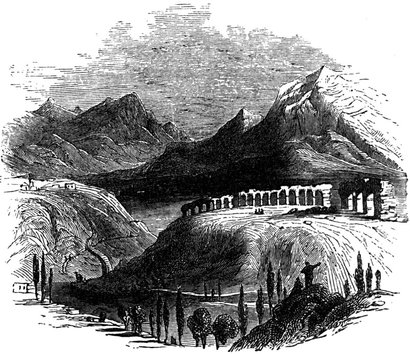
ANTIOCH OF PISIDIA.
A little further on he met with undoubted remains of a Temple of Bacchus, with the thyrsus or Bacchic emblem, and an inscription stating that one Calpurnius was “High Priest for life to the most glorious god Bacchus.” Another building, Mr. Arundell thinks, from the number of fluted columns, must have been a portico, “or the Temple of Lunus, or of Men Arcæus, whose worship was established at Antioch.”[87] Le 113Quien, in his “Oriens Christianus,” enumerated twenty-six bishops of Antioch. One of these, Methodius, and six other metropolitans subscribed the protest of the Eastern Church against the errors of Calvin. Hamilton, subsequently, found at Antioch an inscription reading ANTIOCHEAE CAESARE, which proves the truth of Arundell’s inferences (i. p. 474).
Cilicia had but few towns of much importance, and these chiefly on the coast or not far inland. Indeed, when we have mentioned Tarsus, Soli, Mallus, and Mopsuestia, we have noticed the principal places in this province. Of these, Tarsus[88] alone calls for any 114lengthened description. Of the early history of this city little is known, but a tradition, illustrated by one of its coins, asserted that Sardanapalus was buried there.[89] Its situation, however, led to its becoming the capital of Cilicia, a position it long retained. Tarsus stood on a rich and fertile plain on both sides of the river Cydnus. Historically, it is first noticed by Xenophon, as, in his day, a great and wealthy city, under a Persian satrap named Syennesis, the unwise ally of Cyrus the Younger. It remained under the Persian rule till the time of Alexander the Great, who nearly lost his life by imprudently bathing when too hot in the Cydnus (Curt. iii. 5; Arrian, ii. 4). In later days it was, generally, under the Seleucidæ, though, for a brief period, subject to the second and third Ptolemy.
Supporting the cause of Cæsar, the great Julius himself paid Tarsus a visit, when the Tarsians changed the name of their city to Juliopolis. Augustus made it a “libera civitas.” Hence, St. Paul, her most illustrious son, spoke truly, when he said it was “no mean city,” 115and urged with equal truth and justice that he was “free-born,” while his judge had only obtained this right “at a great price.” The fact is, its position on the immediate confines of Syria and of Mesopotamia was of the highest importance to the Romans in their conflict with the Parthians and Persians. It still retains its old name, slightly modified into Tarsous, and is still the chief city of this part of Karamania.
Tarsus[90] was famous in early days for a remarkable class of coins, known as Satrap-money. Among these are coins of Tiribazus, Pharnabazus, Syennesis, and of other rulers, between B.C. 410 and B.C. 370. A description of a coin of Pharnabazus will show their general character. On the obverse of this silver piece is a bearded and helmeted head, possibly the mythological type of Bellerophon or Perseus, either of which would be appropriate to the Græco-Asiatic population of Cilicia, and the name of Pharnabazus in Phœnician letters. On the reverse, is a seated representation of the Jupiter of Tarsus, with the legend, Baal-Tarz, evidently the Zeus Tersios of the Greeks, recorded on another coin as ΔΙΟΣ ΤΑΡΣΕΩΝ, “Of the Jupiter of the Tarsians.” The Duc de Luynes attributed this coin to the famous Pharnabazus (B.C. 413-374), who, originally Satrap of the N.W. district of Asia Minor, is memorable for the steady resistance he made to the Greeks, while the ruler of 116Lydia, Tissaphernes, on the other hand, accepted Lacedæmonian gold. If so, this coin must have been struck when Pharnabazus had given (B.C. 397, 8) the command of the Persian fleet to the Athenian Conon, as Tarsus was then the centre of the operations against Cyprus. Another extremely rare coin of Pharnabazus, with his name in Greek, was struck at Lampsacus in Mysia, perhaps, for the payment of the Greek mercenaries of Artaxerxes.
The towns along the coast of Cilicia have been very carefully studied by Captain Beaufort, who has identified many of them. The first of these, passing from W. to E., was Coracesium, a place historically interesting as having been held for a long time by Diodotus Tryphon, who, having revolted from Antiochus, set the first example of active defiance to the Seleucidæ; Coracesium was, also, the last place where the pirates made a united resistance to the forces of Pompey.[91] The whole story of these freebooters is very interesting. It is clear that their successes were mainly due to two things; first, the peculiar fitness of their ports along the seashore of Cilicia for prolonged resistance, with the high range of Taurus to fall back on if over-pressed; and, secondly, to 117the internecine squabbles of the kings of Cyprus, Egypt, and Syria with themselves and with the Romans, which made it, from time to time, the interest of each party to wink at their worst deeds. The Sacred Island of Delos was their chief western entrepôt; the increasing luxury of the Romans at the same time giving ample encouragement to their traffic in slaves.
The promontory of Alaya, identified by Captain Beaufort with Coracesium, rises, he says, abruptly “from a low, sandy isthmus which is separated from the mountains by a broad plain; two of its sides are cliffs of great height, and absolutely perpendicular, indeed the eastern side, on which the town is placed, is so steep that the houses seem to rest on each other.” Other places along this coast eastwards are, Laertes (the birthplace of Diogenes Laertius), ἐπὶ λόφου μαστοειδοῦς, “on a hill, in form like a woman’s breast,” and Selinus, a river and a town (now Selinty), the first of which is mentioned by Strabo, and the second by Livy. Its later name of Trajanopolis it owed to the sudden death there of the Emperor Trajan (A.D. 117), but, at a later period, the old name was revived in connection with an episcopal church (Hierocles). Beaufort speaks of its magnificent cliffs—“On the highest point of these,” he says, “are the ruins of a castle which commands the ascent of the hill in every direction, and looks perpendicularly down on the sea.” He notices also several other large structures, and, among these, a mausoleum (perhaps that of Trajan), an agora, a theatre, and an aqueduct. The supposed mausoleum, 70 feet long and 50 feet wide, is constructed of large well-cut blocks of stone and contains 118only one vault. Cyprus, distant sixty-five miles, can be clearly seen from this headland.
The next important seaport was Anemurium (now Anamur), in the neighbourhood of which Beaufort discovered a perfect city of tombs. “These tombs,” says he, “are small buildings detached from each other and mostly of the same size, though varying in their proportions; the roofs are arched, and the exterior of the walls is dashed with a composition of plaster and small particles of burnt red brick. Each tomb consists of two chambers: the inner one is subdivided into cells or receptacles for the bodies, and the outer apartment is supplied with small recesses and shelves, as if for the purpose of depositing the funereal offerings, or the urns that contained the ashes. The castle strongly resembles some of the ancient castles of Great Britain. Its keep or citadel is placed on a small rocky eminence, and commands two open courts.... The extreme dimensions are about 800 feet by 300 feet.”
Celenderis (now Chelindreh) was noted in ancient history as the place which Piso, the enemy of Germanicus, attempted to take (Tacit. An. xi. 80), and appears, also, in the Ecclesiastical annals, as one of the episcopal towns of Isauria. As the nearest point of communication with Cyprus, it is still occupied by a small population. There are some remains of a fortress which Tacitus describes as of great strength; while many arched vaults, sepulchres and sarkophagi may be seen on the spot. All along this part of the coast of Cilicia the presence of the Crusaders is clearly shown in the names of existing places, as, for instance, in Cavalière and Provençal Island; indeed, Vertot records that, 119during the settlement of the Christian knights at Rhodes, they took possession of several islands and castles along the shores of Asia Minor. Another place, some eight or nine miles inland, Selefkeh, the ancient Seleuceia ad Calycadnum, is also specially noticed by De Jauna in his History of Armenia, as given by the king of Armenia to the knights of Rhodes for their services. This town, which owed its real or supposed origin to Seleukus Nicator, was famous for its schools of literature and philosophy: Athenæus and Xenarchus, two well-known Peripatetics, having been born there. Seleucia was still in existence in the time of Ammianus, and the ecclesiastical historians, Socrates and Sozomen, speak of Councils having been held here.
Beaufort reports the existence at Selefkeh of many ruins on the west side of the river, and, especially, of an enormous reservoir lined with hard cement (the “opus Signinum” or “Coccio pesto” of the Roman aqueducts). This structure is 150 feet long by 75 feet broad and 35 feet deep, and could, therefore, have held nearly 10,000 tons of water. A little further on is a place called Korghoz, possibly, the Corycus of antiquity, and the site of the Corycian cave, in mythology, the fabled abode of the giant, Typhôs;[92] but, more probably, the crater of an extinct 120volcano. Strabo says it was a deep and broad circular valley, the lower part rugged, but covered with shrubs and evergreens, and, especially, with saffron, which was abundant here. From an internal cavity gushed forth a copious stream, which, for a while lost, after a brief course, reappeared near the sea, which it joined. This was called the “bitter water.” Beaufort found two places bearing the name of Korgho Kalaler (castles), there being many signs in the neighbourhood of the former existence of a city of considerable size:—“A mole of great unhewn rocks projects at one angle from the fortress about 100 yards across the bay, terminated by a solid building twenty feet square.”[93] Can this be the remains of an ancient pharos or lighthouse? We should add that the places, hitherto described, belong to what was usually called Cilicia Tracheia; those we shall now notice, belonging, on the other hand, to the plain country.
Of these we take first, Soli, a colony (Strabo tells us) from Lindus, a relationship the Solians did not forget during subsequent negotiations with the Romans. Soli is first mentioned in Xenophon’s Anabasis, and must, in the following seventy years, have rapidly increased, as Alexander the Great fined the people 200 talents for their attachment to the Persian empire. After having been destroyed by Tigranes, 121Pompey placed there some of the Cilician pirates whom he had spared; at the same time changing the name of the city to Pompeiopolis. Most of the existing remains are, therefore, Roman. “The first object,” says Beaufort, “which presented itself on landing was a beautiful harbour or basin, with parallel sides and circular ends; it is entirely artificial, being formed by surrounding moles or walls fifty feet in thickness and seven feet in height.... Opposite to the entrance of the harbour a portico rises from the surrounding quay, and opens to a double row of two hundred columns which, crossing the town, communicates with the principal gate towards the country; and from the outside of that gate a paved road continues, in the same line, to a bridge over a small river.... Even in its present state of wreck, the effect of the whole is so imposing, that the most illiterate seaman in the ship could not behold it without emotion.” The actual execution of these columns is, however, poor; and, of the original two hundred, only forty-four are now standing.[94] Soli was the birthplace of Chrysippus, Philemon, and Aratus.
Adana, which is noticed first in the Mithradatic War, by Appian, and, subsequently, by Pliny, Ptolemy, Dio Cassius, Procopius, and the Byzantine 122historians, like Tarsus, adopted the name of Hadrian. It is still a place of some size, and the capital of the Pashalik of the same name.
Near the mouth of the river Pyramus (now Gihoon), and further up, are three towns which may be taken together. The first is Mallus, very near the sea, on the left bank of the river over which Alexander threw a bridge, in Mallotis, Strabo’s name for the circumjacent district; or Megarsus (possibly an earlier name for Mallus,) described in Lycophon as standing on a “sea-worn hill”—an expression Beaufort says accurately applies to a place now called Karadash.[95] Mallus retained its name, slightly modified to Malo, till mediæval times (Sanut. Secret. Fid. li. p. iv. c. 26): 2ndly, above Mallus, Mopsuestia, the creation of a certain mythical hero called Mopsus. According to Pliny, this town was a “free” city, and Procopius states 123that Justinian repaired the bridge over it (Ædif. v. 5). During the Byzantine period the name was modified to Mensis. Still further up the same river was Anazarba (sometimes called Cæsarea ad Anazarbum), the capital, in the fifth century, of Eastern Cilicia as Tarsus was of the Western—(Hierocles). It was nearly destroyed by earthquakes in the reigns of Justin and Justinian (Procop. Hist. Arcana, c. 18; Cedren., p. 299). Dioskorides and Oppian were born there. The last place in Cilicia to which we shall call attention is Issus, ever memorable as the scene of the famous conflict between Alexander and Darius. Its modern name, Scandaroon or Alexandretta, is obviously derived from Alexandreia. The town stood at the foot of the main chain of Mount Amanus, and, at the head of the gulf to which it gave its name. It was early (as might have been expected from its position) a considerable town, but, in Strabo’s time, had ceased to be more than a small port. Cicero, in his expedition against the mountaineers in the neighbourhood stayed there for some time (Epist. ad Attic. v. 20). The famous defile leading from Cilicia into Syria was to the east of the town.
124