From the Great Lakes to Puget Sound.
Reading edition
“To the doorways of the West-Wind, To the portals of the Sunset.”
hile, in the old world, armies have been contending for the possession of narrow strips of territory, in kingdoms themselves smaller than many single American States, and venerable savants have been predicting the near approach of the time when the population of the world shall have outstripped the means of subsistence, there has arisen, between the headwaters of the Mississippi and the mouth of the stately Columbia, an imperial domain, more than three times the size of the German empire, and capable of sustaining upon its own soil one hundred millions of people. What little has been done—for it is but little, comparatively—toward the development of its amazing resources, has called into existence, on its eastern border, two great and beautiful cities, which have sprung up side by side on the banks of the great Father of Waters.
It is there, at St. Paul and Minneapolis, that the traveler's journey to Wonderland may be said to begin. And what could be more fitting? for are they not wonders in themselves, presenting, as they do, the most astonishing picture of rapid expansion the world has ever seen?
But it is not their magnitude that excites the greatest surprise. If there is a single newspaper reader in ignorance of the fact that the State census of 1885 found them with a population of 240,597? or that the 23,994 buildings erected within their limits since the beginning of 1882, represent a frontage of over 100 miles and an expenditure of $69,895,390, or that their banking capital considerably exceeds that of either San Francisco, New Orleans, Cincinnati or St. Louis, it is through no fault of the cities themselves. But the visitor may bring with him a just appreciation of their size and commercial importance, and yet have had no conception of their beauty, nor of the abounding evidences of public spirit and private enterprise that will confront him at every turn.
The position of St. Paul, at the head of navigation, and as the focus of the railway activity of the Northwest, commands for it an extensive wholesale trade, its sales aggregating, in 1885, the large sum of $81,420,000. The surprise with which the visitor views the stately piles that are the outward and visible signs of the vast commercial and financial interests of the city, the creation of a few brief seasons, is no greater than the astonishment with which he realizes the absence of all appearance of immaturity. In no city in the Union are the business quarters more solid and substantial; in none is the domestic architecture more attractive. Nothing is crude, nothing tentative, nothing transitional.
Clustered around the great Falls of St. Anthony, stand those colossal flouring mills that have been more than ever the pride and glory of Minneapolis, since they enabled her to pluck from Chicago's crown one of the brightest of its jewels. It is a startling commentary upon the much vaunted supremacy of the great metropolis of the West, that, while the wheat attracted to its market fell gradually from 34,106,109 bushels in 1879, to 13,265,223 bushels in 1885, the amount handled by the millers of Minneapolis increased, within the same period, from 7,514,364 bushels to 32,112,840 bushels. The mills have a total flour-manufacturing capacity of 33,973 barrels per day, an amount equal to the necessities of the three most populous States of the Union, or of one-half the population of Great Britain.
But to turn from the romance of figures to that of song and story. Should the traveler have any desire to visit the far-famed falls of Minnehaha, it is now he should gratify it. Situated almost midway between the two cities, they can be easily reached, either by train, carriage or river steamboat. The poetic interest with which they have been invested by their association with the legend of Hiawatha constitutes but the least of their claims upon the traveler's notice; and, should he turn aside to visit them, not even the sublime scenery of Wonderland will entirely efface the memory of their laughing waters.
The residents of St. Paul and Minneapolis are fortunate in having, within easy access, two of the most beautiful of Minnesota's ten thousand lakes, White Bear and Minnetonka. Justly celebrated for the beauty of their scenery and the excellence of their hotel and other accommodations, they are resorted to annually by thousands of visitors from far and near. Minnetonka is not inappropriately called the Saratoga of the Northwest; but no designation, however high-sounding or significant, can do justice to the exquisite beauty of its scenery or the sumptuousness of its hotels.
It is time, however, that we were directing our steps toward that scarcely less luxurious hotel which is waiting to convey us to the fir-clad slopes of Puget Sound! While holding in honorable remembrance the names of Watt and Stephenson, surely posterity ought not altogether to forget those of the inventors of the sleeping car and dining car; for the railway train of early days was hardly a greater advance upon the old stage-coach than is the completely equipped train of to-day over its predecessor of even twenty-five years ago.
The journey from St. Paul to Puget Sound may be said to fall into eight geographical divisions, with well-marked natural boundaries, and corresponding in the main to the divisions into which the line has been formed for operating purposes. The first extends to the Red River of the North, a distance of 275 miles, lying wholly in the State of Minnesota.
The great attractions of this State are its pine forests, covering nearly one-half of its entire area, and its numerous beautiful lakes. Of the latter, there are no fewer than 215 within twenty-five miles of St. Paul, and they extend right through the central part of the State, on both sides of the railroad, to the prairie region bordering upon the Red River. Many of them are of exceeding beauty, especially in the district known as the
LAKE PARK REGION,
a richly diversified section of country, presenting the most charming scenery.
Among the most famous, are Lake Minnewaska, on the Little Falls and Dakota division of the road, fifty-nine miles from its junction with the main line; Clitherall and Battle Lakes, on the Fergus Falls and Black Hills branch; and Detroit Lake, on the direct line to the West, 230 miles from St. Paul. All these have fine pebbly beaches, lined with beautiful borders of timber, and their accommodations for all classes of visitors—anglers, sportsmen and families—are exceptionally good.
Like all the waters of Minnesota, they teem with fine, gamey fish of many varieties. The accomplished editor of the American Angler, writing in his well-known journal, after a visit to the Northwest in the summer of 1885, stated, that, during a life of nearly a quarter of a century as an angler, no experience with a rod had equaled in variety and weight the two days' fishing he had had on Detroit Lake. Nor was Mr. Harris' success exceptional. A score of one hundred pounds per day on two rods, is, as he goes on to state, considered quite a modest record.
For what is locally regarded as a good catch, we must turn to that of the three gentlemen who, on the afternoon of June 1st, 1885, brought in, as the result of less than three days' work, 603 pike, 138 black bass, 178 rock bass, 28 cat-fish and 25 pickerel; the entire catch weighing 2,321 pounds. This “fish story” is well authenticated. Eastern anglers can have no conception how full of fine fish, of many varieties, these Minnesota lakes are. For black and rock bass, maskalonge, pickerel, wall-eyed pike, and an infinite variety of smaller fish, a recent writer in the American Angler pronounces Detroit Lake the finest fishing ground on the continent. Nor need any angler or sportsman—for prairie chickens, ducks and deer are abundant—expect to have to look to sport to make up for the deficiencies of accommodation; for the Hotel Minnesota is said, on the highest authority, to be a gem of a hostelry for anglers, every facility and convenience they could wish for being obtainable at moderate charges.
The scenic attractions, also, are of a high order, the natural features of the surrounding country being of the most diversified character. The air is pure and invigorating, and hay fever and malarial diseases are absolutely unknown.
Lake Park is another delightful resort in this region, having good fishing and boating within easy distance, and a first-class hotel adjoining the depot.
Before arriving at Detroit, the traveler from St. Paul passes through Brainerd, the “City of the Pines.” The selection of this city for the location of the machine shops of the railroad has given a great impetus to its growth; nevertheless, for deer and bear hunting, it is still one of the best localities in the State. There is fine fishing, too, in its immediate vicinity, and its hotel accommodations also are very good. Here it is, also, that travelers from the East, coming by way of the Great Lakes, join the west-bound train.
The distance to Brainerd from Duluth, the point of debarkation, at the west end of Lake Superior, is 114 miles.
The traveler, who, in 1886, visits Mr. Proctor Knott's “Zenith City of the Unsalted Seas,” will find the straggling village of five years ago a busy city of 20,000 inhabitants, with abounding evidences of the commercial importance it has attained. By reason of the advantages afforded by the great waterway of the continent, for the direct shipment of wheat to the Eastern States or to Europe, Duluth has become almost as formidable a rival of Minneapolis as that city is of Chicago. It handled last year no fewer than 15,819,462 bushels of wheat, while its saw mills cut up 125,000,000 feet of lumber, and an extensive trade was also carried on in coal, salt and lime.
A few miles distant, and connected with it by a railway whose construction involved the building of an exceedingly fine iron bridge, is the city of Superior, also with excellent terminal facilities. The eastern terminus of this, the Wisconsin division of the railroad, is Ashland, an important town and favorite summer resort on Lake Superior. Midway between this town and Duluth the line crosses the Brule river, whose excellent fishing grounds its recent opening has, for the first time, rendered accessible.
The Brule river proper is a large stream, averaging 100 feet in width, of clear, cold water, flowing, its entire length, through one of the great forests of Wisconsin. With high banks, and free from low or marshy ground, it is an ideal trout stream. The best fishing on the river is to be had in a stretch of fourteen miles, extending six miles above, and eight miles below, the crossing of the Northern Pacific Railroad. The trout attain a large size, catches of three and four pound fish being an everyday occurrence. In the surrounding forest, game, including moose, deer, beaver and pheasant, is found in great abundance. Large quantities of venison were shipped hence by rail during the winter of 1885–86, the shipments from November 1st to December 15th alone exceeding 13,000 pounds.
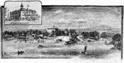
DETROIT LAKE AND HOTEL MINNESOTA, DETROIT, MINN.
Almost equal to the exciting pleasures of the chase is that of shooting the Brule river rapids in a canoe. Accompanied by an experienced guide, the visitor performs this feat without danger; let him attempt it alone, and he is sure of a ducking. For the angler and sportsman, the Brule possesses an additional attraction in the fact, that, while most excellent accommodations are to be had at the railroad crossing, including boats, fishing tackle and guides, there is no settlement of any kind within a considerable distance.
The line from Duluth to Brainerd follows, for many miles, the winding valley of the St. Louis river, through scenery for the most part stern and wild, yet not without an occasional suggestion of the gentler beauty of the far-off Youghiogheny. Between Fond du Lac and Thompson the river has a descent of 500 feet in a distance of twelve miles, tearing its way with terrific force through a tortuous, rock-bound channel. The best point for observing the fine effect of these impetuous rapids and cascades, known locally as the Dalles of the St. Louis, is near the twentieth mile post westward from Duluth.
Pursuing its way in the direction of Brainerd, the train traverses a country comparatively little known. Its scanty population is engaged almost entirely in logging, lumber manufacturing, and hunting, the immense forest covering the face of the country abounding with deer, bear, wolves, foxes and other game.
Emerging from the deep recesses of the forest, and passing swiftly through the lake region already referred to, we find ourselves in a level prairie country, and can dimly descry, in the far distance, the thin, dark line which another hour's ride will show to be the narrow fringe of timber that marks the course of the famous Red River of the North, that true Arimaspes, with whose golden sands thousands and tens of thousands have been made rich.
This, then, is the renowned Red River valley, the story of whose amazing fertility has attracted, from older States and still older countries, one hundred and fifty thousand people. The greatest influx has taken place since 1880, the increase in population between the census of that year and that in the spring of 1885 being 38,719 on the Minnesota side of the river, and 54,918 on the Dakota side.
Although there are vast tracts of land still uncultivated, the general appearance of the valley is that of a well-settled agricultural country. But this will occasion no surprise to those who remember that its annual wheat crop has now reached 25,000,000 bushels, and its crop of other cereals 15,000,000 bushels.
Not a little surprise, however, is occasioned by the discovery that the “valley” of which the traveler has heard so much is not a valley at all, but a great plain, whose slope toward the river is so slight as to be wholly imperceptible.
Where the railroad crosses the river, have sprung up the cities of Moorhead and Fargo, the former in Minnesota, the latter in Dakota. With such advantages of situation as they possess, and with the days of booms, with all their unhealthy excitement and fictitious values, gone, never, it is to be hoped, to return, these cities must continue to increase in commercial importance, with the development of the rich country surrounding them.
Fargo is, indeed, the largest city in the entire Territory of Dakota, and will probably retain its position as such for many years to come.
It is needless to repeat here the oft-told story of Dakota's marvelous growth. Time was when it was capable of being wrought up into a mosaic of wondrous interest and beauty; but, with the multiplication of agencies for giving it publicity, its charm, for the present generation at least, has passed away. It will, nevertheless, afford the historian of the nineteenth century material for one of the most interesting and instructive chapters of his work.
Writing, in 1828, his “Principles of Population,” the great historian of Europe said: “The gradual and continuous progress of the European race toward the Rocky Mountains has the solemnity of a providential event: it is like a deluge of men rising unabatedly, and daily driven onward by the hand of God.” But at that time the State of Illinois, but half way toward the Rocky Mountains and one-third of the way to the Pacific Ocean, was almost the limit of its mighty flow. Wisconsin, with no noteworthy settlements of its own, formed part of the Territory of Michigan; Iowa was an altogether vacant region, without any form of organized government; while other great States of to-day were still either mere parts of the Louisiana purchase, with as yet no separate identity, or were comprised within the then far-extending territory of the republic of Mexico.
The traveler to the Northwest, by the Northern Pacific Railroad, traverses that section of the far-extending dominion of the American people that was the last to be overspread by that great tide of civilization. He sees its evidences in the happy and prosperous homesteads that dot the fertile plains of Dakota, and nestle under the sheltering bluffs of the winding valleys of Montana; he is able to bear witness, also, to its having penetrated the fastnesses of the Rocky Mountains, and converted the hillsides of Eastern Washington and the fair lands of Oregon into smiling wheat fields and fruitful orchards.
But, notwithstanding the hundreds of flourishing settlements scattered along the great highway of travel, with here and there a goodly town or city, he can not but wonder at the apparent sparseness of population when he remembers that one and a half millions of people have their homes between the Great Lakes and Puget Sound.
But let him consider the vast extent of the country; let him call to mind that Dakota, with her 415,664 inhabitants, has yet 230 acres of land to every man, woman and child within her borders, her population averaging less than three to the square mile; that the density of population in Oregon and Washington is but two and one-half and two to the square mile, respectively; while both Montana and Idaho have considerably more square miles than they have inhabitants.
The county of Cass, which stretches westward from Fargo, is one of the best settled sections of the Northwest, there being no land whatever subject to entry. It contains some of the largest wheat farms in the world, and it has produced more than one wheat crop of 5,000,000 bushels. This county has an actual wealth of over $20,000,000, and, with its 120 school houses and numberless churches, it may be taken as admirably illustrating both the capabilities of the country and the character of the people who are building it up.
At Dalrymple, eighteen miles from Fargo, and at Casselton, two miles farther west, are the
GREAT WHEAT FARMS
of Mr. Oliver Dalrymple, comprising some 50,000 acres. Continuing westward, we pass, in rapid succession, various flourishing settlements, among them being Valley City, on the Sheyenne river, the judicial seat of Barnes county.
Presently the train descends into the valley of the James, or Dakota, river, and the prosperous city of Jamestown is reached.
From this point a branch line extends northward, ninety miles, to Minnewaukan, at the west end of Devil's Lake. This remarkable body of salt water, with its deeply indented and richly wooded shores, where the briny odor of the ocean mingles with the fragrance of the prairie flower, is surrounded by some of the best farming lands in Dakota. Its attractions for the tourist, angler and sportsman have obtained wide recognition, fish and game being very plentiful, the climate highly salubrious, the scenery picturesque, and the hotel accommodations good. The James river is said to be the longest unnavigable river on the continent, if not in the world, its flow, for hundreds of miles, being distinguished by scarcely any perceptible increase of volume.
Crossing a high table land, 1,850 feet above sea-level, and 950 feet higher than the Red river at Fargo, and known geographically as the Coteaux de Missouri, the train rapidly pursues its way past various large and well-managed farms to Bismarck, the capital of the Territory.
This city has long commanded an important trade with various settlements on the Upper Missouri, the steamboats employed having transported as much as 45,000,000 pounds of freight within a single brief period of navigation. It is the shipping and distributing point of a vast area whose only railroad facilities are those afforded by the great transcontinental line that here crosses the Missouri river. With the various important settlements that have been established in that great tract of country, Bismarck has either stage or steamboat communication. While, however, river navigation is limited to a comparatively short season, the stages run regularly all the year round, having even been known not to miss a single trip, or to be more than a few hours late, during an entire winter.
But it is not the Fargos, the Jamestowns or the Bismarcks with which the tourist chiefly concerns himself. They attract his attention only because of the evidence they afford of the development and stability of the country, and the enterprise of the people, and he is far more interested in the crossing of the Missouri river, than in either of the two cities that frown at each other across its turbid waters.
The bridge, by which the railroad is carried across the great river, here 2,800 feet in breadth, although 3,500 miles from the Gulf of Mexico, is a structure of immense strength, and not more substantial than it is graceful. It consists of three spans, each of 400 feet, and two approach spans, each of 113 feet, with a long stretch of strongly built trestle work over the gently sloping west bank of the river.
Here the train runs into Mandan, a pleasant little city, nestling under low ranges of hills which encompass it on three sides. This is the terminus of the Missouri and Dakota divisions of the road. The change from Central to Mountain time is made at this point, and the west-bound traveler sets his watch back one hour.
The country west of the Missouri river presents an entirely different appearance from that through which the tourist has been traveling since he entered the Territory at Fargo. It is more diversified; its numerous streams, with handsome groves of cottonwood upon their banks, meandering through pleasant valleys, clothed, where still uncultivated, with that nutritious bunch grass, which, but a few short years ago, made them the favorite feeding grounds of the buffalo. The vast beds of lignite coal that underlie this portion of the Territory crop out at various points, twelve car loads being mined daily at Sims, 35 miles west of Mandan, for shipment by rail. The most important settlements on this division of the road are Gladstone and Dickinson.
Twenty miles west of the latter town, the line enters the singular and picturesque region known as the Bad Lands of the Little Missouri. For a full hour the train pursues its way through scenery of which the whole world is not known to afford any counterpart.
The product of natural forces, still working to the same end, the picture that meets the astonished gaze of the traveler, suggests, where it does not utterly bewilder, either supernatural agency or the operation of laws whose reign has ceased. Reasonable hypotheses all failing, one's imagination connects the weird and mysterious scene with some early geologic epoch when, perchance under the brooding darkness of night, the yet plastic earth was tortured by some wild spirit of Caprice into the fantastic forms in which we see it to-day. But evidences of intelligent design are not altogether wanting, and we turn from mounds of wonderful regularity and symmetry of form, standing like Egyptian pyramids, to reproductions of the frowning battlements of Gibraltar or Ehrenbreitstein, or the dome and towers of some great cathedral.
Marvelous as they are, however, these forms and outlines excite even less astonishment than the wealth of coloring in which they are arrayed. Composed largely of clay, solidified by pressure, and converted into terra-cotta by the slow combustion of underlying masses of lignite, each dome and pyramid and mimic castle is encircled with chromatic bands presenting vivid and startling contrasts. Huge petrifactions and vast masses of scoria contribute to the weirdness of the scene, and, as if to complete its plutonic appearance, smoke goes up unceasingly from unquenchable subterranean fires.
It is a mistake to suppose that these lands are worthless for agricultural or stock-raising purposes. The valleys and ravines are covered with nutritious grasses, and thousands of cattle may be seen grazing where the buffalo and other herbivorous wild animals were wont to roam in days gone by. The term “Bad Lands” is a careless and incomplete translation of the designation bestowed upon the country by the early French voyageurs, who described it as “mauvaises terres pour traverser.”
At the crossing of the Little Missouri, the Marquis de Mores, a wealthy young French nobleman, has established the headquarters of an extensive stock raising and dressed meat shipping business.
From this point, Medora, excursions may be made to Cedar Cañon, one of the most interesting localities in the Bad Lands; or to the burning mine, where may be seen, raging, perhaps the most extensive of the subterranean fires of the entire region. It is also a good point from which to start out on hunting expeditions, large game being by no means exterminated.
Sixteen miles beyond the Little Missouri, the train passes Sentinel Butte, a lofty peak rising precipitously from the plain on the south side of the railroad. One mile more and the Montana boundary is crossed, at an elevation of 2,840 feet above sea-level.
In crossing the great Territory of Dakota, the tourist has traveled 367 miles; in traversing that of Montana, he performs a journey of no less than 800 miles, almost equivalent to the distance from New York to Indianapolis. Fortunately, the luxurious appointments of the train render weariness well nigh impossible, and the trip hourly becomes more interesting and enjoyable.
At Glendive, 692 miles from St. Paul, the road enters the valley of the Yellowstone, the windings of which famous river it follows, more or less closely, for 340 miles.
The valley, from five to ten miles in width, is inclosed by high bluffs of clay and sandstone, their curious formations occasionally reminding the traveler of the Bad Lands, though they have but little variety of color.
If the Red River of the North may justly be regarded as the true Arimaspes, the Yellowstone may, with equal propriety, be designated the modern Amphrysus. It is upon its banks and those of its tributaries that there has been developed, since the opening of the Northern Pacific Railroad, that vast grazing interest which has given Montana as great a reputation for its stock as Dakota has for its wheat.
For many years,—up to and including the winter of 1881–82,—this was the finest buffalo hunting country on the continent. But the slaughter that season was enormous, 250,000 hides being shipped East, principally from Miles City. Few have been seen since that time. There are hunters who believe that small herds might still be found north of the international boundary; but, so far as the United States is concerned, the buffalo is practically extinct. There is, however, a small herd in the National Park. Safe from the hunter's deadly repeater, they will probably multiply rapidly, as it may be supposed that they will soon know instinctively the limits within which they are unmolested.
Miles City, a few years ago the principal rendezvous of the hunter, is now the great resort of the grazier and cowboy, it being the metropolis of the stock interest of the Territory.
The development of this interest within recent years has been as rapid as that of wheat raising in Dakota, and the economist who should turn to the United States census reports for 1880 for the present condition of any considerable section of the Northwest would be led seriously astray.
In 1880, Montana contained 490,000 cattle and 520,000 sheep. According to a recent report of the Governor of the Territory, it contains, at the present time, 900,000 cattle, 1,200,000 sheep, and 120,000 horses. The grazing interests of the West are moving steadily toward Eastern Montana; for, so rapidly do cattle thrive on the nutritious grasses of these northern valleys, that a yearling steer is worth $10 more in Montana than in Texas.
Glendive, already mentioned as the point at which the railroad enters the Yellowstone valley, is second only to Miles City in importance as a shipping and distributing point. It is also a divisional terminus of the railroad.
Two miles west of Miles City is Fort Keogh, one of the largest and most beautiful military posts in the United States. It was established in 1877 by Gen. Nelson A. Miles, as a means of holding in check the warlike Sioux. There are but few Indians to be seen now along the line of the railroad, and those are engaged in agricultural and industrial pursuits. The extinction of the buffalo has rendered the Indian much more amenable to the civilizing influences brought to bear upon him than he formerly was, and very fair crops of grain are now being raised at the various agencies. At the Devil's Lake Agency, 60,000 bushels of wheat were raised in 1885, and purchased by the United States Government at $1 per hundred pounds. The Crows, along the northern border of whose reservation—nearly as large as the State of Massachusetts—the road runs for two hundred miles, are said to be the richest nation in the world, in proportion to their numbers, their wealth aggregating $3,500 per head. This, however, is due to the natural increase of their live stock, chiefly ponies, rather than to their own industry and thrift.
Out amid the solitudes of the far Northwest—for it must not be supposed that the entire country is a succession of settlements—it is wonderful with what interest the traveler regards that trivial event of daily occurrence, the meeting of the east-bound train. But, as he peers through the car window, or stands out on the platform, in critical survey of its passengers, it probably does not occur to him that he is as much an object of curiosity to them as they are, each of them, to him. He represents the far East of this great continent, they the far West. He, perchance, is making his first trip to the Pacific slope, they theirs to the Great Lakes or the Atlantic coast. Among them, however, may be distinguished merry groups of returning tourists, while, reclining in a luxurious Pullman car, or tempting dyspepsia with the rich and varied dainties of the dining car, may be seen one of the early settlers of California, a weather-beaten pioneer, who reached the Pacific slope by way of the Horn, twenty years ahead of the first transcontinental railway, and now goes east, by the Wonderland route, to revisit the scenes of his childhood.
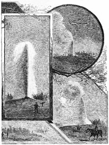
VIEWS OF “OLD FAITHFUL” GEYSER, YELLOWSTONE NATIONAL PARK.
Twenty-nine miles east of Billings, the next divisional terminus and important trading point on the line of the road, the traveler will observe, rising from the right bank of the river, a huge mass of sandstone, interesting as bearing upon its face the name of William Clarke, cut in the rock by the veteran explorer himself, when he visited the locality in 1806. He will, about the same time, be able dimly to descry the peaks of the Big Snow Mountains, which, at first scarcely distinguishable from the fleecy clouds that hang around them, subsequently loom up grandly, constituting one of the most beautiful pieces of scenery in the Northwest.
The disciple of Izaak Walton will not have traveled 225 miles along the banks of the Yellowstone without having seen many an inviting spot for indulgence in what his great master called the most calm, quiet and innocent of all recreations. His arrival, therefore, at Billings, the largest town on the upper river, and the metropolis—notwithstanding that it has a population of only 2,000—of a region larger than Maine, South Carolina, West Virginia or Indiana, affords a not unfitting opportunity for a brief reference to the incomparable trout fishing afforded by the numerous streams accessible from points on the Montana and Yellowstone divisions of the road.
The Yellowstone river itself, west of Billings, has no superior as a trout stream. It contains trout of four distinct varieties, and fishing is so easy as at times to be in danger of losing its charm. The individual scores of various tourists, reported in the American Angler during the summer and fall of 1885, and not containing any that were phenomenally large, averaged twenty-five trout per hour for each rod, a record with which the most ardent angler ought surely to be satisfied. A majority of these scores were made in the vicinity of Livingston, near which town another visitor is reported to have caught twenty-one fine, large trout “after supper,” while two others are stated to have brought in 160 as the result of “a day's sport.” The Yellowstone also contains a gamey fish known to local anglers as grayling, but pronounced by Mr. W. C. Harris to be the whitefish (Corregonus tullibee). That gentleman refers, in a recent article, to the abundance, in these waters, of the celebrated “cut-throat” trout, whose size and abundance, in conjunction with the picturesqueness of its habitat, will, he adds, when generally known, “make a visit to the Yellowstone imperative to the angler who aspires to a well-rounded life as a rodster.” Among other waters, mention may be made of Rosebud Lake, a beautiful spot reached by wagon from Billings, where the trout fishing is declared to be splendid; Little Rosebud Creek, near Stillwater, where eighty-seven trout are reported to have been caught in four hours with a single rod; Prior Creek, near Huntley; Mission Creek, twelve miles east of Livingston; and Sixteen-Mile Creek, sixteen miles from Townsend, all of which are said by visitors to afford excellent sport.
It must not, however, be supposed that the angler enjoys a monopoly of sport in this country of varied attractions; for grouse and ducks are plentiful, as are also, on the mountain ranges, deer, elk and antelope.
Passing Springdale, where the traveler will observe hacks in readiness to convey visitors to Hunter's Hot Springs, two and one-half miles distant, the train approaches, amid scenery increasing in grandeur, the little city of Livingston. Whatever interest may, in the near future, attach to this place as a resort of the gentle brotherhood from all parts of the continent, it will certainly fall short of that which will belong to it as the gateway of that world-renowned region, the
YELLOWSTONE NATIONAL PARK.
“Situated,” to quote the distinguished geologist, Professor John Muir, of California, who recently visited it, “in the heart of the Rocky Mountains, on the broad, rugged summit of the continent, amid snow and ice, and dark, shaggy forests, where the great rivers take their rise, it surpasses in wakeful, exciting interest any other region yet discovered on the face of the globe.” While it contains the most beautiful and sublime of mountain, lake and forest scenery, its fame rests, not upon that, but upon the extraordinary assemblage of the curious products of Nature's caprice, and the infinitely wonderful manifestations of almost extinct forms of her energy that are found within its borders. Approached by a branch of the Northern Pacific Railroad, extending southward from Livingston to its northern boundary, and the only railroad within one hundred miles, this remarkable region has, by a judicious expenditure of public money and by admirable individual and corporate enterprise, been rendered so easy of exploration that the tourist may within the brief period of five days visit all its most interesting points.
So majestically do the snow-capped mountains tower above the lesser hills that inclose the charming valley whose various windings the railroad follows, from Livingston to Cinnabar, that the traveler can scarcely believe that still more magnificent scenery lies beyond. And truly the cloud-piercing Emigrant's Peak, with its famous mining gulch; the yet loftier Electric Peak; the colossal Sphinx; and that most singular formation, the Devil's Slide, form the most fitting introduction that the human mind can conceive to the wonders of the National Park.
Conveyed by an excellently equipped Concord coach from the terminus of the railroad to the hotel at Mammoth Hot Springs, six miles distant, the tourist finds himself surrounded by all the conveniences of modern hotel life.
And within full view of the hotel, from which they are distant but a few hundred yards, are the exquisitely filigreed and richly colored terraces formed by the Mammoth Hot Springs, not the least of the wonders of this famous region. Here one hardly knows whether to admire more the delicacy of the formation or that of the coloring, the former not being excelled by that of the finest lace, while the latter surpasses, both in brilliancy, harmony, and subtle gradations, any chromatic effects known to exist beyond the limits of this enchanted ground.
The keenest interest of the newly arrived tourist, however, usually centres in those constantly recurring evidences of tremendous force, the geysers. With few and unimportant exceptions, these are found within the limits of certain distinctly marked areas, known as the upper, middle, lower and Norris basins, to which one or two days' time is devoted, according to circumstances. The most celebrated of the geysers—those with whose names the world has been made familiar by the pen, brush or camera of author or artist—are in the upper basin. Here are found the Giant and Giantess, the Castle and Grotto, the Bee Hive, the Splendid and the Grand. Here, too, is Old Faithful, the constancy of whose hourly eruption makes it impossible for even the most hurried visitor to the upper basin to leave without witnessing at least one display of its tremendous energy.
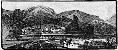
MAMMOTH HOT SPRINGS HOTEL—YELLOWSTONE NATIONAL PARK.
The reader, who, not having visited the National Park, has yet gazed into some of the profound gorges to be found in the great mountain ranges of the far West, will read with astonishment, if not with incredulity, that there is but one cañon in the world,—the Grand Cañon of the Yellowstone. Perhaps slightly exceeded in depth, as it certainly is in gloom, it is yet made to stand pre-eminent among the natural wonders of the world by the majesty of its cataract and the gorgeous blazonry of its walls. To say that the former—no mere silver ribbon of spray, but a fall of great volume—is a little more than twice the height of Niagara, would, by means of a familiar comparison, enable almost any one to form a not altogether inadequate conception of its grandeur. But for the matchless adornment of its walls, we have no available comparison; naught but itself can be its parallel. One great writer describes it as being hung with rainbows, like glorious banners. Another, borrowing from Mr. Ruskin, likens it to a great cathedral, with painted windows, and full of treasures of illuminated manuscript. But, as we take our stand on the brink of the Falls, with twelve miles of sculptured rock spread out before us, rising from 1,500 to 2,000 feet in height, and all aflame with glowing color, we have to acknowledge, with a distinguished writer and a no less celebrated artist, that, neither by the most cunningly wrought fabric of language, nor the most skillful manipulation of color, is it possible to create in the mind a conception answering to this sublime reality. For countless ages, frost and snow, heat and vapor, lightning and rain, torrent and glacier, have wrought upon that mysterious rock, evolving from its iron, its sulphur, its arsenic, its lime and its lava, the glorious apparel in which it stands arrayed. And the wondrous fabrication is still going on. The bewildered traveler would scarcely be surprised to see the gorgeous spectacle fade from his vision like a dream: but its texture is continually being renewed; the giant forces are ever at work; still do they—
“Sit at the busy loom of time and ply, Weaving for God the garment thou seest Him by.”
For the minor wonders of this world of marvels, the formations of geyserite and the petrified forests, Tower and Gibbon Falls and the cliffs of volcanic glass, the caldrons of boiling mud and transparent pools of sapphire blue, the reader is referred to special guides to the Park.
It only remains to be stated that there is regularly established transportation daily between all the principal points, that the distances are not fatiguing, that the charges are reasonable, and the equipment everything that could be desired.
The angler need scarcely be reminded that this is the far-famed region where the juxtaposition of streams of hot and cold water enables him to cook his fish as fast as he can catch them, without moving from his seat or taking them off the hook!
WESTWARD STILL.
Resuming his westward journey at Livingston, the traveler finds himself ascending the first of the two great mountain barriers that had to be surmounted by the engineers of the Northern Pacific Railroad. By a grade of 116 feet to the mile, the line reaches, twelve miles from Livingston, an elevation of 5,565 feet above sea-level. Here it is carried under the crest of the range by a tunnel 3,610 feet in length, from which it emerges into a fine, rocky cañon, at the western portal of which is the military post of Fort Ellis. A few minutes more, and the train runs into Bozeman, a beautifully situated and flourishing little city of twenty years' growth. Few cities can boast of more magnificent scenery, majestic snow-capped ranges standing out against the sky on every side.
Westward for thirty miles extends the rich and fertile Gallatin valley. It is no uncommon thing to get forty bushels of hard spring wheat, or sixty bushels of fall wheat, to the acre in this valley, and its barley is of such superior excellence as to be in great demand for malting purposes at Milwaukee and other Eastern cities.
Twenty-nine miles west of Bozeman, are Gallatin City, and the bright little town of Three Forks, commanding the valleys of the Madison and Jefferson, the agricultural lands of which, now being brought under cultivation, are not inferior to those of the older settled valley of the Gallatin.
Four miles more, and the tourist comes upon a point of considerable geographical interest, the three mountain streams just mentioned pouring their waters into a common channel, to form the Missouri river. It is through a rocky cañon, abounding in wild and magnificent scenery, that the greatest river on the continent enters upon its long course of 4,450 miles. For nearly fifty miles, the line follows its various windings, until finally the river runs away northward through that profound chasm known as the Grand Cañon of the Missouri, or the Gates of the Rocky Mountains. Visitors to Helena will find an excursion to the Grand Cañon, occupying not necessarily more than two days' time, one of the most delightful experiences of their transcontinental journey.
The most important town between Bozeman and Helena, is Townsend, the shipping and distributing point for no inconsiderable portion of one of the best counties in Montana. It has daily communication by coach with White Sulphur Springs, a health resort of great local repute. This coming rival of older and hitherto more famous spas, lies in a beautiful valley, 5,070 feet above sea-level, and surrounded by the grandest of Rocky Mountain scenery. Its accommodations for visitors of all classes are most excellent, including, as they do, one of the best hotels in the Territory. Six miles distant are Castle Mountain and Crystal Cave, the latter a cavern of great extent, having twenty-three separate chambers, full of curious and beautiful stalactitic and stalagmitic formations. The town, mountain and cavern were all fully described and admirably illustrated in the West Shore Magazine for July, 1885.
Not so much by way of tribute, either to its own beauty or that of its situation, as in recognition of its wealth, its commercial importance and the commanding position it has so long occupied in the mining world, Helena, the capital of the Territory, is called the Queen of the Mountains. Situated on the eastern slope of the continental divide, 1,155 miles from St. Paul, it became a great distributing point and financial centre, even when hundreds of miles of mountain and prairie separated it from the nearest railroad. Dependent upon the Missouri river for its commercial intercourse with the world, it was in a state of well-nigh complete isolation during the greater part of every year. Under other conditions, this comparative isolation would have stunted its growth and cramped the energies of its people. But with the assured product of their labor such a commodity as gold, with its universality of demand and stability of value, the sturdy settlers in Last Chance Gulch had always the most powerful of incentives to restless energy. With the steadily increasing production of the precious metals, if not in its own immediate vicinity, at least in the country it dominated, Helena grew rich, until now it claims to be the wealthiest city of its size in the United States.
It was on the afternoon of the 15th of July, 1864, that a party of four miners, weary and sick at heart, pitched their tents in that desolate-looking gulch where now stands this flourishing city. Disappointed at not being able to secure claims in the then prosperous camp of Virginia City, and reduced to great extremity, they regarded the little gulch on the Prickly Pear as their “last chance.” Finding gold in paying quantities, they resolved to settle down; and it is said, that, before two years had elapsed, each of them was worth $50,000.
In the meantime, the little camp in what was thenceforward known as Last Chance Gulch had attracted miners from all parts of the Rocky Mountains. It is stated, in a recent official publication of the Territory, that the gulch yielded $30,000,000 during the first three seasons it was worked; but these figures so far exceed the popular estimate, that they are repeated only under reserve. The present annual production is said to be about $50,000. It would seem to the visitor as though every square foot of ground had been dug up, and, if it be his first experience of a placer mining district, its appearance will strike him as singularly novel.
The romance of mining is well illustrated by the story of the citizen of Helena who was digging out a cellar to his house, when a passing stranger offered to remove the pile of earth that was being heaped up in the roadway, and promised to return with one-half of whatever dust he might obtain by the washing to which he proposed to submit it. Permission granted and the earth removed, the citizen thought no more of the matter. Great, therefore, was his astonishment when, a few days later, the half-forgotten face of the stranger appeared at the door, and he was handed, as his share of the yield of that unpromising dirt, the equivalent of $650.
Possibly, however, a story involving only a paltry sum of three figures, may not answer to the reader's conception of the romantic. It does not excite his imagination. He expects to read of millions. If so, let us turn to the story of the miner, who, confident that he was the possessor of a valuable claim, held on to it in spite of the most adverse circumstances, hiring himself out in winter that he might have a little money wherewith to work upon his claim in summer, until, at last, after eight years of indomitable perseverance and patient toil, he was able to sell his property for $2,250,000; or that of the weary and penniless wanderer, who, having tramped all the way from Nevada, began a toilsome search, to be continued through much suffering and privation for several years, but destined to be rewarded at last by the discovery of one of the richest veins of gold in the Territory, a vein that has yielded, up to the present time, $4,000,000 worth of gold.
The tourist will find an hour's chat with an old-timer an interesting and not altogether unprofitable exercise, albeit he may find it hard to discriminate between statements that he may venture to repeat and those made for his especial benefit as a tenderfoot.
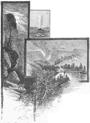
YELLOWSTONE RIVER, NATIONAL PARK.
He need not, however, discredit such stories as that a four-mule team once hauled to Fort Benton, for transportation down the Missouri river, two and one-half tons of gold, valued at $1,500,000; nor yet, that in the early days potatoes were worth fifty cents per pound, and flour one dollar, or that oranges were sold at a dollar each, and small pineapples at seven dollars. These are facts not more startling than many others that might be quoted. In the mining world, at least, truth is positively stranger than fiction.
The annual production of the precious metals in Montana has increased enormously within recent years, doubling itself between 1880 and 1882, and trebling between 1882 and 1884. The annual output now approaches $30,000,000, and the Territory stands at the head of the gold-producing regions of the world, notwithstanding that upward of $200,000,000 worth has been extracted from its soil.
Among the many famous mines on the eastern slope of the mountains are the Drum Lumon, shipping $80,000 worth of bullion per month, of which fully one-half may be set down as profit; the Gloster, shipping $50,000 worth per month; the Whitlach Union, long the most celebrated gold mine in the Territory; those of Red Mountain, said to be the most important undeveloped mineral field in the United States; the Clark's Fork, bordering on the National Park, and now yielding, and with no railroad facilities, 855 tons of ore per day; those of the Helena Mining and Reduction Company at Wickes, reached by a branch of the Northern Pacific Railroad from Prickly Pear Junction, and known to have shipped as much as $125,000 worth of ore in a single month; and the Lexington, which has produced silver ore averaging in assay value from $15,000 to $20,000 per ton. Visitors to the New Orleans Exposition of 1884–85 will remember the magnificent exhibits from the last-mentioned mine, as also those from the Cable and Drum Lumon mines, the latter including one solid chunk of high-grade ore weighing 1,715 pounds.
The most valuable gold nugget ever found in Montana is said to have been worth about $3,200. There is a nugget in the vault of the First National Bank at Helena, weighing 47.7 ounces, and valued at $945.80. But the most interesting sight in the city is, undoubtedly, the process of assaying at the United States Assay Office, where may also be seen those marvelously adjusted and delicately graduated scales, by which the weight of even an eye-lash can be exactly determined.
The next stage of the traveler's journey westward from Helena lies across
THE MAIN RANGE OF THE ROCKY MOUNTAINS.
It is by way of the Mullan Pass—so named from the fact of Lieut. John Mullan, U. S. A., having built a wagon road through it in 1867, to connect Fort Benton, Mont., with Fort Walla Walla, W. T.,—that the railroad is carried over the continental divide. The highest elevation of the pass itself is 5,855 feet; but, by the construction of a tunnel 3,850 feet in length, the line was made to reach the western slope without attaining a higher elevation than 5,547 feet.
It is not until Butler is reached, thirteen miles from Helena, that either the scenery or the construction of the road calls for special notice. But at that point the scenery becomes exceedingly picturesque, the rocks towering above the pines and spruce like the ruins of some ancient stronghold. From now on, too, the tourist will find constant employment in observing how the gigantic barriers, which seem to forbid all further progress, are, one after another, overcome.
Amid scenery increasing in wildness and grandeur, the train pursues its tortuous course; through Iron Ridge Tunnel, near which the track forms an almost perfect letter S; across innumerable ravines; along rocky shelves and through deep cuttings, until at last it enters the eastern portal of the Mullan Tunnel. A few minutes later the traveler is looking out upon the grassy hills and pleasant valleys of the Pacific slope, the approach to the tunnel from the west presenting a singular contrast to the savage grandeur that distinguishes the approach from the east.
Following the valley of the Little Blackfoot, the train presently arrives at Garrison, where passengers desirous of visiting the most flourishing mining city on the American continent, if not in the world, must change cars.
“The most flourishing mining city on the American continent, if not in the world!” exclaims the reader. Even so; and yet we are not in Nevada, nor yet in Colorado; and, besides, the former is about played out; and, as for Leadville, every one remembers the disasters that overtook her, culminating, as they did, in the failure of all her four banks. The city is Butte, that, at the last United States census, had a population of only 3,363, but now claims six times that number, and has a monthly mining pay-roll of $620,000.
The line from Garrison runs through the beautiful Deer Lodge valley, in which are many fine farms. Deer Lodge City, the judicial seat of the county, is pleasantly situated 4,546 feet above sea-level. Being well laid out, it presents, with its wide streets and handsome public buildings, an exceedingly attractive appearance.
It is at the head of this valley, on the western slope of the main range of the Rocky Mountains, and fifteen miles from the Pipestone Pass, that there has been witnessed, during the last three or four years, that rapid growth of population and wealth that is without parallel, even in the marvelous annals of mining. Here, encompassed on three sides by lofty ranges of mountains, Butte pours forth the smoke of its innumerable furnaces; for not only is its production of silver so great that it has come to be designated the “Silver City,” but its copper mines are such as to give employment to the most extensive smelting works in the United States. Its total production during 1885, valued at $15,000,000, viz., $5,000,000 worth of bullion and $10,000,000 worth of copper matte, was twice that of Utah, and three times that of Nevada. It also exceeded that of the whole of California, or the combined production of Idaho, New Mexico and Arizona.
The leading silver mines of the district are the Alice, Moulton, Lexington and Silver Bow, which alone employ 210 stamps and produce 230 tons of ore daily. The magnificent appliances of the Alice mine, including the great Cornish pump that cost $40,000, are the wonder of every visitor. The process of reduction, here as elsewhere, is somewhat complex, especially in the case of the baser ores, being in part chemical and in part mechanical. It involves the crushing of the ore to powder, under the pressure of enormous bars of iron, weighing 900 pounds each, and known as “stamps,” and its subsequent roasting in large, hollow cylinders, salt being largely employed in the former, and quicksilver in the latter, stage of the operation. The roasting mills of the Alice mines treat 100 tons of ore per day, and their bullion product approaches $100,000 per month.
The great Lexington property, which has produced $1,000,000 per annum for four years, is owned by a French company. It claims to be the most complete mine in the entire West, and it is certainly one of the richest and most extensive.
The Moulton and Silver Bow have a daily capacity of forty and thirty tons of ore respectively. They are magnificent properties, well developed and exceedingly productive. The former makes the proud boast of working its ore to a higher percentage of its value than any other mill in the district.
But it is the copper mines and smelters that represent the largest capital; give employment to the greatest number of men; have the largest production, both in tonnage and aggregate value; and, it may be added, make the most smoke.
At the head of the rich and powerful companies engaged in this industry, stands the Anaconda,—its mine at Butte, the greatest copper property in America; its smelting works, at the neighboring town of Anaconda, the largest of their kind in the world. Sold, five years ago, for an amount that would not now be more than sufficient to pay its employés a week's wages, its property is roughly estimated to be worth $15,000,000. With certain contemplated additions to its smelting capacity, it will handle daily 1,200 tons of ore, yielding 180 tons of matte, or 108 tons of pure copper. Its entire machinery run by water-power, it yet requires for its furnaces no less than 180 cords of wood per day; in view of which enormous consumption it is stated to have recently let a contract for 300,000 cords, representing upward of $1,000,000. Second only to this gigantic concern, is the Parrott Company, whose total matte output for 1884 was 14,856,323 pounds, containing 9,324,805 pounds of pure copper, valued, including its silver contents, at about $1,250,000. With largely increased capacity, its production of pure copper will probably have reached 15,000,000 pounds in the year just drawing to a close. Among other leading companies, may be mentioned the Montana, owning some of the richest and most steadily productive mining property in process of development; Clark's Colusa, said to have in sight, above the 300-foot level, at least 150,000 tons of valuable ore; and the Bell and Colorado, two of the richest copper-silver mines in the district.
So much for the mines and smelting works of Butte. What of the city itself? Briefly, it may be said to be a typical Western town, as seen in flush times; nothing too big for it, nothing too good; its quivering energy finding expression, now in the erection of a $150,000 court house, and now in that of the finest opera house on the Pacific slope, outside of San Francisco; its business enterprise filling magnificent stores with costly goods, suited to the tastes, pocket-books and spending proclivities of a community that on last Christmas eve spent $6,000 in presents in a single one of its stores.
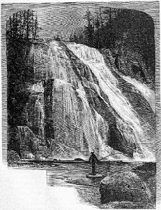
FALLS OF THE GIBBON RIVER, YELLOWSTONE NATIONAL PARK.
There are several good trout streams in the vicinity of Butte, and it is pleasant to know that, in a city whose amusements are mainly of a very different character, there are those who know how to handle the rod.
Proceeding westward from Garrison, the traveler will have some fine views of mountain scenery, including the snow-clad peaks of Mount Powell. Drummond, twenty-one miles west, is the station for the rich mining districts of New Chicago and Phillipsburg. Granite Mountain mine, near the latter place, is exceedingly rich. A vein of ore, six feet wide, and assaying from 125 to 2,000 ounces of silver to the ton, is now being worked, the output reaching $120,000 per month.
Soon the train enters Hell Gate Cañon, at first a beautiful valley, from two to three miles in width, but narrowing as we go westward, until from between its stupendous walls we suddenly emerge upon a broad plateau, where stands the city of Missoula. Formerly a remote and isolated frontier post, Missoula is now a place of considerable importance. Extending southward for ninety miles is the valley of the Bitter Root river, well watered, exceedingly fertile and thickly settled. Here are raised fine crops of wheat and oats, as well as vegetables, apples and strawberries.
The tourist has now entered the finest game country in the Northwest. At any point along the line, for a distance of nearly three hundred miles, he will find deer, elk and bear in great abundance. Let him but place himself on their trail, and he will certainly soon have them within gunshot. Even in the vicinity of Missoula there is excellent sport, one local trapper obtaining $160 bounty for bear last season. Ducks and prairie chickens are also plentiful, and various species of trout abound in the mountain streams.
The most interesting, as it is the most accessible, of the Indian reservations contiguous to the line of the Northern Pacific Railroad, is that of the Flathead tribe, through which the line runs for many miles in the course of its north-westward sweep from Missoula. At Arlee station, the visitor is within five miles of the agency, and at Ravalli a like distance from St. Ignatius mission. For a full account of the excellent work carried on among the Indians by the Jesuit Fathers, together with an exceedingly interesting description of the Flathead country generally, the reader is referred to an article in the Century Magazine for October, 1882, from the accomplished pen of Mr. E. V. Smalley, as well as to sundry articles in that gentleman's own magazine, The Northwest. From a point about 500 feet from the summit of Macdonald's Peak, a few miles north of Ravalli, there is a remarkable view of a deep mountain gorge known as Pumpelly Cañon, which has many of the striking features of the Yosemite valley, in California. Two waterfalls, having an apparent height of about 800 feet, leap into this profound rocky cañon, and form a small circular lake of a dark blue color. This lake falls, by another cataract, into a second lake of exactly the same size and shape as the first, while still another cataract leaps from the lower lake into a deep ravine filled with magnificent forest trees. An excursion to Macdonald's Peak may be made from the mission in a single day. Tourists are, however, recommended to take blankets and provisions, and encamp upon the crest of the mountain to witness the sunrise. Saddle horses are obtainable at the mission, and there is a good trail all the way.
Thompson Falls, 101 miles west of Missoula, is the starting point for the Cœur d'Alène mines. The distress that followed the arrival in this district, in 1883, of several thousand half-starving adventurers, who, expecting to pick up in a few hours' time nuggets enough to make them rich for life, brought neither blankets to protect them from the cold of winter, nor the means of returning to their far-distant homes, or even of reaching less remote centres where work could be obtained, gave the Cœur d'Alène mines a blow from which they were slow to recover. The development that has since taken place, especially since the introduction of hydraulics, has, however, abundantly demonstrated that former claims as to the richness and permanence of the mines were well founded, and we shall probably soon see here the richest placer mining camp in the world.
The matchless river scenery that has done so much toward placing the Northern Pacific Railroad system in the proud position it occupies to-day at the head of the scenic railways of America, is not alone that of the peerless Columbia. For 140 miles of its course, in Western Montana and the Panhandle of Idaho, it follows the windings of a stream that for grand and imposing scenery is second only to that renowned river itself. Should the traveler wake up in the morning, anywhere between the point at which the waters of the Missoula empty themselves into the bright green flood of the Pend d'Oreille river and the head of Pend d'Oreille Lake, he will almost certainly suppose that it is in the current of the far-famed Columbia that he sees reflected, perhaps hundreds of feet beneath him, the varying forms of those stately mountains that soar thousands of feet above. But he is as yet almost a day's journey from the classic regions of the Columbia, albeit the lordly stream, whose scenery will be, hour after hour, a succession of surprises and delights to him, is one of the principal forks of that mighty river, whose still grander scenery it may be said to foreshadow in miniature.
Between the Yellowstone National Park, on the one hand, and the Columbia river, on the other, Clark's Fork and the beautiful lake into which it widens out before turning northward to the British possessions, have been almost completely overshadowed. But their ten thousand beauties will assert themselves. They have not to be sought for in out-of-the-way places, nor are they so localized that a mere passing glimpse is the only reward of strained attention as the train flies onward. On the contrary, from an early hour in the morning until long past noon, there is a continuous unfolding of scenes in which are combined, with Nature's inimitable skill and infinite variety, all that is grandest in mountain, all that is most graceful in woodland and stream. So evenly distributed are the beauties of this long stretch of river scenery, that it is not easy to single out particular points as calling for special notice. There are, however, two that must arrest the attention and command the admiration of every traveler. The first, one mile east of Cabinet, where the river, which has been flowing for some distance considerably below the level of the railroad, enters a magnificent rocky gorge; and the other, about the same distance east of Clark's Fork, where it flows, without a ripple, through a forest of stately pines, whose forms are, with singular fidelity, reflected in its clear and tranquil waters. Soon it is lost to view, but only to reappear, after a short interval, in the form of the lovely
LAKE PEND D'OREILLE.
One of the largest sheets of fresh water in the West, Lake Pend d'Oreille will certainly yield to none in the beauty and variety of its scenery. Fifty-five miles in extreme length, and from three to twelve miles in width, it has an irregular shore line of probably 250 miles, richly diversified with rock and foliage, and surmounted by lofty ranges of hills. The railroad follows the north shore of the lake for about twenty-five miles, passing several little settlements, among which are Hope, Kootenai and Sand Point. Such accommodations as have hitherto been available to the visitor have been provided by respectable residents of Sand Point; but for the season of 1886 arrangements will be made that will constitute Hope the more convenient halting place. That, also, will be the point of arrival and departure for steamers making the tour of the lake.
While the view from the car windows is not to be compared with the scenery at the southern end of the lake, it must, nevertheless, be pronounced superb. In the immediate foreground, the green waters break soothingly upon a pebbly beach, or fall in crested waves. On the right and left recede into distance the deeply indented shores, here clothed with luxuriant forests, there bare and precipitous. Yonder, nineteen miles away, is Granite Point, rising perpendicularly from the water 724 feet, with Granite Mountain behind it, towering 5,300 feet above the level of the lake, itself surmounted by the snowy peaks of Pack Saddle Mountain, and they, in turn, by the great purple range of the Cœur d'Alènes.
Not a few Eastern travelers passing over the Northern Pacific Railroad have remarked upon the resemblance borne by the scenery of Lake Pend d'Oreille to that of their own famous Lake George. It is, however, if possible, even finer, the mountains being loftier, and the forests more luxuriant, than those inclosing the hitherto unrivaled lake in Northern New York.
To fully set forth the attractions of this region for the sportsman, or to do anything like justice to its waters as fishing grounds, would require more space than is devoted in this pamphlet to the entire country between the Great Lakes and Puget Sound. Nowhere, probably, in the United States, is there such an abundance of large game as in the forests of Northwestern Montana and Northern Idaho. Within a few miles of any of the stations on Lake Pend d'Oreille may be found mule deer, white-tailed deer, elk, caribou and moose, black and cinnamon bear, and mountain sheep. Of winged game, geese, ducks and partridge are plentiful, and they may be shot at any season of the year. Various applications have been made to the Northern Pacific Railroad Company, by local hunters, for special rates for the shipment of game East; but the Company has steadfastly refused to encourage the wholesale destruction of game for commercial purposes, preferring that it should be reserved for legitimate sport.
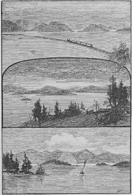
LAKE PEND D'OREILLE, IDAHO.
The true sportsman will immensely enjoy an excursion into the Kootenai country. The best route is from Kootenai station to Bonner's Ferry, on the Kootenai river, a distance of thirty-three miles by wagon road, and thence by boat, either down to the lake, a further distance of ninety miles, or up into the mountains. Complete camping outfits may be obtained from Spokane Falls, the nearest town on the line of the railroad.
That the waters of Clark's Fork and Lake Pend d'Oreille are full of fine fish of many varieties, is established by overwhelming testimony. The want of a common nomenclature, however, is somewhat embarrassing to one whose opportunities for personal observation have been limited. Perhaps, therefore, it will be best to allow the local anglers to tell their own stories. Beginning with the town of Thompson's Falls, to which reference has already been made, we find a recent correspondent of the American Angler claiming for Clark's Fork an abundance of salmon trout, of a species of large lake trout, and a species of whitefish, known locally as “squaw fish.” Salmon trout are, he says, caught at all times of the year, except in midwinter and during high water in the month of June. They average from one-half to two pounds each, and the fishing is best during early spring and late fall. Lake trout have been caught weighing as much as eighteen pounds each; but the average is about six pounds. The “squaw fish” is said to be gamey, but of comparatively little value for the table. The same correspondent says that the mountain streams emptying into Clark's Fork in the vicinity of Thompson's Falls, afford excellent mountain trout fishing, and he quotes large scores made by local anglers. At Heron, which, by the way, is a divisional terminus of the railroad, with a first-class hotel operated in connection with the dining car department, trout is said to be so abundant as to be thought nothing of; “grayling,” sometimes reaching ten pounds in weight, are almost as plentiful; and it is said to be no uncommon thing to see them jumping out of the water, pursued by large whitefish. Bull River, eight miles distant, yields salmon trout weighing up to twelve pounds. The waters of Lake Pend d'Oreille contain, in addition to the common lake trout, a species weighing from five to ten pounds each, and occasionally caught weighing as much as twenty pounds, speckled on both back and sides, and generally resembling Mackinac trout. They are a fine table fish, being much superior to lake trout. The “squaw fish” of this lake are said to resemble the pike. They weigh from one pound to five pounds each. From about the middle of August until the snow flies, the trout fishing is “the best in the world.” There is also a fish resembling the herring, found in one part of the lake in immense shoals.
Soon after leaving Lake Pend d'Oreille, the line enters a dense forest containing few settlements, and little that is interesting or picturesque, beyond the beautiful Lake Cocolala, a long but narrow sheet of water on the north side of the track. On the borders of the forest the train pauses a moment at Rathdrum, the nearest point on the railroad to Fort Cœur d'Alène, on the lake of the same name. This lake even rivals, in the beauty of its waters and the grandeur of its mountain scenery, its more accessible neighbor, Lake Pend d'Oreille, while its conveniences for boating and fishing are equally good.
At the station of Idaho Line, the train enters the Territory of Washington, pursuing its way in a southwesterly direction across the great Spokane Plain.
A short run, and we are at Spokane Falls, a bright and busy little city, charmingly situated on the Spokane river, near the celebrated falls from which it takes its name. Built upon a gravelly plateau, sloping gently toward the river, overlooked by beautiful pine-clad hills, and with lofty mountain ranges in the far distance, Spokane Falls can not but produce a favorable impression upon the passing traveler. Its falls, which are its chief natural attraction, and will be the secret of the great commercial and manufacturing importance that undoubtedly awaits it, are situated on the north side of the town. The river is divided by basaltic islands into three great streams, curving toward each other, and pouring their floods into a common basin, from which the united waters come surging and foaming to make their final plunge of sixty-five feet into the deep chasm below. The tremendous force with which the river tears through its rocky channels, and hurls itself over the falls, is perhaps best illustrated by a comparison with the Falls of St. Anthony, at Minneapolis. While the latter represent a force of 135,000 horse power, the former represents one of 216,000 horse power, utilizable with equal facility. Several extensive flouring mills, as well as saw mills, are already in operation; and there is no doubt that, with the development of the rich wheat country of Eastern Washington, there will come an immense extension of the manufacturing industries of Spokane Falls.
It is probable that the town will soon have two important feeders in branch lines of railway, extending, the one northward to the Colville mining region,—the other southward to the Palouse wheat country. These lines will open railway communication with two of the richest sections of country west of the Rocky Mountains.
Until within the last year or two, the settlements of the Colville valley have been confined to the scattered homes of ranchmen. But recently the tide of immigration that has been flowing into the Territory has reached this remote region, and agricultural operations of a general character are being engaged in. The valley is as fertile as it is beautiful, and not only fine wheat, but fruit of excellent quality, is being raised there.
In the Chewelah district there have recently been found so many rich veins of silver that Mr. E. V. Smalley, who visited it in November, 1885, declares that it is almost certain to become, within a few years, the greatest silver camp on the continent.
Sixteen and forty-one miles respectively westward from Spokane Falls, are Cheney and Sprague, in a good agricultural country, whose rapid development is building them up as solid and substantial towns. Cheney has a large hotel, and is, moreover, the nearest railway station to Medical Lake, a large sheet of water possessing remarkable curative properties, and situated nine miles west. Good hotels and bathing establishments having been erected, Medical Lake is now an exceedingly pleasant resort, the surrounding country being very attractive.
From Palouse Junction, sixty-nine miles west of Sprague, a line extends eastward into the Palouse country. So far as regards scenery, a ride over this line to Colfax and Moscow is as uninteresting a railroad journey as could well be found, the line following a series of valleys that have the appearance of having once formed the rocky bed of some considerable stream.
Colfax is a busy little city in the Palouse river valley, hemmed in so closely on both sides that one of its rivals recently suggested that it might find it an advantage to be roofed over. But it does a considerable business for so small a place, shipping a large proportion of the agricultural produce of the valley, estimated, in 1885, at two million bushels of grain. The agricultural methods of Eastern Washington will strike most visitors as somewhat peculiar. It is not in every State of the Union, nor in every Territory, that the farmer can plow and sow “just when he gets ready.” But here plowing and seeding may be seen in progress ten months out of every twelve, and instances have even been known of winter wheat being sown every month in the year, and all coming to harvest in its proper turn. And such crops! Thirty, forty and fifty bushels to the acre are raised so easily, that, had the farmer a nearer market, he would soon get rich. The construction of the proposed branch southward from Spokane Falls will, however, give him facilities for shipping east over the Northern Pacific Railroad that will certainly pay him better than exporting to England by way of Portland, as he does at present. The self-binding harvester, so familiar an object in many other parts of the country, is here unknown, the grain being cut by immense “headers,” propelled by from four to eight horses each. This strange-looking machine, an exemplification of the old saying, “the cart before the horse,” is better adapted than any other to the peculiar conditions of the country, straw being of no value, and threshing usually going on simultaneously with the cutting of the grain, although the wheat may, after cutting, lie in the fields for many weeks without detriment.
The climate of Eastern Washington, to which alone this remarkable state of things is due, differs entirely from that of the western half of the Territory, from which it is divided by the Cascade range of mountains. It is a mistake to suppose that the humidity which characterizes that portion of the Territory bordering on the Pacific Ocean, distinguishes it as a whole. On the contrary, the eastern half is remarkably dry, and that, too, without those extremes of temperature that usually accompany a dry climate. Should there be a spell of severe cold during the brief winter season, it is invariably cut short by the “Kuro-Siwo,” or Japanese current, which, striking the coasts of British Columbia and Washington Territory, sends a warm wave over the entire Northwestern country, sometimes extending even to the valleys of Montana.
Continuing westward from Palouse Junction, a run of little more than an hour brings us to Pasco, the eastern terminus of the Cascade division of the railroad. This important division, intended to establish direct communication between the magnificent harbors on Puget Sound and the Eastern States, is already operated to the extent of 122 miles, or ninety miles westward from Pasco, and thirty-two miles eastward from Tacoma. Its eastern section has given a great impetus to the development of the agricultural capabilities of the Yakima, Klickitat and Kittitas valleys, which are well adapted, not only to stock raising, but also to the cultivation of fruits and cereals. In this section wool growing is also engaged in with great success. This industry is one of considerable importance both in Washington and Oregon, the entire clip for 1885 being no less than 13,000,000 pounds.
There are few revelations more surprising to an Eastern tourist than that of the magnitude of some of the great Western rivers. The Snake river, for example, is known to him, if at all, merely as one of the various tributaries of the Columbia; and, when he finds himself crossing its mighty flood by a bridge 1,672 feet in length, and learns that its force and volume are such that it drives itself like a solid wedge into the waters of the Columbia, he is apt to wonder that he knows so little about it. Future tourists will not regard this tributary stream with any the less interest for being told beforehand that it is longer than the Rhine, more than three times the length of the Hudson, and that, straightened out, it would reach from the Missouri valley to the Atlantic ocean. It is, moreover, a great commercial highway, being navigated by steamers of considerable tonnage for 150 miles. It flows for a long distance in a deep cañon, the sides of which are so precipitous as to render the river almost inaccessible. Immense shutes have therefore been constructed for the transfer of the wheat that forms the staple product of the country from the warehouses on the high banks to the boats and barges anchored below.
Another section of the famous wheat country of Southeastern Washington, identified with the unmusical name of Walla Walla, borne by the oldest and best town east of the Cascade Mountains, is reached by a branch line extending from Wallula Junction. With 100,000 acres of land cultivated to cereals, with 800,000 apple trees, 100,000 pear, plum and peach trees, 25,000 grape-vines, large herds of cattle, and still larger flocks of sheep, the county of which Walla Walla is the judicial seat may be taken as fairly illustrating the varied capabilities of Eastern Washington. Scarcely less prosperous is the adjoining county of Columbia. These counties, however, being well settled, reference is made to them only as foreshadowing the future condition of those younger counties, adjacent to the Northern Pacific Railroad, which are now in course of settlement. In many of the latter the cultivation of the soil presents even fewer difficulties than in these older settled regions, in many parts of which there is scarcely an acre of level land to be found.
Returning to Wallula Junction, and there resuming our westward journey, we at once enter a region of surpassing interest, none other than the famous land—
“Where rolls the Oregon.”
Its navigable waters within 450 miles of those of the Missouri river, the great Columbia drains an area almost equal in extent to the united area of France and Germany. Excluding the portages at the Cascades and Dalles, with several less important rapids, the river is navigable to Kettle Falls, 725 miles from its mouth. These falls, on the upper river, are not accessible by rail, being a considerable distance above the point at which the railroad enters its valley. They are said to be more impressive even than the famous Cascades on the lower river, there being a perpendicular fall of twenty feet, and then swift rapids between rocky banks of quartz and porphyry. It is on the upper river, also, that there occur the Little Dalles, where the waters tear through a contracted channel with terrific force, constituting, at least at high water, an impassable barrier to navigation.
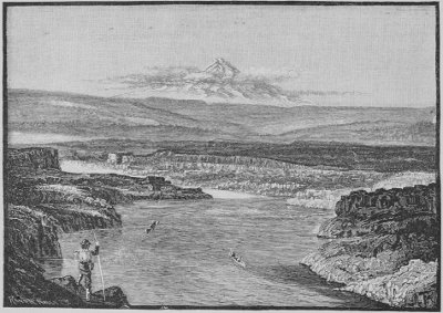
MOUNT HOOD—FROM THE HEAD OF THE DALLES, COLUMBIA RIVER, OREGON.
From Wallula to within a few miles of Portland, a twelve hours' ride, the tourist enjoys an uninterrupted succession of views of that superb scenery which has given the Columbia river its world-wide reputation. Never for more than a few moments does he lose sight of its mighty flood,—now flowing onward with all the majesty of the lower Mississippi, and now surging through the rocky barriers that impede its course; here confined within lofty basaltic walls, there inclosing numerous beautifully wooded islands; and here again marked by long stretches of bare white sand driven continually by the unceasing winds. For some miles west of Wallula the banks of the river are low, and possess no special object of interest. It is not, indeed, until he reaches the Great Dalles that the tourist sees any indication of the magnificent scenery he is approaching. There, however, he has his first glimpse of the queenly Mount Hood, whose snowy peak, soaring 11,225 feet above the sea, stands out sharply against the sky at a distance of thirty-five miles. The Dalles themselves, scarcely noticeable, except when the river is at flood, constitute one of the most curious and interesting sights in the world,—nothing less than that of the mighty Columbia turned on edge. Here, within a gorge so narrow that a child may fling a pebble from bank to bank, is confined the greatest river of the Northwest. The chasm through which it flows has never been fathomed, and can only be approximately determined by an inversion of the grand proportions of the river where it flows through its ordinary channel.
At Dalles City, the eastern terminus of navigation on the middle river, the tourist finds himself in an attractive town of nearly forty years' growth. Here he may with advantage make a brief stay, resuming his journey either by train or by steamer, the fine boats of the Oregon Railway & Navigation Company plying daily between this city and Portland. From the heights commanding the town, magnificent views are to be obtained, Mount Hood looming up in the southwest, and Mount Adams, another of the great peaks of the Cascade Range, in the north.
We have now left behind the low-lying shores that extend for so many miles between the Dalles and Wallula. Henceforward the scenery increases in interest every mile, the mountains becoming loftier and more precipitous, the rocky shores more rugged, and the intervening foliage more luxuriant.
It should be stated that the scenery, especially on the south side of the river, appears to much greater advantage when viewed from the deck of a steamer than when seen from the train. In consideration of this fact, railway tickets are available by steamer without extra charge. The boat leaving the Dalles early in the morning, there is a loss of one day involved in taking the steamer on the westward journey; but, returning from Portland, the tourist is able to reach the Dalles in time for that day's east-bound train.
Forty-three miles from the Dalles are the Cascades, where the river changes from a placid lake to swift rapids and a foaming torrent. Before the completion of the railroad every pound of freight had to be transferred, at this point, from a steamer navigating the river above this insurmountable barrier to one navigating it below, or vice versa. The railway portage of six miles on the Washington side of the river is still operated, and the transfer of such passengers as choose to complete their journey by water is made so speedily and conveniently as to enhance, rather than otherwise, the pleasure and interest of the river trip.
In view of the importance of the river as a free commercial highway, Congress has made several appropriations for the construction, at the Cascades, of a system of locks. It is certainly a gigantic undertaking, and many years will probably elapse before its completion.
To a great convulsion of nature, of whose occurrence there is abundant evidence, may be traced a singular Indian tradition, that Mount Hood and Mount Adams formerly stood close to the river, connected by a natural bridge. The mountains, so goes the story, becoming angry with each other, threw out fire, ashes and stones, and so demolished the bridge, choking the river, which had previously been navigable. The present remoteness of the mountains is attributed to the anger of the Great Spirit, who hurled them thus far asunder. Both, in common with other peaks of the Cascade Range, are extinct volcanoes; and the Indian tradition may have its origin either in some great eruption, or in some sudden movement of what is known as the sliding mountain, an immense mass of basaltic rock gradually wearing its way toward the river.
After gazing in admiration at the fine scenery surrounding the Cascades, the tourist will scarcely be prepared for the announcement that the grandest of all is yet to come. But, after leaving Bonneville, not only is the general effect grander and more imposing, but the objects of special interest are more numerous. Here it is that the advantage of making the trip by steamer is most apparent; for, let the train travel ever so slowly, it is impossible for even the most quick-sighted traveler to take in all the points of interest that crowd one upon another.
On the north side is Castle Rock, rising abruptly from the water's edge a thousand feet or more. Farther down the river, also on the north side, is Cape Horn, an imposing basaltic cliff projecting into the water. On the south side there descend from the lofty perpendicular walls that frown upon the river for many miles, numerous waterfalls, of indescribable beauty. Here is the lovely Oneonta, 600 feet of silver ribbon, floating from the dizzy height. A few moments more, and we are opposite the still more beautiful Multnomah Fall, which has a descent of no less than 820 feet. At this point the train stops fifteen minutes to enable passengers to ascend to the rustic bridge, there to enjoy the best possible view of this incomparable fall, and its wondrously beautiful setting, contrasting so strikingly with the wild scenery around it.
At the Pillars of Hercules, two gigantic columns of rock, one on either side the track, and forming, as it were, the western gateway to this marvelous region, the railroad leaves the river, and runs right on to Portland. The steamer continues its course, past the beautiful city of Vancouver, to the mouth of the Willamette river, by which great tributary of the Columbia, it soon reaches
PORTLAND.
Its phenomenal growth, its commanding position on one of the great waterways of the continent, its wealth, commerce and enterprise, and the singular natural beauty of its situation, render the capital of the Pacific Northwest one of the most attractive cities on the American continent.
Fifteen years ago Portland contained a population of 1,103. By 1880 the construction of the western section of the Northern Pacific Railroad, and the approaching completion of the great transcontinental system, had so stimulated the growth of the city that its population had increased to 17,577. To-day it is estimated at 30,000, or, including the suburbs of East Portland and Albina, at 40,000, and a handsomer city of its size can not be found in the United States.
In everything that distinguishes a great metropolitan city, the progress of Portland has been even more remarkable than the rapid growth of its population. The handsome business blocks that line its principal streets bear witness to the magnitude of its trade and commerce, while its churches, schools and other public buildings testify to the high moral tone and refined taste of its citizens.
Although one hundred miles from the coast, Portland, like London, Rotterdam and Antwerp, is virtually a seaport, and its growth and progress are based upon the solid foundations of its natural advantages. Loading at its wharves, or riding at anchor on the broad bosom of the river, may be seen, not only river craft of all sorts and sizes, but ocean-going vessels of 3,000 tons. When the great wheat crop of Oregon is in course of shipment to Europe, there may be seen a fleet of as fine merchantmen as can be found in the world. The salmon exports alone, for the year ending August 1, 1885, required 120 large vessels, having a total capacity of about as many thousand tons. The total value of the exports to foreign countries for the year just mentioned, was $5,857,057, and that of domestic exports $6,699,776, making a grand total of $12,556,833. In addition to several hundred thousand tons of wheat, and the 120 ship loads of salmon already mentioned, the exports from the Columbia river included over eleven million pounds of wool, over two million pounds of hides, nearly five and one-half million pounds of hops, and twenty-nine million pounds of potatoes.
Portland is said to number among its merchant princes twenty-one millionaires, and certainly there are few cities whose private residences are more strikingly indicative of wealth and refinement. The picturesque surroundings of the city render it an exceedingly desirable place of residence. From the summit of Robinson's Hill a view that it is no extravagance to pronounce one of the finest in the world may be obtained. At one's feet lies the city, nestled in rich foliage. Stretching away, for many miles, from where their waters unite in one common flood, may be seen the Columbia and Willamette rivers. But above all, bounded only by the limits of the horizon, is the great Cascade Range, with all its glittering peaks. On the extreme right, seventy-eight miles distant, as the crow flies, is seen the snowy crown of Mount Jefferson; across the river, fifty-one miles distant, rises Mount Hood, one of the most beautiful mountains on the coast, and the pride and glory of Oregon; to the northeast stand out the crests of Mount Adams and Mount St. Helens, and in the same direction, but one hundred miles away, may be descried the great Tacoma, the grandest mountain on the Pacific slope. All these five peaks are radiant with eternal snow, and it may well be imagined that the effect of the uplifting of their giant forms against the clear blue sky is grand in the extreme.
Tourists coming northward from San Francisco have the choice of two routes and two modes of travel. They may either take one of the fine steamers of the Oregon Railway and Navigation Company, sailing every five days, and performing the voyage in from sixty to seventy-two hours, or they may travel overland by the Oregon & California Railroad, a line that traverses not only the most fruitful plains, but also the most beautiful valleys, of this rich State.
For the benefit of such travelers, and also in view of the possibility of there being those who, both coming and returning by the Northern Pacific Railroad, would like to visit the garden of Oregon, and, if possible, obtain a glimpse of Mount Shasta, it may not be out of place to give a brief description of the line extending southward from Portland to the southern boundary of the State.
For upward of one hundred miles our route lies along the Willamette valley. This is the largest valley in the State, being 150 miles in length, with an average width of fifty miles. Inclosed on the east side by the Cascade Mountains, and on the west by the Coast Range, it contains an area of about four and one-half million acres of rich and beautiful land. Some of the pleasantest towns in the Northwest are to be found in this valley.
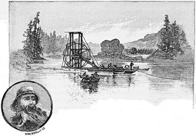
FLOATING FISH WHEEL, ON THE COLUMBIA RIVER, OREGON.
First comes Oregon City, sixteen miles from Portland; this is the oldest town in Oregon. It is situated just below the beautiful falls of the Willamette, amid highly picturesque scenery. Its chief interest for the tourist centres in the falls, which represent a force of over a million horse power, or about eight times that of the Falls of St. Anthony. They may be seen a few hundred yards south of the station, on the west side of the track. Hitherto there has been seen no considerable extent of fertile country; but in Barlow's prairie there appears a fine tract of agricultural land inclosed by tributaries of the Willamette. Others succeed it, and soon good homesteads, surrounded by shade trees and orchards, are seen in every direction. The next town of importance is Salem, the State capital, beautifully situated on the sloping banks of the river. The capitol, and other State buildings, may be seen from the train; and the entire city, with its broad streets and fine oak groves, presents a pleasing appearance.
The twenty-eight miles intervening between Salem and Albany afford some fine views of the Cascade Range, Mount Hood being visible at a distance of seventy miles, and the nearer southern peaks in still bolder outline. Eugene City, 123 miles from Portland, is also charmingly situated and finely laid out on the edge of a broad, rich prairie overlooked by a ridge of low hills. Its geographical position, at the head of navigation, commands for it the trade of a large section of country. It is also the seat of the State University, and is otherwise an educational centre of great importance.
In the course of the next seventy-four miles the railroad ascends about 2,000 feet to Roseburg, the judicial seat of Douglas county, traversed by another of the famous valleys of Oregon, that of the Umpqua. This was formerly a great stock country; but its pastures have gradually disappeared before the plow, and cattle have given way to grain. It is, moreover, a fine fruit growing region. The tourist is now approaching those intricate valleys which have made this line of railway from Roseburg to its terminus at Ashland at once so costly and so picturesque.