Chapter XV · THE MACKENZIE RIVER REGION.
Reading edition
Topography, Agriculture and Arable Land.
Mackenzie River a King of Northern Waters.—Over Three Thousand Miles of Waterway.—Domestic Cattle have Succeeded.—Barley Always Ripens at Fort Simpson.—Potatoes and Other Vegetables have for Many Years Been Grown at Fort Good Hope, a few Miles from the Arctic Circle.—Wheat and Barley Grown at Liard for Many Years.—Interesting Comparison With the Russian Province of Tobolsk.—A Large Town as Far North as Fort Wrigley.—Why Better Results in Grain Growing May be Expected in the Future.
Northern Alberta, including the Athabaska and Peace countries treated of in the chapters immediately preceding, is generally considered, and properly, as forming part of the Great Mackenzie Basin, and that it has been in this volume considered as separate from the immense region on both sides of the Mackenzie, surrounding Great Slave lake, and on both sides of Slave river from Fort Smith to its mouth at the lake in question, is due to the purpose, previously expressed, of treating as separate geographical units regions possessing particular characteristics either of location, soil, climate or natural resources.
The region discussed in the present and immediately succeeding chapters as “The Mackenzie River Region” includes the country north of the Alberta and British Columbia boundary line (the 60th parallel of north latitude) extending as far north as Beaufort sea. To the westward it is bounded by the Yukon territory boundary line, and to the eastward by the height of land east of Slave river, the height of land between the valley of Coppermine river and the lake and river system extending from the north arm of Great Slave lake to Great Bear lake, and a line in prolongation thereof northward to the sea.
There might be some question as to the advisability of considering the country north, south and east of Great Bear lake as part of the country lying more immediately adjacent to the great river of the north. It is true that the slight knowledge of the country north, south and immediately east of Great Bear lake tends to show that it is a region far less inviting than the immediate valley of the Mackenzie, and that it practically forms part of the so-called “Barren Lands” which extend as far eastward as Hudson bay. But this unfavourable evidence is not quite conclusive, and after all, the whole of the country within the limits decided upon is in the Mackenzie watershed, and has been considered in a broad sense as part of the Mackenzie region by the explorers, missionaries, traders, and travellers who have written of the country. So the adoption of the limits decided upon should simplify the geographical situation for the reader, and that is an important thing in considering a territory so vast as that immediately under review.
A King of Northern Waters.
Mackenzie river is one of the longest and broadest streams in the world. According to Mr. R. G. McConnell, of the Geological Survey, one of the first to attempt a scientific survey of the river, the Mackenzie “drains an area of six hundred and seventy-seven thousand, four hundred square miles, and has an approximate discharge at a medium stage of the water, according to some rough measurements made by the writer, of five hundred thousand cubic feet per second. Its basin is traversed for nearly one thousand three hundred miles by Rocky mountains, and the Mackenzie is probably unique among the rivers of the world in the fact of having a large proportion of its basin situated on the farther side of a great mountain chain. Two of its principal tributaries, Liard and Peace rivers, pierce Rocky mountains and drain large areas beyond, while the third, the Athabaska, originates in the heart of the same range, and is confined entirely to the eastern slope. The country from which the Mackenzie draws its supplies is of the most varied description and includes part of the broken plateau region west of Rocky mountains, Rocky mountains themselves through fifteen degrees of latitude, the northern part of the prairie district and the wooded and moss-covered country which succeeds it towards Arctic ocean, while tribute is also drawn from a wide belt of rough Laurentian country on the east, and from portion of the “Barren Lands.” From Great Slave lake to the sea the Mackenzie is an imposing stream, averaging about a mile in width with occasional expansions for long distances to twice this size. It is characterized by the comparative purity of its water, by its long straight reaches and by the absence of sudden bends. Its valley, usually shallow, follows closely all the sinuosities of the stream without the intervention of large flats. Clusters of islands obstruct its channel in a number of places, and are met with at intervals all the way down, while ranges of lofty mountains run parallel with it for part of its course, and form a fitting background to this king of northern waters.”
Silent Sweep of a Mighty River.
“Opposite Fort Simpson,” according to Mr. McConnell, “the main channel of the Mackenzie is almost exactly a mile wide, and it maintains and often exceeds this width for many miles below. Its course, as far as the Great Bend, a distance of seventy miles, is north-northwest, and its current in average stages of the water has a velocity of about four miles an hour. The banks of the valley appear low owing to the great size of the river, but in reality have often a height of two hundred feet or over. The appearance of this part of the Mackenzie and of the unending spruce forests which border it is monotonous and uninteresting, and is only relieved by the majesty inseparable from the silent sweep of a river of its magnitude.”
Slave river, which discharges the water of Lake Athabaska and Peace river into Great Slave lake, is practically an upper reach of the Mackenzie, its course being in the same general direction but the name “Mackenzie” is given only to that long stretch of navigable water from Great Slave lake to the sea.
As Mackenzie river itself is the outstanding geographical feature of the country, as it is the main channel of communication, and as all the settlements are situated upon its banks or those of its tributaries, a table of distances along this gigantic waterway may prove to be a useful guide to those readers of these pages, who are not familiar with the geography of the country. The table is compiled from the report by Wm. Ogilvie, D.L.S., of his survey, and the figures cover the route from Fort Smith, on Slave river, practically on the Alberta boundary line, to Fort McPherson on the delta of the Mackenzie:—
MILES.
Fort Smith0
Fort Resolution190·5
Buffalo creek202·5
Buffalo river249·5
Hay river276·5
Great Slave lake311·5
Fort Providence (lat. 61·4°)357·5
Little lake381·5
Yellowknife river417·9
Head of Line444·0
Fort Simpson (lat. 61·8°)515·0
Nahanni river590·2
Willow lake river606·5
River between Two Mountains645·5
Fort Wrigley (lat. 63°)649·0
Le Vieux Grand Lac river723·0
Gravel river764·2
Fort Norman (lat. about 65°)829·3
Great Bear river829·5
Carcajou river945·5
Mountain river950·2
Sans Sault rapids950·8
Beaver river987·8
Ramparts989·9
Fort Good Hope (lat. 66·16°)998·8
Hare Indian river1001·1
Loon river1022·7
Large river entering on east side,
name unknown1153·0
Red river1213·4
Delta of Mackenzie1241·4
Fort McPherson (lat. 67·26°)1273·5
The Dominion census of 1911 gives us the following figures of the population of these places, and of one or two other posts which will be referred to later:—Fort Good Hope, 434; Fort Liard, 136; Fort McPherson, 387; Fort Norman, 315; Fort Providence, 473; Fort Rea, 774; Fort Resolution, 766; Fort Simpson, 375; Fort Smith, 50; Fort Wrigley, 79; Hay river, 146.
These figures do not represent only the local population at the posts, but in addition the inhabitants, white and red, of the surrounding districts.
Mackenzie Navigation.
For many years the Hudson’s Bay Company have maintained steam communication on the Mackenzie from Fort Smith to Fort McPherson by means of steamers. The pioneer steamer “Wrigley” is one of the historical associations of the country. According to Mr. William Ogilvie, the “Wrigley’s” log shows the following average between Fort Smith, the most southerly part of her run, and Fort McPherson, the most northerly, the distance between these points being about one thousand two hundred and seventy miles. From Fort Smith to Fort Resolution, nearly all on Great Slave river, average running time, about eighteen hours; between Resolution and Providence about seventeen hours, of which twelve and a half are in Great Slave lake; between Providence and Simpson about fourteen hours; Simpson to Wrigley about ten and a half; Wrigley to Norman, about fourteen hours; Norman to Good Hope, about thirteen hours; Good Hope to McPherson, about twenty-four and a half hours. The total running time is one hundred and twenty-three and one-half hours, somewhat over ten and a quarter miles an hour.
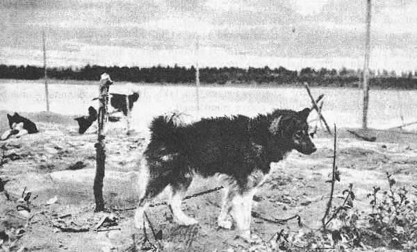
A Typical “Husky” dog.
On “up” runs the following averages have been made:—McPherson to Good Hope, forty hours; Good Hope to Norman, thirty-four hours, Norman to Wrigley, thirty-nine hours; Wrigley to Simpson; nineteen hours; Simpson to Providence, about twenty-eight hours; Providence to Fort Rae, not certain, appears to be about thirteen hours; Providence to Resolution, about twenty hours; Resolution to Smith, about thirty-five hours; Resolution to Rae, about fifteen hours and a return about the same, as it is all lake water. The duration of these runs varied somewhat by the force and direction of the wind. The total running from McPherson to Smith as shown above is two hundred and fifteen and one-half hours, which give a rate of 5·9 miles per hour. The mean of the up and down times is a fraction over eight miles an hour, which is said to be her normal speed.
A Long Navigable Stretch.
Mr. Ogilvie, in his report, points out:—“Excepting a short distance at the head of Mackenzie river, where it is doubtful, it is certain that vessels drawing at least seven or eight feet of water can navigate from the delta of the Mackenzie to the rapids on Great Slave river, a distance of one thousand two hundred and seventy-three miles. If Mackenzie delta also allows that draught, we have about one thousand three hundred and forty miles of navigable water from the rapids to Arctic ocean.”
“Wherever possible the width of the river was determined by triangulation. Between the narrows and Fort Good Hope it is never less than a mile wide and is often more than two, even reaching three miles at some points.
“Since I followed the shore, I cannot speak of the depth of water from personal observation. Captain Bell, of the Hudson’s Bay Company’s steamer ‘Wrigley,’ informed me that the shallowest water found by him in any part of the river, in what he considered the channel, was eleven feet. But as, when I saw him, he had made only two trips on the lower river, he could not speak very definitely as to its depth. Sir Alexander Mackenzie, who discovered the river and descended to its mouth in July, 1789, had a lead line with which to make soundings; but in the swift current a short distance above Fort Simpson his lead caught in the bottom, the line broke and the lead was lost. I have the depths according to him, and will give them in their proper place. One would expect, in such an expanse of water as this, to find some of it shallow, but it appears from all the evidence I could gather that vessels drawing from eight to ten feet of water would find no difficulty in navigation as far as Great Slave lake. Although the river is reported to be shallow where it leaves this lake, doubtless a channel could be found affording the draught above mentioned.
“In the fall of 1887, a whale made its way up the river to the Ramparts, remaining there the whole season, and before the river froze over it was often seen blowing. At first the Indians were afraid, but they soon became accustomed to the sight, and shot at the whale whenever it approached the shore. In the spring its dead body was beached by the ice on the west shore seven or eight miles below Fort Good Hope, and the Indians used part of it for dog meat. I enquired its dimensions of several who had seen it. They described it as being about twice as long as one of their canoes and thicker through than their own height. This would mean a length of from twenty-five to twenty-eight feet. I have often heard it stated that all the channels of Mackenzie delta are shallow, but the presence of this whale assures us that one of them at least is over six feet deep.”
Over Three Thousand Miles of Waterway.
Mr. Ogilvie claims that there is a grand total of three thousand three hundred and sixty-nine miles of water in Mackenzie basin, all navigable, except for eighteen miles, at but two points, one a rapid two miles long on Peace river, and the other Sixteen Mile rapid on Great Slave river. A thorough knowledge of the two great lakes (Great Bear and Great Slave) with all their tributary streams would probably increase this vast length of navigable water by several hundred miles. This does not take into account the Mackenzie delta and sea near its mouth, of the navigability of which nothing very definite is known at present.
Mr. Ogilvie, writing in 1890, figured out these distances in this way:—“The Hudson’s Bay Company’s steamer ‘Grahame’ traverses the waters of Peace and Athabaska rivers, the former from the falls to the rapid at Fort Smith, and the latter up to McMurray. The distance from Chipewyan to the post at the falls on Peace river is two hundred and twenty-two miles.”
“During the last two years the Hudson’s Bay Company has had another steamer, the ‘Athabaska,’ plying on upper Athabaska river, between Little Slave river and Grand rapids. Both this steamer and the ‘Grahame’ on the lower river are flat bottomed stern-wheelers, drawing, when loaded, not more than two and a half to three feet of water. They can each carry about one hundred and forty tons.”
“Upper Peace river is navigable for steamers drawing three or four feet of water, and, with a little improvement at two points, a draught of five to six feet could be utilized. This upper Peace river affords a navigable stretch of five hundred and fifty-seven miles, which, with two hundred and twenty-two miles on lower Peace river, and two hundred on Lake Athabaska, and, say, two hundred on the lower Athabaska, together with the distance given in the above table, gives us two thousand five hundred and sixty-nine miles of navigable water.”
“From our present knowledge, meagre as it is, I think we may assume that Great Slave lake affords us at least five hundred miles more, considering its length and its many deep bays. To this we may add two hundred and forty miles on the Liard, and at least sixty on Peel river.”
The Season of Navigation.
As to the length of the season of navigation on the Mackenzie, Mr. Wm. Ogilvie, in his report, publishes some tables showing dates at which the ice formed and broke up at Fort Norman (latitude about 65°), and Fort Simpson (latitude 61° 52′ north). These tables were compiled from figures taken from the journals kept at all Hudson’s Bay Company’s posts. From these figures it appears that the first ice, between 1872 and 1888, never formed earlier than October 7 at Fort Norman, and in 1883 did not form until October 24. The earliest date at which the river was closed by the ice was November 2, in 1879, and the latest November 18, in 1874. The earliest date at which the ice broke up was May 9, in 1879, and the latest May 24, in 1887.
At Fort Simpson, during the decade of 1876-1886, the drift ice was seen as early as October 11, in 1884, and as late as November 12, in 1879. The earliest date at which the river closed was November 17, in 1876, and the latest was November 30, in 1882. The earliest date at which the ice broke up was May 1, in 1883, and the latest May 14, in 1876.
Landmarks Along the Mackenzie.
Some notes culled from Mr. Ogilvie’s report as to the principal tributaries of the Mackenzie between Great Slave lake and the sea, and as to a few of the more remarkable stretches of the main river, will prove interesting at this point. Seventy miles below Great Slave lake is Little lake, which is about twelve miles long and ten to twelve miles wide, being merely an expansion of the river, like Lakes St. Francis and St. Peter in St. Lawrence system. Thirty-six miles lower down, Yellowknife river enters the Mackenzie from the south. It would appear from the statements of Indians to Mr. Ogilvie that this is the largest tributary of the Mackenzie between the Liard and Fort Providence. Twenty-seven miles below the confluence of the Yellowknife, and continuing to a short distance above the confluence of the Liard, the Mackenzie narrows to an average width of a little over half a mile, with a generally swift current. This continues for seventy and a half miles or nearly as far as Fort Simpson, near the mouth of the Liard and causes this part of the river to be called “The Line,” from the fact that large boats cannot be rowed against the current, but have to be hauled by a line attached to them, and pulled by men on shore. This is the common mode of navigation on all the northern rivers where there are no steamers, as it is less laborious than rowing against a current.
By the survey it is seven hundred and fifty-eight and one-half miles from Fort Simpson to Fort McPherson. The former fort is situated on an island just below the junction of Mackenzie and Liard rivers.
Ninety miles below Fort Simpson, on the west side, a river flows in from the southwest. Mr. Ogilvie had seen its name spelled Na-hone, but remembered that it is spelled by the Reverend Father Petitot, Na-hauner. It is, however, now known as North Nahanni river. This stream, as seen from the opposite side of the river, seems about two hundred yards wide, but it is shallow and rough at the mouth as was ascertained by the noise of its waters being plainly heard across the Mackenzie, here a mile wide. Mr. Ogilvie could get no information as to what it was like for any distance above its mouth, but it pierces the range of mountains to the west, which here come close to the river. The valley thus formed can be seen extending southwesterly through the mountains for many miles. The banks in the stretch of the Mackenzie from Simpson to this point are alternately low and swampy and moderately high, consisting of gravel and sand.
Some Tributaries.
Sixteen miles below the confluence of the North Nahanni, but from the opposite or eastern side, Willow lake river enters the Mackenzie. It is a quarter of a mile wide, deep with a slack current. It is said to flow out of a lake of considerable extent, not far from the Mackenzie.
Thirty-nine miles lower down, and three and a half miles above Fort Wrigley, a stream known to the Indians as “The River between Two Mountains” discharges into the Mackenzie from the east. It is about one hundred and fifty yards wide and shallow.
Seventy-four miles below Fort Wrigley, on the west side, a river discharges a large volume of clear, black water, which rushes bodily half way across the Mackenzie, and preserves its distinctive character for several miles before it mingles with the main stream. The name applied to this river by the people at Fort Wrigley was “La Rivière le Vieux Grand Lac.” It is said to flow out of a lake of considerable extent lying not far from the Mackenzie. Many peaks can be seen up its valley.
A little more than thirty miles lower down, on the same side of the river, another stream enters, apparently not more than a hundred yards wide at its mouth. Mr. Ogilvie saw it from the opposite side of the river only, and heard nothing concerning it.
A small stream enters the Mackenzie opposite this place, and up its valley, about two miles eastward from the river, a sharp peak rising one thousand five hundred feet above the water was noted by Mr. Ogilvie.
Gravel River.
Forty-one miles below the confluence of le Vieux Grand Lac river, or sixty-five miles, by the survey, above Fort Norman, a large river enters from the west. It is shallow at its mouth, as it is throughout its course, according to the reports of the Indians. The current, they say, is swift. They ascend it a long way in the winter to hunt, and descend in the spring on rafts. How far they go up, Mr. Ogilvie could not learn, their unit of distance being the unknown quantity of a day’s travel, but they go much farther than on any other tributary of the lower river.
Mr. Ogilvie obtained the name from some Indians who had travelled it and they called it “Pecat-ah-zah.” This translated means Gravel river, by which name it is known to all the white men in the vicinity, on account of its shallowness and numerous gravel bars.
Mr. Keele, reporting upon his descent of Gravel river in 1908, wrote:—“On Gravel river the high mountains approach to within a distance of about fifty miles of Mackenzie river, and are then replaced by a belt of foothills about three thousand feet in height above sea-level. These foothills in turn decline in elevation and finally die out in a broken, wooded plain, about six hundred feet above sea-level, bordering Mackenzie river. Gravel river has built up an alluvial flat at its mouth, and several alluvial islands in the Mackenzie below this point are probably due to the great load of sediment carried in at flood-time. On account of the long period of sunshine during the days, nearly all the snow disappears from Mackenzie mountains before the summer ends. Vegetation advances very rapidly in summer, and where the soil is good, vegetables of many kinds may be grown along the river banks in the principal valleys.”
Fort Norman.
Fort Norman is situated on the east bank of the Mackenzie just above the entrance of Great Bear river. This river is from two to three hundred yards wide at the mouth, with a moderate current, but a short distance up becomes shallow and the current increases. The color of the water is a beautiful greenish-blue, although when Mr. Ogilvie passed it was somewhat turbid.
Ten miles below Great Bear river, a stream about one hundred yards wide comes in on the westerly side.
Eighty-three miles below Fort Norman, or six and one-half miles above Sans Sault rapids, Carcajou river empties its waters into the Mackenzie from the west.
Nearly five miles lower down again, a river called Mountain river flows in from the west. It is from one hundred to one hundred and fifty yards wide, and shallow.
Sans Sault Rapid.
Less than a mile farther down Sans Sault rapid is reached. This is all on one side of the river, which is here a mile and a quarter wide. As Mr. Ogilvie went up the west side, and the rapid was on the other, extending but little more than a third of the way across, he did not see anything of it. He heard the roar plainly enough, but saw nothing except a swift current. It is caused by a ledge of rocks extending partially across the river. Captain Bell of the “Wrigley,” reported deep water in the channel at the end of the ledge, and the steamer has no serious trouble in ascending. In very low water it is said that this rock is scarcely covered.
About a mile above the Ramparts there is a similar rapid when the water is low, but when Mr. Ogilvie passed there was no sign of it.
Thirty-seven miles below Sans Sault rapid and twenty-one miles above Fort Good Hope, Beaver river joins on the west, but as Mr. Ogilvie continued only on the east side he saw only its mouth, which appeared to be about one hundred yards wide. An Indian with him said that it took its name from the number of beavers formerly found on it. This stream rises in the mountains, but does not seem to be of any importance.
Somewhat less than two miles from Beaver river, and only a short distance above the Ramparts, a river flows into the Mackenzie on its west side. Mr. Ogilvie saw it only across the river, but it appeared to be about two hundred yards wide at its mouth. All he could learn about it at Fort Good Hope was that it came from far up in the mountains.
The Ramparts of the Mackenzie.
Mr. Ogilvie remarks in his report that in the more southwesterly part of the country the Ramparts would be called a “Cañon.” Here, for a distance of seven miles, the river runs between perpendicular and occasionally overhanging walls of rock. At the upper end they rise fifty or sixty feet above the water, but their height increases towards the lower end, at which point they are not less than one hundred and fifty feet above water. At the upper end the cañon is not more than half a mile wide, but its walls gradually expand three miles down, and the width gradually expands to nearly a mile at the lower end. Sir Alexander Mackenzie when passing through sounded at its upper end, and found three hundred feet of water, which accounts for the fact that, although the cañon is so narrow, the current is not perceptibly increased.
According to Mr. McConnell’s description:—“The Ramparts form one of the most interesting features of the Mackenzie. For some distance above, the river is expanded beyond its usual size, but here suddenly contracts to about five hundred yards in width, and bending to the east runs for three or four miles between vertical walls of limestone and shale. At the upper end of the gorge the bounding cliffs are a hundred and twenty-five feet in height, but increase towards the lower end to about two hundred and fifty feet. The current is steady and runs at the rate of four or five miles an hour. In high water there is no sign of a rapid, but in low water a considerable fall occurs near the head, and it is only with difficulty that York boats are taken up. The Ramparts are frequently the scene of great ice jams in the spring and the dammed-back water is stated to have risen on one occasion over a hundred feet, and on its recession left a boat stranded on the heights above.”
Fort Good Hope.
Fort Good Hope is situated a couple of miles or so below the lower end of the Ramparts. According to Mr. Preble (See p. 22), Fort Good Hope probably existed in effect as a Northwest post early in the nineteenth century, but accounts differ as to the precise location, both Sans Sault rapid and the foot of the Ramparts being given as the earliest site. A temporary post was built in the summer of 1805 at “Bluefish river,” about sixty miles below the mouth of Bear lake river. (Masson, Les Bourgeois, II, p. 104, 1890). It was established as a Hudson’s Bay Company’s post on the west bank of the Mackenzie, about one hundred miles below the Ramparts, about 1823, after the union of the rival companies, being spoken of by Franklin in 1825, as “but recently established.” It was removed about 1835 to Manitou island, below the Ramparts, where its site may still be seen on the eastern shore of the island nearly opposite the present establishment. It was destroyed in June, 1836, by a flood caused by an ice jam in the Ramparts, and was rebuilt on its present site in 1837.
The Grand View.
The “Grand View” is a name given to an expanded portion of the Mackenzie below Fort Good Hope, about twenty miles in length. Mr. McConnell writes:—“The river here is almost straight, but curves gently to the north, and is from two to three miles wide. Its great width gives it more the appearance of a lake than a river, and in no other part of the Mackenzie is the magnitude of the mighty volume of water which this river carries to the sea, impressed so forcibly on the mind. The banks are low and the sinuous shore-lines show a succession of wooded points stretching out until concealed by the haze of the atmosphere. The bordering plains slope gently down almost to the water’s edge, and are covered with a scattered growth of willow, spruce and tamarack, with here and there patches of aspens on the drier ridges.”
A little over two miles below Fort Good Hope, Hare Indian river flows into the Mackenzie on its east side. It is about two hundred yards wide at its mouth, and is said to preserve this width for a long distance. The Indians report that this stream rises in a range of hills on the northwest side of Great Bear lake, but about its navigability Mr. Ogilvie could learn nothing.
Twenty-two miles lower down Loon river enters from the east. This river is from eighty to one hundred yards wide. An old man whom Mr. Ogilvie met at Fort Good Hope had explored this stream for some distance and gave him the following notes:—For eight miles there is good navigation, then a rapid half a mile long occurs, at the head of which is a lake about three miles long and one broad, in which the Indians catch many fish. This is called “Rorrie lake” and, some distance above it, is another some two miles in diameter, and called “Round lake” from its shape. Above this again is a succession of lakes for many days’ travel.
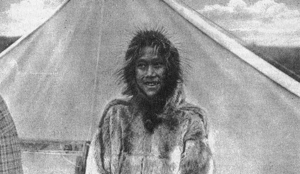
An Eskimo Boy at Arctic Red river.
One hundred and thirty miles below Loon river a stream one hundred yards wide enters from the northeast. This is a river which the old man at Fort Good Hope described to Mr. Ogilvie as one up which a Hudson’s Bay Company’s officer went many years ago to its source, which he found to be not far from the head waters of Anderson river, which flows into Arctic ocean. It would appear from the old man’s statement that several trips up it have been made since, but this information was vague, and Mr. Ogilvie afterwards met no one who could give him a reliable account of this river.
Sixty miles lower down, Red river enters the Mackenzie on its west side just at the foot of the Narrows. It is about two hundred yards wide at its mouth and appears to be shallow. As far as Mr. Ogilvie could learn from persons acquainted with the river, it comes from a flat, swampy country.
Where the River Branches.
Where the upper end of the branch of the Mackenzie channel on which Fort McPherson is situated connects with Mackenzie proper, according to Mr. Ogilvie:—“The channel is three-fourths of a mile wide, but it is only one of four, there being four large islands there. The whole width of the river cannot be less than three or four miles.
“Looking northward down the westerly channel the view is bounded by the sky and widens in the distance so that one can fancy he is looking out to sea. This can hardly be so; but, from the altitude of the bank where I stood, added to my own height, the horizon must have been six miles away, and a bank in the channel of equal height to that on which I stood would have been visible twice that distance. Now, if the supposed bank was timbered, as was that on which I stood, it would be visible ten or twelve miles farther, but none was in sight.
“From the entrance of the small channel of Peel river to the head of the upper island in the Mackenzie is nine miles. From the west shore to the southerly point of this island is a mile and a quarter; from the island to the east shore the distance is nearly as great, showing the river to be more than two miles wide at this point. However, it gradually narrows, and five miles above this is a little over a mile wide, which it averages up to the narrows, about sixty miles from Fort McPherson, or twenty-eight from where we entered it.
“A north wind raises quite a swell here and the salty odour of the sea air is quite perceptible above the delta.”
Agricultural Possibilities.
Alexander Mackenzie and the explorers who immediately followed him down the great river of the north, being fur traders, devoted no space in their published journals to a discussion of the agricultural possibilities of the country, and as their time was necessarily restricted they took no time on their journeys to examine any part of the territory, contenting themselves with noting the main features affecting the navigation of the main stream, the mouths, the tributaries, the occurrence of game, Indian camps, etc.
Following close upon the establishment of permanent trading posts and missions, came the pioneer attempts at agriculture in Mackenzie valley, and we find members of the first exploring parties sent to the country for scientific research commenting upon the crude experiments of the pioneer agriculturalists.
Doctor John Richardson, who accompanied Franklin’s expedition in 1826 (See p. 13), in his volume “The Polar Regions”, in a general description of the resources of the country at that date, wrote:—“Wheat has not been raised within the Arctic circle in America, nor indeed within six degrees of latitude of it. It requires a summer heat of one hundred and twenty days, but it is said to be cultivated up to the 62nd or 64th parallel on the west side of Scandinavian peninsula. Barley ripens well at Fort Norman on the 65th parallel, in the valley of the Mackenzie, after the lapse of ninety-two days from the time of its being sown. All attempts to cultivate it at old Fort Good Hope, two degrees farther north, have failed. Sixty-six degrees of latitude may therefore be considered as the extreme limit of the barley in Norway. Oats do not succeed so far north as barley here.
“At Fort Good Hope, on the Mackenzie (the new fort), in latitude 66¼ degrees north, a few turnips and radishes, and some other culinary vegetables, are raised in a sheltered corner, which receives the reflection of the sun’s rays from the walls of the house, but none of the cerealia will grow, and potatoes do not repay the labour.”
Domestic Cattle Introduced.
Doctor Richardson again referred to the same subject, after his return from his trip with Doctor Rae in 1848 in search of Sir John Franklin’s missing party, and we find in his book published after his return to England, “The Arctic Searching Expedition” (Vol. 1., p. 153), the following:—“We reached Fort Resolution at 10 a.m. and having received some supplies of fish, and two or three deals for repairing the boats, we resumed our voyage, after a halt at the Fort for an hour. Domestic cattle have been introduced at this place, and at the posts generally throughout the country, even up to Peel river and Fort Good Hope and within the Arctic circle. At this season the moschetoes (mosquitos) prevent them from feeding, except when urged by extreme hunger, and fires are made for their accommodation near the forts, to which they crowd, and lying to leeward amidst the smoke, ruminate at their ease.”
At page 165, regarding Fort Simpson (61° 51′ 25′′ north 121° 51′ 15′′ west) Richardson in the same book writes:—“Barley is usually sown here from May 20 to 25, and is expected to be ripe on August 20—ninety-two days. In some seasons it has ripened on August 15. Oats do not thrive quite so well, and wheat does not come to maturity. Potatoes yield well and no disease has yet affected them, though early frost sometimes hurts the crop. Barley in favorable seasons gives a good return at Fort Norman, which is farther down the river; and potatoes and various garden vegetables grow there. The 60th parallel of latitude may, therefore, be considered as about the northern limit of cerealia in this meridian; for though in good seasons and in warm sheltered spots a little barley might possibly be reared at Fort Good Hope, the attempts hitherto made there have failed.
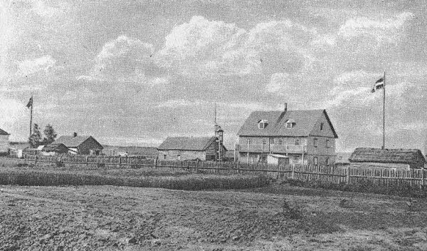
Oat field at Fort Simpson.
“A number of milch cows are kept at Fort Simpson, and one or two fat oxen are killed annually. Hay for the winter provender of the stock is made about one hundred miles up the river, where there are good meadows or marshes, and whence it is rafted down in boats in September.”
Lapland Reindeer.
The occurrence of immense numbers of caribou in the Canadian Northland (see chapters XVIII and XXII), and the fact that this animal in its appearance and habits is practically identical with the Lapland reindeer, which has been successfully introduced into Labrador and Alaska, have led to the belief that the last mentioned animal might be introduced with splendid results into the country, and the Department of the Interior has inaugurated an experiment to ascertain if the plan is feasible. In September, 1911, three carloads of reindeer were despatched to Fort Smith, where they are being taken care of. As these animals serve as beasts of burden, as well as provide meat, milk and leather, this experiment might have an important effect upon the future development of all these northern areas.
Grain Growing at Fort Liard.
At page 170 in the same volume, referring to Fort Liard, Richardson states:—“Though this post is more elevated than Fort Simpson, by at least one hundred and fifty feet, and is only ten degrees of latitude to the southward, its climate is said to be very superior, and its vegetable production of better growth and quality. Barley and oats yield good crops, and in favorable seasons wheat ripens well. This place, then, or the 60th parallel, may be considered as a northern limit of the economical culture of wheat.”
Whatever the discouragements of the pioneer agriculturalists in Mackenzie valley may have been, there was sufficient encouragement to induce the missionaries and employees of the fur companies stationed in the country to persevere.
Mr. A. Isbister, a native of the West, who had lived for three years in Mackenzie river district, but left that country when under twenty years of age, examined before the British parliamentary committee of 1857, stated that he had himself raised barley, oats and potatoes as far north as Fort Norman on Mackenzie river, upwards of a thousand miles from the United States boundary and near the Arctic circle. On the Liard, large crops could be raised, as the soil is better on that river, and wheat had been occasionally raised there. It was possible that settlement might extend to Great Bear lake. There would be sufficient territory in the north to make “a very large state indeed.” Asked if he thought that the whole country on Mackenzie river was all adapted to the wants of civilized man, Mr. Isbister remarked:—“The climate is very severe there, but the soil, so far as I have an opportunity of judging, is tolerably well adapted for cultivation. You can raise barley and potatoes very well indeed, without any risk whatsoever.”
Barley Always Ripened There.
In the Dominion Government Pacific Railway report of 1878 it is stated (p. 333):—“Mr. Hardisty, late Chief Factor in charge of Fort Simpson in latitude 61·8°, informed Professor Macoun that barley always ripened there; that wheat was sure four times out of five. Melons if started under glass ripened well, frost seldom doing them much harm.” In the 1880 report Reverend D. M. Gordon is quoted (p. 102) as authority for the statement that “wheat is grown as far north as Fort Simpson.” In the report of 1878 (p. 333) it is also stated:—“Chief trader Macdougall, in 1875, said all kinds of grain and garden stuff always come to maturity at Fort Liard (latitude 60·25°).”
In 1882 Doctor Bompas, the heroic Church of England Bishop of Mackenzie river, in the course of a report to the Society for the Propagation of the Gospel, wrote:—“The English schoolmaster at Simpson has made successful experiments of farming in that northern region, and through his energetic labours a good crop of barley was raised in the mission fields; also some wheat and potatoes, beans, pease, beet roots and other vegetables.”
The evidence taken before the select committee of the Senate of Canada in 1888 as to agricultural possibilities in Mackenzie valley, excited general interest.
Many Natural Prairies.
The Right Reverend Isidore Clut, O.M.I., missionary Bishop of Arindele, whose diocese included Mackenzie basin, and whose name is still held with reverence throughout this country, examined before the Committee stated that in several places in the basin of the Mackenzie there were a great number of natural prairies, those with round hay and those with flat hay. The round hay, in certain places, grew from three to five feet in height. The flat hay was also very fine but a little shorter. It grew everywhere in the low and wet places.
At the Roman Catholic mission at Providence, the residence of the bishop, one year he had one thousand four hundred and forty barrels of potatoes—(one barrel, ten gallons)—from sixty kegs of seed, but this was a very favourable year. They had been greatly favoured by the heat and by rain at opportune times. On two or three occasions they had had a thousand and twelve hundred barrels of the same roots.
At the Providence mission there was an excellent clay, which was very good for cultivation. Throughout the country in general the bishop found all sorts of land, black soil, loam, clay, sand, marl, etc. Generally they harvested their potatoes at Providence from September 20 to 30. Turnips, carrots, beets, etc., they harvested a little later. Wheat on the banks of Peace river and Liard river was ripe towards the end of August; at Athabaska and at Providence from September 15 to 25. Barley was ripe a little sooner throughout. Rye does not ripen any sooner than wheat, but witness had not made many experiments, for the reason that they like wheat better than rye. Oats they harvested at the same time as wheat, but they had sowed them only once. Potatoes they harvested at Athabaska and at Providence, from September 20 to 30. Turnips, carrots, beets, radishes, etc., they harvest later. Indian corn generally cannot get ripened below Athabaska or on the Mackenzie. Strawberries commenced to ripen towards July 15; gooseberries ripened towards the end of August, and at the commencement of September. Raspberries and currants come after the strawberries. There were also in places many blueberries, cranberries, and other small fruits, such as poires sauvages (Saskatoon), etc. Barley ripened at Fort Norman, at the mouth of Great Bear lake river. Consequently it grew at Fort Wrigley, Fort Simpson, and at Fort Providence. In Liard river and Peace river countries it succeeded also very well. Brother Kearney and the Hudson’s Bay Company had grown potatoes at Fort Good Hope (Arctic circle). At the mission at Providence, and at all the Roman Catholic missions on Mackenzie river, Liard river, Peace river and Slave river, etc., potatoes and other vegetables were
Cultivated Very Successfully.
Wheat grew, according to the Bishop’s evidence, at Providence mission, and at Fort Simpson, but it rarely arrived at perfect maturity. It ripened much better on the borders of Liard river and Peace river. At the mission of the Nativity (Chipewyan at Lake Athabaska) they had often grown fine wheat. At the mission of the Nativity (Athabaska), at Fort Resolution (Great Slave lake), at Fort Smith, at the mission of Fort Providence, they sowed from the time the land began to thaw, that is to say, from May 15 until June 8 or 10. Throughout the length of Liard and Peace rivers, sowing began a little earlier. At the end of August they had already harvested barley and wheat.
Plants which were deep in the ground, such as potatoes, took a good deal of time to spring up because of the ground being frozen below, but those which were near the surface of the ground commenced to grow very soon, and the nearer one approached the north, for example at the Arctic circle, the more rapidly did the vegetation begin, because of the greater length of the days, or the days being without nights. In 1886 the bishop observed the matter at Good Hope. Towards June 7 or 8, vegetation commenced, and in five or six days the leaves of the trees had reached their natural size. It was because it commenced to be warm then, and very warm, and that continued, save when sometimes north winds set in, which would bring back the snow and cold and sometimes injure the crops.
It was difficult, Bishop Clut remarked, to say the extent of country fit for pasturage, and the cultivation of cereals or other plants, for the reason that cultivation had not been tried, except by the missionaries, and a little by the Hudson’s Bay Company.
During his examination before the committee, Bishop Clut was asked:—“How far north has the potato been grown to your knowledge?”
He replied:—“We raise potatoes even as far north as the Arctic circle, at Fort Good Hope, but they are very small. We have no bread there, and an Irish brother has
Raised Potatoes Every Summer.
Once I passed a winter there and they had very little potatoes. Out of five bushels planted they got only six bushels. Two years ago I passed the winter there, and out of ten kegs planted they got twenty-five.” The bishop added that there were then at nearly all of the missions gardens in which were raised potatoes, carrots, beets, onions, cabbages, turnips and lettuce. Even at Fort Good Hope they raised turnips and carrots.
Wild roses grew in abundance as far north as Good Hope.
Horses, at that date, had not been taken farther than Great Slave lake, but cattle had been taken as far north as Fort Good Hope. They were found at the principal establishments of the missionaries, and at the forts of the Hudson’s Bay Company.
Bishop Clut stated that he was certain that if Mackenzie country became settled and cultivated on a large scale, the occasional white frosts of the summer months would be much less frequent. That was the result which they had already observed at their principal mission posts; the more they cleared to any extent the less were the fields susceptible to frost. The months of September and October were generally dry, and the blue sky made them charming. In general they had a clear sky without a cloud and that is what makes the climate so healthy in the basin of the Mackenzie. People could live there to a greater age than in any other part of the globe.
“Chinooks” at the Arctic Circle.
At Arctic circle the southwest “Chinook” wind often made its effect felt, even in winter. The Rev. Father Séguin and Brother Kearney, who had been at Good Hope for twenty-eight years had observed its effect. The bishop had observed it also himself during the winters of 1885 and 1886. This wind modified the temperature a good deal. The missionaries had not remarked that the intensity of the frost had any effect on the native trees of the country. The bishop had not kept account himself of the degrees of heat in summer, but he was able to say that it was excessively hot; and the farther one went towards the north the warmer he would find it becoming; and that heat lasted the twenty-four hours of the day, without sensibly diminishing in its intensity from 10 p.m. to 3 a.m.
Ex-Judge Malcolm MacLeod, Q.C., of Aylmer, Que., a northwesterner by birth, on examination before the committee produced a number of letters received by his father while he held the appointment of senior officer of the Hudson’s Bay Company in the northern district. Among these letters was one which showed that the original explorers of the country between the Mackenzie and the Yukon described it as “a land of milk and honey.”
Judge McLeod added:—“We know for certain that at Fort Liard, wheat is a reliable crop for four years out of five, at any rate.”
Hon. William Christie, ex-member of the Northwest Council, was at one time inspecting chief factor of the Hudson’s Bay Company service. This witness was examined before the committee and explained that as inspecting factor of the Hudson’s Bay service he was in charge of all the districts from Red river to Fort Simpson—from Fort Garry northward—Red river district, Swan river district, English river district, Athabaska river district, and Mackenzie river district. All of these were
Under His Supervision.
He had travelled over the whole of them and descended Mackenzie river as far as Fort Simpson. He did not think that any authoritative attempt had ever been made up to that time to collect statistics, etc., as to resources of this region. The business of the Hudson’s Bay Company was confined to the fur trade, and if there were any scientific investigations in the old days these were conducted under the authority of the British government. The Hudson’s Bay Company’s posts on Mackenzie river were established at convenient points for the fur trade all the way down the river. Fort Simpson was at the head of the whole Mackenzie river district.
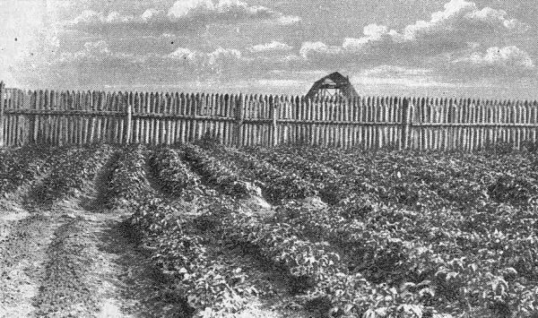
Potatoes at Fort Simpson.
There was no settlement around any of the company’s forts. The white men in the forts were largely from England and Scotland—gentlemen’s sons—and some were married to Indian girls and French half-breeds. Traders, other than those of the company, were at that date going in for furs, up as far as Great Slave lake. The Hudson’s Bay Company opposed them the best way they could, but had sold the country to the Canadian government. The Church of England, as well as the Roman Catholic Church, had missions throughout the region, and had had them for many years.
Mr. Christie informed the committee that he did not think there would be any difficulty in navigating with suitable steamers the Mackenzie from its headwaters to Arctic ocean, because the year before his examination they had had the experience of a successful voyage of the Hudson’s Bay Company’s steamer from Fort Simpson down Mackenzie river nearly to its mouth, below Peel river. They could have gone through to Arctic sea if they had wished to do so, but having no pilot, and not knowing which of the channels they should take, they did not like to venture. It would have been a disastrous thing to the company if that steamer had met with any accident which would have prevented it from returning to Slave river that season.
Reached the Mackenzie From the North.
As to outside communication via the north, Mr. Christie considered navigation by Hudson bay more certain than by Behring strait. During the search for Sir John Franklin’s lost expedition, however, Commander Pullen, of H.M.S. Plover, sailed from Honolulu for Behring strait and Mackenzie river. He went as far north as he possibly could get with the Plover. Then with Lieut. Hooper and some sailors he took to the boats and coasted along to the outlet of Mackenzie river. The party ascended that river with their boats to Fort Simpson the same fall—tracked their boats. The Plover returned to Honolulu that same season.
Donald McIvor, farmer, of Kildonan East, Manitoba, who had been sixteen years in the Hudson’s Bay Company’s service, and had been stationed in Mackenzie river district for over six years, communicated in writing to the committee a very interesting series of answers in response to a schedule of questions submitted by the committee. Witness explained that he considered he had fair knowledge of the district watered by Mackenzie, Athabaska and Slave rivers.
The soil is black loam chiefly, sometimes a little sandy. Witness considered three-fourths of the country fit for pasturage or coarse grains. Barley and potatoes had been grown successfully as far north as Fort Norman. He saw some wheat, very fine, at Methye portage, grown by an Indian, but did not know of its being tried further north then. He never saw any Indian corn during his stay in the district. At Fort Athabaska, barley sown the middle of May was ready the first or second week in August. Farther north, at Fort Norman, barley sown the middle of May could be reaped the middle or the last week in August. In cases where wheat was grown it ripened about the last week in August, potatoes the first of September. The ground was usually fit for seeding about three weeks after the first spring flowers showed. The summer rains began about the latter end of May. At the time witness was in the country nothing was done to any extent in agriculture. Stock raising was carried on at most of the forts, and succeeded admirably.
Ten Years at Fort Liard.
Written answers to a set schedule of questions prepared by the committee were submitted by Mr. William James McLean, chief trader of the Hudson’s Bay Company, Lower Fort Garry, Manitoba.
Witness explained that his personal knowledge of the country under investigation covered trips over the following routes:—From the watershed of Mackenzie river basin at the height of land whence Clearwater river takes its rise, down the aforesaid river to its confluence with Athabaska river, thence down Athabaska river to Lake Athabaska and from there to Great Slave lake down Slave river, and out Lake Athabaska, and on through that lake down Mackenzie river to Fort Simpson, thence up Liard river to Fort Liard, where he was stationed for ten years, from 1863 to 1873. He stated that he planted potatoes and barley at Fort Liard generally about May 10, and reaped barley about August 20. Potatoes were fit for use about that time, but were generally taken out of the ground about September 20. Turnips were planted and dug about the same date as the potatoes. Wild flowers first appeared in the spring about May 25 at Fort Liard, and June 10 at Fort Simpson. Wild strawberries were ripe about the first week in July, gooseberries about the first of August. Other small fruit came in from the middle of July to August 10. The wild vetch or pea grew at Fort Liard, but not to any great extent. Good barley grew at McMurray, Chipewyan, and at Forts Resolution, Simpson and Liard.
Wild Berries Plentiful.
Among some information as to the fertility of Mackenzie basin communicated in writing to the committee by Mr. Frank Oliver of Edmonton was the following:—Berries of various kinds were the only considerable natural food product of Mackenzie river country. They were plentiful in their season throughout the whole of the wooded region which extended to within one hundred miles of the Arctic coast. The blueberry was the most plentiful and was found throughout the whole region. It resembled the huckleberry of the east. The blackberry and mossberry come next in quantity in the far north. The former was not the blackberry of Ontario, and the latter somewhat resembled the strawberry. From Liard river south to the Saskatchewan, the raspberry, strawberry, Saskatoon berry, gooseberry, high and low bush cranberry, chokeberry, and black and red currants flourished as well, besides numerous minor varieties of berries. In some years berries were much more plentiful than in others. In plentiful years they formed an important item of the Indians’ food. There was every reason to believe that the varieties found there which were cultivated profitably in other countries could be as satisfactorily cultivated there, at least from the 61st parallel southward, between the main streams of the Mackenzie and Rocky mountains.
Mr. Oliver explained that the information communicated was chiefly acquired from Murdock McLeod, of Edmonton, who spent the years 1862-63 and part of 1864 in the Hudson’s Bay Company service at Fort Anderson, since abandoned, east of the Mackenzie and about eighty miles up Anderson river from Arctic coast. In the summer of 1863 he accompanied an expedition undertaken on behalf of the Smithsonian Institute, along the Arctic coast from the mouth of Mackenzie to that of Coppermine river. In 1865 he was at Fort Liard. Mr. McLeod stated that in the summer of 1865, while in the Hudson’s Bay employ, at Fort Liard, latitude 59¾°, he sowed about three acres of wheat on May 26; this was in the stook on August 1. It was good grain, though somewhat smutty, and had not been frosted; barley sowed at the same time did equally well, also potatoes. During several summers’ residence at Fort Liard, Mr. McLeod never saw summer frost. He also stated that at Fort Simpson, in latitude 62½° wheat, barley and potatoes had done well. This was borne out by the statement of Reverend Mr. Spendlove, missionary at Fort Simpson, except that in 1887 the barley was frosted.
Professor Macoun’s Testimony.
Professor John Macoun (See p. 16), Botanist to the Geological Survey of Canada, examined before the committee stated that barley ripens at Fort Simpson, latitude 62°, every year between August 12 and 20. Barley and potatoes had been grown at Fort Norman at the mouth of Great Bear lake river, about latitude 65°, and even at Fort Yukon, in the Arctic circle, barley is a sure crop. These are not particular points noted for their good soil, but located solely for the fur trade. Five-sixths of the country is just as good as these points, and will in future produce as good crops. There is no point east of the Mackenzie suitable for agriculture.
Professor Macoun said he had been informed by Chief Factor Hardisty, brother to Senator Hardisty, who had charge of Mackenzie river district for many years, that wheat was a sure crop at Fort Simpson four times out of five, but that the country around Fort Liard, on Liard river, was much superior to Fort Simpson for agricultural purposes. All kinds of garden produce succeeded well, and melons, after being started in a hot bed, ripened well.
According to Professor Macoun’s evidence Mackenzie valley and the whole of the northern prairie country has a soil that is largely composed of what is called alluvium; and passing northwards farther down Peace river to the Mackenzie the surface, from all he could gather from what he had read, is precisely of the same character as the second prairie steppe, which is the surface of black mould mixed with limestone gravel and deeper down there is more gravel and sand in the subsoil.
The whole of the country from Edmonton northwesterly to Arctic ocean in Mackenzie valley, Professor Macoun explained, is underlain by Devonian or cretaceous rock, and by the disintegration of these rocks good soil is produced always. From everything he could gather, the whole region naturally out to the Arctic coast, west of Mackenzie river, has a good soil. Easterly is a land of barrenness. The line of the Mackenzie is not exactly the line. Geologists know that there is a portion of the valley east of the river and up to the base of the Laurentian rocks where the land seems to be good—as regards the soil. Professor Macoun said he was decidedly of opinion that domesticated animals would in the future be raised in Mackenzie basin. Sheep, horses, pigs and cattle could and would be raised there. It is a law of nature that they cannot fatten cattle in southern Texas because it is not cold enough to solidify the fat, as it were, and they have to drive the Texan cattle north and fatten them. As you go north you find that the cattle
Produce More Fat,
and are more easily fattened, because it is a law of nature that in cold climates fat should be laid up.
Asked as to the native grasses, Professor Macoun remarked:—“As to the natural grasses of this country, having just completed an examination of the whole grasses of the Dominion, I am safe in stating that they are the grasses best suited for pasturage of any known to stock men or farmers. The grasses referred to are those known as red-top and Kentucky blue grass, or, scientifically, Poa Pratensis and Poa Seratna, Poa Tenniflora and Ceasia. These four species are well known to American stock men and are considered of the highest value. They are the commonest of the grasses in our northern forest region and along the foot hills of Rocky mountains. Three of these species are known in the eastern provinces. One of them is exclusively western and the greater part of the common pasturage of Ontario is altogether composed of Poa pretensis (Kentucky blue grass, or red-top).”
Expert Investigation.
While a committee of the Senate was hearing this evidence as to the natural resources of Mackenzie country, two experts, scientific explorers, Messrs. McConnell and Ogilvie (See p. 18) were enquiring into the subject on the spot on behalf of the Dominion government. The publication of the official reports of these gentlemen, in due course, strengthened the impression made upon the public mind by the evidence taken by the Senate committee, but the practical result was not much, for there was at that date still plenty of free land to be had in the so-called “Fertile Belt”, and lack of communication effectually prevented any deflection of the tide of immigration towards Mackenzie river.
Mr. R. G. McConnell in 1887 explored Hay river from its mouth at Great Slave lake as far as Alexandra falls, about thirty miles in a direct line up. He reports that for some distance up and while passing through the delta, the river is wide and encloses a line of alluvial islands, but on getting above these it contracts to about one hundred yards in width. Its banks are low and grassy, and the country on both sides is thickly forested. Proceeding up the river the general elevation of the country increases, and the valley becomes higher and wider, and bordering flats make their appearance.
Grassy and partly wooded plains skirt its southern shores and extend southward towards Peace river, and Hay river may be regarded as practically the northern limit of the prairie country, although small isolated plains occur much farther north in the vicinity of Slave river.
Picturesque Water-Falls.
As to Alexandra falls, so named by Bishop Bompas in honour of the then Princess of Wales, Mr. McConnell states that they present a clear unbroken sheet of falling water, and are exceedingly picturesque in appearance. The gorge through which the river below flows here suddenly ceases, and the river precipitates itself over the hard limestone band through which the latter is cut, with a sheer descent of about eighty-five feet, as measured by a single reading of the aneroid barometer.
From the base of the falls the river flows along rapidly for about a mile, and then makes a second leap of about fifty feet, below which are three miles of rapids. At the lower falls the cliff is broken down near the centre, and the descent of the water is interrupted by projecting ledges. Above the falls the river loses its valley almost altogether, and has failed to produce more than a feeble impression on the hard limestone beds which floor the surrounding country. Near the foot of the rapids below the falls “a graceful effect is produced by a couple of small streams which fling themselves on either hand over the brow of the cliffs bounding the valley and make one clear leap to the floor beneath.”
Agriculture at Resolution.
Mr. McConnell reported the western arm of Great Slave lake “bordered all around by a flat wooded country, which has been proved to be adapted to cultivation of barley, and of potatoes and other vegetables. The soil is usually a loam, but in the ridges is often sandy, and in low places passes into a clay. The alluvial lands along Slave river and the grassy plains on Little Buffalo river are the best sections of the district, and deserve the first attention. At Fort Resolution a few acres of land are farmed every year with good results by the Hudson’s Bay Company. Mr. Flett, who has charge of this post, informed me that barley is usually sown on May 15, and requires about one hundred and ten days to reach maturity. Potatoes are planted about the same date, and are dug about September 15; wheat, according to the same authority, has been tried three times with only one failure. At Hay river, sixty miles west of Fort Resolution, some potatoes are annually grown by the Indians, and even at Fort Rae, which is situated on a bleak island in the northern arm of the lake in latitude 62° 39′, some gardening has been attempted by the energetic Roman Catholic missionaries who are stationed there. The soil at this place is very stony, and much difficulty was experienced in removing the boulders, and in bringing the ground into a proper state for cultivation. When this was once effected several kinds of vegetables were grown without trouble. Potatoes planted on May 25 are dug in the middle of September, and yield twenty fold, and the list of garden vegetables raised here includes turnips, onions, cabbages, carrots, radishes, beets and peas. Wheat and barley have not been tried on a large scale, but a few grains were sown at the end of May one season, and became mature, the latter on August 26, and the former four days later. A less favourable spot for farming purposes, than this rocky island, could scarcely be obtained, and the successful raising here affords a promise that the more fertile lands to the west and south will one day be utilized.”
Mr. McConnell in his report on the exploration of Slave river states that the soil there “is often sandy, but good crops of potatoes and other garden vegetables are grown at Fort Smith, and also by the Indians on the east side of the river.”
Wheat at Fort Providence.
Mr. McConnell referred specially in his report, also, to the agricultural operations at Fort Providence (where he wintered), Fort Simpson and Fort Good Hope. He wrote:—“Fort Providence is surrounded by flat arable lands of good quality, and capable of producing excellent crops. Agriculture is engaged in here both by the Hudson’s Bay Company and the Roman Catholic Mission, and large quantities of farm produce are annually raised. Wheat has been sown at the Hudson’s Bay Company’s farm for nine years, and, according to Mr. Reid, has never been a complete failure, although on some occasions it has been slightly touched by summer frosts. It is usually sown about May 20, and requires about three months to ripen. As much as twenty-nine bushels have been obtained from one bushel sown. Barley is a sure crop. It is sown at the same time as the wheat, and is ripe almost a week earlier. Potatoes are planted between May 16 and 25, and are taken up about September 20. Turnips, cabbage, beets and numerous other garden vegetables are grown with scarcely greater difficulty than in latitudes ten degrees farther south. The soil is a stiff clay, with in some places surface beds of sand, and is seldom thawed out to a greater depth than six feet. The muskegs which cover a considerable proportion of the country back from the river are permanently frozen at less than two feet from the surface. It must be borne in mind, however, in this connection, that the histories of other districts have shown that when the country is cleared and the moss burnt off, the penetrative powers of the summer thaw is at once greatly increased, and lands have become productive, which at first appeared hopelessly barren. A number of cattle are kept at Fort Providence, but require to be fed about seven months in the year. Hay of excellent quality is obtained in abundance from neighbouring marshes.”
The Farm at Fort Simpson.
“Like the other posts Fort Simpson has its farm, and according to some statistics which I received from Mr. Laviolette, the various crops raised, with the exception of wheat, which does not ripen, and the dates for planting and reaping are much the same as those previously stated for Fort Providence. Potatoes are usually planted between May 15 and 20, but this season (1888) were not put in, owing to the unusually late spring, until May 28, and require about four months to mature. In the ordinary year forty bushels of seed will yield from six to seven hundred bushels, but the crops are sometimes injured by summer frosts. Barley, which is the only cereal grown, is sown about May 20, and is usually ripe by September 20. No difficulty is experienced in raising such garden vegetables as cabbages, turnips, beets, etc., and Mr. Camsell seemed sanguine that even melons and tomatoes would ripen if properly tried. The soil here is a stiff clay loam. . . .”
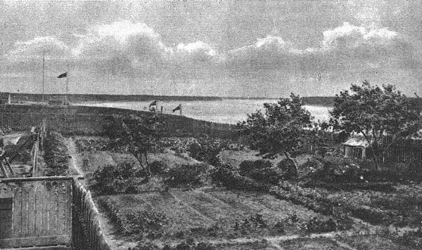
Mission Garden at Fort Providence.
“Fort Good Hope is situated a short distance below the Ramparts and is the lowest fort on the Mackenzie. It was originally built over one hundred miles lower down, and has been moved several times before the present site was finally selected. It is situated only a few miles south of the Arctic circle, but this does not prevent some gardening from being attempted. Potatoes, turnips and other garden vegetables are raised in some quantity, and even barley has occasionally been ripened, although the ground is permanently frozen three or four feet from the surface. Cattle and poultry are kept at the fort, but the former have to be fed over seven months in the year. . . .”
Can Furnish Local Food Supply.
In summing up the result of his explorations, Mr. McConnell stated in his report:—“At all the posts of the Hudson’s Bay Company, along the Mackenzie and its tributaries, with the exception of Fort McPherson, small plots of land are annually cultivated and large quantities of potatoes, turnips, beets and other vegetables are grown for use in the district, while at Fort Liard and Fort Providence, the two most southerly posts in the district, both wheat and barley have been tried with success. There is, however, little reason to hope that Mackenzie river district as a whole, or even the southern part of it, except in limited areas, will ever be able to support a purely agricultural community, or that its products will ever be able to compete in the open markets of the world with the produce of more favoured regions. Its agricultural development will depend on a local market being obtained. When the time comes, as come it must, when the undoubted mineral resources of the region are drawn upon, the food required by the mining population, or the greater part of it at least, can be supplied locally. The amount of arable land is small compared to the total area, and is mostly confined to the vicinity of the larger streams. Away from the rivers, frozen marshes and muskegs and shallow lakes cover the greater part of the surface. The alluvial lands along Slave river, the upper part of Mackenzie river, and the country bordering the Liard for some distance above and below Fort Liard and west of the mountains, are the best parts of the district.”
Climate of Mackenzie Region.
Mr. McConnell, in his report of his explorations of both 1887 and 1888, makes the following references to the climate along Mackenzie river:—“The warm weather which commenced at Fort Simpson on May 1, continued throughout the month, and under its influence the snow quickly disappeared, and the spring advanced with astonishing rapidity.
“In the lower part of the river the ice was broken up at Fort Wrigley on May 18, at Fort Norman on May 19, and at Fort Good Hope on May 21. The ice on the river above Fort Simpson, between the mouth of the Liard and Great Slave lake, did not, however, move until after June 1.”
May 31, 1888, Mr. McConnell found Anemone patens, the first flower of the season, in full bloom above Fort Wrigley. When Mr. McConnell left Fort Norman June 12, 1888, the trees were still leafless, but the various species of willows and birches had hung out their catkins, and the early flowering anemones and other flowers brightened the valley with colour. June 18, when Mr. McConnell left Fort Good Hope, anemone patens and other early flowering plants were in bloom, but the general forest still remained leafless.
The Liard District.
Mr. McConnell’s report gives us occasional comprehensive glimpses of the territory on either side of the Mackenzie. He says that the surface of the country bordering the Mackenzie in the latitude of the Liard, on both the lower and higher levels, is usually more or less undulating, and is diversified by innumerable shallow lakes of all sizes, while a large proportion is underlaid by muskegs and marshes, covered with sphagnum or bog-moss, which remain frozen throughout the year. The higher lands and ridges separating the lakes and marshes are usually rather densely forested, chiefly with white spruce (Picea alba), the Banksian pine (Pinus Banksiana) and the aspen (Populus tremuloides).
As to the basin of the lower Liard itself, Mr. McConnell mentions the following facts:—On his way down to the Mackenzie in 1887 he arrived at Fort Liard, fifteen miles below the mouth of the Nelson, on July 29. In the reach from the Nelson to Fort Liard, the river is generally wide and filled with sandbars and wooded islands. It is bordered in many places with wide alluvial flats, covered with tall, straight cotton wood, large spruce and canoe birch. Its valley is wide and shallow and lined with gently sloping, spruce-clad banks. On some of the flats the Indians have built houses, and fenced in small plots for farming purposes, for which the greater part of this section of the district seems well adapted. Mr. McConnell passed one small Indian farm about thirteen miles below the mouth of the Nelson, and another one at the mouth of Fishing creek, a few miles above Fort Liard, while others were noticed in the lower part of the river.
Fort Liard and its Environment.
Fort Liard is situated on a fertile flat, part of which has been cultivated for years with unfailing success. Wheat and barley are grown here year after year, while potatoes, cabbages, turnips, and other vegetables are raised without the least difficulty. At the time of Mr. McConnell’s visit, August 1, “all the crops were well advanced and in good condition; the barley was just turning colour, and the potatoes were almost large enough to eat. There is no reason, either climatic or otherwise, why the whole country bordering the Liard, from Beaver river to near its mouth, should not, when needed, support an agricultural community.” Mr. McConnell climbed one of the mountains near Fort Liard to a height of three thousand feet and “obtained an extensive view from the summit, over the plains to the eastward. The country in that direction rises gradually from the river in easy undulations, and appears to culminate at a distance of twenty-five or thirty miles in a low plateau through which Black river has cut a wide gap. A dense forest, relieved in places by gleaming lakes and light green marshes, stretches to the horizon.”
Mr. McConnell also states in his report that the valley depression for some distance below the fort is insignificant in size, and farther down disappears altogether, and the river undulates through a low, level plain, elevated only a few feet above its surface. Liard river is over a mile wide at its mouth.
A Mackenzie Valley Plateau.
Ten miles above the Blackwater, Mr. McConnell, in his descent of the Mackenzie in 1888, made a visit to a small plateau which there borders the river at a distance of three or four miles. The valley of the Mackenzie there has a depth of two hundred feet. After leaving it Mr. McConnell crossed a level plain which stretches eastwards to the foot of the plateau. This plain proved to be exceedingly wet and swampy, and most of the way across he was walking knee-deep through yielding moss or ice-cold water. It is partially wooded with small pine, spruce, aspen and tamarack, none of which had a diameter exceeding six inches. From the top of the plateau, the main range of Rocky mountains, which is here too far from the left bank of the river to be seen from the valley, came into sight to the west, while in an opposite direction a good view was obtained of the rocky range which borders the river to the east. The plain between these ranges, through which the river flows, has a width of sixty or seventy miles. It shows numerous lines of wooded heights running parallel with the river, but possesses no conspicuous elevations.
Mr. McConnell explains that rugged limestone ranges are visible along the reach below Fort Norman on both sides of the river, but seldom approach within thirty miles of each other. The plains between, and lower slopes of the mountains, are continuously clothed with forests of small spruce and aspen. The depression in which the river flows has a depth of from one to four hundred feet and a width of from two to three miles. River flats are seldom present, and the banks of the valley slope more or less steeply up from the edge of the water.
Mr. William Ogilvie’s Report.
Mr. Ogilvie, in the splendid report of his survey in 1888 (Sessional papers, 4th Ses. 6th Parlt.), made a special and most comprehensive reference to the agricultural capabilities of the Mackenzie country. Mr. Ogilvie’s reputation as an experienced and most accurate observer justifies an extended quotation from this section of the report.—“Everywhere, the Mackenzie basin”, he wrote (p. 82), “is quite as capable, so far as quality of soil is concerned, of supporting an agricultural population, as the greater part of the provinces of Ontario and Quebec. The soil, as seen from the river, is generally good, and the probability is that it continues so at least as far back from the stream as the woods extend. This extent is said to vary from twenty to forty miles on the east side, where no stream flows in, but where there are streams the distance is much greater, as the timber follows the valleys. Beyond the fringe of timber we come to the so-called barren lands, on which nothing but mosses and lichens grow and which, except as the pasturage of the musk-ox and a few other animals, are practically useless, so far as known at present. On the west side of the river the woods extend to the timber line on the mountains.
“Assuming the limits to be as above, the area of the fertile soil can readily be found. Speaking only of that portion of Mackenzie basin extending from Athabaska lake to Arctic ocean, we have a strip of land nine hundred and forty miles long, and something over sixty wide. This gives in round numbers sixty thousand square miles of land, the agricultural capabilities of which we may reasonably discuss. I think the above area is less than that actually wooded, but on the west side much of the surface is probably at such an elevation, being near the mountains, as to be outside the limits of our discussion. Theoretically, the points involved are the prevalent temperatures during the growing months, the period of vegetation and the duration of sunshine.
Temperature and Sunlight.
“I do not know of any regular record of temperature having been kept at Fort McPherson, the most northerly point at which anyone is permanently settled in the district. The only information which I have is my own record for the last ten days of June while I was camped in the valley near the fort. The lowest temperature during that period was 37.3° Fahr. on June 20, and the mean minimum from June 20 to June 30 was 43.3° Fahr. The highest observed temperature during the same period was 74° Fahr. at 1:30 p.m. on June 21, and the mean temperature at that hour for the ten days was 62° Fahr. The lowest of these temperatures would not injure vegetation. The mean minimum for the whole month would be below this, probably two or three degrees, but even that would not arrest vegetable growth. When, in connection with the temperature, we consider the number of hours of sunshine in June and July, it seems evident that Fort McPherson has all the essentials for the successful cultivation of most cereals and vegetables. At this northern point refraction extends the time during which the sun does not set, so that there are about twenty-four hours of sunshine each day from June 1 to July 15. On May 1, the sun is up for about seventeen and one-half hours, and during August the hours of sunlight vary from nineteen on the 1st to fifteen on the 31st. The total hours of sun are seven hundred and six in May; seven hundred and twenty in June; six hundred and eighty-four in July; and five hundred and twenty-seven in August; in all two thousand six hundred and thirty-seven hours of sun out of the total, day and night, of two thousand, nine hundred and fifty-two hours in the four months. As twilight continues while the sun is less than eighteen degrees below the horizon there is actually no darkness during this period. When the temperature is suitable, vegetation under these conditions thrives to an almost incredible degree, as the following shows. When I arrived at Fort McPherson on June 20, the new buds on the trees were just perceptible, and on the evening of June 22, the trees were almost fully in leaf.
“The mean minimum temperature for the month of July was 45.4° Fahr. The mean temperature for 1:30 p.m. was 64.7° Fahr., but on two occasions the thermometer went to 78° in the shade, and ten times to 70°. These temperatures were noted along the river, at different points of course, although during the greater part of the month my latitude did not change very much.
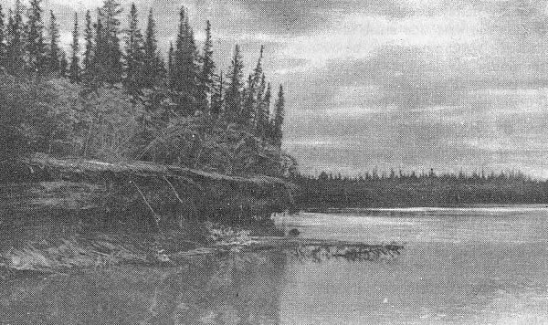
View on Peel river.
“This combination of favorable temperature and long hours of sunlight promises well for vegetable growth, but there are interfering causes. Unfortunately snow storms are apt to occur at any time during the year at Fort McPherson. On July 2, five inches of snow fell and the thermometer went down to 25° (7° below freezing point), yet, strange to say, the frost did not appear to hurt anything. A northeast wind continuing for a day or more, lowers the temperature in a few hours from pleasant, summer heat to what reminds one of the approach of winter.
“As far as I could learn, no attempt at cultivating cereals or roots has been made at Fort McPherson. But at Fort Good Hope some of the people grow potatoes and other garden produce, and, as the difference of latitude is not much over a degree, the same things ought to grow nearly as well at Fort McPherson. The potatoes grown at Fort Good Hope are small, averaging about the size of a large hen’s egg. Those which I tasted were bad, as if they had been frozen, but they were of the previous season’s growth, and it was then the middle of July. Even in Ontario potatoes of that age are not very palatable. This tuber appears to have always vitality enough to increase, as at Fort Good Hope they have had
No Change of Seed for Several Years.
This tends to show that the frosts are not very severe, during the time potatoes are growing and ripening. When I passed, the onions, lettuce and other things planted in the gardens were pretty well advanced, the onion stalks being about as large as pencils. No cereals had been sown, but I think barley would succeed fairly well. I am not aware of any continuous record of temperature at Fort Good Hope, so I cannot say whether the climate at that place is suitable for the growth of plants during June, July, and August. While I was there the days were pleasant and warm and the nights not unpleasantly cool. Nor, if we omit July 2, when snow fell, did I anywhere note any temperature below freezing during July and August.
“It may be said that my observations extended over too great a range of latitude, to be of any value in indicating the temperature any period or any place, as while they were being taken we were constantly moving south. This is true, but it must be remembered that in moving south we were leaving the area of constant sunlight and getting to where night has a cooling effect, so that the objection has not the same weight it would otherwise have.
“The statement given below of the duration of sunlight in the months of May, June, July and August, serves to show that a difference in latitude has not the same effect in changing the summer temperatures of places in high latitudes as it has in more southerly localities. Unfortunately, the records at posts in the district are too few and meagre to either confirm or disprove this theory, and to use the records of such places as Fort Franklin, on Great Bear lake, and Fort Rae, on Great Slave lake, is hardly fair. These points are over three hundred miles apart in an air line, and the temperature at either or both may be influenced by the local conformation of the ground, or other unknown causes. However, taking the records at these places, we have the following comparison: —
Mean temperatureFort Franklin,Fort Rae,
duringlat. 65° 12′lat. 62° 40′
May,35.2°Fahr.27.7°Fahr.
June,51.4°51.4°
July,52°61.2°
August,50.6°56.5°
“The Fort Franklin data are given in Professor Loomis’s Meteorology, published in 1875. He gives as his authority Dove’s tables in the report of the British Association for 1847. Who the observer was is not stated, but it was probably Franklin. The Fort Rae statistics were furnished by Mr. Carpmael to the Senate committee appointed to inquire into the resources of Mackenzie basin, and cover the same months as those given for Fort Franklin. These statistics, as far as they go, confirm the theory, for the extremes at Fort Franklin differ 16.8°, while at Fort Rae the difference is 33.5°, and the monthly differences at the former place are much less than the latter.[18]
“I have computed the following table which shows comprehensively the different durations of sunlight for the latitudes of Ottawa, Chipewyan, and Forts Simpson, Good Hope and McPherson.
Ottawa.Chipewyan.Simpson.Good Hope.McPherson.
Latitude45°26′58°43′61°52′66°16′67°26′
H. Sun.H.M.H.M.H.M.H.M.H.M.
May 1:14081534160517061730
June 1:15161736183921042400
June 21:15301844191422482400
July 1:15241836190222042400
Aug. 1:14321616165618161924
Aug. 31:13081352140814361444
H. Sun.H.H.H.H.H.
May:456514538592706
June:462549570662720
July:464530558625684
Aug.:423467481519527
——————————
Totals.18052060214723982637
“The number of hours of sunlight in each month has been obtained from the mean of the numbers at the beginning and ending of the month. This does not give a strictly correct result, as the sun’s declination, on which the length of the day depends, does not change uniformly, the daily change in June, when the sun has attained its greatest declination, being small as compared with that of September, when the sun is near the equator. Were the light of each day separately computed, the difference would be even more decidedly in favor of the north. In computing the above table, refraction has not been taken into account except in the case of Fort McPherson. Allowance for refraction would increase the duration of sunlight at all the other places, but much more in the north than in the south. As the table now stands it assigns to Fort McPherson eight hundred and thirty-two hours, or thirty-four and two-third days more sunlight than Ottawa, during a total period of two thousand five hundred and fifty-two hours. A better mode of comparison is to reduce the number of hours of sunlight at each place to days. It stands thus:—Ottawa, seventy-five days, five hours; Chipewyan, eighty-five days, twenty hours; Fort Simpson, eighty-nine days, eleven hours; Fort Good Hope, ninety-nine days, twenty-two hours; Fort McPherson, one hundred and nine days, twenty-one hours, and this out of a total of one hundred and twenty-three days.
Agriculture at Fort Norman.
“At Fort Norman, the Hudson’s Bay Company had a garden planted with turnips, potatoes and other garden produce. I was at that point during the last days of July, at which time potato vines were from six to ten inches long, and did not promise a good yield. The Roman Catholic mission had two patches, together about an acre in extent, planted with potatoes. The soil here was much better than in the first patch, being a warm clay loam, while in the other it was nearly all decaying vegetable matter, commonly called ‘muck’. The mission potatoes were much stronger in the vines than the Hudson’s Bay Company’s, and, at the time, nearly covered the ground. The Anglican mission had planted a small piece of ground near the river on a sheltered bench below the top of the bank and facing the south. Here the growth was much stronger than at either of the two other places. Some barley had been sown in it, and was well grown, the stalks averaging from two to two and a half feet high, and the heads being long and just beginning to fill. The growth of grass on this flat is luxuriant, and nettles grow as strong and large as any I have seen elsewhere. Near the edge of the woods wild vetches grow as long and vigorous as they do near Edmonton. Everyone complained of the cold, wet weather which prevailed during the summer and much retarded vegetation. The Roman Catholic missionary in charge of the mission here, told me that in twenty years’ residence at the place he did not recollect such a cool, damp, cloudy summer.
At Fort Wrigley.
“At Fort Wrigley some slight attempts had been made at cultivation, but I do not consider them a fair test of the capabilities of the place. When I was there, on August 15, the people were gathering blueberries, then fully ripe and as large and well-flavored as they are in Ontario. Ripe strawberries were found on August 9 ninety miles below this, and a few raspberries soon afterwards. Above Fort Wrigley wild gooseberries and both red and black currants were found in abundance, some of the small islands being literally covered with the bushes. The gooseberries were large and well flavored, and the currants would compare favourably with the same fruit as cultivated in the vicinity of Ottawa, the black currants being especially large and mellow. This was the middle of August, latitude 63°.
One thousand one hundred and fifty Miles Farther North than Ottawa.
“At Fort Simpson the Hudson’s Bay Company has a large plot of ground planted with turnips, potatoes, onions, and other garden produce such as is generally grown without artificial means in Ontario. On August 24, when I visited this place, the growing vegetables looked almost as good as the same kinds seen at the Ottawa market at the same date. Lettuce particularly was very large and fine. There was also a large area of barley, which looked well and promised an abundant return if allowed to ripen. The grain was then full and plump and just beginning to harden, but fears were entertained that a frost might come and spoil it. The people there claimed that the prevailing cool, cloudy weather had retarded its growth, as otherwise it would then be out of danger from frost. This cereal has been grown with success at Fort Simpson for many years. I understood that wheat had been tried, but with indifferent success. The garden altogether presented an appearance hardly to be expected at a point eleven hundred and fifty miles farther north than Ottawa. It is situated on an island in the river, and the presence of the large body of water may moderate the climate and account for the fine appearance of the garden. Whether the same fine result can be attained a mile or more away from the river can only be decided by trial. I am strongly of the opinion that it cannot.
“On the high river bank below Fort Providence wild gooseberries and currants were very plentiful, though on the eighth of September they were somewhat over-ripe.
“At Fort Providence the usual garden produce is grown every year and generally turns out well. Barley is also grown with success, but in 1888 it was, as everywhere else in the valley, much retarded by cool weather. Up to my departure from the post, the lowest temperature, exclusive of July 2, was 31.8° on August 29. The mean minimum for the month of August was 43°. When I was at Fort Providence the barley was beginning to change color, and, unless a very severe frost came soon after, would ripen. Wheat has been grown here for many years by the Hudson’s Bay Company, generally being fairly ripe before it is touched by frost and sometimes escaping altogether. The wheat is ground in a small hand mill, and the flour used in the ordinary way by the people of the fort. While there I ground a few pounds of the crop of 1887, and had the flour made into a cake, which, though not quite so good as that made from ‘XXXX’ flour, was palatable, and would probably sustain life as effectually as any other, those using it appearing as well and strong as could be desired. I brought home a sample of this wheat for inspection.
Pea Vines still Green in September.
“At Fort Resolution the Hudson’s Bay Company were growing potatoes, turnips and barley. The first were of good quality and size, but there would be no yield of the last. The Anglican missionary also had a garden in which were potatoes, cabbage, cauliflowers, turnips, onions and peas, the latter still green on September 21. The potatoes and cauliflowers were both good in size and flavor. I was informed that small potatoes were grown in a garden at Fort Rae, situated on a long arm of Great Slave lake, but, according to report, there is not much land around the lake available for farming, even were the climate suitable, as it is nearly all rock. At Fort Smith nothing of importance from an agricultural point of view had been done, and the autumn frosts were very severe.
“In conclusion, I may say that I do not wish to be understood as representing this country as suitable for agricultural operations, as I do not think it is. I have merely presented the results of the attempts which have been made. These results are doubtless much more favorable than might be expected, but how far they would hold good elsewhere than in the immediate vicinity of the river is not known. It is probable that the presence of such a large body of water, with a temperature of about 55°, has a beneficial influence on vegetation.