Volume 2 — LIST OF MAPS.
Reading edition
Nos.
I.HOMERIC GREECE AND THE NEIGHBOURING LANDS.
II.GREECE AND THE GREEK COLONIES.
III.GREECE IN THE FIFTH CENTURY B.C.
IV.THE LANDS ROUND THE ÆGÆAN AT THE BEGINNING OF THE KLEOMENIC WAR.
V.DOMINIONS AND DEPENDENCIES OF ALEXANDER, circa B.C. 323.
VI.KINGDOMS OF THE SUCCESSORS OF ALEXANDER, c. B.C. 300.
VII.ITALY BEFORE THE GROWTH OF THE ROMAN POWER.
VIII.THE MEDITERRANEAN LANDS AT THE BEGINNING OF THE SECOND PUNIC WAR.
IX.THE ROMAN DOMINIONS AT THE END OF THE MITHRIDATIC WAR, B.C. 64.
X.THE ROMAN EMPIRE AT THE DEATH OF AUGUSTUS, A.D. 13.
XI.THE ROMAN EMPIRE UNDER TRAJAN, A.D. 117.
XII.THE ROMAN EMPIRE DIVIDED INTO PREFECTURES.
XIII.EUROPE IN THE REIGN OF THEODORIC, c. A.D. 500.
XIV.EUROPE AT THE DEATH OF JUSTINIAN, A.D. 565.
XV.EUROPE END OF SEVENTH CENTURY, A.D. 695.
XVI.GREATEST EXTENT OF THE SARACEN DOMINIONS.
XVII.EUROPE IN THE TIME OF CHARLES THE GREAT, A.D. 814.
XVIII.THE WESTERN EMPIRE AS DIVIDED AT VERDUN, A.D. 843.
XIX.THE WESTERN EMPIRE AS DIVIDED A.D. 870.
XX.THE WESTERN EMPIRE AS DIVIDED A.D. 887.
XXI.CENTRAL EUROPE, c. A.D. 980.
XXII.CENTRAL EUROPE, A.D. 1180.
XXIII.CENTRAL EUROPE, A.D. 1360.
XXIV.CENTRAL EUROPE, A.D. 1460.
XXV.CENTRAL EUROPE, A.D. 1555.
XXVI.CENTRAL EUROPE, A.D. 1660.
XXVII.CENTRAL EUROPE, A.D. 1780.
XXVIII.CENTRAL EUROPE, A.D. 1801.
XXIX.CENTRAL EUROPE, A.D. 1810.
XXX.CENTRAL EUROPE, A.D. 1815.
XXXI.CENTRAL EUROPE, A.D. 1860.
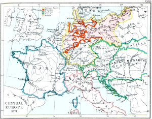
XXXII.CENTRAL EUROPE, A.D. 1871.
XXXIII.BOUNDARIES OF FRANCE, A.D. 1555, 1715, 1791, 1871.
XXXIV.SOUTH EASTERN EUROPE, c. A.D. 910.
XXXV.SOUTH EASTERN EUROPE, c. A.D. 1000.
XXXVI.SOUTH EASTERN EUROPE, c. A.D. 1040-1070.
XXXVII.SOUTH EASTERN EUROPE, c. A.D. 1105.
XXXVIII.SOUTH EASTERN EUROPE, c. A.D. 1180.
XXXIX.SOUTH EASTERN EUROPE, c. A.D. 1210.
XL.SOUTH EASTERN EUROPE, c. A.D. 1340.
XLI.SOUTH EASTERN EUROPE, c. A.D. 1354-1358.
XLII.SOUTH EASTERN EUROPE, c. A.D. 1401.
XLIII.SOUTH EASTERN EUROPE, c. A.D. 1444.
XLIV.SOUTH EASTERN EUROPE, c. A.D. 1464.
XLV.SOUTH EASTERN EUROPE, c. A.D. 1672.
XLVI.SOUTH EASTERN EUROPE, c. A.D. 1700.
XLVII.SOUTH EASTERN EUROPE, c. A.D. 1727.
XLVIII.SOUTH EASTERN EUROPE, A.D. 1861.
XLIX.SOUTH EASTERN EUROPE, ACCORDING TO THE TREATY OF BERLIN, A.D. 1878.
L.THE BALTIC LANDS, c. A.D. 1000.
LI.THE BALTIC LANDS, c. A.D. 1220.
LII.THE BALTIC LANDS, c. A.D. 1270.
LIII.THE BALTIC LANDS, c. A.D. 1350-60.
LIV.THE BALTIC LANDS, c. A.D. 1400.
LV.THE BALTIC LANDS, c. A.D. 1478.
LVI.THE BALTIC LANDS, c. A.D. 1563.
LVII.THE BALTIC LANDS, c. A.D. 1617.
LVIII.THE BALTIC LANDS, c. A.D. 1701.
LIX.THE BALTIC LANDS, c. A.D. 1772.
LX.THE BALTIC LANDS, c. A.D. 1795.
LXI.THE BALTIC LANDS, c. A.D. 1809.
LXII.THE SPANISH KINGDOMS, A.D. 1030.
LXIII.THE SPANISH KINGDOMS, A.D. 1210.
LXIV.THE SPANISH KINGDOMS, A.D. 1360.
LXV.THE SPANISH KINGDOMS, AND THEIR EUROPEAN DEPENDENCIES UNDER CHARLES THE FIFTH.
[Transcriber’s Note: If supported by your device, click any map to view a larger version.]
I
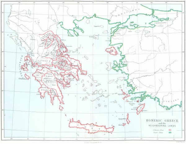
HOMERIC GREECE and the NEIGHBOURING LANDS
II
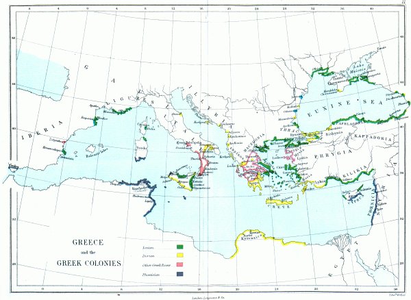
GREECE and the GREEK COLONIES
III
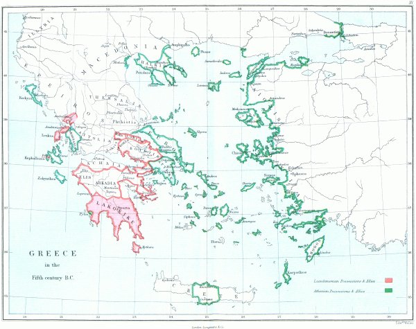
GREECE in the Fifth century B.C.
IV
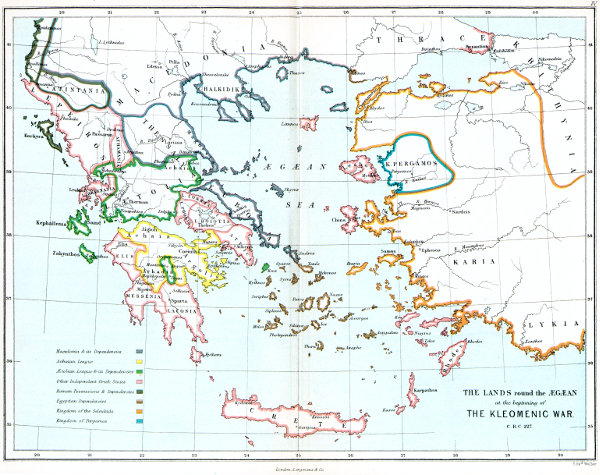
THE LANDS round the ÆGÆAN at the beginning of THE KLEOMENIC WAR. C. B.C. 227.
V
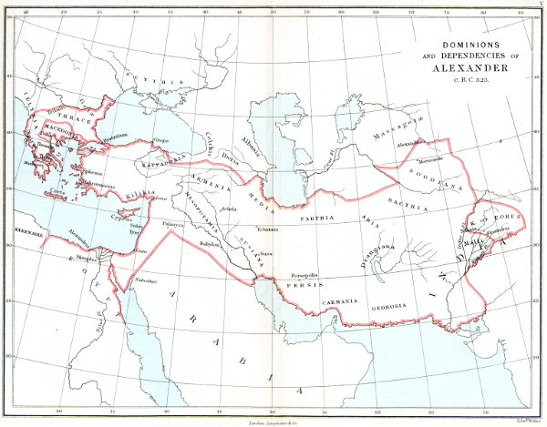
DOMINIONS and DEPENDENCIES of ALEXANDER c. B.C. 323.
VI
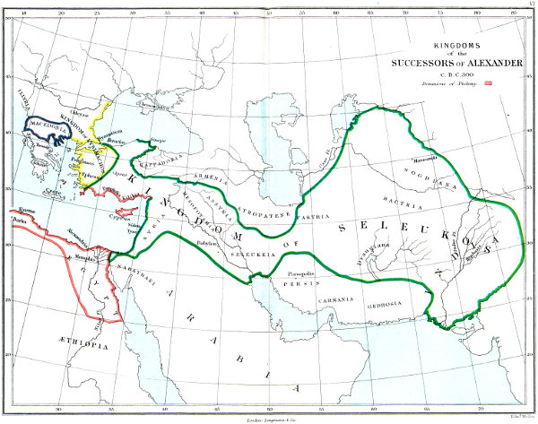
KINGDOMS of the SUCCESSORS of ALEXANDER C. B.C. 300
VII
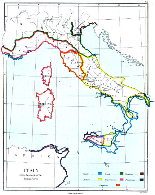
ITALY before the growth of the Roman Power
VIII
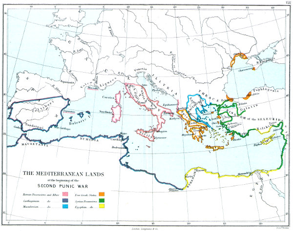
THE MEDITERRANEAN LANDS at the beginning of the SECOND PUNIC WAR
IX
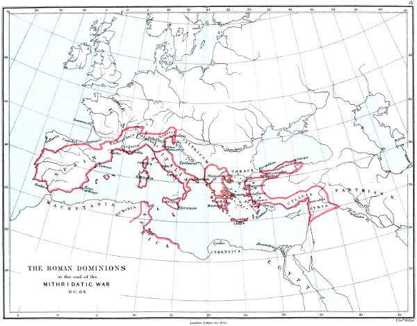
THE ROMAN DOMINIONS at the end of the MITHRIDATIC WAR B.C. 64.
X
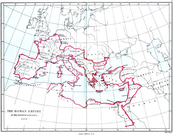
THE ROMAN EMPIRE AT THE DEATH OF AUGUSTUS A.D. 13.
XI
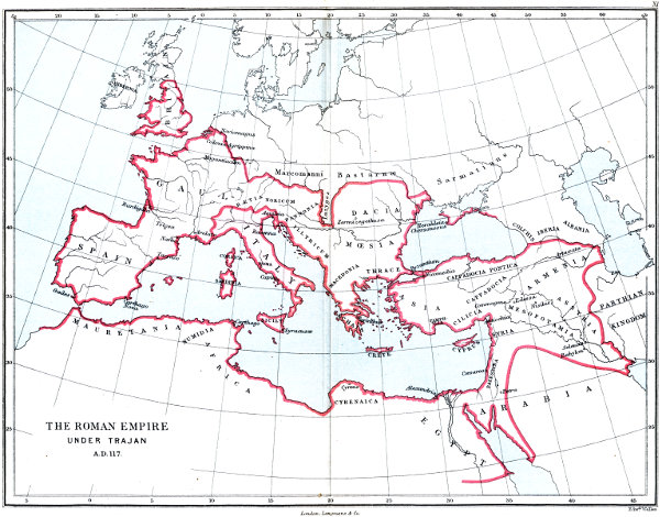
THE ROMAN EMPIRE UNDER TRAJAN A.D. 117.
XII
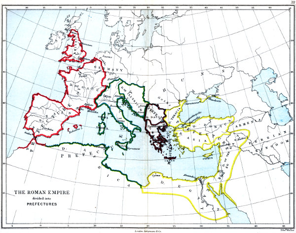
THE ROMAN EMPIRE divided into PREFECTURES
XIII
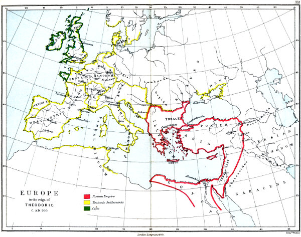
EUROPE in the reign of THEODORIC C. A.D. 500.
XIV
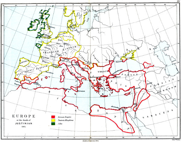
EUROPE at the death of JUSTINIAN 565.
XV
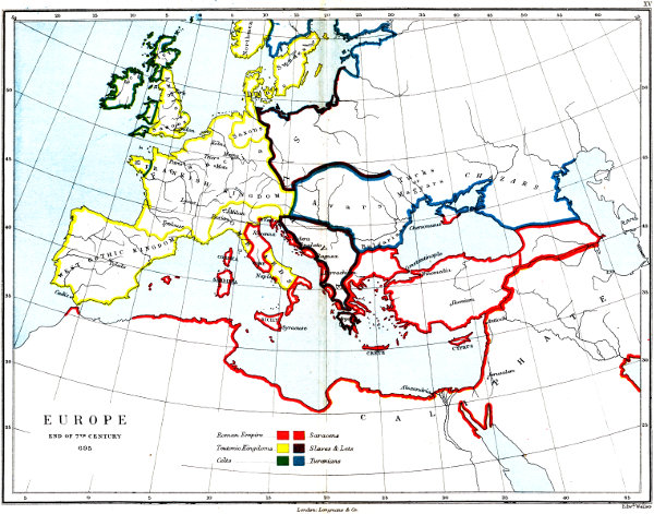
EUROPE END OF 7TH CENTURY 695
XVI
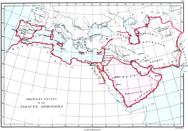
GREATEST EXTENT of the SARACEN DOMINIONS
XVII
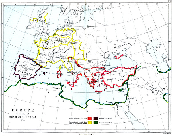
EUROPE in the time of CHARLES THE GREAT 814
XVIII
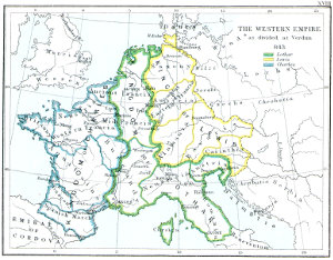
THE WESTERN EMPIRE as divided at Verdun 843
XIX
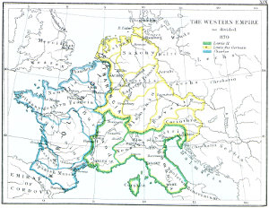
THE WESTERN EMPIRE as divided 870
XX
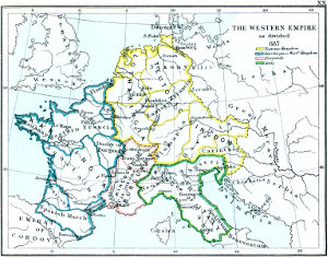
THE WESTERN EMPIRE as divided 887
XXI
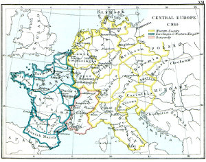
CENTRAL EUROPE C. 980
XXII
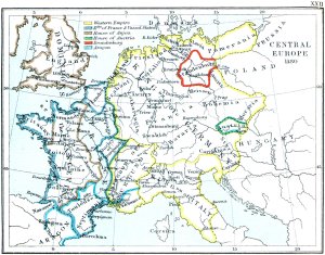
CENTRAL EUROPE 1180
XXIII
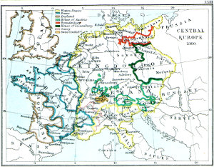
CENTRAL EUROPE 1360
XXIV
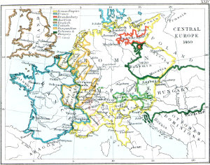
CENTRAL EUROPE 1460
XXV
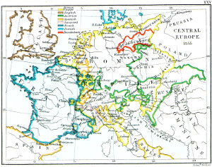
CENTRAL EUROPE 1555
XXVI
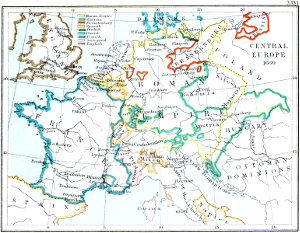
CENTRAL EUROPE 1660
XXVII
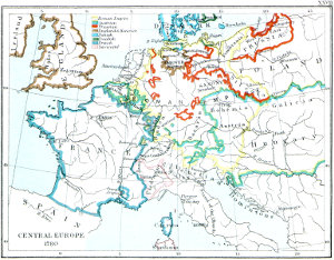
CENTRAL EUROPE 1780
XXVIII
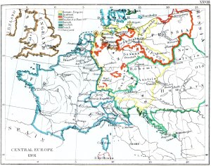
CENTRAL EUROPE 1801
XXIX
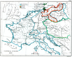
CENTRAL EUROPE 1810
XXX
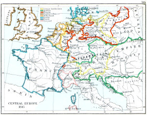
CENTRAL EUROPE 1815
XXXI
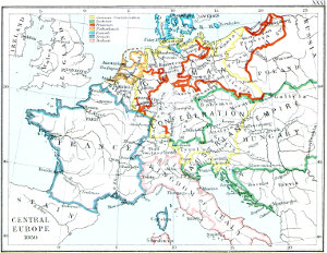
CENTRAL EUROPE 1860
XXXII
XXXIII
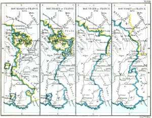
CENTRAL EUROPE 1871
BOUNDARY of FRANCE
1555
1715
1791
1871
XXXIV
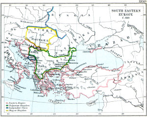
SOUTH EASTERN EUROPE C. 910
XXXV
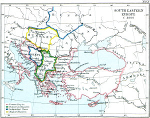
SOUTH EASTERN EUROPE C. 1000
XXXVI
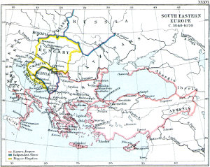
SOUTH EASTERN EUROPE C. 1040-1070
XXXVII
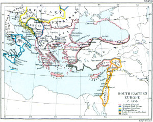
SOUTH EASTERN EUROPE C. 1105
XXXVIII
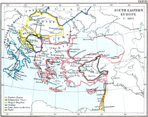
SOUTH EASTERN EUROPE C. 1180
XXXIX
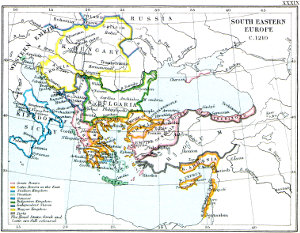
SOUTH EASTERN EUROPE C. 1210
XL
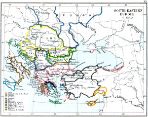
SOUTH EASTERN EUROPE C. 1340
XLI
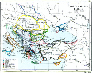
SOUTH EASTERN EUROPE C. 1354-1358
XLII
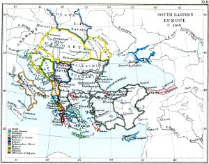
SOUTH EASTERN EUROPE C. 1401
XLIII
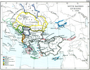
SOUTH EASTERN EUROPE C. 1444
XLIV
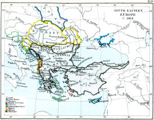
SOUTH EASTERN EUROPE C. 1464
XLV
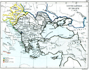
SOUTH EASTERN EUROPE C. 1672
XLVI
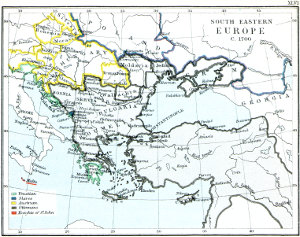
SOUTH EASTERN EUROPE C. 1700
XLVII
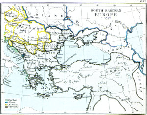
SOUTH EASTERN EUROPE C. 1727
XLVIII
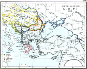
SOUTH EASTERN EUROPE 1861
XLIX
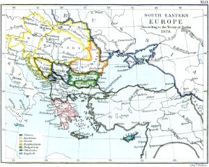
SOUTH EASTERN EUROPE According to the Treaty of Berlin 1878
L
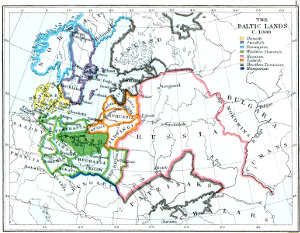
THE BALTIC LANDS C. 1000
LI
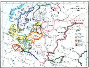
THE BALTIC LANDS C. 1220
LII
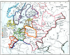
THE BALTIC LANDS C. 1270
LIII
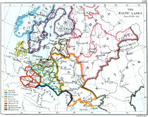
THE BALTIC LANDS Circa 1350-60
LIV
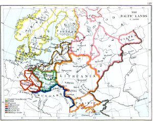
THE BALTIC LANDS C. 1400
LV
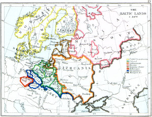
THE BALTIC LANDS C. 1478
LVI
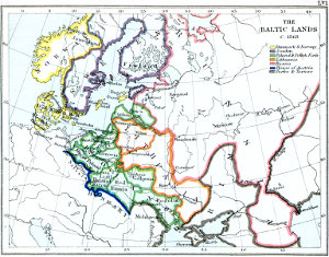
THE BALTIC LANDS C. 1563
LVII
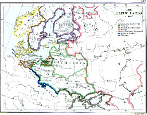
THE BALTIC LANDS C. 1617
LVIII
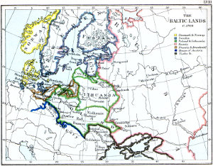
THE BALTIC LANDS C. 1701
LIX
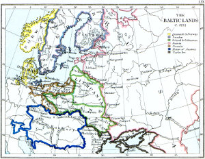
THE BALTIC LANDS C. 1772
LX
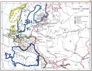
THE BALTIC LANDS C. 1795
LXI
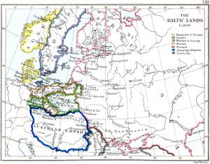
THE BALTIC LANDS C. 1809
LXII
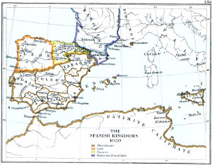
THE SPANISH KINGDOMS 1030
LXIII
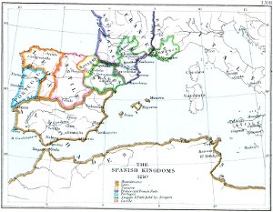
THE SPANISH KINGDOMS 1210
LXIV
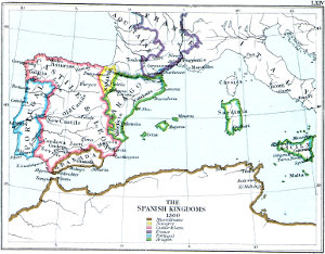
THE SPANISH KINGDOMS 1360
LXV
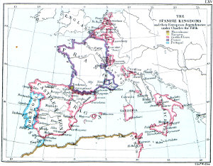
THE SPANISH KINGDOMS and their European dependencies under Charles the Fifth
[Transcriber’s Note—the following change was made to this text: 1864 to 1861—“SOUTH EASTERN EUROPE, A.D. 1861.”]