Part 2 — CHAPTER LXVI. INDIVIDUAL STATES.
Reading edition
The original thirteen States are here arranged in the order of size—the one having the largest area being placed first. They are ranked according to their present area, the claims of some of them at first extending to territory since erected into States; and one, Virginia, has been divided. Her former area would have ranked her as first.
The States that follow are placed in the order of their admission into the Union.
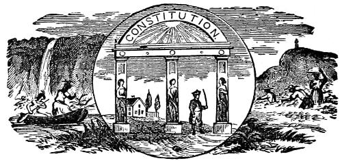
GEORGIA.
This State was the last settled of the original thirteen. It was founded in the benevolent anxiety of Gen. James Oglethorpe and others to relieve the distresses of the poor in England. Those imprisoned for debt were sent out in large numbers. With this object was connected the desire to prevent the extension of the Spanish settlements in Florida, and the English government favored the undertaking. This class of settlers proving indolent and improvident, a better was attracted by laying off many towns, in the best locations, and offering fifty acres free to every actual settler. Many Scotch and German emigrants improved this opportunity, to the great advantage of the colony.
Gen. Oglethorpe imitated the wise conduct of Penn, in his treaties with the Indians.
He commenced his settlement at Savannah, in 1733, cheerfully assisted by the South Carolinians, who were pleased to see a barrier placed between them and the Spaniards. Oglethorpe had several conflicts with them, and succeeded in protecting his colony. The introduction of slaves was at first forbidden; but, as the colony seemed to fall behind the neighboring provinces for want of laborers, the restriction was removed. In 1752 the company gave up their charter, and Georgia became a royal province. It took part with the other colonies in resistance to the aggressions of the English ministry, at the Revolutionary period, and its condition during the war was similar to that of North and South Carolina. Being new, and on the frontier, it was not conspicuous.
The northern part of the State is uneven, the central and lower sections productive under a wise and careful culture, but easily exhausted under bad management. She has long navigable rivers, and her manufacturing and commercial capabilities are excellent. The system of slave-labor and the misfortunes of the Civil War have embarrassed her progress, but the energy of her people is fast raising her to her proper rank as a flourishing State.
Georgia has an area of 52,009 square miles, equal to 33,285,760 acres. She was named after George II.
The population in 1870 was 1,200,000, which entitles her to nine Representatives in Congress.
The State lies in the fifth judicial circuit, and has two judicial districts; also four ports of entry—Savannah, Brunswick, St. Mary’s, and Hardwicke; and two ports of delivery—Augusta and Sunbury.
The capital is Atlanta. The State election is held on the first Tuesday in August. The Legislature meets on the second Wednesday in January.
The enacting clause of her laws is: “Be it enacted by the Senate and House of Representatives of the State of Georgia in General Assembly met; and it is hereby enacted by the authority of the same.”
UNITED STATES SENATORS.
William Few, from 1789 to 1793.
James Gunn, ” 1789 ” 1801.
James Jackson, ” { 1793 ” 1795.
1801 ” 1806.
George Walton, ” 1795 ” 1796.
Josiah Tatnall, ” 1796 ” 1799.
A. Baldwin, ” { 1796 ” 1805.
1805 ” 1807.
J. Melledge, ” 1806 ” 1809.
George Jones, ” 1807 ” 1807.
W. H. Crawford, ” 1807 ” 1813.
Charles Tait, ” { 1809 ” 1813.
1813 ” 1819.
W. B. Bullock, ” 1813 ” 1813.
William W. Bibb, ” 1813 ” 1816.
G. M. Troup, ” { 1815 ” 1818.
1829 ” 1833.
John Forsyth, ” { 1819 ” 1819.
1829 ” 1837.
F. Walker, ” 1819 ” 1821.
John Elliot, ” 1819 ” 1821.
Nicholas Ware, ” 1821 ” 1823.
T. W. Cobb, ” 1824 ” 1828.
O. H. Prince, ” 1828 ” 1829.
John P. King, ” 1833 ” 1837.
W. Lumpkin, ” 1837 ” 1841.
J. M. Berrien, ” { 1825 ” 1829.
1841 ” 1851.
A. Cuthbert, ” 1837 ” 1843.
W. T. Colquitt, ” 1843 ” 1849.
H. V. Johnson, ” 1848 ” 1849.
W. C. Dawson, ” 1849 ” 1855.
Robert Toombs, ” 1853 ” 1861.
R. M. Charleton, ” 1852 ” 1853.
Alfred Iverson, ” 1855 ” 1861.
Joshua Hill, ” 1871 ” 1873.
Foster Blodgett, ” 1871 ” 1871.
Thomas M. Norwood, ” 1871 ” 1877.
John B. Gordon, ” 1873 ” 1879.
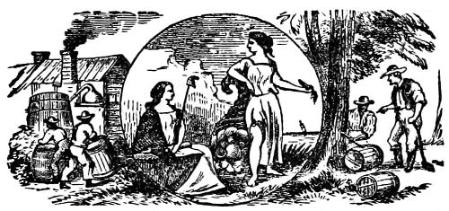
NORTH CAROLINA.
A Florentine navigator, sent out by Francis I., King of France, first published an account of this region. He visited it in 1524. Ribault, a French protestant, sent out with a colony by Admiral Coligni, in 1564, named the southern coast Carolina, from Charles IX. (in Latin Carolus), King of France. The colony was not permanent. In 1585 Sir Walter Raleigh made an unsuccessful attempt to establish a colony on Roanoke Island. Some fifty years later the colonists of Virginia made a settlement in the limits of this State, called Albemarle. This territory was patented to a company of noblemen. The first colony, founded before this patent was issued, and enjoying entire liberty, became an asylum from the religious intolerance, almost universal at that time. In 1666 they numbered 800.
Many French Huguenots, attracted by this freedom and the mild climate and extreme fertility of the soil, settled here and added greatly to the industrious and virtuous elements of the population. The revolutionary struggle was singularly bitter and bloody in this State and South Carolina, from the number and sanguinary character of the royalists and tories, and from the partisan or guerrilla mode of warfare adopted.
The majority were, however, determined and valiant patriots, and rendered it impossible for the British to establish a firm control over this part of the country.
The eastern surface is low, the western mountainous, and much of the midland is covered with pine forests which produce large quantities of turpentine. The soil is favorable to agriculture. Yams, rice, and cotton, in addition to the cereals, are raised with success. The fisheries in Albemarle Sound are an important source of wealth. A large number of minerals are found in the State. Like most of the Southern States, its resources have been but partially developed.
This is one of the original thirteen States, and has an area of 50,704 square miles, equal to 32,450,560 acres, with a population of 1,069,614 (one-third colored), and entitled to eight members of Congress. North Carolina, by act of 1866, was located in the fourth judicial circuit, which is composed of Maryland, Virginia, West Virginia, North Carolina, and South Carolina; and is divided into three judicial districts, called the districts of Albemarle, Pamlico, and Cape Fear. The collection districts, and the ports of entry and delivery in this State have been so often modified and discontinued that there is some uncertainty as to the number. There are, as near as we can determine, ten districts, ten ports of entry, and nine ports of delivery.
Raleigh is the capital. There the Legislature meets biennially on the first Monday in November. The State election is held on the first Thursday in August.
The enacting clause of the laws is as follows: “Be it enacted by the General Assembly of the State of North Carolina, and it is hereby enacted by the authority of the same.”
UNITED STATES SENATORS.
Samuel Johnson, from 1789 to 1793.
Benjamin Hawkins, ” 1789 ” 1795.
Alexander Martin, ” 1793 ” 1799.
Timothy Bloodworth, ” 1795 ” 1801.
Jesse Franklin ” { 1799 ” 1805.
1807 ” 1813.
David Stone, ” 1801 ” 1813.
James Turner, ” 1805 ” 1816.
Nathaniel Macon, ” 1815 ” 1828.
James Iredell, ” 1828 ” 1831.
Montford Stokes, ” 1816 ” 1823.
John Branch, ” 1823 ” 1829.
Bedford Brown, ” 1829 ” 1840.
Willie P. Mangum, ” { 1840 ” 1853.
1831 ” 1836.
Robert Strange, ” 1836 ” 1840.
William A. Graham, ” 1840 ” 1843.
William H. Haywood, ” 1843 ” 1846.
George E. Badger, ” 1846 ” 1855.
Asa Biggs, ” 1854 ” 1858.
David S. Reed, ” 1855 ” 1859.
Thomas L. Clingman, ” 1858 ” 1861.
Thomas Bragg, ” 1859 ” 1861.
Joseph C. Abbott, ” 1868 ” 1871.
John Pool, ” 1868 ” 1873.
Zebulon B. Vance, ” 1871 ” 1873.
Matthew W. Ransom, ” —— ” 1877.
Augustus S. Merriman, ” 1873 ” 1879.
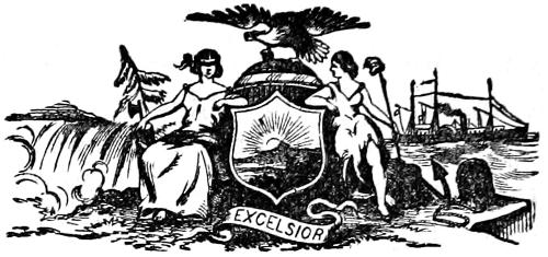
NEW YORK.
The “Empire State” is very fortunately situated for the promotion of all the interests that form the basis of prosperity of a Nation. It contains the commercial metropolis of the country, which is connected, by its great navigable river, the Hudson, and the Erie canal, with the fertile interior and the commerce of the chain of great lakes in the west; while Lakes Ontario and Champlain furnish the means of profitable trade with Canada on the north. As its natural commercial facilities are unrivaled, so also, every auxiliary that can be furnished by art is employed to develop its resources and to attract trade and manufactures.
Its river was discovered by the celebrated navigator, Captain Henry Hudson, in 1609, and he gave it his name. He was employed, at this time by the Dutch, who claimed and settled the territory in the following year. They established posts on Manhattan Island, where New York now stands, and at Albany—calling the country in general, New Netherlands. They held it until 1644; laying claim, also, to Connecticut and New Jersey. Their rule was despotic, and when the Duke of York, afterward James II., King of England, sent a squadron to enforce English claims to it, the inhabitants declined to resist, and it became an English colony without a struggle. The city and colony received the name of New York and continued henceforth in English hands. Its position favored a steady-growth in population and wealth; and it took an active part in the Revolution. Its central position made it the pivot of the war, the leading struggles taking place in or near it. New York city was held by the British during most of the war, but the skillful strategy and watchfulness of Washington, and the valor of his officers and troops preserved the river in American hands throughout. It ratified the Constitution July 26th, 1788, and soon outstripped every State in all things, except education, no State being able to compare with Massachusetts in that respect.
New York is the largest and richest city in the Union. The State abounds in salt and mineral springs, and its central and western parts are unexcelled for agriculture; while the eastern, more mountainous, but nearer to markets, and more abundant in water power, is equally favorable to grazing and manufactures.
Its area is 47,000 square miles, equal to 30,080,000 acres. The population in 1870 was larger than that of any other State, being officially stated at 4,364,411. It has thirty-three Members of Congress.
It forms part of the second judicial circuit, and has three judicial districts; eleven ports of entry, and fourteen ports of delivery, with the privilege of eight or nine others if the President of the United States deems them necessary.
The Capital is Albany. The State elections are held on the Tuesday after the first Monday in November, and the Legislature meets on the first Tuesday in January in each year. The style of the enacting clause is: “Be it enacted by the people of the State of New York represented in Senate and Assembly.”
UNITED STATES SENATORS.
Philip Schuyler, from 1789 to 1791.
Rufus King, ” { 1789 ” 1796.
1813 ” 1825.
Aaron Burr, ” 1791 ” 1797.
John Lawrence, ” 1796 ” 1800.
John S. Hobart, ” 1798 ” 1798.
William North, ” 1798 ” 1798.
James Watson, ” 1798 Resigned.
Governeur Morris, ” 1800 ” 1803.
John Armstrong, ” { 1800 ” 1802.
1803 ” 1804.
DeWitt Clinton, ” 1802 ” 1803.
Theodore Bailey, ” 1803 ” 1804.
Samuel L. Mitchell, ” 1804 ” 1809.
John Smith, ” 1804 ” 1813.
Obadiah German, ” 1809 ” 1815.
Nathan Sanford, ” { 1815 ” 1821.
1825 ” 1831.
Martin Van Buren, ” 1821 ” 1829.
Charles Dudley, ” 1829 ” 1833.
William L. Marcy, ” 1831 ” 1833.
Nath’l P. Tallmadge, ” 1833 ” 1844.
Silas Wright, ” 1833 ” 1844.
Daniel S. Dickinson, ” 1844 ” 1851.
Henry A. Foster, ” 1844 ” 1845.
John A. Dix, ” 1845 ” 1849.
William H. Seward, ” 1849 ” 1861.
Hamilton Fish, ” 1851 ” 1857.
Preston King, ” 1857 ” 1863.
Ira Harris, ” 1861 ” 1867.
Edwin D. Morgan, ” 1863 ” 1869.
Roscoe Conkling, ” 1867 ” 1879.
Reuben E. Fenton, ” 1869 ” 1875.
Francis Kernan, ” 1875 ” 1881.
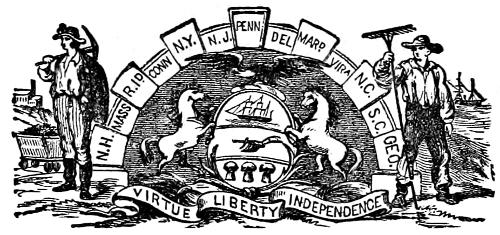
PENNSYLVANIA.
“The Keystone State” has been eminently fortunate in three various ways. Its founder, William Penn, happily united benevolence and high political wisdom, with a thrifty and prudent economy, and possessed sufficient influence and tact to infuse his colony with his own qualities to a large degree, and the advantages acquired in the beginning, have shed their favoring influence on all its future, to the present time.
Penn, as proprietor of his province, had almost kingly power; yet, as a law-giver, he acknowledged the liberties of the people, and accustomed them to many of the forms of self-government afterward incorporated into the Constitution of the United States. His just and conciliatory conduct toward the Indians, and the exemption of Pennsylvania from barbarous Indian wars, in consequence, proves the utility of the practice of unvarying justice and kindness toward them; and stands in strong and significant contrast with the opposite course, so often pursued, and with results so distressing.
A colony was established by Penn in the southeastern part of the State, in the year 1682. The government was conducted by a governor, a council of three, and a House of Delegates, chosen by the people. The largest religious liberty was allowed, and punishment of crime was mitigated from the severity, customary in those times, to something like the mildness now practiced among us.
The colony enjoyed seventy years of enlightened government, and prospered greatly. A large immigration of hardy and thrifty Germans and Swedes spread over the State and supplied, in Revolutionary times, the “fighting material” which the religious principles of the Quakers forbade them to furnish.
The second eminent advantage of the State, was in its central position, the facilities furnished to commerce and trade by the Delaware river on its eastern boundary, and the Ohio, on the west, connecting it with the valley of the Mississippi.
The third superiority, later in development in some of its features, relates to its wealth of resources. Lying midway between north and south, its climate is temperate and mild. Its soil on the eastern border and along the valleys of its numerous rivers is of great fertility; while its inexhaustible coal deposits are far more valuable in promoting the steady growth of her citizens in wealth than mines of gold. Iron, copper, zinc, marble and slate are, apparently, inexhaustible. Her railroads and canals furnish a suitable means for the development of these resources, and the transportation for all her valuable commodities to profitable markets, and prove her later citizens to have inherited the economic wisdom and thrift of the founder of their State.
Pennsylvania valiantly bore the share in the struggles and sacrifices of the Revolution to which her position, her wealth and numbers, called her. Philadelphia—“The City of Brotherly Love” (the name means this,) was the first capital of the Republic. It was there that the Declaration of Independence was originated and signed.
Its area is 46,000 square miles, equal to 29,440,000 acres. The population in 1870 was 3,515,993, entitling her to twenty-seven Representatives in Congress.
It is in the third judicial circuit; and forms two judicial districts. There are two ports of entry, and two collection districts. Harrisburg is the capital; the Legislature assembling on the first Tuesday in January, the State elections being held the second Tuesday in October.
The enacting clause of her laws is: “Be it enacted by the Senate and House of Representatives of the Commonwealth of Pennsylvania in General Assembly met; and it is hereby enacted by the authority of the same.”
UNITED STATES SENATORS.
William Maclay, from 1789 to 1791.
Robert Morris, ” 1789 ” 1795.
Albert Gallatin, ” 1793 ” 1794.
James Ross, ” 1794 ” 1803.
William Bingham, ” 1795 ” 1801.
Peter Muhlenburgh, ” 1801 ” 1802.
Samuel Maclay, ” 1803 ” 1808.
Michael Leib, ” 1808 ” 1814.
Andrew Gregg, ” 1807 ” 1813.
Abner Lacock, ” 1813 ” 1819.
Jonathan Roberts, ” 1814 ” 1821.
Walter Lawrie, ” 1819 ” 1825.
William Findlay, ” 1821 ” 1827.
William Marks, ” 1825 ” 1831.
Isaac D. Barnard, ” 1827 ” 1831.
George M. Dallas, ” 1831 ” 1833.
William Wilkins, ” 1831 ” 1834.
Samuel McKean, ” 1833 ” 1839.
James Buchanan, ” 1834 ” 1845.
Daniel Sturgeon, ” { 1839 ” 1851.
1845 ” 1849.
Simon Cameron, ” { 1857 ” 1861.
1867 ” 1873.
James Cooper, ” 1849 ” 1855.
Charles E. Buckalew, ” 1863 ” 1869.
Richard Broadhead, ” 1851 ” 1857.
William Bigler, ” 1855 ” 1861.
Edgar Cowan, ” 1861 ” 1867.
David Wilmot, ” 1861 ” 1863.
John Scott, ” 1869 ” 1875.
Simon Cameron, ” 1873 ” 1879.
Wm. A. Wallace, ” 1875 ” 1881.
VIRGINIA.
“The Old Dominion,” as this State has been called, in familiar style, has certain high claims to such a distinctive appellation. It was the colony in which the first permanent settlement was made, and for fourteen years before the perils of the wilderness were encountered by the Puritan Fathers of New England, it confronted famine and Indian hostility. Its people were quite different in character from those of most of the other colonies. While many were from the lowest classes, a goodly number of the gentry and nobility of England were transplanted to this colony. Some were men of wealth, character and influence; and the hereditary value of that element became conspicuous when revolutionary times came, and the colonial government, which had been from the first, kept closely dependent on the royal will, being set aside, permitted to this class a free field of action. None were more eloquent, more zealous, more valiant or wise, during the “time that tried men’s souls.” The talents, patriotism, and wisdom of Washington, Jefferson, Madison, Monroe, and many others almost equally useful, attest the quality of the Virginian stock of patriots, and shed honor on their native State.
It was settled in 1607, at Jamestown. The infant colony was long exposed to danger of destruction by Indian hostility; but, favored by circumstances, grew up to strength, and became a protection to others. An almost constant struggle was maintained with the royal governors, who were disposed to encroach on their liberties. Notwithstanding the number of decayed and worthless gentlemen, and the dregs of the English populace, who entered as components into her population, as a whole, they proved worthy of the republic they so largely helped to rear. Their best blood was spilled in its cause, and their material support was never withheld in time of need.
This State is much varied in surface. In the southeast it is low and level; in the west and northwest mountainous, with numerous large streams and fertile vallies, and a charming climate. Its mineral wealth of coal, iron and salt is very great; its water power for manufacturing purposes unsurpassed; and its commercial position everything to be desired. None of these advantages have been more than partially improved; and the future of the State is destined to be exceedingly brilliant. Old and nourishing colleges testify to the interest taken in education; and railroads and other means of internal development have already prepared the way for its greatness. She exports tobacco, flour, oysters, and cotton, and her agricultural wealth is constantly improving.
Virginia is also one of the original thirteen States, and had an area previous to the division in 1862, of 61,352 square miles, equal to 39,265,280 acres; but after West Virginia was set off as a separate State, there were but 38,352 square miles left of this once great State, equal to 24,545,280 acres.
The population in 1860 amounted to 1,596,318, which entitles the State to nine Members of Congress. By the division the number of Representatives was cut down to nine; the new State receiving three out of the twelve. Population in 1870, 1,224,830.
Virginia lies in the fourth judicial circuit, which by the act of 1866, was composed of this State, Maryland, West Virginia, and North Carolina and South Carolina. There were two judicial districts in this State, anterior to the division; the Eastern and the Western. There is now but one.
There were also twelve collection districts in this State, and twelve ports of entry, all of which remain the same as they were before West Virginia was cut off, for they were all located on the Atlantic coast, or on the bays and rivers running into the Atlantic Ocean; there are also ten ports of delivery.
Richmond is the capital. The State election is held on the Tuesday after the first Monday in November. The Legislature meets on the first Monday in December.
The enacting clause of the laws of Virginia is: “Be it enacted by the General Assembly.”
UNITED STATES SENATORS.
William Grayson, from 1789 to 1790.
Richard H. Lee, ” 1789 ” 1792.
John Walker, ” 1790 ” 1790.
James Monroe, ” { 1790 ” 1794.
1792 ” 1794.
John Taylor, ” { 1803 ” 1805.
1822 ” 1824.
Stephen T. Mason, ” 1794 ” 1803.
John Tazewell, ” 1794 ” 1799.
Wilson C. Nichols, ” 1799 ” 1804.
Abraham B. Venable, ” 1803 ” 1804.
William B. Giles, ” 1804 ” 1815.
Andrew Moore, ” 1804 ” 1809.
Richard Brent, ” 1809 ” 1815.
James Barbour, ” 1815 ” 1825.
Armistead T. Mason, ” 1816 ” 1817.
John W. Eppes, ” 1817 ” 1819.
James Pleasant, ” 1819 ” 1822.
John Randolph, ” 1825 ” 1827.
Littleton W. Tazewell, ” 1824 ” 1832.
John Tyler, ” 1827 ” 1836.
William C. Rives, ” { 1832 ” 1834.
1836 ” 1845.
Benjamin W. Leigh, ” 1834 ” 1836.
Richard E. Parker, ” 1836 ” 1837.
William H. Roane, ” 1837 ” 1841.
William S. Archer, ” 1841 ” 1847.
Isaac S. Pennybacker, ” 1845 ” 1847.
James M. Mason, ” 1847 ” 1861.
R. M. T. Hunter, ” 1847 ” 1861.
John W. Johnston, ” 1870 ” 1877.
John F. Lewis, ” 1870 ” 1875.
Robert E. Withers, ” 1875 ” 1881.
SOUTH CAROLINA.
The first permanent settlement in this State was made in 1670, at Port Royal, where the French Huguenots had failed three-quarters of a century before. The noble company who had received a charter for the settlement and government of the Carolinas employed the celebrated philosopher, John Locke, to draw up a philosophical plan of government, which they attempted to carry into effect to the great annoyance of the colonists. It proved impracticable, and was finally abandoned.
The French introduced the culture of the vine with success, and rice was brought at an early day from Madagascar, the cultivation of which became extensive.
Many vexations were endured by the colonists by the injudicious management of the proprietary government, and at length they, by petition, obtained a revocation of the charter, receiving, in 1720, a governor appointed by the crown. They endured for many years all the horrors of warfare with the Tuscarora Indians, whom they finally defeated and expelled. Rutledge, Sumpter, and Marion were distinguished leaders of the patriots during the occupation of the State by the British forces; employing with success a partisan warfare, and defying the efforts of a superior British force to hold the State in subjection.
The climate has been likened to that of Italy, and the products of the north and of the tropics are equally cultivated. The State abounds in agricultural and manufacturing resources, and has a fine commercial position.
South Carolina is one of the original thirteen States, and has an area of 29,385 square miles, making 18,806,400 acres, with a population, in 1870, of 728,000, (over half colored,) which gives her five Members of Congress.
By an act of 1866, South Carolina was located in the fourth judicial circuit; it is divided into two judicial districts, called the Eastern and Western.
There are three collection districts in this State, and four ports of entry, to-wit: Georgetown, Charleston, Beaufort and Port Royal; but no ports of delivery.
The capital is Columbia. The State elections are held on the fourth Monday in November. The Legislature meets on the third Wednesday in October.
The enacting clause of the laws is as follows: “Be it enacted by the Honorable the Senate and House of Representatives, now met and sitting in General Assembly, and by authority of the same.”
UNITED STATES SENATORS.
Pierce Butler, from { 1790 to 1796.
1802 ” 1804.
Ralph Izard, ” 1789 ” 1795.
Jacob Read, ” 1795 ” 1801.
John Hunter, ” 1796 ” 1798.
Charles Pinckney, ” 1798 ” 1801.
Thomas Sumpter, ” 1801 ” 1810.
John E. Calhoun, ” 1801 ” 1802.
John Gaillard, ” 1804 ” 1826.
John Taylor, ” 1810 ” 1816.
William Smith, ” { 1816 ” 1823.
1826 ” 1831.
William Harper, ” 1826 ” 1826.
Robert J. Hane, ” 1823 ” 1832.
Stephen D. Miller, ” 1831 ” 1833.
John C. Calhoun, ” { 1832 ” 1842.
1845 ” 1850.
William C. Preston, ” 1833 ” 1842.
Daniel E. Huger, ” 1842 ” 1845.
George McDuffie, ” 1842 ” 1846.
Andrew P. Butler, ” 1846 ” 1857.
Franklin H. Elmore, ” 1850 ” 1850.
Robert W. Barnwell, ” 1850 ” 1852.
William Desaussure, ” 1852 ” 1852.
Josiah Evans, ” 1852 ” 1858.
James H. Hammond, ” 1857 ” 1860.
James Chestnut, ” 1858 ” 1861.
Arthur P. Hayne, ” 1858.
Thomas J. Robertson, ” 1868 ” 1877.
Frederick A. Sawyer, ” 1868 ” 1873.
John J. Patterson, ” 1873 ” 1879.
MARYLAND.
This territory at first was included in the patent to the Virginia colony; but was, in 1632, re-patented to Lord Baltimore, an English nobleman, who had embraced the catholic faith, and sought, in the American wilderness, an asylum where he and his co-religionists might enjoy the freedom from persecution denied them in England. It was called Maryland from the queen of Charles I., King of England. A part of this patent was covered by that subsequently made to William Penn, and produced much trouble between the descendants of these men, and their respective colonies. A settlement was commenced, mainly by catholic gentlemen, in 1634, and called St. Mary’s, on a branch of the Potomac.
The wise liberality that distinguished the settlement of Pennsylvania marked all the earlier history of Maryland. They cultivated friendly relations with the natives and with their neighbors. Lord Baltimore was liberal in his expenditures for the growing colony, and gave them a liberal government. When the civil war commenced in England, resulting in the death of Charles I. and the rise of Cromwell to power, the first troubles of the colonists of Maryland began, and continued until 1716, when the heirs of the original proprietor resumed their rights and maintained them until the Revolution.
This State was one of the original thirteen, and gave a hearty support to the patriot side during the war for freedom.
The surface of the country is, in great part, low and sandy; the climate agreeable and the soil favorable to agricultural pursuits. Her commercial position is excellent, being situated on either side of Chesapeake bay and bounded by the Potomac river on the west. The District of Columbia, containing the National Capital, was located on the last named river within her limits.
Maryland has an area of 11,124 square miles—equal to 7,119,360 acres. The population in 1870 was 780,806, which gives her six Representatives in Congress. By an act of Congress, passed in 1866, this State was put in the fourth judicial circuit, which is composed of Maryland, Virginia, West Virginia, North and South Carolina. Maryland constitutes one judicial district; has ten ports of entry, viz.: Baltimore, Chester, Oxford, Vienna, Snow-Hill, Annapolis, Nottingham, St. Mary’s, Georgetown, and Havre de Grace; and twelve ports of delivery.
Annapolis is the capital. The State election is held on the Tuesday after the first Monday in November. The Legislature meets on the first Wednesday in January.
The enacting clause of the laws is as follows: “Be it enacted by the General Assembly of Maryland.”
UNITED STATES SENATORS.
Charles Carroll, (of Carrollton) from 1789 to 1793.
John Henry, ” 1789 ” 1797.
Richard Potts, ” 1793 ” 1796.
John E. Howard, ” 1796 ” 1803.
James Lloyd, ” 1797 ” 1800.
William Hindman, ” 1800 ” 1801.
Robert Wright, ” 1801 ” 1806.
Samuel Smith, ” { 1803 ” 1815.
1822 ” 1833.
Philip Reed, ” 1806 ” 1813.
R. H. Goldsborough, ” { 1813 ” 1819.
1835 ” 1836.
Robert G. Harper, ” 1816 ” 1816.
Alexander C. Hanson, ” 1816 ” 1819.
William Pinckney, ” 1819 ” 1822.
Edward Lloyd, ” 1819 ” 1826.
Ezekiel F. Chambers, ” 1826 ” 1835.
Joseph Kent, ” 1833 ” 1838.
John S. Spence, ” 1836 ” 1841.
William D. Merrick, ” 1838 ” 1845.
John Leidsker, ” 1841 ” 1843.
James A. Pearce, ” 1843 ” 1862.
Reverdy Johnson, ” { 1845 ” 1851.
1863 ” 1868.
David Stuart, ” 1849 ” 1850.
Thomas G. Pratt, ” 1850 ” 1857.
Anthony Kennedy, ” 1857 ” 1863.
Thomas H. Hicks, ” 1862 ” 1864.
John A. J. Cresswell, ” 1865 ” 1867.
Philip F. Thomas, ” —— ” 1867.
George Vickers, ” 1868 ” 1873.
William T. Hamilton, ” 1869 ” 1875.
George R. Dennis, ” 1873 ” 1879.
Wm. Pinckney Wythe, ” 1875 ” 1881.
NEW HAMPSHIRE.
This State is often called “The Old Granite State,” as well from its mountainous character as the resolute spirit of its inhabitants. It is small, having an area of only 9,280 square miles, which make 5,939,200 acres. Its population in 1870 was 318,300, entitling it to three Representatives in Congress.
The first settlement was founded at Dover, in 1624, by the English. It suffered much from Indian wars, and its growth was slow. It was made a separate province in 1680, having previously been under the jurisdiction of Massachusetts. It was one of the original thirteen States, and took an active and vigorous part in the Revolutionary War.
Its soil is light and unfavorable to agriculture, but furnishes good pasturage and produces fine cattle. It contains the White Mountains, the highest in New England. Its streams are utilized for manufacturing purposes. Quarries of marble and granite abound. Minerals, and precious stones of several varieties are found in various parts of the State. The hardy and enterprising sons to whom it has given birth are to be found in every State in the Union.
It lies in the first judicial circuit; constitutes one judicial district; and is embraced in one collection district, and therefore has but one port of entry. There are three ports of delivery.
The capital is Concord. The Legislature assembles on the first Monday in June, the State election being held the second Tuesday in March.
The enacting clause of the laws runs thus: “Be it enacted by the Senate and House of Representatives in General Assembly convened.”
UNITED STATES SENATORS.
Paine Wingate, from 1789 to 1793.
John Langdon, ” 1789 ” 1801.
Samuel Livermore, ” 1793 ” 1801.
Simeon Olcott, ” 1801 ” 1805.
James Sheafe, ” 1801 ” 1802.
William Plummer, ” 1802 ” 1807.
Nicholas Gilman, ” 1805 ” 1814.
Nahum Parker, ” 1807 ” 1810.
Charles Cutts, ” 1810 ” 1813.
Jeremiah Mason, ” 1813 ” 1817.
Thomas W. Thompson, ” 1814 ” 1817.
David L. Morrill, ” 1817 ” 1823.
Clement Storer, ” 1817 ” 1819.
John F. Parrott, ” 1819 ” 1825.
Samuel Bell, ” 1823 ” 1835.
Levi Woodbury, ” { 1825 ” 1831.
1841 ” 1845.
Isaac Hill, ” 1831 ” 1835.
Henry Hubbard, ” 1835 ” 1841.
John Page, ” 1836 ” 1837.
Franklin Pierce, ” 1837 ” 1842.
Leonard Wilcox, ” 1842 ” 1842.
Charles G. Atherson, ” { 1843 ” 1849.
1852 ” 1853.
Benning W. Jenness, ” 1845 ” 1846.
Joseph Cilley, ” 1846 ” 1847.
John P. Hale, ” { 1847 ” 1853.
1855 ” 1865.
Moses Norris, ” 1849 ” 1855.
Jared W. Williams, ” 1853 ” 1854.
John S. Wells, ” 1855 ” 1855.
James Bell, ” 1855 ” 1857.
Daniel Clark, ” 1857 ” 1866.
George C. Fogg, ” 1866 ” 1867.
James W. Paterson, ” 1867 ” 1873.
Aaron H. Cragin, ” 1867 ” 1877.
Bainbridge Wadleigh, ” 1873 ” 1879.
NEW JERSEY.
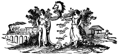
This State was first settled at Bergen by the Swedes sent over by the Christian hero-king, Gustavus Adolphus, in the year 1638. They, however, soon fell under the control of the Dutch, who claimed the territory. The next settlement was made at Elizabethtown, from Long Island, in 1664. New Jersey came into the hands of the English along with New Netherlands, but soon became an independent province; Philip Carteret becoming its first governor, in 1665. It was for some time under the control of the celebrated Quaker, William Penn, received a liberal form of government, and, not suffering from the Indians enjoyed prosperity for many years. Afterwards it passed through various vicissitudes in its government, was for a time joined to New York, but recovered its independent existence in 1738; and was one of the original thirteen States, taking a very prominent part in the Revolution. Its territory, lying between New York and Philadelphia, was the field on which the hostile armies fought and manouvered, for some years. It ratified the Constitution unanimously, December 18th, 1787. It has been rewarded for its patriotism and devotion to liberty by unbroken prosperity. Its manufactures are in a flourishing state. Its vicinity to the great commercial centres of the Atlantic coast; the mildness of its climate, and the adaptation of its soil to the growth of fruit and vegetables have made it the Garden State of the Union. Its agricultural wealth is much increased by its abundant beds of marl and peat. The extreme north is hilly and the extreme south low and sandy. Education receives much attention.
It has an area of 8,320 square miles, or 5,324,800 acres. The population, by the census of 1870, was 905,794, which gives her seven Representatives in Congress.
This State lies in the third judicial circuit, and forms one judicial district. There are six ports of entry, and as many collection districts; and also eight ports of delivery.
Its capital is Trenton. The State election is held on the Tuesday after the first Monday in November, and the Legislature assembles the second Tuesday in January.
The form of the enacting clause is as follows: “Be it enacted by the Senate and General Assembly of the State of New Jersey.”
UNITED STATES SENATORS.
Jonathan Elmer, from 1789 to 1791.
William Patterson, ” 1789 ” 1790.
Philemon Dickerson, ” 1790 ” 1793.
John Rutherford, ” 1791 ” 1798.
Fred’k Frelinghuysen, ” 1793 ” 1796.
Richard Stockton, ” 1796 ” 1799.
Franklin Davenport, ” 1798 ” 1799.
James Schureman, ” 1799 ” 1801.
Jonathan Dayton, ” 1799 ” 1805.
Aaron Ogden, ” 1801 ” 1803.
John Condit, ” 1803 ” 1811.
Aaron Kitchell, ” 1805 ” 1809.
John Lambert, ” 1809 ” 1815.
Mahlon Dickerson, ” 1817 ” 1833.
James J. Wilson, ” 1815 ” 1821.
Samuel L. Southard, ” { 1821 ” 1823.
1833 ” 1841.
Joseph McIlvaine, ” 1823 ” 1826.
Thos. Frelinghuysen, ” 1829 ” 1835.
Ephraim Bateman, ” 1826 ” 1829.
Garret D. Wall, ” 1835 ” 1841.
Jacob Miller, ” 1841 ” 1853.
William L. Dayton, ” 1842 ” 1851.
John B. Thompson, ” 1853 ” 1863.
William Pennington, ” 1858 ” 1858.
William Wright, ” { 1853 ” 1859.
1863 ” 1866.
Robert F. Stockton, ” 1851 ” 1853.
John C. Ten Eyck, ” 1859 ” 1865.
Richard S. Field, ” 1862 ” 1863.
James W. Wall, ” 1863 ” 1863.
John P. Stockton, ” 1865 ” 1866.
F. T. Frelinghuysen, ” 1867 ” 1869.
Alexander G. Cattell, ” 1866 ” 1871.
John P. Stockton, ” 1869 ” 1875.
F. T. Frelinghuysen, ” 1871 ” 1877.
Thos. F. Randolph, ” 1875 ” 1881.
MASSACHUSETTS.
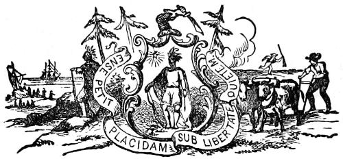
The “Bay State,” so named from the deep encroachments of the sea on her eastern border, was settled in 1620, at Plymouth, by English Puritans; a class of sternly pious men, who abandoned England to find freedom of worship in the savage wilds of America. They were men of great resolution and intelligence, and succeeded in imbuing the new colony with a fair degree of their own virtue. They suffered much, at first, from deprivation of the comforts they had left in England, and from the hostility of the Indians. They were too much in earnest to be tolerant, and persecutions of pretended witches, of Quakers and Baptists, have given them an unenviable notoriety.
This State was a leading one among the original thirteen, and the first to take up arms and to be invaded by the British forces at the commencement of the War of the Revolution. Her influence on the national character has been great.
This State is the first in the Union for cotton and woolen manufactures, its cotton mills alone employing about twenty-five thousand hands. In extent of all its manufactures it is third in the Union. The soil is sterile in great part, but the energy of the people finds abundant other sources of wealth. Commerce and fisheries receive much attention, and produce much wealth.
Education is carefully attended to, and its public school system a model for other States. She has an area of 7,800 square miles. Her population in 1870 was 1,457,351, and entitles her to eleven Members of Congress. It is in the first judicial circuit, and forms one judicial district. There are fourteen ports of entry, and twenty-five ports of delivery in this State.
Boston is the Capital, the metropolis of New England, and an important center of intellectual and business energy. The Legislature meets on the first Wednesday in January, and the State elections are held on the Tuesday after the first Monday in January.
The enacting clause is: “Be it enacted by the Senate and House of Representatives, in General Court assembled, and by the authority of the same, as follows:”
UNITED STATES SENATORS.
Tristram Dalton, from 1789 to 1791.
Caleb Strong, ” 1789 ” 1796.
George Cabot, ” 1791 ” 1796.
Theo. Sedgewick, ” 1796 ” 1799.
Benj. Goodhue, ” 1796 ” 1800.
Samuel Dexter, ” 1799 ” 1800.
Dwight Foster, ” 1800 ” 1803.
Jonathan Mason, ” 1800 ” 1803.
John Q. Adams, ” 1803 ” 1808.
Timothy Pickering, ” 1803 ” 1811.
James Lloyd, ” { 1808 ” 1813.
1822 ” 1826.
Joseph B. Varnum, ” 1811 ” 1817.
Christopher Gore, ” 1813 ” 1816.
Eli P. Ashmun, ” 1816 ” 1818.
Harrison Gray Otis, ” 1817 ” 1822.
Prentiss Mellen, ” 1818 ” 1820.
Elijah H. Mills, ” 1820 ” 1827.
Nathaniel Silsbee, ” 1826 ” 1835.
Daniel Webster, ” { 1827 ” 1841.
1845 ” 1850.
Rufus Choate, ” 1841 ” 1845.
John Davis, ” { 1835 ” 1841.
1845 ” 1853.
Isaac C. Bates, ” 1841 ” 1845.
Robert C. Winthrop, ” 1850 ” 1851.
Robert Rantoul, ” 1851 ” 1851.
Edward Everett, ” 1853 ” 1854.
Julius Rockwell, ” 1854 ” 1855.
[2]Henry Wilson, ” 1855 ” 1873.
Charles Sumner, ” 1851 ” 1874.
George S. Boutwell, ” 1873 ” 1877.
William Washburn, ” 1874 ” 1875.
Henry L. Dawes, ” 1875 ” 1881.
CONNECTICUT.
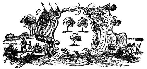
This State takes its name from its principal river, which, entering from the north, runs through the State nearly in the center. It was settled in 1633 from Massachusetts, the fertility of the valley of the Connecticut attracting them to brave the perils of conflict with the Indians, and with the Dutch, settled where New York now stands, who laid claim to it. The Dutch withdrew, the Indians were subdued in many bloody battles, and a Puritan State—exceeding, if possible, the religious strictness of the Massachusetts colony, and not behind her in energy, in virtue, in attention to education, and love of liberty—soon grew up to wealth and prosperity.
A decisive battle in 1636, on the Mystic river, annihilated the Pequod Indians.
Connecticut, in 1700, followed the example set by Massachusetts in 1638, by founding Yale college, which, to this day, very fairly rivals Harvard in the former State. Both have contributed largely to the intelligence and culture of the American people. It took a leading part in the Revolution; ratified the constitution June 9th, 1788; and has displayed the zeal in promoting the public good that has been so prominent in the cultivation of her educational and material interests.
The surface of the State is uneven and rocky. Manufactures and commerce are the leading interests, although agriculture is not neglected. It is rich in minerals. Gold, silver, lead, iron, copper and bismuth are found, while marble, of fine quality, and granite abound.
Its area is small, embracing only 4,674 square miles, or 2,991,360 acres. It has four representatives in Congress. The population in 1870 was 537,418. It is part of the second judicial circuit, and constitutes one judicial district. She has five ports of entry, and five collection districts, with twenty-two ports of delivery.
It has had two capitals ever since the first two colonies, established at Hartford and New Haven, were united; and holds her State election on the first Monday in April. The Legislature meets the first Wednesday in May.
The enacting clause runs thus: “Be it enacted by the Senate and House of Representatives in General Assembly convened.”
UNITED STATES SENATORS.
Oliver Ellsworth, from 1789 to 1796.
William S. Johnson, ” 1789 ” 1791.
Roger Sherman, ” 1791 ” 1793.
S. M. Mitchell, ” 1793 ” 1795.
Jonathan Trumbull, ” 1795 ” 1796.
Uriah Tracey, ” 1796 ” 1807.
J. Hillhouse, ” 1796 ” 1810.
C. Goodrich, ” 1807 ” 1813.
S. W. Dana, ” 1810 ” 1821.
David Doggett, ” 1813 ” 1819.
James Lanman, ” 1819 ” 1825.
E. Boardman, ” 1821 ” 1823.
H. W. Edwards, ” 1823 ” 1827.
Calvin Willey, ” 1825 ” 1831.
Samuel A. Foot, ” 1827 ” 1833.
G. Tomlinson, ” 1831 ” 1837.
Nathan Smith, ” 1833 ” 1835.
John M. Niles, ” { 1835 ” 1839.
1843 ” 1849.
Perry Smith, ” 1837 ” 1843.
Thaddeus Betts, ” 1839 ” 1840.
J. W. Huntington, ” 1840 ” 1847.
R. S. Baldwin, ” 1847 ” 1851.
Truman Smith, ” 1849 ” 1855.
Isaac Toucey, ” 1852 ” 1857.
Francis Gillette, ” 1854 ” 1856.
L. S. Foster, ” 1855 ” 1867.
James Dixon, ” 1857 ” 1869.
Orris S. Ferry, ” 1867 ” 1879.
W. A. Buckingham, ” 1869 ” 1875.
Wm. W. Eaton, ” 1875 ” 1881.
DELAWARE.
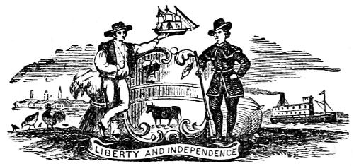
The first settlement of Delaware was made by the Swedes, in pursuance of the policy of the valiant Gustavus Adolphus, king of Sweden. European wars, in which he was engaged, and in which he lost his life in 1633, deferred the project, but it was carried into effect in 1638, near the present city of Wilmington. They extended their settlements from the entrance of Delaware bay far up the river, until the Dutch, from New Netherlands, who claimed the country, attacked and reduced them to submission, uniting New Sweden, as it had been called, to their own colony, in the year 1655. It fell, with that colony, into the hands of the English in 1664. It was included in the grant made to William Penn, in 1692. It was long attached to Pennsylvania, but in 1703 received permission to form a separate government, on the wise and liberal plan pursued by Penn. This form of government continued through the Revolutionary war.
The surface of the State is level, or gently undulating, the climate is agreeable, except that, in winter, the sea breeze is somewhat harsh; the soil is sandy but fertile. Grain and fruit are raised, peaches being produced in great profusion. Her commercial and manufacturing business is limited, and she is destitute of mineral wealth.
It is next to Rhode Island in size, containing the small area of 2,120 square miles, or 1,356,800 acres. Population 125,015.
UNITED STATES SENATORS.
George Read, from 1789 to 1793.
R. Bassett, ” 1789 ” 1793.
John Vining, ” 1793 ” 1798.
Kensey Johns, ” 1794 ” 1795.
Henry Latimer, ” 1795 ” 1801.
Joshua Clayton, ” 1798 ” 1799.
W. H. Wells, ” { 1799 ” 1804.
1813 ” 1817.
Samuel White, ” 1801 ” 1810.
J. A. Bayard, ” 1804 ” 1813.
O. Horsey, ” 1810 ” 1821.
N. Van Dyke, ” 1817 ” 1826.
C. A. Rodney, ” 1822 ” 1823.
T. Clayton, ” { 1824 ” 1827.
1837 ” 1847.
D. Rodney, ” 1826 ” 1827.
H. Ridgely, ” 1827 ” 1829.
L. McLane, ” 1827 ” 1829.
J. M. Clayton, ” { 1829 ” 1837.
1845 ” 1849.
A. Naudain, ” 1830 ” 1836.
R. H. Bayard, ” 1836 ” 1845.
P. Spruance, ” 1847 ” 1853.
John Wales, ” 1849 ” 1851.
J. A. Bayard, ” 1851 ” 1864.
M. W. Bates, ” 1857 ” 1859.
J. P. Comeygs, ” 1856 ” 1857.
W. Saulsbury, ” 1859 ” 1871.
G. R. Riddle, ” 1864 ” 1867.
J. A. Bayard, ” 1867 ” 1869.
Thomas F. Bayard, ” 1869 ” 1881.
Eli Saulsbury, ” 1871 ” 1877.
RHODE ISLAND.
This is the smallest of the States, having an area of but 1,306 square miles, or 835,840 acres.
It was settled in 1636 by Roger Williams, and became an avowed place of refuge for persecuted christians of all names, but especially for Baptists, among whom Mr. Williams was a leader. It was chartered as a separate colony in 1644, and the excellent constitution framed under it lasted until 1818. It was one of the original thirteen States and took an earnest share in the struggles of the revolution, though it was not represented in the convention that framed the Constitution, and did not ratify it until 1790.
Its citizens are mainly engaged in the manufacturing and commercial pursuits for which their excellent harbors and streams furnish eminent facilities. It has always been prosperous, its people being distinguished for industry and activity. Its population was, in 1870, 217,356.
Rhode Island forms part of the first judicial circuit; constitutes one judicial district; and has three ports of entry, and seven of delivery. It has two capitals, having been originally formed of two separate colonies. These are Providence and Newport. The election for State officers is held on the first Wednesday in April. The Legislature is held twice in the year, in May and January. The style of her enacting clause is: “It is enacted by the General Assembly, as follows.”
UNITED STATES SENATORS.
Theodore Foster, from 1790 to 1803.
Joseph Stanton, ” 1790 ” 1793.
William Bradford, ” 1793 ” 1797.
Ray Green, ” 1797 ” 1801.
Charles Ellery, ” 1801 ” 1805.
Samuel L. Potter, ” 1803 ” 1804.
Benjamin Howland, ” 1804 ” 1809.
James Fenner, ” 1805 ” 1807.
Elisha Matthewson, ” 1807 ” 1811.
Francis Malbone, ” 1809 ” 1809.
C. G. Champlin, ” 1809 ” 1811.
Jeremiah B. Howell, ” 1811 ” 1817.
William Hunter, ” 1811 ” 1831.
James Burrill, ” 1817 ” 1821.
James D’Wolf, ” 1821 ” 1825.
Nehemiah R. Knight, ” 1821 ” 1841.
Asher Robbins, ” 1825 ” 1839.
Nathan F. Dixon, ” 1839 ” 1842.
James F. Simmons, ” { 1841 ” 1847.
1857 ” 1862.
William Sprague, ” 1842 ” 1844.
John B. Francis, ” 1844 ” 1845.
Albert C. Green, ” 1845 ” 1851.
John H. Clarke, ” 1847 ” 1853.
Charles T. James, ” 1851 ” 1857.
Philip Allen, ” 1853 ” 1859.
Samuel G. Arnold, ” 1862 ” 1863.
Henry B. Anthony, ” { 1859 ” 1865.
1865 ” 1877.
William Sprague, ” 1862 ” 1875.
Ambrose E. Burnside, ” 1875 ” 1881.
VERMONT.
This State received its name from the French name of its range of mountains, (“verd mont” meaning “Green Mountain.”) It was settled in 1731, and was at first considered part of New Hampshire, and afterwards claimed by New York. These claims were vigorously resisted, but it had no organized government until 1777. It did good service in the Revolution; but was not admitted into the Union until 1791, making the fourteenth State. Col. Ethan Allen at the head of 270 “Green Mountain Boys” took possession of Forts Ticonderoga and Crown Point in the name of the Continental Congress, in 1775, and thus assured the northern water communication with Canada to the Americans.
The climate of Vermont though cold, is pleasant and even, the soil fertile in the valleys, and the streams supply excellent water power, which, however, is little used. Maple sugar is produced in abundance, while its facilities for raising stock are equal to those of New Hampshire. Granite, marble of fine quality, and slate quarries abound. Its provision for education is very liberal.
It has three representatives in Congress; forms part of the second judicial circuit, and constitutes one judicial district. One port of entry and two of delivery are authorized to be named by the President of the United States.
Montpelier is the capital. The State election is held on the first Tuesday in September, and the Legislature meets on the first Wednesday in October.
The enacting clause begins: “It is hereby enacted by the General Assembly of the State of Vermont.”
UNITED STATES SENATORS.
Moses Robinson, from 1791 to 1796.
Stephen R. Bradley, ” { 1791 ” 1795.
1801 ” 1813.
Elijah Paine, ” 1795 ” 1801.
Isaac Tichenor, ” { 1796 ” 1797.
1815 ” 1821.
Nathaniel Chipman, ” 1797 ” 1803.
Israel Smith, ” 1803 ” 1807.
Jonathan Robinson, ” 1807 ” 1815.
Dudley Chase, ” { 1813 ” 1817.
1825 ” 1831.
James Fisk, ” 1817 ” 1818.
William A. Palmer, ” 1818 ” 1825.
Horatio Seymour, ” 1821 ” 1833.
Samuel Prentiss, ” 1831 ” 1842.
Benjamin Swift, ” 1833 ” 1839.
Samuel S. Phelps, ” 1839 ” 1851.
Samuel C. Crafts, ” 1842 ” 1843.
William Upham, ” 1843 ” 1855.
Solomon Foote, ” 1851 ” 1866.
Samuel S. Phelps, ” 1853 ” 1854.
Lawrence Brainard, ” 1854 ” 1855.
Jacob Collamer, ” 1855 ” 1865.
Luke P. Poland, ” 1865 ” 1867.
George F. Edmunds, ” 1866 ” 1881.
Justin S. Morrill, ” 1867 ” 1879.
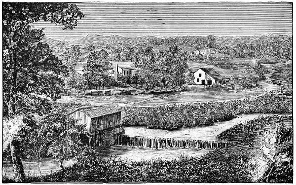
VIEW IN THE BLUE GRASS REGION, KENTUCKY.
KENTUCKY.
Kentucky was formed from the territory of Virginia, and in point of seniority is the fifteenth State of the American Union, having been admitted on the first of June, 1792.
The sobriquet of “dark and bloody ground” applied to Kentucky is very suggestive of the sanguinary conflicts of her pioneer population with the aboriginal lords of the soil. The celebrated Daniel Boone was among the first white men to explore the wilderness of Kentucky. The first white settlement was commenced at Boonesborough, about the year 1769. The area of the State is 37,680 square miles, equal to 24,115,200 acres.
The climate is mild, and adapted to the production of cereals, grapes, and fruits. The soil is very fertile. The surface presents a varied aspect in its several portions. The southeastern part of the State is mountainous, the central and northern portions are undulating, sometimes hilly. The river bottoms are very productive. The State is well timbered. Apple, pear, peach, plum and various other fruit trees are cultivated with great success. The staple products are corn, tobacco and hemp. Horses, mules and cattle are raised. Kentucky abounds in bituminous coal, lead, iron pyrites, marble, freestone, gypsum, and cliff limestone.
The population in 1870 was 1,321,000. She is entitled to ten representatives in Congress, is in the sixth judicial circuit and forms one judicial district, has one port of entry, Louisville, and two ports of delivery, viz.: Paducah and Columbus. Frankfort is the capital.
The State elections are held on the first Monday in August. The Legislature meets on the first Monday in December, and is composed of two houses—the Senate consisting of 38 members elected for four years; and a House of Representatives elected for two years. The enacting clause of the laws is: “Be it enacted by the General Assembly of the Commonwealth of Kentucky.”
UNITED STATES SENATORS.
John Brown, from 1792 to 1805.
John Edwards, ” 1792 ” 1795.
Humphrey Marshall, ” 1795 ” 1801.
John Breckenridge, ” 1801 ” 1805.
Buckner Thurston, ” 1805 ” 1810.
John Adair, ” { 1805 ” 1806.
1806 ” 1807.
1810 ” 1811.
Henry Clay, ” { 1831 ” 1842.
1849 ” 1855.
John Pope, ” 1807 ” 1813.
George M. Bibb, ” { 1811 ” 1814.
1829 ” 1835.
Jessie Bledsoe, ” 1813 ” 1815.
George Walker, ” 1814 ” 1814.
William T. Barry, ” 1814 ” 1816.
Isham Talbot, ” { 1815 ” 1819.
1820 ” 1825.
Martin D. Hardin, ” { 1816 ” 1817.
1817 ” 1819.
1835 ” 1841.
John J. Crittenden, ” { 1842 ” 1849.
1855 ” 1861.
Richard M. Johnson, ” { 1819 ” 1823.
1823 ” 1829.
William Logan, ” 1819 ” 1820.
John Rowan, ” 1826 ” 1831.
James T. Moorehead, ” 1841 ” 1847.
Jos’h R. Underwood, ” 1847 ” 1853.
Thomas Metcalf, ” 1848 ” 1849.
Archibald Dixon, ” 1852 ” 1855.
David Meriwether, ” 1852 ” 1852.
J. B. Thompson, ” 1853 ” 1859.
Lazarus W. Powell, ” 1859 ” 1865.
J. C. Breckenridge, ” 1861 ” 1861.
Garrett Davis, ” 1861 ” 1873.
James Guthrie, ” 1865 ” 1868.
Thomas C. McCreery, ” 1868 ” 1879.
John W. Stevenson, ” 1871 ” 1877.
TENNESSEE.
Tennessee belonged to the territory of North Carolina while a colony, and was settled by emigrants from it in 1757. They built Fort Loudon in East Tennessee, but were destroyed, or driven away, by the Indians, in 1760. Settlement was soon resumed, but continually harrassed by Indian attacks. In 1774 Col. Lewis and Capt. Shelby attacked and defeated them. They remained quiet until after the Declaration of Independence, when the Cherokees were stirred up by British emissaries. From 1776 to 1779 three several expeditions were made against them, the Indians being decisively defeated each time. The Cherokees and Shawnees were warlike tribes, and continued, for some years, to make occasional attacks on the settlements, which did not, however, prevent their steady growth.
In 1789 North Carolina renounced her claim to the territory, and in 1790 it became a separate province, being admitted into the Union as a Sovereign State in 1796, making the sixteenth, or the third admitted after the Revolutionary war—Vermont, in 1791, being the first; and Kentucky, in 1792, the second.
This State has an area of 45,600 square miles, or 29,184,000 acres. It had a population in 1870 of 1,257,983.
Tennessee is very agreeably diversified with mountain, hill and dale, containing within its limits fertility of soil, beauty of scenery, and a delightfully temperate climate. The State is generally healthy. The soil in the main is good, and while among the mountains it is not arable, it is favorable for grazing, and stock is largely exported.
Indian corn, tobacco, and cotton are the great staples.
Gold has been found in the south-east portion of the State. Among the other minerals found here are iron in abundance, some lead, silver, zinc, marble of very fine quality, and various others. The State is entitled to ten Representatives in Congress; is in the sixth judicial circuit; has three judicial districts; and has two ports of delivery—Memphis and Knoxville.
Nashville is the capital. The State election is held on the first Monday in August, and the Legislature meets on the first Monday in October, once in two years. The Legislature consists of a Senate of twenty-five members, and a House of Representatives of seventy-five members.
The enacting clause of the laws of this State is: “Be it enacted by the General Assembly of the State of Tennessee.”
UNITED STATES SENATORS.
William Blount, from 1796 to 1797.
William Cocke, ” { 1796 ” 1797.
1799 ” 1805.
Andrew Jackson, ” { 1797 ” 1798.
1823 ” 1825.
Joseph Anderson, ” 1797 ” 1815.
Daniel Smith, ” 1797 ” 1809.
Jenkin Whiteside, ” 1809 ” 1811.
George W. Campbell, ” 1811 ” 1818.
Jesse Wharton, ” 1814 ” 1815.
John Williams, ” 1815 ” 1823.
John H. Eaton, ” 1818 ” 1829.
Hugh L. White, ” 1825 ” 1840.
Felix Grundy, ” 1829 ” 1840.
Ephraim H. Foster, ” { 1838 ” 1839.
1843 ” 1845.
A. O. P. Nicholson, ” 1840 ” 1843.
Alexander Anderson, ” 1840 ” 1841.
Spencer Jarnagin, ” 1841 ” 1847.
Hopkins L. Turney, ” 1845 ” 1851.
John Bell, ” 1847 ” 1853.
James C. Jones, ” 1851 ” 1857.
Andrew Johnson, ” 1857 ” 1863.
David T. Patterson, ” 1865 ” 1869.
J. S. Fowler, ” 1865 ” 1871.
William G. Brownlow, ” 1869 ” 1875.
Henry Cooper, ” 1871 ” 1877.
Andrew Johnson, ” 1875 ” 1881.
OHIO.
The first permanent settlement in this important State was made on the 7th day of April, 1788. Though this fine territory lay nearest to the most populous and enterprising of the original States, the intrigues of the French before the Revolution, the hostility to which they excited the Indians, and the difficulties arising from the various claims of different States to the lands, which rendered titles insecure, prevented any permanent settlement until about the time when the present Constitution of the United States was originated. All these difficulties were now removed, and emigration, long restrained, rushed like a flood down the Ohio. 20,000 persons, during this year (1788), passed down the river in pursuit of new homes. Cincinnati and many other places were settled about this time. From 1790 to 1795 there was much suffering from the hostility of the Indians; but this period having passed, the settlements multiplied and grew apace.
The settlers were, in large part, from New England; accustomed to wring a thrifty living from a rocky soil; and their industry soon brought great results from this more generous field. The population increased rapidly. In 14 years it amounted to 72,000; and was admitted into the Union with that number Nov. 29th, 1802.
The climate is healthy and mild, the soil generally very fertile, and her inhabitants have made the most of it. Coal, iron, and marble are very abundant. Manufactures have not been much developed in this State, but they are steadily growing. The lake on the north, and the river on the south, with more than 5,000 miles of railway and canals, furnish all the elements of a great and steady growth.
It was, on its admission, the seventeenth State in the Union.
It has an area of 39,964 square miles, equal to 25,576,960 acres. The population in 1870 was 2,622,214, entitling her to twenty Members of Congress.
It is in the sixth judicial circuit, and forms two judicial districts, the Northern and Southern.
This State has three ports of entry—Cleveland, Toledo, and Portland; and four ports of delivery, to be located where the President directs.
The capital of this State is Columbus. The State election is now held on the second Tuesday of October. The Legislature meets on the first Monday of January, biennially.
The enacting clause of the laws is as follows: “Be it enacted by the General Assembly of the State of Ohio.”
UNITED STATES SENATORS.
John Smith, from 1803 to 1808.
Thos. Worthington, ” { 1803 ” 1807.
1810 ” 1814.
Edward Tiffin, ” 1807 ” 1809.
Return J. Meigs, ” 1808 ” 1810.
Stanley Griswold, ” 1809 ” 1809.
Alexander Campbell, ” 1809 ” 1813.
Jeremiah Morrow, ” 1813 ” 1819.
Joseph Kerr, ” 1814 ” 1815.
Benjamin Ruggles, ” 1815 ” 1833.
William A. Trimble, ” 1819 ” 1821.
Ethan A. Brown, ” 1822 ” 1825.
Wm. Henry Harrison, ” 1825 ” 1828.
Jacob Burnett, ” 1828 ” 1831.
Thomas Ewing, ” { 1831 ” 1837.
1850 ” 1851.
Thomas Morris, ” 1833 ” 1839.
William Allen, ” 1837 ” 1849.
Benjamin Tappan, ” 1839 ” 1845.
Thomas Corwin, ” 1845 ” 1851.
Salmon P. Chase, ” 1849 ” 1855.
Benjamin F. Wade, ” 1851 ” 1869.
George Ellis Pugh, ” 1851 ” 1861.
John Sherman, ” 1861 ” 1879.
Allen G. Thurman, ” 1869 ” 1881.
LOUISIANA.
The Spaniards, who found so much gold in other parts of the American continent, made repeated explorations of the region lying near the mouths of the Mississippi in the hope of discovering it there. Failing in this, they made no settlements. The French planned the establishment of a vast empire covering the best territory now in the bounds of the United States, and explored the Mississippi and its tributaries with untiring courage and zeal, both from the Great Lakes and from the mouth of the river. A few years after La Salle had perished in his bold wandering, a French naval officer, Lemoine D’Iberville, formed the first settlement in Louisiana (so named after the French King, Louis XIV., by La Salle.) This was in 1699; but no great progress was made until the Mississippi Company was formed in France, under the idea that Louisiana was rich in gold and diamonds; when, in 1718, eight hundred persons emigrated from France and settled at New Orleans. In 1732 the colony contained, in all, seven thousand five hundred persons, and continued to prosper until 1763, when, by the peace of Paris, all the French possessions in America except the territory west of the Great River, were given up to England. This remnant soon passed to the Spaniards, and again to the French, from whom it was bought by President Jefferson for $15,000,000, in 1803.
This purchase was regarded, even by Jefferson, as probably exceeding the powers of the government, under the Constitution; but it was essential to the development, unity, and greatness of the country. The Mississippi Valley is the heart of North America, and the use of the river as necessary to the value of the prairie States lying east of it, as to the defense and strength of the country. The possession of it could, alone, make the United States a great power among nations. Napoleon Bonaparte, then First Consul of the French Republic, designed, in ceding it to the United States, to give England, his relentless enemy, a powerful rival; but even his keen foresight could not have anticipated the wonderful growth in which the Louisiana Purchase was so necessary an element.
The surface of Louisiana is low, and the southern part often overflowed by the high water of the rivers. Many islands of great fertility and beauty lie along the coast; one of them consisting of an immense bed or mine of rock salt. Fruits grow to great perfection and orange trees are specially fruitful, a single tree often bearing 5,000 oranges. Cotton and cane sugar are the principal staples. New Orleans has an extensive commerce, and manufactures will sometime find in it a profitable field. The palmy days of this, as of all the other Southern States, is in the future; her most valuable resources having been scarcely touched. New Orleans will naturally become the third great commercial city of the Union, New York and San Francisco, only, being likely to take precedence of her.
Louisiana was admitted into the Union April 8th, 1812, making the eighteenth State.
She has an area of 46,431 square miles, equal to 29,715,840 acres. The population in 1870 numbered 732,731; she has six Representatives in Congress.
Louisiana forms a part of the fifth judicial circuit, and constitutes two judicial districts, viz.: the eastern and western districts of Louisiana. This State has one collection district, denominated the district of New Orleans; which city is the only port of entry. The shores of the river Ohio, and all the rivers emptying into the Mississippi, are attached to the district of New Orleans, though most of them do not lie in the State. Several of the cities and towns on these rivers are made ports of delivery. Collection districts are not always confined to one State.
New Orleans is the capital. The Legislature meets on the first Monday in January, once in two years. The State election is held on the first Monday in November.
The enacting clause of her laws is as follows: “Be it enacted by the Senate and House of Representatives of the State of Louisiana, in General Assembly convened.”
UNITED STATES SENATORS.
Thomas Posey, October to December, 1812.
James Brown, from { 1812 to 1817.
1819 ” 1824.
Allan B. Macgruder, ” 1812 ” 1813.
Eligius Fromentin, ” 1813 ” 1819.
W. C. C. Claiborne, ” 1817 ” 1818.
Henry Johnson, ” { 1818 ” 1824.
1843 ” 1849.
William Kelly, ” 1822 ” 1825.
Dominique Bouligny, ” 1824 ” 1829.
Josiah S. Johnston, ” 1824 ” 1833.
Edward Livingston, ” 1829 ” 1831.
Geo. A. Waggaman, ” 1831 ” 1835.
Alexander Porter, ” 1833 ” 1837.
Robert C. Nichols, ” 1833 ” 1841.
Alexander Morton, ” 1838 ” 1842.
Alexander Barrow, ” 1841 ” 1847.
Charles M. Conrad, ” 1842 ” 1843.
Pierre Soulé, ” { 1847 ” 1847.
1849 ” 1855.
Solomon W. Downs, ” 1847 ” 1853.
John Slidell, ” 1853 ” 1861.
Judah P. Benjamin, ” 1853 ” 1861.
John S. Harris, ” 1868 ” 1871.
Wm. Pitt Kellogg, ” 1868 ” 1873.
J. R. West, ” 1871 ” 1877.
INDIANA.
1. Indiana was first explored by the enterprising French Jesuits, who highly appreciated the beauty, resources, and grand future of the vast Mississippi valley. Wiser than their sovereign, Louis XIV., they would have taken firm and effectual possession of all this region, from the Great Lakes to the Gulf, but Louis was too much occupied with his palaces, the splendor of his court, the banishment of Protestants, and war with his neighbors to lend a due support to their plans. They explored the region in 1682, formed a settlement at Vincennes in 1730, and made friends of the Indians. The career of the French, in Europe and America, was checked by the extravagance of the Court, and disastrous wars; and this little colony remained for nearly three generations solitary and stationary in the wilderness; fraternizing with the Indians and enjoying life as only the French can under such dreary circumstances.
2. After the Revolution all this region was included in the Northwest Territory. The grim earnestness of the Americans in pushing their fortunes alarmed, without conciliating, the Indians, and for a long time a deadly struggle alone could preserve the growing settlements from total extinction. The brave and talented Tecumseh and his twin brother, the Prophet, made a desperate effort to drive back or exterminate the settlers; but they were conquered, and the Indians retreated, step by step, before the advancing flood of emigration. In 1809 Indiana was erected in to a separate Territory, and admitted into the Union as a separate State on the 11th of Dec., 1816. It is 275 miles long by 135 in width. The surface is mainly level or gently undulating; the irregularities in the southern part, seldom rising more than two hundred feet, but with a rocky foundation to the soil, presenting many advantages to manufactures along the streams; these facilities are increased by the extent and value of bituminous coal deposits which underlie nearly one-fourth of the area of the State.
3. Indiana has a happier mixture of prairie and woodland than any other western State. Its commercial facilities are great. Reaching Lake Michigan on the northwest, Chicago forms a fine metropolis for the northern parts; while the Ohio on the south furnishes cheap transportation to Cincinnati and Pittsburg toward the east, or New Orleans to the southwest. Lying between the fertile and busy regions west and the great eastern markets, it is crossed in all directions by railroads. It is in the centre of the most highly favored part of the Union, and its advantages and resources seem boundless. Its staple in agriculture is corn, but all the grains, vegetables, and fruits of the temperate zone are raised with success. The climate is mild, but it lies in the region of variableness in weather characterizing all the western States in its latitude.
The resources of the State have been in a course of rapid and uninterrupted development for 60 years, but they are so great, and there are so many other inviting fields luring emigrants further west, that a comparatively small part of its wealth has yet been reached. There is a magnificent provision for education, and its intelligent and enterprising citizens are worthy of the Great Republic.
4. Indiana was the nineteenth State in the Union. She has an area of 33,809 square miles, equal to 21,637,760 acres. Her population in 1870 was 1,673,046, which entitles her to thirteen Representatives in Congress. Indiana is the seventh judicial circuit, and forms one judicial district. There is no port of entry in this State; but there are three ports of delivery, to-wit: Evansville, New Albany, and Madison which are attached to the New Orleans collection district.
The capital is Indianapolis. The State election is held on the second Tuesday of October. The Legislature meets only once in two years, on the first Wednesday of January.
The enacting clause of her laws is in these words: “Be it enacted by the General Assembly of the State of Indiana.”
UNITED STATES SENATORS.
James Noble, from 1816 to 1831.
W. Taylor, ” 1816 ” 1825.
W. Hendricks, ” 1825 ” 1837.
N. Hanna, ” 1831 ” 1833.
John Tipton, ” 1833 ” 1839.
O. H. Smith, ” 1837 ” 1843.
A. S. White, ” 1839 ” 1845.
E. A. Hannegan, ” 1843 ” 1849.
J. D. Bright, ” 1845 ” 1852.
J. Whitcomb, ” 1849 ” 1855.
C. W. Cathcart, ” 1852 ” 1853.
John Pettit, ” 1853 ” 1855.
G. N. Fitch, ” 1857 ” 1861.
H. A. Lane, ” 1861 ” 1867.
D. Turpee, ” 1863 ” 1863.
J. A. Wright, ” 1862 ” 1863.
T. A. Hendricks, ” —— ” 1869.
O. P. Morton, ” 1867 ” 1879.
Daniel D. Pratt, ” 1869 ” 1875.
Joseph E. McDonald, ” 1875 ” 1881.
MISSISSIPPI.
This State was explored by De Soto, a companion of Pizarro, in his cruel conquest of Peru, in 1541, and later by the enterprising French governor of Canada, La Salle, in 1684. The first settlement was made by the French, at Natchez, in 1716. It was one of a chain of settlements by which they proposed to connect the basins of the St. Lawrence and the great lakes with the Mississippi valley and the Gulf of Mexico.
The Natchez Indians gave the early colonists great trouble, but were finally so completely conquered that the national name became extinct, the few remnants surviving, becoming incorporated with other tribes. They were supposed to have anciently emigrated from Mexico or South America, some of their customs being similar to those of the Peruvians.
In 1763 the French ceded all this territory to England, except that of Louisiana, which became the possession of Spain.
The Choctaw Indians held possession of the northern part of the State for a long time, and became considerably civilized.
The northern part of the State is prairie, the soil being extremely rich, while the south is sandy. The surface is generally level or undulating. Commerce and agriculture form its principal resources; though neither have been highly developed. Cotton is the principal staple. It is remarkably well adapted to the growth of fruit, though it has been very little cultivated. The State is well supplied with railroads, which, with the Mississippi flowing the whole length of her western boundary, furnish ample transportation for all the produce of her fertile soil.
The Territory of Mississippi became a State in 1817; making the twentieth State. The area is 47,156 square miles, equal to 30,179,840 acres. The population in 1870 numbered 834,170; which entitles her to six Representatives in Congress. The State lies in the fifth judicial circuit, and is divided into two judicial districts, viz.: the Northern and Southern districts of Mississippi. She has three ports of entry, viz.: Natchez, Vicksburg, and one near the mouth of Pearl river, to be established whenever the President may direct; also three ports of delivery, viz.: Grand Gulf, Ship Island and Columbus.
Jackson is the capital. The State election is held on the Tuesday after the first Monday in November, and her Legislature meets biennially on the Tuesday after the first Monday in January.
The enacting clause of the laws is in these words: “Be it enacted by the Senate and House of Representatives of the State of Mississippi in General Assembly convened.”
UNITED STATES SENATORS.
Walter Leake, from 1817 to 1820.
Thomas H. Williams, ” { 1817 ” 1829.
1838 ” 1839.
David Holmes, ” 1820 ” 1825.
Powhattan Ellis, ” 1825 ” 1833.
Thomas B. Reed, ” 1826 ” 1829.
Robert Adams, ” 1830 ” 1830.
George Poindexter, ” 1830 ” 1835.
John Black, ” 1832 ” 1838.
R. J. Walker, ” 1835 ” 1845.
James F. Trotter, ” 1838 ” 1838.
John Henderson, ” 1839 ” 1845.
Jesse Speight, ” 1845 ” 1847.
Joseph W. Chambers, ” 1845 ” 1847.
Jefferson Davis, ” { 1847 ” 1851.
1857 ” 1861.
Henry S. Foote, ” 1847 ” 1853.
John W. Rea, ” 1851 ” 1851.
Walter Brooks, ” 1852 ” 1852.
Albert G. Brown, ” 1854 ” 1861.
Stephen Adams, ” 1852 ” 1857.
Henry R. Revels, ” 1869 ” 1871.
James L. Alcorn, ” 1871 ” 1877.
Adelbert Ames, ” —— ” 1875.
Henry R. Pease, ” —— ” 1877.
Branch K. Bruce, ” 1875 ” 1881.
ILLINOIS.
Illinois was first visited by Europeans in the persons of French Jesuit missionaries in the year 1672, who explored eastern Wisconsin and northern Illinois in that year. The oldest permanent settlement in the valley of the Mississippi was made at Kaskaskia, in this State, in the year 1720, by the French. The name of the State is derived from the aboriginal inhabitants. In the Indian dialect it was “Illini,” and signified a perfectly formed man. The French settlers changed the name to Illinois. This State was formed from what was known as the Northwestern territory, and was the twenty-first of the American Union. It was admitted and became an independent State on the 3d day of December, 1818. It has an area of 55,405 square miles, equal to 35,459,200 acres. Its population in 1870 was 2,539,638. Extending through more than five degrees of latitude, Illinois has quite a variety of climate. The surface is level. The soil is fertile and the agricultural capabilities of this State are not surpassed by any sister State, if indeed by any portion of earth’s surface, of equal extent. Her staple products are corn, wheat, oats, potatoes, hay, and products of the dairy, besides large quantities of fruit. The State is rich in minerals. A large portion of the lead producing region of the country is in this State. Bituminous coal is found in almost every county in the State. Copper is found in large quantities in the north, and iron in both south and north. Lime, zinc, marble of excellent quality, freestone, gypsum, and other minerals, are found in various parts.
The State is entitled to nineteen representatives in Congress, and forms a part of the seventh judicial circuit. It forms two judicial districts, viz.: northern and southern. It has one port of entry, Chicago, and four ports of delivery, viz.: Alton, Quincy, Cairo, and Peoria. The capital is Springfield. The State election is held on the Tuesday after the first Monday in November. The legislature meets biennially on the first Monday in January. The enacting clause of the laws is as follows: “Be it enacted by the people of the State of Illinois represented in the General Assembly.”
UNITED STATES SENATORS.
J. B. Thomas, from 1818 to 1829.
N. Edwards, ” 1818 ” 1824.
John McLean, ” { 1824 ” 1825.
1829 ” 1830.
D. J. Baker, ” 1830 1 month.
E. K. Kane, ” 1825 to 1836.
J. M. Robinson, ” 1830 ” 1841.
W. L. D. Ewing, ” 1835 ” 1837.
R. M. Young, ” 1837 ” 1843.
S. McRoberts, ” 1841 ” 1843.
J. Semple, ” 1843 ” 1847.
Sidney Breese, ” 1843 ” 1849.
S. A. Douglas, ” 1847 ” 1861.
James Shields, ” 1849 ” 1855.
L. Trumbull, ” 1855 ” 1873.
O. H. Browning, ” 1861 ” 1863.
W. A. Richardson, ” 1863 ” 1865.
Richard Yates, ” 1865 ” 1871.
John A. Logan, ” 1871 ” 1877.
Richard J. Oglesby, ” 1873 ” 1879.
ALABAMA.
This State was, at first, held by Georgia under her colonial charter, but was given up to the general government, in 1802, for the sum of $1,250,000. It then became a part of the Mississippi territory, but was separated when Mississippi became a State, in 1817.
It was settled in 1711, at Mobile, by the French, it being a part of the territory explored and claimed for France by La Salle in 1684. The Indian name of Alabama means “Here we rest.” Its soil can scarcely be excelled for fertility in the world. It has every variety of climate, from the high and stern severity of a mountain region in the north, through all gradations, to the heat and luxuriant vegetation of the tropics along the southern coast. The center abounds in coal and iron, and various other minerals are found in abundance. Until the Revolution it was a hunting ground for the Indians. Being then stirred up by British emissaries, and threatening the security of the frontiers, they were severely chastised. After the return of peace, when the growing wealth and population of the original States excited them to enterprise, the territory invited population by its surpassing fertility, and it graduated to the importance of a sovereign State by admission into the Union, Dec. 14th, 1819, forming the twenty-second State.
It has an area of 50,722 square miles, equal to 32,462,080 acres, and had a population in 1870 of 966,988, by which she is entitled to eight Representatives.
It forms a part of the fifth judicial circuit, and is divided into three judicial districts, the Northern, Middle and Southern.
It has one port of entry, (Mobile,) and two ports of delivery, viz.: Tuscumbia and Selma.
The capital of the State is Montgomery.
The State election is held on the Tuesday after the first Monday in November. The Legislature meets on the third Monday in November.
The enacting clause of its laws is as follows: “Be it enacted by the Senate and House of Representatives of the State of Alabama, in General Assembly convened.”
UNITED STATES SENATORS.
William R. King, from { 1819 to 1844.
1846 ” 1852.
John W. Walker, ” 1819 ” 1822.
Henry Chambers, ” 1825 ” 1826.
Israel Pickens, ” 1826. Superseded the same year by—
John McKinley, ” { 1826 ” 1831.
1837 ” 1841.
Gabriel Moore, ” 1831 ” 1837.
Clement C. Clay, ” 1837 ” 1841.
Arthur P. Bagby, ” 1841 ” 1849.
Dixon H. Lewis, ” 1844 ” 1847.
Benjamin Fitzpatrick, ” 1852 ” 1861.
Jeremiah Clemens, ” 1849 ” 1853.
Clement C. Clay, Jr., ” 1853 ” 1861.
Willard Warner, ” 1868 ” 1871.
George Goldthwaite, ” 1871 ” 1877.
George E. Spencer, ” 1868 ” 1879.
MAINE.
This State forms the northeastern boundary of the Republic; Canada and New Brunswick lying north and east. It was at first a province, granted by charter to Sir Ferdinand Gorges, by the King of England, in 1638; but was united with Massachusetts by purchase in 1652. It was settled by the English, at Bristol, in 1625. It was admitted as a State into the Union March 15th, 1820, being the twenty-third in order of admission. It contains 31,766 square miles, or 20,330,240 acres in area. In 1870 the population was 626,463.
It has now five Representatives in Congress.
The northern part of this State is almost a wilderness, and furnishes large quantities of lumber, which are floated down her large rivers, and supplied, in great abundance, to the Atlantic seaports, and the West Indies. Ship-building is an extensive branch of industry, the great length and irregular line of coast forming numerous harbors. It has extensive fisheries, and a large sea-faring population. Its numerous streams are highly favorable to manufactures, though comparatively little has as yet been done in this direction. The climate is severe and the soil somewhat sterile, so that it ranks low as an agricultural State. It has received comparatively few additions to its population by foreign immigration; and its inhabitants are mainly from the old English stock, and the State ranks high in morality. It depletes itself by furnishing, like many other of the older States, annually, a large number of vigorous, enterprising young men to settle the new and fertile regions of the west.
It forms part of the first judicial circuit, and constitutes one judicial district. It has thirteen ports of entry, and thirty-two ports of delivery.
The capital is Augusta, on the Kennebec river.
The State elections are held on the second Monday of September; and the Legislature meets on the first Wednesday of January in each year.
The enacting clause of its laws is: “Be it enacted by the Senate and House of Representatives, in Legislature assembled.”
UNITED STATES SENATORS.
John Holmes, from 1820 to 1833.
John Chandler, ” 1820 ” 1829.
Albion P. Harris, ” 1827 ” 1829.
Peleg Sprague, ” 1829 ” 1835.
Ether Shepley, ” 1833 ” 1836.
John Ruggles, ” 1835 ” 1841.
Judah Dana, ” 1836 ” 1837.
Reuel Williams, ” 1837 ” 1843.
George Evans, ” 1841 ” 1847.
John Fairfield, ” 1843 ” 1847.
Wynan B. S. Moore, ” 1848 ” 1848.
James W. Bradbury, ” { 1847 ” 1853.
1848 ” 1857.
Hannibal Hamlin, ” { 1857 ” 1861.
1869 ” 1881.
Amos Nourse, ” 1857 ” 1857.
William P. Fessenden, ” { 1853 ” 1864.
1865 ” 1869.
Lot M. Morrill, ” 1861 ” 1877.
Nathan A. Farwell, ” 1864 ” 1865.
MISSOURI.
This State was first settled by the French, at or near the present capital, in the year 1719. Here a fort was established, called Fort Orleans, and the neighboring lead mines were worked the next year. St. Genevieve, the oldest town in the State, was settled in 1755, and St. Louis in 1764. In 1763 it, with all the territory west of the Mississippi, was assigned by treaty to Spain. This territory was ceded back to France in 1801, and with Louisiana was purchased by the United States in 1803. It remained a part of Louisiana until the admission of the State of that name, when the remaining portion of that purchase was called Missouri. In 1821 it was admitted into the Union, forming the twenty-fourth State. This State has an area of 67,380 square miles, equal to 43,123,200 acres.
Her population in 1870 was 1,715,000, entitling her to thirteen Representatives in Congress.
The climate of Missouri is variable; in winter the thermometer sinks below zero; the summers are excessively hot; the air is dry and pure. The State is quite as healthful as any in the west. The soil is good and of great agricultural capabilities. The great staple is Indian corn. The other products cultivated largely are hemp, wheat, oats, tobacco. Sheep and cattle are considerably raised, and fruit culture is successful.
This State is in the eighth judicial circuit; and forms two judicial districts, the Eastern and Western. It has no port of entry, and but one port of delivery, Hannibal.
The capital is Jefferson City. The State election is held on the Tuesday after the first Monday in November, and the Legislature meets on the last Monday of December. The enacting clause of the laws is: “Be it enacted by the General Assembly of the State of Missouri as follows.”
UNITED STATES SENATORS.
Thomas H. Benton, from 1821 to 1851.
David Barton, ” 1821 ” 1831.
Alexander Buckner, ” 1831 ” 1833.
Lewis F. Linn, ” 1833 ” 1843.
David R. Atchison, ” { 1843 ” 1849.
1849 ” 1855.
Gratz B. Brown, ” 1863 ” 1867.
Henry S. Geyer, ” 1851 ” 1857.
Trusten Polk, ” 1857 ” 1861.
James S. Green, ” 1856 ” 1861.
Waldo P. Johnson, ” 1861 ” 1862.
John B. Henderson, ” 1862 ” 1869.
Charles D. Drake, ” 1867 ” 1871.
Carl Schurz, ” 1869 ” 1875.
Francis P. Blair, ” 1871 ” 1873.
Lewis V. Bogy, ” 1873 ” 1879.
Frank M. Cockrell, ” 1875 ” 1881.
MICHIGAN.
The name of this State is a contraction of two words in the Chippewa language, meaning “Great Lake,” and was applied, by the Indians, to the two surrounding the lower peninsula. It was explored by Jesuit missionaries, who established numerous missions among various Indian tribes, and pushed their way, through perils and fatigues, west to the Mississippi, which, they followed far north and south; to be soon outstripped by the adventurous La Salle. Detroit was founded about 1701. The settlements made little progress under French rule; and when, in 1763, it passed under English control, the conspiracy of Pontiac nearly destroyed them. It was not till 1796 that the United States government took possession of the territory. Its growth was much retarded by the war of 1812, when it endured, for two years, all the barbarities of Indian war.
A territorial government was organized in 1805. In 1818 the lands were brought into the market, since which its prosperity has been uninterrupted. It is remarkable in its position, and eminently so by its resources. The southern peninsula is very productive. The northern peninsula contains the richest copper mines in the world, and unlimited supplies of iron, while the quantity of the finest lumber, and the facilities for transporting it are superior. The fish taken in its lakes are excellent and abundant; its people are enterprising and intelligent; and its State authorities have established one of the best Universities in the Union. Its future promises to become equal at least to that of the most favored State.
The Territory of Michigan was changed into a State preliminarily June 15, 1836, and was fully admitted to an equality with all the States January 26, 1837, making the twenty-fifth State (Arkansas was admitted on the same day). Her area is 56,243 square miles, equal to 35,995,520 acres. The population in 1870 was 1,184,296, which entitles her to nine Representatives in Congress. By an act of 1866, Michigan was located in the sixth judicial circuit; and forms two judicial districts, and has four collection districts and four ports of entry, viz.: Detroit, Port Huron, Grand Haven, and Michilimackinac; also five ports of delivery (if the President deem them necessary).
The capital is Lansing. The State election is held on the Tuesday after the first Monday in November. The Legislature meets biennially on the first Wednesday in January.
The enacting clause of the laws is as follows: “The people of the State of Michigan enact.”
UNITED STATES SENATORS.
Lucius Lyon, from 1836 to 1839.
John Norvall, ” 1836 ” 1841.
Augustus S. Porter, ” 1839 ” 1845.
William Woodbridge, ” 1841 ” 1847.
Lewis Cass, ” 1845 ” 1857.
Alpheus Felch, ” 1847 ” 1853.
Thomas Fitzgerald, ” 1848 ” 1849.
Charles E. Stewart, ” 1853 ” 1859.
Zachariah Chandler, ” 1857 ” 1875.
Kinsley S. Bingham, ” 1859 ” 1861.
Jacob M. Howard, ” 1862 ” 1871.
Thomas W. Ferry, ” 1871 ” 1877.
Isaac P. Christiancy, ” 1875 ” 1881.
ARKANSAS.
Arkansas was originally a portion of the Territory of Louisiana. It remained a part of that territory until 1812, when the present State of Louisiana was admitted into the Union. The remainder of the territory was then formed into the Missouri Territory, and so remained until 1821 when Missouri was admitted into the Union, and Arkansas was erected into a separate territory, bearing the present name. In 1836, a State constitution was formed at Little Rock, and Arkansas became a State in the Union. It constituted the twenty-sixth State. It has an area of 52,193 square miles, equal to 33,406,720 acres. The population in 1870 was 483,197, which entitles her to four Representatives in Congress. The eastern portion of the State, extending back one hundred miles from the Mississippi, is generally a vast plain covered with marshes, swamps, and lagoons. The Ozark mountains which enter the northwest part of the State divide it into two unequal parts, of which the northern has the climate and productions of the Northern States, while the southern portion, in climate and productions, resembles Mississippi and Louisiana. The lowlands of Arkansas are unhealthy, while the more elevated portions of the State will compare favorably with the most healthful and invigorating portions of the Northwest. There is a great variety of soil in this State. While some portions, like the river bottoms, are exceedingly fertile, other parts are sterile and barren.
The staple products are Indian corn, cotton and live stock. Arkansas gives indications of rich mineral resources.
This State lies in the eighth judicial circuit, and forms two judicial districts, the eastern and western. It has no ports of entry or delivery.
The capital of the State is Little Rock. She holds her State election the first Monday in November. The Legislature meets but once in two years, on the first Monday in January. The enacting clause of the laws is: “Be it enacted by the General Assembly of the State of Arkansas.”
UNITED STATES SENATORS.
William S. Fulton, from 1836 to 1844.
Ambrose H. Sevier, ” 1836 ” 1848.
Chester Ashley, ” 1844 ” 1847.
William K. Sebastian, ” 1848 ” 1861.
Solon Borland, ” 1848 ” 1853.
Robert W. Johnson, ” 1853 ” 1861.
Charles B. Mitchell, ” 1861 ” 1861.
Alexander McDonald, ” 1868 ” 1871.
Benjamin F. Rice, ” 1868 ” 1873.
Powell Clayton, ” 1871 ” 1877.
Stephen W. Dorsey, ” 1873 ” 1879.
FLORIDA.
This peninsula was discovered by Ponce de Leon, a companion of Columbus, in 1512, on Easter Sunday, called by the Spaniards Pascua Florida, which, with the profusion of flowers found at this early season in that tropical region, caused him to name it Florida—“the flowery land.” It was first colonized by French Huguenots, for whom Admiral Coligni desired to find an asylum in the new world, from the fierce bigotry of the times. The first settlers (1564) became discouraged and returned; the second colony, established in 1566, was destroyed by the Spaniards. These founded a settlement in 1565 at St. Augustine, which was the oldest town in the United States settled by Europeans. It remained in their hands until 1763, when, by the terms of the “Peace of Paris,” it fell into the hands of the English. It was returned to Spain in 1783.
It was acquired from Spain by treaty made with the United States in 1819, but the American authorities did not take possession until July, 1821. The consideration given by our government was about five million dollars. It is a point running out from the Southeast border of our territory, of but little elevation above the sea level, and swampy, but covered with an exuberant growth of vegetation with a chain of lakes from south to north through the center. The warmth of the climate, where no winter is ever known, promotes the growth of the rarest and most beautiful flowers; the clustering vines and dense foliage render its forests almost impenetrable, and its delicate mosses are the wonder and delight of the naturalist; while the splendid plumage of its tropical birds, flitting among the lemon and orange groves, laden at once with bud, flower and fruit, combine to add the scenery of the equatorial regions to the homely but more useful vegetable growth and beauty of our temperate zone. It is a resort of invalids during the rigors of the northern winter, its otherwise excessive heat being tempered by the sea breezes from either side. With its marshes drained and its vegetable growth subdued and guided by the industrious agriculturist, its supply of the fruits and other production of warm climates would be inexhaustible. It is but partially settled, and its agricultural, commercial, and manufacturing facilities but slightly developed. Its wealth of resources remain to reward the enterprise and industry of the future. The railroad connections between its cities and other States furnish a sufficient basis for improvement.
Florida was admitted into the Union, March 3, 1845; making the twenty-seventh State. This State has an area of 59,268 square miles, equal to 37,931,520 acres. The population in 1870 amounted to 187,756. She has two Representative in Congress.
Florida lies in the fifth judicial circuit, and forms two judicial districts; and has seven ports of entry—St. Augustine, Key West, Apalachicola, Pensacola, Magnolia, St. John’s River, and Fernandina; and two ports of delivery—Palatka and Bay Port.
The capital is Tallahassee. The State election is held on the Tuesday after the first Monday in November. The Legislature meets on the Tuesday after the first Monday in January.
The enacting clause of the laws is: “Be it enacted by the Senate and House of Representatives of the State of Florida, in General Assembly convened.”
UNITED STATES SENATORS.
David L. Yulee, from 1845 to 1861.
J. D. Wescott, ” 1845 ” 1851.
Jackson Morton, ” 1849 ” 1855.
S. R. Mallory, ” 1851 ” 1861.
A. S. Welch, ” 1868 ” 1869.
Thomas W. Osborn, ” 1868 ” 1873.
Abijah Gilbert, ” 1869 ” 1875.
Simon B. Conover, ” 1873 ” 1879.
Chas. W. Jones, ” 1875 ” 1881.
IOWA.
1. The name of this State in the Indian tongue is said to mean “This is the Land.” Few States have a surface, soil, and position so uniformly excellent for all their different sections. A high rolling prairie, well drained by streams, of great fertility, and almost no sterile or waste land; beautiful to look upon in its alternations of rise and fall, of prairie, stream, and timber; bounded on its extremes by the two mighty branches of the “Father of Waters,” with numerous smaller rivers hundreds of miles in length within its limits; its southern region underlaid by a vast bed of coal, its northern rich in deposits of lead; a climate free from the severity of Minnesota and Wisconsin winters, and from the intemperate heats of Missouri and Kentucky summers, it is a land to be satisfied with; and justifies the picturesque name given it by its ancient appreciative owners.