Part 2 — CHAPTER VI
Reading edition
The Lower River and the Ocean Tides
Remarkable Change in Climate and Topography—Farms and Villages—First View of Mt. Hood on West Side—Vancouver and its Historic Interest—The North Bank Railroad—View at the Mouth of the Willamette—Sauvie’s or Wapatoo Island—Beauty of the Willamette and its Tributaries—Simpson’s Poem—Approach to Portland—Site of Portland—Transportation Facilities—Portland’s Commerce—Homes and Public Buildings—Art in Portland—The Historical Society Museum—The Oregonian and its Editor—Once more on the River—The Fishing and Lumbering Villages—Scenery of the Lower River—Astoria and the Outlook to the Ocean—Industries of Astoria—The Fisheries—The Fleet of Fishing Boats on the Bar—The Ocean Beaches and the Tourist Travel—Through the Outer Headlands to the Pacific.
Having returned from our side trip to the mountain peaks of Hood and Adams and having resumed our station on the bank of the River just below Rooster Rock, we see that we are now in a new world. We are at sea-level. Dense forests clothe the shores, except for the places where the axe of the settler or the saws of the lumberman have made inroads. Moss drapes the rocks. Ferns and vines take possession wherever the trees have been removed. Even in summer a feeling of humidity usually pervades the air. A certain softness and roundness seems to characterise both the vegetable and animal world. The smell of the sea is in the atmosphere, even though the sea is yet distant. No longer do our eyes wander over boundless expanses of rolling prairie, crowned to the highest knolls with wheat-fields, as on the other side of the mountains. The mountains fall away, and low bottoms, sometimes oozy with the inflowing river or the creeks from the forests, stretch away in the lazy, hazy distance. The River no longer flows tumultuously and with that militant energy which is so characteristic of the long stretches from Kettle Falls to The Dalles. It has a calm and stately majesty, the repose of accomplished warfare and victory. It has hewn its way down to the level of the ocean and no longer needs to fret and storm. It has conquered a peace.
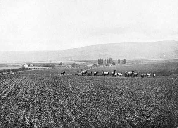
Band of Elk on W. P. Reser’s Ranch, Walla Walla, Wash. Photo. by W. D. Chapman.
Below Rooster Rock, the shores are flats with low hills in the background, and the River expands to a width of from one to two miles. If we still imagine ourselves in a small boat, we find the most delightful of sensations in gliding past the grassy islands and shores thick with fir or cottonwood. Or if we choose to take our way to one of the elegant steamers, Spencer or Bailey Gatzert, we shall still partake of the same life and feel the same sense of repose and contentment which belong by natural right to this portion of the River.
Soon after leaving Rooster Rock, we begin to pass frequent pleasant farms on either bank. On the Washington side we see two pretty villages, Washougal and La Camas. The first has the historical distinction of being at or nearly at the highest spot reached by the English explorer Broughton in 1792, and named by him Point Vancouver. La Camas is the location of the most extensive paper mills in the North-west.
If, while we are in this section of the River and our eyes are bent eagerly forward to catch the ever-changing shore and river lines, we happen to glance backward, our gaze is fastened as with a magnet, and for a moment utterance fails. For what do we see? Glistening white, ethereal, Mt. Hood rises before us, a vision which, of the many mountain visions that we have seen, seems the most beautiful. Mt. Hood indeed is the background of many a noble scene upon the River, but there is none quite equal in amplitude, in variety, to this,—River, forest, shore, foreground of timbered hills, Cascade Gorge, distant white and purple chain of Cascade Mountains, and the volcanic cone overtopping and overawing all. This view of Mt. Hood from the vicinity of La Camas has perhaps been oftener the subject of painting than any other.
A few miles below La Camas we reach the most historic and perhaps the most beautiful spot upon the Columbia, Vancouver. As the capital for twenty years of the Hudson’s Bay Company’s Fur Empire, associated with the name of Dr. John McLoughlin, the centre of almost every event of importance in the early history, connected with both American and British occupation, and later as the location of the United States military post and preserving the names of Grant, Sheridan, McClellan, Hooker, and others of our famous generals, Vancouver has indeed a rich historic setting. But aside from such associations with the past, every tourist must note the location of Vancouver as one of rare beauty. In fact, the spot is almost ideal for a great city. The splendid River, a mile and a half in width, offers limitless facilities for shipping, while, beginning at the water’s edge, a gradually rising slope of land extends in a superb swell several miles to the north. Every feature of scenery that could delight the eye—Mt. Hood with the Cascades to the east, the Willamette Valley to the south, the Portland and Scappoose hills to the west, the River blending all—seems to have been lavished on Vancouver. It has been a surprise to many that the great city had not grown here rather than at Portland, which, though on an equally fine location, is on the tributary and much smaller Willamette. The chief reasons of this were the nearer proximity of Portland to the rich farming country of the Tualatin and the presence in the Columbia a mile below Vancouver of a sand-bar which embarrassed shipping. This is now removed.
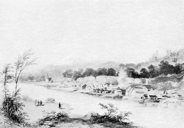
Oregon City in 1845. From an Old Print.
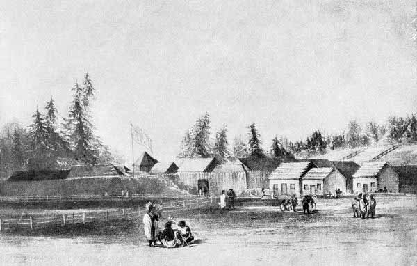
Fort Vancouver in 1845.
At Vancouver the newly-built “North Bank” Railroad (Spokane, Portland, and Seattle) has constructed across the Columbia a bridge a mile and three quarters in length, said to be the largest and costliest of its kind in the world. This same railroad has also bridged the Willamette a few miles west of Vancouver, thus effecting an entrance to Portland. This railroad is one of the most interesting and remarkable undertakings of the age. It is said that its cost from Spokane to Portland exceeded forty million dollars. Vancouver expects much from this road, even anticipating that much of the shipping hitherto centring in Portland will be diverted to the larger river. However that may prove, it is plain that Vancouver has the promise as well as the memory of great things.
Six miles west of Vancouver is one of those imposing scenes in which our River so abounds. This is the junction of the Willamette with the Columbia. This spot was noted by Broughton in 1792 as one of exceptional beauty, and to it he attached the name Belle Vue Point. It is indeed a combination of both historical and scenic interest. The Willamette steals shyly and coquettishly through green islands to fall into the strong arms of the stately Columbia. The western arm of the Willamette, commonly called the “Slough,” joins the Columbia eighteen miles below at the picturesque little town of St. Helens. Between the Columbia and the Slough lies Sauvie’s Island, named from a Hudson’s Bay man, and famous throughout Hudson’s Bay times as well as Indian times. The island was the seat of power of the Multnomah tribe. The scene of the book known as the Bridge of the Gods by Frederick Balch is mainly upon this island, and in that book will be found some glowing descriptions of this beauty spot. To the Indians it was known as Wapatoo Island. In the ponds grew the plant called the wapatoo, an onion-like root, very nutritious and palatable, and, with salmon, constituting the chief food of the natives. Not only so, but the Multnomah Indians used the wapatoo as a commercial stock, carrying on regular trade with both the coast and the up-river tribes.
According to the early explorers there were great annual fairs on Wapatoo Island, when Indians from ocean beach, from valley, from mountains, and from River, both up and down, would gather to exchange products, to gamble, race horses and boats, and have a general period of hilarity and good fellowship.
The gathering of the wapatoos developed upon the patient “klootchmen” (women) of the tribe. They would go out in canoes to the shallow water where the roots grew and then, stripping naked, would hang over the side of the boat and dislodge the wapatoos with their toes from the soft mud. Soon the surface would be covered with the floating roots. The squaws would gather these into the canoes. Then they would move to another place for another load. Sometimes they would spend almost the whole day in the water. The wapatoo still grows in the ponds and lagoons of the island. These ponds formerly abounded in ducks and geese and cranes and swans. Even yet there is fine hunting. During the damp soft days of the Oregon winter, the Nimrods of Portland betake themselves thither in great numbers.
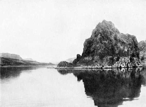
Lone Rock, Columbia River, about Fifty Miles East of Portland. Photo. by E. H. Moorehouse, Portland.
From the steamer, as we enter the mouth of the Willamette, or from the greater elevation of the lighthouse, one may command one of the lordliest views that even this land of lordly views affords. Five snow-peaks, Hood, Rainier-Tacoma, St. Helens, Adams, and Jefferson, rise snow white from the purple forests of the Cascade Range. Up the Columbia the great gorge through which we have passed stands open to view, while down-river the sinuous and hazy lines of low-lying shore betoken the nearer proximity of the ocean. Up the Willamette, enchanting islands, with low watery shores, occupy the foreground, while a short distance back from the western bank, a chain of picturesque hills, heavily timbered, encloses the vista. On the east side a low bench with bluffy promontories, crowned with the beautiful smooth-barked madrona tree, rises from the green meadows.
If we could, from so fair an entrance, ascend the Willamette to its source in the Cascade Mountains two hundred miles away, and if we could turn into the Tualatin, the Yamhill, the Clackamas, the Molalla, the La Creole, the Santiam, the Calapooia, affluents worthy of union with the Willamette, and if we could tarry among the vales and meadows and oak-crowned hills and distant Coast and Cascade ranges of mountains, all across that superb valley, fifty miles wide by a hundred and fifty long, as beautiful as Greece or Italy,—we would then all agree that the Willamette deserves a volume by itself and that it is almost a crime to introduce it so briefly here. Every old Oregonian, in thinking of the Willamette, at once associates it with the apostrophe to it by S. L. Simpson, the gifted and unfortunate poet of Oregon, whose genius deserved a wider recognition than it ever received. The first stanza of his poem is this:
From the Cascades’ frozen gorges, Leaping like a child at play, Winding, widening through the valley, Bright Willamette glides away. Onward ever, lovely River, Softly calling to the sea, Time that scars us, maims and mars us, Leaves no track or trench on thee.
And now that we have fairly entered the Willamette, it becomes speedily evident that we are in the near vicinity of a large and prosperous city. Steamboats, an occasional steamship, sailing ships, sometimes huge four-masted steel ships towed by coughing tugs, long booms of logs in tow of some spluttering stern-wheeler, scows of every description, gasoline launches, rowboats,—a motley fleet, they seem to be making they way with all possible haste upon the stream.
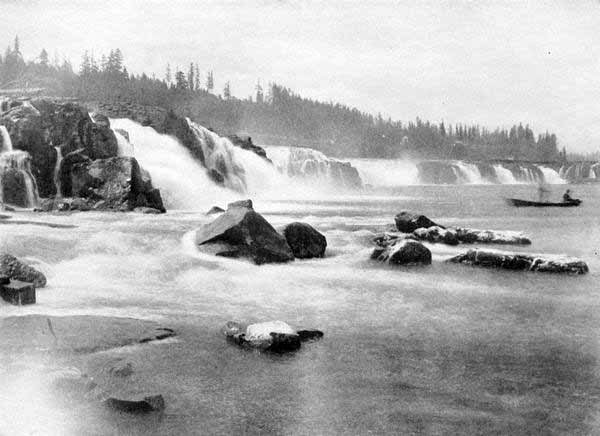
Willamette Falls, Oregon City, Ore. Photo. by E. H. Moorehouse.
We are indeed approaching Portland, the metropolis of the Columbia, the “Rose City,” in many respects the most interesting and attractive of Western cities. The approach to Portland is one hard to match for stately beauty. The city occupies both sides of the Willamette, the main business part on the west side, but the larger residence part on the east.
The first settler on the original site of Portland was a man named Overton. Lownsdale, Chapman, and Lovejoy bought him out. Then Captain John H. Couch in 1845 located a donation land claim on what is now the northern part of the west side city. At that time the site was somewhat cut up with gulches and clothed in the densest of dense forests, with perfect jungles of every species of undergrowth. But duller eyes than those of the gallant mariners, Couch, Flanders, Ainsworth, Pettygrove, and Lovejoy, could have seen beneath the tangled thickets the making of a city, though it may well be questioned whether even they, in their wildest flights of fancy, ever pictured the scene of to-day, where the city of these sixty years’ building now sits, a queen upon her circling throne of hills. The location of Portland is almost ideal. The hills to the west rise to a height of about eight hundred feet, but many fine homes are located there, and car lines cross the hills in many directions. Above the fogs and smoke these high-line homes have every possible charm. On the east side of the Willamette the land is a level bench with limitless room for expansion. There are a few picturesque elevations on the east side, as Mt. Tabor and Mt. Scott, and these have been used for homes with the taste which characterises the entire city.
Portland is the centre of every species of transportation facility. It has one of the most extensive and well-equipped electric railway systems in the United States. In addition to the urban lines, there are interurban lines in every direction, to Vancouver, Troutdale, Oregon City, Milwaukee, Hillsboro, and Salem, the last named the capital of the State and fifty miles distant. We find also that four transcontinental railroads have a terminus in Portland, the Southern Pacific, the Northern Pacific, the Union Pacific, and the Great Northern. Steamship lines run to Alaska, Puget Sound, San Francisco and other California ports, to all the coastwise ports of Oregon, to the Hawaiian Islands and the Orient, and to Mexico and South America. Sailing ships convey the products of the North-west to all the ports of the world.
As a result of these facilities for commerce we find such figures as the following: During the year 1907 there entered and cleared at Portland twelve hundred and twenty ocean-going vessels, registering more than 1,700,000 tons, net, and with a carrying capacity of 3,500,000 tons. In the cargoes of this total, were 175,000,000 feet of lumber and 18,000,000 bushels of wheat, flour included. Portland has in fact reached the front rank as a wheat and flour shipping port, being in the class with Galveston and New York, some of the time having led both of them. In December, 1907, Portland’s record of wheat shipments, exclusive of flour, was 3,000,000 bushels. The Bureau of Statistics of the Department of Commerce and Labor gave the value of all breadstuffs shipped from Portland for the eleven months ending November 30, 1907, at $10,536,234. During the same period the shipments of the same commodities from San Francisco totalled $4,143,592, while from the three Puget Sound ports of Seattle, Tacoma, and Everett, the aggregate was $13,989,178. During November, 1908, there were shipped 903,000 bushels of wheat, 180,145 barrels of flour, 209,246 bushels of barley, and 9,752,552 feet of lumber. During the year 1908 the value of wheat and flour reached a total of $18,340,405, while the lumber exports aggregated 162,089,998 feet.
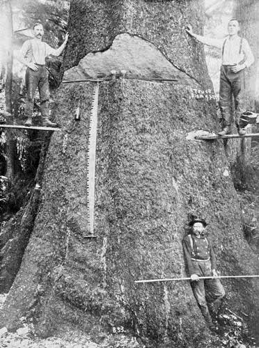
Among the Big Spruce Trees, near Astoria, Oregon. Photo. by Woodfield, Astoria.
Perhaps the most gratifying feature of the shipping trade to Portland people has been the increase in the size of ships entering the River. In 1872 the average wheat cargo exported was 33,615 bushels, while now it is four times as much. The record cargo was that of the British bark Andorinha, in the fall of 1908, 189,282 bushels. The channel from Portland to the Columbia Bar and that across the Bar have so much improved that no lightering was necessary during the year 1908, and ships of twenty-five and twenty-six feet draft have gone from Portland to the ocean without difficulty. In connection with this fact we are told that in June, 1907, the International Sailing-ship Owners’ Union abolished the differential of thirty cents per ton which had stood for some years against Portland. These conditions, together with the completion of the North Bank Railroad, by which a greatly added traffic from the Inland Empire will be turned to Portland, seem to indicate that Portland is on the direct road to a greater commercial leadership than she has yet known. The lumber industry centring in Portland is as remarkable as that of grain. Oregon’s available forests, according to Government estimates, reach a total of three hundred billion feet, board measure. It is estimated that during the years 1906-8 the lumber cut in Oregon reached about two billion feet each year, of which about one fifth was sawed in Portland. It is asserted, in fact, that Portland is the largest lumber producing city in the world. Lumbermen believe that it is only a question of a few years when Portland will cut a billion feet of lumber a year. While grain and lumber are the great articles of export from Portland, there are vast totals of fruit, hay, live-stock, dairy and poultry products, fish, and manufactured articles of many kinds.
But to the thoughtful traveller it is of more interest to see the use made of wealth than the wealth itself. Portland now contains about two hundred thousand people, said to have more per capita wealth than any other city, with two exceptions, in the United States. What are these people doing with their accumulations? For answer the traveller visits the schools, the public buildings, the churches, the stores, the places of amusement, the homes, and he finds every evidence of taste, good judgment, refinement, and artistic skill. The Portland Hotel, the Oregonian building, the Marquam Grand Theatre, the Marquam building, the Chamber of Commerce building, the Corbett block, the Wells-Fargo building, the First Congregational, Presbyterian, Catholic, and Baptist churches and Jewish Synagogue, the Union Depot, the City Hall, the City Library,—these and many other structures challenge the admiration of travellers from even the best-built cities of the East. During the year 1907, building permits were issued to an amount exceeding nine million dollars, of which nearly half was expended for dwelling houses. Portland is indeed a city of homes, and workingmen own their own houses to an unusual degree.
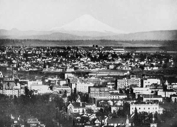
Portland in 1908. Mt. St. Helens, Sixty-five Miles Distant.
As the visitor traverses Portland’s streets, he sees amply demonstrated the propriety of the cognomen, the “Rose City.” Almost every yard boasts its roses, and on almost every porch the scarlet rambler or some other climber casts its rich colouring. Soil and climate are said to produce an ideal combination for the finest grades of roses, as well as of many other species of flowers. The Portland Fair of 1905 was the means of beautifying a section of the city near Macley Park. While most of the structures were of a temporary nature, the unique and interesting Forestry building has been left, and this is a rare attraction to the Eastern visitor. The two tasteful and significant groups of statuary, The Coming of the White Men and Sacajawea, still grace the spot where they were dedicated. Portland contains many other attractive works of art at available points. Among these is the Skidmore Fountain, on one of the most crowded thoroughfares of the city, a real gem of art.
No visitor to Portland should fail to visit the City Hall and the valuable and interesting historical collection of the Oregon Historical Society. Mr. George H. Himes, the Secretary of the Society, has devoted years to the gathering of this museum of pioneer relics. Some of them are priceless. Here is the first printing press in Oregon, used for some years by Rev. H. M. Spalding at the Nez Percé Mission. Here is Mrs. Whitman’s writing desk. Here is Captain Robert Gray’s sea-chest. The ages of discovery, of the fur-traders, of the missionaries, of the pioneers, are all lived over again in the inspection of these relics.
Probably most people who have followed the course of public thought and action in the West, if asked what agency and what man would first come into their minds at the mention of the name of Portland, would answer at once,—“The Oregonian and its editor, Harvey Scott.” This great journal and its great editor, associated together most of the time for over forty years, have indeed constituted one of the most potent forces in framing the thoughts and the institutions of the Columbia River people. It is frequently said that Harvey Scott and Henry Watterson are the only great American editors yet remaining of the old type, the type of a personal intellectual force and a public teacher. The present type of editor is rather an advertising manager than a political and social leader, a business man rather than a generator of ideas.
There are many additional features of interest in and around Portland. Whether viewed artistically, commercially, financially, socially, or historically, this fair metropolis of the Columbia River Empire is in a class by herself. Only by personal acquaintance can the student of the West satisfy himself as to Portland.
But once more we must address ourselves to the River. One may go to Astoria by rail down the southern bank, or he may, if he prefer, as we certainly do, go by water. He can go by almost every species of boat known to man, from an ocean steamship to one of the lateen-sailed fishing boats which abound on the lower River.
When we have retraced our course to the mouth of the Willamette and have again committed ourselves to the oceanward flow of the Columbia, we find a continuance of the same low, oozy, and verdant banks, the same timbered hills on either side in the middle distance, and the same dominant snow-peaks and unbroken Cascade Range in the farthest background. We pass many little towns, whose leading occupations are manifestly lumbering and fishing. We try to live over again the sensations which we think must have been felt by Lewis and Clark or Broughton, as they, first of civilised men, lifted the veil from this solitude.
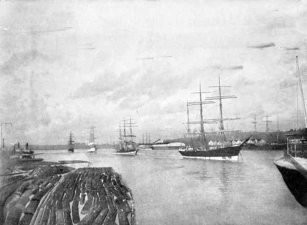
Portland Harbour, Oregon. Photo. by E. H. Moorehouse, Portland.
In this section of the River there are no stupendous pinnacles as in the Gorge of the Cascades. Yet the scenery is infinitely varied, and although less bold, it is, in its way, equally attractive with the loftier scene. One unique spot attracts the eye, and almost recalls the beauty of Rooster Rock. This is Mt. Coffin, on the Washington side, near the mouth of the Cowlitz River. This was one of the “Memaloose” or sepulture places of the Indians. There in early times their dead, in great numbers, were deposited upon platforms after the usual Indian fashion.
After passing the ingress of the Cowlitz, we find the River widening to yet grander proportions. Islands become numerous. Among these islands not a few desperate affrays and even tragedies have occurred among warring fishermen, union against non-union. Lurking among these islands, too, are numerous unlicensed vendors of spirits. In the uncertainty as to which of the States may have jurisdiction at places, these illicit traffickers move from island to island and cove to cove and one overhanging forest to another, evading officers of both States and of Federal Government alike. Sometime a novelist will be inspired with the poetry and humour and tragedy and pathos of this fisher life on the lower River, with its mingling of the life of law-breaker and desperado, and this section of our River will blossom into literature and find a place with the moonshiners of the South and the cowboys of the Rockies. All the material is ready. The River waits only for its Owen Wister or Hamlin Garland or Jack London to introduce it to the world of readers.
But the River moves and we must move with it. Many signs indicate to us that we are approaching the ocean. If we are moving in a small boat, we may pause to camp under some one of the thick-topped spruce trees whose stiff spicules pierce our unwary hands like pins. If we should spend a night we would find the water heaving and falling two, four, or five feet, with the ocean tides. Broader and broader grows the River. Numerous salmon canneries and seining stations appear. Passing a fishing village on the north bank called Brookfield, we notice a very curious rock, Pillar Rock, in the River a quarter of a mile from shore. It rises forty feet directly out of the water. We are told by one versed in Indian lore that this is the transformed body of a chief who tried to imitate the god Speelyei by wading across the River. For his presumption he was turned into a rock.
Soon after passing Pillar Rock we see the curious spectacle of a house on piles apparently right in the middle of the River. More curious still, we see horses seemingly engaged in drawing a load through the very water itself. The mystery is soon solved. The house is built on a sand-bar. It is a seining station. The horses are pulling a seine from its moorings at the point of the sand-bar to the point where its load may be discharged. Lumber, salmon, and water,—this is the world in which we now live and move and have our being.
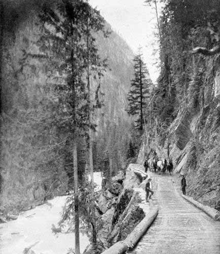
Fish River Road, in Upper Columbia Region, B. C. Photo. by Trueman, Victoria.
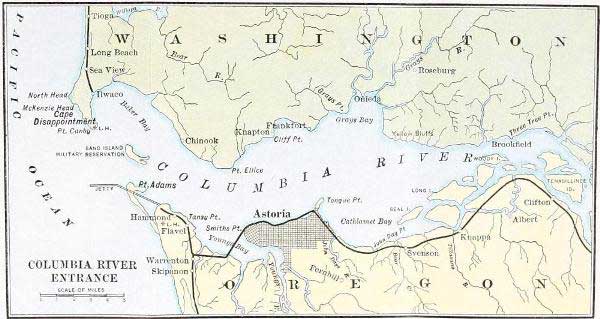
We next enter a broad expanse of the River, nine miles wide, on the north side of which is a deep cove. There is the historic spot in which Robert Gray on May 3, 1792, paused at his highest point to fill his water casks and to float the Stars and Stripes over Oregon, claimed for the United States of America. As we look westward, the headlands seem to part in front of us, and between them sky and water join. The greatest ocean is before us, though still twenty miles away. The River has reached the end of his fourteen-hundred-mile journey. Soon we pass, on the Oregon side, the bold promontory of Tongue Point, and Astoria, the second largest city on the navigable waters of the Columbia, is before us.
To the history of this oldest American town west of the Rocky Mountains we have already referred many times. Interesting in so many features of the past, Astoria is full of problems and suggestions, commercial and otherwise, for the present and the future. The city has grown slowly, always wondering why Portland should have so outstripped her. She certainly has such a location that it seems a crime not to utilise it for a great city. The River is here five miles wide. Upon its ample flood all the navies of the world might ride at anchor, sheltered from the sea by the long low sand-ridge of Point Adams. The site of the city, though somewhat rugged and broken, is entirely capable of reduction to a convenient grade, and is singularly noble and commanding. From the plateau three hundred feet high upon which the splendid waterworks are located, is a view of imposing grandeur;—River in front, dense forest to rear, with the blue saddle and pinnacled horn of Saddle Mountain,—Swallalochost in Indian speech, with its thunder-bird of native myth,—and the ocean to the west. We find Astoria to be a well-built city of about fifteen thousand permanent inhabitants, with perhaps five or six thousand more during the height of the fishing season. Almost every resource of industry offers itself in this favoured region about the mouth of the River. Though the country is densely timbered in its native state, the soil is such that when cleared it is of the finest for dairy and vegetable purposes. The mildness of the climate keeps the clover and grass green and the flowers in bloom the long year through.
As might be expected the chief industries as yet developed are lumbering and fishing. There are magnificent forests of fir, spruce, cedar, and hemlock, in all directions, while in and around Astoria there are six immense establishments for transforming the timber into merchantable lumber. This lumber aggregates something like a hundred and twenty million feet annually, and it goes to all the ports of the world. There is occasionally floated to the bar and thence to San Francisco, a log-boom chained in substantial fashion and containing several million feet of logs. Such a great boom is one of the most curious sights of the River-mouth. But transcending all else in importance at Astoria is the business of canning and drying salmon. What silver is to the Cœur d’Alene, what wheat is to Walla Walla, what apples are to Hood River, that salmon are to Astoria. The people think, act, and reason in terms of salmon. And well they may. He who has not seen Chinook salmon from the Columbia River has not seen fish. Nay, he cannot even be said to have really lived in the larger sense of the term. Take a genuine Chinook salmon of fifty or sixty pounds, caught in June, fat, rich, glistening,—but words are a mockery. Nothing but the actual experience will convey the impression. The salmon output on the River has for some years run from two hundred and fifty thousand to five hundred thousand cases per year, twenty-four cans to the case. The amount dried and smoked represents something like an equal amount. This is for the River from Astoria to The Dalles. The great bulk of this, however, is put up at Astoria or in its immediate vicinity. It is estimated that from thirty million to forty million salmon are caught yearly on the Oregon side of the lower River. This represents a value of four or five million dollars, about half of this going to the fishermen and half to the cannerymen. Some ten thousand men are engaged in fishing about the mouth of the River. These men are largely Finns, Russians, Norsemen, Italians, Sicilians, and Greeks. They have various co-operative associations and are independent of the cannerymen, to whom they furnish the fish at some stipulated price, usually five cents a pound.
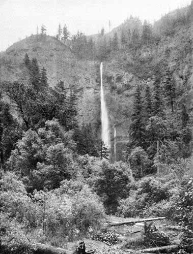
Multnomah Falls, 840 Feet High, on South Side of Columbia River about Sixty Miles above Portland. Photo. by E. H. Moorehouse, Portland.
There are many tragedies at the mouth of the River. The best fishing is just off the Bar and the best time to draw the nets is at the turn of the tide. In a fishing boat in the chill of the early morning, the fishermen will frequently become benumbed and drowsy, and will neglect the critical moment. When the tide fairly turns on the Bar it runs out like a mill race, and woe to the boat that waits too long. It goes out to sea, reappearing perhaps, bottom-up, in the course of the day, with owners and cargo gone. Some experienced men have asserted that not less than a hundred fishermen are lost every summer. Many boats are now fitted with gasoline power, and loss of life is lessened thereby.
To the visitor at the River’s mouth the fairest sight of all in connection with the fishing industry is the incoming fleet of boats in the early morning, or the outgoing fleet of evening. On a June night it scarcely grows really dark at all, and as the faint glow of the north turns at two or three o’clock into the morning flush, the lateen sails can be seen like a flock of gulls on the rim of the ocean. When the full radiance of the dawn, with its bars of carmine and saffron, has “turned to yellow gold the salt-green streams,” the fleet is within the outer headlands. Hundreds, sometimes thousands of them, a regular cloud of them, converge from all parts of the offing to the wharves of lower Astoria.
With all its benefits the fishing industry brings almost infinite trouble. The two States of Oregon and Washington never agree on laws governing the periods of lawful fishing. Sometimes Federal authorities bear a part in the imbroglio. Gill-net men, seiners, fish-trap men, union men, non-union men, local, State, and Federal officials, all combine in one great general mix-up. In the midst of the confusion the countless salmon pursue their course up the River and its tributaries in summer, back to the ocean again in autumn. The Federal Government maintains fish hatcheries on a number of streams, and from them young salmon to the number of millions are turned out each year to replenish the diminishing supply.
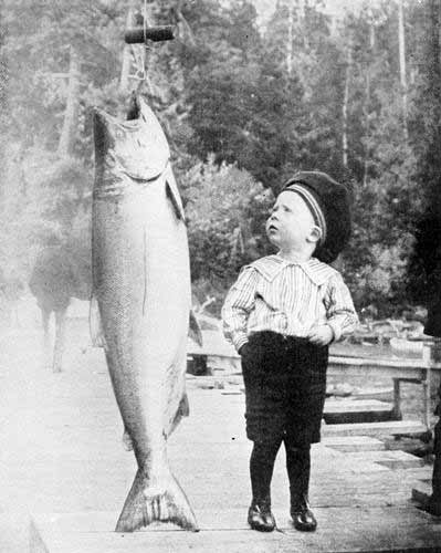
Chinook Salmon, Weight 80 Pounds. Photo. by Woodfield, Astoria.
A great and constantly growing tide of tourists from all parts of the Willamette Valley and the upper Columbia region go to Astoria during the summer. The fine steamers, T. J. Potter, Hassalo, Charles D. Spencer, and others of less size, convey these thousands of tourists to Astoria, while the railroad from Portland brings yet other thousands. From Astoria, the North Beach is reached by steamer to Ilwaco, and thence by rail to all points of the fishhook of land which extends from the northern headland of the River to the mouth of Willapa Harbour. During the season this beach is almost a continuous city from Cape Hancock to Leadbetter Point, twenty miles distant. Clatsop Beach on the south side of the River is reached by rail from Astoria. Every charm that an ocean resort can possess has been lavished on these two beaches on either side of the River. The bathing, boating, climbing, fishing, hunting, clamming, crabbing,—they are all there. To the population of that part of the River country east of the Cascades, the transition from the dust and heat of the summer to the cool and rest and freshness of the beach, with its breath from six thousand miles of unbroken sea, is almost like a change of scenes in a play. Both these beaches, especially Clatsop Beach, are the location of a rich store of Indian legend and romance. “Cheatcos” and “Skookums” haunt the forests, and the spirits of Tallapus and Nekahni and Quootshoi have been enthroned on every peak and cape.
All rivers must reach the sea, and all journeys must end. And so both our River and our journey find their end in the ocean. From Astoria we can see the outer headlands and the ocean space between. As we survey this merging of the Great River with the greater deep, our eyes turn in fancy to that clear, bright lake, fourteen hundred miles away in the snowy peaks of British Columbia, from which the River flows. And in imagination we view again the vistas of lagoons and islands, cliffs and glaciers, lakes and cañons, plains and forests, through which the Columbia takes its course, while once more the changing scenes of the historical drama associated with that splendid waterway are enacted before our eyes.
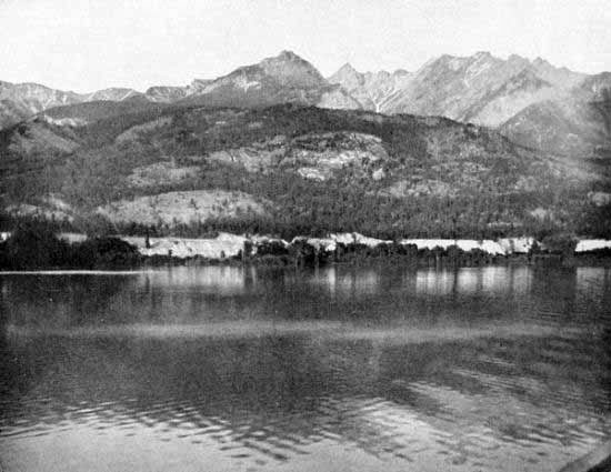
Lake Adela, near Head of Columbia River, B. C. Photo. by C. F. Yates.
But now all these scenes and vistas must be left behind, and we must pass between the capes. The long sandspit of Point Adams lies on the south, and the bold rock-promontory of Cape Hancock on the north, seven miles apart, each crowned with a lighthouse. Between them we secure a view of the great jetty in course of construction by the Federal Government. This is one of the most important improvements in connection with the River. When this work, together with the canal and locks at Celilo, is completed, the River may be regarded as really navigable on a large scale. The work on the jetty was inaugurated soon after the jetty-building by Captain Eads at the mouth of the Mississippi River had drawn the favourable attention of people and Government to this method of deepening river mouths. The jetty consists of a double line of piling, filled with rock and mattresses of woven willows. This constitutes a solid core against which the current of the River on one side piles the silt, while on the other the ocean waves pound the sand into a permanent barrier-reef. The philosophy of it is so to narrow the entrance that the accelerated current of the River will scour out the channel to an increased depth. Piles have been set in place by an ingenious system of pneumatic pipes by which compressed air bores a hole in the sand. Into this hole the pile is dropped, and the sea-waves in a moment fill in and tamp the sand around it. Thus the ocean is made to fence itself out. Upon the jetty a railroad has been built, and a train, loaded with rock and willows, runs out on this every eleven minutes for dumping material into the space between the piles. Very gratifying results have already been secured. There is now a depth of twenty-six feet on the Bar at low water. The crest of the Bar has been cut much deeper at several narrow points, and this indicates the progress that may be expected. It is hoped that the completed jetty will maintain a permanent channel of forty feet at low water. In stormy weather the work on the jetty is difficult and dangerous. The impact of the Pacific waves when lashed by a sixty-mile “sou’-wester” is something terrific. Large sections of piling have been torn out, and much loss has resulted. But patience and money triumph over all obstacles, and the work goes steadily on. Some conception of the magnitude of the commerce to be accommodated by this great work may be formed from the fact that in the year 1907 the freight handled on the lower River by both river and ocean vessels amounted to 4,251,681 tons, valued at $76,583,804. This is but a fraction of what will come with the full development of the Columbia Valley and with the needed improvements to navigation. The Federal Government maintains life-saving stations on both sides of the River. Many a tale of daring could these heroes of the beach tell, should we stop to question them.
We are at the point of the jetty. The buoys rise and fall behind us. The horrible blare of the fog-horn sounds across the thunder of the surf, as we cross the imaginary line from headland to headland. Sea-captains tell us that ten miles from the River’s mouth—so powerfully does the mighty current cleave the sea—they can dip up fresh water. But now, to west and north and south, the deep blue, though crossed by the pale green of the River water, assures us that we are fairly upon the Bar. The River of the West is all behind us. If it be very clear, we can just discern upon the horizon’s verge, cameo-like and glistening white, Mt. Hood, monarch of the Oregon Cascades, for ever standing guard over the disappearing River.
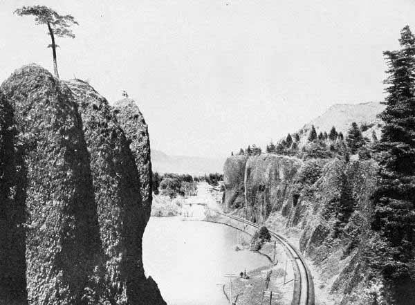
Bridal Veil Bluff, Columbia River, Ore. Photo. by E. H. Moorehouse, Portland.
As the shore line grows vague, it would not be difficult for the imagination to conjure up the navigators of the Old World who sailed these seas, then unknown seas of mystery and romance. Looming up through the ocean mists we may see strange ships and stranger crews emerge,—junks with Oriental castaways swept hither by storms and ocean currents; caravels with the dauntless sailors of the sixteenth century; buccaneers and pirates, a motley flotilla. Then the stout crafts of Drake, Behring, Heceta, Cook, Malaspina, Valdez, Bodega, Vancouver, La Pérouse; ships of discovery, of trade, of war, of adventure, of science; flags of Spain, of Russia, of Portugal, of France, of England;—on they throng from the hazy Pacific rim toward the Oregon shore. And soon we seem to see, circling around them, canoes with their red-skinned paddlers from the River’s mouth. But ships and flags, explorers and natives, fade like a dissolving view. In their place appears a gallant bark, with banner streaming free. What ship? What banner? The Columbia Rediviva, and the Stars and Stripes—the flag that still waves over the land of the Oregon.
And now our vessel rises and falls upon the long swell of the Pacific. Our journey on the Columbia River is ended, and we are upon the open sea.
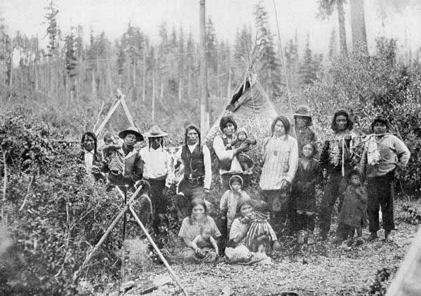
Band of Kootenai Indians, B. C. Photo. by Allan Lean, Nelson.
INDEX
A Abernethy, Clark & Co., builders of steamers on Columbia, 236 Abernethy, George, first Provisional Governor, 194 Adams, Mount, origin of, in Indian myth, 22-24; elevation of, 358; caves of, 359; sport in vicinity, 360; structure of, 361-362; storm on, 364; ascent of, 365-366; views from, 366-368 Aguilar, Martin, Spanish explorer, 44-45 Ainsworth, J. C., first captain of steamer Lot Whitcomb, 235; joins new company, 237; skill in running rapids, 243 Albatross, ship connected with Winship enterprise, 109-11 American Board of Foreign Missions undertakes work for Oregon Indians, 145 Applegate, Jesse, disasters of family on Columbia River, 174; extract from pioneer address, 178 Armstrong, Capt. F. P., trip on Kootenai River, 280-281 Arrow Lakes, steamboat journey on, 292; scenery of, 293 et seq. Arteaga, voyage on the Alaskan coast, 55 Astor, John Jacob, founder of Pacific Fur Co., 89; establishes company at Astoria, 113; his plans and mistakes, 115-116 Astoria, founding of, 120; restored to United States, 125, 182; amplitude of harbour, 389; scenery of surroundings, 390; industries of, 390-391; fishing fleets, 392; resorts adjoining, 393 Astoria and Columbia River Railroad, 362 B Baker, Dr. D. S., railroad builder, 363-364 Baker, D. S., the steamer, running the Dalles, 243 Bailey Gatzert, steamer on Columbia River, 248 Balch, Frederick, his story, The Bridge of the Gods, 22 Bancroft, H. H., discussion of loss of Tonquin, 203 Banff, attraction as a resort, 274 Bannock Indian War, 233 Barlow, S. K., building road across Cascade Mountains, 176 Barrell, Joseph, originator of fur company at Boston, 102 Bassett, W. F., first gold discovery in Idaho, 253 Bateaux, description of, 134 Baughman, Capt., pilot on Columbia and Snake Rivers, 241 Beaver, vessel of the Pacific Fur Company, 123-124 Beaver, first steamship on Columbia River, 235 Beers, Alanson, members of Executive Committee of Provisional Government, 194 “Beeswax Ship,” story of, 41-42 Behring, Vitus, explorations on Pacific Coast, 50-51 Belcher, Sir Edward, expedition to Columbia River, 164 Belle, steamer on Columbia River, 236 Benton, Thomas H., expressions in regard to Oregon, 187; special advocate for Oregon, 197 Bishop, B. B., steamboat builder on Columbia River, 235 Blakeney, Capt., in charge of steamer Isabel on Upper Columbia, 278 Blalock, Dr. N. G., connection with large enterprises, 328 Blanchet, Rev. F. N., book on Catholic Missions, 154; journey to Oregon, 155; locates in Willamette Valley, 155 Blanchet, Rev. Magloire, Catholic Mission at Walla Walla, 157 Boas, Dr. Franz, investigator of Indian legends, 35 Bodega, first voyage, 51; later voyage, 55 Bonneville, Capt. E. L. E., organises trading company, 161; makes explorations on Columbia River, 162; meets Washington Irving, 162 Bradford, Daniel, steamboat building on Columbia River, 235 Bradford & Co., steamboat line on Columbia River, 236 Broughton, Lieut. W. R., in command of the Chatham, 62; entrance of Columbia River and exploration, 66-67; erroneous statements, 67-68 Buchanan, James, course in regard to boundary of Oregon, 199 Bullfinch, account of American fur-trade, 101 Burnett, Peter, speech to immigrants, 169; governor of California, 170; opinion in regard to Provisional Government, 195 C Cabinet Rapids, 321 Cabrillo, navigator on coast of California, 43 Calhoun, John C., attitude on Oregon question, 186; peculiar situation of, 198-199 Cameahwait, chief of Shoshone Indians, meeting with Lewis and Clark party, 77; finding Sacajawea, 78 Canadian boatmen, their skill and gayety, 132-133 Canadian Pacific Railroad, route of, over Rocky Mts., 274; over Selkirks, 285-286; excellence of management, 288; steamboats on lakes, 292 Canadian Rockies, character of, and steepness of descent, 275 Canoes, 133 Cape Horn, 349 Carolina, steamer crossing Columbia Bar, 235 Cascades, a dividing line, 340; historic and physical interest of, 340; locks, 341; first notice of tide, 341; fish-wheels and spearmen, 342 Cascade Mountains, general description, 12-13; the great peaks, 13-14; valleys on east side, 14; valleys on west side, 15-16; cleft by Columbia River, 333 Cass, Senator, speech in regard to Oregon, 199 Castle Rock, unique appearance, 343; ascents of, 344; cave and arrowheads, 346 Catlin, George, account of Indians who sought “Book of Life,” 138 Cayuse War, beginning, 210; ending, 212 Celiast, Indian woman, 34 Champoeg, meetings for Provisional Government, 192-193 Chelan Lake, type of Columbian lakes, 298; first appearance, 299; glacial origin, 300; depth of cañon, 300; comparison with other scenes, 300-301; storms on, 301-302; sunset on, 303 Chemeketa, the Indian council ground, 142 Chinook wind, legend of, 24-27 Chittenden, Major H. M., book on American fur-trade, 203 Choteau, Pierre and Auguste, founding of St. Louis, 108 Christian Advocate, account of Indians looking for “Book of Life,” 137 Clark, William, lieutenant of exploring party, 73; Indians think him “medicine man,” 82; Indians looking for “Book of Life,” 136-137 Clarke, Gen. N. S., in command of Columbia, 224 Clatsop Plains, favourite resort of Indians, 34 Clay, Henry, attitude on Oregon question, 186 Coe, Capt. Lawrence, building steamer Colonel Wright, 235; account of first trip on upper Columbia and Snake Rivers, 243-244 Cœur d’Alene, Lake, as a resort, 297; its mines, 298 Colleges founded as result of missions, 157 Colonel Wright, the steamer, on upper Columbia, 235; makes first trip on upper rivers, 243-244 Columbia Basin, forces that wrought it, 6-7; general description, 10-15; climate, 17-18 Columbia River, many names, 3; early attracts attention, 4; connection with Kootenai River, 11; tomanowas bridge, 21; damming at Cascades, 21-22; discovery by Heceta, 55; discovered and named by Robert Gray, 64; results of discovery, 65; first navigation by Lewis and Clark party, 82; falls passed by party, 83; submerged forests, 84; descent by Lewis and Clark, 84-85; first sight by Hunt’s party, 95; Tonquin on bar, 117; forts on, 129-131; crossing of Bar by the ship, L’Indefatigable, 156; descent by immigrants of 1843, 172-174; description of Bar by Provost, 184; massacres upon, by Indians, 221; steamboat business, 239 et seq.; first steamboats on lower part, 235; on upper part, 243; railroads along, 261-262; navigability of, 266; prospective traffic of, 267-269; character above Golden, 278 et seq.; character below Golden, 285; lakes of, 291 et seq.; from Robson to Kettle Falls, 296; from Kettle Falls to Wenatchee, 298; rapids and shores from Wenatchee to Pasco, 321; irrigating enterprises, 323-324; between Pasco and The Dalles, 328-329; canal, 330; section beginning at The Dalles, 234-236; peculiar character at Cascades, 239; tomanowas bridge, 340; compared with other scenes, 350; appearance below Rooster Rock, 374; between Portland and the ocean, 387-389; farewell to, 396 Columbia River Navigation Co., 237 Columbia, the steamer, on River, 235 Condon, Professor Thomas, geological theories, 5 Cook, Capt. James, journey on Oregon coast, 55; death, 56 Cortereal, Gaspar, Straits of Anian, 43 Coxe, account of fur-trade, 100 Coyote god, fight with Kamiah monster, 19-21 Coyote Head, 337 Crooks, Ramsay, partner of Pacific Fur Co., 89; hard experience with Indians, 96 Culliby Lake, 42 Cultee, Charley, Indian story teller, 35 Curry, Governor, calling for volunteers, 221 D Dalles, The, historical interest of, 330; varied resources of, 330-331; scenery, 331 Day, John, treatment by Indians and death, 96-97 Dayton, Congressman, expressions about Oregon, 187 Dawson, Professor, explanation of sources of Columbia, 278 De Haro at Nootka, 55 De May in battle of Pine Creek, 227 Demers, Rev. Modest, missionary to Indians, 155 De Smet, Rev. Pierre J., books on Catholic missions, 154; in Northern Idaho, 155; in Europe for reinforcements, 156; crossing Bar, 156 Disoway, G. P., account of Indians who sought “Book of Life,” 137 Dixson, figures on profits of fur-trade, 102 Donation Land Law attracts immigration, 177 Dorion, Madame, desperate situation in Blue Mountains, 126 Drake, Francis, explorations, 44 E Eagle, steamer above Cascades, 235; rescuing victims of Indian war, 236 Edwards, Rev. P. L., associate missionary, 141 Eells, Rev. Cushing, missionary to Oregon Indians, 151; locating at Tshimakain, 152 Elliott, S. G., first railroad surveys, 259 England, difficulty with Spain over Nootka Sound, 62 F Farnham, T. J., in command of Peoria party, 164; history of Oregon and California, 164 Ferrelo, explorations on the coast, 43 Field, mountain resort, 276 Fiske, Wilbur, leading missionary movements, 140 Florida Treaty with Spain, 184 Fonte, extravagant stories, 46 Fort Clatsop built by Lewis and Clark, 85 France, assistance to American colonies, 50 Franchère, Gabriel, history of Pacific Fur Co., 118; founding of Astoria, 120; account of destruction of Tonquin, 203 Fuca, Juan de, 44 Fur-trade, beginnings, 56-57; on Oregon coast, 60-61; connection with discoveries, 89; historical importance, 99; financial profits of, 103 G Gale, Joseph, building of Star of Oregon, 166; sails to California, 167; on Executive Committee of Provisional Government, 194 Gale, William, on ship Albatross, 109; extract from journal, 113 Galiano, voyage around Vancouver Island, 55 Garnett, Major, in Yakima War, 225 Gaston, Lieutenant, in battle of Pine Creek, 226 Gervais, Joseph, location in Oregon, 142 Ghent, Treaty of, 182 Gilliam, Cornelius, in Cayuse War, 201 Glacier, Canadian resort, 286-287 Glacier Lake, 310 Glacier Peak, 311 Golden on Columbia River, 277 Grande Ronde Valley, first view by Hunt Party, 94 Grant, Captain, attempting to keep back American immigration, 171 Gray, Capt. Robert, in command of Lady Washington, 60; as a fur-trader, 61; discovers Columbia River, 64 Gray, W. H., history of Oregon, 147; characteristics, 149; four sons, 149; estimate of population, 188; in Provisional Government, 190-191; steamboat enterprises, 241; adventure on Snake River 241 Gray, Capt. Wm. P., story of ascent of Snake River, 241; trip down Snake River, 247 Great Britain, claims to Oregon, 180-181 H Halhaltlossot, or Lawyer, 151 Hallakallakeen (Joseph), summer camp, 297 Hard winter of 1861, 257 Hassalo, the steamer, 235-237 Hassalo, No. 2, 248 Hathaway, Felix, building schooner, Star of Oregon, 166 Heceta, first voyage, 51; discovery of Columbia River, 52-54 Henry, Andrew, trading post on Snake River, 108-109 Hickey, Capt. F., at restoration of Astoria, 125 Hill, David, on Executive Committee of Provisional Government, 194 Hill, J. J., railroad builder, 262 Holladay, Ben, president of Oregon Central Railroad, 259 Holmes, Oliver W., quotation, 275 Hood, Mount, origin of, in Indian myth, 22-24; first appearance of, 333; elevation, 354; approach to, 354; Cloud Cap Inn, 355; view from, 356; historic character of view, 357; appearance from La Camas, 376 Hood River and Valley, appearance and productions of, 238 Howard, General O. O., in Nez Percé War of 1877, 230; description of Joseph, 231 Hudson’s Bay Company, organisation of, 104; joined with North-western Fur Co., 107; forts, 128 et seq.; boats and boatmen, 131-134; policy toward Americans, 150-153; attitude toward Provisional Government, 192, 195; treatment of Dr. McLoughlin, 196 Hunt, Wilson P., forms land division of Pacific Fur Co., 89; leader in journey, 92 et seq. I Idaho, name of, 32; reached by Lewis and Clark, 79-81; first steamboat, 235; gold discoveries, 252 et seq.; university, 315; irrigation systems, 317 Illecillewaet River, 287 Immigration of 1843, beginnings, 168; at Fort Hall, 171; constructing flatboats on Columbia, 173; disasters on River, 174-175; succoured by Dr. McLoughlin, 176; settlement in Willamette Valley, 176 Indians, sad history, 18; myths, 19 et seq.; names, 31-32; traders in furs, 103 Indians’, the three Nez Percé, quest for the “Book of Life,” 139 Indian War of 1855, beginning, 219; battle at Walla Walla, 221; unsatisfactory end, 224 Indian War of 1858, 225 et seq. Inland Empire, origin, 6; general description, 14 Intelligencer, National, expressions in regard to Oregon, 187 Irving, Washington, author of Astoria, 113 J Jason P. Flint, steamer on Columbia, 235 Jefferson, Thomas, connection with Pacific Coast, 69-70; organisation of Lewis and Clark expedition, 72-73; instructions to party, 74 Jenny Clark, steamer on Willamette, 236 Jetty, at mouth of River, construction, 395; prospective results, 396 Joint Occupation Treaty, 134 Joseph, Indian chief, in Walla Walla council, 217-218 Joseph (Hallakallakeen), in great war of 1877, 229; captured, 231; later life and character, 232 Joseph War of 1877, 229 et seq. K Kamiah monster, myth of, 19-21 Kamiakin, Yakima chief, 213; at Walla Walla Council, 214; conspiracy to kill Governor Stevens, 216; description of by Stevens, 216; breaking up of treaties, 218; new force of warriors, 220; apparent success, 224 Kamm, Jacob, engineer on steamer Lot Whitcomb, 235 Keith, J., at restoration of Astoria, 125 Kelley, Hall J., home and character, 159; expedition to California and Oregon, 160; return to New England, 161 Kelley, Col. J. K., in battle of the Walla Walla, 221 Kendrick, Capt. John, in command of the Columbia Rediviva, 60; in fur-trade, 61 Kettle Falls, historic interest, 296 Kennewick, 227 Kicking Horse River (Wapta), origin of name, 277 Kilbourne, Ralph, builder of Star of Oregon, 166 Kimooenim River, or Snake River, first view by Lewis and Clark party, 81 Kip, Lieutenant, account of Walla Walla Council, 214-215 Klickitat Indians, legends, 28-30; atrocities of, at Cascades, 221 Kobaiway, Indian chief, 35 Konapee, story of, 37-39 Kooskooskie River, discovered by the Lewis and Clark party, 79; navigation on, by Lewis and Clark party, 81 Kootenai River, character of navigation, 280-281; Bonnington Falls of, 294 Kootenai Lake, description of, 295-296; sporting on, 296 L La Camas, paper mill, 375 Ladd, Carrie, steamer on Willamette, 236 Lamazee, or Lamazu, brings news of destruction of Tonquin, 123 Lark, wreck of, 124 Lausanne, Methodist mission ship, 142 Lawyer, Indian chief favourable to whites, 214-216 Le Breton, G. W., part in founding Provisional Government, 192 Ledyard, John, connection with Jefferson, 70; comprehension of fur-trade, 101 Lee, Rev. Daniel, missionary to Indians, 141; mission at The Dalles, 142 Lee, Rev. Jason, missionary to Indians, 140; locating mission at Chemawa, 142; in the East for reinforcements, 142; death, 143; connection with Ewing Young, 144; memorial to Congress, 144; influence, 145; lecture at Peoria, 163; chairman of meeting of settlers, 189 Lewis and Clark expedition, its inception by Jefferson, 71; summary by Captain Lewis, 87; mention of, by Jefferson, 88 Lewis, Jo, part in Whitman massacre, 206 Lewis, Meriwether, selection by Jefferson for leader of party, 72; description of crossing Divide, 75 Lewiston, founding of, 245 Linn Senator, presenting memorials to Congress, 189; his death, 197 Lisa, Manuel, organises the Missouri Fur Company, 108 Looking Glass, famous speech, 215 Lot Whitcomb, the steamer, on Columbia River, 235 Louise, Lake, beauties of, 274 Louisiana Purchase, significance, 71 M Macbeth, Miss Kate, opinion about Indians who looked for “Book of Life,” 136-137 Mackenzie, Alexander, expedition to Pacific Coast, 71; journey to the Arctic Ocean, 106; reaches Pacific Ocean, 106 McBean, Wm., account of Walla Walla Council, 217 McCellan, Robert, partner of Pacific Fur Company, 89 McClellan, Geo. B., assists Stevens in reconnaissance for Pacific Railroad, 260 McDougall, Duncan, smallpox bottle, 122; marries daughter of Comcomly, 122; sells out Company, 124 McKay, Dr. W. C., physician at Pendleton, 319 McKenzie, Donald, partner of Pacific Fur Company, 89; leads division of party, 92; sells out Company, 124 McKinley, Allen, building of steamer on Columbia, 235 McLoughlin, Dr. John, as factor of Hudson’s Bay Company, 130; reception of Methodist missionaries, 141; meets the Whitman party of missionaries, 150; connection with building Star of Oregon, 166; sees approaching success of Americans, 167; stories connecting him with Americans, 168; account of Provisional Government, 195; becomes an American citizen, 196; land troubles, 196; sadness of old age, 196; summary of character, 197 Maldonado, extravagant stories, 46; map, 48 Maquinna, Indian chief, 202 Martinez, voyage on coast of Oregon, 55 Mary, steamer on Upper Columbia, 235; rescues victims of Indian war, 236; on her regular route, 237 Mazama Club, influence of, 353 Meares, Capt. John, English explorer, 44; voyages to Oregon Coast, 58; at mouth of Columbia, 59-60 Meek, Jo, part in founding Provisional Government, 192 Memaloose Island, 337 Miller, Joseph, partner of Pacific Fur Company, 89 Minto, John, account of founding of Provisional Government, 190 Montcachabe, Indian who first crossed the continent, 70 Moody, Mary, steamer, first steamer on Pend Oreille Lake, 245 Moody, Z. F., builds steamer, 245 Moorehouse, Major Lee, Indian photographer, 320 Morigeau, Baptiste, pioneer on Lake Windermere, 283 Moscow, site of University of Idaho, 315 Moses, Indian chief, 297 Mountain Buck, steamer on Columbia, 236 Mountaineers’ Club, purpose and location, 353 Mowry, Wm., report of speech by Nez Percé Indian, 139 Multnomah, steamer on Columbia, 236 Multnomah Falls, 348 N Nekahni, Mt., location of, 33; beauty of, 39; the “treasure ship,” 40-41 Nelson, metropolis of the Kootenai, 294; fruit industries of, 294; mines of, 295; transportation of, 295 Nesmith, J. W., extract on immigration of 1843, 169; account of Indian guide, Sticcus, 172; in Indian War of 1855, 221 Nez Percé Indians, origin of, 21; first meeting with Lewis and Clark party, 80; looking for “Book of Life,” 137 Nootka Sound, discovery of, 51; important centre, 55; as a cause of dispute between England and Spain, 62 North Bank Railroad, 262; cost of, 377; bridge, 377 North-west Fur Company, organisation, 105; unites with Hudson’s Bay Company, 107, 128; in possession of Columbia Basin, 125 O Oak Point founded by Winship brothers, 110 Ogden, Peter Skeen, ransoms survivors of Whitman massacre, 207 Okanogan, the steamer, first to run Tumwater Falls, 242 Okanogan Indians, story of, 284-285 Oneonta Gorge, 347 Oregon, name of, 31 Oregon Question, its complicated and momentous character, 200 Oregon Railroad and Navigation Co. organised, 246 Oregon Short Line Railroad, 262 Oregon Steam Navigation Co. organised, 237; development of business, 238; its portages, 238; sells out, 246 Oregon Transportation Co. organised, 237 Oregonian, newspaper, influence of, 386 Osborne, Mr., escape from Whitman massacre, 207 P Pacific Fur Co., organisation of, 89; its dissolution, 125 Paha Cliffs, 336 Pakenham, British envoy, and his course in regard to Oregon, 199-200 Pambrun, Pierre, instructed Indians in Catholic faith, 137 Parker, Rev. Samuel, in Oregon to investigate condition of Indians, 145; his traits, 146; book, 146 Pasco, lands around, 326; prospects of, 327 Patriot, Illinois, report of the Indians looking for “Book of Life,” 137 Peacock, ship of Wilkes Expedition lost on Columbia Bar, 165 Pearce, E. D., connection with discovery of gold in Idaho, 252 Pearson, express rider, rides to notify Stevens of Great Yakima War, 219-220 Pendleton, its industries and some of its citizens, 319-320 Peoria party of immigrants, 163 Perez, voyage of, 51 Perkins, Rev. H. K. W., mission at The Dalles, 142 Peupeumoxmox, Indian chief in war of 1855, 213; leads force to Walla Walla, 214; killed, 221 Polk, President, management of Oregon Question, 199-200 Poppleton, Irene Lincoln, article in Oregon Historical Quarterly, 237 Portland developed by discovery of gold in California, 251; location, 381; transportation facilities, 382; commerce, 382-383; buildings, 384; artistic character of, 385; Historical Society, 385-386 Potter, T. J., steamer on Columbia, 248 Priest Rapids, character of, 322; origin of name, 322; power for pumping, 324 Provisional Government, origin of, 190-192; organisation of, 193; officers of, 194; state house for, 194 Provost, J. B., at restoration of Astoria, 125; agent of United States for receiving Astoria from Great Britain, 182; describes Columbia Bar, 182-183 Pullman, site of State College, 315 R Raccoon, British man-of-war at Astoria, 124 Railroad Creek, scenery about, 309-310 Rainier, Mt., origin of name, 32 Rector, Wm., road across Cascade Mountains, 176 Revelstoke, character as a junction, 292 Rock Island Rapids, 321 Roosevelt, Theodore, view of Calhoun’s policy in regard to Oregon, 198; reference to Columbia River, 246 Rooster Rock, appearance of, 349-350; River below, 375 Rosalia, monument of Steptoe, 315 Ross, Alexander, adventure in Yakima country, 126-127; narration of profits in fur-trade, 131; on blowing up of Tonquin, 203 Ruckle and Olmstead put steamer on Columbia, 236 Russia, entrance upon American exploration, 50-51 S Sacajawea, with Lewis and Clark party, 75; sees the whale, 85; finds her brother, Cameahwait, 78 St. Helens, Mt., origin of, in Indian myth, 22-24 St. Joe River, its beauties, 297 St. Peter’s Dome, 346 Salmon River, Lewis and Clark party at the head of, 79 Saltese, Cœur d’Alene chief, 226 San José, ship connected with Indian story, 42 Scott, Harvey, character and influence as an editor, 386 Sea-otter, importance in the fur-trade, 100 Señorita, steamer on Columbia, 236 Shakspere, his location of Caliban and Ariel in the Far West, 47 Shaw, Col. B. F., battle of Grande Ronde, 222 Shepard, Rev. Cyrus, missionary to Indians, 141 Sheridan, battle at Cascades, 22 Shoshone Indians, meeting with Lewis and Clark party, 76-78 Shuswap Indians, story of, 284-285 Sierra Nevada, the steamship, its cargo of treasure, 239 Simpson, S. L., extract from poem of, 380 Smith, Rev. A. B., minister to Oregon Indians, 151; at Kamiah, 152 Smith, J. C., connection with gold mines in Idaho, 253 Smith, Jedediah, American trapper thought to have taught religion to Indians, 137 Smith, William, mate on Albatross, 109 Snake River, orchards of, 316; heat, 317; irrigation systems of, 317; Shoshone Falls of, 317 Snow-peaks, general group of, 353; zones of, 370-372 Snickster, adventure in Steptoe expedition, 228 Sowles, Capt. Cornelius, character of, 116 Spain, connection with Oregon exploration, 48; downfall, 48-49; settlement of California, 49; favouring conditions for exploration, 50; conflict with England over Nootka, 62; character of claims to Oregon, 180 Spalding, Rev. H. H., in Oregon as missionary, 147; his traits of character, 148; among Nez Percés, 151; first printing press west of Rocky Mountains, 152 Spalding, Mrs. H. H., characteristics, 148 Speelyei, Indian god, struggle with Wishpoosh, 8-9; creates Indian tribes, 9 Spencer Chas. D., steamer on Columbia, 248 Spokane, remarkable character as a city, 315; water power of Falls, 315; grandeur as spectacle, 315; railway system, 316 Spokane House, location of, 315 Spotted Eagle, remarkable speech, 223 Star of Oregon, schooner built on Willamette River, 166; trip to San Francisco, 167 Stark, Benjamin, in steamboat business, 236 Statesman, Washington, extracts in regard to Idaho mines, 255-256 Stehekin River, cañon of, 303; Rainbow Falls of, 305; Horseshoe Basin of, 306 Steptoe, Col. E. J., dissension with Stevens, 223; fort at Walla Walla, 224; disastrous expedition to Spokane, 225 et seq. Stevens, Hazard, account of Walla Walla Council, 215 Stevens, I. I., appointed Governor of Washington, 213; makes treatise, 213; Council at Walla Walla, 214; goes to northern country to make treaties, 215; describes Kamiakin, 216; makes treaty with Flatheads, 218; returns to Olympia, 221; organises volunteers, 222; second Council at Walla Walla, 222; trouble with Steptoe, 223; trouble with Wool, 224; battle at Walla Walla, 224; reconnaissance for railroad in 1853, 260 Sticcus, Indian guide of immigrants, 172; tries to save the Whitman Mission, 206 Stuart, David, founding of Fort Okanogan, 121 Stump, Capt. T. J., on first steamer down Tumwater Falls, 242 Sturgis, profits of fur-trade, 103 Sutter, Captain, connection with discovery of gold, 250 Swan, data on income of furs, 103 Swift, Jonathan, placing of Gulliver near the coast of Oregon, 47 T “Takhoma, Mt.,” origin of name, 32 Tallapus, Indian deity, 33 Tamahas, part in Whitman massacre, 206, 212 Tamsaky, in Whitman massacre, 206; killed, 212 Taylor, Captain, part in battle of Pine Creek, 226 Telaukait, part in Whitman massacre, 206 Tenino, the steamer, value of its business, 239 Tetons, Three, first seen by Hunt party, 81 Thompson, David, crossing the continent, 106; at Astoria, 121; remains of his fort on Lake Windermere, 282 Thompson, R. R., builds steamer Colonel Wright, 235 Thorn, Jonathan, disposition as captain of Tonquin, 116; tyrannical course in entering Columbia River, 117-118 Thornton, J. Quinn, description of Oregon State House, 194 Timothy, Nez Percé Indian guide to Steptoe’s command, save command, 226-227 Tonquin, fitting out for Astoria, 117; entrance of Columbia River, 118-119; destroyed by Indians, 124; account of capture, 203 Touchet Valley, adaptability to orchards, 325 Trappers, two general classes of, 90 Treaty with England in regard to Oregon, 200 Trevett, Vic, tomb of, 337 Troup, Capt. James, skill in running rapids, 242; on D. S. Baker over The Dalles, 243 U Umatilla Plains first seen by the Hunt expedition, 94 Umatilla Rapids, singular character of, 328 Union Transportation Co. organised, 237 United States, character of claims to Oregon, 181; notifies Great Britain to regain Astoria, 182 V Valdez, circumnavigation of Vancouver Island, 55 Vancouver, Capt. George, as English commissioner, 62; equipment for exploration, 62; at mouth of Columbia River, 63; meets Gray, 63; at Columbia Bar, 66 Vancouver Island, location of important explorations, 56-57 Vancouver, Fort, its condition as a Hudson’s Bay post, 128-129 Vancouver, city of historic interest, 376; scenery, 377 Venture, the steamer, carried over Cascades, 236 Verendrye, first European to enter Rocky Mountains, 70 Villard, Henry, first arrival in Oregon, 260; railroad on Columbia River, 261; financial disasters, 261 Vizcaino, commander of Spanish fleet of exploration, 44 Von Holst, opinion in regard to Calhoun’s management of the Oregon matter, 198 W Walker, Rev. Elkanah, missionary to Oregon Indians, 151; at Tshimakain, 151 Walker’s Prairie, location of first church, 315 Walker, Wm., account of Indians who sought the “Book of Life,” 137 Walla Walla, Fort, arrival at, by immigrants of 1843, 173 Walla Walla City, historic nature of, 318; appearance and surroundings, 318; Whitman Mission, 318 Walla Walla Council of Stevens with Indians, 213 et seq. Wallowa Lake, beauty and historic interest of, 320 Wallula, 328 Wapatoo Island, first seen by Lewis and Clark party, 86; description of, 378 Wapta River, 277 Wasco, steamer built on Columbia, 235; rescues victims of Indian War, 236; under new management, 237 Washington, State, evidences of development, 314 et seq.; views of, from Mt. Adams, 366 et seq. Washington Territory, created by Congress, 212; volunteers for Indian War, 222 Washougal, historic interest of, 375 Webster, Daniel, attitude on Oregon question, 186-187; inclined to yield to England, 197 Wehatpolitan, story of, 345 Wenatchee, interest as an irrigated region, 314 Whitcomb, Lot, builds steamer of same name, 235 White, Dr. Elijah, in Oregon in 1837 as Indian agent, 142 White, Capt. Lew, commands steamer Colonel Wright on trip up Columbia, 243-244; launches steamer Forty-nine on Columbia, 245 Whitman, Dr. Marcus, entrance upon work for Oregon Indians, 145; popularity with trappers, 146; return to New York, 146; marriage and return to Oregon, 147; his appearance and character, 147; getting waggon across continent, 150; among Cayuses, 151; conception of value of Oregon, 153; journey in midwinter to St. Louis, 154; helps organise immigration of 1843, 168; guides immigrants, 171; doctors Indians for measles, 205; assassinated, 206; connection with Dr. McLoughlin, 196 Whitman, Mrs. Narcissa, appearance and qualities, 147; her death, 207 Whitman massacre, 206-208 Whitman College, 319 Whitman County, agricultural resources of, 316 White Salmon River and Valley, 338 Wilkes, Lieut. Chas., commands expedition to Columbia River, 165; establishes idea of unity of Pacific Coast, 165; assists in equipping schooner Star of Oregon, 160; advice to settlers about a government, 190 Willamette River, scenery around mouth, 378; tributaries and Valley, 380; apostrophe to, by S. L. Simpson, 380 Willamette Valley, general view, 15 Willamette University grows out of mission to Indians, 143 Williams in the Steptoe retreat, 228 Windermere Lake, 280 Winship brothers, project for trading company on Columbia River, 109-113 Wishpoosh, the Beaver, Indian legend, 8 Wool, Gen. J. E., discord with Stevens, 222, 224 Wright, Colonel, campaign against Spokane Indians, 225, 229 Wyeth, Nathaniel, takes Methodist missionary party across continent in 1834, 141; commendation by Lowell, 162; plans great enterprise on Columbia, 162; builds fort at mouth of Willamette, 163; attracts attention to Oregon, 163 Y Yakima Valley, productive capacity of, 325 Yaktana, Indian chief in adventure with Ross, 127 Young, Ewing, in California, 160; drives cattle to Oregon, 161; death of, 189 Z Zaltieri, map of America, 47
Larger Image
Larger Image
American Waterways
The Romance of the Colorado River
The Story of its Discovery in 1540, with an account of the Later Explorations, and with Special Reference to the Voyages of Powell through the Line of the Great Canyons.
By Frederick S. Dellenbaugh
Member of the United States Colorado River Expedition of 1871 and 1872
435 pages, with 200 Illustrations, and Frontispiece in Color. $3.50 net
“His scientific training, his long experience in this region, and his eye for natural scenery enable him to make this account of the Colorado River most graphic and interesting. No other book equally good can be written for many years to come—not until our knowledge of the river is greatly enlarged.”—The Boston Herald.
“Mr. Dellenbaugh writes with enthusiasm and balance about his chief, and of the canyon with a fascination that make him disinclined to leave it, and brings him thirty years later to its description with undiminished interest.”—New York Tribune.
The Ohio River
A COURSE OF EMPIRE
By Archer B. Hulbert Associate Professor of American History, Marietta College, Author of “Historic Highways of America,” etc.
390 pages, with 100 Illustrations and a Map. $3.50 net
An interesting description from a fresh point of view of the international struggle which ended with the English conquest of the Ohio Basin, and includes many interesting details of the pioneer movement on the Ohio. The most widely read students of the Ohio Valley will find a unique and unexpected interest in Mr. Hulbert’s chapters dealing with the Ohio River in the Revolution, the rise of the cities of Pittsburg, Cincinnati, and Louisville, the fighting Virginians, the old-time methods of navigation, etc.
“A wonderfully comprehensive and entirely fascinating book.”—Chicago Inter-Ocean.
Narragansett Bay
Its Historic and Romantic Associations and Picturesque Setting
By Edgar Mayhew Bacon Author of “The Hudson River,” “Chronicles of Tarrytown,” etc.
340 pages, with 50 Drawings by the Author, and with Numerous Photographs and a Map. $3.50 net
Impressed by the important and singular part played by the settlers of Narragansett in the development of American ideas and ideals, and strongly attracted by the romantic tales that are inwoven with the warp of history, as well as by the incomparable setting the great bay affords for such a subject, the author offers this result of his labor as a contribution to the story of great American Waterways, with the hope that his readers may be imbued with somewhat of his own enthusiasm.
“An attractive description of the picturesque part of Rhode Island. Mr. Bacon dwells on the natural beauties, the legendary and historical associations, rather than the present appearance of the shores.”—N. Y. Sun.
The Great Lakes
Vessels That Plough Them, Their Owners, Their Sailors, and Their Cargoes; together with A Brief History of Our Inland Seas
By James Oliver Curwood
With about 80 Full-page Illustrations, $3.50 net
This profusely illustrated book, as entertaining as it is informing, has the twofold advantage of being written by a man who knows the Lakes and their shores as well as what has been written about them. The general reader will enjoy the romance attaching to the past history of the Lakes and not less the romance of the present—the story of the great commercial fleets that plough our inland seas, created to transport the fruits of the earth and the metals that are dug from the bowels of the earth. To the business man who has interests in or about the Lakes, or to the prospective investor in Great Lakes enterprises, the book will be found suggestive. Comparatively little has been written of these fresh-water seas, and many of his readers will be amazed at the wonderful story which this volume tells.
The St. Lawrence River
Historical—Legendary—Picturesque
By George Waldo Browne Author of “Japan—the Place and the People,” “Paradise of the Pacific,” etc.
385 pages, with 100 Illustrations and a Map. $3.50 net
While the St. Lawrence River has been the scene of many important events connected with the discovery and development of a large portion of North America, no attempt has heretofore been made to collect and embody in one volume a complete and comprehensive narrative of this great waterway. This is not denying that considerable has been written relating to it, but the various offerings have been scattered through many volumes, and most of these have become inaccessible to the general reader.
This work presents in a consecutive narrative the most important historic incidents connected with the river, combined with descriptions of some of its most picturesque scenery and delightful excursions into to its legendary lore. In selecting the hundred illustrations care has been taken to give as wide a scope as possible to the views belonging to the river.
The Niagara River
By Archer Butler Hulbert Professor of American History, Marietta College; author of “The Ohio River,” “Historic Highways of America,” etc.
350 pages, with 70 Illustrations and Maps. $3,50 net
Professor Hulbert tells all that is best worth recording of the history of the river which gives the book its title, and of its commercial present and its great commercial future. An immense amount of carefully ordered information is here brought together into a most entertaining and informing book. No mention of this volume can be quite adequate that fails to take into account the extraordinary chapter which is given to chronicling the mad achievements of that company of dare-devil bipeds of both sexes who for decades have been sweeping over the Falls in barrels and other receptacles, or who have gone dancing their dizzy way on ropes or wires stretched from shore to shore above the boiling, leaping water beneath.
The Hudson River
FROM OCEAN TO SOURCE
Historical—Legendary—Picturesque
By Edgar Mayhew Bacon Author of “Chronicles of Tarrytown,” “Narragansett Bay,” etc.
600 Pages, with 100 Illustrations, including a Sectional Map of the Hudson River. $3.50 net
“The value of this handsome quarto does not depend solely on the attractiveness with which Mr. Bacon has invested the whole subject, it is a kind of footnote to the more conventional histories, because it throws light upon the life and habits of the earliest settlers. It is a study of Dutch civilization in the New World, severe enough in intentions to be accurate, but easy enough in temper to make a great deal of humor, and to comment upon those characteristic customs and habits which, while they escape the attention of the formal historian, are full of significance.”—Outlook.
The Connecticut River AND THE Valley of the Connecticut
THREE HUNDRED AND FIFTY MILES FROM MOUNTAIN TO SEA
Historical and Descriptive
By Edwin Munroe Bacon Author of “Walks and Rides in the Country Round About Boston,” etc.
500 Pages, with 100 Illustrations and a Map. $3.50 net
From ocean to source every mile of the Connecticut is crowded with reminders of the early explorers, of the Indian wars, of the struggle of the Colonies, and of the quaint, peaceful village existence of the early days of the Republic. Beginning with the Dutch discovery, Mr. Bacon traces the interesting movements and events which are associated with this chief river of New England.
The Columbia River
Its History—Its Myths—Its Scenery—Its Commerce
By William Denison Lyman Professor of History in Whitman College, Walla Walla, Washington
Fully Illustrated
This is the first effort to present a book distinctively on the Columbia River. It is the intention of the author to give some special prominence to Nelson and the magnificent lake district by which it is surrounded. As the joint possession of the United States and British Columbia, and as the grandest scenic river of the continent, the Columbia is worthy of special attention.
In Preparation:
Each will be fully illustrated and will probably be published at $3.50 net
1.—Inland Waterways By Herbert Quick
2.—The Mississippi River By Julius Chambers
3.—The Story of the Chesapeake By Ruthella Mory Bibbins
4.—Lake George and Lake Champlain By W. Max Reid Author of “The Mohawk Valley,” “The Story of Old Fort Johnson,” etc.