Chapter II · THE OASES OF THE NORTH-WEST AND PASTORAL LIFE IN THE SCRUB
Reading edition
The inhabited zones of the Andes in the north-west—Valles, Quebradas, Puna—The irrigation of the valles—The historic routes—Convoys of stock—The breeding of mules and the fairs—The struggle of the breeders against drought—The Sierra de los Llanos.
The whole life and wealth of the arid provinces of north-western Argentina depend upon irrigation; the water-supply definitively settles the sites of human establishments. The water resources are irregularly distributed. They are especially abundant in the south (San Juan, Mendoza, and San Rafael), where the torrents of the Cordillera are fed by the glaciers, and on the outer fringe of the hills above the Chaco, at the foot of Aconcagua, which gathers masses of cloud and rain on its flanks (Tucumán). In the intermediate district, on the contrary, in the regions of La Rioja and Catamarca, and in the interior of the hilly zone to the north-west of Tucumán, the amount of available water is small; the oases shrink into small spots far removed from each other.
This natural inequality was not felt at first. For a long time the spread of cultivation and the progress of wealth were restricted only by the scarcity of population, the difficulties of transport, and the inadequacy of the markets. The best endowed oases paid no attention to the surplus supply of water, for which they had no use. We have to come down to the close of the nineteenth century to find men reaching the limits which nature has set to colonization, and mapping out their domain. It is not until then that La Rioja ceases to compete with Mendoza, or Catamarca with Tucumán. While large industrial enterprises develop at Mendoza and Tucumán, strong centres of urban life arise, the population increases, and immigrants stream in, the oases of the interior scarcely change. Their population does not keep its level. Life has an archaic character that one finds nowhere else in Argentina. The physical conditions have retarded, one would almost say crystallized, the economic development. The living generation exploits the soil in ways that to some extent go back as far as the indigenous tribes, the masters of their Spanish conquerors in the art of irrigation. The industry of fattening and convoying cattle, which was once the chief source of wealth of the whole country, is still alive in those districts.
The zone of the elevated tablelands of the Andes without drainage toward the sea—the Puna—has still, below 22° S. latitude on the northern frontier of Argentina, a width of about 250 miles. This breadth steadily contracts southward as far as 28° S. latitude, where the Puna ends about the level of the road from Tinogasta to Copiapo.
To the east and south of the Puna the Argentine Andes are cut from north to south by a series of long gullies and large basins, between which there are lofty and massive chains with steep flanks. Some of these lie in the heart of the mountains, while others often open like gulfs upon the edge of the plain. These depressions with rectilinear contours are a common feature of the topography of the Andes in this latitude. The central plain of Chile is closely related to them. In the Argentine speech they are called valles: Valle de Lerma, Valle Calchaqui, Valle de Iglesias, de Calingasta, d'Uspallata. They are, however, not "valleys" in the sense of hollows made by erosion by running water. They owe their formation to tectonic movements, subsidences of the surface. The scanty rivers of the arid Anacs are not capable of doing work of that kind. When they enter the already formed bed of a valle, they seem to be lost in the immense space. Often they dry up in it, leaving behind the sediment and salts with which the water was laden. In other places they cut at right angles across the valle, escaping by narrow breaches in it, while the depression continues its course on either side, taking in sections of a number of independent streams.
Opposed to the valle is the eroded ravine, carved out by water, the quebrada. It opens upon a valle with a V-shaped mouth, which widens out at the top, and one can recognise at sight the various slopes and the successive stages of erosion. Narrow and winding, a level bed of shingle filling the entire base of the valley, it rises rapidly toward the mountains and provides a route from the valle to the puna. These valles, quebradas and puna are the three inhabited zones of the Andes. The first is the richest. The inhabitant of the valle, proud of his comparative comfort, has for his neighbour in the quebrada or the puna—the coyada—a contempt such as one finds the inhabitants of the good land in Europe feeling for the people in poorer districts.
The narrower the valle, the less rain there is. The observations give 112 millimetres of rain per year at Tinogasta, 290 at Andalgala, and 200 at Santa Maria. Salta and Jujuy have a much moister climate, and have no less than 570 and 740 millimetres of rain annually. This is because the eastern chain of the Andes, which stretches from the Sierra de Santa Victoria on the Bolivian frontier to Aconcagua, sinks lower at the latitude of Salta, and lets in the moisture of the Chaco to the heart of the zone of the Andes. The rains of Salta and Jujuy are suspended during the winter, but they are so heavy during the summer months (November to March) that maize, which needs only the summer rain, can be cultivated without irrigation. But when we follow the Valle de Lerma southward from Salta the maize harvest becomes more and more uncertain, and it is no longer sown in dry soil when we get to about twenty miles from Salta, in the latitude of the confluence of the Arias and the Juramento. However, the summer rains, which are good for maize, are very injurious to the vine; they spoil the grapes. Thus the southern limit of the cultivation of maize in dry soil almost coincides with the northern limit of the vine. At that point we have the real beginning of the typical scenery of the valles.
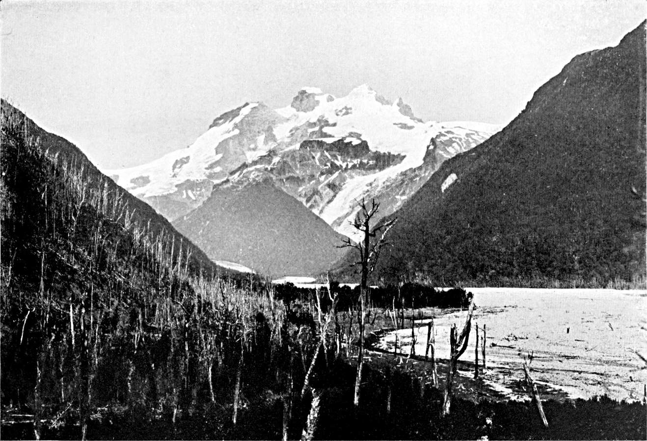
THE PATAGONIAN ANDES.
Mount Tronador (11,500 feet) on the Chilean frontier, dominating the road from Lake Nahuel Huapi to Chile. The glaciers still reach the bottom of the valley, which they filled at one time. A burnt forest in the foreground.
Plate III.
Click to view larger image.
The need of irrigation is due to the scarcity of rain, but it is accentuated by a number of causes which tend to increase the aridity. The valles are the scene of scorching day-winds, the zonda, like the Föhn of the Swiss Alps, which, there being no snow, dry up the water of the springs and of the irrigation trenches, or use the deposits left by the waters to form dunes, which they push southward, sometimes like veritable glaciers of sand. Moreover, the soil of the valles is generally composed of coarse and permeable alluvial deposits, which absorb the rain-storms immediately. There is at the foot of both sides of the hills which enclose each valle an immense and far-lying bed of imperfectly rounded shingle. This double zone of detritus is strangely desolate, for the vegetation on it is restricted to isolated bushes of jarilla and tola. From the sheepfolds on the mountains to the oases in the valleys one hardly meets a single house. The bed of the valley is not so desolate. A broad ribbon of sand marks the dry bed of a torrent, and on the clays of its banks, if the sheet of water underground is not too deep, one finds, in spite of the goats and asses and charcoal-burners, little forests of algarrobas, which the foundries use for fuel.
The modern alluvial beds, gravel and sand, represent the upper stratum of a considerable series of continental deposits which lie on the Paleozoic crystalline rock of the Andes.16 They chiefly consist of red sandstone and coloured marls, which crop up here and there through the alluvial covering and give the landscape a rugged character, worn by water and wind. There is no trace of humus: nothing to soften the vivid colours of the rock. Bodenbender, to whom we owe the first general attempt to classify the series, points out the importance of distinguishing the different strata in connection with the question of water supply and the conditions of human life.17 A complete geographical study would have to follow the geological description in detail. In places—on the eastern edge of the Sierra de los Llanos—the fine modern clays are in contact with the granites of the hills and form above them a thick bed that is rich in fresh water. In other places—south-westward of the Sierra de la Famatina, as far as the Bermejo—the outcrop is of red sandstone only. The tablelands of Talampaya and Ischigualasta, which are cut across by the gorges of the tributaries of the Bermejo, form one of the most conspicuously desert regions in the whole Republic. Wherever the gypsiferous marls of the Calchaqui are near the surface, the springs are saline. The undulations of the impermeable rocky substratum bring to light the water that gathers in the alluvial beds. Thus the streams which come down the Famatina range in the west disappear in the alluvial beds on the fringe of the Sierra, but re-appear presently in the oasis of Pagancillo.
Hence the valles are by no means wholly productive. The oases represent only a limited portion of them. It would be impossible to imagine a more striking contrast than that of the freshness and life of the oases compared with the surrounding desert. Screens of poplars shelter them from the zonda. The water runs along trenches paved with round pebbles under the spreading vines, at the foot of which, to economize water and space, lucerne is sown. Each garden feeds a family. Near the raw-brick houses there are large earthenware vessels, as tall as a man, in which the corn is kept. The hammering of the cooper fills the air.
In places the oasis is watered by a stream. In those cases there is on each side of the bed of the stream a narrow fringe, a continuous ribbon, of smiling gardens, which hide the path. Above and below Santa Maria a trench is opened every mile in the wet sands of the Rio. The water rises in it and fills it, and is directed by it toward one of the banks, where it is jealously collected and distributed. The water which flows from the irrigated fields and returns to the river, as well as that which the porous side of the trench has permitted to escape, goes to fill another trench and supply other fields farther on. The region of Los Sauces, in the northern part of the province of La Rioja, to the south of Tinogasta, shows a different type of irrigated cultivation, on account of the sandy course of the stream. The fields follow the feeding artery for about fifty miles. It is bled at the beginning of each bend, the waters remaining underground like hidden wealth.
In most cases however, the valle has no running water. What reaches it from the lateral quebradas is lost in the alluvial beds accumulated at the point where the quebrada enters the valle. In order to make use of it the cultivated areas are grouped on the cone of deposition; at least, that is the position in the great majority of the oases. A costa is a line of separate oases with their backs to the same slope. When the valle is narrow, the costas on either side of the sterile depression face each other, like two parallel roads. The water of the quebrada is never sufficiently abundant to irrigate the whole of the cone of the torrent. In order to create an oasis there, they have selected the most easily cultivable zone, which is usually the foot of the cone, where the deposits are finer and more fertile, retain the moisture better, and require less watering. The summit of the cone is composed of coarse stones, the first to be dropped by the torrent as it loses its strength. These are bad lands, where the water is wasted.
To meet the occasional drought and the danger of sudden floods in this fluvial zone, which is entirely the domain of the torrent, there is need of constant care and ingenuity. At Colalao del Valle the cultivated fields are five or six miles from the summit of the cone. After a number of successive years of drought the stream of water which reached them on the flanks of the cone lost half its volume and threatened to disappear altogether. They then built a stone dam at the outlet of the quebrada, and the water accumulates behind this during the night. At three o'clock in the morning the sluices are opened, and the stream, having thus nursed its strength, reaches the fields down below about seven o'clock. Then the sun and the wind rise, just at the time when the reservoir is empty, and by the middle of the day the stream ceases, and irrigation is suspended. At Andalgala, above which rises the glittering crest of Aconcagua, the waters of the melting snows which feed the torrent have not time to be "decanted" before they reach the valley. They come down laden with mud and sand. Above the points where the irrigation-channels begin the people make, in the bed of the torrent, a dam of branches of trees which filters the water. It is swept away by every flood that occurs, and is at once restored.
What is even more admirable than the ingenuity of the vallista in utilizing the natural resources is the minute detail of the water-rights. It seems as if the vallista is even more cunning in protecting himself from his neighbour than in dealing with nature. The water-customs of these Andean valleys are worth an extensive study. The water does not belong to the State, and is not used by concession from the State. It is private property. The owner uses or abuses it as he pleases on the lands which he has selected. A man may be poor in land and rich in water, which he accordingly sells. There are frequent business deals in regard to water-rights, just as in regard to the soil and its produce. Appropriation of water often precedes appropriation of the soil. Many oases are communities where the non-irrigated lands are common to the whole population, and the irrigated fields alone are divided.
A primary group of customs regulates the relations to each other of communities higher up and lower down the same stream. At Catamarca the water of a certain stream is shared by Piedra Blanca and Valle Viejo. Piedra Blanca, in the upper part, absorbs the whole of the water for a week, but it must then suspend its irrigation during the following week and permit the stream to flow down the valley. The same evening, or the next morning, according to the season, the water reaches Valle Viejo. It is a custom known as the quiebras in the southern valleys of the desert side of Peru, where it allows different stages of cultivation to proceed simultaneously. In the same way, above Santa Maria, where several communities (S. José, Loro Huasi, etc.) receive the water brought by a channel from the Rio Santa Maria, each of them has a right to the full output of the channel for three days. At the end of that time the sluices are closed, and the water passes to the next community. There is grave trouble for any oasis that has its rights infringed or does not compel the communities higher up to respect them.
Amongst individuals the water-right is generally defined by a measurement of time, a certain number of days or hours—during which the owner controls the entire flow of the spring or stream. It is only when the water is more abundant that we find another method of fixing the right of water, defining it by bulk. The water is then said to be demarcada, as the unit is customarily the marco, or the volume which passes through an opening about twenty-one centimetres in width and eight in height. The marco has infinite divisions, and each subdivision has its own name—the naranja, the bombilla, the paja, and so on.
As all the water is utilized, and the rights of all are equally entitled to respect, the division of the water into marcos (demarcacion) is in practice merely a proportional distribution of it amongst those who have rights to it. If the sum total of rights expressed in marcos represents something like the total flow of a stream during an average season, in the time of low water it is disproportionate, and the water no longer flows to the tops of the marcos. In other words, the quantity of water granted to each rises or falls with the rise or fall of the stream itself.
Theoretically, when the water-right is defined in marcos it is permanent. Often, however, it is impossible to grant each proprietor a permanent title to the water. Even in oases where the water is "demarked," the turno—that is to say, the turn of the proprietors to have water—which is the absolute rule in the poorest oases, reappears during the months of scarcity, in winter, when there is no rain, and at the beginning of summer. It reappears also when the right of ownership has been broken up into fractions that are too small, and it is better to grant a larger volume of water for several hours instead of a constant stream of water which would be too scanty for profitable use. At Andalgala the "turn" is sometimes obligatory, and regulated by custom, in channels where the irrigating proprietors are too numerous; at other times optional, and settled by convention amongst the owners themselves, when water is scanty. At Valle Viejo (Catamarca), when the water runs low, they set up the mita; that is to say, the sluices remain closed in each channel during four days out of eight, each proprietor in turn giving up his right to a permanent supply in order to have a double allowance when his turn comes. The turno is, therefore, a general practice. Everywhere we can see the farmers on the watch along the acequias, waiting for the moment to close their neighbour's trench with a pellet of clay and to let the stream into their own trenches with a blow of the spade.
The most minute precautions are taken in order that no one shall suffer injury. As the irrigation is always slower and less thorough during the night, they take it in turns to have the day and the night alternately. When the community receives the water from another community higher up the stream, the succession of "turns" amongst its members differs every time. The water comes down charged with sediment, pushing in front of it a mass of liquid mud, as the flush of a torrent does. It takes some time for the stream to become regular and clear. The first irrigator therefore exercises his right under unfavourable conditions. In the local phraseology the volcada de agua is not as good as the corte de agua, which means the irrigation that begins when the acequia is full.
Irrigation entails the services of quite a staff of arbitrators and administrators. The head men, who have jurisdiction of a higher order and secure the accurate distribution of the water amongst a number of channels or communities, are now, as a rule, officials of the administration, appointed by the provincial authorities (juez de Irrigacion at Catamarca, juez de rio at Rosario de Lerma). But the juez de agua of each community or each channel is a syndic elected by the interested parties. At Santa Maria the juez de agua is elected by the owners and confirmed by the Government. He controls irrigation throughout the department, settling all differences, submitting plans of work to a meeting of the owners, and assigning their respective charges in labour and contributions according to their rights.
This land of customs and traditions is also a land of lively movement. The briskness of the traffic is primarily due to continuous exchange between the various zones of the mountainous district. This large trade, so scattered that the railways could not dream of satisfying its needs, is carried, in the old fashion, on the backs of mules. The lively aspect of the roads between the tableland and the lower valleys of the region, the brisk interchange of goods between zones with different climates, is one of the common features of life on the Andes.
But the classic spectacle presents a different aspect in different latitudes. In Peru, and in southern Bolivia, the higher valleys—Jauja, Cuzco, the Pampas of Cochabamba and Sucre—have centres of dense population and agricultural wealth at a height of between 9,000 and 11,000 feet. They raise cereals, and receive from the tropical districts (montañas and yungas) sugar, cane-brandy, cocoa, and coca-leaf. The valleys of the Argentine Andes are usually at a less elevation than the yungas and montañas of Bolivia and Peru. But they are not hot districts, and have not tropical vegetation. Frost prevents the harvesting of sugar-cane at Salta, at a height of 4,000 feet. As to the coca-leaf, which is not as much used here as in the north, the Argentine valles do not send it to the tableland, but receive it indirectly from there, through the southern yungas. In default of tropical crops, the Argentine valles sow wheat and maize, which they sell to the Indians of the cold districts of the Puna for wool and salt.
These commercial currents are of very ancient, probably pre-Columbian origin. Boman has discovered ears of maize in the prehistoric tombs of the Puna de Atacama.18 The Puna, at a height of 11,000 to 12,000 feet, is permanently inhabited, unlike the high valleys of the Cordillera de San Juan, which are occupied only during the summer season by Chilean shepherds. It is primarily a pastoral and mining region, but it has some tilled land, at more than 6,700 feet above the level of the valleys. The higher limit of annual cultivation in the cold districts, which is fixed by the summer temperature, does not fall in the same way as that of arboriculture in warm districts, because trees suffer from the winter frosts. The Indians of Cochinoca and Susques sow lucerne and barley for fodder, and the quinoa and potato for food. Transport between the Puna and the valles is carried on by the inhabitants of the Puna, and is not shared by the vallistas. They are especially active in the north, in the province of Jujuy. Belmar shows how important the sales of the Puna woollen goods were by the middle of the nineteenth century.19 These fabrics were used by the mill-owners of the Rio Grande de Jujuy to pay for the work of the Indians of the Chaco, whom they employed in the sugar-cane harvest. The competition of the manufactured products of Europe now menaces the domestic weaving of the Puna, just as the competition of the flour of the Pampa menaces the cultivation of cereals in the valles.
Besides this traffic of local interest the valles serve for a traffic of a higher, almost a continental character. It seems certain that during the pre-Spanish period the road from the Peruvian tablelands to Chile avoided the inhospitable desert of the Puna de Atacama, entered the region of the valles to the east, and crossed the Cordillera in the latitude of Tinogasta, or even a little further south. That was the route of the armies of the Incas, which in the fourteenth century came as far as Maule. The pre-Columbian roads, of which Boman has found traces between the Valle de Lerma and the Valle Calchaqui, seem to correspond with this direction of traffic. By this route the long quechua passed amongst the Diaguites populations. The conquerors followed the Indian guides. Almagro, in going from Peru to Chile, passed through the valles at the eastern edge of the Andes.
Later the valles were incorporated in the many variations of the historic high road, one of the first and busiest of Spanish America, which goes from the Rio de la Plata to Lima: a route both for armies and merchants. The plan proposed by Matienzo (1566) to make a road from the silver mines to the estuary of the Paraná, through the Valle de Calchaqui, seems to have been intended merely to improve a line of communication that had already been in use. Buenos Aires for a long time received European goods by this road. About 1880 the Salta route recovered for a time its continental importance, during the Pacific War and the occupation by the Chileans of the maritime provinces of Bolivia.20 At that time it was the only outlet for Bolivia.
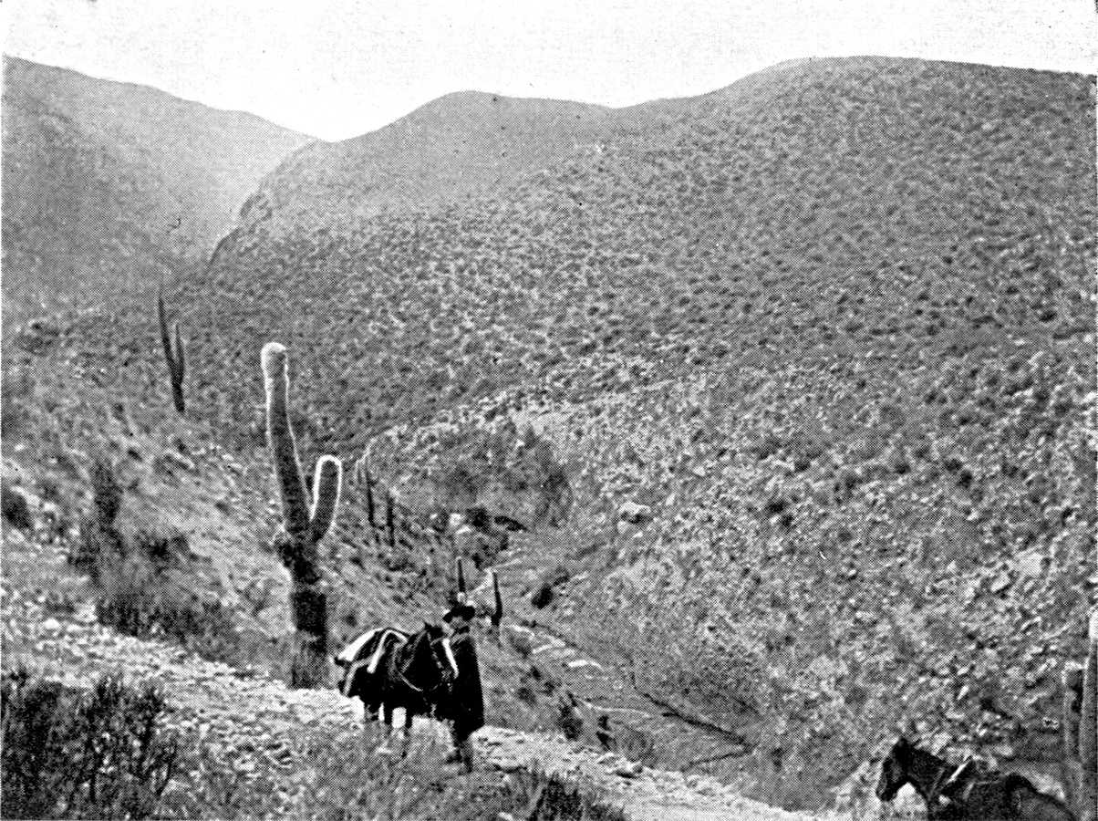
VEGETATION OF THE INTERIOR VALLEYS (ANDES OF THE NORTH-WEST).
Descent of Tafi del Valle, going to Santa Maria. The ravine is excavated out of the mass of coarse deposits which forms a fringe between the mountain and the valley. On this permeable soil the vegetation is particularly thin. Cactus.
Photograph by the Author.
Click to view larger image
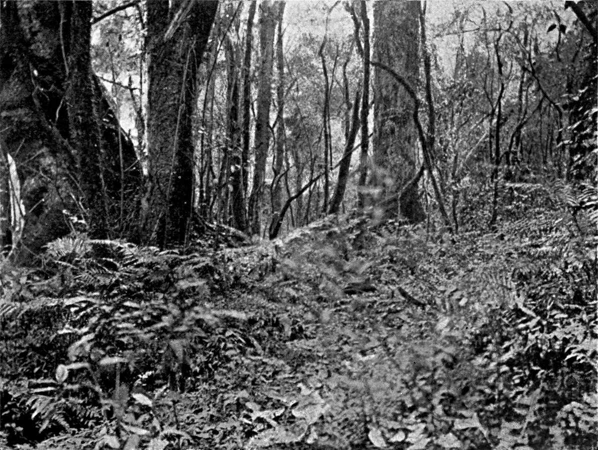
FOREST ON THE OUTER SLOPE OF THE SUB-ANDEAN CHAINS.
Sierra de San Antonio (Salta province). Perennial foliage, creepers, ferns.
Photograph by the Author.
Plate IV.
Click to view larger image
But of all the forms of traffic that have enlivened the valles the most constant, and the form that has had the most profound influence on their existence, is the movement of cattle. The cattle trade has been of fundamental importance in the history of the colonization of South America. Animals were the only goods that could be conveyed any great distance. At the beginning of the conquest the productive regions of the continent, which supplied the export trade with Europe, were very limited in extent. Pastoral colonization began at once, and spread over a very wide area. Herds of oxen, for meat or draught, horses, and mules, made their way toward the centres of consumption: towns like Lima, Bahía, and Rio, the Peruvian mines, and the sugar-refineries of the north-east of Brazil, and later toward the yerbales of Paraguay or the seaports of the Caribs and the Rio Grande do Sul, where the jerked meat industry developed. The cattle routes converge upon these centres.
The export of cattle and mules from the Argentine plains to Peru was fully established by the close of the sixteenth century, and it seems to have continued without interruption ever since. Upper Peru is, however, not the only market on which the Argentine breeders lived. At the end of the eighteenth century D'Azara demanded that they should permit the sale of horses and mules to Brazil, for use in the mines. The cattle traffic with Portuguese territory had not then assumed the form of a regular commerce, and the Brazilians made raids on the north-eastern provinces for the animals they needed—60,000 a year, D'Azara says.21 The export of cattle to Paraguay and Misiones was, on the other hand, of substantial economic importance in the eighteenth century. Before the Revolution, Rengger says, as many as 200,000 head of cattle passed yearly from Corrientes to Paraguay, which paid for them in maté and tobacco.22 This trade was kept up intermittently in the nineteenth century. The exports from Corrientes were especially important at the time when the Paraguay stock was reconstituted after the war (40,000 head of cattle in 1875).
Finally, the Chilean market was opened to the Argentine breeders about the middle of the nineteenth century. In the time of Martin de Moussy the convoys of cattle to Chile were so numerous that the lucerne fields of both slopes were stripped bare at the very beginning of the season; and they were rented at a high price.23 Not only the mining provinces of the north, but central Chile also, bought Argentine cattle. The opening of the Chilean market was followed by a remarkable expansive movement in the pastoral colonization of Argentine territory. We can follow the progress of this not only in Martin de Moussy's book, but in all contemporary works of travel. Its chief theatres are the provinces of San Luis and of Santiago del Estero, north of the Rio Dulce, where Hutchinson, in particular, describes the activity of the ranches.24 Finally, after the Pacific War (1880) the nitrate district, taken from Bolivia and Peru by Chile, received a great influx of population, and works sprang up in the midst of the desert. The nitrate fields, wholly barren and doomed, under their shroud of grey dust, to an unalterable desolation, became at once one of the chief centres of consumption for Argentine stock.
It is difficult to give accurate details of the volume of trade in cattle in colonial Argentine. However, the facts given by travellers (though they often merely borrow from each other) suffice to show how important this traffic was in the life of the country and the extent of the zone that was occupied with it. As early as the middle of the seventeenth century Córdoba seems to have exported to Peru as many as 28,000 to 30,000 mules annually.25 At the close of the eighteenth century, we read in D'Azara, 60,000 mules were exported; and Helms gives the same figure.26 The mules were bought young by Córdoba dealers at Buenos Aires, Santa Fé, and Corrientes, reared at Córdoba, and then sent to Salta, where they were sold in their third year to mule-dealers from Peru.
An article in the Telegrafo Mercantil of September 9, 1801 (reproduced in the Junta de Historia y Numismatica americana, Buenos Aires, 2 vols., 1914-5) contains very valuable information in regard to the mule trade. From 1760 to 1780 Salta sent between 40,000 and 50,000 mules annually to Peru. At Salta they were worth ten piastres each before they were broken in, and thirteen or fourteen afterwards; and they were sold at the age of four years. The arrieros, who conveyed European goods and home products (ropas y frutas), bought a large number of them. The Telegrafo complains that this trade has been gradually transformed. The mules now came from Santa Fé and Córdoba to Salta two years old, and after the invernada they were still, at fair time, barely three years old. They suffered much during the long journey to Lima, and the losses of the caravans were heavy. They could not be loaded for the journey, and, as the arrieros could no longer secure adult and strong animals, the freight to the tableland had risen, to the serious loss of merchants on the coast. The reply of a Potosi mule-dealer (December 13th) clearly shows that the last years of the eighteenth century had been marked by increasingly heavy demands from Peru for Argentine mules. In order to meet these demands the Córdoba breeders had developed production. The buyers, coming to Salta from Lima, Cuzco, and Arequipa, took, without discussion or examination, the batches that were offered them. The correspondent of the Telegrafo complains bitterly of these caballeritos who came from Peru with their 100,000 piastres, and raised the price at Salta, alleging that their instructions were to get mules at any cost.
Robertson gave in 1813 the recollections of a mule-dealer as to the convoys of mules between Santa Fé and the Andes, which had already ceased at that time. Each convoy or arreo comprised 5,000 to 6,000 mules. They came from Entre Rios, or even from the Uruguay, whence they were brought, after crossing the Paraná, to the Santa Fé ranches. The Santa Fé breeders owned the best part of the land on the left bank of the river. The expedition also included thirty waggons of goods and 500 draught-oxen; and fifty gauchos were in charge of it. The main expense was then tobacco and yerba. One feature of this mule traffic that is emphasized in all the descriptions is that it was divided into two stages, with an interval between them, for breaking in. As we have already learned from Azcarate, Córdoba, Santa Fé, Santiago, and Salta kept the mules for two or three years before sending them to Peru. Córdoba and Santiago del Estero seem to have been important in connection with the industry of breaking in the mules.
The sending of cattle on foot to Bolivia and Chile is now only a subsidiary element of the national economy, but it is not yet quite extinct, as the table on p. 53 shows.
Whatever its point of departure, the traffic in stock always passed through the valles. Transport of cattle was particularly difficult in the Argentine Andes. The chief obstacles were not the elevation of the passes or the steepness of the roads, but the scarcity of water and the extent of the travesias, which were equally poor in pasturage and water, and had to be crossed rapidly by doubling the stages. The difficulties of the journey were very profitable to the oases that lay along the route. The cattle-driver could not dispense with the hospitality of the vallista or dispute the price he cared to charge.
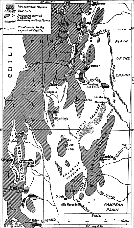
MAP II.—IRRIGATION IN THE WEST AND NORTH-WEST OF ARGENTINA.
Extent of the irrigations in the north (zone of the great summer rains), and the south (glacier zone) The historic industry of fattening cattle in the invernadas and the export of cattle to the Andean regions only survive in part. On the other hand large modern industries have developed at Tucumán, Jujuy (sugar-cane), Mendoza, and San Juan (vines), and they supply the Buenos Aires market.
Click to view larger image.
The length of the journey and the difficulty of keeping the animals in good condition in the poor pastures of the breeding districts made it advisable to stay longer in the oases. There thus arose lucerne-farms—the invernadas—to receive and fatten the cattle which passed through. Lucerne is the characteristic and most profitable produce of the valles. It is grown wherever there is an assured supply of water, and is invariably found in the upper section of the system of irrigation-channels; the cereals are sown lower down, and are the first to suffer from drought. In the quebradas, where space is more limited, the lucerne-fields cover the entire oasis. Every cattle track has a corresponding line of invernadas, which is often completed on the opposite slope by a last group of lucerne-farms where the beasts recover from the journey before they are sold and dispersed.
1910 1911 1912 1913 1914
Export of Cattle:
To Bolivia 3,600 6,600 6,200 6,300 4,800
To Chile 61,200 87,500 68,400 58,800 28,300
Export of Mules:
To Bolivia 2,700 4,600 7,900 8,300 2,500
To Chile 2,300 3,200 5,000 2,600 3,500
Export of Asses:
To Bolivia 9,000 10,500 15,000 15,600 14,40027
Besides the official routes there have for a long time been clandestine tracks, through more difficult ravines, by which stolen cattle were conveyed with impunity. Guachipas was the gathering place for cattle of suspicious origin, and, to avoid being seen in Salta and Jujuy, they passed through the Quebrada del Toro or the Quebrada d'Escoïpe. When Brackebusch visited Guachipas in 1880 the inhabitants still kept something of their reputation as smugglers.
A map of the cattle-tracks which are still used in the Argentine Andes is a complicated network in which we can trace two main directions, crossing each other at right angles. One set of tracks leads to the west, toward the Pacific coast, the other set to the north, toward the Bolivian tableland.
The cattle traffic is now restricted to Chile. It survives at San Juan, Jachal, Vinchina, and Tinogasta. The cattle descend to Chile about Coquimbo, Vallenar, or Copiapo. But the trade is now busiest in the region of the saltpetre-beds. The roads lead from the Valle de Lerma and the Valle Calchaqui toward the tableland by the Quebrada del Toro or the Quebrada de Cachi or de Luracatao, crossing lofty passes at the foot of the Nevados of Acay and Cachi, and reuniting between Santa Rosa de Pastos Grandes and San Antonio de los Cobres to cross the Puna de Atacama. Vegas (pastures) and fresh water are scarce here. The track passes interminably by depressions covered with a carpet of glistening salt, dominated by volcanic crests. It is used in every season of the year, but in winter the caravans are exposed to the cold wind laden with snow, the viento blanco. San Pedro is the port in this desolation. Here there are, on the flanks of the enormous cone of Licancour, fields of lucerne and groups of figs and algarrobas. The cattle are left there for a few days' rest, to prepare them for the last stage, the Calama oasis on the Antofágasta railway.
The centre of this trade is Salta, or, rather, the little village of Rosario de Lerma, nine miles south of it, where most of the caravans are formed. The saltpetre works make yearly contracts in advance with the Rosario dealers, fixing the number and price of the beasts to be delivered at Calama. The cost of transport includes, besides the pay of the cattle-drivers—eighty to a hundred piastres a journey—the shoeing of the mules, the rent of pasture at San Pedro, and the value of the beasts which die on the way. In 1913 the number of animals exported by this route was put at 30,000. The saltpetre works buy also draught-mules for their waggons. Draught-mules must be heavy, and only animals over five feet in height are sent to Chile. Bolivia is now the only market for the smaller mules and for asses.
The trade in mules in its traditional form and the industry of breaking-in still flourish at Santa Maria. The mule-dealer's business is very different from that of the cattle-dealer. The mules are so tough that it is possible to send them by roads which would be unsuitable for cattle.28 The journeys are longer, and the contracts are less settled in advance. Moreover, breaking-in is a delicate operation that requires experience. The survival of the mule-trade at Santa Maria is an example of the maintenance of an industry owing to the presence of skilled handicraft. The men who break in the mules at Santa Maria have a remarkable caste-pride. Their first job is to go to Santiago or Córdoba to buy the mules. They bring them back to Santa Maria by way of Catamarca or the valley of Tafi. At Santa Maria the mules are broken in, then taken to the lucerne-farms at Poma to be put into good condition. There they remain in pasture for several months; and at length, when the season is suitable, the little band of Santa Marieños gathers together and, driving the now docile beasts in front of them, and putting no loads on them in order that they may keep fresh, make for the fair at Huari in Bolivia, or even as far as Sucre. There they sell at a hundred and fifty piastres each the animals which they had bought for half that price before being broken in. The number of mules hibernating at Poma is about 4,000.
The business done in the fairs of the southern Andes is very varied in character, but their main function was always as markets for stock.29 They are held in March or April, when the rains do not fall, but pasture is still abundant and travelling easy. The fair at Vilque, north of Lake Titicaca, is no longer visited by dealers in Argentine mules. The Salta fair which was held at Sumala, near Rosario de Lerma, has ceased to be important; at the close of the eighteenth century it was the chief centre of the mule-trade. The fair held at Jujuy is still, like the annual pilgrimage to the Virgen del Valle de Catamarca, one of the great dates in the life of the Andes. In the eighteenth century it was mainly a cattle-fair, but it is now frequented only by mule-dealers. The development of the railways is gradually causing it to decline.
The cattle-trade has long been really a form of barter. The Argentinians who took their herds to Peru brought back with them European goods that had come via Panama and the Pacific. At Jachal direct communication with Argentina is still so costly that they prefer to get many manufactured articles from Chile. Everywhere else, however, the sellers of stock take payment in cash. The Santa Marieños bring back from Bolivia only a few bags of coca and, for chief payment, letters of exchange, which they cash in the Salta banks when they return. Their gains swell the profits of the merchants of Salta, Catamarca, and Jujuy, who get their goods at the large importing houses of Buenos Aires. It is the first form under which the influence of Buenos Aires reaches the valles. It gets their custom before it begins to absorb their produce.
A large proportion of the stock sent to Chile now comes from the Andean valleys themselves. The most arid and desolate regions round the oases breed only goats and asses; but as soon as the soil improves sufficiently to give a better vegetation, it is found good enough for a hardy and tenacious breed of horned cattle. The land is divided into large ranches, and the owners have also lucerne-farms, either individually or communally, the tillers of the oasis each putting in their beasts, which wander about in small groups without control. During the summer they go of their own accord up to the cerros, where the rains have brought out the vegetation, and drinking-water is found in the ravines for several months. In the winter they return to the valley, within range of the reservoirs and permanent acequias. Bodenbender gives us a few details about movements from place to place owing to such differences, as they are in vogue in the western part of the province of La Rioja, in the district of Guandacol. There the herds are taken during years of drought up to the mountains of the west.
Apart from the Andes, the zone which used to feel the influence of the trans-Andean markets has been steadily reduced in the last forty years. At one time it comprised the whole range of the scrub, and even overflowed upon the prairie region, but it is now limited to the nearest cantons to the fringe of the mountains. Over the greater part of the monte the cattle are now sent in other directions; either to Buenos Aires or to other Argentine towns with a growing population, such as Córdoba, Mendoza, and Tucumán.
The rupture of commercial relations with Chile has, however, not made any notable change in the pastoral industry. Pastoral life in the scrub has very uniform characters. It is chiefly dominated by the question of water-supply. Natural open water is scarce, and the cattle can drink only where man's industry makes it possible. The problem of taming the beasts, which the breeders on the prairies have not always been able to solve, is simplified by the scarcity of water. There is no need to hunt the cattle, no periodical rodeos, when the herd is drawn in every night by thirst to the water-supply. Advance in colonization means the provision of wells and reservoirs (baldes and represas), without which the breeders cannot occupy the plain permanently, but have to fall back during the dry season upon the few streams that cross it. The word balderia means districts where the presence of a sheet of water not far underground has enabled them to form a system of wells. The best known is the Balderia Puntana, in the northern part of the province of San Luis.
Of the regions apart from the Andes which still depend on the Chilean market it will be enough to mention two, which may be regarded as typical. The first is the Chaco Salteño, on the eastern slope of the Sierra de la Lumbrera. The Lumbrera is a lofty anticlinal range of limestones and red sandstones, which pass to the west underneath the clay of the Chaco plain, and separate it from the great longitudinal sub-Andean corridor, which was followed by the old road, and is now followed by the railway from Tucumán to Jujuy. Colonization began beyond the Lumbrera in the eighteenth century by passing round it, from south to north, by the valleys of the Juramento and the San Francisco (which joins the Bermejo). The ranches, which employed the Indians—the occupation of the Chaco at this point being pacific—bordered the Bermejo and the Rio del Valle, which flows from the Lumbrera range toward the former bed of the Bermejo, and washes the foot of the range at the edge of the plain.
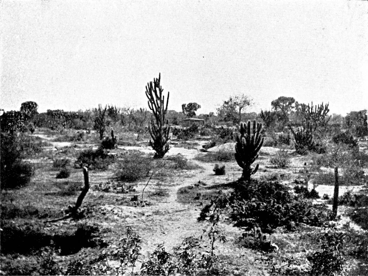
DRY SCRUB OF THE CENTRAL CHACO.
On the Añatuya line (province of Santiago del Estero). Cactus. The leafless tree in the foreground is a red quebracho. The leafy trees are white quebrachos.
Photograph by the Author.
Click to view larger image.
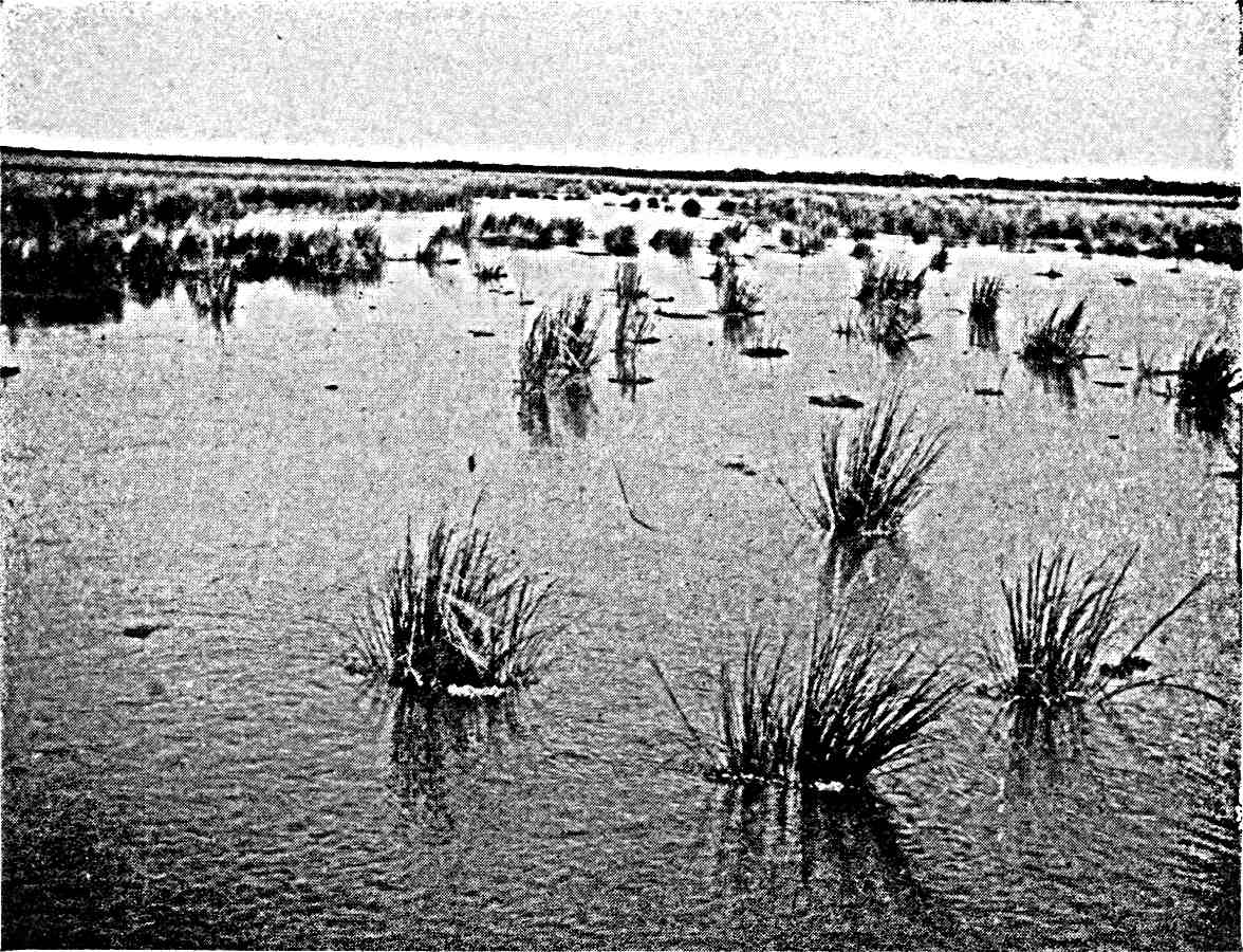
MARSHES (ESTEROS OR CAÑADAS) OF THE EASTERN CHACO.
On the Tartagal line (province of Santa Fé). It is by means of these marshes, which form in the forest, that this part of the plain is drained.
Photograph by the Author.
Plate V.
Click to view larger image.
The cattle live in the scrub during the summer, when the rains have brought out the grasses. In winter they go up to the moist forest, with perennial vegetation, which covers the flanks of the range.30 The comparative abundance of water lessens the labour of the breeders and, at the same time, the discipline of the herds. When the time comes, the whole ranch is mobilized for the purpose of collecting the adult cattle and making a convoy of them. Horsemen, with the double leather apron which hangs at the saddle-bow to protect them from the branches, ride up the range with their dogs and plunge into the scrub. The savage beasts are rounded up and held at bay. The procession is formed, and sets out, either by the rugged paths across the forest and mountain or along the easier tracks over the plain to Embarcación or Lumbreras, where they reach the railway. If buyers from the sugar-refineries at Jujuy do not take them, the cattle are put into trucks and sent to the Salta market, where there are sales all the year round. At Salta the beasts are fattened on the lucerne-farms before crossing the Cordillera. There is hardly any tillage, either because the winter drought makes the result dubious or because the breeders are not good at agricultural work.
The Sierra de los Llanos in La Rioja is another centre for extensive breeding. From the railway, which follows the range at some distance, between Chañar and Puntá de los Llanos, before it reaches La Rioja, no one would have the least suspicion of the importance and life of the region. It is, nevertheless, one of the main foci of Argentine history. It has proved a cradle of population and wealth. It was there that Quiroga and, later, the strange adventurer who was known by the nickname of the "Chacho" gathered the strength that enabled them to dominate part of Argentina. Colonization is even older here than in the Chaco Salteño. It occupied two distinct periods, separated by a long interval. At first it advanced from north to south, passing round the foot of the Sierra. It is marked by a line of springs, poor but permanent, the waters of which are absorbed as soon as they flow down to the porous alluvial beds of the plain. They appear much in the names of the district—agüitas, aguaditas, and so on, abound. The road from La Rioja to San Luis passed these springs, and some population grew up about them. Thus the two sides of the range—the costa baja in the east and the costa alta in the west—became inhabited. The estate of Facundo is one of these aguaditas of the costa alta.
The two costas form the historic territory of the Llanos. It was from there that colonization swarmed over the plain long afterwards. This expansive movement began about 1850; that is to say, at a time when the breeders enjoyed comparative peace and security, and especially when the invernadas of San Juan and Mendoza were developed, together with the export of cattle to the agricultural provinces of Chile. The price of stock rose, and the unoccupied land became of value. The occupation and exploitation of the plain was the work of the last two generations. They pushed on to the very edge of the salt lakes, leaving no vacant space. The travesias which surrounded the narrow inhabited zone of the costas were filled with life. The Sierra and its two costas are no longer an oasis in the desert, as they were in the time of Sarmiento; though they still differ from the remainder of the pastoral zone in the density of their population and the variety of their resources.
The early date of the colonization may be traced in a special system of tenure, though this is also found in parts of the provinces of Catamarca and Santiago del Estero. On the plain the right of ownership was obtained in the nineteenth century by purchase or by concessions of public lands which belonged to the provincial Government. They were allotted in very large estates, and these, intact or broken up, are the actual ranches. In approaching the foot of the range one passes estates in the mercedes. The name indicates concessions that date from the colonial epoch, and they are, in all parts of South America that were early colonized, the source of land-ownership. But what is peculiar to the mercedes of the Llanos is that they have never been divided amongst the heirs of the first owner.31 Sometimes the number of co-proprietors is small. They are conscious of their relationship to each other and know the value of the rights of each. The merced is in that case only an undivided property held in common. Sometimes, however, the numbers of comuneros is so great that they have lost count of the exact share of the merced which belongs to each of them. The merced feeds a whole population, legitimate heirs and usurpers mixed together. In these cases it is a real communal property, and one might compare it, in spite of its different origin, with the Indian communities which exist in Argentine territory as well as that of most of the other Andean States.
The economy of the Llanos is less simple than that of the Chaco Salteño. There is agriculture as well as breeding. There is not much rain, and it is confined to the summer months. The mean rainfall is, no doubt, higher than what we find at La Rioja (about 30 centimetres), but it is not good enough to dispense with irrigation. The aguadas, springs and brooks at the foot of the range, are the only provision of permanent water, and it is very limited. The oases watered by these springs and brooks cover only a few acres at the foot of the steep cliffs of the range. It has not been possible to cultivate the land far from the mountains. At Chamical a trench that was made to convey water to the railway dried up. All that can be done is to follow for a few miles with a line of wells a subterranean stream of fresh and not very deep water. At Bella Vista a comunero has dug an acequia several miles long, and he sells the water at a rate of five piastres for forty-eight hours. But when it reaches the end of the acequia, it is lost between the trench and the field to which they would conduct it. At Ulapes, though it is one of the chief centres, it takes the full outflow of the spring during sixteen hours to irrigate one cuadra (a little over two acres), and each man's "turn" is for seventeen days. The entire oasis measures about fifty acres. At Olta the thin stream of water is surrounded by so many cupidities that the "turn" comes only every fifty-eight days, so that each field has to live fifty-eight days on one watering. At Catuna where a trickle of brackish water is eagerly collected at the foot of a dejection-cone, the water-right is regulated by an arrangement of turns that covers ninety days, so that plants die of thirst in the interval. The plots vary according to the quantity, quality, and regularity of the water. The orange-tree is the most exacting, the fig the most tenacious, of the trees. The poorest oases consist only of a few gardens of dusty fig-trees.
However small it is, the oasis always stands for a rudiment of communal life, a poblado, a centre round which life is organized in this pastoral, anarchic, amorphous world. Land that has a water-right is regarded as detached from the merced and never remains undivided.
Besides these properly irrigated lands there are the bañados: cultivated plots in the hollows, where the moisture left by the storms is concentrated and preserved. These are much more extensive, and they are very irregularly distributed. Inequalities of the alluvial ground that almost escape the eye are sufficient to direct the streaming of the water after rain, and it is quickly absorbed. Man assists nature as well as he can, and one sees everywhere tiny ridges of earth across the paths, for the purpose of diverting the water to the plots. These are the tomas. When you follow a toma downward, you see it after a time pass under a hedge of dry thorn, and this encloses a field, a cerco. The crops have to be jealously guarded against the cattle which roam in the scrub. The cercos are sometimes so numerous that they give the impression of a regular agricultural district. Most of them are planted with maize. The maize harvest rarely fails in the summer, for it is then, on account of the regular rains, that the maize grows and ripens. When the ears have been gathered, the cattle are let into the cerco, as maize-straw is excellent fodder. But wheat also grows well in the bañados. Provided the year has had a few late showers, the wheat sown in autumn stands the winter drought more or less well, and ripens after the early rains, at the beginning of summer. The Llanos produce a hard wheat; it is not milled, but eaten, like rice, in the grain. There have been times when the Llanos have exported wheat. The census of 1888 gives the Department of General Belgrano, on the eastern slope of the Llanos, an area of 900 acres under maize and 1,900 under wheat. When the Chilecito railway was constructed, this wheat competed with that brought on mules from Jachal, in the mining district of the Famatina range. Like the gardens in the oases, the cercos may be divided, and they are the personal property of those who cultivate them.
Sowing and reaping are, however, mere episodes in the life of the Llanero. He is mainly occupied with cattle-breeding. The quality of the pasture differs considerably according to the nature of the soil and the good and bad character of the season. Sometimes it forms a thick carpet under the brushwood, but in other places it is poor and there is nothing but the leaves and pods of the algarroba. If the herd is too large, the grass will not grow again; the breeder recognizes at a glance the campo recargado—the field which has had its capacity overstrained. The pasture has to be carefully nursed. But the most urgent problem is to get a supply of water for the cattle. Round the Sierra the underground water is often fresh, and there are plenty of wells. Still, in order to avoid having to draw the water, they dig large trenches at suitable spots in the clay, and round these they arrange the earth that has been dug out, with an opening toward the hills to catch the water when it is raining. These are the represas. As in the case of the bañados, ridges of earth direct the stream to the represa. It is surrounded by a hedge as carefully as the field is. On the plain rain is rare, and the represas are usually the only reserve. They have to last the whole year; even two years if there is a particularly dry summer that prevents re-filling. Thus they become sometimes veritable lakes. From a distance you can see, above the top of the brushwood, the bald curve of the mound of beaten earth which encircles them. The water flows over it when there has been much rain. The mound is sometimes 4½ to 5½ yards high; as it is at Tello, between the Sierra d'Ulapes and the Sierra de los Llanos, where the San Juan coach used to change horses.
The represa is the real centre of the estate. The house is built near it, and guards the entrance. From early morning until dusk the cattle come to it, singly or in groups. The rancher admits them, lets them drink, and closes the gate behind them. If the thirsty cattle have not his mark and belong to a neighbour, he sends them to drink at their own represa; but he gives water to lost beasts, from a distance, whose owner will presently come for them. Near the represa is the enclosure (potrero) for calves that have just been born. The cows come there every morning, and they are milked for a few months to make cheese. Like the cerco, the represa is the personal property of the man who made it, or of one who has inherited it and sees to its upkeep.
The cattle of the Llanos move a good deal. There are certain irregular migrations, and others that are periodic or connected with the seasons. Everywhere on the fringe of the Sierra the cattle remain in the ravine and on the foot-hills during the winter. In the summer they return of themselves to their querencia on the plain. The irregular migrations are due to scarcity of water or pasture. Driven by hunger, the beasts travel a long distance of their own accord. They mingle with other herds, sometimes so far from the ranches where they were born that no one recognizes their mark. Sometimes, again, the rancher himself goes, when his represa is dry, to ask hospitality in some more favoured canton. He is fortunate if the drought has not been general; if part of the country has been spared and can offer a refuge.
But it sometimes happens that the whole district has suffered, and the land is naked and scorched everywhere. There is then no help except a long journey, to San Luis or to the lucerne-farms of San Juan, for the cattle. The misfortune of the Llanos sends up at once the rent of the invernadas all round. A general evacuation of the cattle is a desperate remedy, and is, in fact, often impracticable. During the whole summer the men wait patiently, hoping for the end of the drought. There is room for hope until April, when storms are still possible. If the month ends without rain, it is too late to remove the exhausted cattle; the stages across the desolated country are too severe.
The memory of the worst years of drought—the "epidemics," as the Llanero calls them—lives for a long time. They make a deep impression on the popular imagination, and legend makes plagues of them, in the Biblical way. The drought of 1884 was particularly disastrous. The herds were destroyed, and families that had been wealthy the day before set out on foot, "having nothing to put a saddle on": a touching picture of misery for this race of centaurs, people who feel themselves mutilated when they are not on horse. The rain returns next year. The pasture grows all the better because the herd is smaller, and the Llanos give the traveller who crosses them an exaggerated impression of their natural wealth.
Until quite a recent date the cattle reared in the Llanos were destined exclusively for Chile. Dealers from Jachal or Tinogasta came in the autumn, and the cattle passed the winter in the invernadas at the foot of the Cordillera. From the Sierra d'Ulapes, which is a southward continuation of the Llanos, the cattle destined for Chile were first sent to San Juan. They took one or two weeks to reach it. Five men were needed for a herd of a hundred beasts: eight for a herd of two hundred. The caravan was directed by an estanciero (rancher) or his capataz, or by dealers who came originally from the Llanos.
Exports to Chile have not entirely ceased. In 1913 the dealers from Tinogasta and Jachal, who had not appeared in 1912, came back. The southern part of the Sierra d'Ulapes, which is some distance from the railway, reserves its cattle for San Juan. The cattle are, however, more and more sent by rail to the coast. In the Sierra d'Ulapes the dealers from Villa Mercedes, which has become one of the great markets of Argentina, come every year, rent an enclosure (protrero), and collect in it, one by one, a herd of cattle, which they then take away on foot. They are sold at the fair at Villa Mercedes, and they disperse in every direction toward the fattening zones of the Pampa.
This commercial revolution has led to a rise in the price of cattle, and this in turn has raised the value of land. When the value of the land rises, the methods of working it are necessarily improved, there is greater security, and thefts of cattle (cuatrerismo) become impossible. The farmers are not content merely to enlarge their represas or dig deeper wells. They divide the fields by fences—cheap iron wire stretched on home-made posts, or hedges of spines like those which protect the bañados. Thus pasture can be reserved untouched for the difficult months.
This subdivision of the land by fences began in the south, in the Ulapes district, in touch with the richer districts of San Luis and Córdoba. In the Llanos proper the practice has scarcely begun. At Ulapes it is even done on the mercedes. Each comunero, without opposition, encloses as much space as he can, and leaves his cattle outside, on the common land, as long as possible. He only brings them into his enclosed land when the common pasture is exhausted. This will bring about the end of the mercedes; and, indeed, communal ownership is not suited to modern conditions. The latest sign of progress is the appearance of lucerne fields. Lucerne can be grown on the bañados wherever anything else can be grown; and the creation of lucerne-farms will give the pastoral industry a security and stability it never had before, besides enabling the breeders to collect stores of dry forage and exploit the full pastoral capacity of the monte.