← Table of contents
Six Thousand Country Churches

Part 3 — EXPLANATORY NOTE

Reading edition

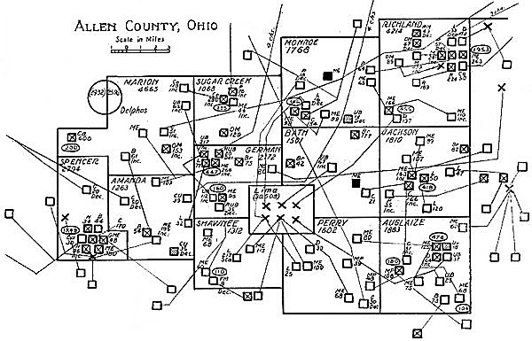
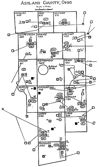
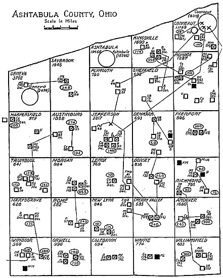
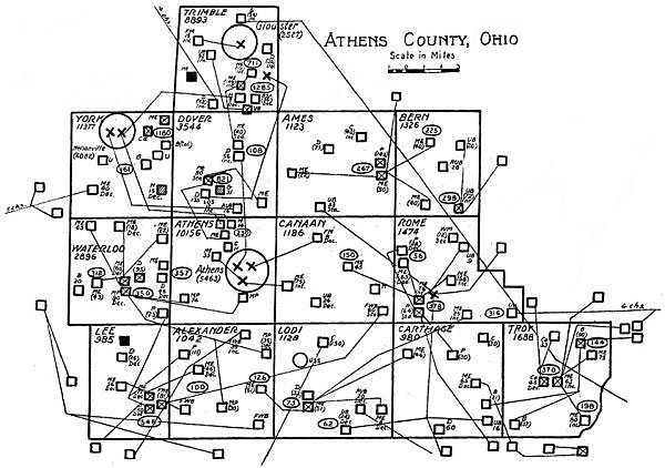
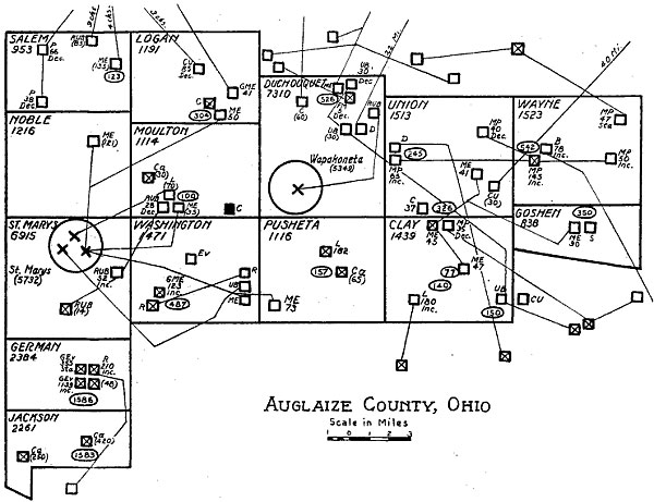
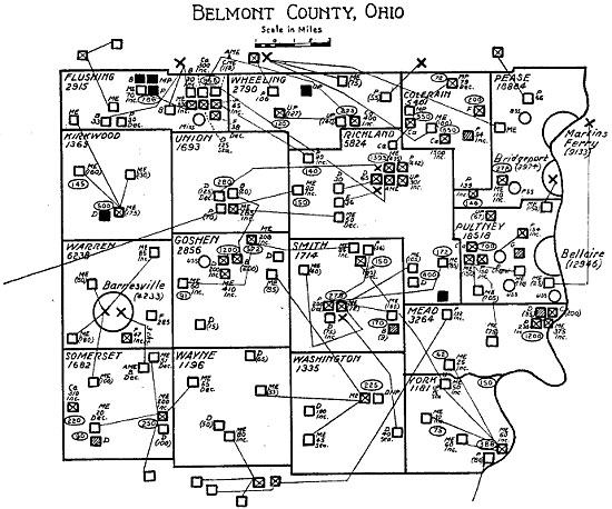
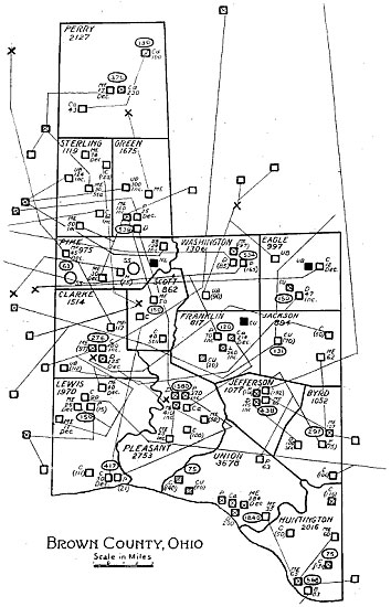
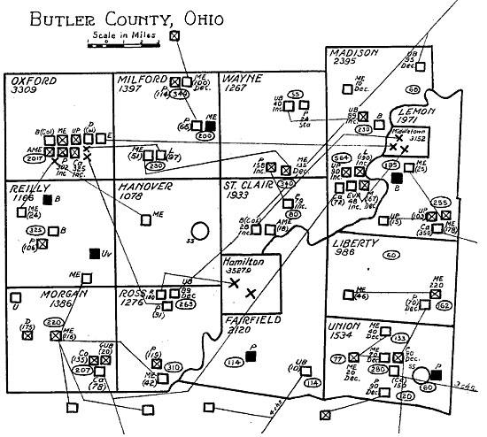
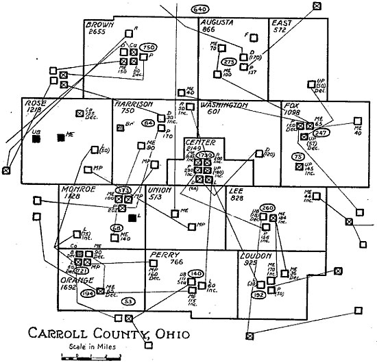
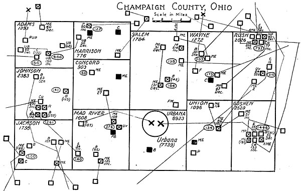
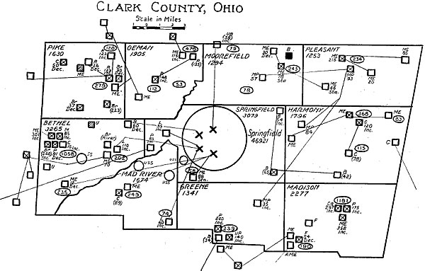
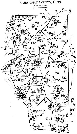
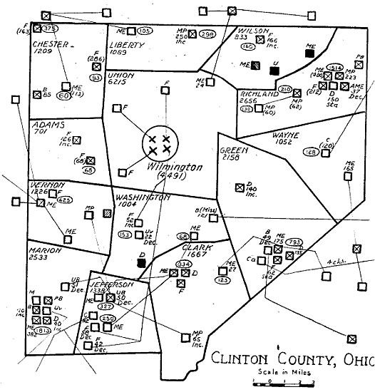
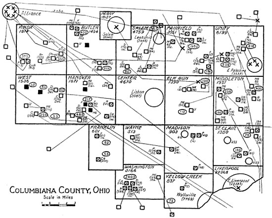
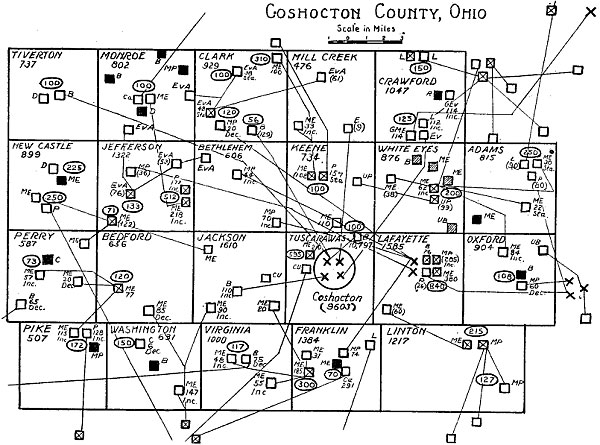
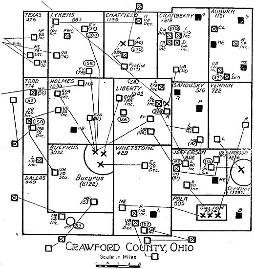
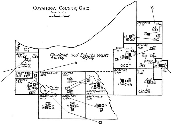
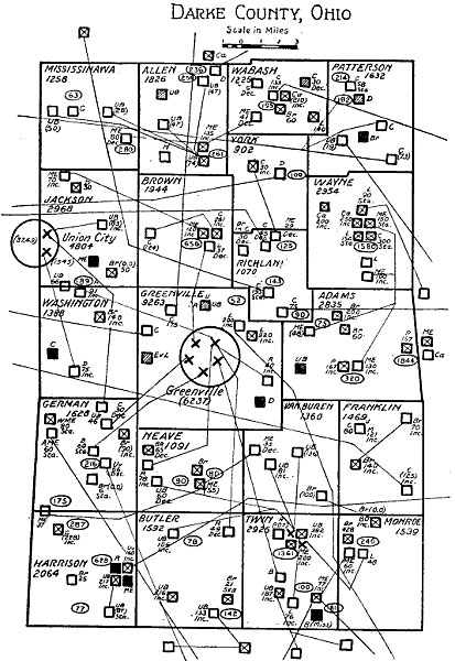
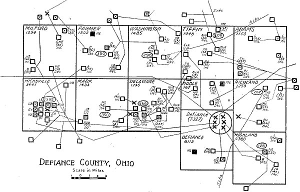
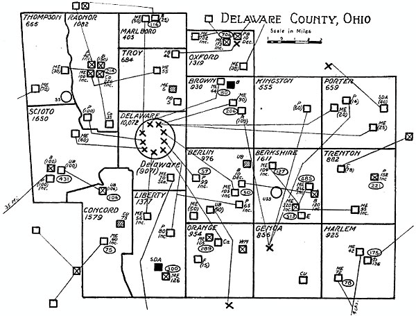
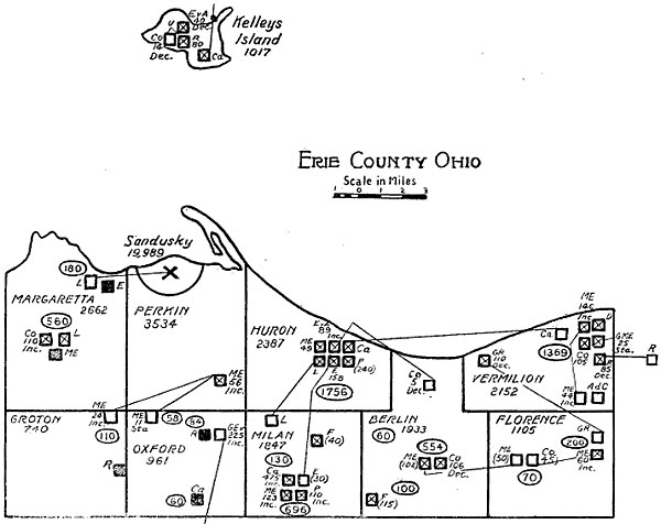
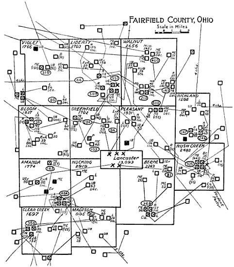
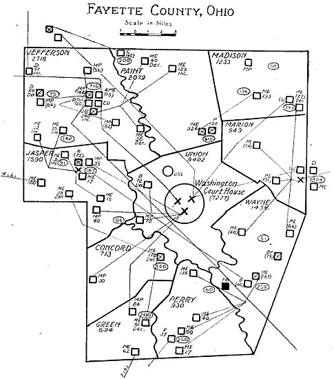
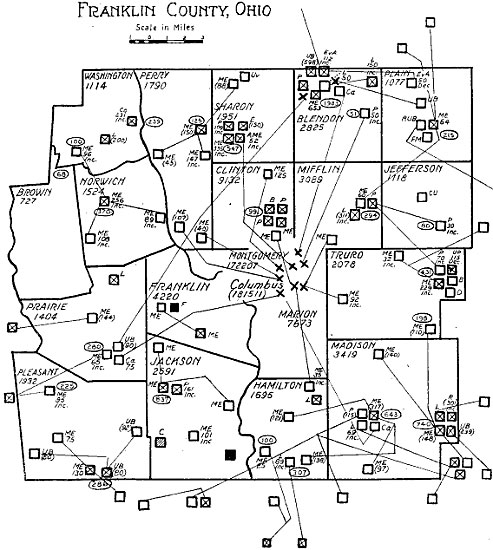
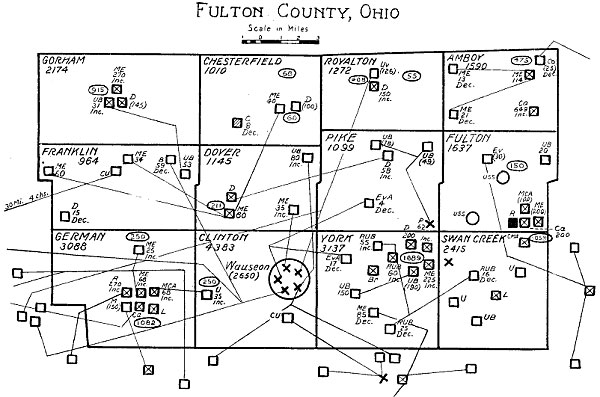
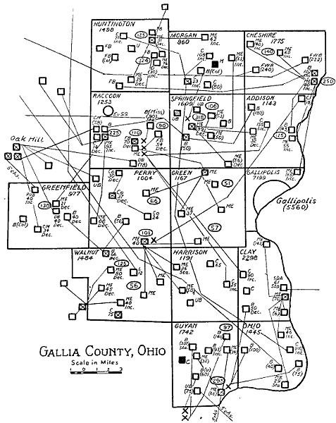
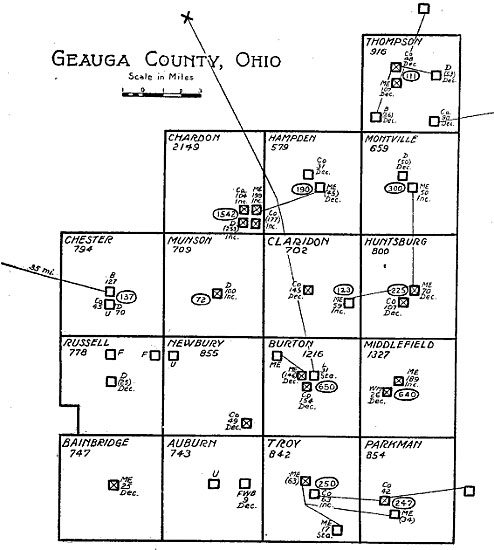
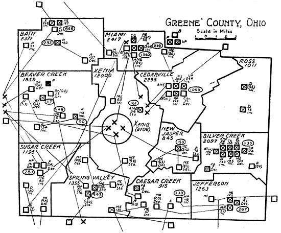
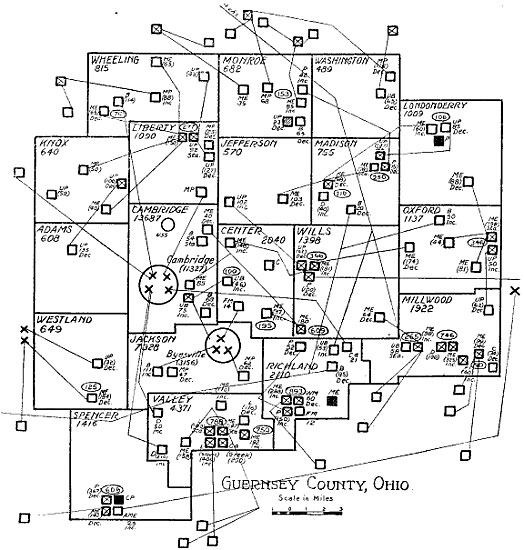
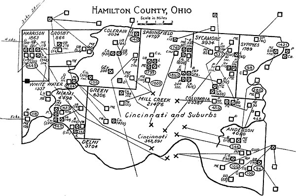
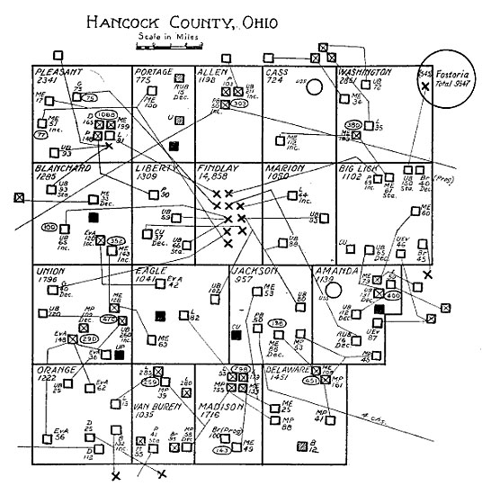
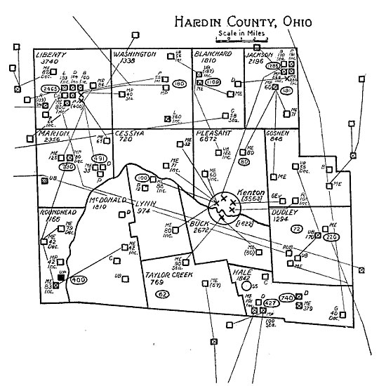
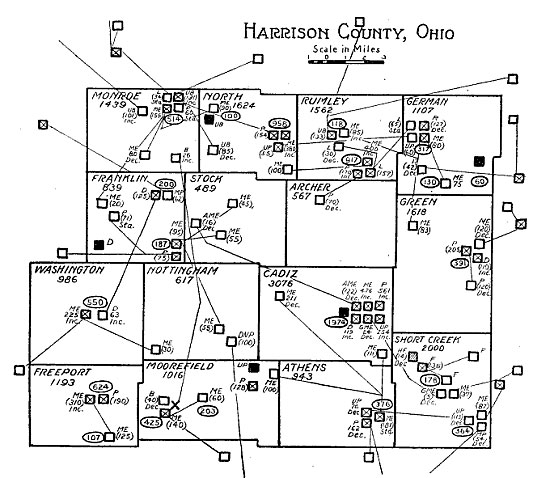
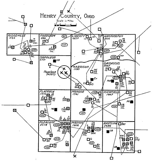
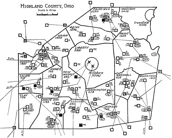
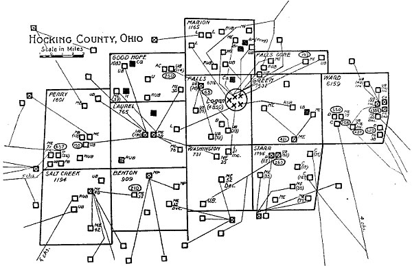
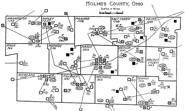
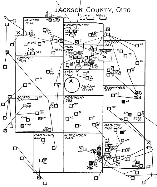
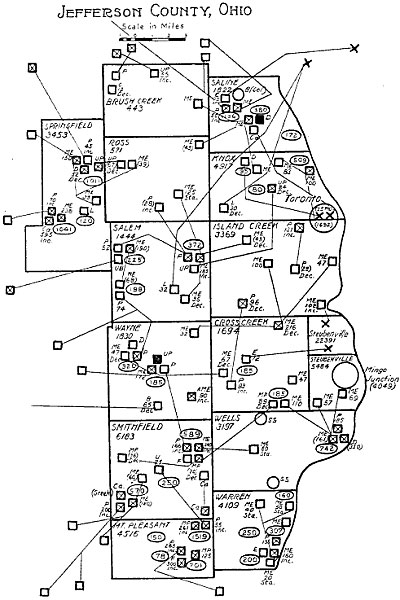
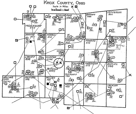
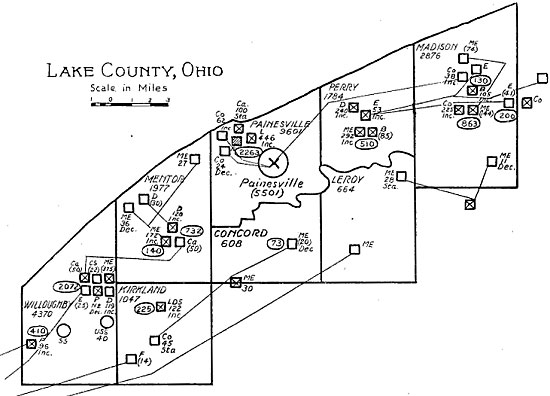
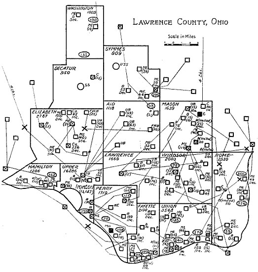
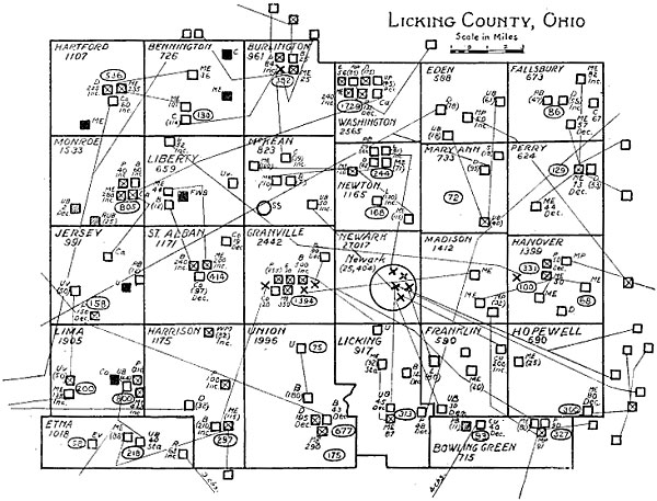
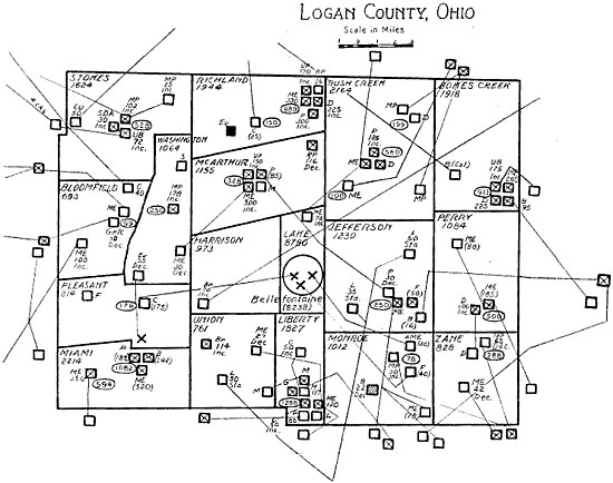
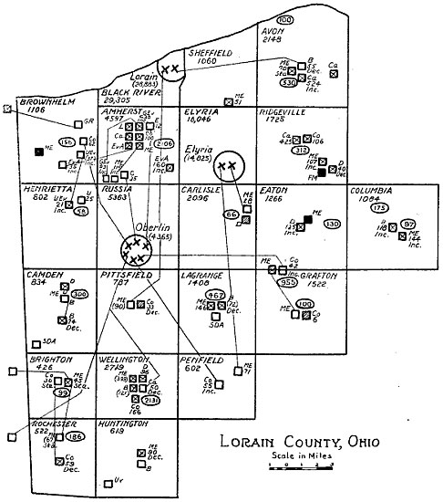
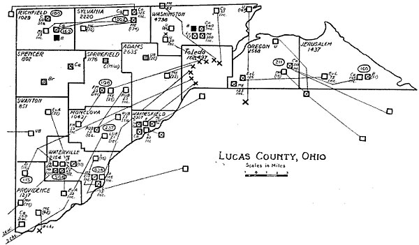
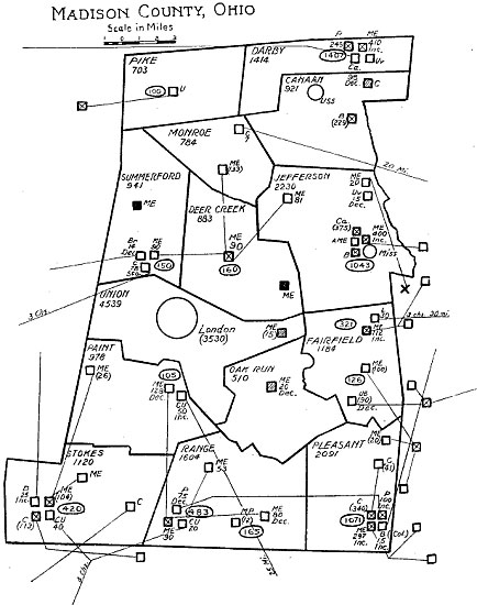
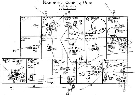
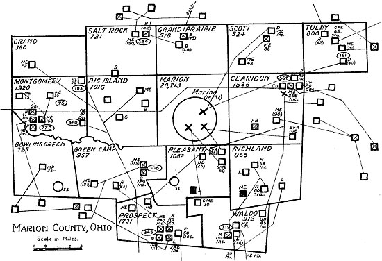
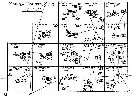
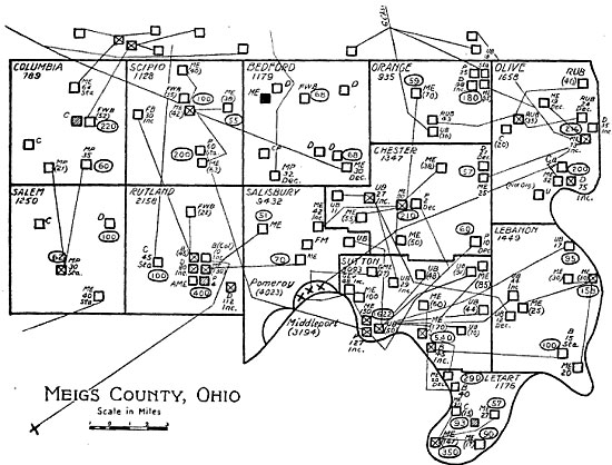
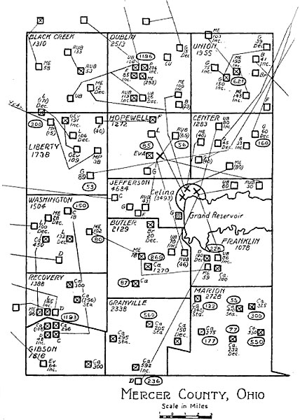
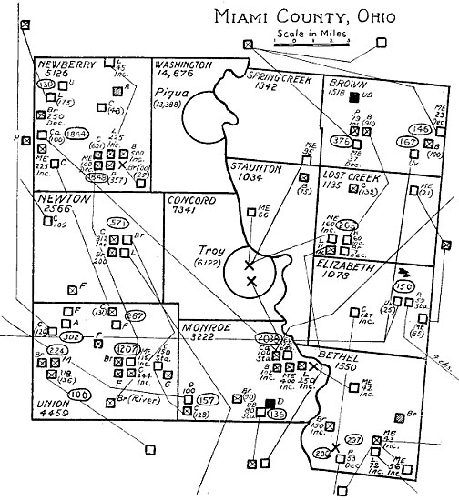
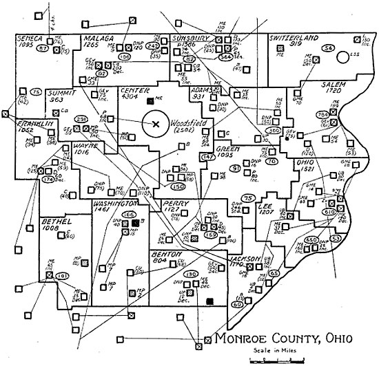
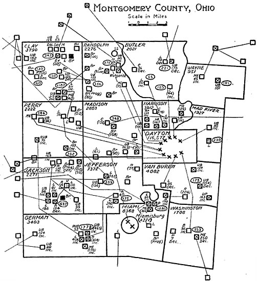
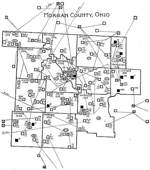
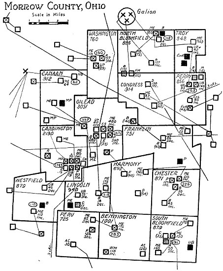
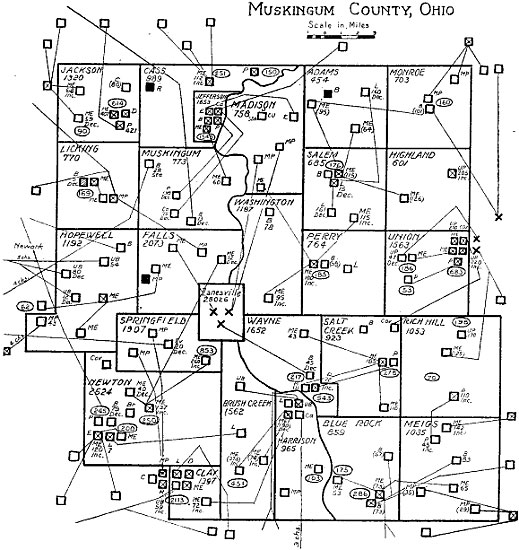
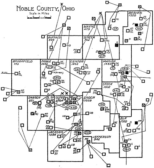
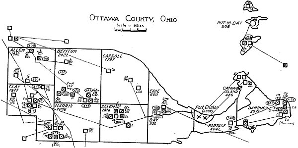
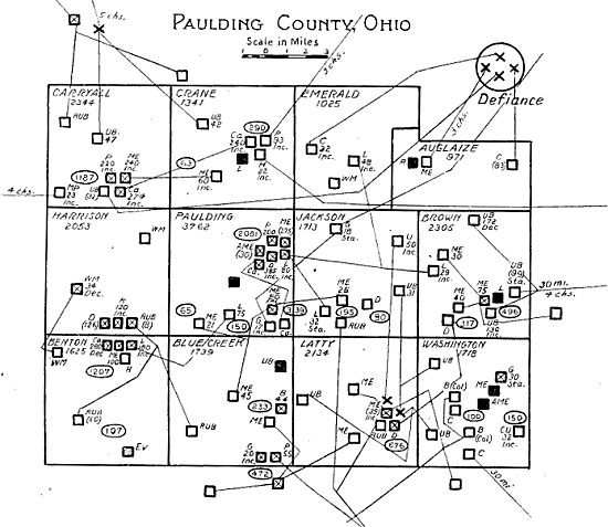
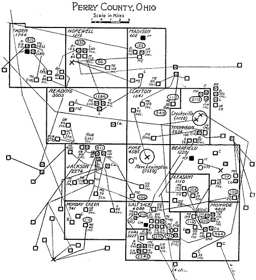
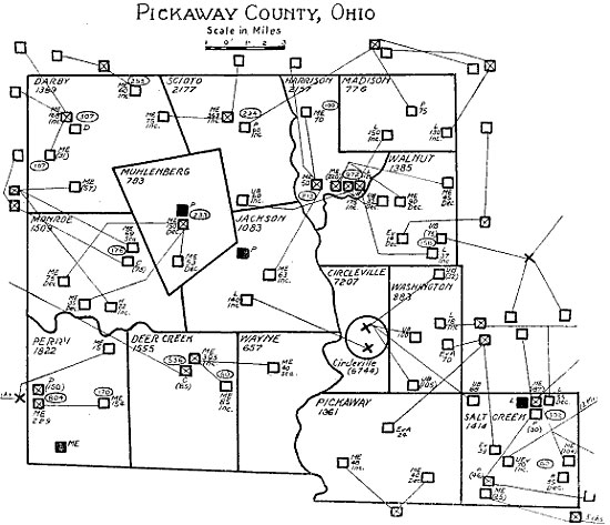
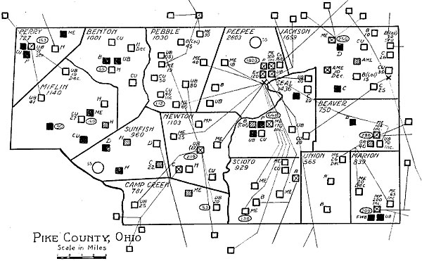
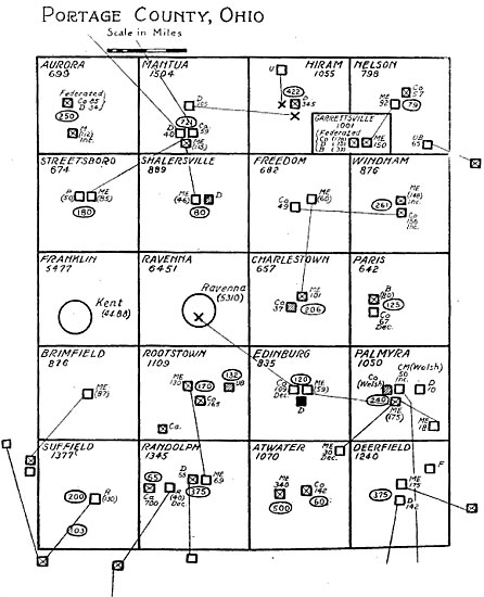
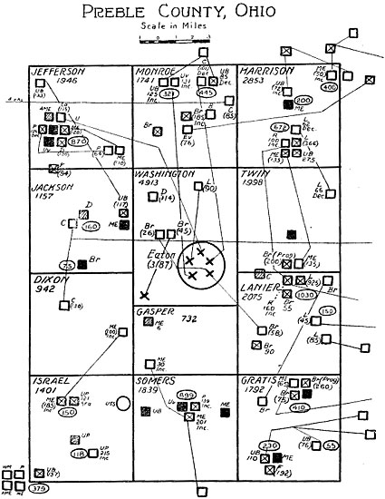
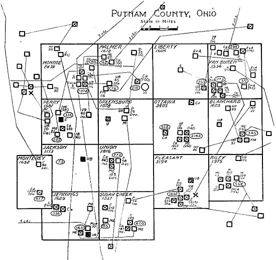
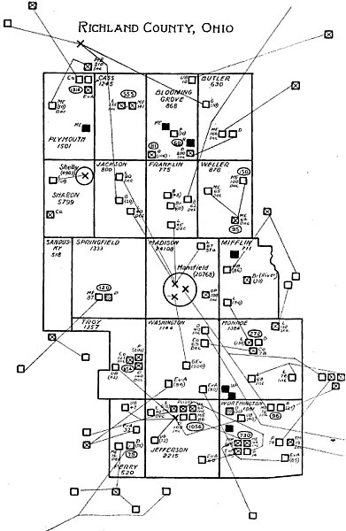
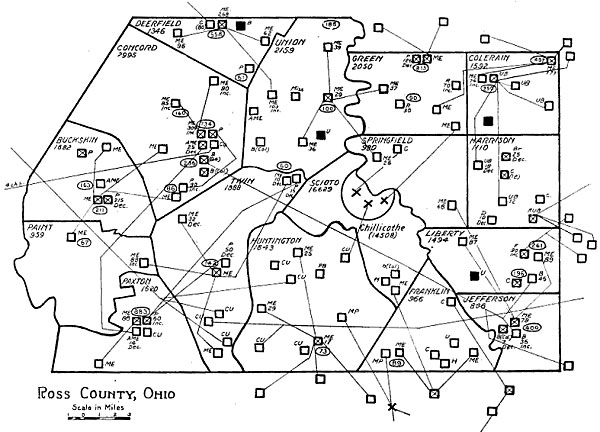
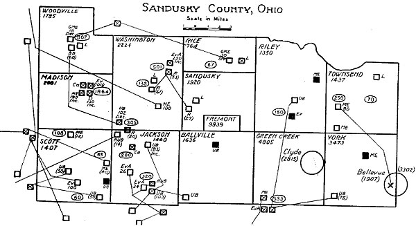
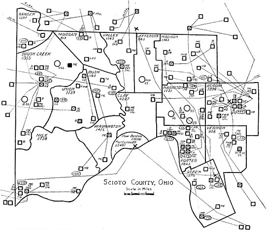
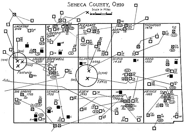
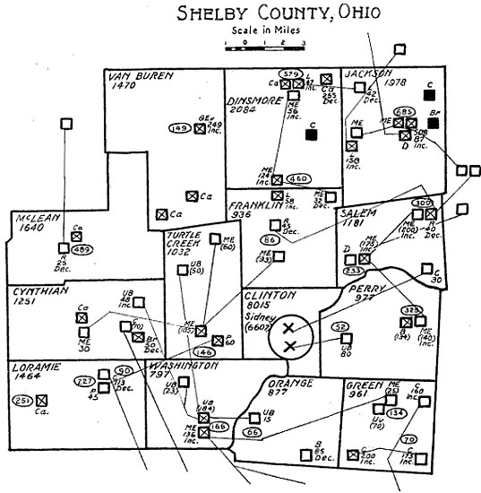
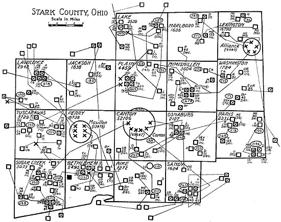
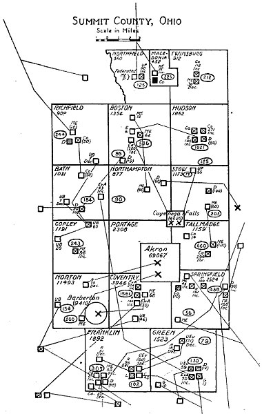
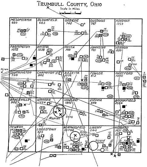
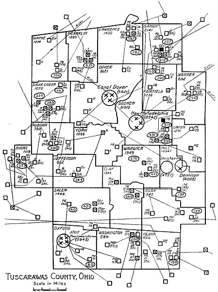
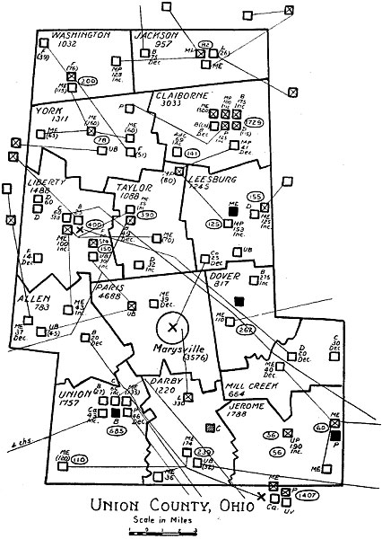
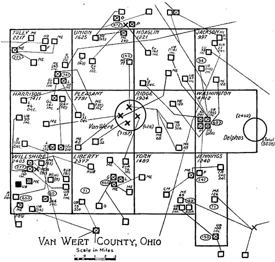
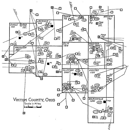
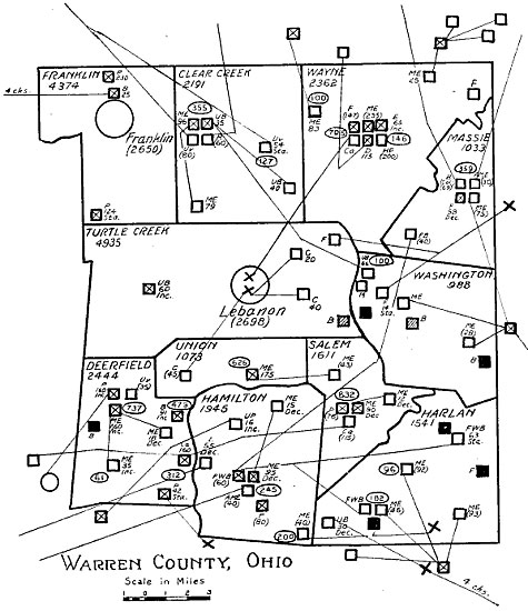
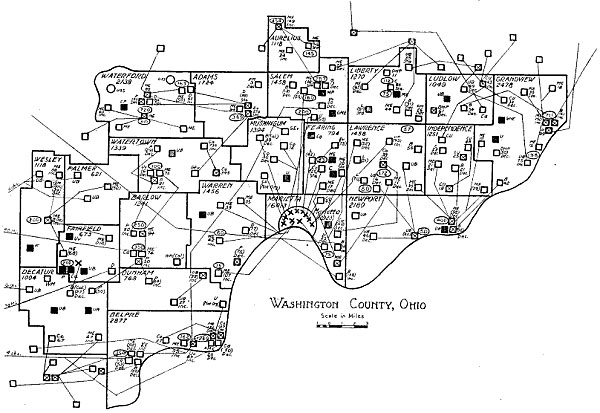
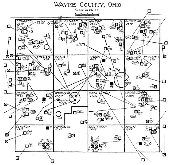
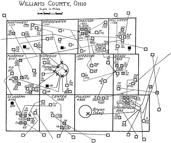
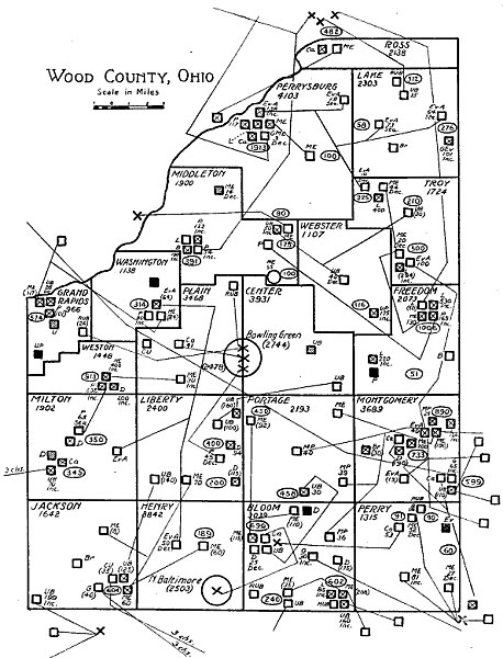
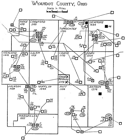
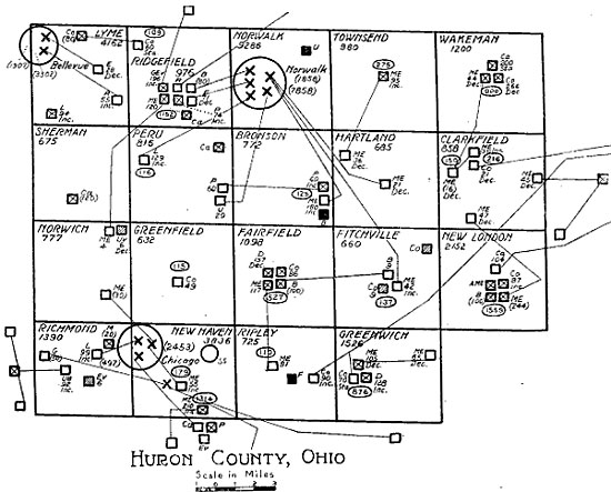
On the maps the location of each rural church is indicated by a square and the residence of each minister by a cross. Lines connect each church with the residence of its pastor. Therefore the maps show for each church whether it receives the whole or a part of a minister’s service, and for each minister how many churches he serves and the distances he must go to reach them and the various parts of his parish.

The capital letters adjacent to each square indicate the denomination of the church. The figures in parentheses and next to the square indicate the enrolled membership. The figures not so enclosed indicate the resident membership. The abbreviations, Inc., Sta., and Dec. indicate whether the membership is increasing, stationary, or declining. Increase or decline in membership, however, is only indicated where it was possible to find the membership of ten or five years ago. When the figures for ten years ago are available, these are taken as a basis for comparison with the membership at the present time. Often the records of the churches are so kept as to make it impossible or very difficult to find the membership of either five or ten years ago.

Shaded squares indicate closed churches. These have no minister and hold no regular services.

Abandoned churches are indicated by black squares. It is believed that large numbers of them were not reported.

Churches marked “Not Organized” do not appear in the tabulations.

In the northwest corner of each township is given its name, while underneath are figures indicating its population. The large circles in the township indicate cities or towns of more than 2,500 inhabitants. Figures in parentheses indicate the number of their population, which number is included in the figures for the township. But in each case where they are not in parentheses the town or city is itself a township. Figures in an oval indicate the number of persons living in the adjacent village or small town.

A key to the maps is here given.

KEY

✕Minister’s Residence ⊠Church with resident minister

□Church without resident minister ▧Church closed

■Church abandoned ◯Sunday School or Mission

Resident membership is indicated by numerals, enrolled membership by numerals in parentheses. Inc. denotes increasing membership; Dec., decreasing, and Sta., stationary membership.

ㆁNumerals in an oval indicate the population of a village.

ACAdvent Christian GEvGerman Evangelical

AMEAfrican Methodist Episcopal GMEGerman Methodist Episcopal

BrBrethren (German Baptist) HHoliness

Br (OO)Old Order Brethren IBAInternational Bible Students Association

Br (Prog.)Progressive Brethren LLutheran

BBaptist LDSLatter-Day Saints

B (Miss.)Missionary Baptist MMennonite

B (Col.)Colored Baptist MorMoravian

B (United)United Baptist MEMethodist Episcopal

BSABrothers’ Society of America MPMethodist Protestant

CChristian NazNazarene

CaCatholic PPresbyterian

CMCalvin Methodist PBPrimitive Baptist

CMAChristian Missionary Alliance RReformed

CNJChurch of New Jerusalem RUBRadical United Brethren

CSChristian Science SSaints

CUChristian Union SDASeventh Day Advent

DDisciples SDBSeventh Day Baptist

DNPDisciples, Non-Progressive UUnion

EProtestant Episcopal UBUnited Brethren

EvAEvangelical Association UPUnited Presbyterian

FFriends UEvUnited Evangelical

FMFree Methodist UvUniversalist

FWBFree Will Baptist USSUnion Sunday School

GChurch of God WMWesleyan Methodist
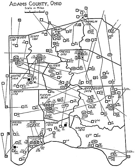
Adams County, Ohio
Adams County, Ohio
Allen County, Ohio
Allen County, Ohio
Ashland County, Ohio
Ashtabula County, Ohio
Athens County, Ohio
Athens County, Ohio
Auglaize County, Ohio
Belmont County, Ohio
Brown County, Ohio
Brown County, Ohio
Butler County, Ohio
Butler County, Ohio
Carroll County, Ohio
Champaign County, Ohio
Clark County, Ohio
Clark County, Ohio
Clermont County, Ohio
Clinton County, Ohio
Columbiana County, Ohio
Illustration from Six Thousand Country Churches
Crawford County, Ohio
Cuyahoga County, Ohio
Darke County, Ohio
Darke County, Ohio
Defiance County, Ohio
Delaware County, Ohio
Erie County, Ohio
Erie County, Ohio
Fairfield County, Ohio
Fayette County, Ohio
Franklin County, Ohio
Fulton County, Ohio
Fulton County, Ohio
Gallia County, Ohio
Gallia County, Ohio
Geauga County, Ohio
Geauga County, Ohio
Greene County, Ohio
Greene County, Ohio
Guernsey County, Ohio
Hamilton County, Ohio
Hancock County, Ohio
Hardin County, Ohio
Hardin County, Ohio
Harrison County, Ohio
Henry County, Ohio
Henry County, Ohio
Highland County, Ohio
Hocking County, Ohio
Holmes County, Ohio
Holmes County, Ohio
Huron County, Ohio
Huron County, Ohio
Jackson County, Ohio
Jefferson County, Ohio
Knox County, Ohio
Knox County, Ohio
Lake County, Ohio
Lake County, Ohio
Lawrence County, Ohio
Licking County, Ohio
Logan County, Ohio
Logan County, Ohio
Lorain County, Ohio
Lorain County, Ohio
Lucas County, Ohio
Lucas County, Ohio
Madison County, Ohio
Mahoning County, Ohio
Marion County, Ohio
Marion County, Ohio
Medina County, Ohio
Medina County, Ohio
Meigs County, Ohio
Meigs County, Ohio
Mercer County, Ohio
Mercer County, Ohio
Miami County, Ohio
Miami County, Ohio
Monroe County, Ohio
Monroe County, Ohio
Montgomery County, Ohio
Morgan County, Ohio
Morgan County, Ohio
Morrow County, Ohio
Morrow County, Ohio
Muskingum County, Ohio
Noble County, Ohio
Noble County, Ohio
Ottawa County, Ohio
Ottawa County, Ohio
Paulding County, Ohio
Perry County, Ohio
Perry County, Ohio
Pickaway County, Ohio
Pike County, Ohio
Pike County, Ohio
Portage County, Ohio
Preble County, Ohio
Preble County, Ohio
Putnam County, Ohio
Putnam County, Ohio
Richland County, Ohio
Ross County, Ohio
Ross County, Ohio
Sandusky County, Ohio
Scioto County, Ohio
Scioto County, Ohio
Seneca County, Ohio
Seneca County, Ohio
Shelby County, Ohio
Shelby County, Ohio
Stark County, Ohio
Stark County, Ohio
Summit County, Ohio
Summit County, Ohio
Trumbull County, Ohio
Tuscarawas County, Ohio
Union County, Ohio
Union County, Ohio
Van Wert County, Ohio
Vinton County, Ohio
Vinton County, Ohio
Warren County, Ohio
Warren County, Ohio
Washington County, Ohio
Wayne County, Ohio
Wayne County, Ohio
Williams County, Ohio
Wood County, Ohio
Wood County, Ohio
Wyandot County, Ohio
Explore with AITake your curiosity a little further.

Reading settings