Front matter
Reading edition
Please see the Transcriber’s Notes at the end of this text.
The cover image has been created for this e-text and is in the public domain.
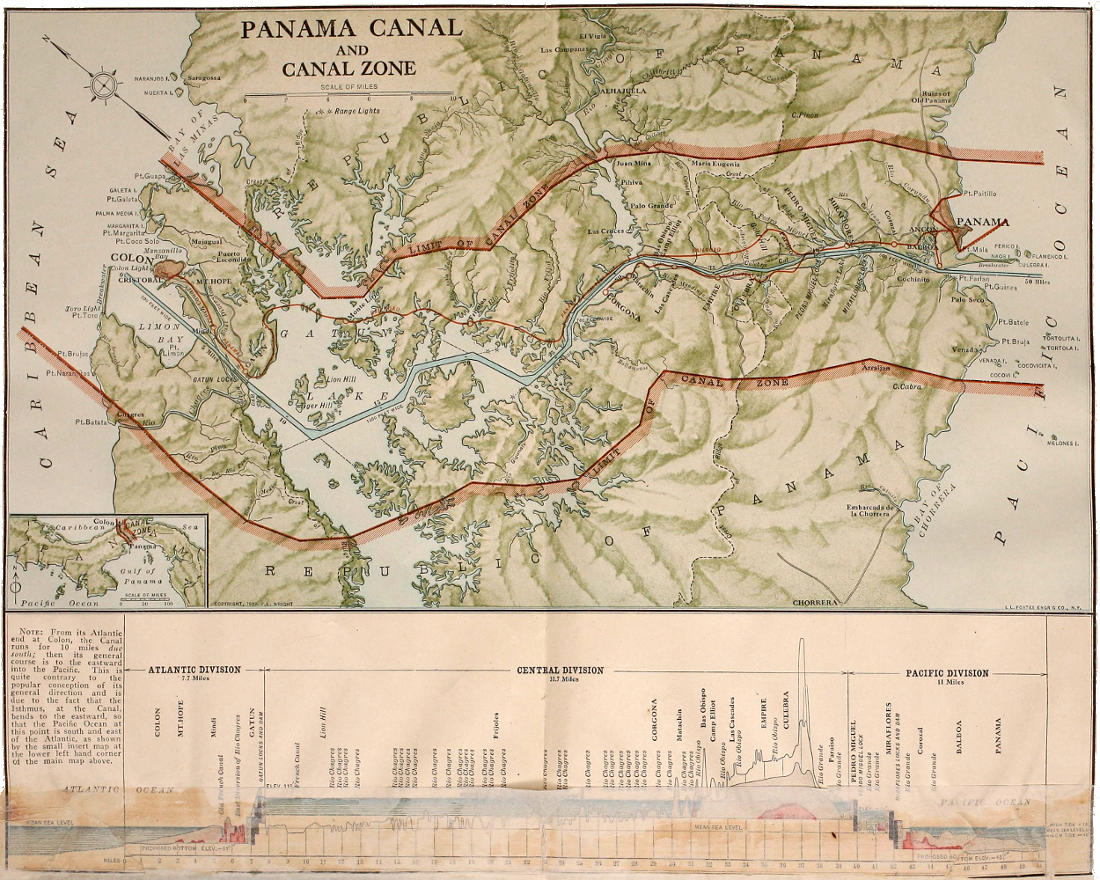
Note: From its Atlantic end at Colon, the Canal runs for 10 miles due south; then its general course is to the eastward into the Pacific. This is quite contrary to the popular conception of its general direction and is due to the fact that the Isthmus, at the Canal, bends to the eastward, so that the Pacific Ocean at this point is south and east of the Atlantic, as shown by the small insert map at lower left hand corner of the main map above.
Larger map (1 MB)
PANAMA And the Canal IN PICTURE AND PROSE
A complete story of Panama, as well as the history, purpose and promise of its world-famous canal—the most gigantic engineering undertaking since the dawn of time
Approved by leading officials connected with the great enterprise
By WILLIS J. ABBOT Author of The Story of Our Navy, American Merchant Ships and Sailors, Etc.
Water-colors by E. J. READ and GORDON GRANT
Profusely illustrated by over 600 unique and attractive photographs taken expressly for this book by our special staff
Published in English and Spanish by SYNDICATE PUBLISHING COMPANY LONDONNEW YORKTORONTO HAVANABUENOS AIRES 1913
Copyright 1913, by F. E. Wright