Front matter
Reading edition
Every attempt has been made to replicate the original as printed. The footnotes follow the text.
Some images have been moved out of paragraphs for easier reading.
(etext transcriber's note)
In certain versions of this etext, in certain browsers, clicking on this symbol will bring up a larger version of the image. Clicking on the larger symbol that appears over certain maps will bring up a very much larger version (approx. 3mb).

The World’s Great Explorers and Explorations.
Edited by J. Scott Keltie, Librarian, Royal Geographical Society; H. J. Mackinder, M.A., Reader in Geography at the University of Oxford; and E. G. Ravenstein, F.R.G.S.
PALESTINE.
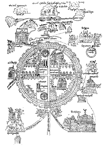
A PICTORIAL MAP OF JERUSALEM AND THE HOLY LAND, FOR THE USE OF PILGRIMS. (From a MS. of the 13th Century in the Burgundian Library at Brussels.)
Frontispiece.
P A L E S T I N E.
BY MAJOR C. R. CONDER, D.C.L., R.E. LEADER OF THE PALESTINE EXPLORING EXPEDITION. NEW YORK DODD, MEAD & COMPANY Publishers