Nalakihu-Citadel Trail
Reading edition
This booklet will guide you through Nalakihu (nah-LAH-kee-hoo), the small excavated surface pueblo near the parking area, and the Citadel, the large fortified, unexcavated structure on top of the butte. The trail is short and will lead you around to the rear of the Citadel, passing a large limestone sink, and to the top of the butte, where you may obtain a magnificent view of the surrounding country and see many other ruins from this vantage point. Numbered stakes on the trail correspond to numbered paragraphs in this leaflet, which will assist you in your understanding of this area and its early people.
We ask that you please keep off the ruin walls, and do not remove any pottery fragments, rocks, plants or other material from the area. Thank you.
1
This unexcavated, rectangular pithouse structure was of a type used by some of the inhabitants of the area prior to A.D. 1125.
Surface masonry architecture was not adopted by this tribe (archeologists call them the Sinagua—see-NAH-wah) until the early 1100s at which time their neighbors to the north, a tribe which scientists named the Anasazi (the Old People), introduced above-ground masonry structures to this region.
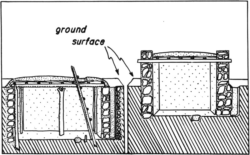
Reconstruction of two types of pithouses found in this region. Note the two methods of roofing and the ventilator at right.
2
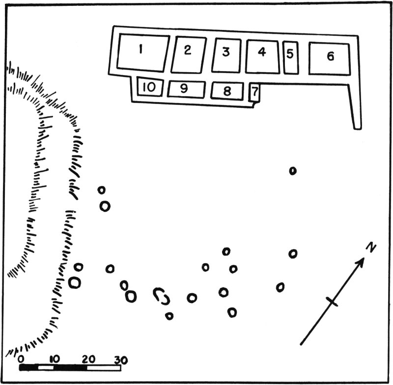
Ground plan of Nalakihu.
2
Nalakihu is a Hopi word meaning “Lone House” or “House Standing Alone.” This pueblo had 10 rooms on the ground floor, 3 or 4 more rooms which formed a second story, providing a home for about 25 to 30 people.
A charred roof beam of ponderosa pine, lying on the floor of the first room, gave a tree-ring date of A.D. 1183, indicating that this little pueblo was built in the late 1100s. Dates of 1192 and 1260 have been obtained on wood from the Citadel above which would cause us to believe that both pueblos were built at approximately the same time.
By observing how the walls of various rooms butt against each other we can deduce that the rooms at the secondary doorway constitute the oldest part of the pueblo, because these walls were erected at one time and the other walls butt against them. When these three rooms constituted the whole pueblo, it was probably a one-family house.
3
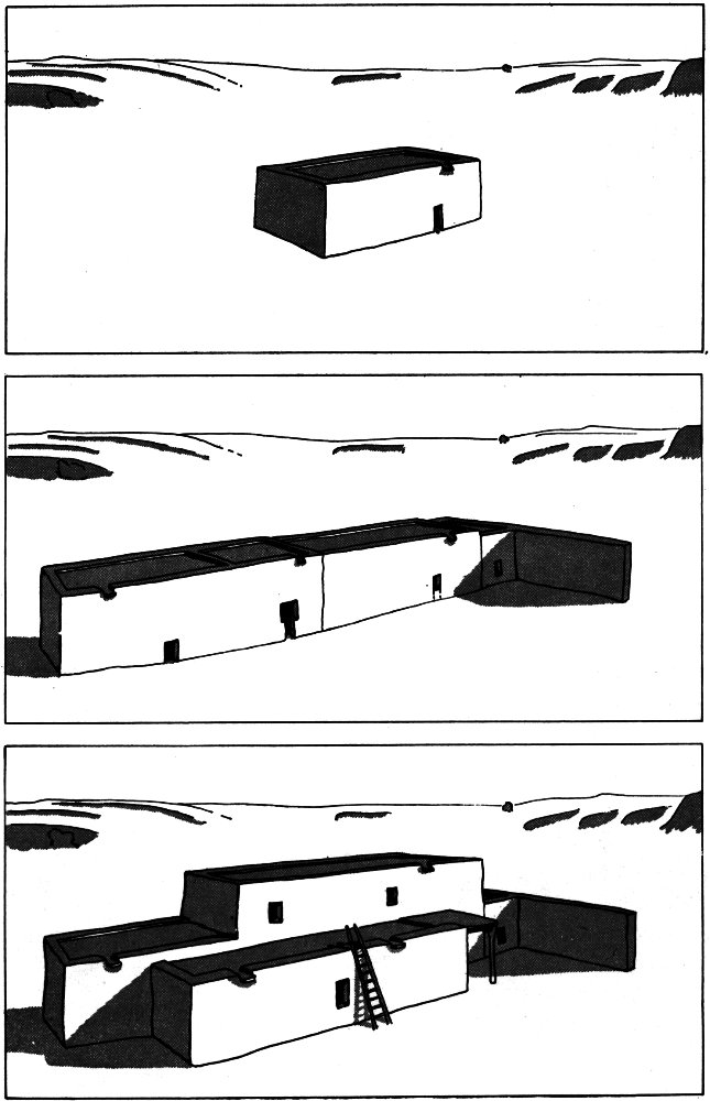
Three possible constructional stages through which Nalakihu may have passed. (Hatchways are omitted and drains are merely guesswork.)
4
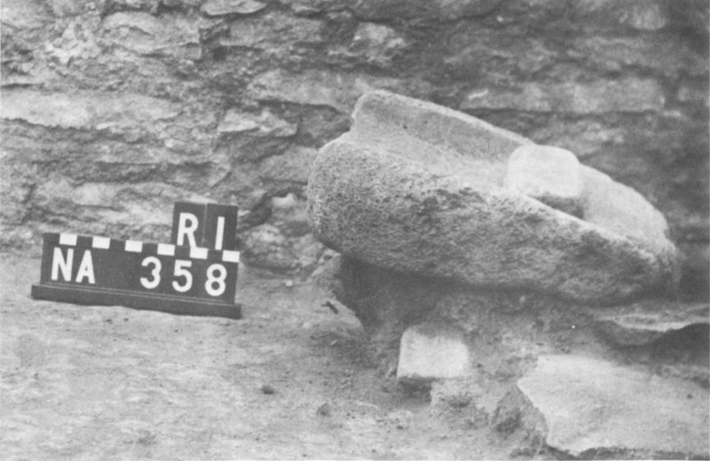
Metate (or mealing grindstone) resting on collapsed roof material in Room 1. There is a mano, or handstone, in it.
The three rooms in front of Nalakihu had no firepits and apparently were used for storage. The same applies to rooms 5 and 7. The remaining rooms had firepits and other features indicating they were dwelling rooms, such as ventilators to bring in fresh air at floor level, deflectors to keep draft of incoming air off firepits, and in room 4, loom holes to anchor the lower horizontal bar of a vertical loom.
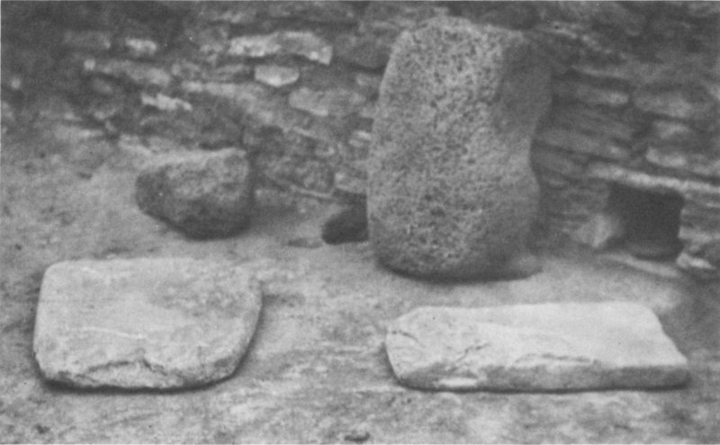
Arrangement of metates (grinding stones) found on floor of Room 1.
5
3
(Please enter inner room.) Roofs in Nalakihu had a main beam spanning the room’s shorter axis, with the rafter poles crossing it. Over these, narrow wooden shakes and sometimes stone slabs supported another layer of reeds, branches, bark, or grass, and 3 or 4 inches (7.5 or 10 cm) of clay. Two collapsed roofs were found in each of four rooms so we know a second story once existed over the central portion of the pueblo.
Note the T-shaped doorway through which you passed and also the occasional lines of black volcanic rock in the walls which probably were not for decoration because some courses in the building were covered with plaster.
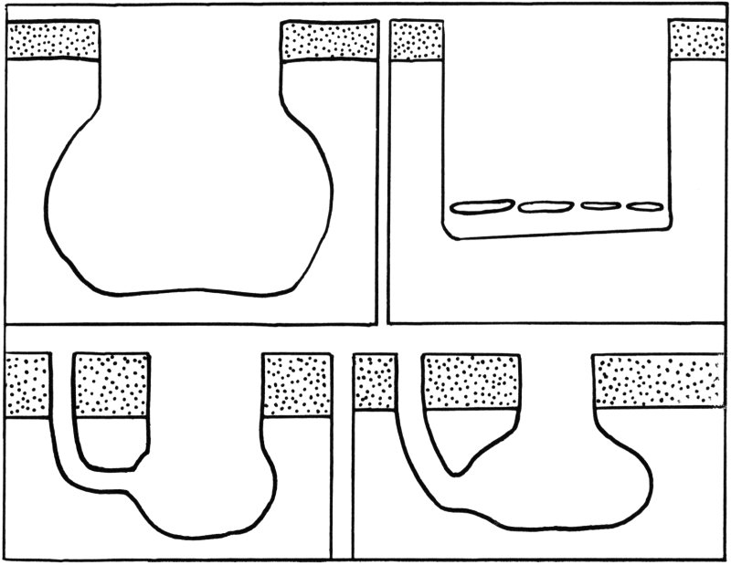
Cross-sections of various pits near Nalakihu.
4
You are now standing on the upper of two terraces. Exactly what they were used for we are not sure, but they may have been “kitchen gardens” similar to those in use today in some of the Hopi villages.
Below the terraces to the right of Nalakihu, archeologists discovered an unusual group of 6 burials and 16 storage, roasting or burial pits. Most of the pits were jar-shaped, some had vertical sides, and there were two pit ovens with flues, sort of teapot-shaped, with the spout actually being the flue. Three of the six burials were those 6 of infants in shallow pits, some lined with stone slabs. Only a bowl or a few sherds (pieces of broken pottery) were placed with them for grave offerings. These pits have been backfilled and are not visible today.
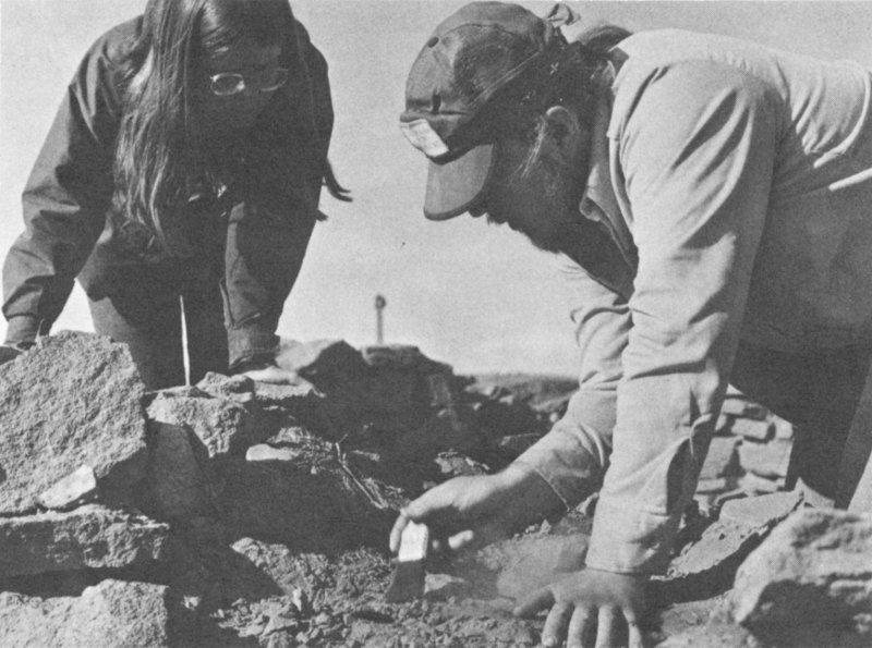
Archeologists work carefully to uncover a portion of collapsed roof.
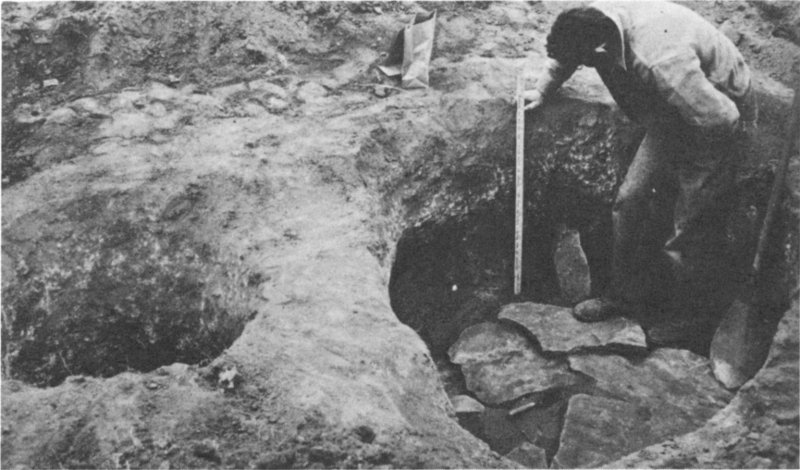
Pits 9 and 10 in which a few sherds, and bones of common raven, bighorn, and mule deer were found.
7
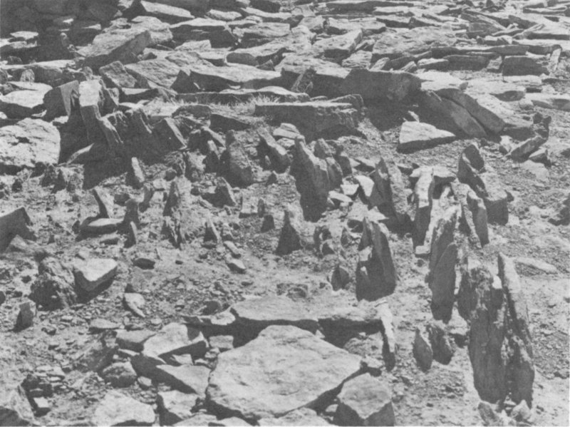
Rocks standing on edge in Citadel Ruin are the remains of walls that collapsed intact.
The Sinagua buried their dead with the body extended full length while the Anasazi buried them in a flexed position with the knees drawn up toward the chest.
The people who used these pits may have attached religious significance to owls, for only owl bones were found here. Winona Ruins south of here along U. S. Highway 66 produced only hawk bones.
Please stay on the trail.
5
You are standing in a circular ring of volcanic rock outlining a room. On the slopes of Citadel Butte are several similar round or rectangular outlines, none of which have been excavated. There is another just above you, and several below.
6
The structure above is a fortified pueblo built on a small remnant butte of volcanic origin. Note the loop holes. Through the higher of these openings defensive warriors could shoot with bow and arrow. The lower ones at floor level were air vents.
The black rock around you is basalt, formed by the cooling of molten lava. Its color is due to the presence of iron minerals.
7
The valley below was the farming area used by the early inhabitants of not only the Citadel and Nalakihu, but of many other 8 villages, the ruins of which you may observe on the surrounding mesas. How many can you count? There are at least eight visible.
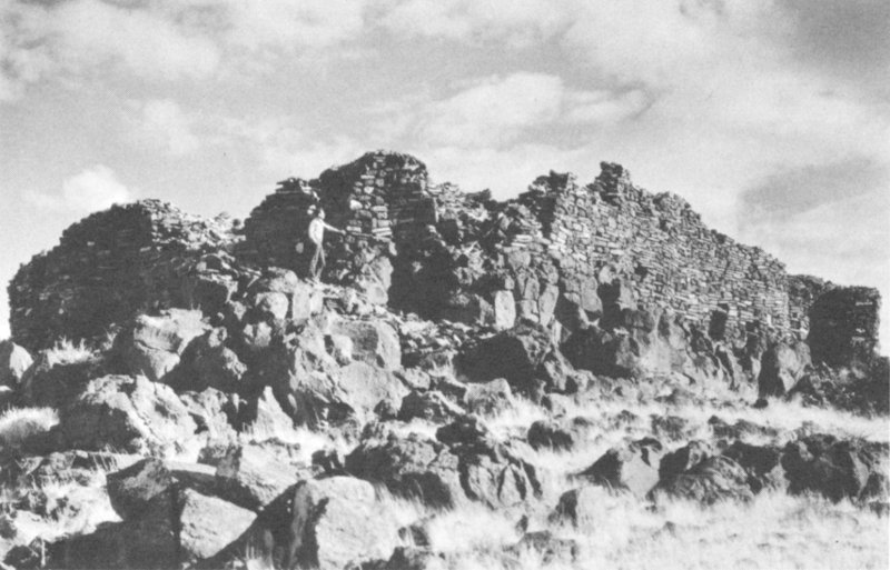
The Citadel, as seen from the west.
8
Note the way the walls of the Citadel follow the outline of the volcanic cliff upon which the structure is built. Again the loop holes are quite evident. The structure was probably two stories high on this side, which exhibits the best example of the masonry at this site.
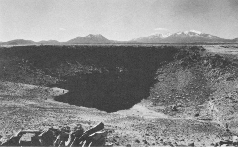
Citadel Sink with the San Francisco Peaks in the background, as seen from Citadel Ruin.
9
9
This limestone sink in the foreground was formed when the roof of a cavern in the Kaibab Limestone collapsed, probably plugging the outlet and allowing a pond to form. There is another sink 2 miles (3.2 km) to the south, and ruins are clustered around its edge also. The thick Kaibab Limestone forms the greatest portion of the walls of the sinkhole. It is stained by seepage from the overlying red Moenkopi Sandstone, a thin layer of which can be seen at the base of the black lava which forms the surface.
10
You are now entering the Citadel by an entrance utilized by the Indians of yesteryear. Note the loop hole guarding this entrance.
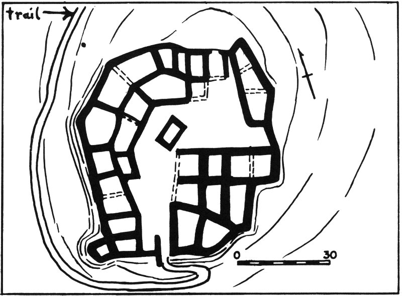
Ground plan of the visible walls of the unexcavated Citadel.
11
This ruin has never been excavated. It might tell a story of peaceful farming people finding it necessary to defend themselves from neighboring tribes. Around the depression in the middle there is space for an estimated 30 rooms; the outlines of some can readily 10 be seen. Approximately 50-60 persons probably lived in this village.
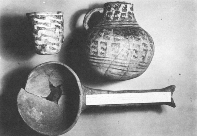
Pottery from cremation burials, a mug, pitcher, and a ladle.
Most of the broken pottery found on the Citadel’s slopes is of the type made by the Anasazi, a prehistoric tribe which once lived to the north of here. Nalakihu’s pottery, however, was only one-third Anasazi, the other two-thirds being of the Sinagua and Prescott tribes. The latter lived to the south and west. Different people who were drawn to this region by the good farmlands created by the cinder cover that fell with the eruption of Sunset Crater in A.D. 1065, lived together as neighbors in this region, thus accounting for the different types of pottery in the ruins.
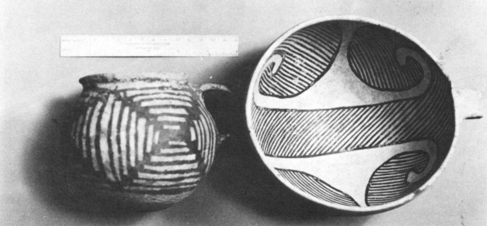
Black-on-white pitcher and bowl funeral offerings.
11
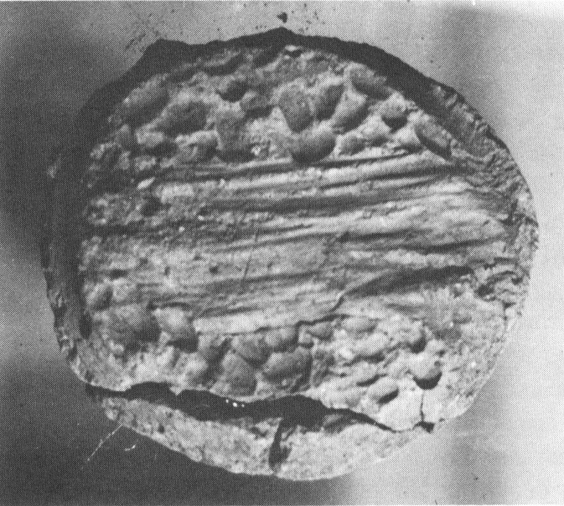
Clay pot lid, showing imprints of beans and corn husks.
12
Almost all of the dwellings were occupied for only a short period. When the winds finally duned up the black cinders and blew them off into the arroyos and the springs dried up, the people had to move to a more productive location to grow their crops. We believe that the Anasazi moved north into the Tsegi Canyon country while the Sinagua moved south into the Verde Valley and east to Chavez Pass near Winslow by the middle 1200s.
Every litter bit hurts!
13
You can see why the early people utilized this vantage point for the construction of a fortified pueblo. Today, we can thank them for a magnificent view of the surrounding country. In the distance can be seen the San Francisco Peaks, O’Leary Peak, Sunset Crater, Painted Desert, Gray Mountain, and numerous volcanic cones, remnants of the San Francisco volcanic field, over 2 million years old.
The structures you see from this point represent only a few of the more than 800 sites found within Wupatki National Monument. The largest ruin in this area is Wupatki ruin, 9 miles (14.5 km) to the southeast. Wupatki, which has been excavated, housed about 250 persons during its period of occupation. A visit to Wupatki is well worth your while.
14
We hope you have enjoyed this trail. Please Return This Booklet to the Register Stand Before You Go, or You Can Purchase It by Dropping 15 Cents in the Coin Slot.
12