The Montezuma National Forest
Reading edition
THE MONTEZUMA NATIONAL FOREST was established by proclamation of President Theodore Roosevelt on June 15, 1905. Its gross area is 837,228 acres, of which 737,440 acres are Government land.
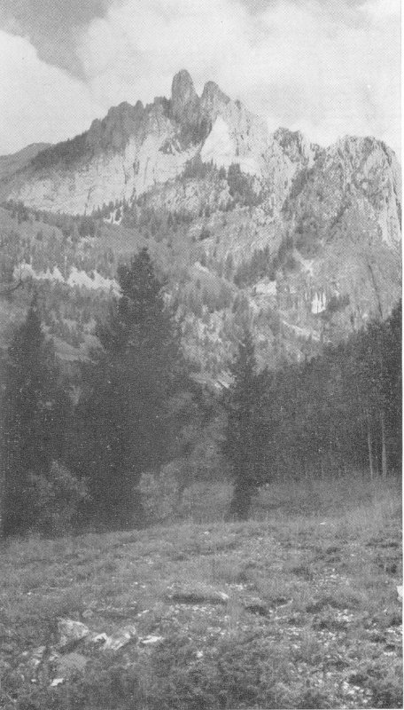
F-376865 OPHIR NEEDLES
The topography of the forest varies from the extremely rugged San Miguel Range in the north and the rough 3 but slightly lower La Plata Range on the east, to the high mesas of the southwestern part. The Dolores River flows southwest through the eastern part of the forest. Near the town of Dolores the river makes an abrupt turn to the north, and the west boundary of the forest follows to a greater or less degree the Dolores River Valley. Throughout the forest innumerable streams and canyons lead down from the San Miguel and La Plata Ranges and the Dolores Plateau.
The San Miguel Range extends westward through the north end of the forest. Lizard Head Peak (13,156 feet), Sunshine Mountain, Lone Cone, Wilson, and Dolores Peaks, and Mount Wilson (14,250 feet) are outstanding topographical features.
MONTEZUMA—KING OF MEXICO
Montezuma was the ninth king of Mexico and a powerful general of the Aztec tribes. When Hernando Cortez conquered Mexico in the early part of the sixteenth century, Montezuma was the dominant war chief of the Western Hemisphere and was held in fear by other tribes. He tried, however, to avoid war with the Spaniards and welcomed them to the capitol. Cortez, having thus obtained an advantage, held Montezuma and the city captive. In the succeeding battles, Montezuma was killed by his own people.
The name has retained historically romantic significance and occurs frequently throughout the Southwest. It is appropriate for this forest where most of the names and many of the customs are of Spanish origin.
EARLY HISTORY OF THE AREA
Spanish traders and explorers made frequent trips into southern Colorado during the eighteenth century. Those of record were led by Capt. Juan Marie de Rivera, in 1765, and Padre Francisco Escalante, in 1776. Each party followed approximately the same route from Santa Fe to the San Juan Basin, westward to the Mancos River, thence northward across the forest through the Dolores and San Miguel Valleys to the vicinity of the present town of Placerville. From this point they crossed the Dallas Divide to the Uncompahgre and Gunnison Valleys. De Rivera’s route beyond that point is unrecorded. Escalante continued through 4 Colorado, Utah, Arizona, and New Mexico to Santa Fe.
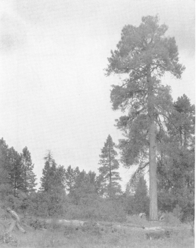
F-376867 T-I-M-B-E-R!
During these expeditions, Spanish names were given to many of the geographical and topographical features and were retained throughout the forest. Farther north, they were replaced by English names.
In 1831, the St. Louis Fur Company employed a party under command of W. G. Walton to trap along the headwaters of the San Juan River. The party spent the summer of 1833 in the valley of the Rio Dolores and at Trout Lake. Parties under the command of Lieutenant Howard in 1861 and Colonel Nash in 1866 were also in the Dolores Valley. Prospectors soon followed, and claims were located in the vicinity of Rico in 1869. Ranchers came in very soon after the prospectors, and the mining and cattle industries were principally responsible for settlement and development within and adjacent to the forest.
THE HIGHWAYS AND RAILROADS
Mancos, where the forest headquarters are located, 5 and the southern part of the forest may be reached over U S 160 from Durango and Alamosa, Colo., to the east or Cortez and Monticello, Utah, from the west. U S 550, a highly scenic route from Montrose, Ouray, and Silverton, joins U S 160 at Durango.
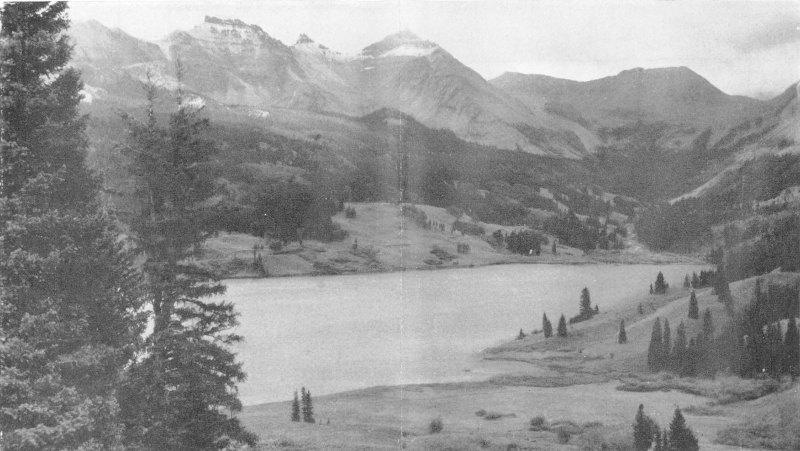
F-376864 TROUT LAKE WITH VERMILION PEAK AND SAN JUAN MOUNTAINS IN BACKGROUND
During the summer, busses operate over these highways between Grand Junction and the Mesa Verde National Park, which lies a short distance south of the Montezuma National Forest.
The best approach from the south is U S 666, from Shiprock, N. Mex., to Cortez, on U S 160. From points near that junction two State highways extend northward through the forest. State Highway 145 passes through Dolores, Rico, Telluride, Placerville, and Norwood, important towns within or near the forest, to junctions with State Highways 62 and 90. State Highway 147 is a more direct route between Dolores and Norwood, and State Highway 184 connects Dolores and Mancos.
The Rio Grande Southern Railroad was completed in 6 1891 and led to the rapid development of the forest area. This railroad traverses approximately the same route as State Highway 145 between Dolores and Placerville, and the principal towns of the forest may be reached by rail from Ridgeway or Durango, where connections are made with the Denver and Rio Grande Western Railroad.
OBJECTIVES OF NATIONAL FORESTS
There are 158 national forests within the United States, including two in Alaska and one in Puerto Rico. They contain approximately 175,000,000 acres of public land and are administered by the Forest Service, United States Department of Agriculture. The Montezuma is one of 14 in Colorado.
To grow a timber crop and to protect the forest and vegetative cover as a precautionary measure against erosion on the watersheds, are important and necessary. To this end the national forests were established with the positive injunction that all their resources were to 7 be protected, developed, and used in perpetuity for the benefit of all citizens. Therefore, conservative use of all forest resources, with adequate protection to insure a continual supply, has been the primary consideration in their management.
WATERSHED VALUES OF THE MONTEZUMA
The forests of the Montezuma have high watershed value and a forest cover is very important, because the dominant soil types are silt and clay loam which erode readily. If these soils are not held in place, much material is carried away by the streams. In the aggregate, this has a considerable effect on the Colorado River and the water it furnishes for irrigation.
The headwaters of the principal streams of this region rise on the forested watersheds of the Montezuma. These watersheds are covered with deep snows each winter, and the forest cover retards the melting snow and provides a more uniform distribution of the run-off. Watershed protection is, therefore, an essential and important factor in the administration of the forest.
Irrigation water for Thompsons Park, the Montezuma and Paradox Valleys, and the Norwood-Redvale country is provided by streams which rise in the Montezuma Forest. The towns of Rico and Telluride obtain their water supply from the forest. In addition to the use of water for irrigation and domestic purposes, a number of water-power sites have been developed on the forest. A large volume of water flows into the Colorado River, and these waters are impounded by Boulder Dam and used for power and irrigation in the general development of that project.
TIMBER IS CHIEF RESOURCE
The Montezuma National Forest has a stand of about 2,072,000,000 board feet of timber. About 57 percent of this is Engelmann spruce, 23 percent is ponderosa pine, and 19 percent is a mixture of alpine and cork-bark fir. There are also small quantities of Douglas fir and piñon pine.
During the last 5-year period there has been an average yearly cut of 12,000,000 board feet of lumber on the forest. Most of this was sawed at McPhee, where the largest sawmill in Colorado is located. It has a capacity of 80,000 board feet each working day. In previous years, it has sawed considerable timber cut from privately-owned land, but is now dependent largely upon timber from the forest. The spruce timber, of which 8 there is a large amount on the Montezuma, is especially well suited for pulpwood.
Timber is grown and cut in accordance with approved forestry methods. Mature trees to be removed are marked in advance of cutting by trained foresters. Trees which are not mature are left to be cut in later years. They respond to the influence of more light, soil moisture, and nutriment with greatly increased growth and also seed the open places.
UTILIZATION OF FORAGE RESOURCES
Raising livestock is a large and important industry in and adjoining the forest. Stock is wintered on the nearby ranches and depends for summer pasture on the forest ranges. Some 20,000 cattle and 66,000 sheep, owned by 285 stockmen, are grazed on the forest each summer.
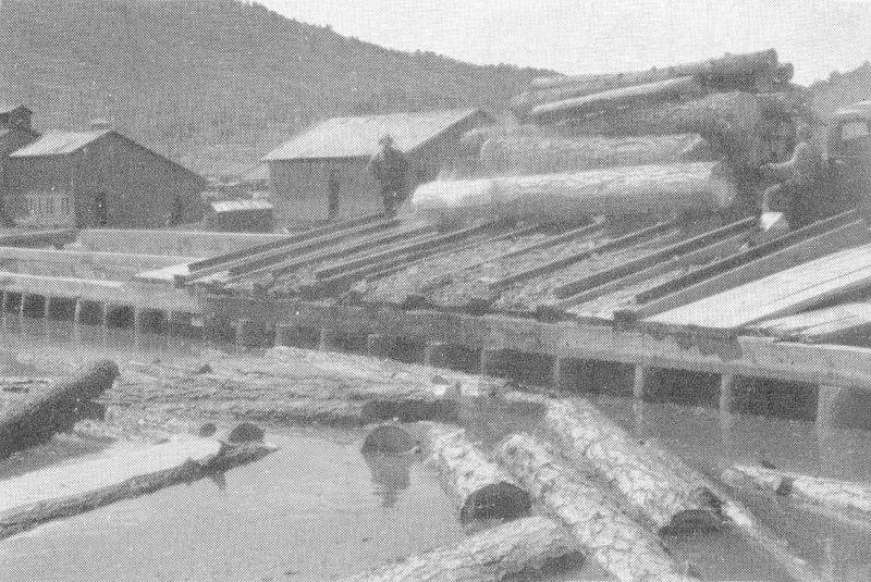
F-376871 MILL POND AT M’PHEE
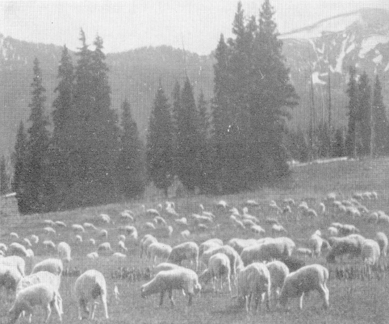
F-80528 SHEEP GRAZING IN A GRASS PARK AREA OF THE MONTEZUMA
9
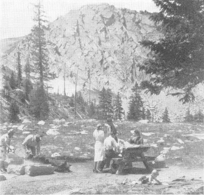
F-364895 IMPROVED PUBLIC CAMP AND PICNIC GROUNDS ARE AVAILABLE AT MANY ATTRACTIVE POINTS ON NATIONAL FORESTS AND ARE EQUIPPED WITH FIREPLACES, TABLES, AND SANITARY FACILITIES.
The handling of the summer range is a large undertaking. Distribution and management of livestock are carefully regulated to prevent damage to the forest growth and to conserve the forage resources. A cover of grasses and weeds must be retained to prevent erosion. Forest officers constantly study the ranges and work with stockmen in planning management of grazing and construction of improvements needed for the control of stock.
In the allotment of range, previous use of the range and the raising of sufficient forage to feed stock during the winter are determining factors. The permanent ranch owner is given preference, which helps to stabilize the industry.
HERE MINING IS ALSO IMPORTANT
Mining was and still is an important industry of the forest region. The mines of Telluride and Ophir, in San Miguel County, have been heavy producers. Telluride, with its famous Liberty Bell, Smuggler Union, and Tomboy mines, is still one of the producing camps of southwestern Colorado. Figures furnished by the 10 United States Bureau of Mines place the total ore production of these camps during the period 1875 to 1937, inclusive, at $119,349,969. The output for 1930 to 1937, inclusive, was $2,539,940.
Rico, the principal mining camp of Dolores County, reached the peak of production in 1893, when ores to the value of $2,696,371 were mined. The total output of mines in that vicinity since 1879 is placed at $20,574,557.
Mining claims may be located in the national forests wherever ores of sufficient value to justify development are found. Legitimate mining is encouraged by the Forest Service.
RECREATION USE AND DEVELOPMENT
The recreation areas of the forest are extensively used by local residents and tourists for picnicking, camping, fishing, hunting, and riding. Improved public camp and picnic grounds are available at many attractive points and are equipped with fireplaces, tables, and sanitary facilities. Medium-price resort accommodations are available near and within the forest from which trips may be made to points of scenic and historical interest. Saddle horses and pack horses are obtainable for those who wish to ride or camp in the back country and see the forest from the many trails that lead into the areas not accessible by roads.
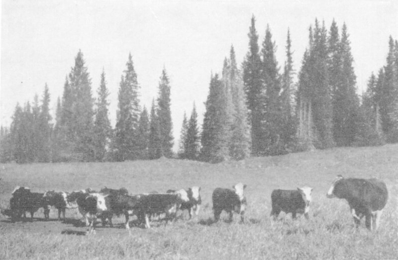
F-24903A USE OF FORAGE RESOURCE HELPS TO STABILIZE THE LIVESTOCK INDUSTRY
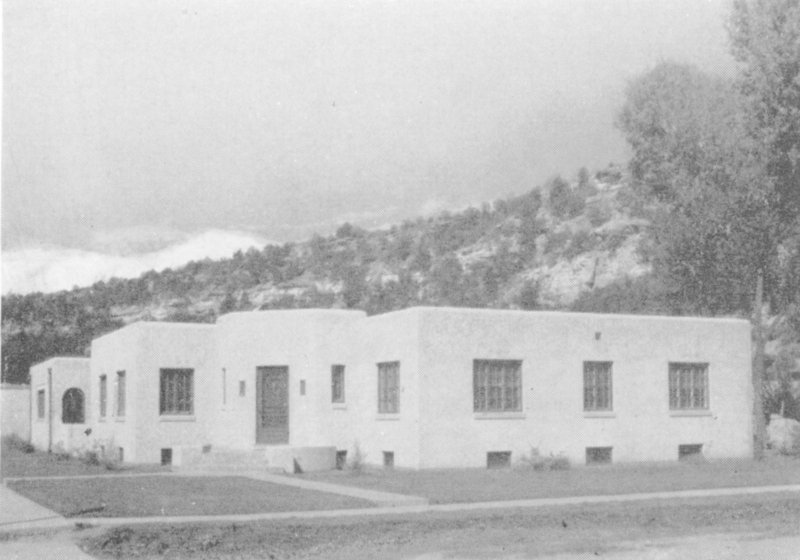
F-376869 DOLORES RANGER STATION
11
WILD AREAS OF THE FOREST
The Wilson Mountain Wild Area extends west from Lizard Head and Blackface Mountains to Flat Top and Dolores Peaks and contains about 27,347 acres. Sunshine, Wilson, and Gladstone Mountains and Wilson Peak are included, and the area affords the utmost in scenery and mountain climbing. Nearly half of it is barren land above timberline. About 5,000 acres are wet meadows or alpine grasslands. The remainder is covered with timber, chiefly Engelmann spruce and alpine fir. Grazing of domestic stock, improvements necessary for fire protection, and development of water-storage projects may be permitted, but there will be no summer homes, no resorts or commercial enterprises, no scenic highways, and no commercial timber cutting.
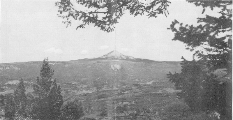
F-376868 LONE CONE PEAK
12
An area of 2,800 acres, especially adapted to scientific and educational use and known as the Narraguinnep Canyon Natural Area, has been designated in the canyon of that name which drains into the Dolores River, about 24 miles west of the town of Dolores. Access to this canyon is difficult and no timber cutting or grazing of domestic stock is permitted. Under these restrictions, it will be possible to preserve in its virgin condition a typical southwestern Colorado canyon type of ponderosa and piñon pine, juniper, oak, serviceberry, and other shrubs and plants.
HUNTING AND FISHING
In 1937, forest officers estimated that there were 470 elk, 4,000 mule deer, 400 black or brown bears, and a few mountain sheep on the forest. Deer, mountain sheep, and bears are not increasing but are holding about even numbers, while elk are increasing. The forest could support more of these game animals, and efforts are being made to build up the big game resources. Game birds are not plentiful, but grouse and ptarmigan may be seen. Ducks nest on the numerous reservoirs and small lakes on the forest.
13
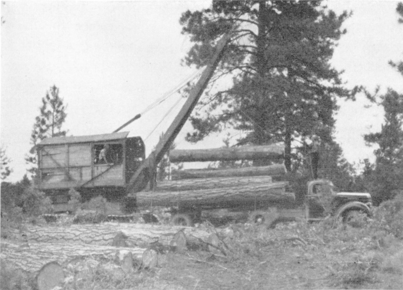
F-376866 LOADING LOGS
Excellent trout fishing is found in the streams and lakes. The Dolores River affords 50 miles of good angling and its west fork 30 miles more. East and West Mancos Rivers, Bear, Bilk, and Beaver Creeks, and tributaries of the Dolores River are good fishing streams. Trout and Woods Lakes contain large fish and are popular places for recreation.
Forest officers or State game wardens will gladly give information about the routes to follow, the location of improved campgrounds, the better places to hunt or fish, and where to obtain horses to go beyond the end of the motor roads.
Sportsmen who enter the forests to hunt or fish should obtain the State license required by law; and all are asked to exercise care with fire.
HELP PREVENT FOREST FIRES
The area now within the Montezuma National Forest suffered repeatedly from fires before the forest was established. Since being put under administration, the fire loss has been reduced. Nevertheless, the loss has been considerable—4,037 acres of timber, grass, and brushland within the forest having been burned over in 28 years, or an average of about 144 acres annually. Seventy-nine percent of this was burned in 6 bad fire 14 years. In 6 favorable years, the loss was less than 1 acre annually. Without prompt action of local citizens and forest officers, however, the average burned and the damage sustained would unquestionably have been very much greater.
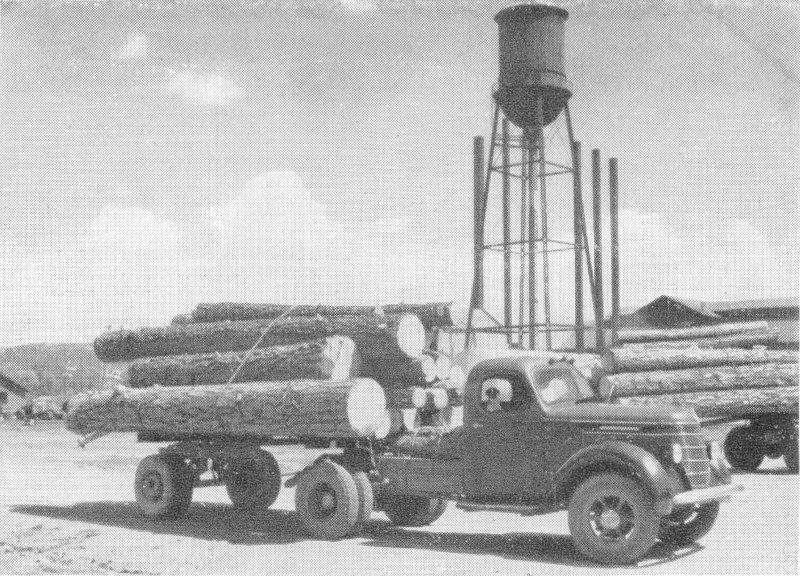
F-376870 HAULING LOGS FROM THE NATIONAL FOREST
Fire is the most destructive enemy of the forests. A lighted match, cigarette, or cigar carelessly tossed aside, or a campfire left burning may result in a disastrous forest fire and the destruction of valuable forest cover.
About 51 percent of the fires that occur in the Rocky Mountain Region are man-caused and are preventable. Visitors to the forests are urged to exercise the greatest care with fire, and to follow carefully the SIX RULES FOR PREVENTION OF FOREST FIRES printed elsewhere in this folder.
ASK THE FOREST RANGERS
The Montezuma National Forest is divided into five ranger districts, each of which is administered by a forest ranger, working under the direction of the forest supervisor. The rangers are always ready to furnish information to visitors and assist them in every way possible. The headquarters of the supervisor and the rangers are listed below:
Forest Supervisor U. S. Forest Service, Mancos, Colo.
Forest Ranger Mancos District, Mancos, Colo.
Forest Ranger Dolores District, Dolores, Colo.
Forest Ranger Glade District, Dolores, Colo.
Forest Ranger Rico District, Rico, Colo.
Forest Ranger Norwood District, Norwood, Colo.
Forest Ranger Timber Sales, McPhee, Colo.
15