LIST OF MAPS AND ILLUSTRATIONS.
Reading edition
Map of Country Traversed.
General Map, with Routes.
Plan of Momien; by Burmese Surveyor.
Mandalay, the Capital of Independent Burma; from Mandalé Hill Frontispiece.
From a photograph by Colonel Sladen.
To face page
The Deva-faced Cliff, Second Defile of the Irawady 34
From a photograph by the Author.
Rocky Barrier on the First or Upper Defile of the Irawady 55
From a photograph by Major Williams.
Kakhyen Women 74
From a photograph by Major Williams.
Our Camp at Ponsee 89
From a photograph by Major Williams.
Kakhyen Men—Kakhyen Matrons 125
From photographs by Major Williams.
Kakhyen and Shan Pipes, Musical Instruments, etc. 134
From photographs.
Nantin Valley, Town of Muangtee to the Left 178
From a sketch by the Author.
Extinct Volcano of Hawshuenshan; from Summit of Momien Hill 186
From a sketch by the Author.
Within the Walls of Momien or Teng-yue-chow 192
From a sketch by the Author.
Waterfall of the Tahô; Momien in the Distance 208
From a sketch by the Author.
Valley of Sanda, looking Westward from the Hill behind the Town 254
From a sketch by the Author.
Shan Head-dress, Bracelets, and Ear Ornaments 296
From photographs.
Posturing Girl at Mandalay 354
From a photograph by the Author.
View in Bhamô 364
From a photograph by Major Williams.
Tsitkaw, on the Tapeng, looking towards the Kakhyen Hills 401
From a photograph by the Author.
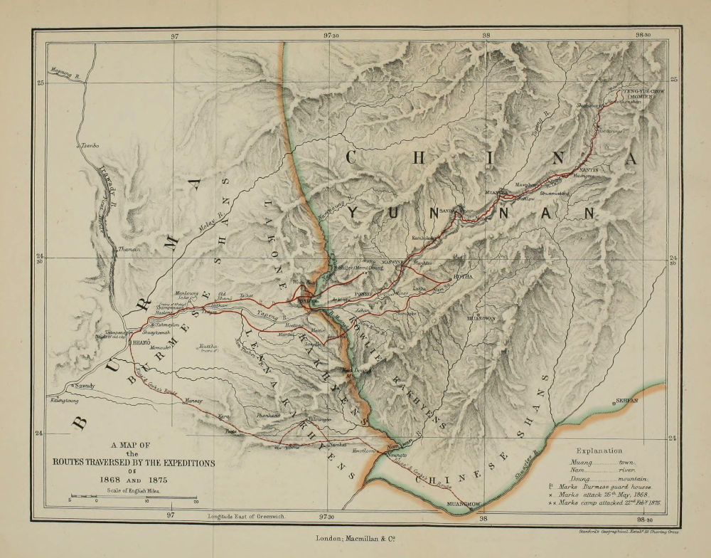
A MAP OF the ROUTES TRAVERSED BY THE EXPEDITIONS OF 1868 AND 1875 Stanford’s Geographical Estabᵗ 55 Charing Cross. London; Macmillan & Cᵒ.
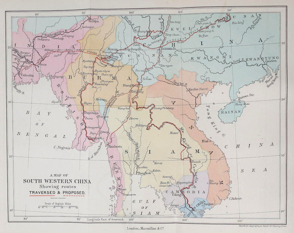
A MAP OF SOUTH-WESTERN CHINA Showing routes TRAVERSED & PROPOSED. Stanford’s Geographical Estabᵗ. 55 Charing Cross. London; Macmillan & Cᵒ.
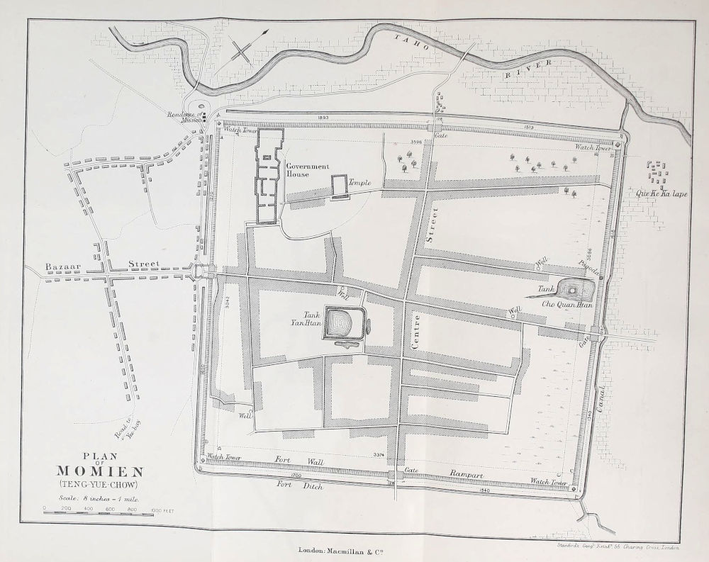
PLAN OF MOMIEN (TENG-YUE-CHOW) Stanford’s Geogˡ. Estabᵗ. 55 Charing Cross, London. London; Macmillan & Cᵒ.