Guide to the Area (SEE MAP ON PAGE 48.)
Reading edition
Guide to the Area (SEE MAP ON PAGE 48.)
This guide has been prepared to enable the visitor more readily to identify and appreciate the chief points of historical interest on the two battlefields. While there are other locations of importance on park property and on privately owned adjacent lands, those listed below may be considered the most conspicuous.
Wherever an area, such as Henry Hill and Chinn Ridge, featured prominently in both battles, its story has been told jointly, rather than separately. This has been done in order to avoid unnecessary backtracking. 40 It should be observed that the numbers 1 to 9 have been located on a tour map for the visitor’s convenience.
For the purposes of orientation a visit to the museum should precede a tour of the fields.
1. HENRY HILL.
Covering an area of approximately 200 acres, the top of this plateau embraces parts of the old Henry Farm and of the Robinson tract. It extends roughly northeast from the Henry woods to Lee Highway near the site of the Robinson House. Twice the hill held the key to victory. After hours of heavy fighting in the first battle, its loss to McDowell proved a significant factor in the collapse of Federal resistance, while in the second, its stubborn defense secured the retreat of Pope’s Army over Bull Run.
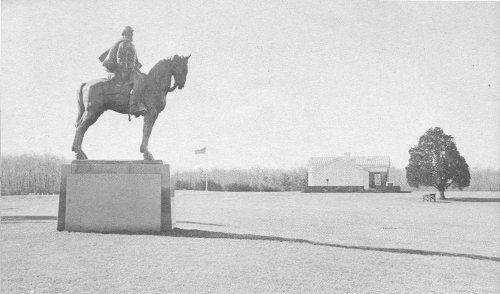
Looking west across Henry Hill to the Administration-Museum Building. The Jackson Monument is shown in the left foreground.
Some of the points of special interest here include:
Administration-Museum Building. On a commanding rise of the hill is located the Administration and Museum Building, which represents the focal center in the interpretation of the area. From the terrace on the north and east sides of the building, a sweeping panoramic view may be had of the valley of Young’s Branch and the hills beyond which constitute the chief scenes of tactical maneuver of the two battles.
Jackson Monument. Located approximately 125 yards east of the Administration-Museum Building is the equestrian statue of “Stonewall” Jackson. It was erected by the State of Virginia in 1940, reputedly on the spot where he received his famous nickname. To a large degree Jackson’s 41 character and personality dominated the fighting of both First and Second Manassas.
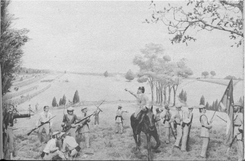
Diorama in the museum depicting incident when Jackson was given the name “Stonewall.”
Line of Confederate Batteries. Just north of Jackson’s statue are markers indicating the position of Confederate batteries of 26 guns which engaged the 11 guns of Ricketts’ and Griffin’s Federal batteries at a distance of about 330 yards. With this furious artillery duel the first battle reached its crisis. Today, cannon mark this position.
Bee Monument. South of the Jackson statue, about 100 feet, stands a white marble monument erected to the memory of Gen. Barnard E. Bee, who fell mortally wounded at this spot in the first battle. Shortly before, while desperately attempting to rally his men, Bee had won immortal fame with the stirring battle cry which gave Jackson the name of “Stonewall.”
Bartow Monument. About 180 feet north of the Jackson statue is a stone block bearing a bronze tablet erected to the memory of Col. F. S. Bartow, commander of the 2d brigade of Johnston’s army, who was killed in the first battle on this spot. At a critical moment in the early phase of the battle, Bee and Bartow had given Evans valiant support.
Position of Ricketts’ and Griffin’s Guns. Just south of the Henry House are cannon and markers indicating the advanced position occupied by the Union batteries of Ricketts and Griffin during the first battle. In a surprise attack, which practically annihilated these two gallant batteries, Ricketts was severely wounded.
Henry House. About 650 feet northwest of the Administration-Museum Building stands the Henry House which was erected shortly after 42 the war on the site of the famous original structure. During the first battle, the original little house was caught in the line of cross artillery fire which killed its owner, Mrs. Judith Henry. Badly damaged, it suffered further mutilation during the following year. By the end of the second battle the house was a complete ruin.
Grave of Judith Henry. In the Henry yard, a few feet west of the house, is the grave of the widow, Judith Henry, enclosed by an iron railing and shrubbery. She is said to have been buried here by Confederate soldiers the day after the first battle. A son and daughter are also interred here. Mrs. Henry’s tragic death is dramatically treated in Stephen Vincent Benet’s poem, “John Brown’s Body.”
Union Monument. This pyramidal monument of reddish brown stone, located in the yard on the east side of the Henry House, was erected by Union soldiers in 1865 to the memory of their comrades who fell in the first battle. It is one of the earliest memorial monuments of the Civil War.
2. ROBINSON HOUSE.
About 800 yards northeast of the Administration-Museum Building, on a projecting spur, stands the Robinson House on the site of the wartime structure owned by the free Negro, James Robinson. No part of the present house is original, though a section of it dates to about 1888. The original house was torn down in 1926 to permit the construction of the larger portion of the present structure. Suffering little damage in the first battle, the original house and fields were sacked by Sigel’s Federal troops in the second battle. For these damages Robinson was awarded $1,249 by Congress in a Private Act of March 3, 1873. A picturesque view unfolds from this point eastward across Bull Run and westward to the mountains.
3. STONE BRIDGE.
The Stone Bridge and the stream, Bull Run, that flows beneath it are inseparably linked with the story of the two battles of Manassas. Located on the Warrenton Turnpike, approximately 1½ miles east of its intersection with the Manassas-Sudley Road, it formed, during the first battle, the anchor of the Confederate left and the objective of the Federal diversion under Tyler. Following the rout of McDowell’s forces, it constituted one of the main avenues of escape. In the second battle, it was the main route of the Federal advance and retreat. Though the bridge was destroyed a number of times, the abutments are original. The present Lee Highway bridge crosses Bull Run about 100 feet south of the old structure which is now memorialized by the State of Virginia.
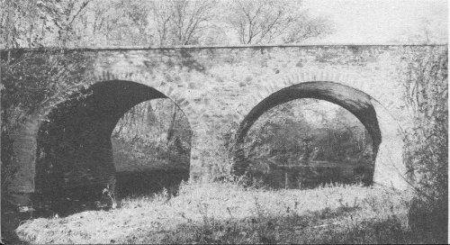
The Stone Bridge as it now appears.
43
4. STONE HOUSE (MATTHEWS).
Built in the early part of the nineteenth century, this two-and-one-half story structure of reddish brown native stone, stands as the best preserved and most conspicuous landmark on the two battlefields. It is located on the north side of Lee Highway, near its junction with the Manassas-Sudley Road. Here the tides of battle twice engulfed it as it served alternately as a hospital for the wounded of each side. Shells may still be seen embedded in its walls. For a number of years after the war it was operated as a tavern.
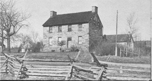
The Stone House.
5. CHINN RIDGE.
This commanding ridge was twice utilized by the Confederates in turning movements that brought defeat to Federal arms. In the first battle, the brigades of Early and Elzey, supported by Beckham’s artillery, hurled back the Federal right under Howard to precipitate a general rout of the Federal army. In the second, Longstreet’s troops swept forward to seize the ridge in an attack that, but for the successful defense of Henry Hill, would have turned the Federal left. The ridge is served by a park road which terminates at a commanding overlook at its northern end.
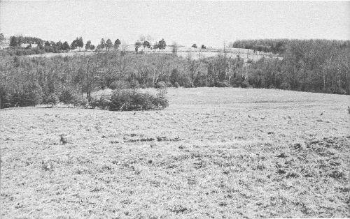
Looking east from Chinn Ridge to Henry Hill, showing the nature of the terrain that saw heavy fighting in both battles. The Henry House is shown on the left: the Administration-Museum Building in center of photograph.
Site of the Chinn House. Only the foundation walls and the bases of two massive chimneys remain to attest what was once one of the most 44 spacious residences on the Manassas battlefields. Built reputedly in the late eighteenth century, the house derived its name from Benjamin T. Chinn, who purchased the property in 1853. Twice used as a field hospital, it stood until 1950 when, in ruinous condition, it was dismantled.
Webster Monument. About 600 yards north of the Chinn House stands a granite boulder with bronze plaque marking the spot where Col. Fletcher Webster, son of the statesman, Daniel Webster, fell mortally wounded in the second battle, August 30, 1862. The boulder was brought from “Marshfield,” Mass., the estate of the elder Webster.
Chinn Spring. Located on the north side of the Chinn House Road, a few yards from the little stream known as Chinn Branch, is Chinn Spring. Following the heat of battle, many of the exhausted and wounded soldiers of both armies came here to drink gratefully from its cool, bubbling waters. It is an attractive spot, shaded by tall oaks and marked by grass that is always green.
6. UNFINISHED RAILROAD.
About 300 yards south of the present Sudley Church, the old grade of an independent line of the Manassas Gap Railroad crosses the Manassas-Sudley Road (Virginia Route 234). Stretching southwestward from this point for a distance of nearly 2 miles is the section of the grade occupied by Jackson’s troops during the 45 second battle. From this protecting screen he first revealed his position in the attack on King’s column on August 28. Here, in the next 2 days, he successfully repelled repeated Federal assaults. Though brush and trees have grown up along much of it, the grade is still clearly defined.
7. SUDLEY CHURCH.
Just west of the Manassas-Sudley Road, near its intersection with the Groveton-Sudley Road (Virginia Route 622), stands Sudley Church on the approximate site of the wartime structure that twice served as a hospital. In the first battle, the Federal wounded overflowed the church into a number of neighboring houses.
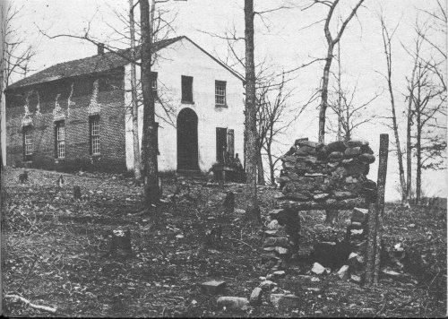
Wartime photograph of the Sudley Church. Courtesy Library of Congress.
8. “DEEP CUT.”
Approximately three-quarters of a mile northwest of Groveton and immediately in front of the old railroad grade is “Deep Cut,” scene of the bitterest fighting of the second battle. Here the troops of Fitz-John Porter suffered terrific losses in gallant but vain attempts to penetrate Jackson’s defenses. Heavy woods have now grown up in what was then open land largely obscuring the shaft of reddish brown stone erected to the memory of the Union troops who fell there. Most of the land of the “Deep Cut” area is not at present owned by the park.
9. THE DOGAN HOUSE.
Here at Groveton, at the intersection of the Groveton-Sudley Road and Lee Highway, is located the Dogan House, 46 one of the main landmarks of the second battle. It was across this area, on August 29, that Hood’s division drove back the Union division of Hatch before it retired to the west of Groveton. The next day the area was involved in heavy artillery and infantry fire.
The small, one-story house of weather-boarded logs originally served as the overseer’s house of the Dogan farm. Later, it was occupied by the Dogan family after their main house had burned. Like the Stone House, it now stands as one of the two remaining original structures in the park.
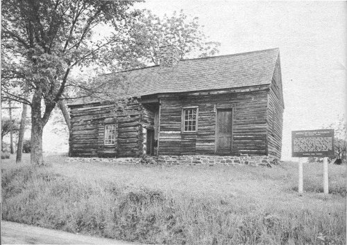
The Dogan House.