PART III.ToC
Reading edition
PART III.ToC
Tucker Offered the Command of the Peruvian Fleet, With the Rank of Rear Admiral — Arrives in Lima — No Precedent for the Return of Money — Commissioned a Rear Admiral in the Navy of Peru — Commands the Allied Fleets of Peru and Chile — Spanish War — Tucker's Plan for a Naval Campaign; Projected Expedition Against Manila — Cessation of Hostilities — Tucker Retires From the Command of the Fleet, and Is Appointed President of the Peruvian Hydrographical Commission of the Amazon — Crosses the Andes and Reaches the Amazon — Explores the Yavari River — Ordered to the United States to Superintend the Building of an Exploring Steamer — Returns to the Amazon With Steamer Tambo. Expedition Up the Ucayali and Exploration of the Tambo River — Ordered to the United States to Procure a Steamer of Light Draught of Water — Returns to the Amazon With Steamer Mairo — Second Expedition Up the Ucayali — Canoe Expedition Up the Pachitea and Exploration of the Pichis River — Expedition Up the Amazon and Huallaga Rivers — Ordered to Lima. Ordered to New York to Superintend the Charts Made by the Hydrographical Commission — Publication of Charts Abandoned on Account of the Financial Condition of Peru — Letter From President Pardo — Letter From Minister Freyre — Tucker Retires to His Home in Petersburg, Virginia — Occupations and Amusements of Old Age — Death — Character and Qualities — Conclusion.
While residing in Raleigh, North Carolina, Tucker received a letter from the Peruvian Minister to the United States, requesting an interview on affairs of importance. Going to Washington, Tucker saw the Minister, and the result of the interview was that he accepted a proposition to go to Peru and enter the Navy of that Republic as a rear-admiral, his commission to be dated from the time of his arrival at Lima. He was allowed to take with him two staff officers, one with the rank of captain and the other with that of commander.
When Tucker entered the Navy of Peru, that Republic was engaged in a war with Spain. Spain had never recognized the independence of her former South American colonies, and thinking a favorable opportunity had arisen for asserting her dormant claims, the Spanish Government sent an iron-clad frigate, accompanied by several smaller vessels, to attack the Chilean and Peruvian seaport cities on the Pacific coast. The attack upon Valparaiso, the chief port of Chile, was successful, but the Spanish squadron was beaten off at Callao by the Peruvian batteries. Whilst preparing for the defense of Callao, the Peruvian Government determined to place its naval establishment on such a footing that it would be able to meet any force Spain could send to the Pacific. Tucker had, and most deservedly, the reputation of being a hard fighter, a thorough disciplinarian, and a splendid seaman; hence the Peruvian Government of President Prado directed its Minister at Washington to engage his services if possible. The cause was one which enlisted all Tucker's sympathies, and he agreed to take command of the Peruvian fleet. Tucker became much attached to Peru, and served the Republic zealously and faithfully. He had many warm friends in Lima, and no matter what party held the Government, the trust and confidence reposed in him by the authorities in Lima was always implicit.
Tucker arrived in Lima accompanied by his personal staff, David Porter McCorkle, captain of the fleet, and Walter Raleigh Butt, commander and aide. Just before their leaving New York the Peruvian Minister handed Tucker a bag of gold, with which he was told to pay all the traveling expenses of himself and staff; this was done, but when the party arrived at Lima the bag was still half full. Tucker insisted on returning this surplus to the Government, but there was no precedent for such a thing, and it was not without some difficulty that there could be found an officer of the treasury authorized to receive and receipt for the unexpected money.
The appointment of a foreigner to command their fleet was distasteful to some of the Peruvian officers, and this fact coming to Tucker's knowledge, he informed General Prado, the President of the Republic, that he had no wish that any officer should be forced to serve unwillingly under his command, and preferred resigning if the dissatisfaction at the appointment of a stranger to command the fleet was general or deep-seated. The officers who were dissatisfied were relieved from duty, and others were easily found who were not only willing but anxious to serve under Tucker.
The Peruvian squadron was lying at Valparaiso when Tucker hoisted his flag on board the frigate Independencia. The Chilean squadron was also lying at Valparaiso, and Tucker, as senior officer present, was in command of the allied fleets of both Peru and Chile.
An efficient state of drill and discipline was soon established in the fleets. A feeble attempt at mutiny broke out on one occasion during the temporary absence of Tucker, but it was easily quelled without bloodshed, and no similar attempt was ever again made whilst Tucker was in command. Officers of the Peruvian Navy, who were themselves opposed to giving foreigners high rank in their service, admitted that the fleet had never been in so good a condition for effective service as whilst it was under Tucker.
The Spanish squadron had retired from the coast, but was expected to return as soon as it had been refitted and revictualed, but no apprehension was felt as to the result of another attack by the Spanish, for the allied fleets were believed to be fully equal to the task of protecting the coasts and ports of the Republics.
Tucker's plan of naval operations was to sail with a small squadron, composed of the most efficient vessels under his command, for Manila, a most important dependency of Spain in the East Indies. He expected to take the Spaniards entirely by surprise, to capture all Spanish vessels in port, and to hold Manila and the other ports of the Philippine Islands until peace was established.
In order to provide for the reappearance of the Spanish fleet on the coast during his absence, Tucker advised the allied Governments to enroll as a naval reserve all the Peruvian and Chilean masters, mates and crews of merchant vessels, pilots and mariners engaged in employments on shore. A part of his plan was that all merchant steamers carrying the flags of the Republics, which could be made available for war purposes, should be inspected and held ready for active service in the Navy and manned by the naval reserve whenever the Government should think it necessary to employ them. This force, with the harbor defense iron-clads, and the forts and batteries on shore, Tucker thought would be a sufficient protection for the coast, whilst his squadron of the most efficient sea-going vessels was absent in the East Indies, where the capture of Manila would have dealt a heavy blow to Spain, and rendered an honorable peace, carrying with it an acknowledgment of the independence of Peru and Chile, a matter of easy attainment.
This plan, which would probably have been entirely successful if carried out with skill, daring and judgment, as it would have been by Tucker, was favorably considered by the Governments of the allied Republics, but it was not carried out, probably on account of the financial embarrassments under which the Republics labored, and which rendered it exceedingly difficult to find the funds required to fit out the expedition.
The Manila expedition having been abandoned, and the Spanish fleet which had been employed on the Pacific coast having returned home, Tucker requested permission to visit Lima, in order that he might lay before General Prado, President of the Republic, a plan for making an exploration and survey of the Peruvian or Upper Amazon River and its tributaries. The President heartily approved of the enterprise, for the Government was at that very time considering the practicability of opening better communications between the west coast and the eastern part of the country, and of finding an outlet by the waters of the Amazon for the rich productions of the interior.
Tucker resigned his commission as rear-admiral in the Navy of the Republic, and was immediately appointed President of the Peruvian Hydrographical Commission of the Amazon. He left Lima with a full corps of assistants, and made his way across the mountains to the head of navigation on the Palcazu river, where the party was received on board a Government steamer that had been dispatched from Iquitos to meet them. The headquarters of the Commission was established at Iquitos, the principal settlement on the Upper Amazon river, and the place where the Government factories and magazines were located.
In the small steamer Naps, belonging to the Government, Tucker made an exploring expedition of two hundred and fifty miles up Yavari, the river which forms the boundary between Peru and Brazil.
None of the Peruvian steamers on the Amazon being suitable for exploring and surveying purposes, the Government at Lima ordered Tucker to proceed to the United States and procure such a vessel as was required for the duty pertaining to his Commission. In obedience to this order Tucker spent some months in the United States, and had a steamer built by Messrs. Pusey, Jones & Co., of Wilmington, Delaware, expressly adapted to the navigation of the shoals and rapids of the Upper Amazon. This vessel, named the Tambo, was delivered to Tucker at Para, the Brazilian city at the mouth of the Lower Amazon. Embarking on board the Tambo, Tucker took the steamer up the river to Iquitos, where supplies were taken on board sufficient to last for several months. He then proceeded to make an important expedition up the Upper Amazon, the Ucayali and the Tambo rivers. The Tambo river had never been explored, and it was thought that it presented a feasible route for navigation to San Ramon, a military station in the heart of the interior, only about thirty miles distant from the large and important city of Tarmo, which is connected by railway with Lima.
Leaving Iquitos, the Tambo, with the Commission on board, passed up the Amazon to the mouth of the Ucayali river, up the Ucayali past the rapids of the "Devil's Leap," and entered the Tambo river. The Tambo was found to be a narrow stream, full of rocks and rapids and not practicable for navigation by steamers. When the steamer Tambo could ascend no higher, Tucker fitted out a small boat and pulled some twenty miles farther up the river, but everywhere found such obstructions as rendered it an impracticable route to the interior. It is, perhaps, to be regretted that time did not allow of an examination of the other affluents of the Usayali trending towards San Ramon and Tarmo.
On his return to Iquitos, Tucker was again dispatched to the United States to procure another and smaller exploring steamer. During his absence Captain James Henry Rochelle was directed by the Government at Lima to take charge of the Hydrographical Commission as its acting president.
After an absence of some months, Tucker returned to Iquitos with the new steamer, which was named the Mayro, and was little more than a large steam launch, intended for use where a vessel of greater draught of water could not be employed.
The next expedition decided upon was for the exploration of the water route towards Huanaco, by way of the entirely unknown river Pichis. Most of the tributaries of the Ucayali had been traveled more or less by the Jesuit priests from the College of Ocopa, but none of them had attempted the route of the Pichis, the banks of which were in possession of roving tribes of Indians, who permitted no stranger to pass through their country. It was thought possible, and even probable, from the stories told by the natives, that the head of the Pichis river would be found well suited for being the eastern terminus of the trans-Andean railway.
In February, 1873, the Mayro, with a detachment of the Commission on board, was dispatched from Iquitos, with orders to await at the mouth of the Pachitea river the coming of the Tambo. Tucker embarked on board the Tambo on the 1st of April with the main body of the Commission, and arrived at the confluence of the Pachitea and Ucayali, seven hundred and sixty-five miles from Iquitos, on the 13th of May. The river had commenced to fall, which rendered it prudent not to ascend the Pachitea in steamers, for had one of them got aground whilst the water was falling, it would probably have remained in that situation until the next annual rise of the river.
The water of the Amazon, and the same may be said of all its tributaries, begins to rise about October, and continues to increase its flood until December. In December there is a short period of no rise, or perhaps even a slight fall, after which the river again continues to rise until May, when the permanent fall commences and continues until the following October, when the annual flood again sets in. Sand bars are constantly forming and shifting in the channel of the river, and for a steamer to run on one of them whilst the water is falling endangers the detention of the vessel until she is floated off by the annual rise in October.
The annual fall of the river having set in when the Tambo reached the mouth of the Pachitea, Tucker determined to continue the expedition in canoes. Six of the largest and best canoes that could be procured from the Indians were fitted out, and the whole Commission embarked in them, accompanied by its escort of a dozen Peruvian soldiers under the command of Major Ramon Herrera.
From the 19th to the 30th of May the Commission prosecuted its survey of the Pachitea without interruption, but on the 30th, at a place called Cherrecles Chingana, fifteen or twenty Cashibo Indians came down to the left or north bank of the river, and by signs and gestures signified a desire for friendly communication. The canoes were paddled in to them, and some few presents of such articles as could be spared were distributed among them, and, apparently, received most thankfully. But the Cashibos did not let the occasion pass without showing the treachery for which they are notorious. When the interview was ended, seemingly in the most amicable manner, and as the canoes of the Commission were paddling off, a flight of arrows was discharged at them by a party of Cashibos who had been lying in ambush during the interview. A few volleys from the Remington rifles, with which all the members of the Commission were armed, soon dispersed the savages and drove them to the jungle.
Of all the savage tribes that roam about the head waters of the Ucayali, the Cashibos alone are cannibals. They are brave, cunning and treacherous, and are only surpassed by the Campas in their hatred of the white man. The Campas inhabit the spurs and hills at the foot of the eastern Cordilleras, where the Ucayali and Pichis rivers have their origin. They are a fierce, proud and numerous tribe, and are held in great fear by their lowland neighbors. They permit no strangers, especially no whites, to enter their country, and the members of the expedition under Tucker were the first white men who ever ascended the Pichis into the regions of this warlike tribe.
The canoes of the expedition entered the mouth of the Pichis on the 6th of June. Being an unknown river, it became necessary to give names to the prominent points as they were discovered; and these names were used subsequently in making the charts of the surveys of the Commission.
The navigation of the Pichis was found to be clear and unobstructed from its mouth for a distance of fifteen miles up to Rochelle Island, which is in latitude 9° 57' 11" south, longitude 75° 2' 0" west of Greenwich, and three thousand one hundred miles from the Atlantic coast, following the course of the Amazon river. Rochelle Island was reached on the 7th of June, and was named after Captain James Henry Rochelle, the senior member of the Commission. Any steamer which can navigate the Pachitea can ascend the Pichis this far without difficulty, but above Rochelle Island the navigation becomes more difficult, and probably impracticable for any but steamers of very light draught and strong steam power.
On the 15th of June the expedition arrived at the head of canoe navigation on the Pichis. The point was named Port Tucker, after the president of the Commission. Port Tucker is in latitude 10° 22' 55" south, longitude 74° 49' 0" west of Greenwich, distant three thousand one hundred and sixty-seven miles from the mouth of the Amazon, following the course of the river, and one hundred and ninety miles in a direct line from the Pacific coast. The lofty mountains so plainly in sight from Port Tucker are the eastern spurs of the Andes, the chosen land of the savage and numerous Campas Indians.
Several days before the expedition reached the shoals which terminate the navigation of the Pichis, the tom-toms or drums of the Campas were heard night and day beating the assembly of the warriors. The purpose for which the braves were to be assembled was not a matter about which there was the least doubt, but probably sufficient numbers were not got together in time to execute their intentions, for no attack was made on the Commission whilst it was in the Campas country.
During this expedition the Palcazu river was also ascended to Port Prado, or Puerto del Mairo, the head of navigation for steamers of light draught. Port Prado is in latitude 9° 55' 22" south, longitude 75° 17' 45" west of Greenwich, distant three thousand one hundred and nineteen miles from the mouth of the Amazon, following the river, and only about forty miles from the important interior city of Huanaco, to which place it is in contemplation to extend the trans-Andean railway. If the road were continued from Huanaco to Port Prado there would be a complete trans-continental line of communication by railway and steamboats from Lima in Peru to the mouth of the Amazon.
Two new rivers were discovered by the Commission flowing into the Pichis. One of them was named the Trinidad, from having been discovered on Trinity Sunday, and the other was called Herrera-yacu, after Major Ramon Herrera, of the Peruvian Army, who commanded the escort of the Commission. The supplies of the expedition were running too short to allow of any but a cursory examination of these two rivers. The Trinidad, trending to the westward, can only be of value as affording a water route to the plains lying between the Pichis and the Ucayali, but it is possible that the Herrera-yacu may furnish a nearer water route to Cerro de Pasco than any yet known.
Whilst the canoes of the Commission were descending the Pachitea, they were attacked by the Cashibos, who assembled on the banks of the river, and, waiting until the leading canoes had passed, let fly flights of arrows at the canoe which brought up the rear. The Cashibos were dispersed by a few rounds from the Remington rifles of the Commission, and the explorers met with no further forcible opposition on the way to the steamers awaiting them at the mouth of the Pachitea, where they arrived after a canoe voyage of forty-one days, during which many difficulties and some dangers were encountered and overcome. Not a single person under Tucker's command was killed, or died from sickness, during this expedition, and, singular to relate, after all the hardships and exposure endured the explorers were in much better health when they returned to their steamers than when they left them at the beginning of the expedition.
On the 15th of July, 1873, the steamers Tambo and Mayro, comprising the exploring squadron, reached Iquitos after an absence of three months and ten days. From the 15th of July to the 18th of September the Hydrographical Commission was on shore at Iquitos, employed making charts of the surveys of the late expedition, whilst the steamers were being refitted for further service.
On the 18th of September the Commission again embarked and proceeded to the mouth of the Yavari river, which forms the boundary between Peru and Brazil. The greatest pains were taken to properly establish this point. On a small island in the middle of the river, and very near its confluence with the Amazon, many astronomical observations were taken, resulting in giving the latitude 4° 18' 45" south, longitude 69° 53' 10" west of Greenwich, the distance from the Atlantic coast by the courses of the Amazon being one thousand eight hundred and eleven miles. From the Brazilian frontier the main stream of the Amazon was surveyed and its tributaries examined by the Commission up to Borja, where the river rushes from a narrow gorge of the mountains and leaps into the lowlands. Borja is in latitude 4° 31' 37" south, longitude 77° 29' 43" west of Greenwich. From the Atlantic coast to Borja, a distance of two thousand six hundred and sixty miles, the Amazon is navigable, without serious obstruction or difficulty, for either river or sea-going steamers of several hundred tons burthen.
It would take many long years to make a thorough survey of the waters of the Amazon, which is, in fact, more of an inland sea than a river, with hundreds of branches forming a network of communicating channels extending for sixty or seventy miles on each side of the main stream. At the height of the annual floods the whole country, with the exception of the highest land, on which the towns are invariably built, is covered with water, forming a vast swamp and jungle, traversed in every direction by navigable channels, which at the season of low waters become rivers or natural canals.
The principal object for which the Commission presided over by Tucker had been instituted was accomplished when the main channels of the river and of its affluents was traced from the Peruvian and Brazilian frontiers to the head of navigation of the main river and of its tributaries, so as to show the nearest approach by water communication to the eastern terminus of the trans-Andean railway. This duty having been executed, Tucker was ordered to proceed to Lima for conference with the Government as to the results of the explorations and surveys he had made.
After consultation with Tucker, Señor Pardo, the President of the Republic, directed that charts of the surveys made by the Hydrographical Commission should be published in New York, and that Tucker and two members of the Commission should be detailed to prepare the work for the press and superintend the engraving of the plates. The other members of the Commission returned to their homes, having completed the duty for which they were engaged.
There were some changes from time to time in the Peruvian Hydrographical Commission of the Amazon, but the following list of its members may be taken as correct:
President—John Randolph Tucker. Members—James Henry Rochelle, David Porter McCorkle, Walter Raleigh Butt. Secretaries—Timotéo Smith, Maurice Mesnier. Surgeon—Francis Land Galt. Civil Engineers—Manuel Charron, Manuel Rosas, Thomas Wing Sparrow, Nelson Berkeley Noland. Steam Engineers—John W. Durfey, David W. Bains.
On arriving in the United States, Tucker established an office in New York, and, assisted by Captain Rochelle and Mr. Sparrow, soon had the charts and plans, with explanatory notes, ready for the hands of the printers and engravers; but in consequence of the financial difficulties into which Peru had fallen, the publication was delayed from time to time and finally abandoned altogether, as is shown by the following letter from Señor Pardo, President of the Republic:
Lima, Marzo 13, 1877.
"Sr. J.R. Tucker. "39 Broadway, New York City.
"Estimado amigo:—He recibido su apreciable carta de 10 del pasado, que me es grato contestar manifestándole que las graves dificultades ecónomicas porgue hoi atravissa la República, oblejan el Gobierno á dar por terminada la comiseon de que fué ud encargado para la publicacion de los Mapas y Cartas topográficas de las regiones Amazonicas.
"En esta virtud, se sirvirá ud. entregar al señor Freyre, Ministro del Perú en Washington, las reforidas Cartos, Mapas, y todas las demas útiles pertenecientes al Gobierno del Perú, que hoi existen en poder de la Comision que ud. preside; todo bajo de inuentario y con las formalidades necesarias.
"En cuanto al pagar de sus suldos y los de los Senñores que forman parte de esa Comision, he ordinado al Ministro de Hacienda disponga lo conveniente para su pronto abono, y juzgo que asi-luego les servan completamente satisfechos.
"Deseandole a ud. la mejor conservacion, me as grato reiterarle las expresiones de mi amistad y particular estima."
"Su afrino S.S.
"Pardo."
[TRANSLATION.]
"Lima, March 13, 1877.
"J.R. Tucker, Esq. "39 Broadway, New York City.
"Esteemed Friend:—I have received and answer with pleasure your appreciated letter of the 10th ultimo, apprising you that the grave economical difficulties which at present afflict the Republic, obliges the Government to order the termination of the commission with which you are charged for the publication of the maps and charts of the Amazonian regions.
"For this reason, you will be pleased to deliver to Mr. Freyre, Minister of Peru in Washington, the referred to charts, maps and all other articles belonging to the Government of Peru, which now remain in charge of the Commission over which you preside; all to be delivered under inventories and with the necessary forms.
"In regard to the payment of the salaries of yourself and the other gentlemen who form part of the Commission, I have ordered the Minister of the Treasury to take measures for the prompt disbursement of what may be due, and I judge that in a short times these claims will be completely satisfied.
"With my best wishes, it gives me pleasure to repeat the expression of my friendship and particular esteem.
"Truly your faithful Servt.,
"Pardo."
In compliance with the directions of President Pardo, the charts made by the Commission were delivered to the Peruvian Legation at Washington. These charts were all ready for publication, and had they been published would have afforded much valuable information in regard to the Upper Amazon and its tributaries, water courses which are daily becoming more and more important to commerce, and which are destined in the not distant future to be navigated by lines of ocean as well as by lines of river steamers.
The following letter from Colonel Manuel Freyre, Peruvian Minister at Washington, describes the charts and plans which Tucker delivered to the Legation, and which it is to be hoped are still preserved:
"Legacion del Peru. "Washington, Marzo 22 de 1877.
Senor Don Juan R. Tucker, Ex-Presidente de la Comision Hidrografica del Amazonas.
"La caja que dijó le. depositada en poder del Cónsul Tracy, ha sido recibida en esta Legacion, y contiene los siguientes planos; à saber:
"1st. Un plano del Rio Amazonas Peruano, desde lo boca del rio Yavari hasta Borja, termino de la navegacion á vapor, dibujado sobre diez pliegos y en una escala de una pulgada por cada das millas. Los rios Ytaya y Pastaza están incluidos en esta Plano, que cuenta 848 millas del rio Peruano Amazonas, 45 millas del rio Ytaya, y 7 millas del rio Pastaza."
"2d. Un plano del rio Yavari desde su boca hasta la confluencia de los rios Yacarana y Yavarasina, dibujado, sobre das pliegos y en una escala de una pulgada por cada dos millas. Este plano cuenta 220 millas del rio Yavari.
"3d. Un plano del rio Nanay desde su boca hasta el término de la navegacion para vapores de poco calado debujado sobre dos pliegos. Este plano contiene 160 millas del rio Nanay.
"4th. Un plano del rio Tigre-Yacu desde su boca hasta un punto 111 millas aniba de la boca, dibujado sobre dos pliegos y en una escala de una pulgada por cada dos millas."
"5th. Un plano del rio Huallaga desde la boca hasta Rumi-Callirina, el têrmino de la navegacion para vapores, dibujado sobre dos pliegos y en una escala de una pulgada por cada dos millas. Este plano cuenta 169 millas del rio Huallaga.
"6th. Un plano del rio Morona desde su boca hasta un punto 37 millas arriba de dicha boca, dibujado sobre un pliego y en una escala de una pulgada por cada dos millas."
"7th. Un plano del rio Potro desde la boca hasta el término de la navegacion para vapores de poco calada, dibujada sobre un pliego y en una escala de una pulgada por cada dos millas. Este plano contiene 64 millas del rio Potro.
"8th. Un plano del rio Ucayali desde la boca hasta la confluencia de los rios Urubamba y Tambo, dibujado sobre nueve pliegos y en una escala de una pulgada por cada das millas. Los rios Urubamba y Tambo, desde sus bocas hasta el mas alto punto donde espracticable la navegacion á vapor, están incluidos en este plano, que contiene 885 millas del rio Ucayali, 24 millas del rio Urubamba, y 53 millas del rio Tambo."
"9th. Un plano del rio Pachitea desde su boca hasta la confluencia de los rios Palcazu y Pichis, dibujado sobre dos pliegos y en una escala de una pulgada por cada dos millas. Este plano contiene 191 millas del rio Pachitea."
"10th. Un plano del rio Palcazu desde la boca hasta el puerto del Mairo, dibujado sobre un pliego y en una escala de una pulgada por cada dos millas. Estate plano contiene 37 millas del rio Palcazu.
"11th. Un plano del rio Pichis desde la boca hasta el término de navegacion en canoas, dibujado sobre un pliego y en una escala de una pulgada por cada dos millas. Una parte del rio Herrera-yacu y otro parte del rio Trinidad se hallan en este plano, que contiene 85 millas del rio Pichis, 4 millas del rio Trinidad, y 5 millas del rio Herrera-yacu.
"12th. Un plano del rio Amazonas Peruano y sus afluentes, dibujados sobre un pliego y en una escala de una pulgada por cada quince millas. Este plana contiene 1661 millas del rio Amazonas Peruano y sus afluentes.
"13th. Todas las mencionadas planos están dibujados sobre treinta y cinco pliegos, siendo cada pliego treinta pulgados de largo por quince pulgada de ancho.
"14th. Un plano del rio Amazonas Peruano y sus afluentes, dibujado sabre un pliego y en una escala de una pulgada por cada diez millas, siendo el pliego cines piés de largo por cinco piés de ancho. Este plano contiene en un solo pliego todos los reconocimientos verificados por la Comision Hidrografica del Amazonas, que son por todo 2945 millas.
"Loo demas planos dán los mismos reconocimientos mas detalladamenente.
"15th. Un plano del pueblo de Yquitos, dibujado sobre un pliego.
"Dios que á le.
"Manl. Freyre."
[TRANSLATION.]
"Legation of Peru. "Washington, March 22d, 1877.
"John R. Tucker, Esq., Ex-President of the Hydrographical Commission of the Amazon.
"The box deposited by you with Consul Tracy has been received at this Legation, and contains the following charts, to wit:
"1st. A chart of the Peruvian Amazon river, from the mouth of the River Yavari to Borja, the termination of steam navigation, drawn upon ten sheets, and on a scale of one inch to each two miles. The Rivers Itaya and Pastaza are included in this chart, which contains 848 miles of the Peruvian Amazon river, 45 miles of the Itaya river, and 7 miles of the Pastaza river.
"2d. A chart of the Yavari river from its mouth to the confluence of the Rivers Yacarana and Yavarasino, drawn upon two sheets and on a scale of one inch for each two miles. This chart comprises 220 miles of the Yavari river.
"3d. A chart of the River Nanay from its mouth to the termination of navigation for steamers of light draught, drawn upon two sheets and on a scale of one inch for each two miles. This chart contains 160 miles of the River Nanay.
"4th. A chart of the River Tigre-yacu, from its mouth to a point 111 miles above its mouth, drawn upon two sheets and on a scale of one inch for each two miles.
"5th. A chart of the River Huallaga, from its mouth to Rumi-Callirina, the termination of steamer navigation, drawn upon two sheets and on a scale of one inch for each two miles. This chart comprises 169 miles of the Huallaga river.
"6th. A chart of the River Morona, from its mouth to a point 37 miles above its mouth, drawn upon one sheet and on a scale of one inch for each two miles.
"7th. A chart of the River Patro, from its mouth to the termination of navigation for steamers of small draught, drawn upon one sheet and on a scale of one inch for each two miles. This chart contains 64 miles of the Patro river.
"8th. A chart of the River Ucayali, from its mouth to the confluence of the Rivers Urubamba and Tambo, drawn upon nine sheets and on a scale of one inch for each two miles. The Rivers Urubamba and Tambo, from their mouths to the highest point to which steamer navigation is practicable, are included in this chart, which contains 885 miles of the River Ucayali, 24 miles of the River Urubamba, and 53 miles of the River Tambo.
"9th. A chart of the River Pachitea, from its mouth to the confluence of the Rivers Palcazu and Pichis, drawn upon two sheets and on a scale of one inch for each two miles. This chart contains 191 miles of the River Pachitea.
"10th. A chart of the River Palcazu, from its mouth to Port Mairo, drawn upon one sheet and on a scale of one inch each for two miles. This chart contains 37 miles of the River Palcazu.
"11th. A chart of the Pechis river, from its mouth to the termination of canoe navigation, drawn upon one sheet and on a scale of one inch for each two miles. A part of the River Herrera-yacu, and also a part of the River Trinidad, are included in this chart, which contains 85 miles of the River Pichis, 4 miles of the River Trinidad, and 5 miles of the River Herrera-yacu.
"12th. A chart of the Peruvian Amazon river and its affluents, drawn upon one sheet and on a scale of one inch for each 15 miles. This chart contains 1661 miles of the Peruvian Amazon river and its affluents.
"13th. A chart of the River Ucayali and its affluents, drawn upon one sheet and on a scale of one inch for each 15 miles. This chart contains 1284 miles of the River Ucayali and its affluents.
"All the above mentioned charts are drawn upon 35 sheets, each sheet being 30 inches long and 15 inches broad.
"14th. A chart of the Peruvian Amazon river and its affluents, drawn upon one sheet and on a scale of one inch for each ten miles, the sheet being 5 feet long by 5 feet broad. This chart contains, on one single sheet, all the surveys made by the Hydrographical Commission of the Amazon. The other charts give the same surveys more in detail.
"15th. A plan of the town of Iquitos, drawn upon one sheet.
"May God guard you.
"Manl. Freyre."
Tucker was in the sixty-seventh year of his age when he retired to his home in the City of Petersburg, Virginia, where he had purchased a comfortable house with a lawn and garden attached. Here he passed the evening of an active life in the enjoyment of a private fortune, which, though not large, was sufficient to supply all his moderate wants and simple tastes. Relatives and friends frequently visited him; he read much, and books, especially the older English classics, were a source of much pleasure to him; the improvement of his lawn and garden was a pursuit which afforded him unfailing interest and occupation.
On the 12th of June, 1883, he was apparently in his usual good health. In the course of the morning a friend called on him, and they conversed together for some time, seated in the shade of a tree on the lawn. His friend having taken his departure, Tucker reseated himself for a few minutes in his chair, suddenly arose, straightened up his tall form to its full height, and fell forward—dead. Physicians were immediately summoned, but all the efforts to revive him were ineffectual. He had died from disease of the heart; passing away from this world without a struggle or a sigh, and going where souls as pure as his have nothing to fear.
His remains were taken to Norfolk, Virginia, where they were received by old friends and comrades, who knew and loved him well, and interred by the side of his wife's grave, in a beautiful private cemetery near the city.
Admiral Tucker possessed many of the qualities of a great commander. His judgment was excellent, and it was very rarely the case that he was mistaken as to what it was possible for the force at his disposal to accomplish. He always commanded the respect and confidence, as well as the good will, of his men. A strict disciplinarian, the prompt and unhesitating obedience to orders he exacted was cheerfully rendered by his subordinates. His plans were coolly and deliberately formed, and, having been once determined upon, were carried out with energy and resolution. In the ordinary intercourse of private life he was so gentle, generous and genial that his friends and associates felt for him a regard approaching affection. In youth he was an eminently handsome man and in maturer years his presence was imposing. Sailors and Indians are fond of giving personally descriptive names to those with whom they are thrown in contact; when Tucker was a lieutenant he was called "Handsome Jack" by the men-before-the-mast, and the warriors of the savage tribes that wander about the head waters of the Amazon knew him as the "Apo," the meaning of the word being "High Chief."
In concluding this sketch of the eventful life of John Randolph Tucker, it is but doing justice to his memory to say that the sea-service never produced a more thorough and accomplished sailor, and that there never was bred to the profession of arms a more honorable and gallant gentleman.
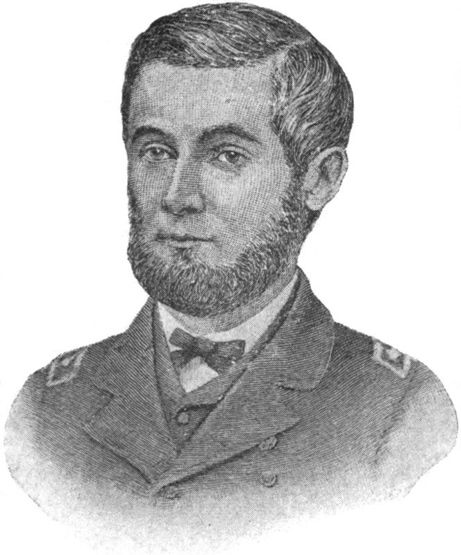
James Henry Rochelle