Front matter
Reading edition
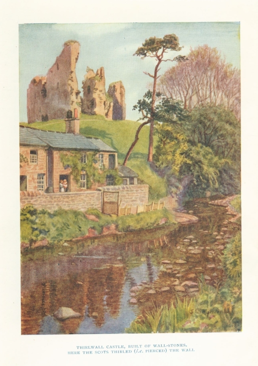
THIRLWALL CASTLE, BUILT OF WALL-STONES, HERE THE SCOTTS THIRLED (i.e. PIERCED) THE WALL
HADRIAN'S WALL
BY JESSIE MOTHERSOLE
WITH FOURTEEN ILLUSTRATIONS BY THE AUTHOR MAPS & PLANS
JOHN LANE THE BODLEY HEAD LIMITED LONDON VIGO STREET W.1
First Published ... October 1922 Second Edition ... December 1922 Third Edition ... December 1924
MADE AND PRINTED IN GREAT BRITAIN BY MORRISON AND GIBB LTD., EDINBURGH
BY THE SAME AUTHOR
THE ISLES OF SCILLY : Their Story, Their Folk, and their Flowers With 26 Plates in Colour
THE SAXON SHORE Illustrated in Colour and Black & White
PREFACE TO THIRD EDITION
Since the first appearance of this book, a very important event has occurred in the history of Hadrian's Wall. It has been definitely recognized as a monument of national importance, to be scheduled and protected under the authority of the Office of Works. This means that owners and occupiers of the lands over which it extends will be powerless to interfere with it, unless by the authority of the Department, and that they will be liable for the repair of any damage that may be done to it.
It is not too much to say that this marks the greatest epoch in the history of the Wall since, at the end of the fourth century, it ceased to be garrisoned, and was allowed to fall into disrepair. Neglect or wanton destruction fell to its share for fourteen hundred years. Now the Office of Works has set the seal on the tireless efforts of Mr. John Clayton and Dr. Collingwood Bruce, who would indeed have rejoiced to see this day.
* * * * * * *
Important discoveries have been made at several points along the line of the Wall during the last three years.
The site of the fort at Burgh-by-sands was definitely located by Mr. W. G. Collingwood, F.S.A., and Mr. R. G. Collingwood, F.S.A., in 1922. Since 1903, when the main road was "up" for drainage purposes and no Roman remains were found, the very existence of the fort had been questioned.
But excavation has resulted in the discovery of the east gate, lying just north of Hadrian's Wall, on the edge of the main road, which represents roughly the via principalis. Stone barrack-buildings were also traced, running north and south, and the fort was proved to have lain across the line of Hadrian's Wall, as did Cilurnum. The main road is a cutting, below the level of any Roman remains. The stones of some of the fort walls had rotted so completely that the spade cut quite through them, and thus my scepticism about "perishing stones" in the neighbourhood was rebuked (p. 207). The Church at Burgh probably occupies the site of one of the central buildings, perhaps of a granary, the massive stones from which would be very handy for the Church-builders.
Hadrian's Wall was found to join the main road a little to the east of the Vicarage, from which point the road is laid partly on the Wall's foundations, and partly on its berm, up to the junction of Wall and fort.
A site known as Old Castle, about 200 yards eastward from the fort, marks the position of the mediæval castle of Sir Hugh de Morville, built, no doubt, of stones from the Wall and fort. The remains of a small Roman bridge, which carried the Military Way over the Powburgh Beck, are to be seen some 300 yards east of the Old Castle.
At Rudchester, Mr. Parker Brewis, F.S.A., has directed excavations of the fort of Vindobala. It was found to be similar in plan to Cilurnum, lying across the Wall, and with six gates. Three out of the five chambers of the headquarters buildings were uncovered, including the Chapel of the Standards with the treasury beneath; and there was also found the largest granary yet known in the north of England.
Both portals of the double west gate, and also the west portal of the south gate, were found to have been built up as early as the middle of the second century.
The Excavation Committee of the Society of Antiquaries of Newcastle-on-Tyne, appointed in February 1924, has been enlarged into "The North of England Excavation Committee," which hopes to open up other sites on the Wall during 1925, with Mr. Parker Brewis still as Director. A detailed report of the work at Rudchester will shortly be published.
Below Birdoswald, Dr. R. C. Shaw, of Manchester University, is, as I write, completing the excavation of the bridge over the Irthing, referred to on page 163. No trace has been discovered of any western abutment, and it has therefore presumably been washed away by the strong current of the river; but on the eastern side a whole series of abutments has been uncovered. The course of the river is now much farther west than it was in Roman times, and it was evidently necessary in their day to rebuild the abutments farther and farther west as the river receded in that direction.
The remains of these abutments are most impressive, and Hadrian's Wall has been found standing up to nine courses of stones.
The stages of the work appear to be as follows:
I. A very interesting feature, and one likely to give rise to much discussion, is the discovery of a 10-foot thick wall, of earlier date than the Great Wall, and ending in an abutment which is also 10 feet thick. The bridge starting from this abutment could only have been wide enough to carry the rampart-walk. Farther inland this wall has been found to a height of one or two courses of stone above the foundations.
II. Here a wall of superior masonry, of the character usually associated with Hadrian's Wall, has been built, 7½ feet wide, on the lower courses of the earlier wall, the original wall having been allowed to remain near the water. The new wall was found to be accompanied by a road about 14 feet wide, which was carried up to an abutment of large masonry blocks—re-used material, apparently taken from the breastwork of the earlier abutment. The road has a gravel surface and a foundation of cobbles.
III. A tower, larger than the one at Chesters, was built on the top of the aforesaid road-abutment. Of its two floor-levels, the earlier, of clay, was Hadrianic or Antonine, later than the Wall, and earlier than the late Antonine rising. The second floor, of sand, was also probably second century, the two floors agreeing approximately with what are known as the 1aand 1b levels.
A new length of wall, westwards towards the river, was added when the tower was built, the abutment was reconstructed, and buttressed on the south side by a massive tapering breastwork.
IV. Possibly a rectangular abutment was added to the face of the tapering breastwork, but this phase is not yet clear.
V. A very massive curved abutment and a Water-pier, with stone pavement between them, were constructed still farther west, forming an open sluice. The character of this work suggests the time of Severus or later in the third century.
VI. The open sluice was filled with gravel and stones, sealed down with a layer of lime; probably in the fourth century.
Since the work is still in progress, these notes can only indicate the stage reached up to 17th November 1924.
Dr. Shaw has also excavated two Wall-turrets, one behind the byre of Willowford farm-house, which has been left uncovered, and another nearer Gilsland. The Wall was found to have been thickened to 10 feet in width in the neighbourhood of the turrets.
* * * * * * *
The question has often been raised as to whether it is better to walk the Wall from east to west (as I did) or from west to east. I am an "East-to-Wester" all the time. It is far pleasanter to end the walk on the seashore of a picturesque fishing-village than in the smoky suburbs of a great industrial city.
And has not the trend of humanity always been westward? ... "A kind of heavenly destiny," says Wordsworth in his "Stepping Westward."
It is almost certain that the Romans worked westward in building the Wall. As their first fine enthusiasm began perhaps to wane, they found it necessary to call in the help of tribes from Devon and Cornwall, and from near London, and also of men of the fleet. Inscribed stones have been found at Netherby near Carlisle, and at Triermain near Birdoswald, giving evidence that men of the Classis Britannica worked on the Wall at the western end; and other stones, at Holmhead and at Howgill, give the names of two southern tribes, the Dumnonii and the Catuvellauni, suggesting that they also helped at this end.
* * * * * * *
Following Dr. Collingwood Bruce, I have called the road from Newcastle to Carlisle "Wade's Road." This is a mistake, for General Wade died in 1748, as his monument in Westminster Abbey shows, and the road was not made until 1753. The Act of Parliament authorizing it was passed in 1750.
* * * * * * *
In conclusion, I must add a few words about the purpose of the Wall. On page 23, I have said: "No one ever doubts what it was meant to be or to do." This is true, in the sense that the Wall, in its perfect condition, would cry aloud to all comers, "Thus far and no farther." It was essentially a barrier. But the old idea that it was intended to be used as a fighting-ground is exploded. It had been built two centuries before the Romans could have practised bow-and-arrow warfare, such as Kipling describes in "Puck of Pook's Hill." The auxiliaries were then armed only with the usual short sword and heavy throwing-spear, quite unsuitable weapons for warfare from a wall; and the width of the Wall was insufficient for the use of catapults and ballistæ.
No; the Wall was an elevated sentry-walk, a continuous look-out tower; it was a guarantee that no one could enter Roman territory without Roman permission. When the sentries on the Wall gave warning of an attack from the north, the cohorts from the forts would not line up on the Wall; they would fling wide the northern gates, and march out to meet the enemy in the open. The whole question is very interestingly discussed in an article on "The Purpose of the Roman Wall," by Mr. R. G. Collingwood, in No. VIII. of The Vasculum.
INTRODUCTION
"You never can bring in a Wall. Some man or other must present Wall." Midsummer Night's Dream.
The idea of a colour-book on Hadrian's Wall was suggested to me by friends in 1914. Then came the Great War, blotting out all thought of work of this kind.
But in 1920 I was taken by these friends along the line of the Wall, and I soon fell a victim to its many attractions. My friends went home; but I found hospitality at the farms and other houses in the neighbourhood, and began to paint at once.
Before long I decided to "walk the Wall" every foot of the way, 73½ miles, from sea to sea, being inspired thereto by the example and the record of William Hutton. Many of my readers will need an introduction to this delightful character, whose book—to which I shall often have occasion to refer—is now out of print.
William Hutton was an archæologist of Birmingham, who in 1801, at the age of seventy-eight, travelled alone and on foot "six hundred miles to see a shattered Wall."
He then published an account of the Wall and the walk, written in a very original and interesting style, although, as he tells us, "the Battledore, at an age not exceeding six, was the last book I used at school."
"The respectable and amiable Author" (to use the words of contemporary critics) started from Birmingham with his daughter; but since she rode on a pillion behind a servant, and he went on foot, they can hardly be said to have "accompanied" each other. They used to meet at the inns, for dinner, bed and breakfast; and at Penrith they parted, she making her way to Keswick and the Lakes, he to Carlisle and his beloved Wall.
He sent his daughter two notes during his Wall journey: the first from Carlisle, in which he said he was sound in body, shoe and stocking, and had just risen from a lodging among fleas; the second, from Newcastle, when he wrote (to quote her words) "that he had been at the Wall's End; that the weather was so hot he was obliged to repose under hedges; and that the country was infested with thieves: but, lest I should be under any apprehensions for his personal safety, he added they were only such as demolished his idol, the Wall, by stealing the stones of which it was composed."
Of his aim in writing his book, he thus speaks:
"I would enliven truth with the smile, with the anecdote; and while I travel the long and dreary Wall, would have you travel with me, though by your own fireside; would have you see and feel as I do; and make the journey influence your passions as mine are influenced."
There is no doubt that his enthusiasm is infectious, and that whoever follows the Wall in the same spirit as he did, will not find it a "long and dreary" journey.
For myself, I was fascinated by it; I enjoyed every step of the way; and the pictures of the Wall which are here reproduced are the fruit of many happy days spent in its company.
Owing to present conditions, the original idea of a colour-book was dropped, for something more portable and less costly, so the number of illustrations in colour is limited to six, instead of the twenty-five I had prepared; and of the remaining nineteen, only eight appear in monochrome.
In one sense I did not walk the Wall alone. I had two companions, William Hutton and Dr. Collingwood Bruce. The latter was represented by his Handbook on the Wall, which was first published in 1863, and which has proved its value by having appeared, in seven successive editions, as the standard work on the subject. Dr. Bruce and Mr. John Clayton will always be remembered as the great pioneers of practical research on the Wall.
I owe much to the kindness of Mr. F. Gerald Simpson, who hopes to return to active work on the Wall next year (at Birdoswald), and who is my authority on many points in the archæology of the Wall which his recent excavations have brought to light. Much is waiting to be done, but the adequate prosecution of the work in the future will depend entirely on how much financial help is forthcoming from those interested in historical research.
I was very fortunate in falling in with the Three Days' Pilgrimage of the Society of Antiquaries of Newcastle-upon-Tyne and the Cumberland and Westmorland Archæological Society, and in being allowed to join it, in September 1920; and I have to thank the members for their kind welcome to a stranger, and for their readiness to help me. In this connection I must specially mention Mrs. T. H. Hodgson, Mr. Robert Blair, F.S.A., and Mr. W. G. Collingwood, F.S.A.
Archæologia Æliana, issued yearly by the Society of Antiquaries of Newcastle-upon-Tyne, and the annual Transactions of the Cumberland and Westmorland Antiquarian and Archæological Society have been of the greatest service as works of reference. To the former I am also indebted for the plans of the Roman Bridge and of Cilurnum and Borcovicium (Figs. 6, 8, and 12).
From the work entitled Romano-British Buildings and Earthworks, by the late Mr. John Ward, F.S.A., the author and the publishers (Messrs. Methuen & Co.) have kindly allowed me to take Figs. 9, 10, 11, 12, and 14.
Readers who wish to study the latest discoveries with regard to the Vallum will find them in the recently published The Purpose and Date of the Vallum and its Crossings, by Mr. F. Gerald Simpson and Dr. R. C. Shaw (Titus Wilson, Kendal). It forms part of vol. xxii. of the Transactions of the Cumberland and Westmorland Antiquarian and Archæological Society, but it can also be obtained separately.
For those who do not care to walk all the way, and who wish to see a great deal of the Wall in a short time, the George Inn at Chollerford makes a delightful centre. It stands on the bank of the North Tyne, with well-kept gardens sloping down to the water's edge, just where a five-arched stone bridge crosses the river. The bridge dates from 1771, the year when every bridge over the Tyne except the one at Corbridge was swept away by heavy floods.
Chollerford is only 21 miles by road from Newcastle, and the road runs on the Wall foundations nearly all the way. The little station of Humshaugh, on the branch-line from Hexham, is quite close to the George.
For motorists an excellent plan is to make the George their headquarters and thence to visit the Fort of Cilurnum at Walwick Chesters. Then to travel by car along Wade's Road, noting the points of interest en route, until the entrance to Housesteads (Borcovicium) is reached. Here the car must be left and the fort examined. The walk thence along the mural ridge can be made long or short according to inclination. Tracks run down to Wade's Road at frequent intervals—at Milking Gap, Peel, Caw Gap and Pilgrims' Gap (by the Haltwhistle Burn). From Borcovicium to Pilgrims' Gap would be a walk of nearly 6 miles along the Wall ridge; so for those who do not care to walk so far on rough ground, a better plan would be to send the car on to Bradley farm-house and to descend to the road by Milking Gap; travel by car to Peel and examine the fine remains of Wall there; return to the car for another 2½ miles along Wade's Road, and then walk up by the Haltwhistle Burn to examine the Cawfields mile-castle and the Wall in its neighbourhood.
Gilsland is the best centre for visiting, not only the Fort of Amboglanna, at Birdoswald, but also the Nine Nicks of Thirlwall and Thirlwall Castle, and the site of the Fort of Magna at Carvoran. There is very good accommodation at Gilsland. From Birdoswald, cars can travel actually on the line of the Wall as far as the village of Banks, near which, at Hare Hill, the highest piece of Wall yet standing is to be seen. The road journey can be continued past Lanercost Priory through Brampton to Carlisle, whence road and Wall run close together, for the most part, all the way to Bowness, where the Wall ends; but only the pedestrian can examine it thoroughly.
Those who prefer to travel by train can easily visit the Wall in sections, making Hexham, Gilsland and Carlisle their headquarters. On the line between Newcastle and Carlisle, Fourstones is the station for visiting Cilurnum; Haydon Bridge for Sewingshields; Bardon Mill for Vindolanda and Borcovicium; Haltwhistle for Æsica and Winshields; Greenhead for Thirlwall Castle and the Nine Nicks; Gilsland for Amboglanna; and Naworth for Lanercost and Banks.
CONTENTS
CHAP.
Preface to Third Edition
Introduction
I. The Message of the Wall
II. Historical
III. Descriptive
IV. The Vallum
V. The Walk: Wallsend to Walbottle
VI. Walbottle to East Wallhouses
VII. Hunnum and St. Oswald's
VIII. Brunton and The Roman Bridge
IX. Cilurnum
X. Walwick to Sewingshields
XI. Sewingshields to Housesteads
XII. Housesteads to Peel Crag
XIII. Peel Crag to Walltown
XIV. Walltown to Gilsland
XV. Gilsland To Lanercost
XVI. Lanercost To Bleatarn
XVII. Bleatarn To Grinsdale
XVIII. Grinsdale To Drumburgh
XIX. Drumburgh To Bowness
XX. Vindolanda, Corstopitum, Bewcastle
Conclusion
Index
LIST OF PLATES
IN COLOUR
1. Thirlwall Castle ... Frontispiece
2. North Gate of Housesteads Mile-castle
3. The Wall on Peel Crag
4. Thorny Doors Gap
5. The Wall Overhanging the Irthing
6. View looking South from Amboglanna
IN MONOCHROME
7. The Wall from Cuddy's Crag
8. The Bath-house at Cilurnum
9. The Basalt Cliffs above Crag Lough
10. North Gate, Borcovicium
11. Crag Lough from Milking Gap
12. Castle Nick Mile-Castle
13. Peel Crag, from the Gap
14. The Roman Milestone on the Stanegate
MAPS
Contour of Wall-ridge
Map of Hadrian's Wall
LIST OF ILLUSTRATIONS IN THE TEXT
FIG.
1. Section of the Wall and Vallum
2. Comparative Plans of Mile-castle and Wall-turret
3. Sections of Vallum in Three Stages
4. Roman Head from Benwell Hill
5. Roman Altar from Rudchester
6. Plan of Roman Bridge near Cilurnum
7. Lewis for Lifting Stones
8. Plan of Fort of Cilurnum
9. Fortification Turrets from Trajan's Column
10. Fortification Gates from Trajan's Column
11. Gate of Fort on Mosaic, Avignon Museum
12. Plan of Fort of Borcovicium
13. Cross-Section of Fort Wall
14. Comparative Plans of Fort Gates
LIST OF FORTS ON THE WALL WHOSE ANCIENT NAME IS KNOWN.
Fort. Modern Name. Miles between. Size. Gates. Troops stationed there. Great Wall joins its Wall.
Segedunum Wallsend — 3½ acres 4 4th Cohort Lingones North Jamb of W. gateway
Pons Aelii Newcastle 4 ? 4 1st Cohort Cornovii ?
Condercum Benwill Hill 2¼ ? 4 1st Ala Asturians Midway
Vindobala Rudchester 7 3½ acres 6 1st Cohort Frixagi (Frisii) "
Hunnum Halton Chesters 7½ 4¼ " 4 Ala Saviniana "
Cilurnum Walwick Chesters 6 5¼ " 6 2nd Ala Asturians "
Procolitia Carrawburgh 3½ 3½ " 4 1st Cohort Batavians North Rampart
Borcovicium Housesteads nearly 5 n'ly 5 " 4 1st Cohort Tungrians " "
Vindolanda Chesterholm — 3¼ acres 4 4th Cohort Gauls Lies 1 mile south of Great Wall
Æsica Great Chesters 5½ 3 " 4 1st Cohort Asturians North rampart
Magna Carvoran 2½ 3½ " 4 2nd Cohort Dalmatians Lies to south of both Wall and Vallum
Amboglanna Birdoswald 3¼ 5½ " 6 1st Cohort Dacians North rampart
Amboglanna Birdoswald 3¼ 5½ " 6 1st Cohort Dacians North rampart
46½ miles from Wallsend.
HADRIAN'S WALL
HADRIAN'S WALL