Help Us Protect This Park
Reading edition
Please note the following requirements which are necessary for the protection of the natural beauties of the park, as well as for your comfort and convenience:
The park is a sanctuary for all living things. It is a violation of the law to destroy, injure, or disturb trees, shrubs, flowers, birds, animals, or any natural feature in the park.
The speed limit is 35 miles an hour, unless otherwise posted. Drive carefully; keep to the right. Report all accidents to a park ranger.
Camping or lighting fires at places other than designated campgrounds or picnic areas is not allowed, except by permit. To camp in remote sections of the park, except during periods of high fire hazard, permits may be secured at the office of the superintendent, the Oconaluftee Ranger Station, or from the district park rangers or wardens. Camping is restricted to certain periods at the campgrounds. Individual sites provided with fireplaces and water are available.
Please help to keep the park clean. Do not scatter papers, picnic remnants, and the like; use trash receptacles along roads, in picnic areas, and campgrounds.
Fire is one of the greatest dangers to the park. Put out fires completely upon leaving. Be sure cigarettes and matches are out before disposal. Lunches may be eaten along roadsides, but fires should not be built.
Only those persons having special permits may collect botanical or geological specimens in the park. Such permits may be secured by competent scientists upon application to the superintendent.
Dogs and cats are permitted in the park if on leash, crated, or otherwise under physical restrictive control at all times.
The feeding, touching, teasing, or molesting of bears is prohibited.
Deliberate infraction of park regulations may bring penalty of fine or imprisonment or both.
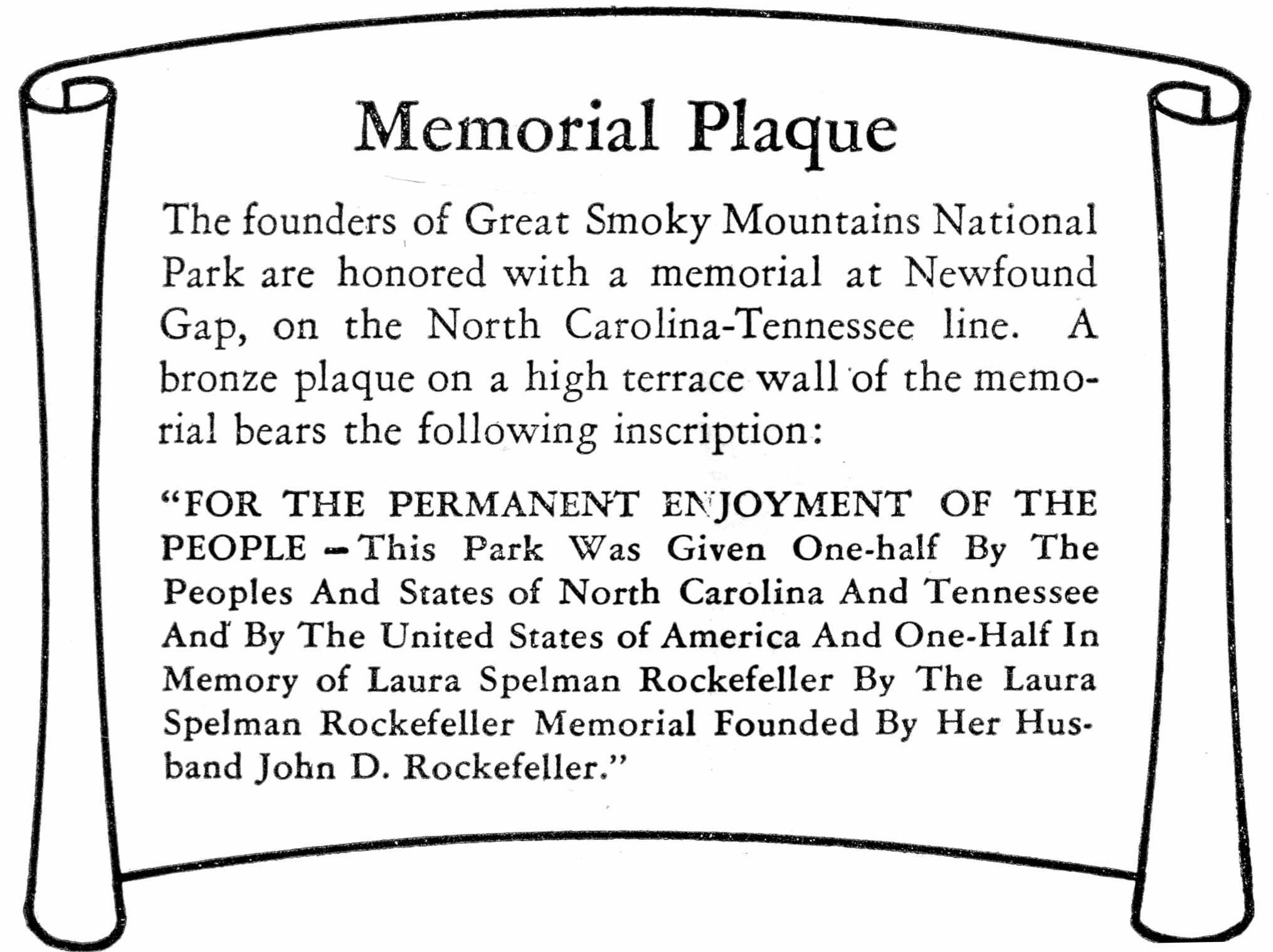
Memorial Plaque
The founders of Great Smoky Mountains National Park are honored with a memorial at Newfound Gap, on the North Carolina-Tennessee line. A bronze plaque on a high terrace wall of the memorial bears the following inscription:
“FOR THE PERMANENT ENJOYMENT OF THE PEOPLE—This Park Was Given One-half By The Peoples And States of North Carolina And Tennessee And By The United States of America And One-Half In Memory of Laura Spelman Rockefeller By The Laura Spelman Rockefeller Memorial Founded By Her Husband John D. Rockefeller.”
Revised 1954 16—53420-6 GPO
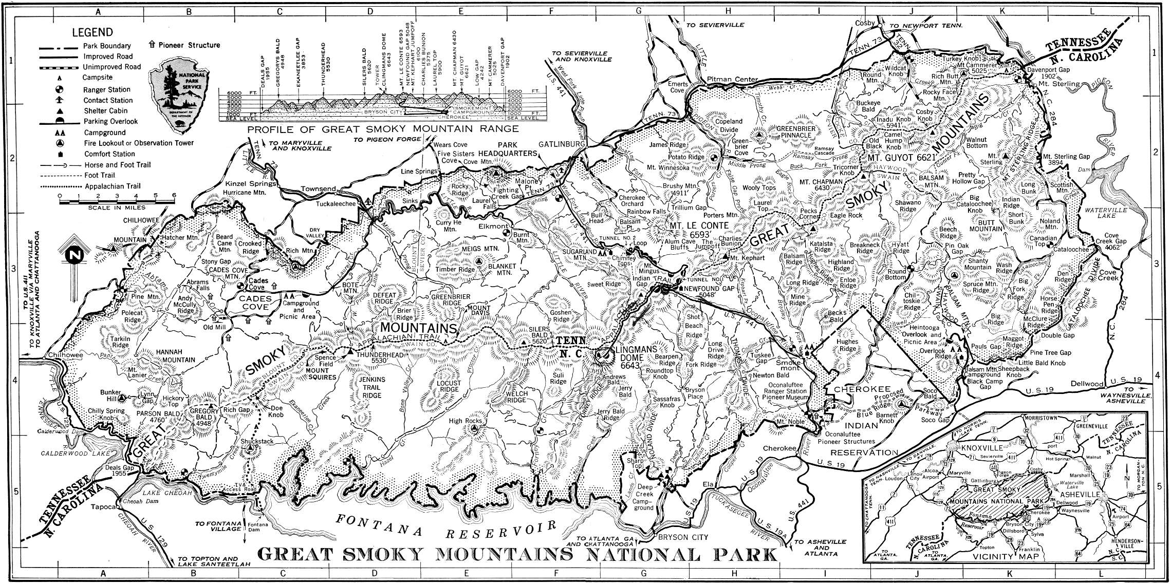
GREAT SMOKY MOUNTAINS NATIONAL PARK
COMPLETELY EXTINGUISH MATCHES AND CIGARETTES BEFORE THROWING AWAY. BE SURE CAMPFIRE IS OUT BEFORE LEAVING IT. ALWAYS USE CAR ASHTRAYS. LET'S NOT BE GUILTY OF STARTING A FOREST FIRE.
From—
Gatlinburg Cherokee Townsend Map
To— entrance entrance entrance Elevation Remarks Index
Miles Miles Miles Feet
Park Headquarters 1.5 28.3 18.5 1463 Office of superintendent F-2.
Pioneer Museum and Oconaluftee Ranger Station 27.9 1.9 45.9 2025 Museum; park office, North Carolina section I-4.
Chimneys Campground 6.5 23.6 23.5 2750 In Tennessee section on U. S. 441 G-3.
Smokemont Campground 24.6 5.2 41.5 2198 In North Carolina section on U. S. 441 I-4.
Balsam Mountain Campground 53.3 23.5 71.3 5340 In North Carolina section; 11.3 miles north of U. S. 19 J-4.
Cades Cove Campground 26 63 7.7 1960 In Tennessee section; 7 miles south of Tennessee Route 73 C-3.
Deep Creek Campground 45.8 16 63.8 1800 In North Carolina section; 2.1 miles north of U. S. 19 G-5.
Heintooga Ridge Picnic Area 53.8 24 71.8 5325 Excellent mountain vistas J-4.
Chimneys Footbridge 8.7 21.1 25.7 3550 At parking area above lower tunnel G-3.
Alum Cave Parking Area 10.5 19.3 27.5 3850 Trail to Alum Cave Bluffs and Mount Le Conte G-3.
Cherokee Orchard 4.7 35.5 24.7 2550 Trails to Mount Le Conte and Rainbow Falls G-2.
Newfound Gap 15 14.8 42 5048 Where U. S. 441 crosses Smokies, Appalachian Trail, and Clingmans Dome Highway G-3.
Indian Gap 16.3 16.1 43.3 5266 Historic pass through Smokies G-3.
Forney Ridge Parking Area 22.5 22.3 49.5 6311 Clingmans Dome Trail G-4.
Fighting Creek Gap 4.6 31.4 15.4 2320 Trail to Laurel Falls and Cove Mountain F-2.
Cherokee Indian Reservation 31.3 1.5 48.5 1900 Eastern band of Cherokee Indians I-5.
Little River Gorge 5.8 32.5 1 2000 Scenic drive E-2 and
to 1,100 D-2.
Cades Cove 26 63 7.7 1807 Extensive level area surrounded by mountains C-3.
Tremont “Y” 18.2 45 0.7 1147 Junction of Cades Cove and Little River Roads D-3.
Greenbrier 11 43 31 1680 Trails into area of excellent forests and streams H-2.
Cosby 23.1 52 43.1 2459 Northeastern section of park, Tennessee side J-1.
Cataloochee 50.4 60.5 70.4 2643 Excellent scenic drive, eastern section of park K-3.
Loop trip around western end of park 165 165 165 One-day drive, Gatlinburg to park headquarters, Elkmont, Townsend, Maryville, Tapoca, Bryson City, Cherokee, and Gatlinburg