3 Guide and Adviser
Reading edition
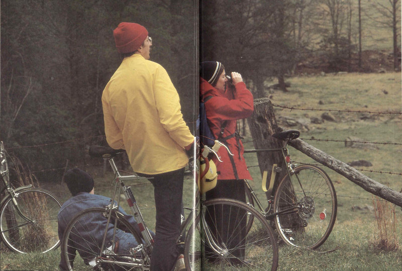
The Cades Cove loop drive is reserved for bicyclists certain hours each week. Its level demeanor looks like heaven if you have biked across the mountains.
100
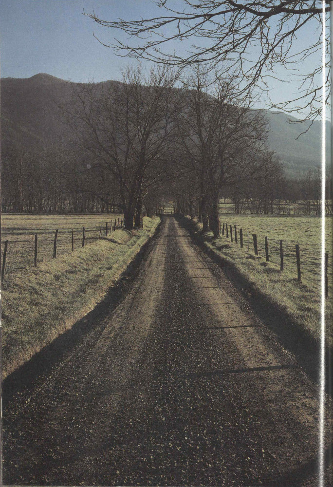
A low sun casts fencepost shadows on a Cades Cove road. The relatively flat cove was premium farmland. Geologically, the cove floor is limestone, younger than the rocks forming surrounding ridges. The Rich Mountain mass skidded across what is now the cove as the Smokies range was being formed.
101
Guide and Adviser Topical Reference
Going to the Great Smokies 101
Map 102
Visitor Centers 104
The Smokies by Car 107
Wildflowers and Fall Colors 110
Activities 112
Hiking and Backpacking 114
Accommodations 118
For Your Safety 120
Nearby Attractions 122
Books to Read 125
Index 126
Going to the Great Smokies
The Great Smoky Mountains National Park straddles the North Carolina-Tennessee boundary for about 110 kilometers (70 miles). It is accessible by car from the Interstate highways encircling it as they connect the Tennessee cities of Knoxville and Chattanooga with Asheville, North Carolina; Greenville, South Carolina; and Atlanta, Georgia. The Blue Ridge Parkway reaches its southern terminus here on the park’s North Carolina side. Major gateways to the park are Cherokee and Bryson City, North Carolina, and the cities of Pigeon Forge, Gatlinburg, Townsend, and Cosby, in Tennessee. These urban areas with their tourist services are connected by Newfound Gap Road (U.S. 441), the only park road that crosses the mountains. It is closed to commercial vehicles.
The National Park Service, U.S. Department of the Interior, is responsible for the management of the park. The superintendent’s address is Gatlinburg, Tennessee 37738. Telephone (615) 436-5615. Park headquarters is located 3.2 kilometers (2 miles) south of Gatlinburg, on the Newfound Gap Road.
Maps, guides, and information on routes, points of interest, accommodations, and services are available from several sources. For a Tennessee highway map write to the Department of Transportation, Nashville, Tennessee 37243-0349, or telephone (615) 741-2331. For Tennessee vacation information write to Department of Tourist Development, P.O. Box 23170, Nashville, Tennessee 37202, or telephone (615) 741-2158.
For a North Carolina highway map write to Travel and Tourism Division, 430 No. Salisbury, Raleigh, North Carolina 27603, or telephone (919) 733-4171. The division distributes several brochures on North Carolina vacations, recreation, and special events; specify your interest in the Smokies. The North Carolina Outdoors booklet lists areas and facilities, including private campgrounds, keyed to the official highway map.
102
Park Map
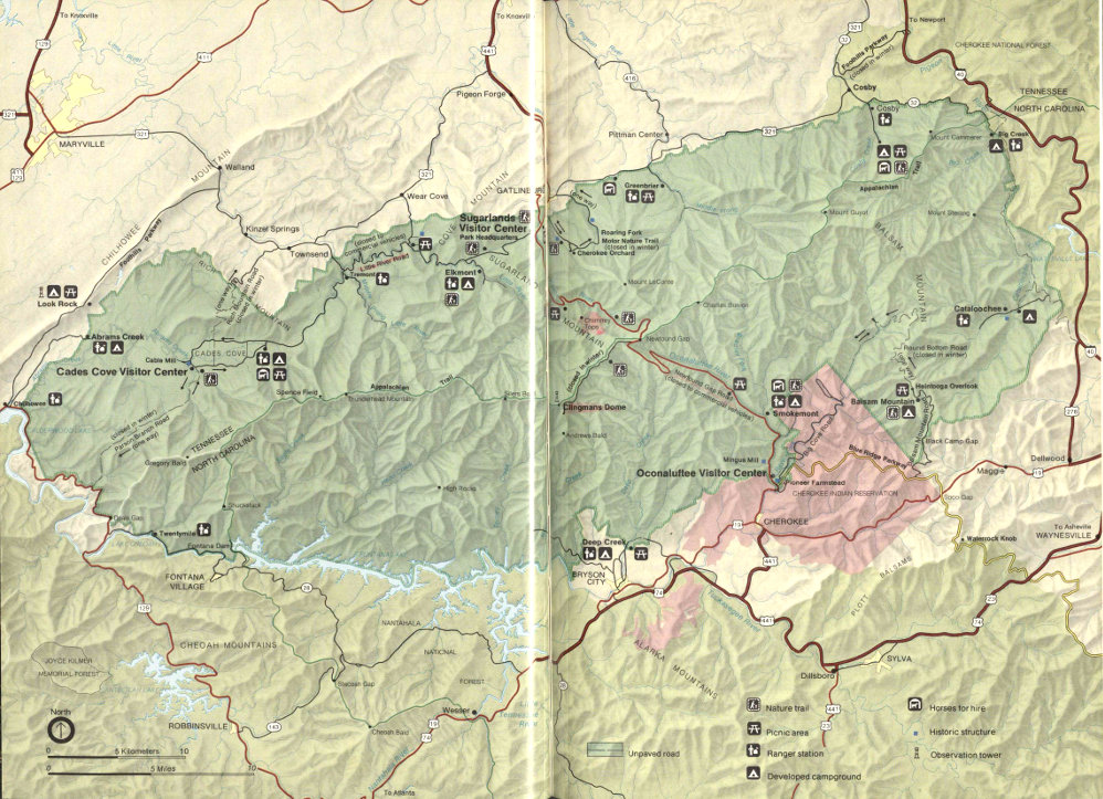
Great Smoky Mountains National Park High-resolution Map
104
Chambers of commerce offer trip information:
Pigeon Forge Chamber of Commerce P.O. Box 1390 Pigeon Forge, Tennessee 37868 800-251-9100 or (615) 453-8574.
Gatlinburg Chamber of Commerce P.O. Box 527 Gatlinburg, Tennessee 37738 800-822-1998 or (615) 436-4178.
Townsend Chamber of Commerce Townsend, Tennessee 37882.
Cosby Chamber of Commerce Cosby, Tennessee 37722.
Cherokee Chamber of Commerce P.O. Box 460 Cherokee, North Carolina 28719 (704) 497-9195.
Bryson City Chamber of Commerce Bryson City, North Carolina 28713 (704) 488-3681.
Lodging and supplies are available in Pigeon Forge, Gatlinburg, Sevierville, Townsend, Maryville, Bryson City, Cherokee, and other Tennessee and North Carolina towns surrounding the park. No public transportation serves the national park. Major airlines serve Knoxville, Tennessee and Asheville, North Carolina, where cars may be rented.
Visitor Centers
National Park Service Visitor Centers are located just inside the park on both the North Carolina and Tennessee sides. On the Tennessee side the Sugarlands Visitor Center is 3.2 kilometers (2 miles) south of Gatlinburg. The Cades Cove Visitor Center (closed in winter) is located in the Cable Mill area of the Cades Cove Loop Road. On the North Carolina side the Oconaluftee Visitor Center is 3.2 kilometers (2 miles) north of Cherokee.
If you plan to be in the park just a few hours or up to several days, you will do yourself a favor by checking out a visitor center. Museum displays give you a quick and interesting insight into both nature and history in the park. At Sugarlands there is a free movie. Books, maps, and other publications are offered for sale in the visitor centers and free park folders are available. These resources—and the people working the information desks—can help you plan your stay in the park within the time limits you must meet.
The Great Smokies is a large park whose diverse features are separated by significant driving times. Park employees can help you use your time to best advantage.
Visitor centers also offer restroom facilities, drinking water, and a mail drop and they sell film for your convenience. Here you can get backpacking information and apply for a backcountry use permit. (See section on Backcountry Use.) Visitor center bulletin boards carry information on road conditions, urgent contact requests, and interpretive programs.
Visitor centers are open 8 a.m. to 4:30 p.m. during the winter, with extended hours of operation in the spring, summer, and fall. The Cades Cove Visitor Center is open from 9 a.m. to 5 p.m. from mid-April to late November.
Interpretive Programs
Guided walks and evening programs are conducted by the National Park Service throughout the park. Most of these start or take place at the visitor centers and at campground amphitheaters. The uniformed park employees who render these services are trained in the natural history and/or history of the Great Smokies. They give you excellent vignettes of the park’s nature and its historical period of Indian 105 and mountaineer life and the opportunity to ask questions. You, for instance, might enjoy a short nature walk up a burbling Smokies stream and so learn about the more than 1,100 kilometers (700 miles) of streams in the park. Schedules of these activities and programs are posted at the visitor centers and on campground bulletin boards. A copy of the schedule is in Guide to Great Smoky Mountains National Park, which is available free at any visitor center, ranger station, or campground.
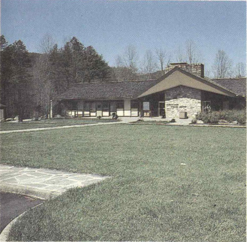
Sugarlands Visitor Center (above) in Tennessee and Oconaluftee Visitor Center in North Carolina (below), are the best places to begin your park trip. Exhibits explain the natural and human history of the Great Smokies. A free park folder is available, books and maps are sold, and you can check the posted schedule of activities being offered.
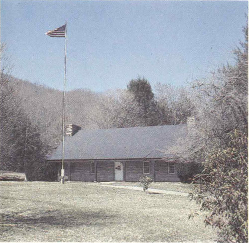
Live demonstrations of mountain life skills and folkways are also provided periodically (spring through October) at places such as the Pioneer Farmstead beside the Oconaluftee Visitor Center and the nearby Mingus Mill, or at the Cable Mill in Cades Cove. You even might be able to buy cornmeal freshly ground just as it was a century or more ago.
Self-guiding nature trails have been laid out throughout the park. Look for these marked trails near campgrounds, visitor centers, and picnic areas. Most are easy walks of 1.5 kilometers (a mile) or less which take you through former farmsteads now returning to forest, groves of the world-famous cove hardwoods, reclaimed logged-over lands, or other aspects of the park. Trails are well marked and seldom difficult. At the trail’s start look for a container offering a descriptive brochure for sale on the honor system.
Two self-guiding motor nature trails lead you through impressive areas of the park in the comfort and convenience of your own vehicle. Near Gatlinburg, off the Cherokee Orchard Road, is the Roaring Fork Motor Nature Trail. Its scenic route takes you by several restored pioneer buildings. The Cades Cove Loop Road is an 18-kilometer (11-mile) drive through the pleasant scenery of Cades Cove. Here you get 106 pleasant vistas out across the cove where you may well see deer grazing against a mountain backdrop. The fields recall the rural scene of many years ago. A brochure available at the start of the loop describes points along the way that are designated by numbered signs. At several points you can park your car and visit preserved farm structures, both log and frame, and churches and cemeteries. Partway through the loop is a small visitor center and the restored Cable Mill. Associated restored buildings here display farm implements once used for valley and mountain farming in this region.
Guided interpretive programs are offered largely in summer. Check the current schedule at the visitor centers or on campground bulletin boards.
Evening campground programs offer interesting free family entertainment. Try the many interpretive programs offered at park campgrounds in the evenings throughout the week. Check bulletin boards for the schedules.
The three most often asked questions in the park are: Where can I fish? Where can I camp? and What about the bears? Some evening programs cover the bears in detail and you will learn about unusual denning habits in the Smokies. All evening programs are offered for the general public by trained National Park Service interpreters. You will enjoy them no matter how much, or how little, you know about the topic. And you are free to ask questions, knowing they will be taken seriously.
Evening programs cover such topics as the pioneer life, wildlife, hiking, and the incredible botanical story of the Smokies. There are programs on the “preserve and protect” philosophy of how the park is managed, and exploring the park. For the adventurous there are “night prowls,” guided experiences after dark to sample the sights, sounds, and odors of the night forest.
Quiet walkways provide short walks on easy grades. They usually begin at parking areas that accommodate no more than two cars, so crowds are excluded. This is a nice way to experience the naturalness of the Smokies in walks not exceeding 0.5 kilometers (0.3 miles).
107
The Smokies by Car
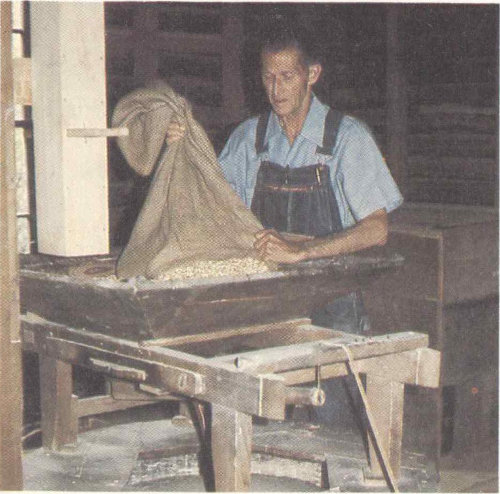
They still grind corn sometimes by the old water-driven methods at the restored Mingus Mill, just up the road from the Oconaluftee Visitor Center.
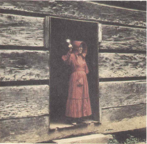
But school’s in session at Little Greenbrier only for the sake of people who come to the park to see what life was like in the Smokies a couple of generations back. These living history demonstrations are sometimes offered in summer at various parts of the park. Check schedules at a visitor center or campground.
A few comments may save time and open new vistas for your driving in the Smokies. Within just an hour’s drive of each other here are climatic differences created by elevation. You can drive through the spruce-fir forests typical of Maine up near Clingmans Dome in late morning and be driving through lush southern hardwoods back near Sugarlands or Oconaluftee in early afternoon.
The roads are designed for scenic driving. There are numerous turnouts and parking areas at viewpoints or historic sites.
Traffic, winding roads, and the scenery conspire to making driving time more important than distance here in the park. Figure about twice the time to drive a given distance that you would for normal highways. Be on the alert for unexpected driving behavior from others—they may be under the influence of the scenery! Gasoline is not sold in the park, so check your gauge. Remember that winter storms may close the Newfound Gap and Little River Roads.
The main road in the park is the Newfound Gap Road (U.S. 441) between Gatlinburg and Cherokee. It is the only road across the mountains. Along it and at the Newfound Gap Parking Area you will get some of the best scenic high-mountain vistas in the park—and on the East Coast, for that matter. If you want to go still higher you can drive up the Clingmans Dome Road from Newfound Gap and walk up to the observation tower. Here you are at the highest point in the national park, and the third highest east of the Rockies. The reward is a 360-degree panorama of the sea of peaks for which the Smokies (and Natahalas and Unakas and ...) are famous. Clingmans Dome 108 Road is a deadend spur off the Newfound Gap Road at the crest of the Smokies.
If you want to sample the Blue Ridge Parkway and also enjoy some beautiful mountain scenery from right up in it, try the Balsam Mountain Road, which leaves the parkway between Oconaluftee and Soco Gap. It winds for 14.5 kilometers (9 miles) back into the national park’s Balsam Mountain Campground. Incredible azalea displays will dazzle you here in season. If you are adventurous and want to try a mountain dirt road, continue past the campground to the Heintooga Picnic Area and the start of the Round Bottom Road (closed during winter). This is a 22.5-kilometer (14-mile), partially one-way, unpaved road that descends the mountain to the river valley below and joins the Big Cove Road in the Cherokee Indian Reservation. You come out right below Oconaluftee at the edge of the park.
Another view of the Smokies awaits you along the Little River Road leading from Sugarlands to Cades Cove. The road lies on the old logging railroad bed for a distance along the Little River. (The curves suggest these were not fast trains!) Spur roads lead off to Elkmont and Tremont deeper in the park, and to Townsend and Wear Cove, towns outside the park. Little River Road becomes the Laurel Creek Road and takes you on into Cades Cove where you can take the one-way 18-kilometer (11-mile) loop drive and observe the historic mountain setting of early settlers. If you are returning to Gatlinburg or Pigeon Forge from Cades Cove, try exiting the park toward Townsend and driving the beautiful Wear Cove Road back to U.S. 441 at the north end of Pigeon Forge.
Perhaps the most bucolic scenes in the Smokies are to be seen from the Foothills Parkway between Interstate 40 and Route 32 near Cosby, around the northeast tip of the park. Here you look out across beautiful farmland with the whole mass of the Smokies rising as its backdrop.
Other interesting drives in the park are the Rich Mountain Road, Parsons Branch Road (both closed in winter), and the Roaring Fork Motor Nature Trail. At the west end of the park there is another section of the Foothills Parkway between Chilhowee and Walland. The parkway is administered by the National Park Service. A small leaflet, “Auto Touring,” is available for a small charge at any of the three visitor centers.
Mountain People and Folkways
Right beside the Oconaluftee Visitor Center as you enter the North Carolina side of the park is the Pioneer Farmstead, a restored small farm along the Oconaluftee River. As you leave the visitor center headed toward the mountains, Mingus Mill Parking Area soon appears on your left. The turbine-powered gristmill used water power to grind cornmeal and flour. Its millrace leaves a lively creek and spills toward the mill under arching mountain-laurel. Stones used to grind wheat came from France. Cornmeal stones were of local origin. Mingus Mill is open from May through October and a miller is usually on hand to answer your questions.
On the North Carolina side of the park limited restored structures are also found at Cataloochee.
The Cable Mill area in Cades Cove presents the largest group of restored structures on the Tennessee side of the park. Farming is still permitted in Cades Cove itself to preserve the open fields of the rural scene there. The 18-kilometer (11-mile) loop drive through Cades Cove takes you by numerous log and frame structures. The Elijah Oliver place is a particularly beautiful log structure with outbuildings in a cozy, shaded setting. The stream flowing through Elijah Oliver’s springhouse once kept his milk supply cool.
109
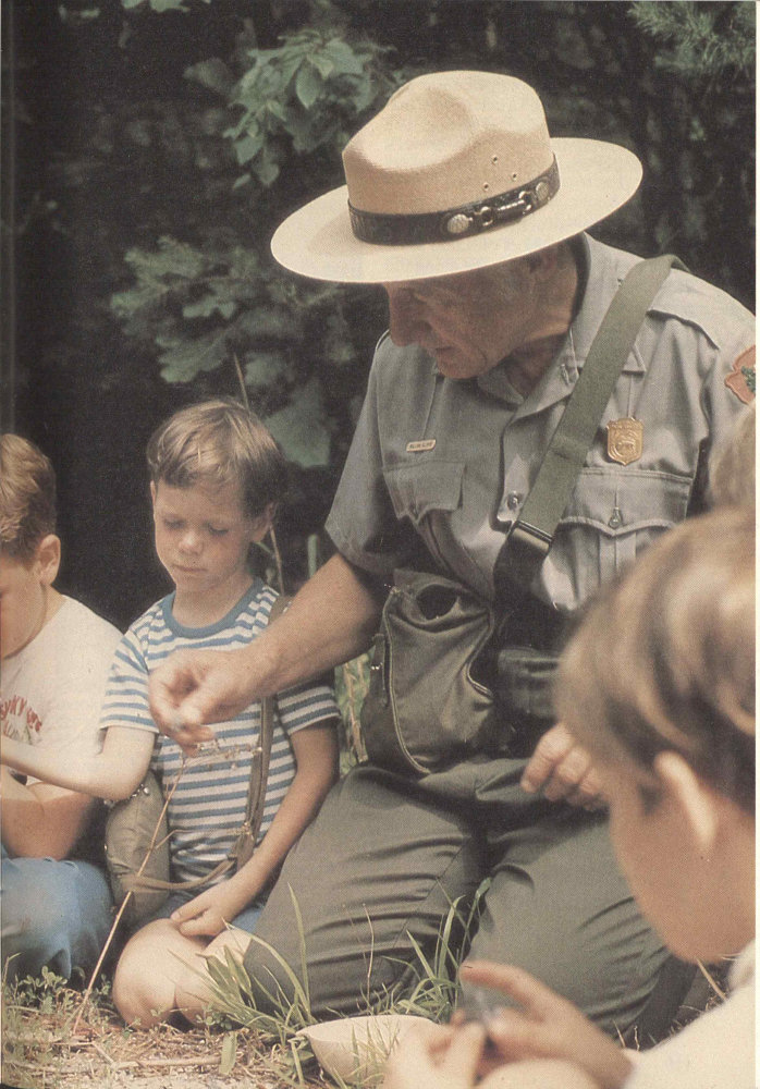
Ranger-led walks and evening campfire programs can be highlights of your park trip.
110
Other pioneer structures include the Little Greenbrier School off Little River Road and cabins and houses along the Roaring Fork Motor Nature Trail. Close scrutiny of the many log structures shows subtle variations in notching and other details.
Living history demonstrations are offered in season at Cades Cove, Mingus Mill, and the Pioneer Farmstead. Check the visitor center and campground bulletin boards for schedules. These may include craft demonstrations and concerts of traditional mountain music. A “Mountain People” leaflet is available for a small charge at any of the park’s visitor centers.
Wildflowers and Fall Colors
With abundant warm sunshine and frequent rainfall it is no surprise that about 200 species of showy wildflowers bloom in the Smokies. They begin in March and last until about November. Spring comes to mind when most of us think about flowers, but practically the whole year has something to offer. Spring seems to burst with flowers as they take advantage of good conditions for a short period between the cold of winter and the shade of summer, when full foliage blocks sunlight from the forest floor.
Bloom dates depend on the weather and can vary from year to year. Here are recommended dates to guide you: Dogwood and redbud, mid- to late-April; spring flowers, late March to mid-May; mountain-laurel and flame azalea, May and June; Catawba rhododendron, mid-June; and rosebay rhododendron, June and July.
Springtime flowers are trilliums, phacelia, violets, lady’s-slippers, jack-in-the-pulpits, and showy orchis. There are familiar exotic (non-native) species too, such as the dandelion. (In the Smokies exotics are generally flowers of field and not of forest.) Goldenrod, ironweed, and asters bloom in late September to early October.
In August you may see wild clematis, yellow-fringed orchis, bee-balm, cardinal-flower, monkshood, and blue gentian.
Many flowers grow along park roadsides. Other good locations to see them are along quiet walkways and on designated nature trails throughout the park. See photographs of flowering shrubs and wildflowers on pages 58-61.
Fall colors generally peak between October 15 and 25. The presence of hardwood 111 species usually associated with more northerly climes makes the autumn leaves here the more spectacular. Up and down the mountain the brilliant reds of maples, the golden yellow of beech, and the deeper hues of oaks and more southerly species blend spectacularly. Fall color is the result of the breakdown of green chlorophyll in deciduous leaves. Yellow and brown pigments present all summer now become prominent. Red colors are produced when sugars are trapped in the sap of the leaves.
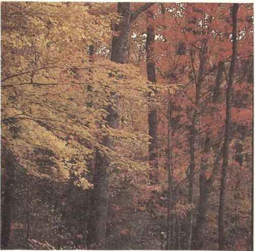
Spring and fall bursts of color are annual drawing cards in the Smokies. As the seasons progress, fall colors descend the mountains and spring colors “climb” upwards.
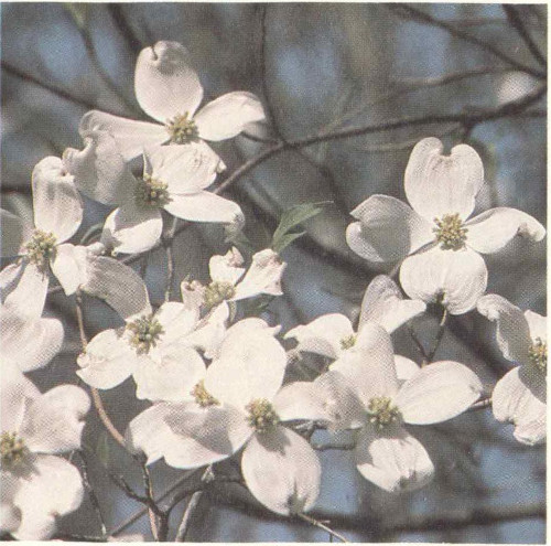
If you don’t mind chilly nights this can be great camping weather, and a generally pleasant time of year here. Keep in mind that the traffic is particularly heavy in the park during the fall foliage season, especially on weekends.
A leaflet “Forests and Wildflowers” is available from any park visitor center for a small charge.
112
Activities
Horseback Riding
The park has many kilometers of horse trails and this is considered some of the finest riding country in the East. If you have your own horses and want to use them in the Smokies, write to the superintendent and request the “Great Smoky Mountains Trail Map” folder and other current information on horse use in the park. The folder provides basic information on sites and regulations and indicates horse trails. The regulations are designed to minimize the environmental impact of stock.
If you don’t own a horse, don’t worry. You can rent one from a concessioner by the hour, half day, day, or overnight at five locations in the park: Cades Cove, Cosby, Dudley Creek, Smokemont, and Sugarlands. The National Park Service requires the concessioner to send a guide with all horse parties; this service is included in the basic rental rate. For overnight trips you must bring your own food. Saddlebags and shelter are provided.
If you want to experience a more traditional “outfitted” horseback trip, write to area chambers of commerce for names of commercial outfitters.
Bicycling
The best place to bike in the Smokies is Cades Cove. If you don’t arrive on your own bike or carry it on your car, you can rent one from the concessioner there, except in winter. The 18-kilometer (11-mile) loop road is a paved, generally level-to-rolling one-way country road around the cove. It takes you by restored pioneer and settlers’ structures, both log and frame.
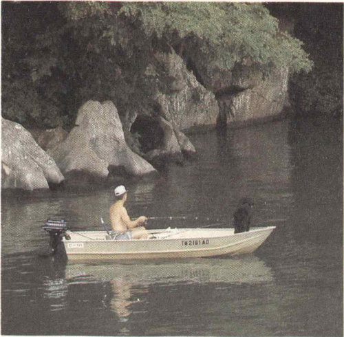
Fishing Smokies streams and rivers and the nearby TVA lakes is a popular pastime. Most sought after in the park are rainbow and brown trout.
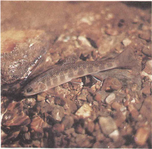
Pictured here is the brook trout. Please take a good look because possession of any brook trout is prohibited in the park.
Along the way are many pleasant streams, hiking trail access points, wooded stretches, 113 and the Cable Mill area with a small visitor center. The scenery is nothing if not glorious. You look out across the rolling, open meadow to the mountains. And you may see herds of deer grazing. In summer bikers have the loop road to themselves—no cars allowed—on Saturday mornings until 10 a.m.
Biking conditions elsewhere in the park are not generally good. The Newfound Gap Road is steep, winding, crushingly long, and can be full of traffic. Other park roads tend to be winding and narrow as well.
The Cades Cove bicycle concession is located at the campground.
Fishing
The Smokies offer a chance to fish in rushing mountain streams and rivers. Of the 70 or so kinds of fish in the park, those that can be fished for are smallmouth bass, rock bass, and rainbow and brown trout. The native brook trout is protected and its waters are closed to fishing. Rainbows and brown trout are non-native species and are managed to provide sustained-yield fishing.
With a valid Tennessee or North Carolina license you may fish open park waters from sunrise to sunset. A license is required for all persons 13 years of age and older in Tennessee and 16 years of age and older in North Carolina. Buy licenses in nearby towns. Fishing with bait is prohibited. Only single-hook artificial lures may be used. Possession and size limits may vary with stream and species of fish, so check before you fish. In general, the possession of any brook trout is prohibited. The National Park Service hopes to restore some native brook trout waters encroached upon by introduced brown and rainbow trout.
Local regulations are posted on streams and can be obtained at any park ranger station or visitor center. Or write to the park superintendent in advance of your trip.
Birding the Smokies
The variety of birds here is striking. A one-day count throughout the park and vicinity in winter will net more than 50 species even in a bad year. More than 20 warblers are considered to breed within the park, and nearly 30 members of the finch family have been reported here. Geese and ducks number nearly 20 species, but are not often seen. Craggy mountain heights provide ideal habitat for ravens, some hawks, and occasional migrating peregrine falcons. Eagles and falcons are only occasionally, or rarely, seen, but the mere possibility is exciting. If you are interested in finding a particular bird or good birding places, check at a visitor center. Some birds are only seasonal residents or visitors of the park.
Serious birders will want to see a copy of the bird checklist. Free copies are available at visitor centers.
114
Hiking and Backpacking
A Hiker’s Paradise
The fact that the National Park Service maintains 1,450 kilometers (900 miles) of trails says something about the Smokies and hiking: it’s an East Coast hiker’s paradise. Trails come in all lengths and levels of difficulty, for the handicapped, children, super-athletes, old folks, day hikers, and long-distance backpackers. The latter of course means the Appalachian Trail, which threads the Smokies crest on its way from Maine to Georgia. More on the AT below.
The intimacy of the Smokies wilderness surprises many who are attracted by the stunning mountain scenery. This intimacy, best seen afoot, is all but missed from your vehicle. So is the mood set by wildflowers, cascading streams, birdsong, and the fragrance of fir trees so startling in the Southeast. Hiking trails give access to waterfalls such as Juneywhank, Abrams, Hen Wallow, and Ramsay Cascades. A leaflet, “Streams and Waterfalls,” is available at visitor centers for a small charge.
On sale at visitor centers you will find copies of the National Park Service’s “Great Smoky Mountains Trail Map” folder. It has up-to-date information and a shaded relief map of trails and popular trailheads in the park. Detailed trail descriptions are found in the Sierra Club Totebook, Hiker’s Guide to the Smokies, sold at visitor centers and in area book and outdoor equipment stores.
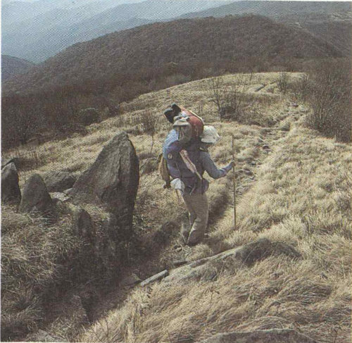
From mountain balds (above) to rocky canyon ledges (below), Smokies trails introduce you to aspects of the park invisible to motorists. Afoot, you experience the intimacy of natural detail that makes the Smokies internationally renowned.
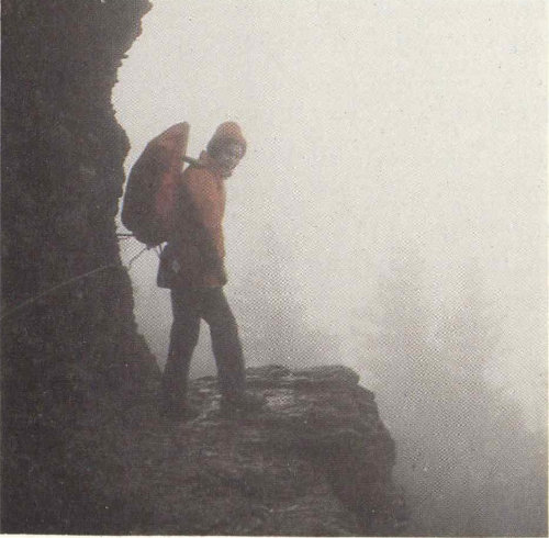
You will want to wear comfortable, non-slip shoes whether you go out for a half-hour or a day. And you must expect variable weather, characteristic of the Smokies. Abundant rainfall can materialize quickly on a day which began so clear just hours ago. A light poncho or other rain gear is 115 handy. Make sure you will be warm enough, too. (See “Hypothermia and Winter Warnings.”) Days that are warm at Sugarlands or Oconaluftee can be very cold if rain and wind catch you at higher elevations.
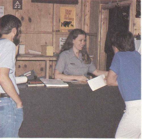
All overnight camping except in established park campgrounds requires a free backcountry use permit. The permit system assures you and your party an appropriate measure of solitude in the backcountry.
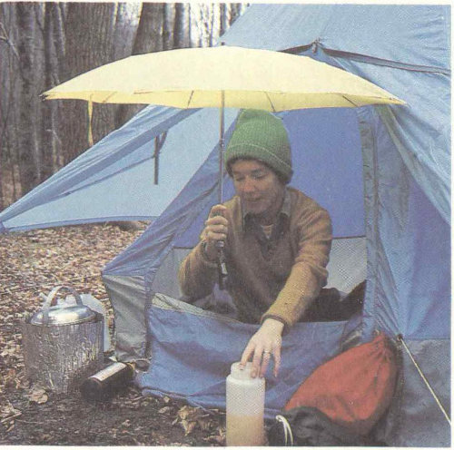
No matter where you camp in the park, you must be fully prepared for rainy weather.
Attractions shift with the seasons in the Smokies. The best way to meld your own interests with current attractions for a pleasant hike is to seek advice at a visitor center. Describing your interests and asking “What’s best to see this time of year?” may well produce custom-tailored hiking advice. You will notice hikes are described in time as well as distance because steeper trails make simple distance a deceptive measure. A leaflet, “Walks and Hikes,” describes over 50 popular day hikes and is available from park visitor centers for a small charge.
Backcountry Use Permits
All overnight hiking in the park requires a backcountry use permit available free at visitor centers, and the Cades Cove campground kiosk. The permit system has as its purpose to protect the unspoiled character of the Smokies backcountry for the enjoyment of present and future users. Permits distribute use so that impact is not disproportionate in popular areas, and thus they provide backcountry users with an opportunity for increased solitude. You do not need a backcountry use permit for day hiking, only for overnight use. The “Great Smoky Mountains Trail Map” folder (see above) explains the permit system and its use. Information is also available at ranger stations or visitor centers. Or write: Backcountry Permit, in care of the park address; telephone (615) 436-1231 and ask for “Backcountry.” You can reserve a specific backcountry campsite for one to three specific nights up to 30 days in advance under this permit system. You can do this in person, by telephone, or by 116 mail. The permit itself must be picked up in person no earlier than 24 hours before the beginning of the trip. Note: Reservations for the entire trip are automatically canceled if your permit is not picked up by 12:00 noon on the first day of the scheduled trip. Permits will not be issued to groups larger than eight persons.
Competition for use of trail shelters along popular trails is great in the peak season. But you can pick and choose from among many uncrowded trails that offer trailside campsites. All water obtained in the backcountry should be boiled or chemically treated.
The Appalachian Trail
Of all the distance the Appalachian Trail spans between Maine and Georgia, perhaps no sustained portion is as virtually untouched by humanity as the 110 kilometers (70 miles) threading the crest of the Smokies. And this despite the fact that the overall trail is 3,244 kilometers (2,015 miles) long. You can park your car in the Newfound Gap Parking Area and walk the AT north or south for a pleasant walk—or day-long hike—along the Smokies crest. A popular destination to the north is Charlies Bunion. There, because of unrecovered fire openings on extremely steep mountain slopes, you achieve a real alpine sense and literal “peak” experience. You can also park below Clingmans Dome, a short spur drive south of Newfound Gap, and experience the AT.
About every 10-16 kilometers (8 to 10 miles) there are overnight shelters providing primitive bunks. These three-sided shelters are closed in on the fourth side with chainlink fence as bear-proofing. To stay in these shelters requires a backcountry use permit/reservation. Stays are limited to one night at a given shelter.
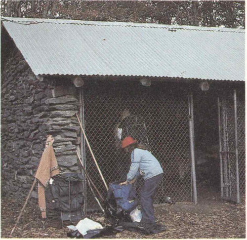
The Appalachian Trail traces 110 kilometers (70 miles) along the crest of the range. Overnight shelters are screened against bears. Shelter use requires a backcountry use permit (see text). Through-hikers on the Appalachian Trail must also write ahead for permit information.
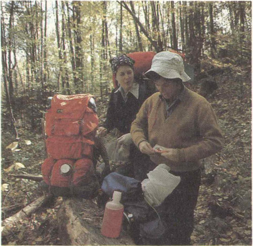
Most park trails are well defined and well marked. They offer backpackers ready—if not easy—access to some of the East’s finest wildlands.
117
If you are hiking the Appalachian Trail from outside the park you can stop at the Twentymile Ranger Station (on the south) or the Big Creek Ranger Station (on the north) to get your permit and reserve shelter space. You can also write ahead for a permit and reservation up to 30 days in advance (see above). For through-hikers—those hiking the entire AT between Maine and Georgia—the situation is different. You can obtain a “through permit” in advance of your trip. Write to Backcountry Permits at the park address and explain your trip.
Because it follows the Smokies crest the AT acts as backbone to a network of trails within the park. With such spur trails, many with their own pleasant waterfall, creek, or other natural feature as an attraction, you have access to the AT from numerous trailheads. Such AT sections are much less crowded than those near Newfound Gap and Clingmans Dome. You get the same sense of walking the crest of eastern America and participating in the trail experience that began as a dream of a pioneering land-use planner, Benton MacKaye, early in this century.
For information about the complete Appalachian Trail write The Appalachian Trail Conference, P.O. Box 236, Harpers Ferry, West Virginia 25425.
Backcountry Basics
While you need a backcountry use permit only for overnight backcountry travel, it would be remiss not to say something about backcountry basics for casual trail walkers and day hikers. Once you leave a parking area or campground in the Smokies, you are in the wilderness. This is the nature of the place. The National Park Service advises against solo camping or hiking in the backcountry. Even experienced hikers can get into trouble and, if alone, may not be able to obtain help. This information is not offered to scare or offend you, but just to make you realize where you are and to make you concerned about your safety.
Stream crossings can be dangerous if the streams are swollen after a rainstorm. Don’t attempt to ford a swollen stream. Return to the trailhead and plan another trip. It’s worth the extra effort and precaution.
Sudden weather changes are characteristic of the Great Smokies. Be prepared to get wet and either hotter or colder. Rain, wind, and cold can become a deadly combination before you recognize your own symptoms of hypothermia. Rainstorms are typical of warmer weather, so always carry raingear in late spring and summer.
Stay on park trails. If you become lost, do not leave the trail. Particularly, do not follow a stream because dense undergrowth will rapidly tire you. Most trails intersect others within a few kilometers and signs at the junctions can put you back on course. If you find yourself lost late in the day, find a protected spot and spend the night. After-dark travel is dangerous. Try to stay warm and dry. Show some sign if possible, such as a fire.
Do not climb on cliff faces and waterfalls. The fine spray mist off waterfalls makes surrounding rocks treacherous footing and increases safety hazards.
If you intend to try winter camping, write to the superintendent for information about the equipment you should have, a backcountry permit, and conditions you may encounter. At higher elevations winter conditions can differ radically from the popular image of winter in the mid-South.
118
Accommodations
Camping
Camping is a good way to get into the spirit of the Great Smoky Mountains. The National Park Service maintains ten developed campgrounds in the park: at Smokemont, Elkmont, Cades Cove, Cosby, Deep Creek, Look Rock, Balsam Mountain, Cataloochee, Big Creek, and Abrams Creek. Fees are charged. Campgrounds offer water, fireplaces, tables, comfort stations, tent sites, and limited trailer space. No shelters are provided; bring your own and other camping equipment. There are no showers or trailer hookups. Disposal stations for trailer holding tanks are found at Smokemont, Deep Creek, Cades Cove, and Cosby Campgrounds and across the road from the Sugarlands Visitor Center. Primitive campgrounds have pit toilets.
Camping is limited to seven days at all campgrounds during the peak season. You may reserve campsites at Elkmont and Cades Cove in Tennessee and Smokemont in North Carolina by writing to Ticketron Reservations, P.O. Box 617516, Chicago, Illinois 60661-7516. Telephone reservations may be made by calling 1-800-452-1111. For prompt service call the national park (see page 101) for the current per-night camping fee and Ticketron’s reservation handling fee. Then mail Ticketron a money order, not a personal check, to cover the reservation plus handling for the entire period you request. General tips: Avoid mid-summer’s peak camping season. Spring and autumn can be pleasant and offer dazzling flower and leaf-coloration shows. Arrive early in the day and seek your campsite on arrival. Look for a campground off the beaten path, generally away from the Newfound Gap Road (see map).
Chambers of commerce can supply you with commercial camping information. Regional lists of campgrounds are maintained by tourist offices in both Tennessee and North Carolina. For Tennessee write: “Fishing and Camping in East Tennessee,” Knoxville Tourist Bureau, 500 Henley St., Knoxville, Tennessee 37901, or telephone (615) 523-2316. For North Carolina write: “North Carolina Outdoors,” Travel and Tourism Division, 430 No. Salisbury, Raleigh, North Carolina 27603, or telephone (919) 733-4171.
LeConte Lodge lies atop Mount LeConte, third highest Appalachian peak. You must hike a half-day up mountain trails to get there. Make reservations several months in advance. The lodge sits amidst spruce and fir trees. You can hike in via Alum Caves Bluffs; the lodge sits at trail junctions to Rainbow Falls, Grotto Falls, and the Appalachian Trail. You need bring only personal articles. For information and reservations, write: LeConte Lodge, 250 Lonesome Valley Rd., Sevierville, Tennessee 37862, (615) 429-5704. The only other park accommodations besides campgrounds are the Wonderland Hotel, a small turn-of-the-century hotel in Elkmont. For information or reservations call (615) 436-5490. Closed in winter.
119

A new breed often encountered on today’s trails is called backpackee!
120
For Your Safety
Bears, Bears, Bears
Tales could be told that would curdle your blood ... but not about the black bear’s aggressiveness. These stories would be about the stupidity of some human beings. For reasons of pride in our own species—and so as not to demean bears—we will not recount these tales here. Just this:
The black bear is the largest wild animal in these parts. It can weigh 225 kilograms (500 pounds) or more, but is capable of incredibly fast sprints on rough terrain. It is a wild animal, and protected as such it sometimes loses its normal fear of people. This makes the bear appear tame, but it is then actually more dangerous than its truly wild counterparts. If you come upon a bear while you are in your car, keep the windows shut. Do not attempt to feed, tease, molest, or get close to a bear. Do not try to take a closeup portrait photograph of a bear; either use a telephoto lens or be satisfied with a distant shot.
Avoid and steer clear of a sow bear with cubs. She will do anything to protect them if she thinks they are threatened. Keep in mind that, even if you don’t see her, she is seldom far away. Cubs are cute, but you approach or show interest in them at your peril.
Bear feeding is prohibited. It is dangerous to you and those who come after you. It also establishes habits that may lead to the death of the bear. Roadside bears are frequently hit by cars, killed by poachers, or fed harmful substances. Don’t be guilty of killing a bear with kindness.
Campers and backpackers must observe certain regulations designed to minimize the extent to which bears are attracted to human pursuits in the park. If you plan to camp or backpack, make sure you are familiar with these regulations on food storage, etc. For example, food cannot be left unattended. If you are backpacking, it must be hung out of reach of bears. If you are camping in a campground, food must be stored in the trunk of your car. Ask for additional information when you obtain your backcountry use permit or when you check into a campground. Failure to observe these regulations may bring a fine.
Theories abound about how to act if you should confront a bear. All such theories assume the bear isn’t just as startled as you, and that “bear behavior” is predictable. It is not. As many as 600 bears may inhabit the park. This many individuals of any highly evolved species are unlikely to act—much less to react—with any great predictability.
Hypothermia and Winter Warnings
In the Smokies you must always be prepared for sudden changes in weather, especially as you go from one elevation to another. Know how to take care of yourself in extremes of cold, heat, and wetness. Always carry rain gear because storms arise quickly. In mid-summer at higher elevations a wet hiker can succumb to hypothermia, an all-weather killer. Hypothermia is a condition in which the body loses heat faster than it can generate it. You cannot imagine how rapidly hypothermia symptoms can appear even in mild weather—until they strike you. Then it may be too late. Know how to recognize hypothermia’s symptoms: uncontrolled shivering, slurred speech, memory lapse, fumbling hands, stumbling, drowsiness, and inability to get up after a nap.
Prepare yourself against the possibility of hypothermia by keeping a warm, dry layer of clothing next to the body, topped with 121 a layer to ward off wind and precipitation. Snack often on high-energy foods and take ample liquids. In winter wear multiple layers of insulating clothing under your top layer of rain and wind protection.
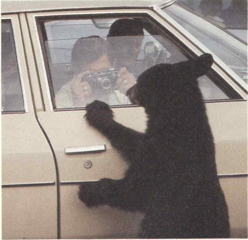
There is a saying that high boots will protect you from poisonous snakes, but that common sense is needed to keep you out of trouble with bears.

The timber rattlesnake (above) and the copperhead are the only poisonous snakes in these mountains.
Remember that hypothermia strikes in any season, not just winter. Winter hazards include frostbite; icy trails and deep snow; and trails obscured by deep snow.
Management Regulations
Drive safely, observing posted speed limits, and pull off the road or park only at designated areas. Do not leave valuables inside a locked car where they can be seen. Leave them home, take them with you when you leave your car, or lock them in the trunk.
Hunting is prohibited in the park. Firearms must be broken down so they cannot be used. The use of archery equipment, game calls, and spotlights is also prohibited.
All plants, animals, and artifacts are protected by Federal law here. Do not disturb them in any way. Fishing is permitted subject to State and Federal regulation and licensing.
All overnight camping in the backcountry requires a backcountry permit. Otherwise, camp and build fires only in designated campground sites.
A Word About Pets. It is best not to bring pets. They are permitted in the park but only if on a leash or under other physical control at all times. They may not be taken on trails or cross-country hikes. Veterinary services are found in nearby towns. If you want to board your pet during your stay here, check with the chambers of commerce in nearby cities.
122
Nearby Attractions
To describe the many attractions near the Smokies would require an encyclopedic guidebook. Nearby are TVA’s “Great Lakes of the South,” Biltmore House and Gardens, large national forests, Oak Ridge’s American Museum of Science and Energy, and other features too numerous to mention. Here are just a few features often associated with a Smokies vacation.
The Blue Ridge Parkway. From the northeast the Blue Ridge Parkway makes a delightful highway approach to the Smokies on the North Carolina side. The parkway is administered by the National Park Service and connects Shenandoah National Park, Virginia, with the Great Smoky Mountains National Park. It meticulously follows the southern Appalachians for 755 kilometers (469 miles). It is a roadway designed for motor recreation and so provides leisurely travel free of commercial development. All along it are trails and scenic viewpoints. In season, wildflowers and fall colors can be stupendous. Just before the parkway reaches the Smokies it enters the Balsam Mountains, from which you look directly across at the Smokies. Just after Soco Gap on the parkway you can turn almost due north onto a spur road into the national park’s Balsam Mountain Campground and its Heintooga Overlook area.
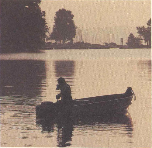
Several lakes created by Tennessee Valley Authority (TVA) dams provide open water recreation opportunities, including excellent bass fishing, adjacent to or near the park.
For a free map and folder detailing services, lodging and accommodations, and points of interest, write: Superintendent, Blue Ridge Parkway, 200 BB and T Building, One Pack Square, Asheville, North Carolina 28801.
The Gateway Cities. For many people a trip to the Smokies is not complete without taking in the sights of Pigeon Forge, Townsend, and/or Gatlinburg, Tennessee, or Bryson City or Cherokee, North Carolina. At either end of U.S. 441 these municipalities go all-out to serve the tourist trade. Restaurants and motels are major industries along with curio shops, art galleries, and the theme villages that characterize our American tourist scene.
123
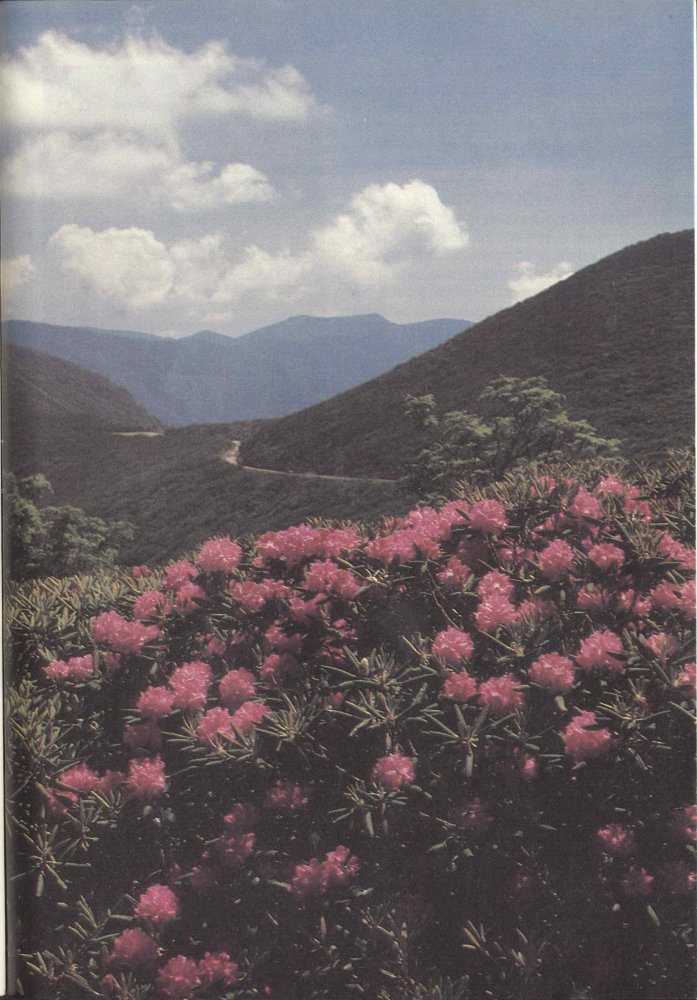
The Blue Ridge Parkway has its southern terminus at the North Carolina entrance to the park. This is Craggy Gardens, near Milepost 364, famous for its Catawba rhododendron displays.
124
Taken together these surrounding municipalities offer most facilities and services you might need during your stay in the Smokies. Cameras and photographic supplies, groceries, pharmacies, local literature and guides, banks, and countless other services are available.
Cherokee Indian Heritage. The Cherokee Indian Reservation abuts the park boundary on the southeast. In Cherokee there are museums and shops where the art and crafts of these eastern woodlands Indians, thought to be of original Iroquoian stock, are displayed and offered for sale. Each year a play, “Unto These Hills,” is performed locally. It describes the Cherokee’s history and early encounters with Europeans. Most of these activities occur on the North Carolina side of the park.
Mountain Folkways and Crafts. Mountain ingenuity and the human bent for creativity gave rise to crafts characteristic of the southern mountains. These are kept alive in various outlets surrounding the Smokies. In Gatlinburg you can visit the famed Arrowmont School of Arts and Crafts, which has done so much to revive original handicraft arts and support the artists by marketing their work.
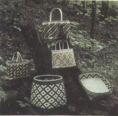
Three main types of basketry are made by Cherokees. Rivercane baskets are now relatively scarce because the once-abundant cane is itself scarce now. White oak baskets are more common. Baskets are also woven from honeysuckle. Above are exquisite examples of basketry by Carol S. Welch, a member of the Eastern Band of Cherokee Indians.

The American Museum of Science and Technology at Oak Ridge National Laboratories provides a thoroughly modern contrast to the traditional folkways of the Smokies.
125
Armchair Explorations
Some Books You May Want to Read
The Great Smoky Mountains and their national park are both rich in lore, much of which has been collected and committed to print over the years. Your appreciation of a trip to these mountains can be greatly enhanced, both before and after, by reading accounts of the area’s history, natural history, and folklore. There are also field identification guides to nearly everything you see here, from rocks and flowers to spiders and mammals. And there are trail and hiking guidebooks full of good tips and advice on interesting trips, both day trips and overnights. Listed here are selected titles usually available for purchase at park visitor centers, or to be found in your public library. Many of these may also be purchased in bookstores in communities near the park. Several interesting and useful maps of the area are also available. For a more complete list of publications write to the Great Smoky Mountains Natural History Association, Gatlinburg, Tennessee 37738. This nonprofit association maintains a sales list of technical and other books about the Smokies as part of its efforts to enhance the interpretation of the park’s values to the public.
Brooks, Maurice. The Appalachians, Houghton Mifflin Company, 1965.
Broome, Harvey. Out Under the Sky of the Great Smokies, The Greenbrier Press, 1975.
Campbell, Carlos. Birth of a National Park in the Great Smoky Mountains, The University of Tennessee Press, 1960.
Cantu, Rita. Great Smoky Mountains: The Story Behind the Scenery, KC Publications, 1979.
Dykeman, Wilma and Jim Stokely. At Home in the Smokies, National Park Service Handbook 125, 1978.
Frome, Michael. Strangers in High Places: The Story of the Great Smoky Mountains, The University of Tennessee Press, 1980.
Kephart, Horace. Our Southern Highlanders, The University of Tennessee Press, 1922.
Shields, Randolph. The Cades Cove Story, Great Smoky Mountains Natural History Association, 1977.
Tilden, Freeman. The National Parks, Alfred A. Knopf, 1968.
126
Index
Numbers in italics refer to photographs, illustrations, or maps.
A B C D E F G H I J K L M N O P Q R S T U V Q X Y Z
A
Accommodations 104, 118
Acorns 67, 68, 70
Adams (flies) 46, 47
Adirondacks, mountains 55
Altitude 30
American Museum of Science and Technology 124
Animals 42, 53, 55-56, 57, 80;
diseases, 68;
effects of settlement, 81-82, 83;
feeding habits, 67-73, 75, 81;
comeback in national park, 83-84;
photos, 33, 63-65
Appalachian Trail 12-15, 16, 25, 51, 116-17
Arrowmont School of Arts and Crafts 124
Azalea, flame 37, 60
B
Balds 36-37, 75, 79-80, 114
Basketry 124
Basswood 32
Bear 69-70, 73, 76-77, 105, 120
Bicycling 52, 112-13
Birds 32, 33, 42, 53, 55, 62, 72, 83, 113
Blue Ridge Parkway 122, 123
Boar 69, 70-73, 74, 75
Bobcat 63
Bryson City 124
Buckeye, yellow 33
Bug, Humpy or Guffus 46
C
Caddis, olive 46
Caddisfly 45
Cades Cove 30, 83, 112;
motor trail, 105-6, 108, 110;
photos, 7, 94-95, 98-100;
settlement, 80;
visitor centers, 104, 110
Cahill 46, 47
Camping 115-18, 120, 121
Cardinal 62
Champion Coated Paper Company 48
Cherokee (city) 124
Cherry, fire 61
Chickadee 32
Climate 30
Clingmans Dome 9, 30, 51, 107
Coachman, ladywing 46
Copperhead 65
Coreopsis 59
Craggy Gardens 122
Crestmont 49
D
Deer, whitetail 63, 67
Deermouse 63
Dog-hobble 60
Dogwood, flowering 61, 111
E
Elkmont 49, 118
Enloe, Mrs. Clem 47
F
Fish 41, 45, 56-57, 113
See also Flies, artificial; Trout
Flicker, common 62
Flies, artificial 46-47
Flowers 17, 24, 25, 32-33, 58-59, 110
Fontana Lake 42
Forest 9, 16-17, 27, 30;
as food source, 67-68, 81;
cove 25-26, 33, 34-35, 54-55, 56, 83;
effects of settlement, 79-81, 82-83;
fires and flooding, 50, 51, 82;
photos, 32-35, 50, 51, 66, 111
See also Industry, lumber
Forney Creek 39
Fringe-tree 60
Frogs 64
G
Gatlinburg 122
Great Smoky Mountains 9, 10-15, 16, 18-20, 30, 52, 53-57, 96
Great Smoky Mountains National Park:
accommodations, 104, 118;
brochures, 101-14 passim;
camping, 115-18, 120, 121;
ecological effects, 82-84;
established, 8-9, 16, 82-83;
health precautions, 120-21;
International Biosphere Reserve, 17, 31;
location, 101;
maps, 100, 101-5, 112, 114;
motor trails, 95, 98-99, 105-6, 107-8, 110;
nearby attractions, 122-23;
recreation, 106, 112-13;
regulations, 121;
restorations, 7-8, 78, 92-93, 107, 108-10;
visitor centers, 104, 105
Grey Hackle Peacock 46
Grotto Falls 38, 118
Guyot, Mount 51
H
Hare’s Ear, gold ribbed 46
Hawkweed, orange 59
Hiking 30, 104, 105, 106, 114-17, 119
Horseback riding 112-13
Hooper Bald 70
I
Indians, Cherokee 9, 16, 79-80, 96-97, 108;
Reservation, 124
Industry, lumber 8, 48-49, 51, 82
J
Jack-in-the-pulpit 58, 110
K
Knoxville 95
L
Lady’s-slipper, pink 59
Lakes, TVA 112, 122
LeConte, Mount 10-11, 118
Lily, Turk’s-cap 59
Linnaea 17
Little Greenbrier School 107, 110
Little Pigeon River 51
Lizard, fence 32, 64
Logging See Industry, lumber
M
Magnolia, umbrella 61
Maps 101, 102-3, 112, 114
Maryville 95
Messer, Milas 85
Mingus Mill 93, 107, 110
Motor trails 95, 98-99, 105-6, 107-8, 110
Mountain laurel 61
Mushrooms 20, 21
N
Natural Chimneys 55
Nymphs 46
O
Oconaluftee:
river 48;
Valley 80;
Visitor Center 104, 105
Opossum 63
Owl, barred 62
P
Painted-cup, scarlet 58
Passion-flower 59
Pigeon Forge 122
Pioneer Farmstead 78, 92-93, 110
Plants 20, 22-24, 31, 52, 53-57, 58-61, 81, 110-11.
See also flowers
Proctor 49
R
Rabbit, cottontail 63
Rattlesnake, timber 65, 121
Raven 33
Ravensford 49
127
Redbud 60
Restorations 7-8, 78, 92-93, 107, 108-10
Rhododendron, catawba 61;
rosebay 33
S
Salamanders 16, 17, 40-41, 64-65, 75
Secret weapon 46
Settlement 6, 7-8;
mountain people 80-81, 92-93, 108-10;
occupations 85-91, 124
Shrubs 27, 60-61
Silers Bald 51
Silverbell, mountain 60
Skunk, spotted 63
Smokemont 49
Snakes 64, 65, 121
Sorrel, wood 24, 25
Spruce 33
Squirrels 32, 33, 68
Streams 43, 45
Sundew 37
T
Titmouse, tufted 62
Toad, American 65
Townsend 95, 122
Trees See Forest
Trillium:
great white 33;
painted 58, 110
Trout:
brook, 41 44-45, 51, 112, 113;
brown, 41 44, 51, 113;
rainbow 39-40, 41, 44, 51, 113
Turkey, wild 62
Turtle, box 32
V
Violet, bird’s-foot 59
Visitor centers 104, 105
W
Warbler, yellow 62
White Mountains 55
Witch hazel 25
Witch-hobble 60
Wooly worm, yellow 46
Wulff, royal 46
Y
Yellow Hammer (antique gold) 46;
(peacock) 46
Yellow-poplar 61
★GPO:1981—341-611/7 Reprint 1991
128