EXPLORATIONS IN AUSTRALIA. (continued 3)
Reading edition
Wednesday, 14th December, Lake Torrens. At the first dawn of day I got to the top of the hill, and remained there some time after sunrise. To the south-east there is the appearance of a point of land, which I suppose to be the island which I saw when I first struck the lake. There is the appearance of water between. A little more to the eastward I can see nothing but horizon. To the east there is again the appearance of very low distant land—a mere dark line when seen through a powerful telescope. To the north of that there is nothing visible but the horizon, with a blue and white streak between. To the north-north-east beyond the point, a little low land is to be seen running out from the point, with water in the far distance. Rode down to the beach to see what that was composed of; found it to be sand, mud and gravel; firm ground next the shore. Tried a little distance with the horses, but found it too soft to proceed with them. I then dismounted, and tried it on foot, but could only get about two miles; it became so soft, that I was sinking to the ankles, and the clay was so very tenacious that it completely tired me before I got back to the horses. The quantity of salt was not so great here as at the first place I examined. What I thought was a point of land bearing north-north-east turns out to be an island, which I can see from here. The point of the bay is north from where I took the bearings. Between the island and the point I can see nothing but horizon; too low to see any water. Traced the creek up for seven miles in search of water or springs, but could see none, nor any indications. Had breakfast, and started on a course of 20 degrees north of west in search of water or springs. Crossed the Davenport and ascended a low range, but still could not see any indications of water; the country similar to that passed over yesterday. Changed my bearing towards the camp, and arrived there a little before sundown. The horses were very thirsty, and drank an awful quantity of water, but being hot it will do them no harm. It is remarkable that to east of the hot springs I can find no others. This is the third time I have tried it, and been unsuccessful. I am almost afraid that the next time I try the lake I shall not find the north boundary of it. Where can all this water drain to? It is a mystery.
Thursday, 15th December, Louden Springs. Surveyed run Number 4, and sent Kekwick to correct observations from Mount Stevenson.
Friday, 16th December, Louden Springs. Finished Number 4 run. To-day we have discovered a large fresh-water hole in a creek joining the George and coming from the south-west. The water seems to be permanent; it is half a mile long and seems to be deep. On the banks a number of natives have been encamped; round about their fires were large quantities of the shells of the fresh-water mussel, the fish from which they had been eating: I should think this a very good proof of the water being permanent. After finishing the survey I followed the creek up for a number of miles in search of more water, but could find none. It spread into a number of courses over a large plain, on which there was splendid feed.
Saturday, 17th December, Louden Springs. Started for the springs under Mount Margaret to finish the western boundary of Number 1 run. Arrived towards sundown. Found the creek occupied by natives, who, as soon as they caught sight of us, bolted to the hill and got upon the top of a high cliff, and there remained for some time, having a good view of us. I did everything in my power to induce them to come down to us, but they would not, and beckoned us to be off back the road we came. At night they had fires round us, but at some distance off.
Sunday, 18th December, Mount Margaret. About 9 a.m. the natives made their appearance on the hill, and made signs for us to be off; they were eight in number. I found that we had camped close to a large quantity of acacia seed that they had been preparing when we arrived, but had no time to carry it away before we were on them. One old fellow was very talkative. I went towards them to try and make friends with them, but they all took to the hills. By signs I induced the old fellow to stop, and in a short time got him to come a little nearer. When I came to the steep bank of the creek he made signs for me to come no further. I showed him I had no arms with me, and wished him to come up. I could understand him so far that he wished us to go away, that they might get their seed. I thought it as well not to aggravate them, but to show them that we came as friends; and as I had completed all I had to do here, I moved the camp towards the Freeling Springs, at which they seemed very glad, and made signs for us to come back at sundown. They seemed to be a larger race than those down below; the men are tall and muscular, the females are low in stature and thin. I examined the Mount Margaret range in going along; there are a number of gum creeks coming from the north side which flow into the Neale. We searched them up and down, but could find no water. The number of channels that join them in the range is so great that it would take weeks to examine them minutely for water. We camped in one of them without water, although the country promises well for it.
Monday, 19th December, Gum Creek. Started on a north-west course to examine the country between this and the Mount Younghusband range. We could see no springs until we reached the Blyth, in which there is water, but a little brackish; it will do well for cattle. Rode through the middle of the range, and came upon some horse-tracks, not very old; saw where the party had camped, and a cairn of stones they had erected on the top of one of the hills. Followed their tracks some distance down the gully; they seemed to be going to the Burrow Springs; they appear, however, to have gone back again. Left the tracks, and proceeded to the Freeling Springs. Arrived there in the afternoon. No one has been here since I was, as far as I can see. The country we have passed over yesterday and to-day has been really splendid for feed. The springs continue the same, running in a strong stream and of the finest quality.
Tuesday, 20th December, Freeling Springs. Sent Kekwick and one of the men to examine the goldfield, and to select a place for sinking to-morrow morning. My eyes were so bad that I was unable to go. They returned in the afternoon, bringing with them samples from the quartz reefs, in which there was the appearance of gold. Kekwick said he had not seen such good quartz since he left the diggings in Victoria. There was every indication of gold, and I determined to give the place a good trial before leaving it.
Wednesday, 21st December, Freeling Springs. Commenced digging, but found the rocks too near. Surface indications were very slight here, but I found another place which seemed to promise better, so began sinking there, and at four feet came upon some large boulders, round which was very good-looking stuff for washing; took some of it to camp and washed it. No gold, but good indications; a quantity of black sand and emery, also other good signs. I shall continue the hole, and see what is in the bottom. Thunderstorm this afternoon; south-west hot wind.
Thursday, 22nd December, Freeling Springs. Occupied in sinking, but made little progress in consequence of the stones being so large, and the want of proper tools, crowbar, etc. Washed some more stuff from round about the boulders; the produce same as yesterday; no gold.
Friday, December 23rd, Freeling Springs. Found that we could do nothing with the stones with the tools we have. Examined the country round about, and found another place, which will be commenced to-morrow. Examined a quartz reef which had every indication of gold. I regretted that I had not another man, so that I might be able to examine the country for some distance round. It is necessary to have two men at the camp, which cannot be moved to where we are sinking, as there is no water within two miles. It would not be safe to leave the camp with one man only, and two digging, which is all our strength. Heavy thunderstorm from the south-west, but very little rain. The wind blew my tent in two. At sundown it passed over and cleared up, which I regretted to see, as I expected heavy rains at this season, to enable me to make for the north or north-west.
Saturday, 24th December, Freeling Springs. Sank upwards of six feet through gravel, shingle, stones, and quartz. Wind south-west. Heavy clouds; wind hot.
Sunday, 25th December, Freeling Springs. Wind south; heavy clouds, but no rain; towards evening changed to south-east. Cool.
Monday, 26th December, Freeling Springs. Got to the bottom of the hole; washed the stuff, but no gold. Commenced another hole by the side of the quartz reef, which looks well. In the morning the wind was from the north; at 10 a.m. it suddenly changed to south, and blew a perfect hurricane during the whole day, with heavy clouds; but no rain has fallen.
Tuesday, 27th December, Freeling Springs. The storm continued during the night, until about 3 o'clock this morning, when a few drops of rain fell, but not enough to be of any service to me. Bottomed the hole by the side of the quartz reef: no gold, and I think we shall not be able to sink any more; our tools are getting worn out. For the rest of the day examined the quartz reef, in which there is every appearance of gold; I shall stop the search for it and proceed to the north-east to-morrow, for I think some rain has fallen in that direction, which will enable me to examine the country and see if the lake still continues.
Wednesday, 28th December, Freeling Springs. At 7 a.m. started with Kekwick on a north-east course. At seven miles crossed the Neale, spread over a large grassy plain four miles broad, and ascended a low ridge of table-topped hills, stony, with salt-bush and grassed. Crossed another creek, at twenty miles, with myall and stunted gums running over a plain in numerous courses. Plenty of grass but no water. After crossing it, ascended a high peak, which I supposed to be the top of the Hanson range, but found another long table-topped hill, higher, about three miles distant. Ascended that, but could see nothing but more table-topped ranges in the distance. This hill is thirty-five miles from Freeling Springs. Searched for water, and after some time found a little water in one of the creeks, where we camped, it being after sundown. The country from the last creek is not so good, and very stony, so much so that it has lamed my horse, and nearly worn his shoes through at the tips. The horses have drunk all the water, and left none for the morning.
Thursday, 29th December, Hanson Range. Started at 6 a.m. on the same course for another part of the range. At six miles crossed a grassy creek of several channels, with myall and gum, but no water, running to north-east, nearly along our line. At seventeen miles struck the same creek again where it is joined with several others coming from the west-north-west and north. They are spread over a large broad plain covered with grass. Searched for water, but could not find any. Crossed the plains and creeks to a white hill on a north course, and at three miles reached the top; it was a low chalky cliff on the banks of the creek. Changed our course to the first hill I had taken. At seven miles and a half reached the top, which I found very stony. To the north can be seen the points of three other table-topped hills; to the north-east is a large stony plain about ten miles broad, beyond which are high sand hills, and beyond them again, in the far distance, is the luminous appearance of water. Not being on the highest part of the range I proceeded two miles to the south-east to get a better view. From here we could see the creek, winding in a south-east direction, until it reached the lake, which seemed to be about twenty-five miles off. We could not distinctly see it, the mirage and sand hills obscuring our view. My horse having lost both his fore shoes and there being no prospect of water further on, I was reluctantly obliged to return to the camp. We had seen a little rain water on the plain, about seven miles back, at which we decided to camp to-night. Arrived there a little before sundown. My horse very lame, scarcely able to walk along the stones. I am disappointed that there is not more rain water; there seems only to have been a slight shower.
Friday, 30th December, Hanson Range. The horses having strayed some distance, we did not get a start till half-past seven on a course of 323 degrees, to a white hill, to see whether there are any springs on the other side; at one mile and a half reached it, but no springs. Changed our course to a very prominent hill (which I have named Mount Arthur) bearing 275 degrees, and after crossing two small myall creeks and a stony plain with salt bush and grass, at ten miles we struck a large myall and gum creek, coming from the north-west, with some very deep channels. We went some miles up it, but could find no water, the courses for the water being too sandy and gravelly to retain it. At twenty-four miles from the last hill arrived at the summit of Mount Arthur. Changed course to 195 degrees. At ten miles struck another myall and gum creek of the same description as the others, coming from the range; no water. Camped. My horse is nearly done up; I am almost afraid he will not be able to reach the camp to-morrow.
Saturday, 31st December, Hanson Range. Started shortly after daybreak for the camp. At fifteen miles struck another myall and gum creek running into the Neale, and at twenty miles came upon the Neale, which is here three miles broad. Here we saw some recent native tracks and places where fires had been. Arrived at the camp at sundown; horses quite done up. I am sorry that I have been unable to make the lake on this journey; I could have done it, but should most likely have had to leave my horse; he never could have done it. I should then have been obliged to walk the distance back, with all the water dried up. Had I seen the least indication of water on ahead, I should have gone.
Sunday, 1st January, 1860, Freeling Springs. In the afternoon it became cloudy. Wind north. No rain.
Monday, 2nd January, Freeling Springs. Having observed a hill on Saturday that seemed to me a spring, where the Neale comes through the range, I sent Kekwick to examine it, my eyes being too bad. Sent Muller to examine some more quartz reefs in which I think gold exists. Towards sundown he returned with two good specimens, in which I am almost sure there is gold. The reef is twelve feet wide. Shortly after, Kekwick returned and reported springs and two large water holes, and numerous smaller ones, with abundance of permanent water, although slightly brackish. I shall move up and fix their position as soon as I am satisfied with the search for gold.
Tuesday, 3rd January, Freeling Springs. Sent Kekwick and Muller to get some more specimens of quartz. They returned with some in which there were very good indications of gold. It was useless for us to try any more, our tools being of no use. The reefs would require to be blasted. I am afraid there will be no surfacing here. I have done all that lies in my power to get at the gold; but without proper tools we can do nothing, so I shall be obliged to give it up, and start to-morrow for the Neale, to where I sent Kekwick yesterday.
Wednesday, 4th January, Freeling Springs. Started at 8 a.m., and arrived in about thirteen miles. The large water hole is upwards of a mile long, with fully forty yards of water: in width, from bank to bank, it is seventy yards, and upwards of fifteen feet deep; there are large mussel shells on the banks, and plenty of good feed. All round to the south there are low sand hills covered with grass. To the east, in some places, it is stony, with salt-bush, and many broad well-grassed valleys coming from the Mount Kingston range. About a quarter of a mile to the west of the large hole there is a course of springs coming from the Kingston Hills and sand hills, and emptying themselves into the creek. The water is delicious, and plentiful, and, if opened, these springs will yield an ample supply for all purposes. To the west are hills, with the creek coming through them, with water all the way up to where I crossed it in my return last trip. To the north are stony undulating rises, with salt-bush and grass.
Thursday, 5th January, The Neale. Examining the country round to the north and round Mount Harvey. It is poor and stony. On the eastern and northern sides it becomes bad at three miles from the creek. The country in the other directions is good, and will make a first-rate run. This, in connexion with the Mildred and McEllister Springs, will feed any number of cattle.
Friday, January 6th, The Neale. As my rations are now drawing to a close (for we started with provisions only for three months, and have been out now for three months and more), I must sound a retreat to get another supply at Chambers Creek. It was my intention to have sent two men down for them, but I am sorry to say that I have lost confidence in all except Kekwick. I cannot trust them to be sent far, nor dare I leave them with our equipment and horses while Kekwick and I go for the provisions. Situated as I am with them, I must take all the horses down; and if I can get men to replace them at Chambers Creek, I will send them about their business. They have been a constant source of annoyance to me from the very beginning of my journey. The man that I had out with me on my last journey has been the worst of the two. They seem to have made up their minds to do as little as possible, and that in the most slovenly and lazy manner imaginable. They appear to take no interest in the success of the expedition. I have talked to them until I am completely wearied out; indeed, I am surprised that I have endured it so long. Many a one would have discharged them, and sent them back walking to Adelaide; in fact, I had almost made up my mind to do so from here, and to run the chance of getting others at Mr. Barker's. Although they have behaved so badly, and so richly deserve to be punished (for they have taken advantage of me when I could get no others to supply their places), I could not find in my heart to do it. Kekwick is everything I could wish a man to be. He is active, pushing, and persevering. At any time, and at any moment, he is always ready, and takes a pleasure in doing all that lies in his power to forward the expedition. Would that the two others were like him! I should then have no trouble at all. Started at 7 a.m. on my return on a south-east course, and camped at a small spring on the east side of Mount Younghusband. Distance, twenty miles.
Saturday, 7th January, Mount Younghusband. Started at 7 a.m. for the Milne Springs, where I shall remain for a day or two to get all the horses fresh shod, and leave what things I do not require, intending to get them on my return. Arrived there at 11 o'clock. Found the water much the same as it was when I first saw it.
Sunday, 8th January, Milne Springs. Severe attack of lumbago. Sun hot; but cool breeze from south-east.
Monday, 9th January, Milne Springs. Unable to ride, so I was obliged to send Kekwick and one of the men to the westward. This was a great disappointment to me, as I should like to have seen the country myself to have connected it with my farthest north-west point on my first journey. The other man was shoeing the horses. Sun hot. Cool breeze from south-east. Very cold night and morning.
Tuesday, 10th January, Milne Springs. Latitude, 28 degrees 15 minutes 45 seconds. Shoeing horses. Flies a great trouble; can do nothing for them. If they are allowed to remain a moment on the eye, it swells up immediately, and is very painful. Kekwick and the other man returned at 9 o'clock p.m. They report having found two springs, one about nine miles west, and the other about thirty miles, in a large spring country, which they had not time to examine well. Although I am so unwell, I must start to-morrow and see what it is. Judging from their description, there must be something good; and I cannot leave without seeing it, although my provisions are nearly done.
Wednesday, 11th January, Milne Springs. Shortly after sunrise started with Kekwick on a west course for the larger spring country, leaving the near one until our return. At eleven miles and a half crossed the Blyth, coming from the south. At twenty-eight miles reached the spring country. Changed to 150 degrees, and at two miles camped at the spring. The springy place has the appearance of a large salt lagoon, three miles broad and upwards of eight miles long. At the south end of it is a creek with brackish water, and on its banks are the springs, the water from which is very good; they are not running.
Thursday, 12th January, West Springs. There are a number of natives at these springs. We have seen their smoke, and both old and recent tracks. Started on a south course. At four miles and a half came upon a creek, with reeds and brackish water, running a little to the west of north. Traced it down for upwards of a mile and a half. Saw that it ran into the swamp west of where we struck it. Could see no springs upon its banks. Returned to the place where we first struck it, and proceeded a mile on a course of 120 degrees to three large patches of very green reeds, which turned out to be eight feet high. Could find no surface water except what was brackish. The country was moist all round. Thence on the same bearing for two miles. Sent Kekwick to examine some places that looked like springs. They were in the middle of a large salt lagoon, having a crust of limestone, under which the water was, and if broken open, in many places where there was no sign of water, a beautiful supply could be obtained. Changed to 245 degrees, and, at about fifteen miles, changed to 90 degrees, through sand hills. We have seen many places where water can be obtained at a few inches below the surface. Camped at the spring. Feel very ill; can scarcely sit on my horse.
Friday, 13th January, West Springs. Being anxious to see the nature of the country between this and the Mount Margaret range, I started at 6.30 on a course of 110 degrees over occasional sand hills and stony places, with splendid feed. At ten miles and a half reached a stony rise, and changed my course to 76 degrees, for five miles, to a black hill composed of ironstone. Changed to 105 degrees, for one mile, to examine a white place coming down from the range, which had the appearance of springs, but found it to be composed of white quartz. Changed again to 50 degrees to a rough hill, which had also the appearance of springs. At two miles crossed the bed of the Blyth, which takes its rise in the range. No water in it, but loose sand and gravel. At seven miles reached the rough hill, after crossing three small tributaries; was disappointed in not finding water. Ascended the hill, from which we had a good view of the surrounding country, but see no indications of water. I must now make for the second spring found by my men three days ago. Course north, over stony hills and table land, in which I crossed my former tracks going to the Freeling Springs. Arrived at the spring at 7.30 p.m. All of us, men and horses, very tired.
Saturday, 14th January, Springs South of Mount Younghusband. Examined the spring, and found it to be a very good one; it is situated near the banks of the Blyth, on the same spongy ground that I discovered last time, and which was marked off as a run. Searched about, and found two more good springs. There was plenty of water in the creek, but the dry season had made it brackish. Discovered a spring in one of the creeks that runs east from Mount Margaret. The natives had cleared it out, and the water, which was very good, was about two feet from the surface. In the other two creeks we also found springs which only required opening. I then made for the camp, where I found everything all right.
Sunday, 15th January, Milne Springs. Preparing for a start to-morrow for Chambers Creek, by way of Louden Springs; I must endeavour to find some more springs, for I am not quite satisfied yet about that country. Very much annoyed by the misconduct of the two men I left behind at the camp; they have had the impertinence to open my plan-case, and have so damaged my principal plan with their hot moist hands, that I know not what to do with it. This is not the first time they have done it.
Monday, 16th January, Milne Springs. Started at 7.10 a.m. on a bearing of 138 degrees 30 minutes. At about twenty-two miles struck four other springs, beyond the Messrs. Levi's boundary; from one of them there is a strong stream of water flowing. They are almost completely hidden, and one cannot see them until almost on the top of them. I have taken bearings to fix them, and have named them Kekwick Springs. Five o'clock p.m. Arrived at Louden Springs. Distance, thirty-one miles.
Tuesday, 17th January, Louden Springs. Started shortly after daybreak, on a course of 110 degrees, over as fine a grass country as I have yet travelled over. At sixteen miles crossed the Douglas, running through sand hills covered with grass, but no water, nor any signs of springs. Proceeded in the same direction for eight miles, when we were stopped by a lagoon. Changed my course to south-south-west to a hill that had the appearance of water, but found beyond it another large dry lagoon, on the banks of which we saw the tracks of a single horse crossing the end of the lagoon, and steering for Lake Torrens; they seemed to be about two months old. Can they be the tracks of that infatuated man who left me on the 20th of November? In all probability he has lost my downward track and himself also. They are only about two miles to the east of mine. Camped without water on a sand hill.
Wednesday, 18th January, Sand Hill. Started shortly after daybreak on a south-south-east course, still in search of springs (crossing my outward track of last journey), at a place where I thought it most likely for them, but was unsuccessful. If I could have found one here, I should have gone direct to the Emerald Springs, but the horses would suffer very much if they were to be another night without water; the food is so dry, and the weather so hot, they cannot endure more than two days and one night without it. Changed my course to Strangway Spring. Arrived there at 2.30. Some of the horses very much done up. Camped, and gave them the rest of the day to recruit.
Thursday, 19th January, Strangway Springs. Started for the Beresford Springs. At nine miles and a half arrived there; and, at eight miles beyond, made the Hamilton Springs, where we camped for the night.
Friday, 20th January, Hamilton Springs. Started by way of the Emerald Springs, to see if Mr. Barker's party is there, or if any person had been there and got the parcel, and forwarded it to Mr. Chambers. Arrived at the springs, and found that some one had got it. Mr. B.'s party had gone. Went on to Chambers Creek, and found them there.
Saturday, 21st January, Chambers Creek. Here we found provisions awaiting us, as we expected; but the two men still exhibit a spirit of non-compliance, and refuse to proceed again to the north-west; they are bent upon leaving me and returning to Adelaide although they know that there are no men here to supply their places. They have demanded their wages and a discharge, which, under all the circumstances of the case, and considering how badly they have served me, I feel myself justified in withholding. I shall therefore be compelled to send Kekwick down as far as Mr. Chambers' station with my despatches, etc., and to procure other assistance. This will be a great loss of time and expense, which the wages these men have forfeited by not fulfilling their agreements will ill repay. Here we heard of the man Smith, who, it seems, left the mare, whether dead or alive we know not at present. He was lost for four days without water (according to his own account), and, after various adventures, and picking up sundry trifles from different travelling parties, who relieved him out of compassion, reached the settled districts in a most forlorn condition. Mr. Barker had left his station some three weeks before we arrived.
JOURNAL OF MR. STUART'S FOURTH EXPEDITION—FIXING THE CENTRE OF THE CONTINENT. FROM MARCH TO SEPTEMBER, 1860.
Friday, 2nd March, 1860, Chambers Creek. Left the creek for the north-west, with thirteen horses and two men. The grey horse being too weak to travel was left behind. Camped at Hamilton Springs.
Saturday, 3rd March, Mount Hamilton. Camped at the Beresford Springs, where it was evident that the natives, whose camp is a little way from this, had had a fight. There were the remains of a body of a very tall native lying on his back. The skull was broken in three or four places, the flesh nearly all devoured by the crows and native dogs, and both feet and hands were gone. There were three worleys on the rising ground, with waddies, boomerangs, spears, and a number of broken dishes scattered round them. The natives seemed to have run away and left them, or to have been driven away by a hostile tribe. Between two of the worleys we observed a handful of hair, apparently torn from the skull of the dead man, and a handful of emu feathers placed close together, the feathers to the north-west, the hair to the south-east. They were between two pieces of charred wood, which had been extinguished before the feathers and hair were placed there. It seemed to be a mark of some description.
Sunday, 4th March, Beresford Springs. Night and morning cold; day very hot. Wind south-west.
Monday, 5th March, Beresford Springs. Wind changed to the east during the night. Morning very cold. Arrived at the Strangway Springs. Day very hot. Wind variable.
Tuesday, 6th March, Strangway Springs. Very hot during the night. Made William Springs and camped. The day exceedingly hot, wind south-west, in which direction a heavy bank of clouds arose about noon; in the evening there was a great deal of lightning, and apparently much rain falling there, but none came down our way.
Wednesday, 7th March, William Springs. The night very hot and cloudy, with the wind from the west, but without rain. Started for Louden Spa,* (* The Louden Springs of the two last expeditions.) the first few miles being over low sand rises and broad valleys of light sandy soil, with abundance of dry grass; by keeping a little more to the north-west the sand rises can be avoided. At seven miles we struck a swamp, but could see no springs. On approaching the Douglas the country becomes more stony, and continues so to the Spa, where we camped.
Thursday, 8th March, Louden Spa. Cold wind this morning from the south-east; the clouds are gone. Camped at Hawker Springs.
Friday, 9th March, Hawker Springs. Very cold last night. Wind from the south. During the day it changed to the south-east, and the sun was very hot. Camped at the Milne Springs, and found the articles we had left* there all right (* See last expedition.); the natives had opened the place where we had put them, but had taken nothing.
Saturday, 10th March, Milne Springs. At half past 11 last night it began to rain, and continued doing so nearly all day. Wind south-east.
Sunday, 11th March, Milne Springs. About 10 o'clock last night we were flooded with water, although upon rising ground, and were obliged to move our camp to the top of a small hill. It rained all night and morning, but there are signs of a break in the clouds. During the day it has rained at intervals. The creek is coming down very rapidly, covering all the valley with a sheet of water.
Monday, 12th March, Milne Springs. A few heavy showers during the night, but now there seems a chance of a fine day, which will enable us to get our provisions dried again. The country is so boggy that I cannot proceed to-day, but if it continues fair I shall attempt it to-morrow morning. This rain is a great boon to me, as it will give me both feed and water for my horses, and if it has gone to the north-west it will save me a great deal of time looking for water.
Tuesday, 13th March, Milne Springs. Started for Freeling Springs. The country in some places is very soft, but the travelling is better than I expected. As we approached the Denison ranges the rain did not seem to have been so heavy, but when we came to the Peake, we found it running bank high, and very boggy. Impossible to cross it here, so I shall follow it up in a west-south-west direction. Camped at Freeling Springs.
Wednesday, 14th March, Freeling Springs. Started on a course a little to the south of west, to try and find a crossing-place. At two miles it turned a little to the north of west, but at ten miles it turned to the south-west, and was running very rapidly, about five miles an hour. I was obliged to stop at this point, as I could not cross the creek, the banks being so boggy. I have discovered another spring at eleven miles on the same bearing as the Freeling Springs, but I cannot get to it. From here it has the appearance of being very good; a hill covered with reeds at the top, the creek running round the east side of it. I shall endeavour to cross to-morrow and examine it.
Thursday, 15th March, The Peake. The creek being still impassable, I remained here another day. Yesterday the horse that was carrying my instruments broke away from the man who was leading him, burst the girths, and threw the saddlebags on the ground. The instruments were very much injured, in fact very nearly ruined; the sextant being put out of adjustment, has taken me all day to repair, and I am not sure now whether it is correct or not. It is a great misfortune. Wind north; clouds north-east.
Friday, 16th March, The Peake. Saddled and started to cross the Peake about three miles to the south-west, but had a fearful job in doing so, the banks being so boggy, and the current so strong. The horses could hardly keep on their feet, and most of them were up to their saddle-flaps, and some under water altogether. One poor old fellow we were obliged to leave in it, as he was unable to get out, and we were unable to help him, although we tried for hours. He is of very little use to me, for he has never recovered his trip to Moolloodoo and back. He has had nothing to carry since we started, and seemed to be improving every day. I wish now that I had left him at Chambers Creek along with the grey, but as he looked in better condition, I thought he would mend on the journey, and I intended him to bring the horses in every morning, when we got further out. We have been from 10 a.m. to 3.30 p.m. in getting across, including the time spent in trying to extricate Billy. I cannot proceed further to-day, and have therefore camped on the west side of the springs that we saw from the last encampment, which I named Kekwick Springs. There are six springs. The largest one will require to be opened; the reeds on it are very thick, and from ten to twelve feet in height. We tried again to get the horse on shore, but could not manage it; the more we try to extricate him, the worse he gets. I have left him; I do not think he will survive the night. It is now sundown, and raining heavily; the night looks very black and stormy. Wind from the south-west.
Saturday, 17th March, Kekwick Springs. About 8 o'clock last evening the wind changed to the north-west, and we had some very heavy rain, which lasted the greater part of the night. Early in the morning the wind changed again to the south-east, with occasional showers. At sunrise it looked very stormy. I must be off as soon as possible out of this boggy place. The old horse is still alive, but very weak. The water has lowered during the night. If no more rain falls to the south-west it will soon be dry, when he may have a chance of getting out. I cannot remain longer to assist him; it would only be putting the rest of my horses in danger. I would have remained here to-day to have dried my provisions, but the appearance of the weather will not allow me. They must take their chance. Started on a north-west course for the Neale. At fifteen miles struck it, and changed to the west to a creek coming south from the stony rises. The banks of the Neale are very boggy. The first four miles to-day were along the top of a sandy rise, with swampy flats on each side, with a number of reeds growing in them, also rushes and water-grass. At four miles was a strong rise, but before we arrived at it we had to cross one of the swamps, in which we encountered great difficulty. After many turnings and twistings, and being bogged up to the shoulders, we managed to get through all safe. It was fearfully hard work. For three miles, on the top of a stony rise, the country is poor (stones on the top of gypsum deposit), but after that it gradually improves, and towards the creek it becomes a good salt-bush country. Wind from the south-east; still very cloudy.
Sunday, 18th March, Neale River. Wind south-east; heavy clouds. I observed a bulbous plant growing in this creek resembling the Egyptian arum; it was just springing. I will endeavour to get some of the seed, if I can. I hoped we should have got our provisions dried to-day, but it was so showery we could not get it done. The creek is so boggy that we cannot cross it, and must follow it round to-morrow. A sad accident has happened to my plans. There was a small hole in the case that contains them, which I did not observe, and in crossing the Peake the water gained admittance and completely saturated them; it is a great misfortune. Sundown: still raining; wind same direction.
Monday, 19th March, Neale River. Rained during the night, and looks very stormy this morning. Followed the Neale round to where it goes through the gap in Hanson range; in places it was rather boggy, but good travelling in this wet weather—firmer than I expected. We had much difficulty in crossing some of the side creeks. Camped on the south side of the gap. Wind south-east; cloudy, with little rain.
Tuesday, 20th March, Neale River Gap, Hanson Range. Wind south-east; a few showers during the night. Still no chance of getting my provisions dried. It cleared off about noon, and became a fine day. Followed the Neale round, and camped on one of the side creeks coming from the south of west. Ground still soft. Wind south-east. Saw some smoke in the hills this morning, but no natives. Good country along both sides of the range on the west side of the Neale.
Wednesday, 21st March, Neale River. Beautiful sunshine. Shall remain here to-day, in order to dry my provisions. On examining them I find that a quantity of our dried meat is quite spoiled, which is a great loss—another wet day, and we should have lost the half of it.
Thursday, 22nd March, Side Creek of the Neale River. Wind south-west; clear sky. I intended to have gone north-west from this point, but, in attempting to cross the creek, we found it impassable. My horse got bogged at the first start, and we had some difficulty in getting him out. We were obliged to follow the creek westward for seven miles, where it passes between two high hills connected with the range. We managed at last, with great labour and difficulty, to get across without accident. At this place four creeks join the main one, and spread over a mile in breadth, with upwards of twenty boggy water-courses; water running. It has taken us five hours, from the time we started, to cross it. The principal creek comes from the south-west. I ascended the two hills to get a view of the surrounding country, and I could see the creek coming from a long way off in that direction. At this point the range seems broken or detached into numerous small ranges and isolated hills. I now changed my course to north-west, over table land of a light-brown colour, with stones on the surface; the vegetation was springing all over it and looking beautifully green. At six miles on this course camped on a myall creek. The work for the horses has been so very severe to-day that I have been induced to camp sooner than I intended. Wind south.
Friday, 23rd March, Myall Creek. Wind south. Started on the same course, north-west. At three miles crossed another tributary—gum and myall. The country, before we struck the creek, was good salt-bush country, with a plentiful supply of grass. The soil was of a light-brown colour, gypsum underneath, and stones on the surface, grass and herbs growing all round them. After crossing the creek, which was boggy, we again ascended a low table land of the same description. At ten miles came upon a few low sand rises, about a mile in breadth. We then struck a creek, another tributary, spread over a large plain, very boggy, with here and there patches of quicksand. We had great difficulty in getting over it, but at last succeeded without any mishap. We then entered a thick scrubby country of mulga and other shrubs; the soil now changed to a dark red, covered splendidly with grass. After the first mile the scrub became much thinner; ground slightly undulating. After crossing this good country, at twenty miles we struck a large creek running very rapidly at five miles per hour; breadth of water one hundred feet, with gum-trees on the bank. From bank to bank it was forty-four yards wide. This seemed to be only one of the courses. There were other gum-trees on the opposite side, and apparently other channels. Wind south. A few clouds from the north-west.
Saturday, 24th March, Large Gum-Tree Creek. Found it impossible to cross the Neale here; the banks were too boggy and steep. We therefore followed it round on a west course for three miles, and found that it came a little more from the north. Changed to 290 degrees, after trying in vain to cross the creek at this point. At about four or five miles south-south-west from this point there are two high peaks of a low range. The higher one I have named Mount Ben, and the range Head's Range; its general bearing is north-west to opposite this point; it turns then more to the west. I can see another spur further to the west, trending north-west. At four miles and a half after leaving we found a ford, and got the horses across all safe. I then changed to the north-west again, through a scrubby country—mulga, acacia, hakea, salt bush, and numerous others, with a plentiful supply of grass. The soil is of a red sandy nature, very loose, and does not retain water on the surface. We had great difficulty in getting through, many places being so very thick with dead mulga. We have seen no water since we left the creek. Distance, eighteen miles. I was obliged to camp without water for ourselves. As we crossed the Neale we saw fish in it of a good size, about eight inches long, from which I should say that the water is permanent. I shall have to run to the west to-morrow, for there is no appearance of this scrubby country terminating. I must have a whole day of it.
Sunday, 25th March, Mulga Scrub. I can see no termination, on this course, to this thick scrub. I can scarcely see one hundred yards before me. I shall therefore bear to the west, cut the Neale River, and see what sort of country is in that direction. At ten miles made it; the water still running, but not so rapidly. The gum-trees still existed in its bed, and there were large pools of water on the side courses. We had the same thick scrub to within a quarter of a mile of the creek, where we met a line of red sand hills covered with a spinifex. The range on the south-west side of the creek seemed to terminate here, and become low table land, apparently covered with a thick scrub, the creek coming more from the north. I did not like the appearance of the spinifex, an indication of desert to the westward. Camped on the creek. Wind north-west; heavy clouds from the same direction.
Monday, 26th March, The Neale River West. I am obliged to remain here to-day to repair damages done to the packs and bags, which have been torn all to pieces; it will take the whole of the day to put them in order. We have seen very few signs of natives visiting this part of the country. I shall go north to-morrow and try to get through this scrub. Wind south, sky overcast with heavy clouds; looks very like rain.
Tuesday, 27th March, West Neales. Rained very heavily during the night, and is still doing so, but less copiously. About noon it cleared up a little. I have sent Kekwick to get a notion of the country on the other side of the low range, while I endeavour to obtain an observation of the sun. The range is scrubby, composed of a light-coloured and dark-red conglomerate volcanic rock, easily broken. The view from it is not extensive. At a mile from the creek the sand ceases, and stony ground succeeds up to the range. Feed excellent south-west from the camp. To the eastward rugged hills, apparently with fine open grass and forest lands. Numerous rows of water holes visible. To the south-east, country more open. To the south-south-east and south still the same good country. From south to west the same; hills to the west from five to eight miles distant. View from another hill north-west two miles and a half. The hills on the west still continue towards the north-west, but become lower. Country scrubby, with occasional patches of open grass land. Creek coming in from north-north-west. From north-west to north-north-east mulga scrub. From north-north-east to east low range in the distance, like table land. Too cloudy to take an observation; occasional showers during the day. Wind south-south-east; still looking very black. Repairing my saddles; some of my horses are getting bad backs.
Wednesday, 28th March, West Neale River. Started on a north course to get through the mulga scrub. At ten miles could see the range to the north-east. The scrubby land now became sand hills; I could see no high ground on ahead, the scrub becoming thicker; it seemed to be a country similar to that I passed through on my south-east course (first journey), and I think is a continuation of it. I therefore changed my course to the north-east range, bearing 35 degrees. After five miles through the same description of country, mulga scrub with plenty of grass, we arrived at water, where three creeks join, one from the south-west, one west-north-west, and the other from about north-west. The water was still running in the one from the west-north-west with large long water holes; also water holes in the other two; gum-trees in the creek. I suppose this to be the Frew; excellent feed on the banks of the creek up to the range, which is stony. I ascended the table range in order to have a view of the country round. To this point the range comes from east-south-east, but here it takes a turn to the east of north, all flat-topped and stony, with mulga bushes on the top and sides; the rocks are of a light, flinty nature. At about six miles north the country seems to be open and stony. That country I shall steer for to-morrow. To the north-east is the range, but it seems to drop into low table land; distant about fifteen miles. To the north-west and west is the thick mulga, scrubby country. There are numerous tracks of natives in the different creeks, quite fresh, apparently made to-day. Wind south-east; clouds.
Thursday, 29th March, The Frew. Started on a north course. At one mile, after crossing a stony hill with mulga, we suddenly came upon the creek again; it winds round the hill. Here another branch joins it from the north, the other coming from the east of north. Along the base of the range there were very large water holes in both branches. The natives had evidently camped here last night; their fires were still alight; they seemed only just to have left. From the numerous fires I should think there had been a great number of natives here. All round about in every direction were numerous tracks. We also observed a number of winter habitations on the banks of the creek; also a large native grave, composed of sand, earth, wood, and stones. It was of a circular form, about four feet and a half high, and twenty to twenty-four yards in circumference. The mulga continued for about six miles; but at three miles we again crossed the north branch of the creek, coming now from the north-west. The mulga was not thick except on the top of the rises, where splendid grass was growing all through it. We now came upon the open stony country, with a few mulga creeks. There was a little salt bush, but an immense quantity of green grass, growing about a foot high, which gave to the country a beautiful appearance. It seemed to be the same all round as far as I could see. At fourteen miles we struck the other branch, where it joined, with splendid reaches of water, to the main one, which now came from the west of north, and continued to where our line cut the east branch. This seems to be the place where it takes its rise. Camped for the night. The whole of the country that we have travelled through to-day is the best for grass that I have ever gone through. I have nowhere seen its equal. From the number of natives, from there being winter and summer habitations, and from the native grave, I am led to conclude the water there is permanent. The gum-trees are large. I saw kangaroo-tracks.
Friday, 30th March, Small Branch of The Frew. Course north. At two miles and a half changed to 332 degrees to a distant hill, apparently a range of flat-topped hills. At sixteen miles crossed a large gum creek running to the south of east; it spreads out over a flat between rough hills of half a mile wide. The bed is very sandy; it will not retain water long. On the surface it very much resembles the Douglas, but is broader, and the gum-trees much larger. There were some rushes growing in its bed. I have named it the Ross. We then ascended the low range for which I had been steering. Four miles from the creek it is rough and stony, composed of igneous rock, with scrub, mulga, and plenty of grass quite to the top. To continue this course would lead me again into the mulga scrub, where I do not want to get if I can help it. It is far worse than guiding a vessel at sea; the compass requires to be constantly in hand. I again changed to the north, which appears to be open in the distance. I could see another range of flat-topped hills. After crossing over several small spurs coming from the range, and a number of small creeks, volcanic, and stony, we struck another large gum creek coming from the south of west, and running to the south-east. It was a fine creek. These courses of water spread over a grassy plain a mile wide; the water holes were long and deep, with numerous plants growing on their banks, indicating permanent water. The wild oats on the bank of the creek were four feet high. The country gone over to-day, although stony, was completely covered with grass and salt bush; it was even better than that passed yesterday. Some of the grass resembled the drake, some the wild wheat, and some rye—the same as discovered by Captain Sturt. There is a light shade over the horizon from south-east to north-west, indicating the presence of a lake in that direction. I have named it after my friend Mr. Stevenson. There are small fish in the holes of this creek, and mussel shells, also crabs about two inches by one inch and a half.
Saturday, 31st March, The Stevenson. I am obliged to remain here to-day; my horses require shoeing. The country cuts up the shoes very much.
Sunday, 1st April, The Stevenson. I find to-day that my right eye, from the long continuation of bad eyes, is now become useless to me for taking observations. I now see two suns instead of one, which has led me into an error of a few miles. I trust to goodness my other eye will not become the same; as long as it remains good, I can do. Wind east; cool. Heavy clouds.
Monday, 2nd April, The Stevenson. Started at 8 o'clock; course 355 degrees to distant hills. At six miles we struck a gum creek with water in it, but not permanent. At ten miles we crossed another, running between rugged hills; a little water coming from the west and running east-south-east through a mass of hills. At twelve miles crossed a valley a quarter of a mile broad, through which a gum creek runs, with an immense quantity of drift timber lying on its banks. At twenty miles arrived at the first part of the range, and at twenty-eight miles camped on a gum creek running east and coming from the south of west. The first three miles of to-day's journey were over good country; it then became rather scrubby, with numerous small creeks and valleys running to the east. Plenty of grass and salt-bush, with gravel, ironstone, and lime on the surface. At a mile before we made the rugged creek the ironstone became less, and a hard white stone took its place, and continued to the range, on which it is also found. Gypsum, chalk, ironstone, quartz, and other stones, are the chief materials of which it and the other hills are composed. There are also a few of a hard red sandstone. The range is broken, and running nearly east and west. The country round is slightly undulating; numerous small creeks running to the eastward, with a deal of grass and salt-bush. No water in this creek. Camped without. Wind east.
Tuesday, 3rd April, Gum Creek, South of Range. Ascended the hill at three miles from last night's camp. The country very rough, stony, and scrubby to the base. The view from it is very extensive. I have named it Mount Beddome, after S. Beddome, Esquire, of Adelaide. To the west is another broken range, about fifteen miles distant, of a dark-red colour, running nearly north and south. The country between is apparently open, with patches of scrub. A gum creek comes from the south-west and runs some distance to the north-east; it then turns to the east. In the distant west appears a dense scrub. On a bearing of 330 degrees there is a large isolated table hill, for which I shall shape my course, to see if I can get an entrance that way. To the north are a number of broken hills and peaks with scrub between; they are of every shape and size. To the east another flat-topped range; country between also scrubby; apparently open. Close to the range, distant about twenty miles saw hills in the far distance; to the east another flat-topped small range; between it and the other the creek seems to run. The highest point of it bears 80 degrees, and I have named it Mount Daniel, after Mr. Daniel Kekwick, of Adelaide. From east to south-east the country is open and grassy; low ranges in the distance. Saw some rain water, bearing 30 degrees, to which I will go, and give the horses a drink; they had none last night. Distance, two miles. Obtained an observation of the sun, 118 degrees 17 minutes 30 seconds. At six miles crossed the broad bed of a large gum creek; gravel; no water. At eight miles the red sand hills commence, covered with spinifex; and on the small flats mulga scrub, which continues to the base of the hill. Red loose sand; no water. Distance, twenty miles from Mount Beddome to this hill. The country good, until we get among the spinifex.
Wednesday, 4th April, Mount Humphries. At break of day ascended the mount, which is composed of a soft white coarse sandstone. On the top is a quantity of water-worn quartz, cemented into large masses. The view is much the same as from Mount Beddome, broken ranges all round the horizon, and apparently a dense scrub from south-west to west. It then becomes an open and grassy country, with alternate patches of scrub. I can see a gum creek about two miles distant; I can also see water in it, which the horses have not yet discovered. I shall therefore go in that direction, and give them a drink. To the north and eastward the country appears good. Went to the aforesaid water, to see if there is any that I can depend upon. On my return, wanting to correct my instrument, which met with an accident three or four days ago, by the girths getting under the horse's belly (he bolted and kicked it off), I sent Kekwick to examine the creek that I saw coming from the north. He says there is plenty of water to serve our purpose. The creek is very large, with the finest gum-trees we have yet seen, all sizes and heights. This seems to be a favourite place for the natives to camp, as there are eleven worleys in one encampment. We saw here a number of new parrots, the black cockatoo, and numerous other birds. The creek runs over a space of about two miles, coming from the west; the bed sandy. After leaving it, on a bearing of 329 degrees, for nine miles, we passed over a plain of as fine a country as any man would wish to see—a beautiful red soil covered with grass a foot high; after that it becomes a little sandy. At fifteen miles we got into some sand hills, but the feed was still most abundant. I have not passed through such splendid country since I have been in the colony. I only hope it may continue. The creek I have named the Finke, after William Finke, Esquire, of Adelaide, my sincere and tried friend, and one of the liberal supporters of the different explorations I have had the honour to lead. Wind south-east. Cloudy.
Thursday, April 5th, Good Country. Started on the same course to some hills, through sand hills and spinifex for ten miles. Halted for half an hour to obtain an observation of the sun, 117 degrees 6 minutes. Within the last mile or two we have passed a few patches of shea-oak, growing large, having a very rough and thick bark, nearly black. They have a dismal appearance. The spinifex now ceased, and grass began to take its place as we approached the hills. From the top of the hill the view is limited, except to the south-west, where, in the far distance, is a long range. The country between seems to be scrub, red sand hills, and spinifex. To the west the country is open, but at five miles is intercepted by the point of the range that I am about to cross. To the north-west and east is a mass of flat-topped hills, of every size and shape, running always to the east. Camped on the head of a small gum creek, among the hills, which are composed of the same description of stones as the others. This water hole is three feet deep, and will last a month or so. The native cucumber is growing here.
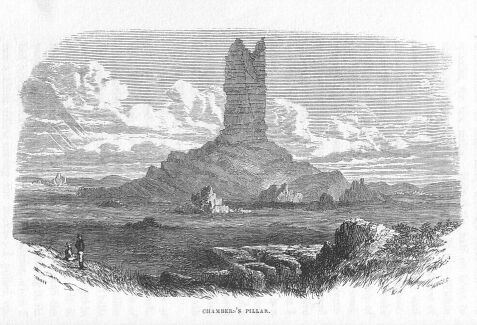
CHAMBERS PILLAR.
Friday, 6th April, Small Gum Creek in Range of Hills. Started on the same course, 330 degrees, to a remarkable hill, which has the appearance at this distance of a locomotive engine with its funnel. For three miles the country is very good, but after that high sand hills succeeded, covered with spinifex. At six miles we got to one of the largest gum creeks I have yet seen. It is much the same as the one we saw on the 4th, and the water in it is running. Great difficulty in crossing it, its bed being quicksand. We were nearly across, when I saw a black fellow among the bushes; I pulled up, and called to him. At first he seemed at a loss to know where the sound came from. As soon, however, as he saw the other horses coming up, he took to his heels, and was off like a shot, and we saw no more of him. As far as I can judge, the creek comes from the south-west, but the sand hills are so high, and the large black shea-oak so thick, that I cannot distinguish the creek very well. These trees look so much like gums in the distance; some of them are very large, as also are the gums in the creek. Numerous tracks of blacks all about. It is the upper part of the Finke, and at this point runs through high sand hills (red), covered with spinifex, which it is very difficult to get the horses through. We passed through a few patches of good grassy country. In the sand hills the oak is getting more plentiful. We were three-quarters of an hour in crossing the creek, and obtained an observation of the sun, 116 degrees 26 minutes 15 seconds. We then proceeded on the same course towards the remarkable pillar, through high, heavy sand hills, covered with spinifex, and, at twelve miles from last night's camp, arrived at it. It is a pillar of sandstone, standing on a hill upwards of one hundred feet high. From the base of the pillar to its top is about one hundred and fifty feet, quite perpendicular; and it is twenty feet wide by ten feet deep, with two small peaks on the top. I have named it Chambers Pillar, in honour of James Chambers, Esquire, who, with William Finke, Esquire, has been my great supporter in all my explorations. To the north and north-east of it are numerous remarkable hills, which have a very striking effect in the landscape; they resemble nothing so much as a number of old castles in ruins; they are standing in the midst of sand hills. Proceeded, still on the same course, through the sand rises, spinifex, and low sandstone hills, at the foot of which we saw some rain water, where I camped. To the south-west are some high hills, through which I think the Finke comes. I would follow it up, but the immense quantity of sand in its bed shows that it comes from a sandy country, which I wish to avoid if I can. Wind south-east. Heavy clouds; very like rain.
Saturday, 7th April, Rain Water under Sandstone Hills. Started on the same course 330 degrees, over low sand rises and spinifex, for six miles. It then became a plain of red soil, with mulga bushes, and for seven miles was as fine a grassed country as any one would wish to look at; it could be cut with a scythe. Dip of the country to the east, sand hills to the west; afterwards it became alternate sand hills and grassy plains, mulga, mallee, and black oak. From the top of one of the sand hills, I can see a range which our line will cut; I shall make to the foot of that to-night, and I expect I shall find a creek with water there. Proceeded through another long plain sloping towards the creek, and covered with grass. At about one mile from the creek we again met with sand hills and spinifex, which continued to it. Arrived and camped; found water. It is very broad, with a sandy bottom, which will not retain water long; beautiful grass on both banks. Wind east, and cool.
Sunday, 8th April, The Hugh Gum Creek. I have named this creek the Hugh, and the range James Range. It is scrubby on this side and is not flat-topped as all the others have been, which indicates a change of country. On the other side the bearing is nearly east and west. Examined the creek, but cannot find sufficient water to depend upon for any length of time; the gum-trees are large. Numerous parrots, black cockatoos, and other birds. Wind east; very cold during the night.
Monday, 9th April, The Hugh Gum Creek. Started for the highest point of the James range. At four miles arrived on the top, through a very thick scrub of mulga; the range is composed of soft red sandstone, long blocks of it lying on the side. To the east, apparently red sand hills, beyond which are seen the tops of other hills to the north-east. On the north-west the view is intercepted by a high, broken range, with two very remarkable bluffs about the centre. I shall direct my course to the east bluff, which is apparently the higher of the two. In the intermediate country are three lower ranges, between which are flats of green grass, and red sand hills. To the west are grassy flats next to the creek; beyond these are seen the tops of distant ranges and broken hills; at about six miles the Hugh seems to turn more to the north, towards a very rough range of red sandstone. We then descended into a grassy flat with a few gum-trees. We have had a very great difficulty in crossing the range, and now I am again stopped by another low range of the same description, which is nearly perpendicular—huge masses of red sandstone on its side, and in the valley a number of old native camps. After following the range three miles, we at last found out a place to cross it. Although this is not half the height of James range, we encountered far more difficulty; the scrub was very dense, a great quantity having withered and fallen down: we could scarcely get the horses to face it. Our course was also intercepted by deep, perpendicular ravines, which we were obliged to round after a great deal of trouble, having our saddlebags torn to pieces, and our skin and clothes in the same predicament. We arrived at the foot nearly naked, and got into open sandy rises and valleys, with mulga and plenty of grass, among which there is some spinifex growing. At sundown, after having gone about eight miles further, we made a large gum creek, in which we found some water; it is very broad, with a sand and gravel bottom. Camped, both men and horses being very tired.
Tuesday, 10th April, Gum Creek, Bend of the Hugh. I find our saddle-bags and harness are so much torn and broken that I cannot proceed until they are repaired. I am compelled with great reluctance to remain here to-day. This creek is running to the west. On ascending a sand hill this morning, I find that it is the Hugh (which seems to drain the sand hills) that we saw to the east from the top of James range. There is another branch between us and the high ranges. At about four miles west it seems to break through the rough range and join the Hugh. A large number of native encampments here, and rushes are growing in and about the creek: there is plenty of water.
Wednesday, 11th April, Bend of the Hugh. Got the things put pretty well to rights, and started towards the high bluff. I find that my poor little mare, Polly, has got staked in the fetlock-joint, and is nearly dead lame; but I must proceed. At six miles and a half we again crossed the Hugh, and at another mile found it coming through the range, which is a double one. The south range is red sandstone, the next is hard white stone, and also red sandstone, with a few hills of ironstone; a well-grassed valley lying between. The two gorges are rocky, and in some places perpendicular, with some gum-trees growing on the sides. The cucumber plant thrives here in great quantities, and water is abundant. At twelve miles we got through both the gorges of the range, which I have named the Waterhouse Range, after the Honourable the Colonial Secretary. The country between last night's camp and the range is a red sandy soil, with a few sand hills, on which is growing the spinifex, but the valleys between are broad and beautifully grassed. At fifteen miles again crossed the Hugh, coming from the east, with splendid gum-trees of every size lining the banks. The pine was also met with here for the first time. There is a magnificent hole of water here, long and deep, with rushes growing round it. I think it is a spring; the water seems to come from below a large bed of conglomerate quartz. I should say it was permanent. Black cockatoos and other birds abound here, and there are numbers of native tracks all about. I hoped to-day to have gained the top of the bluff, which is still seven or eight miles off, and appears to be so very rough that I anticipate a deal of difficulty in crossing it. I am forced to halt at this bend of the creek, in consequence of the little mare becoming so lame that she is unable to proceed further to-day. Our hands are very bad from being torn by the scrub, and the flies are a perfect torment. Indications of scurvy are beginning to show themselves upon us. Wind west; cool night.
Thursday 12th April, The Hugh. Started for the bluff. At eight miles we again struck the creek coming from the west, and several other gum creeks coming from the range and joining it. We have now entered the lower hills of the range. Again have we travelled through a splendid country for grass, but as we approached the creek it became a little stony. At twelve miles we found a number of springs in the range. Here I obtained an observation of the sun. As we approached near the bluff, our route became very difficult; we could not get up the creek for precipices, and were obliged to turn in every direction. About two miles from where I obtained the observation, we arrived with great difficulty at the foot of the bluff; it has taken us all the afternoon. I expected to have gone to the top of it to-night, but it is too late. It will take half a day, it is so high and rough. We are camped at a good spring, where I have found a very remarkable palm-tree, with light-green fronds ten feet long, having small leaves a quarter of an inch in breadth, and about eight inches in length, and a quarter of an inch apart, growing from each side, and coming to a sharp point. They spread out like the top of the grass-tree, and the fruit has a large kernel about the size of an egg, with a hard shell; the inside has the taste of a cocoa-nut, but when roasted is like a potato. Here we have also the india-rubber tree, the cork-tree, and several new plants. This is the only real range that I have met with since leaving the Flinders range. I have named it the McDonnell Range, after his Excellency the Governor-in-Chief of South Australia, as a token of my gratitude for his kindness to me on many occasions. The east bluff I have named Brinkley Bluff, after Captain Brinkley, of Adelaide, and the west one I have named Hanson Bluff, after the Honourable R. Hanson, of Adelaide. The range is composed of gneiss rock and quartz.
Friday, 13th April, Brinkley Bluff, McDonnell Range. At sunrise I ascended the bluff, which is the most difficult hill I have ever climbed; it took me an hour and a half to reach the top. It is very high, and is composed principally of igneous rock, with a little ironstone, much the same as the ranges down the country. On reaching the top, I was disappointed; the view was not so good as I expected, in consequence of the morning being so very hazy. I have, however, been enabled to decide what course to take. To the south-west the Waterhouse and James ranges seem to join. At west-south-west they are hidden by one of the spurs of the McDonnell range. To the north-west the view is intercepted by another point of this range, on which is a high peak, which I have named Mount Hay, after the Honourable Alexander Hay, the Commissioner of Crown Lands. About five miles to the north are numerous small spurs, beyond which there is an extensive wooded or scrubby plain; and beyond that, in the far distance, is another range, broken by a high conical hill, bearing about west-north-west, to which I will go, after getting through the range. To the north-east is the end of another range coming from the south. On this, which I have named Strangway Range, after the Honourable the Attorney-General, is another high hill. Beyond is a luminous, hazy appearance, as if it proceeded from a large body of water. A little more to the east there are three high hills; the middle one, which I should think is upwards of thirty miles from us, is the highest, and is bluff at both ends; it seems to be connected with Strangway range. To the east is a complete mass of ranges, with the same luminous appearance behind them. I had a terrible job in getting down the bluff; one false step and I should have been dashed to pieces in the abyss below; I was thankful when I arrived safely at the foot. I find that I have taken the wrong creek to get through the bluff. The Hugh still comes in that way, but more to the westward. Started at 10 o'clock; the hills very bad to get over; wind easterly. Camped at sundown on the creek; there is an abundance of water, which apparently is permanent, from the number of rushes growing all about it. The feed is splendid. There are a number of fresh native tracks.
Saturday, 14th April, McDonnell Range. Started at 8 o'clock to follow the creek, as it seems to be the best way of getting through the other ranges; but, as it comes too much from the east, I must leave it, and get through at some of the low hills further down. This we at last contrived to do after a severe struggle. It has taken us the whole day to come about five miles. We are now camped, north of the bluff, at a gorge, in which there is a good spring of water; the creeks now run north from the range.
Sunday, 15th April, The North Gorge of McDonnell Range. I ascended the high hill on the east side of the gorge; the atmosphere being much clearer, I got a better view of the country. To the north-west, between the McDonnell range and the conical hill north-north-west, is a large plain, apparently scrub; no hills on the horizon, but a light shade in the far distance; the conical hill bears 340 degrees from this; it appears to be high. From the foot of this, for about five miles, is an open grassy country, with a few small patches of bushes. A number of gum creeks come from the ranges, and seem to empty themselves in the plains. The country in the ranges is as fine a pastoral hill-country as a man would wish to possess; grass to the top of the hills, and abundance of water through the whole of the ranges. I forgot to mention that the nut we found on the south side of the range is not fit to eat; it caused both men to vomit violently. I ate one, but it had no bad effect on me.
Monday, 16th April, The North Gorge of McDonnell Range. Started at 9 o'clock to cross the scrub for the distant high peak. For five miles the plain was open and well grassed: afterwards it became thick, with mulga bushes and other scrubs. At twenty miles we again encountered the spinifex, which continued until we camped after dark. Distance, thirty miles. Met with no creek or watercourse after leaving the McDonnell ranges.
Tuesday, 17th April, In the Scrub. Got an early start, and continued through the scrub and spinifex on the same course, 340 degrees. At three miles passed a small stony hill, about two miles to the west of our course. At eighteen miles saw to the west two prominent bluff hills, and two or three small ones, about ten miles distant from us. At thirty-two miles crossed a strong rise. There are three reap-hook hills about three miles west, their steep side facing the south. At sundown reached the hills. At two miles passed a small sandy gum creek, the only watercourse we have seen between the two ranges. Followed the range to the north-west till after dark, hoping to find a gum creek coming from the range, but without success; nothing but rocky and sandy watercourses. Camped. The poor horses again without water; I trust that I shall find some for them in the morning; if not, I shall have to return to the McDonnell range. Very little rain seems to have fallen here; the grass is all dried up. The spinifex continues until within a mile of the range. The small gum creek that we passed is running south-west into the scrub.
Wednesday, 18th April, Under the High Peak, Mount Freeling. At daybreak sent Kekwick in search of water, while I ascended the high mount to see if any could be seen from that place. To my great delight I beheld a little in a creek on the other side of the range, bearing 113 degrees, about a mile and a half. I find this is not quite the highest point of the range; there is another hill, still higher, about fifteen miles further to the north-north-west. About two miles off I can see a gum creek looking very green, coming from the range in the direction in which I have sent Kekwick, where I hope he will find water. The country from west to north-east is a mass of hills and broken ranges; to the south-west high broken ranges. To the north-north-east is another hill, with a plain of scrub between. To the south-east scrub, with tops of hills in the far distance. Brinkley Bluff bears 166 degrees and Mount Hay 186 degrees. Returned to the camp, and find to my great satisfaction that Kekwick has discovered some water in the creek about two miles off. I am very glad of it, for I am sure that some of my horses would not have stood the journey back without it. I must not leave this range without endeavouring to find a permanent water, as no rain seems to have fallen to the north of us; everything is so dry, one would think it was the middle of summer. The sun is also very hot, but the nights and mornings are cool. Wind east. Old tracks and native camps about. The range is composed of the same description of rocks as the McDonnell ranges, with rather more quartz than mica. We here found new shrubs and flowers, also a small brown pigeon with a crest. I have built a small cone of stones on the peak, and named it Mount Freeling, after the Honourable Colonel Freeling, Surveyor-General. The range I have called the Reynolds, after the Honourable Thomas Reynolds, the Treasurer.
Thursday, 19th April, Mount Hugh. The horses separated during the night, and were not found until after one o'clock. Moved to the east side of the mount to where I had seen the water from the top. We found plenty of water in the gum creek which is the head of the one we crossed on Tuesday night, just before making the range. We were obliged to come a long way round before we could get to it, the hills being all rough sharp rocks, impassable for horses; abundance of grass with a little spinifex on the hills. At this camp I have marked a tree "J. M.D. S."; the cone of stones on the top of the mount bears 293 degrees. Ten miles distant in a branch creek about half a mile to the north of this is more water; and a little higher up, in a ledge of rocks, is a splendid reservoir of water, thirty yards in diameter and about one hundred yards in circumference. We could not get to the middle to try the depth, but where we tried it it was twelve feet deep. A few yards higher up is another ledge of rocks, behind which is a second reservoir, but smaller, having a drainage into the former one. Native tracks about. Wind north. I have named this Anna's Reservoir, after Mr. James Chambers' youngest daughter.
Friday, 20th April, East Side of Mount Hugh. Started to the south-east to find a crossing place over the range; this was not an easy matter, from the roughness of the hills; at last, however, we got over it. On the other side we found a large gum creek with water in it, running to the north-east. Camped. The range is well grassed, with gum creeks coming from it, and a little mulga scrub. Here we have discovered a new tree, whose dark-green leaf has the shape of two wide prongs; the seed or bean, of which I have obtained a few, is of a red colour; the foliage is very thick. The stem of the largest we have seen is about eighteen inches in diameter. The wood is soft; when in the state of a bush it has thorns on it like a rose. Here we have also obtained some seed of the vegetable we have been using; we have found this vegetable most useful; it can be eaten as a salad, boiled as a vegetable, or cooked as a fruit. We have also some other seeds of new flowers. The bearing from this to the cone of stones on Hugh Mount, 233 degrees 45 minutes.
Saturday, 21st April, Gum Creek, East Side of Mount Freeling. Started at half-past seven across the scrub to another high hill. For seven miles the scrub is open, and the land beautifully grassed. At twelve miles from the camp we crossed another gum creek, coming from the range; as far as I could see it ran to the north-east. After seven miles the scrub became much thicker. We had great difficulty in getting through, from the quantity of dead timber, which has torn our saddle-bags and clothes to pieces. There are a number of gum-trees, and the new tree that was found on Captain Sturt's expedition, 1844, but mulga predominates. At fourteen miles we struck a large gum plain, but after a short time again entered the scrub. At about twenty-two miles met another arm of the gum plains, with large granite rocks nearly level with the surface. We found rain water in the holes of these rocks. At thirty-two miles crossed the sandy bed of a large gum creek divided into a number of channels; too dark to see any water. Four miles further on, camped on a small gum creek with a little rain water; the creeks are running to the north-east. The soil is of a red sandy colour: the grass most abundant throughout the whole day's journey. Occasionally we met with a few hundred yards of spinifex. Wind south-east. Native tracks quite fresh in the scrub and plain; we also passed several old worleys.
Sunday, 22nd April, Small Gum Creek, under Mount Stuart, Centre of Australia. To-day I find from my observations of the sun, 111 degrees 00 minutes 30 seconds, that I am now camped in the centre of Australia. I have marked a tree and planted the British flag there. There is a high mount about two miles and a half to the north-north-east. I wish it had been in the centre; but on it to-morrow I will raise a cone of stones, and plant the flag there, and name it Central Mount Stuart. We have been in search of permanent water to-day, but cannot find any. I hope from the top of Central Mount Stuart to find something good to the north-west. Wind south. Examined a large creek; can find no surface water, but got some by scratching in the sand. It is a large creek divided into many channels, but they are all filled with sand; splendid grass all round this camp.
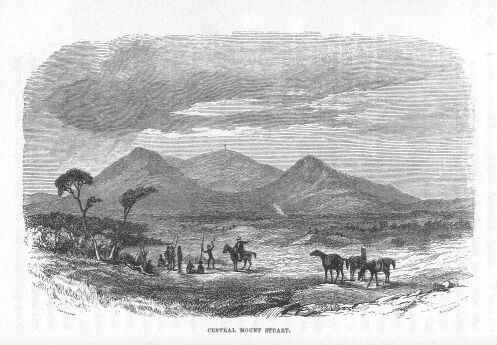
CENTRAL MOUNT STUART.
Monday, 23rd April, Centre. Took Kekwick and the flag, and went to the top of the mount, but found it to be much higher and more difficult of ascent than I anticipated. After a deal of labour, slips, and knocks, we at last arrived on the top. It is quite as high as Mount Serle, if not higher. The view to the north is over a large plain of gums, mulga, and spinifex, with watercourses running through it. The large gum creek that we crossed winds round this hill in a north-east direction; at about ten miles it is joined by another. After joining they take a course more north, and I lost sight of them in the far-distant plain. To the north-north-east is the termination of the hills; to the north-east, east and south-east are broken ranges, and to the north-north-west the ranges on the west side of the plain terminate. To the north-west are broken ranges; and to the west is a very high peak, between which and this place to the south-west are a number of isolated hills. Built a large cone of stones, in the centre of which I placed a pole with the British flag nailed to it. Near the top of the cone I placed a small bottle, in which there is a slip of paper, with our signatures to it, stating by whom it was raised. We then gave three hearty cheers for the flag, the emblem of civil and religious liberty, and may it be a sign to the natives that the dawn of liberty, civilization, and Christianity is about to break upon them. We can see no water from the top. Descended, but did not reach the camp till after dark. This water still continues, which makes me think there must certainly be more higher up. I have named the range John Range, after my friend and well-wisher, John Chambers, Esquire, brother to James Chambers, Esquire, one of the promoters of this expedition.
Tuesday, 24th April, Central Mount Stuart. Sent Kekwick in search of water, and to examine a hill that has the appearance of having a cone of stones upon it; meanwhile I made up my plan, and Ben mended the saddlebags, which were in a sad mess from coming through the scrub. Kekwick returned in the afternoon, having found water higher up the creek. He has also found a new rose of a beautiful description, having thorns on its branches, and a seed-vessel resembling a gherkin. It has a sweet, strong perfume; the leaves are white, but as the flower is withered, I am unable to describe it. The native orange-tree abounds here. Mount Stuart is composed of hard red sandstone, covered with spinifex, and a little scrub on the top. The white ant abounds in the scrubs, and we even found some of their habitations near the top of Mount Stuart.
Wednesday, 25th April, Central Mount Stuart. There is a remarkable hill about two miles to the west, having another small hill at the north end in the shape of a bottle; this I have named Mount Esther, at the request of the maker of the flag. Started at 9 o'clock, on a course a little north of west, to the high peak that I saw from the top of Mount Stuart, which bears 272 degrees. My reason for going west is that I do not like the appearance of the country to the north for finding water; it seems to be sandy. From the peak I expect to find another stratum to take me up to the north-north-west. Around the mount and on the west side, the country is well grassed, and red sandy soil; no stones. To the north and south of our line are several isolated hills, composed principally of granite. At ten miles there is a quartz reef on the north side of the south hills. At twelve miles struck a gum creek coming from the south and running to the north; it has three channels. We found a little rain water in one, and camped, to enable us to finish the mending of the saddle-bags. Wind east; very cold morning and night. The large creek that flowed round Mount Stuart is named the Hanson, after the Honourable R. Hanson, of Adelaide.
Thursday, 26th April, Gum Creek on West Course. Started at a quarter past 8 o'clock on the same course for the high peak. At two miles crossed some low granite and quartz hills; and at four miles crossed a gum creek running to the north with sand and gravel beds. No water. The country then became difficult to get through, in consequence of the number of dead mulga bushes. At ten miles the grass ceased, and spinifex took its place, and continued to the banks of the next gum creek, which we crossed at twenty-two miles; the bed sandy, and divided into a number of channels, coming from the south-east, and running a little to the east of north, but no water in them. Native tracks in its bed. On the west side of the creek the grass again begins, and continues to the hills, where we arrived at five minutes to 7. Camped without water. There seems to have been very little rain here—the grass and everything else is quite dry. Distance, thirty-eight miles.
Friday, 27th April, East Side of Mount Denison. Sent Kekwick to the south-west to a remarkable hill which I hope may yield some water, with orders to return immediately if he should find any nearer, so that we might get some for the horses. I waited till past 12, but he did not return, so I started, intending to go to the top of the mount. On getting to the north-east side of the ranges, I liked the appearance of the country for water, and seeing that the top of the mount was still some distance off, and that it would make it too late to return, I set to work myself to look for water. After an hour's search I was successful, finding some rain water in a gum creek coming from the hills. The natives must have been there quite recently, as their fires were still warm; and, as I had left the camp and provisions with only one man, I hurried back, had the horses saddled and packed, and brought them down to the water, leaving a note for Kekwick to follow in a west-north-west direction to a gum creek about three miles distant. Kekwick's search was also successful; he found permanent water under the high peak to which I sent him, and which I have named Mount Leichardt, in memory of that unfortunate explorer, whose fate is still a mystery. I have seen no trace of his having passed to the westward. Kekwick describes the water he has found as abundant and beautifully clear, springing out of conglomerate rock much resembling marble; its length is upwards of a quarter of a mile, falling into natural basins in the solid rock, some six feet in depth and of considerable capacity. The country round the base of the range is covered with the most luxuriant grass and vegetation. Mount Leichardt and the range are composed, at their base, of a soft conglomerate rock in immense irregular masses, heaped one on the other; the higher part where the spring appears is of the same conglomerate, but broad and solid, having smooth faces, which makes the ascent very difficult.