TRAIL TO THE TOP OF THE ROCK AND RUINS
Reading edition
The first stake is some distance along the trail, so keep walking and watch for it.
1.
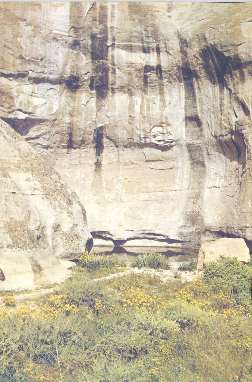
The cave-like depressions in the side of the rock are created by water. Rain falling on the top of the mesa enters cracks in the rock, runs down the cracks (called joints), and comes out of small openings on the side of the mesa. The water seeping out of the opening gradually wears away the rock. The freezing of the water in winter and thawing in summer helps to weaken the sandstone.
The tall trees in the vicinity of this stake are ponderosa pine (Pinus ponderosa). They are readily identified by the needles, which grow two or three to a cluster. These trees grow in well-watered, protected areas within the Monument. The larger ones are somewhere between 200 and 300 years old.
2.
Here you can stop and catch your breath before beginning the steep climb. Look at the top of the mesa, to your right, just below the railing. You can see very clearly two different formations of rock. The lower is the sandstone called Zuñi formation and the higher is the Dakota formation. The line between these two formations represents a time interval of between 25 and 30 million years. More about this later.
Behind the numbered stake near the base of the rock, you will see a Gambel oak (Quercus gambelii). It is commonly associated with 12 ponderosa pine and is the most abundant oak of the low mountains and plateaus of the Southwest. It is characterized by its deeply-lobed leaves, and its habit of growth. It ranges from a shrub to a tree in size, and is often seen in dense stands, which give it the name of “scrub” oak in certain localities. Deer and livestock browse this tree, and small animals use its acorns for food.
3.
The policy of the National Park Service is to keep the parks looking as natural as possible. Since it is natural for dead trees to be in a forest the ones you see in this area will not be cleaned up. When a tree falls in a National Park Service area it will lie where it fell and eventually will decay and supply nourishment for future trees.
4.
Take a break here and look at the valley between the multicolored mesa and the higher parts of the Zuñi Mountains. This valley was formed by water gradually wearing away the softer rocks of the Chinle formation. The harder sandstones of El Morro and the adjacent mesa on the southwest and the sandstones and limestones of the higher slopes resisted such erosion.
During the last few million years, while the Zuñi Mountains were being gradually pushed up to their present height, more than 10,000 feet of sedimentary rocks have been removed from what you see. This has been done by running water and wind, carrying away the rocks a few particles at a time. Before that, about 100 million years ago, this entire area, as far as you can see in any direction, was under the water of an ancient ocean. Forty million years before that, the sands of El Morro were accumulating on a broad, desert-like plain, built up by sand deposition of sluggish, wandering streams, and re-sorted by wind into large dunes.
Before continuing along the trail, you will notice many small trees around you which are called pinyon (Pinus edulis). These pine trees have two needles to a cluster and are never tall like the ponderosa pine. They are usually less than 35 feet in height, and have a rounded, compact crown. Pinyons are seldom found growing in pure stands but are associated with various kinds of juniper. Because of the nature of their growth, heavy stands of pinyon and juniper are often called pigmy forests. The pinyon produces edible nuts which are abundantly used by local residents as well as marketed commercially elsewhere in the United States.
5.
Here you can see at close hand the difference between the dark, upper layers of ocean sands and the light color of the lower and earlier stream and dune sands. Look here at the cliff above you and a little to the right. The lower is Zuñi sandstone, of the Jurassic period, and forms the bulk of El Morro. The upper is Dakota sandstone of Cretaceous period, representing beach deposits of the ancient sea which covered all the area. The contact surface between these two units represents a time interval of between 25 and 50 million years when erosion instead of new deposition was taking place.
6.
Look on the left side of the trail and a little behind you. You will see a dark green stake that marks one of the four corners of the 13 unexcavated ruin. Let your eye follow along the top of the incline to your right and you will see another green stake, another corner. As you follow the trail on this side of the box canyon, look to your left for the last two stakes and you can tell how big this ruin is. Please do not leave the trail.
This village was possibly two or three stories high, but after the Indians left, the roofs collapsed and the walls fell in. Then the sand blew in, weeds began to grow, and you see the result.
7.
Looking at the cliff wall across this little box canyon, you can see a definite horizontal line about half way down. The materials above and below the line were laid down about the same time, but the line represents a layer of softer material which has weathered away faster.
The reason for the unevenness is that stream channels cut into the underlying sandstone, and then, as the land slowly settled to allow the sea to encroach, the channels filled up with sand. The sands were reworked by waves on the beach and the tops smoothed out and leveled. Small lagoons and swampy areas formed along the coastline. As you climb the steps at No. 11, you will cross a small seam of coal-like material which was formed from one of these swamps.
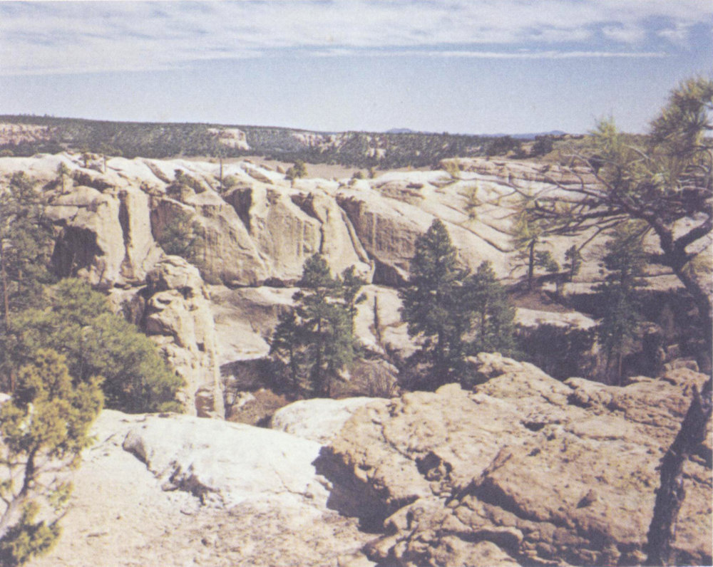
The geological disconformity described at Stake 7.
14
If you look across the box canyon, on the horizon you will see the ruins of another village. It was occupied about the same time as the one on this side of the mesa.
Across the top of the mesa, the trail will be marked with two parallel lines. Please stay between the lines.
STAY ON THE TRAIL
8.
The boulders of mixed colors topping the pedestals of Zuñi sandstone are the Basal Conglomerate of the Dakota formation. This involved erosion and reworking of the old surface (Zuñi) plus the deposition of new materials. Thus some of the light colored particles in the Dakota are Zuñi sandstone.
The steps cut in the rock were constructed by the National Park Service. They are not the work of prehistoric Indians.
9.
The line, to the left of the post, extending through the rock on both sides of the mesa, is one of the principal causes of the development of the box canyon. After El Morro was buried by several thousand feet of younger rocks, some 60 million years ago, it was subjected to great pressures from the weight of the overlying rocks and the movements which caused the Zuñi Mountains to project so far above sea level. These pressures caused the sandstone to crack into the long openings which we call joints. As running water and wind gradually removed the overlying rocks, the waters were able to run down into the joints and, alternately freezing and thawing, broke up the rock into small fragments which could be washed away.
If you stand on this line and look down the box canyon to the west, you can see that each steep canyon wall is simply one side of a joint, while the material on the other side has been eroded away. If you look eastward towards the headquarters area, along this joint line, you can see how El Morro maintains its vertical walls by breaking into blocks which fall away from the main mass of the sandstone and leave a vertical joint face. This joint line is different from the others which you may have noticed in climbing over the rock because it goes so far and cuts through the rock so deeply.
10.
The dark colored splotches are lichens. A lichen is composed of two different organisms, an alga and a fungus, living together and supporting each other. The fungus furnishes the moisture for the alga, and the alga the food for the fungus. This coexistence is known as symbiosis.
As you walk from No. 10 to 11, you will pass several potholes that become pools of water after a rain. Some of these were artificially enlarged by the Indians who lived on the mesa top, to serve as supplementary sources of water.
11.
The dark color here is caused by carbonized remains from the plants which grew in the ancient swamps. Coal is formed in much the same way, but there is too much inorganic material in this seam to produce coal. This is the coal-like seam mentioned at No. 7. On the 15 very top, the dirt is from the Mancos formation of Cretaceous age, and is composed of marine shales deposited in the ancient sea which covered the area. It was originally much thicker, and is younger than any of the other rocks exposed here.
Immediately ahead and extending to the right for nearly 300 feet is the ruin called Atsinna, a Zuñi word referring to the “writing on rock.”
12.
Atsinna, the larger of the two ruins, is approximately 200 by 300 feet, the size of some city blocks. Like the other village, parts of it probably were three stories high, mainly along the north side. It was terraced down toward the south, thus providing a southern exposure. You are standing on the second floor level about ten feet above the original ground level. The first floor was filled with debris from the collapse of the upper stories.
The Indians obtained most of their water from the pool at the base of the rock, as did the later Spanish and American travelers, but they also caught as much water as they could on the mesa top.
13.
This round room, is called a kiva. Kivas were built primarily for religious ceremonial reasons, but had other purposes, just as the large halls in cities today are used for exhibits, concerts, lectures, and other activities. In addition to religion, these rooms were used for workrooms, playrooms, general meeting places, fraternal society meetings, etc.
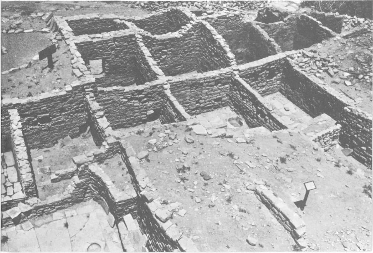
A portion of Atsinna. Part of the square kiva is shown at lower left
Now contrast this round kiva with the square kiva across the trail toward the northeast. Both kivas served the same functions, but they represent two different architectural styles or traditions in use at approximately the same time.
16
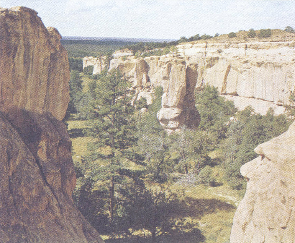
The box canyon as seen from its eastern end looking west
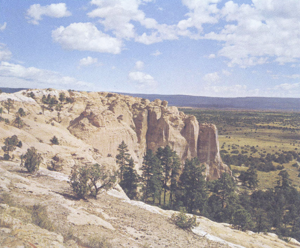
Looking out over Inscription Rock from the south
17
Atsinna was occupied during the 13th and 14th centuries. The reason for the abandonment of this site is not definitely known. Perhaps the Indians found that the growing seasons were too short at this elevation and they had too many crop failures. Apparently these people moved to the west, where they founded the several Zuñi villages known in historic times. There, around the present pueblo of Zuñi, the growing season is slightly longer and irrigation can be practiced, and possibly the soil is more fertile.
The prominent peak on the horizon to the south is called Cerro Alto, which is Spanish for high mountain. This peak is a volcanic cinder cone.
14.
The stones you see at this station were used for grinding corn after it had been dried and stored. The corn was placed on the large stone called metate and ground with the smaller stone called mano.
15.
The trail now descends from the mesa top back to the Monument headquarters. We hope that you have enjoyed your trip over Inscription Rock. Should you have any questions, the ranger on duty will be happy to be of assistance.
PUBLISHED IN COOPERATION WITH THE NATIONAL PARK SERVICE BY SOUTHWEST PARKS AND MONUMENTS ASSOCIATION 221 NORTH COURT TUCSON, ARIZONA 85701
Southwest Parks and Monuments association was founded in 1938 to aid and promote the educational and scientific activities of the National Park Service. As a nonprofit organization authorized by Congress, it makes interpretive material available to park visitors by sale or free distribution. All net proceeds support the interpretive and research programs of the National Park Service.
21st Edition—10M—8/92