CLIMBING IN THE BRITISH ISLES (continued 2)
Reading edition
The following notes are among the records of Penygwrhyd:—
On September 23, 1887, W. E. C. and A. E. ascended Snowdon from Glaslyn by the first gully on Clogwyn y Garnedd.
In 1890, on June 20, W. P. and G. B. B. descended from Snowdon to Haseler's Cross by the gully immediately above it in Clogwyn y Garnedd.
In 1890, on September 27, F. W. J. found an excellent gully climb, possibly that referred to in the note of September 23, 1887. He started from Glaslyn, keeping to the right edge of the lake, and, facing towards Bwlch y Saethau, saw a gully choked by jammed stones (five in number), beginning almost from the foot. It has often been climbed. The most interesting and difficult piece is where a large stone roofs a cavern some 15 ft. high. In it there is a kind of skylight, through which the climber must go by an indescribable twist of the body. From the bottom of the gully to the huts where the climb ends is 900 ft., all except a portion of the upper end being narrow gully, and the rest a scramble over rocks.
On December 13, 1891, Mrs. H. ascended the big Clogwyn y Garnedd gully direct to the summit of Snowdon.
On September 24, 1892, Miss B. and a large party of gentlemen climbed (second lady's ascent) the Clogwyn y Garnedd gully through the cavern.
In May 1893 a party climbed up by this and down by the next gully, on the north, which has its head just below the huts.
In September 1893 the two Misses T. descended the great gully in 1 hour 25 minutes.
In 1894, on September 14, Messrs. W. E. C., S., and B. descended the face of Clogwyn y Garnedd to the left of the big gully.
SNOWDON FROM THE NORTH, WITH LLIWEDD ON THE LEFT
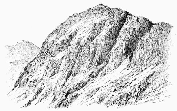
Lliwedd (2,947 ft.) stretches away eastward from the summit of Snowdon, dividing Cwm Dyli on the north from Cwm y Llan on the south. Strictly speaking, perhaps the name only applies to the central portion, where its magnificent northern crags overlook the head of Llyn Llydaw, but, as in the case of Crib Goch, the significance of the name has been enlarged, and it is frequently used to denote the whole length of the ridge.
At the Nant Gwynant end a transverse ridge, called Gallt y Wenallt, bears near its base some remarkably fine rocks, on which there is very good climbing. West of the Gallt a side valley, called Cwm Merch, runs nearly due south, and beyond this Cwm Lliwedd proper begins. The southern slope of it is steep, but that to the north is imposingly precipitous. It is, in fact, unsurpassed in Wales. Advancing in the direction of Snowdon, the cliffs become less sheer and the crest less broken, and as soon as the highest point of Crib Goch is 'on with' the head of Llydaw Bwlch Ciliau offers a rough descent into Cwm Dyli. Next on the west comes the Criman, corresponding geographically to Clogwyn y Person on Ddysgl, but more broken; beyond them Bwlch y Saethau (i.e. Arrows Gap), leading down to the head of Glaslyn. The last quarter of a mile up to the top of Snowdon is very steep, rising nearly 1,000 ft. in that distance. It was here that Mr. Maxwell Haseler, in 1879, lost his life by keeping too much to the right.
LLIWEDD FROM THE NORTH-WEST.
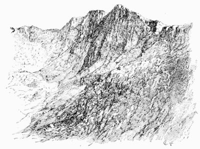
In August 1872 Mr. T. H. Murray Browne and Mr. W. R. Browne, the discoverers of the Scafell Pinnacle, saw the merits of this climb, and attacked it without success. Public attention was first drawn to Lliwedd as a climbing-ground by the ascent made in 1883 by Messrs. T. W. Wall and A. H. Stocker, and thus described by the former in the Alpine Journal: [16] —
'This northern face consists of four buttresses, with three fairly well-defined couloirs between them. The summit ridge has two peaks, of which the western, nearer Snowdon, is the higher by a few feet. In January 1882 from the summit of Crib Goch Mr. A. H. Stocker and myself were struck by the grand appearance of the Lliwedd cliffs, and hearing from Owen, the landlord of the Penygwrhyd Hotel, that the northern face had never been climbed, the desire to make the first ascent naturally came upon us. On the 10th we made our first attempt by the central couloir, which leads up to the depression between the two summits. As it was raining the whole day the rocks were in an abominable state, and it was with the greatest difficulty that we managed to get up about 150 ft.' On January 3, 1883, they tried again. 'On January 4, after carefully observing the rocks of the buttress to the west of the central couloir, we came to the conclusion that it might be possible to cross the face in an upward direction from east to west, and then strike straight up. At 11.15 A.M. we got on the rocks, beginning from the lower of two dark green patches seen from below. From this a ledge runs up to the right, and if it had only been continuous Lliwedd would present no very great difficulties. Unfortunately this was not the case; there were most formidable-looking gaps in it, and the ledges above and below were tacked on to it by smooth and almost perpendicular gullies. Three bits in particular may be mentioned as far the hardest, although they are more or less typical of these crags, which nowhere offer 20 consecutive yards of easy rock-work. The first difficulty which presented itself was where the ledge was broken by a bold face of rock. One of us was pushed to the top of the smooth part, and finding that he could not descend to the ledge on the other side, he ascended a little higher, anchored himself firmly to the rocks, assisted his companion up, and let him down to the required ledge; then, throwing the rope over a pinnacle, he gave both ends to his companion to hold tight, and slid down the 40 ft. of rope to join him. After a few yards of easier work we came to a ledge about 6 inches wide and 4 yards long; the rock above was nearly perpendicular, with no hand-hold, and there was nothing below. It was the only way; we could not turn it, and somehow we got over, but neither of us wishes to be there again. From that ever-to-be-remembered ledge the climbing was grand work up to the point where we had to turn from a westerly direction to go straight up the face. Here there was one nasty corner. A narrow ledge about 2 inches wide had below it a sloping face of rock with three minute cracks in it. One of us had crossed this in safety, and so assumed a position in which the rope would have been of very little use. He was then opposed by a steep bit, topped by 4 ft. of perpendicular rock, with a very steep slope of heather above. At the moment that his last foot left the highest peg of rock his other knee slipped, and the heather, grass, and earth began to give way in his left hand. It was an awkward moment, for the other man was not well situated for supporting a jerk at the end of 30 ft. of rope, which would mean a fall of about 50 ft. Happily the other knee got on the heather and the axe held firm in the earth. Our difficulties were then over. The rocks grew less and less difficult as we ascended, and after 4½ hours of incessant work up 850 ft. of rocks we found ourselves on the summit ridge, exactly 13 yards from the cairn.
LLIWEDD FROM LLYN LLYDAW a, East buttress. b, Central gully. c, West buttress. d, Slanting gully.
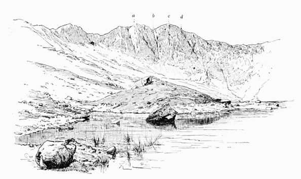
'It may be mentioned that the only real difficulties lie in the first 200 ft.; above that point the mountain presents rock-work of a very high order, but nothing stupendously difficult, the rock being very firm.
'Future climbers will probably find that of the three couloirs the western is comparatively easy; the central may perhaps be ascended by climbing the lower rocks on the right, and the eastern by a long détour to the left. The buttress to the left of the central couloir looks as difficult as rocks possibly can look. But there is a chance that a careful search among the rocks to the left of the central couloir might reward a rock-climber with an exciting and successful scramble. In any case the whole northern face is distinctly difficult.'
Under the date of April 12, 1884, we find recorded by H. S. and C. S. an ascent of Lliwedd by the ridge from Llyn Llydaw, which is apparently nothing more than the ordinary walk, but in 1887, early in April, is an important note in the hand of Mr. Stocker.
'Hints for the Ascent of Lliwedd by the North Face.
(N.B. Lliwedd consists of two peaks—the eastern and western buttress—with a well-defined gully running up between them.)
'1. Ascent of Western Buttress to the Right of Central Gully.—Make for the lower of two green patches easily seen from below just to the right of the foot of the central gully. From it work upwards to the right to the second green patch; then again upwards, still to the right, to a very small, steep green slope. From this the climb is almost straight up, inclining a little to the left at first. This will land the climber a few yards to the west of the cairn.
'2. Ascent by Central Gully and Western Buttress.—Go up the gully till the foot of the steep bit is reached; then climb out of the gully by ledges on the right on to the western buttress. As soon as possible make straight up the face, keeping the gully a little to the left. This will land the climber at the cairn.
'No. 2 is an easier climb than No. 1. All through the hand and foot hold is very good. The chief difficulties lie in the first 200 ft. after leaving the gully. The upper part is fairly easy. The whole climb is about 850 ft.'
In 1887, April 11, O. E. and T. V. S. ascended Lliwedd by the central gully at first and afterwards in a line rather left of the summit. Time, under 3½ hours.
In September 1887 W. E. C. and A. E. climbed Lliwedd by Mr. Stocker's second route in 1 hour 23 minutes from base to cairn, and subjoined a list of previous ascents, viz.—
First attempt. T. H. M. B. and W. R. B., August 1872 (Vis. Bk.) January 7, 1883, Messrs. Stocker and Wall, by route 1. April 24, 1884, Messrs. A. H. S. and P., by route 2. April 11, 1887, Messrs. O. E. and T. V. S., by route 2. September 10, 1887, Mr. R. W., by route 1. September 20, 1887, Messrs. W. E. C. and A. E., by route 2.
On May 20, 1888, Mr. Alfred Evans and two friends, W. E. C. and — K., left Penygwrhyd at 10 A.M., crossed the northern arête of Crib Goch and Cwm Glas, and climbed Clogwyn Person and by Crib y Ddysgl to the top of Snowdon. Evans and K. then descended by the second or third gully from Bwlch Glas on Clogwyn y Garnedd to the head of Llyn Llydaw. C., E., and K. started up the central gully of Lliwedd at 5.5 P.M. At the bottom, and for some distance up, the rocks are water-worn and but little broken up, and the water flowing down rendered this part difficult. At the moment when C. was about 300 ft. above the scree Evans was about 80 ft. below him, and could not advance. C., therefore, went down 3 or 4 ft. and rested. Evans then tried to get out of the gully by the ledge mentioned in Mr. Stocker's account. This ledge is divided in two parts by a huge outstanding buttress with very scanty footing. Both men passed this; then Evans lowered himself by K.'s ankle on to a rocky foothold and tried to work to the right, but after doing 5 or 6 ft.—half the requisite distance—his feet slipped, his arms were unable to support him, and he fell on his feet about 5 yards on to the edge of a steeply sloping grass ledge running up to this part of the cliff. From this point in four or five terrible leaps he fell over and over, a total distance of 200 ft., to the screes below. The accident happened at 6.55 P.M., and K. is stated to have descended to the body, a distance of 200 ft. of the most awkward climbing in the whole gully, in the space of 5 minutes. This is hardly credible, but under such circumstances people do not judge time accurately.
This accident need never have happened. If ever a party courted disaster it was done on this occasion.
A cross was erected by friends of Mr. Evans on the spot where his body was found, but being much damaged by stones it had to be removed in 1892 to a rocky knoll not far off, where its position is more secure. It records the age of Mr. Evans as 24.
On June 10, 1889, M., A. L. M., and B. climbed the north face of Lliwedd by the rocks of the western buttress, keeping close to the central gully almost the whole of the way.
On January 1, 1893, F. P., F. W. O., and H. J. R. ascended the north face of Lliwedd by the western buttress, starting just to the right of the central gully, and coming up at the cairn. Time, 3 hours.
At Easter 1893 H. G. G. and — W. climbed by the central gully and the western buttress, coming out at the cairn, in 3 hours 5 minutes, all the rocks being dry.
On April 7, 1893, T. H. M. climbed the north-west face alone in 2½ hours: he found two difficult spots near where Messrs. G. and W. scratched their initials on the rocks. Everything was dry.
On September 14, 1894, W. E. C. and M. K. S. ascended the central gully for about 200 ft., then went up the western buttress, and crossed the gully again to the eastern buttress, about 300 ft. below the top, reaching the summit in 2 hours and 20 minutes.
On October 14, 1894, J. M. A. T., H. H., and H. E. ascended the central gully to a point apparently beyond that where others have broken out upon the face, and continued up a steep stretch of rock by taking a narrow gutter between the centre and right wall, the upper part being found difficult. A broad ledge brought them to a similar reach, where the outward slope of the holds became more and more pronounced. Finding the rocks above quite impassable, the party descended by means of an iron claw, which had to be left, and then by a ledge in the right wall and an awkward corner got out on the face of the west buttress. Here they found the ledges narrow and the crags extremely steep, but working upwards and tending to the right they crossed an incipient gully by an awkward stride, and thereafter met with only ordinary difficulties, but on passing a cleft which opens into the gully enjoyed a magnificent view of the latter, and struck the summit at the cairn. They pronounced the climb to be quite impossible for one man.
The Slanting Gully.—This gully, on the west side of the western buttress, is easily identified, being the next one to the west of the great central gully and a striking feature of the north face of Lliwedd. It is clearly marked all the way up, and is most readily approached by crossing diagonally up the screes below the great gully and then skirting the base of the rocks of the western buttress. This gully was attacked on January 9, 1894, by Messrs. F. O. W., C. W. N., E. H. K., and H. K. It was then frozen up and covered with snow to a depth varying from a few inches to 3 ft. In 4 hours an estimated height of 350 or 400 ft. above the starting-point was attained, the whole of this distance, with the exception of a few steps in deep snow, having to be climbed. The party kept in the gully the whole way, usually close against the rocks on the western side. Progress was finally arrested at a point where the gully becomes, for some distance, a mere crack, formed by the western rocks overhanging an almost smooth slab, where hold for hand or foot seems almost entirely wanting. With longer time at disposal it seemed possible that this difficulty might have been surmounted by wriggling up inside the crack, or by a dangerous scramble on the face of the slab. Two members of the party were provided with crampons, and derived great steadiness and safety from their use. The uniformly steep angle at which this gully lies may be gathered from the fact that a rücksack dropped from the highest point was picked up at the starting-point on the return. It was the opinion of most of the party that the condition of the snow and rocks was, on the whole, favourable for climbing, as the ice and snow gave some assistance in places which without them might have been still more difficult.
The next attempt is valuable, as notes were taken on the heights of some of the obstacles.
On March 26, 1894, the gully was attacked by J. C. M., O. M., and W. P. from the screes (2,300 ft.) at 1.55 P.M. They arrived in the cave (2,690 ft.) at 5 P.M. They considered the conditions favourable, except that the snow was melting, but found the climbing difficult all the way. At about 2,500 ft. a chimney 70 ft. high had to be squirmed up. They were of opinion that the gully could not be climbed direct, and all their efforts to break out on either side were frustrated. The climbing does not, as in the central gully, become more easy as progress is made; on the contrary, the difficulties increase. The party carried two ropes, one of 50 ft. and one of 80 ft., and at one place had to use the full length of both together. The descent took 2 hours.
On Thursday, August 30, 1894, this gully cost a valuable life. Mr. J. Mitchell, of Oxford, an assistant editor of the New Historical English Dictionary, started from the foot at about 2 P.M. The first pitch was quickly ascended, and he then proceeded, apparently without difficulty, to the foot of the long chimney, which he passed by means of the face. On reaching the top he waved his handkerchief, and, being asked what it was like, replied that it was very stiff. Not long after he was seen in a cave, which the lookers-on (probably in error) identified with the highest point reached by previous climbers. From this he climbed with great difficulty to the top, as it appeared from below, of a long chasm, with his head just below an overhanging rock, upwards of 150 ft. above the cave, and after more than half an hour of fruitless endeavour to make further progress he fell at 4.30 P.M., and was killed on the spot. The body was found at the above-mentioned cave, and was brought down by four quarrymen at great personal risk. The lesson which should be drawn from this is, that if a man will insist on climbing alone he should not choose for his attack climbs which parties of greater skill and experience than his own have found to be beyond their powers.
Cwm y Llan.—This large cwm stretches away from Snowdon top to the south-east between Yr Aran and Lliwedd. The scenery consists mainly of the South Snowdon Slate Works, which occupy the centre of the valley, at a height of about 1,100 ft., and of Sir Edward Watkin's road up Snowdon.
There is very little climbing, though some parts of Geuallt and Aran are very steep. On the Lliwedd side there is a good rock (Craig Ddu), not far from the slate works, and others rather smaller near the exit of the valley, while at the head, near Bwlch y Maen, almost under Snowdon and near Bwlch y Saethau, some difficult passages occur.
The slate quarry here must not be confused with 'Cwm y Llan slate quarry,' which is not in this valley at all, but on the western slope of Aran, about a third of a mile beyond Bwlch Cwm y Llan. This little pass (about 1,700 ft.) is very useful to anyone who, after a climb on Lliwedd, wishes to reach the nearest railway station, for Pont Rhyd-ddu is very much nearer than Llanberis and can be reached without climbing over Snowdon summit. From the top of Lliwedd the pass is in full view, and a stone wall is seen stretching half-way from it towards two little reservoirs which are some 600 yards higher up the valley than the slate works. It is a mile and a half from Lliwedd by way of these reservoirs to the top of the bwlch, which will hardly be reached within half an hour. From the bwlch a fair path on the right bank of the stream leads towards Llynygader, and soon crosses the path from Snowdon to Beddgelert. By keeping round the hill to the right the Carnarvon highroad (which is easily seen from above) is gradually neared. The distance from the bwlch direct to the station may be covered in three-quarters of an hour, making in all 1¼ hour from Lliwedd, as compared with at least 2½ hours which would be required to reach Llanberis from the same point.
Cwm Creigiog is a shallow and unimportant hollow on the south-west side of Snowdon, lying between Aran and the ordinary Beddgelert path to the summit. The cwm has no attractions for a climber, yet at least one life has been lost in it. This was in the winter of 1859, when a Mr. Cox is said to have ascended Snowdon from Llanberis, and to have become exhausted on the way down to Beddgelert, between Llechog and the farm called Fridduchaf. His foolish guide left him alone and went in search of food, with the result, which in such cases usually follows, of finding his unfortunate employer dead on his return. The spot is marked by a heap of stones. Mr. Baddeley says it 'marks the spot where a tourist lost his life from exhaustion in 1874'—perhaps a mistake arising out of a death of the same kind in that year on quite another part of the mountain.
Clogwyndur Arddu ('Black Precipice') is the magnificent ridge which divides Cwm Clogwyn on the south from Cwm Brwynog on the north, being the western buttress of Y Wyddfa, or more strictly of Carnedd Ugain. The ascent from the Snowdon Ranger traverses nearly the whole length of the ridge, which broadens out at its western end into Moel y Cynghorion, beyond which again is the low pass of Bwlch Maes y Cwm (1,100 ft.), giving an easy passage from Llanberis to Snowdon Ranger and Beddgelert. The cliffs on the north side of the ridge are grand, and have been concerned in more than one fatal accident. In 1846 the Rev. Henry Wellington Starr, B.A., of Magdalen Hall, Oxford, eldest son of Mr. George Starr, of Hilperton, Wiltshire, and then a curate in Northampton, left Dolbadarn Inn on September 6 to ascend Snowdon. He failed to return, and on inquiry being made by his friends people came forward with evidence which seemed to show that he had reached the top of Snowdon, then descended to Gorphwysfa, crossed the head of Llanberis Pass, and ascended Glyder Fawr. At that point a guide professed to have met him, and brought him about half-way down, particularly noting that he wore a single glove, corresponding exactly to another which he had left with his luggage at the hotel. Search was made in every direction, but it was not till the beginning of June in the following year that any light was thrown on the mystery. On that day some of the clothes were found accidentally by William Hughes, a huntsman, who was exercising his dogs, apparently on Moel Cynghorion, and next day, on further search being made, the skeleton was discovered buried under gravel. His purse and chain were found, but his watch and ring were gone. It appears from the evidence of Griffith Ellis, of Llanberis, who found part of the remains, that the deceased had fallen over the cliff of Clogwyn Coch, on Moel Cynghorion, while ascending from Llyn Cwellyn—that is, by the 'Snowdon Ranger' route. [17]
In 1859 a fatal accident took place near the eastern end of the ridge. The victim, George Henry Frodsham, a clerk in Liverpool, described as a young man of very fine physique, arrived at Llanberis on Saturday, August 13, accompanied by his cousin, F. A. Nicholson, and four friends, T. Clayhills, J. Snape, J. Goodiear, and A. Gardner. It was midnight, but they started off at once for Snowdon. They got as far as the 'half-way house,' where the proper path turns left, and up towards Cyrn Las; they, however, took the right-hand fork, which leads to the old copper level above Llyn du'r Arddu. Struggling up the rocks from the mine, Frodsham, encumbered by an umbrella and a bag, and being, moreover, in the dark, slipped and fell, unknown to his friends, who returned to the proper path and gained the summit. His cousin is said to have searched for him continuously from 4 A.M. on Sunday to 9 P.M. on Monday. At 6 A.M. on Tuesday the body was found by W. Owen; the skull was fractured both at the top and at the back, and the bag and umbrella were found 200 yards higher up, indicating that distance as the extent of his fall. A sapient jury drew from this sad event the moral that a guide should be employed as a safeguard against sudden mists; but few men need fear mists less than those who choose to climb when it is pitch dark. It may be said that this party neglected no precaution which is likely to ensure a fatal accident—inexperience, fatigue, darkness, difficult rocks, the burden of bags and umbrellas.
Llechog (i.e. 'Flat, Slabby Place').—There are two ridges of this name on Snowdon; one is traversed by the ordinary route from Beddgelert and that from Rhyd-ddu, and is precipitous on its curving north front; the other forms the western wall of Cwm Glas Bach, and is traversed for some distance by the pony path from Llanberis. Towards the Llanberis Pass road it presents a fine rocky ridge, very steep and lofty, on which good climbing may here and there be found.
Moel Eilio (2,382 ft.), less than three miles south-west of Llanberis station, has a namesake on the west side of the river Conway, not far from Llanrwst. The name is sometimes spelt Aeliau. The view from the top is extremely fine; the ascent is easy, and, as there is a railway on each side of it, access to the foot of it is very simple. The rockiest side is towards the east. Early in the century a poor little fellow named Closs, while trying to follow his mother from Bettws Garmon to Llanberis, was lost on this mountain. The story is told by H. L. Jones (1829) in his finely illustrated book, and by Wright (1833) and Bennett (1838). The last-named gives his epitaph.
Garnedd Goch Range.—Garnedd Goch (2,315 ft.) (i.e. 'The Red Cairns') is a very rugged and unfrequented range of hills lying to the west of Beddgelert. The huge Nantlle slate quarries on the north side of it have spoilt some very pretty scenery and some very pretty climbs. Beddgelert and Snowdon Ranger are good starting-points, and better still is Penygroes station, on the line from Portmadoc to Carnarvon.
Moel Hebog ('Hawk Hill,' 2,578 ft.) seems to have been ascended last century by Lord Lyttelton, by the Ordnance surveyors, and in August 1857 by Mr. J. H. Cliffe, who in his book (published 1860) gives a clear description of his ascent. In his opinion one of the cairns on the summit was then 'very ancient.'
It is essentially a Beddgelert mountain, but can be conveniently taken from many other places at the cost of more time, as, for instance, from Snowdon Ranger on the north, Tremadoc and Criccieth on the south, and Brynkir station on the west.
A man in the pink of condition who knows the way well can get to the top from Beddgelert in about three-quarters of an hour, but most people take 1½ or 2 hours. The horizontal distance is under 2 miles, nearly the same as that from Wastdale Head to Scafell Pike; but the vertical height is less by one-quarter.
The proper route is very simple. A shoulder runs down north-west on to the Carnarvon road, and the ridge of it, after being reached by proceeding due west from Beddgelert, is followed straight to the top. This shoulder may, of course, be used by those who approach from the Snowdon Ranger, but for them a better plan is to take, about ¼ mile after passing the Pitt's Head, a road which continues on the right bank of the stream to Glan y Gors, a few yards beyond which a turning on the right leads across a side stream and past the farm of Hafod Ryffydd to the foot of Cwm Meillionen, and, by following either the cwm or the ridge on the left hand, the top of Moel Hebog is easily reached.
The routes from Tremadoc, Criccieth, and Brynkir all take the dull side of the mountain; but this disadvantage is counterbalanced by the increased effect which this gives to the view of Snowdon on reaching the top, and to the peep down into the valley of Beddgelert, below. The most difficult way to hit off is that from Nantlle, but in point of rock scenery it is the finest of all, and was chosen by the Alpine Club for their excursion when they met here in 1883.
Mynydd Mawr (i.e. 'Great Mountain') rises just opposite to and west of the Snowdon Ranger Inn.
The noble crag Castell Cidwm (i.e. castle of the wolf or robber) runs steeply down to Llyn Cwellyn, and well deserves a visit. Borrow, on seeing it from the south, was reminded of Gibraltar. Craig y Bera also, which overhangs Drws y Coed, is part of this mountain, and has some very striking rock scenery.
Denbigh.
This county has little climbing. A few rocks near Bettws y Coed offer short climbs, which are more satisfactory than the limestone rocks of Orme's Head, near Llandudno, or of the Eglwyseg cliffs, near Llangollen; but we find in Dinas Bran, close by, an extremely steep, castle-crowned hill, and much favoured by picnickers. It seems, however, to have been the scene of some early climbing, made too, quite properly, with the rope.
Leland says, 'Ther bredith in the Rok Side that the Castelle stondith on every yere an Egle. And the Egle doth sorely assaut hym that distroith the Nest goyng down in one Basket and having a nother over his Hedde to defend the sore Stripe of the Egle.'
Under such circumstances a climber ought to find St. Paul a better patron saint than St. Martin.
Montgomeryshire.
Berwyn Mountains.—The name is said to signify 'White Tops' (Bera-gwen). The range runs parallel to the river Dee, forming its south bank for many miles. It is not lofty, Moel Sych (2,716 ft.) and Cader Fronwen (2,573 ft.) being the highest points. The individual hills are not of striking form, and are really little more than high heathery moors, on which large numbers of grouse breed, but there are many points on the south-east side where small but striking rocks are found, chiefly about the heads of cwms hollowed out of the 'Llandeilo' and 'Bala' strata. These cwms are occasionally visited for the sake of the waterfalls, two or three of which are exceedingly fine.
The rocks at Llangynog would be remarkably good if they had not fallen a prey to the spoilers in the form of quarrymen.
Merionethshire.
Merioneth mountains and shire Cardigan To travel over will tire horse and man,
says Taylor, the Water Poet, and, indeed, as a climbing county it is only second to Carnarvon, and contains such fine mountains as Cader Idris, the Arans, and the Rhinogs. The climbing capital is Dolgelly, though the excellent service of the Cambrian Railway makes it easy to scale almost any mountain from almost any place in the county. The reason of this is that all the places of resort are near the coast, and the mountains are not far inland, so that the railway following the coast puts them all in communication with each other, and it is almost equally convenient to stay at Barmouth, Harlech, Towyn, Aberdovey, or Machynlleth. Indeed, this is almost the only county where railways are cheerfully accepted by the mountaineer as friends and not as enemies. He does not love them at Bettws y Coed, he loathes them at Llanberis, but here they are unobtrusive and at the same time supremely useful.
Aberglaslyn.—Through this beautiful defile lies the only correct approach to Snowdon. It is a true mountain scene, somehow suggesting Scotland rather than Wales, and of such beauty that, according to the story, three Cambridge dons, who went round Wales criticising nature and deducting marks for every defect, unanimously awarded full marks to this. There is fairly good practice climbing on both sides of it, but not very steep, in spite of the fears of some of the early travellers, who (like Hutton in 1803) thought the sides would close before they got through, and reached Beddgelert with a sense of relief.
It was one of the earliest scenes in Wales which the taste of last century admitted to be picturesque. Sandby's view was taken about 120 years ago.
Cnicht or Cynicht (2,265 ft.), Moel Wyn (2,529 ft.)—Mr. J. H. Cliffe ascended the former on September 4, 1857, and declared that he could only hear of one man who had preceded him (the climbing clergyman).
Under certain aspects and conditions it is one of the most striking mountains in Wales, owing to its sharp, conical form, but it bears very little really good rock.
Beddgelert is the best place from which to ascend, and if the old and higher road to Maentwrog be taken to ¼ mile short of the tramway in Cwm Croesor, a ridge on the left hand can be followed right up to the peak without fear of mistake.
If the ascent of Moel Wyn be included it adds less than an hour to the time taken by the last expedition. On the other hand, if Moel Wyn is ascended from Tanygrisiau, on the Ffestiniog line, it is equally easy to take in Cynicht.
Rhinog Fawr (2,362 ft.—just north of Rhinog Fach) is one of the most striking of the rocky hills which rise behind Harlech. It is more visited than would otherwise be the case because the pretty lake of Cwm Bychan and the famous pass of Bwlch Drws Ardudwy, both places of considerable resort, lie at its feet, one on either side. It is one of the barest and most rocky mountains in all Wales, and yet it has hardly anywhere on it a crag of respectable height. Little nameless problems, however, abound, and men who are content to enjoy a day's promiscuous scrambling, without accomplishing any notorious climb about which they will afterwards be able to boast, may be recommended to ramble over Rhinog Fawr.
Easy Ascents.—Several stations on the Cambrian line are convenient for the start, especially Harlech and Llanbedr. Vehicles can be got in summer to take visitors to near Cwm Bychan (about 5 miles), from the east end of which to reach the top of the mountain requires a long hour, by way of the lakelet of Gloywlyn and up the western slope of the mountain. From Dolgelly the way is not so easy to find. Bwlch Drws Ardudwy, the pass between the two Rhinogs, is the first place to make for, and for this the best plan is to go by the Precipice Walk or by the Trawsfynydd highroad to the Camlan stream, which comes in on the left half a mile or more beyond Tynygroes Inn. A path follows the stream for nearly 3 miles to a slate quarry, which can also be reached rather more quickly by crossing the bridge at Penmaenpool, especially if the train be used as far as that station. Half a mile up the stream beyond the quarry the course leaves the brook and strikes away north-north-west round Rhinog Fach, rising as little as may be, so as to join the track up Bwlch Drws Ardudwy. From the head of the pass, rugged as it looks, a way may be picked northward to the east slope of the summit, but many people prefer to descend to the west a long way, so as to strike the easier south-western shoulder. A yet simpler route than the last, but, as involving 3 miles more of the hateful Trawsfynydd road, intolerable unless a carriage be taken, turns out of the route to the left half a mile beyond the ninth milestone, and makes for the north side of Rhinog Fawr. The path for nearly 3 miles is that which leads to Bwlch Drws Ardudwy, and is quitted just after passing through a wall. The stream on the right hand is now followed up to the pool at its head, until a turn to the left and south brings the pedestrian up on to the summit. This route may also be used from Trawsfynydd (where the Great Western have a station very useful for Ffestiniog on one side and Bala on the other), and there is no better place to start from if climbing is wanted, for of that there is plenty to be found in Craig Ddrwg, the ridge which stretches away to the north. In winter this range is very fine, but as stern and desolate as it is possible to imagine anything. The writer has reason to remember that here, in January 1895, he experienced the most intense cold that he has met with in Great Britain.
Arenig Fawr (2,800 ft.) is called 'Rennig' by Daines Barrington, who, writing in 1771, adds that it 'is commonly considered as the fifth mountain of North Wales in point of height.'
The ascent from Arenig station, on the Great Western Railway, between Bala and Ffestiniog, is very easy, as the rise is only 1,700 ft., and the distance about 1¾ mile. The usual and most expeditious way of making the ascent is by proceeding westward from the station for ¼ mile to the farm of Milltergerrig, but for scenery and for climbing an opposite direction should be taken for nearly a mile, till the stream is struck which issues from Llyn Arenig, really a very fine tarn and backed by most respectable cliffs. Further south than the tarn again good rocks will be found. The usual, and indeed the proper, way of dealing with this mountain is to traverse it from north to south, ending up at Llanuwchllyn station, on the Great Western line from Bala to Dolgelly. The eastward view is extremely fine, and superior by far to that from many of the highest points in Wales.
This was one of our earliest mountain meteorological stations, as it was here that the Hon. Daines Barrington conducted his experiments on rainfall in 1771. [18]
Its height, too, was measured, as Pennant (1781) tells us, by Mr. Meredith Hughes, a surveyor of Bala.
One of the ancient Welsh writers mentions this mountain in a most contemptuous manner. Borrow alludes to this, and remarks that upon him, on the contrary, none of all the hills which he saw in Wales made a greater impression.
The Arans.—This mountain is the highest in Merionethshire, and by many wrongly considered the second highest in Wales. It lies between the Berwyns and Cader Idris.
Like the latter, it is of volcanic trap rock, heavily speckled in parts with quartz, and exposed on the east side, where it has been subjected to much weathering. There is a good deal of old débris from the face, that is now grass-covered.
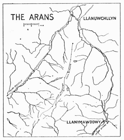
The road between the Aran and the outlying hills of the Berwyn is over 1,900 ft. high; we have, however, to descend to 860 ft. in passing from the Aran to Cader Idris. The main ridge runs almost exactly north and south for 6 miles, its west side—a large tract of marshy moorland—sloping down gently to the vales of Dyfrdwy (= the goddess's water; sometimes called the Little Dee) and Wnion, and its east side, irregularly escarped, falling for the most part very rapidly for the first thousand feet. Its ridge culminates in two peaks 1½ mile apart, Aran Benllyn (2,902 ft.) and Aran Fawddwy (2,970 ft.) The word Aran means an 'alp,' or a 'high place;' Mawdd is said to mean 'spreading,' and the terminations ach or wy mean 'water.'
Aran Benllyn was one of several of which the height was measured in Pennant's time by 'the ingenious Mr. Meredith Hughes, of Bala,' who made it out to be 30 yards less than Cader Idris.
In April 1881 the Alpine Club had one of their informal meetings at Bala, and chose the east front of the Aran as their route from there to Dolgelly.
The ordinary ascents of the Aran are effected from Llanuwchllyn in 2 hours, from Drws y Nant in 1¼ hour, and from Dinas Mawddwy in about 3 hours.
Rock Climbs.—These are never extensive, though there are many little pieces that require much ingenuity to surmount. Excepting for a few boulder climbs on the ridge itself the crag work is confined to the east face of the mountains, the side overlooking Lliwbran and Craiglyn Dyfi. Climbers are often asked, where can a man start practising rock work? The Arans are first-rate for this. Whatever the difficulty on the mountain a few minutes' traversing will generally take one out of it, if direct ascent or descent be considered undesirable. The mountain face is so broken up that we have no gullies or arêtes separated by impossible walls of rock from the easy parts of the mountain. In short, from the enthusiastic shin-scraper's point of view the architecture of the Aran face is defective.
(a) From Lliwbran.—The rocks rising from Lliwbran are columnar in structure, and by the time a generation of climbers have torn away the grass from the holds they will show up plenty of neat little problems from 50 to 100 ft. high.
Looking up from the lake the crag, which is a high dependence of Aran Benllyn, shows on the right an almost unrelieved slabbiness at an easy angle, which gives good practice in small footholds. Up to the centre of the crag is a steep grass gully, in a line with a large boulder down near the lake, with an overhanging wall that blocks the direct ascent of the gully, and with a fine clean-cut buttress on the left. We may creep up the corner of the wall on the left, or circumvent it by traversing round to the right.
The route to the ridge from the big boulder is easiest up an oblique gully just invisible from it. Between our crag and the summit of the Benllyn is an easy walk due east down to the green shoulder south of Lliwbran, that takes us quickly by Nant y Barcud and Cwm Croes to the Twrch valley and the main road. This descent to Llannwchllyn, though not direct, recommends itself in wet or misty weather, and is in any case worth taking as a variant. Aran Benllyn itself offers nothing on its broken escarpments; though the face shows up rather well in profile from a distance, the climber need scarcely use his hands in zigzagging up the face to the cairn. The view from the summit justifies our traversing the peak on the way to Aran Fawddwy. It includes the length of Bala lake and a goodly extent of Llyn Fyrnwy, and the outline of Aran Fawddwy shows up magnificently.
Passing along the ridge to the south of Benllyn we keep up at a high level for the whole distance of 1½ mile to Aran Fawddwy, the greatest depression being less than 250 ft. below Benllyn. If we bear to the left, just dipping below the ridge, we pass along the foot of an overhanging mass of rock of considerable length that is undercut in a remarkable fashion. There are many places along it where one may shelter comfortably in bad weather. It is difficult to climb up the rock direct, but towards its south extremity we may work up into a small cave and climb out by the left on to the ridge again.
Five minutes then bring us to a fine cairn that marks an easy descent to Craiglyn Dyfi, the source of the Dyfi river, with a good view of the best rocks on Aran Fawddwy. The final ascent of this peak begins after a few feet of descent to a wall that crosses the ridge at its lowest.
(b) On Craiglyn Dyfi.—A small terrace at about the level of the wall just referred to leads round the rocks to the left into a large scree gully, which offers good sport in snowy weather. Half-way along this terrace is a 'problem' of unusual severity—a narrow crack in an overhanging face, with very scanty hand-holds where the crack closes, some 20 ft. up the face. The pleasantest bit of scrambling is on to the summit of Aran Fawddwy from the lake, by the arête that is seen in outline from the large cairn on the ridge, from which point the two vertical portions of the arête are well marked. It can be reached easily from the lake, or we may descend from the cairn for some 600 ft., and then traverse across to the south till a small gully is passed that shows a cave pitch at its lower extremity. The rock arête forms the south side of this gully and runs up for 400 ft. It reminds us of the easy climb up Tryfaen from the Glyder side, though in one or two places we have difficulties here, whereas there are none on the Tryfaen scramble.
It begins below the level of the cave, and after passing over rough rocks at an easy angle we come to a fine wall with a wide crack up it on the left. A huge splintered block is fixed in the lower part of the crack, and we may surmount the block and just squeeze in, passing out on to the roof. There are one or two variations possible here. In fact, instead of starting on the arête we might pass up the gully to the cave. It has mossy walls and a dripping interior. It is marked by a small pile of stones on the right and a well-bleached sheep's skeleton in the gully just above. The pitch may be taken on the left by steep wet grass, which is unpleasant, or we can attack it direct. We go well inside, and with back to the right we find good holds on the left, thus working up until the roof itself offers hold for both hands. From here it is best to pass on to the arête a few feet below the crack above described.
The way is then easy, but interesting, and leads to a straight-up crack in a wall in front of us that has to be negotiated. It looks severe, but the surface of the rock is so rough that no real trouble is experienced with it. The crack is much more formidable to descend. Shortly after this we find ourselves out on the open face again, the gully on the left having disappeared, and only a few crags above us marking the summit of the mountain. Striking directly upwards we reach the top in a quarter of an hour, the last 25 ft. being, if we choose, by way of a chimney, that begins with some difficulty and lands us just to the left of the large cairn that marks the highest point.
(c) By Llaithnant.—Passing due south of the Aran Fawddwy cairn, along the route to Dinas, we see a fine rock in front between us and the near end of the Dyrysgol ridge, forming the head of Llaithnant. It is marked by an overhanging rock half-way down the left-hand ridge. A steep and wet scree gully leads down to the valley, and we may go part of the way down until we are about 100 ft. below the overhanging block.
Here we can strike across to the arête, and keeping close to the gully on our right have 250 ft. of fairly good scrambling. We skirt close under the big boulder, and passing to the right of it (a traverse can also be managed on the left, lower down) clamber over rather loose rock to the grass terrace above the pitch. Then good rock follows, and bearing towards the right we come in sight of a square-walled chimney overlooking the main gully, marked by small cairns at top and bottom. Its holds are all on the left, so we back up on the right and find ourselves close to the main ridge again. Another chimney still further to the right might be taken, but it is always very wet; the two pitches in it are both very small, and it is only interesting when ice is about.
A grass gully separates our arête from a few rocks nearer Dyrysgol, which are of basaltic character and rather interesting to descend.
Cader Idris.—The name ('Chair of Idris') includes the whole mountain range, some 7 miles long, that separates the Mawddach from the Dysynni. It is a continuation of the outcrop of volcanic trap rock that stretches from the Arans down to Cardigan Bay, and, as usual with such mountains, its volcanic origin has had much to do with its grand scenery.
The range runs in an E.N.E. direction from the sea south of Barmouth, and reaches its greatest elevation at Pen y Gader (2,929 ft.) It forms two other noteworthy peaks on the chain, Tyrran Mawr (2,600 ft.), 2 miles to the south-west, and Mynydd Moel (2,800 ft.), 1½ mile to the north-east.
The north side presents a fairly even front of precipitous rock for 3½ miles. Near the highest point, however, a huge amphitheatre of rock, a thousand feet in height, suggesting a volcanic crater half fallen away, breaks the continuity of the ridge, and contributes the finest bit of mountain scenery that this side of Cader can offer. Probably this hollow suggested first the name of 'Cader,' though there is a recess on the summit ridge that is usually taken to be the seat in question.
But the mountain can show something even better on the south side. Its high dependency Mynydd Pencoed joins the main ridge almost at the summit of Pen y Gader, and its extremity Craig y Cae forms with Cader itself another crater-like hollow, which, with Llyn y Cae lying at the foot of the crags, is even wilder and more magnificent than the one on the north side. Excepting the crags in this cwm the south side of Cader consists of steep grass slopes, and the general aspect of the mountain is uninteresting.
An account is published in the Gentleman's Magazine (vol. xxxviii. p. 147) of an ascent of the mountain in 1767 by L. N.
Cader Idris was also climbed in 1863 by Prince Arthur.
Several members of the Alpine Club worked their way up the direct route from Llyn y Gader in 1881, and there is some mention in the Alpine Journal (vol. xii.) of a few ascents by Mr. H. Willink.
The gullies along the north face of the mountain were explored for many years by F. H. B.
The wandering Borrow wordily describes a night adventure on Cader Idris. A pleasantly-written chapter on it may be found in Paterson's Mountaineering Below the Snow Line, and just recently an article has appeared on the same subject in the Scottish Mountaineering Journal. This latter article has a good general view of the whole length of the north face.
On the north face, between Pen y Gader and Cyfrwy, a tailor named Smith, of Newport, met his death by a fall from the crags in 1864. His body was not found until the following spring.
There is another Pen y Gader in South Wales, the highest point in the Black Forest of Carmarthen (2,630 ft.); also between Y Foel Fras and the Conway River a hill goes by the same name.
The ordinary excursions up the mountain are made from Dolgelly, by the Foxes' Path, in 2¼ hours; by the Bridle Path, in 2¾ hours, or by Mynydd Moel in 3 hours; from Arthog, easily reached by train from Barmouth, in 3 hours; from Tal y Llyn in 2 hours; and from Towyn in 4 hours.
The walk up from Towyn is by the Dysynni valley and the Bird Rock. This has a very bold and steep front, broken up by narrow ledges. It can be ascended with different degrees of ease, and is worth climbing for the view. The rock is named from its usual frequenters, the kite, hawk, and cormorant showing up in large numbers on the face.
Rock Climbs.—(a) On Mynydd Moel.—These are all fairly easy in dry weather, and are worth exploring on a slack day. Standing at the eastern corner of the little square Llyn Aran, we notice the highest point of Mynydd Moel to the west. A fine-looking arête leads up to it from the north, with a well-marked pinnacle apparently half-way up the climb. This we shall call the north ridge. A prominent pillar of unusual steepness is seen to our left, reaching to the height of the Ceu Graig ridge. Its eastern side is cut into by a narrow gully that seems from below to pass behind the pillar.
To the right of the Ceu Graig pillar is seen another gully, looking steep but grassy; it is found to offer a pleasant route on to the ridge. Above the upper screes at the foot of the higher crags several ascents may be planned from below. The best is marked by two oblique chimneys that start upwards to the left. Between this and the north ridge a large scree gully leads up to the highest part of the mountain, and from it on the right several short scrambles on good slabby rocks are obtainable.
CRAIG ADERYN (BIRD ROCK)
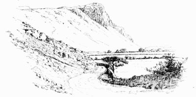
The first of the Ceu Graig gullies, counting from left to right, is to the left of the pillar, and takes three-quarters of an hour to ascend from the lake. It starts with a water slide that we take on the right, and we pass back into the gully immediately afterwards. Then the ascent of an easy chimney makes us a little wet if the weather has been rainy, and a pitch appears just above. This can be taken on the right or left. The right-hand route gives us wet rocks; the left leads up a side chimney, and back into the gully by an awkward grass traverse. After this the gully divides, and leads us to the neck that joins on to the pillar on our right.
The steep outside face of the pillar can be ascended, but is rather dangerous. It is a sample of mantelpiece climbing, but the holds are mostly of grass and heather, and some of the steps are long.
The next gully, a short distance to the right of the pillar, is more open than the first, and is less steep. Some water is generally coming down. The first obstacle is a wide cavern, that can be mounted immediately to the left or avoided by passing up the easy open chimney on that side of the gully. The second is a waterfall, and that also is by preference passed on the left; the difficulty finishes with a short corkscrew chimney. From this we emerge on to the open face of the mountain, and a few feet of good rock bring us to the main ridge. We are now at about the level of the upper limit of scree on the Mynydd Moel face, and a traverse can be effected round to the oblique chimney already referred to. In doing so we pass first a scree gully and then an inviting cleft up to the left, but this is found to lose its interest after the first 20 ft.
The oblique chimneys can be recommended for beginners, as the climbing is only about 250 ft.; the rocks are very good, and the angle about 45°. Water comes down the gully, but does not offer any trouble, except, perhaps, at the first obstacle. If this is taken direct we climb up the right wall, which overhangs, and cling sufficiently close to permit the water to pass behind us. The second pitch is taken on the right, the rock being so much undercut that we can pass behind the water. After this a little more scrambling leads to a scree and an easy finish.
SKETCH MAP OF CADER IDRIS
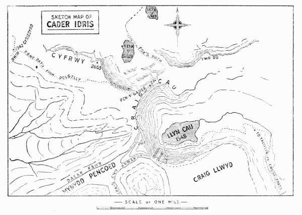
The north ridge is somewhat disappointing. It works well up to the pinnacle, which may also be approached by a dilapidated chimney on the left. But just above this, where another ridge joins from the north-west, it becomes a mere walk along the edge of a cliff.
Perhaps the neatest way of descending this cliff is by a very narrow vertical chimney, marked at top and bottom by small piles of stones, a little to the north of the big scree gully, and close to the highest point of Mynydd Moel.
(b) West of Mynydd Moel.—Here the north cliff is very much broken. There are innumerable scree gullies up the face, but the rock ridges in between them have no good features. There are one or two pinnacles just below the ridge, easy to reach from above, but difficult from below. One especially is worth a scramble, about 5 minutes' walk from Mynydd Moel; a thin and uncommonly difficult chimney leads up its outside face.
(c) On Pen y Gader.—The central gully up Pen y Gader is a prominent feature of this face of the mountain. It was climbed many years ago, but no definite account of its early history has been obtained. It is in three obvious portions, as indicated in the illustration, and is generally wet. The two shelves that divide the climb stretch obliquely upwards to the right across the whole face, and may be reached in a great variety of ways. Nevertheless the only good climbing is in the two lower portions of the main gully.
The first piece takes us on to the shelf with about 70 ft. of climbing. The gully narrows considerably, and we are forced on to the right-hand side and up a steep and smooth slope of water-worn rock. Then we cross over the water to the left, and effect an easy exit on to the ledge. We next scramble over some irregular blocks and into a narrow recess at the foot of the second pitch. This is a narrow chimney, very pleasant in dry weather, landing us in 50 ft. on to the second ledge. From here the ground is more open, and the climbing is of a slight character to the summit, except in winter, when the whole gully is apt to be heavily glazed. Under such circumstances the lowest pitch is almost dangerous.
The first pitch may be varied by striking up from the screes a few yards to the left of the main gully, by the cleft shown in the illustration. The second can be quitted altogether, and the columnar rocks to the west taken in a variety of ways; and all along the upper corridor will be found short pitches leading to the summit ridge.
(d) On Cyfrwy.—There are two well-defined arêtes leading up close to the summit of Cyfrwy. The first a a is in an easterly direction, and may be seen in profile from the direction of Pen y Gader. This is easily recognisable by the curious truncated pinnacle or tower some way up. The second bears up from the north, and also shows a pinnacle, but of smaller dimensions. Beyond the two arêtes the climbing on Cyfrwy is inferior, but between them there are a few interesting routes up the crags.
CADER IDRIS (seen across Llyn y Gader)
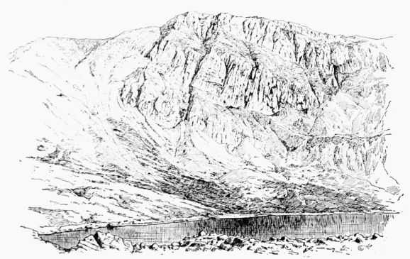
The terrace e e is easily reached from the screes. From it there are two definite climbs, one b b up a gully to the left, that leads out on to the east arête, the other c c up a more open gully that passes to the summit ridge. It is possible that the notch between the great tower and the east arête can be reached from this side, but the upper part looks difficult.
The east arête was climbed in about 1888 by the writer. The first recorded ascent was in January 1891 (H. K., W. E. S., and O. G. J.), and the first ascent by a lady in August 1891 (Miss L. G., K. W. D., and O. G. J.)
THE CYFRWY CLIMBS, FROM THE NORTH.
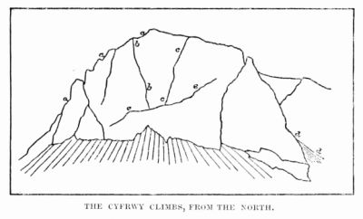
It can be followed all the way up. The tower is best turned on the right, and the vertical wall of 40 ft. that immediately follows is climbed direct from the little gap, with just a slight divergence to the left. The only serious difficulty on the arête is a wall of rock 100 ft. higher up. It can be surmounted by a thin cleft, the jammed stones in which are unsafe; or by working up the face a little to the left. The situation is very exposed. This, and any other bad bits, can generally be avoided by climbing down to the scree gully on our left. Near the top of the arête we pass the exit of the chimney b b, which descends steeply to the right.
CYFRWY ARÊTES (The northern is seen in profile, the eastern is much foreshortened)
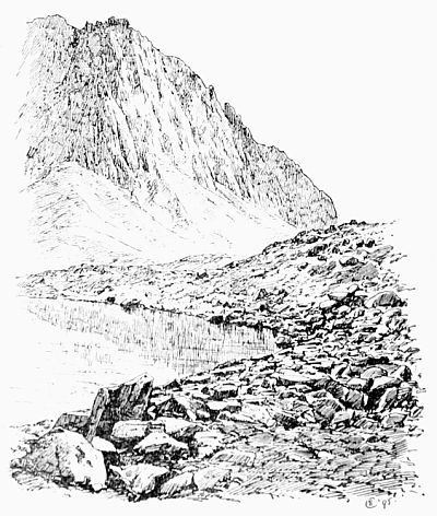
The north arête has probably not been climbed, but the gullies on each side have been taken. They call for no special comment. The one to the right is worth ascending for the view of the fine rocks on this face. It is mostly scree with a small pitch near the top, and was once marked above by a little cairn. It is admirable when hard snow is about.
The gully c c to the left is very open and risky, consisting of a series of shelves formed by the falling away of the porphyritic pillars that characterise the face.
The climb b b is rather better. The scrambling from the terrace is easy but steep, until a large overhanging boulder entirely blocks the way. We then climb up the vertical wall on the left and traverse back to the gully. It finishes very abruptly on the narrow upper ridge of the east arête, and in a most unexpected way we find ourselves looking down to Llyn y Gader with the face of Pen y Gader directly opposite.
There are a few short climbs on the face of Tyrrau Mawr, but nothing very definite can be picked out.
(e) On Craig y Cae.—The great gully of Mynydd Pencoed was climbed for the first time on May 18, 1895 (W. P. H. S., E. L. W. H. S., and O. G. J.) It is by far the finest climb in the Cader district; the work in it is as varied as in any of the more familiar gullies in the neighbourhood of Snowdon, and the rock scenery in its upper portion can scarcely be surpassed on British soil. The upper part of the gully attracted the attention of the writer in 1890, but it was not until April 1895 that he made any attempt to enter the gully at its lower extremity. Then he succeeded in forcing his way over the first pitch, but the great rush of water coming down the gully made the second pitch impossible, and the untimely fracture of an ice axe prompted a temporary withdrawal.
On the day when the successful attempt was made the rocks were unusually dry. In wet weather the difficulties of the climb are likely to be very much increased, more especially in the narrower pitches, where the route chosen by the climber is identical in position with that chosen by the water, though opposite in direction so long as valour needs diluting down to discretion. It seems probable that grass traverses may be found to circumvent the lower pitches. The first and second, for example, may be avoided by traversing into the gully from the left, over the grassy buttress that supports the Pencoed Pillar. The third pitch may be passed immediately on the left, if one treats the loose soil with due consideration. The fourth and fifth seem from above to permit an alternative route up to the right, over steep grass and back to the gully by a treacherous-looking upward traverse to the left. From here the three remaining pitches directly up the gully offer the simplest solution to the rest of the problem; variations to the left and right have been freely suggested, but are still untested.
LLYN Y CAE (OR CAU) AND CRAIG Y CAE (FROM CADER IDRIS)
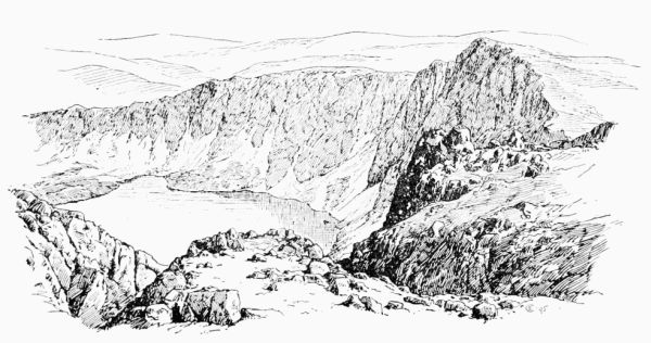
The climbing starts within 200 ft. of the level of Llyn y Cae, with a short pitch some 12 ft. high, marked above by a cairn of stones. The second pitch begins almost immediately, and must be taken direct, the roof of the cave in its upper portion to be approached by a serpentine squirm of the body after the cave is entered, up the thin crack on the right. The third pitch is ferocious in aspect, but uncertain in action, on account of the poor quality of its material. It consists of a large cavern with a pendulous mass of brittle rock hanging down from the roof somewhat to the left. The cavern is penetrated as far as possible on this side, and then, with back to the hanging rock and feet on a hold invisible from below, a passage may be effected outwards to the firm hand-holds in the open. A jammed stone with débris attached, in the most handy situation at the corner of the exit, is best left alone.
Soon after this we approach a long narrow chimney close to the left wall of the gully. It is about 35 ft. in length, and the upper part gives trouble. But a very fine foothold some 12 ft. up gives breathing space for the final portion. Then the interest ceases for a while, as we mount some 130 ft. of scree and smooth rocky slabs at an easy angle. This is an excellent arrangement, for the fifth pitch, that now comes on, is likely to demand all our powers of admiration for a while.
It consists of a cavern divided by two steep buttresses into three parts, side by side, the middle one being most open to inspection but most difficult to approach directly. Immediately above the left-hand portion a vertical chimney rises some 40 ft., its lower end projecting well over the cave and manifesting no direct route of approach from below. To get to the foot of this chimney is the chief difficulty. The method adopted was rather intricate, and probably permitted much improvement. It has, however, the advantage that the leader need not climb straight away the full 80 or 90 ft. without a halt. He first penetrates as far as possible into the cave on the left, until the roof bars further progress. Then he traverses over a dangerously smooth and wet slab, with no perceptible foothold, to the middle portion of the cavern. From here he works upwards and outwards until with a long stride he steps out on to a little ledge on the right wall of the gully. Here a hole through a large block enables him to manipulate the rope with safety, and the second man can join him. The second may reach the terrace more directly, if the rope is available, by working directly up the middle of the gully till the level of the ledge is reached; but the climbing is very uncertain, on account of the treacherous footholds. From the ledge the leader passes back across the centre and over a notched curtain of rock into the upper chimney. Here there is no doubt as to the route; a resting-place is afforded for a moment by a little cave, through the roof of which only the thinnest can hope to wriggle. The edge of this roof is mounted on the right, and a few feet higher a jammed block that dominates the pitch is turned on the right, up some rather treacherous grass that needs very careful treatment. The writer would like to add a word of advice to this already lengthy description of the pitch. Don't attempt to qualify for the through route of the little cave by slipping downwards and jamming in the chimney.
The three remaining pitches are short and near together, the last one finishing a few feet below the summit of the ridge, some 850 ft. above the lake.
East Gully.—The gully immediately to the east of the Pencoed Pillar was first climbed on May 19, 1895 (W. P. H. S., W. E. S., and O. G. J.) As seen from the opposite shores of the lake it presents a striking appearance, the middle part looking very difficult. It starts higher up the face than the western climb (about 440 ft. above the lake), and finishes on the ridge at a somewhat lower level than the top of the latter (870 ft. above lake). Thus the climbing is much reduced, and the whole ascent can be accomplished in an hour by a party of three. The scrambling in it is almost continuous, and towards the middle, where the rock walls close in the gully, the route is very steep, though none of the pitches are severe.
We begin with oblique slabs of rock rather inclined to be wet. Then the direct route lies over a block of rock with uncertain holds, but a cleft to the left promises much better, and a traverse at the top leads back easily to the gully again. The scrambling is very pleasant where the right wall begins to overhang, and remains interesting till the gully divides. From here screes lead up each part to the crest of the ridge, but a small rock arête separating the two branches give us climbing all the way.
Still more to the east is a shorter gully, composed for the most part of scree, that can be taken in 20 minutes. It has two pitches, the upper one requiring a rope. The first is taken up on either side, and is only about 12 ft. high. The second is a cave pitch with a very fine interior. The ascent is effected by backing up the rather loose walls of the cave, and then bearing out to the left and over the obstacle. From here to the summit is nothing but scree. The gully is afflicted with the near neighbourhood of badly weathered rocks, and shows signs of having been quite recently bombarded from the crags on the left.
These three gullies on Mynydd Pencoed represent all the climbing that has as yet been attempted on the south side of Cader. It is much to be hoped that a few interesting routes will yet be found between the pillar and the small col that represents the lowest portion of Craig y Cau, and the account of what has been done may induce others to visit this unfrequented region. To the same end it might be advisable to throw out the remark that the Pencoed Pillar, some 700 ft. high, looks quite inaccessible from the grassy buttress at its foot.
South Wales.
It is scarcely worth while to enumerate the southern counties, as all alike are destitute of climbs, except upon the sea cliffs. Some of these are remarkably bold and picturesque, especially about Lydstep (Tenby) and St. David's Head; but they cannot compare in any way with those of Ireland, and least of all for climbing purposes, being mainly of limestone. Just north of Aberystwith are some highly curious rocks, giving a climb or two. Some twenty years ago a schoolboy was killed by falling from them.
Of the inland rocks it will be sufficient to mention a few.
CLIFFS NEAR LYDSTEP (TENBY)
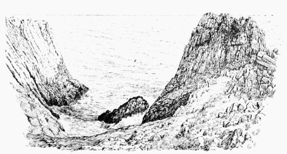
The Brecon Beacons (2,910 ft.), in Brecknockshire (which name the travellers of old, with some justice, modified to 'Breakneckshire'), are sandstone peaks of very striking outline. Indeed, Mackintosh (who saw them from the east) says, 'I was more impressed than I have been with any mountain in Wales. Their outline excited a very unusual idea of sublimity.'
Brecon is the best starting-point, and it is a good plan, though by no means necessary, to drive to the Storey Arms inn (1,400 ft.), eight miles towards Merthyr, or to go by train to Torpantau, and thus avoid walking over any part of the way twice.
CLIFFS NORTH OF ABERYSTWITH
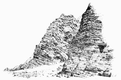
The way is easy, and easily found; but a wary eye should be kept upon the streams, which in this part of Wales are surprisingly rapid and copious.
A curious notion once prevailed that nothing would fall from the top of this hill. Many years ago an unfortunate picnicker disproved this. See the Times Index, but the statement there made that he fell 12,000 ft. is somewhat startling.
The Black Mountains, a wide stretch of charming hill-walking, have little to attract the mere climber, nor will he find much on such hills as the bastion-like Blorenge (1,720 ft.), in spite of their possessing caps of 'mill-stone grit.'
Plynlimon (2,469 ft.) is seldom mentioned except with derision.
The Beauties of Wales (1818) does indeed speak of 'the towering summit which bears the name of Plinlimmon,' and quotes the equally appropriate description given by Philips—
That cloud-piercing hill Plinlimmon from afar the traveller kens, Astonished how the goats their shrubby browse Gnaw pendent.
But, in truth, the great difficulty which travellers have, whether far or near, is to ken it at all; and many of them have vented their disappointment in words of bitter scorn.
Pennant (1770) candidly admits that he never saw it, which is easily understood, for the mountain is neither easy to see nor worth looking at when seen. The ascent is a protracted bog-walk. It was made in 1767 [19] by L. N., but Taylor, the Water Poet (1652), sensibly calls it
Tall Plinillimon, Which I no stomach had to tread upon.
An amusing notice used to be seen at Steddfa Gurig (then an inn), 2½ miles south of the summit, and 13¼ miles by road from Llanidloes: 'The notorious hill Plinlimon is on the premises.' This place, being 1,358 ft. above the sea, is the best starting-point for the ascent of the mountain, and coaches run past it from Llanidloes.
Aberedw Rocks are fairly typical of the kind of climbing which is to be found in South Wales. The rocks being quite close to the station of that name on the Cambrian Railway, are brought within easy reach of Rhayader and Builth Wells on the north and of Brecon on the south. Three or four rock terraces, 15 to 20 ft. high, break the slope of the hill beside the railway, and a sort of rocky cove penetrates it as well. Bits here and there are not unlike the 'chimneys' on Slieve League, but the material is more friable, resembling loose walls of very inferior slaty fragments. A few harder masses stand out picturesquely as small pinnacles, especially in the cove, near the head of which a lofty bulging piece of rock has a vertical rift in it, which for a few feet offers quite a difficult climb.
The river Edw (close by) has extremely steep, cliff-like banks, and these are a common feature in other tributaries of the Wye. The Bachwy, for instance, has a gorge which, seen as the writer has seen it during a winter flood, is profoundly impressive. Malkin's description (1804) should not be missed. He found 'rudely-shaped eccentricities of nature, with all the mysterious gloom of vulgar and traditional ascription,' 'dwarfishly fructified rock,' 'features all of a revolting cast,' and 'a prospect rude and unchastised.'
The Irvon, again, has sides so rocky as to be chosen by the falcon for nesting.
Cwm Elan, 5 or 6 miles from Rhyader, is a very pretty spot, and the gorge of Cefn Coch is exceedingly striking. Mackintosh says that the height is not less than 800 ft., and the cliffs are in many parts mural and quite perpendicular. He declared that, while the cliffs on the left-hand side of the river are very fine, he had seen nothing to surpass those on the right. This from a hill traveller of his experience is remarkably high praise. The writer has only visited these rocks once, and has never attempted to climb there, nor, indeed, has he ever heard of anyone else doing so. The Birmingham reservoir is to submerge several miles of this cwm and the two houses in which Shelley stayed.
Stanner Rocks are quite near the station of the same name on the branch of the Great Western from Leominster to New Radnor, and on the north side of the railway. The material of which they are composed is superior for climbing purposes to the soft shaly stuff so common in South Wales, being the same eruptive trap rock which forms the hills of Hunter, Worsel, and Old Radnor, and has metamorphosed the surrounding limestone. These rocks narrowly miss being a good climb. The train from Leominster takes about 50 minutes.
Near New Radnor is a precipice down which Cliffe (1854) mentions that a gentleman rode, and he also records that another climbed the fall called Waterbreakitsneck.