LIST OF ILLUSTRATIONS.
Reading edition
Portrait of the Author ....... Frontispiece [missing]
PAGE
The Colorado River ......16
Parunuweap Canyon .....18
Bird's-eye View of the Cliffs ....19
San Francisco Peak .....21
Cliff near Fort Wingate .....22
Scenery on the High Plateaus ...23
The Mogollon Escarpment ....25
Snow-clad Mountains on the River ..26
Our Messenger ......28
Apache Basket ......29
Our Messenger's Wife .....30
Ruins of Toyalone .....31
A Zuñí Court .......33
Adobe Church, Zuñi .....34
The Site of Moenkopi . . . . . . . . 36
Mountain of the Holy Cross ...38
Wingate Cliff .......40
Pyramid Butte near Fort Wingate ..41
Zuñi Cliffs .......42
Great Neck Nine Miles South of Salazar .43
Cinder Cone and Neck, Northeast of Grant Station 44
Two Large Necks, the More Distant One being the Cabazon45
Neck Six Miles Northeast of Juantafoya ..46
A Group of Necks near Mount Taylor .47
Panorama from the Edge of Mount Taylor Mesa 48
Panorama in the Valley of the Puerco .50
Ruins at the Head of McElmo Canyon . . . 52
A Navajo Hogan ......53
An Ancient Coiled Vase from Tusayan ..54
A Typical Cliff Dwelling ....56
A Room in a Pueblo .....57
A Navajo Ready for a Journey ...58
A Navajo Boy .......59
Gardens of Zuñi ......60
A Tusayan Ladder ......61
A Zuñi Stool ......61
X CANYONS OF THE COLORADO.
PAGE
A Tusayan Field Shelter .....62
Another Tusayan Field Shelter ...63
View of Hano, One of the Seven Pueblos of Tusayan . 64
Mesa Verde . . . . ... . . between 64 and 65
Mount Moran, Teton Range, Wyoming ..66
Marble Basins, Mammoth Hot Springs, Yellowstone Park 69
Terraced Basins, Mammoth Hot Springs, Yellowstone Park 70
Tabernacle Crater and Lava Beds of the Basin Province 73
View on Great Salt Lake Desert, showing Mountains half buried by Lake Sediments .....74
An Indian Hunter ......76
Reservoir Butte, showing Terraces of the Ancient Lake Bonneville Shorelines . . . . . . . 77
Pavant Butte, over a Submarine Volcano of the Great Basin 78
An Indian Camp ......79
Indians Gambling ......80
Ruin near Moenkopi .....81
Ruins of Payupki, Six Miles Northwest of Mashongnavi, Tusayan .. 82
Shupaulovi .......85
General View of Zuñi, looking West ..86
The Gray Cliffs ......88
Section and Bird's-eye View of the Plateaus North of the Grand Canyon ......90
A Group of Stone Corrals ....91
Ruins ........92
Lagoon on the Kaibab .....95
Pink Cliffs, Paunsagunt Plateau ...96
A Permian Butte ......99
Vermilion Cliffs at Kanab .....100
A Midsummerday's Dream on the Colob .103
An Indian Village ......104
Antinaints, Putusiv, and Wichuts in Festal Dress . 105
Perspective View of Typical Solitary House .106
Perspective View of Round-House Structure of Lava . 107
An Ancient Cliff House .....108
A Zuñi Eagle Cage .....109
A View of Zuñi ......110
Walpi Dance Rock .....112
A Passageway in Walpi .....114
A Passageway in Mashongnavi ...115
The Hurricane Fault ..... between 114 and 115
Temples and Towers of the Rio Virgen . between 114 and 115
Towers of the Vermilion Cliffs .... between 114 and 115
Panorama ....... between 114 and 115
Terraced Houses in Zuñi .....116
The Start from Green River Station ..118
View in Sichumovi ......121
Trail up Walpi Mesa .....122
Ridges on Bitter Creek .....123
Mesas ........124
LIST OF ILLUSTRATIONS. XI
PAGE
A Valley West of Green River ...125
Alcove Lands ......126
Bad Lands . . . . . . . . . . 127
Our Indian Guide .....128
Our Guide's Boy ......129
Green River Plains .....130
The Chief Kiva of Shupaulovi . . . . . . 131
Walpi .........132
Camp at Flaming Gorge . . . . . . . 134
Mashongnavi, with Shupaulovi in the Distance . . 135
Horseshoe Canyon ......136
Scene in Hano ......139
Pescado Pueblo, Outside Steps ....140
Oven near Pescado Pueblo ....141
Primitive Andiron in Shumopavi ...142
Tusayan Mealing-Stones ....143
Kiva and Stone Corrals of Mashongnavi ..144
"Hogbacks" with Intervening Valleys .146
An Ancient Pueblo Metate ....148
The Home of the Chief ....150
Gate of Lodore .......153
Wreck at Disaster Falls . . . . . . 155
Metalliferous Veins exposed to View ..156
Winnie's Grotto, a Side Canyon ...159
Eroded Towers capped with Large Blocks of Sandstone . 161
Fire in Camp ......162
An Isolated House at Zuñi ....164
An Oraibi Court ......166
The Rescue . . . . . . . . . ...169
Echo Park .......170
Fragment of Wall, Zuñi .....171
Kivas of Shumopavi .....172
General View of Awatubi . . . . . . . 173
Swallow Cave . . . . . . . . 175
View of Shumopavi . . . . . . . . 177
Ruins .......178, 179
Indian Lodge in the Uinta Valley ...181
Warrior and Bride .....183
Our Interpreter and His Family ...185
House Building at Oraibi ....186
General View of Ojo Caliente ....188
Sumner's Amphitheater ....190
Chimneys and Roofs, Zuñi ....193
A Tusayan Interior .....194
Lighthouse Rock, Canyon of Desolation ..197
Gunnison Butte, Gray Canyon ...199
Ruins of Ketchipauau .....201
Bird's-eye View of the Land of the Standing Rocks . 202
The Butte of the Cross .....204
Land of the Standing Rocks . . . . 205
XII
CANYONS OF THE COLORADO.
PAGE
Moenkopi .......207
Oraibi Houses .......208
The Heart of Marble Canyon ...210
A Lateral Canyon. ......213
A Tusayan Mealing Trough. ...215
The Heart of Cataract Canyon . . . . . 217
Water Basin in Gypsum Canyon ...219
The Water Pocket Canyon ....221
Plan of the Ruin of Kiu-Tiel, near Tusayau . . 222
Pescado Houses .......225
Repairing Boats at the Mouth of Dirty Devil River . 226
Ruins on the Brink of Glen Canyon ..228
Island Monument iu Glen Canyon ...231
Glen Canyon .......232
An Enclosing Wall of Upright Stones at Ojo Caliente 235
Marble Canyon .......236
Noonday Rest in Marble Canyon ..239
View of Marble Canyon from Vermilion Cliffs . . 240
Adobe Walls, Zuñi .....243
At the Mouth of the Little Colorado ..246
Walls of Gneiss ......249
Running a Rapid ......250
Head of the Grand Canyon ....252
The Inner Gorge ......254
Signal of Discovery or Alarm . . . . . 257
Signal, "Who are you?" Answer, "Pani" . . . ...258
Signal of Successful War Party ...261
A Signal of Peace ......262
Moki Method of Dressing the Hair ..265
Moki Method of Spinning ....266
An Alcove in the Red Wall ...269
Kanab Canyon, near the Junction ...270
Kanab Canyon in the Red Wall Limestone . . 273
The Brink of the Inner Gorge ....275
The Grand Canyon of the Colorado, showing Amphitheater and Sculptured Buttes .....276
Climbing the Grand Canyon Wall ..279
Triangulation Station .....281
Cavate Houses ......283
Standing Rocks .......285
Mount Trumbull, from Mount Logan ..288
Mary's Veil, the Upper Fall on Pine Creek . . . 290
Filling's Cascade, the Lower Palls on Pine Creek . 291
Aboriginal Ladder . ... . . . . . 292
Another Style of Ladder ....293
Entrance to Parunuweap .....295
Towers on the Rio Virgen ....296
Mukuntuweap Canyon . . . . . . . 298
The Witches' Water Pocket ....301
Wunavai Gathering Seeds .....302
LIST OF ILLUSTRATIONS. Xlll
PAGE
Terrace Fireplace and Chimney of Shumopavi . . 305
A Sweat House .......306
An Interior Lodge ......309
Halved and Pinned Trapdoor Frame of Zuñí Kiva . . 310
Wooden Pivot Hinges of a Zuñi Door .310
A Poultry House of Sichumovi resembling an Oven . 312
The Human Pickle .....314
Recent Lava Flow on the Uinkaret . . . . . 317
A Zuñi Window glazed with Selenite ..318
A Zuñi Chair .......319
An Ancient Circular Doorway or "Stone Close" in Kin-Tiel 320
A Gaming Ring ......320
Interior View of a Tusayan Kiva ..322
Cave Lake in Kanab Canyon ....324
Ancient Pottery from Tusayan ...326
Tusayan Fetiches and Implements ...329
Dance Paraphernalia from Tusayan ..332
The Thousand Wells .....334
Terraced Houses in Oraibi showing Entrance to Kiva in Foreground ........335
The House of Talti, Chief of the Council in the Town of Oraibi 337
Praying for Rain ......339
Mashongnavi .......340
Tusayan Trays .......341
Tusayan Maskettes .....343
Sichumovi and Hano .....344
Walpi, a Village of Tusayan ...346
Tusayan Basketry ....330, 348, 349
Zuñi from Housetops, looking East ..350
Navajo Indian with Silver Ornaments ..352
Bringing down the Batten . . . . 353
Navajo Church, near Fort Wingate ...354
Round Tower on a Rock ....355
Toyalone, from the Top of a House in Zuñi .356
Typical Terraced Communal Pueblo ..357
Dancer holding up the Great Plumed Arrow .358
Dancer "swallowing" the Great Plumed Arrow . 359
Navajo Woman weaving a Belt ...360
Navajo Woman spinning ....361
A Room in a Zuñi House ....362
Ashtishkee, a Navajo Chief ....365
Navajo Medicine Lodge, viewed from the South . . 366
Navajo Medicine Lodge, viewed from the East . . 367
Navajo Fire Dance ......368
Workshop of Navajo Silversmith ...369
Zuñi Woman weaving a Belt ....370
Weaving of Diamond-shaped Diagonals .371
Zuñi Fetiches .......372
Effigy Pottery from Zuñi ....373
Zuñi Pottery .......374
XIV CANYONS OF THE COLORADO.
PAGE
Zuñi Grails .......375
Culinary Pottery from Zuñí . . . . . . 376
Navajo Fabrics ......377
The Grand Canyon ......378
A Gable with Pinnacles ....381
Niches or Panels in the Red Wall Limestone .382
Bounded Inward Curves and Projecting Cusps of the Walls ...384
The Eastern Temple ......387
The Western Temple .....388
Granite Falls, Kaibab Division, Grand Canyon . . 391
Dikes in the Canyon Wall ....392
Pinnacles of the Kaibab .....395
Vishnu's Temple ......396
Key to the Panorama from Point Sublime, looking East, between 396 and ...397
Key to the Panorama from Point Sublime, looking West, between ...396 and ...397
Key to the Panorama from Point Sublime, looking South, between ...396 and ...397
Grand Canyon at the Foot of the Toroweap, looking East, between ...396 and ...397
The Great Unconformity at the Head of the Grand Canyon, between ...396 and ...397
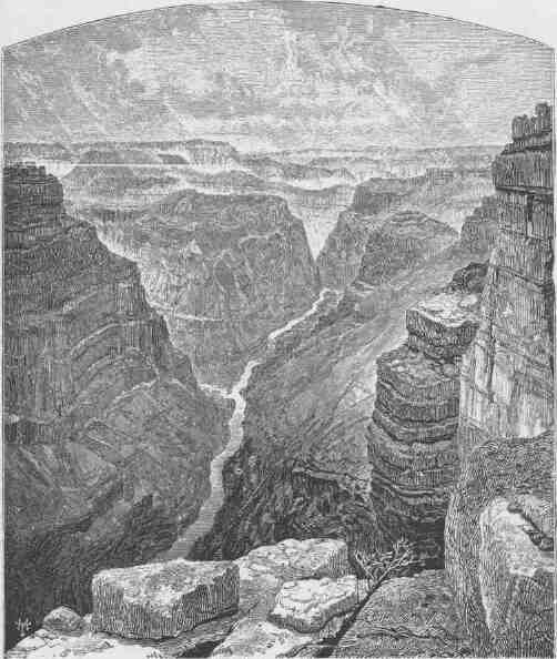
THE COLORADO RIVER.
CANYONS OF THE COLORADO.
CHAPTER I.
THE VALLEY OF THE COLORADO.
THE Colorado River is formed by the junction of the Grand and Green.
The Grand River has its source in the Rocky Mountains, five or six miles west of Long's Peak. A group of little alpine lakes, that receive their waters directly from perpetual snowbanks, discharge into a common reservoir known as Grand Lake, a beautiful sheet of water. Its quiet surface reflects towering cliffs and crags of granite on its eastern shore, and stately pines and firs stand on its western margin.
The Green River heads near Fremont's Peak, in the Wind River Mountains. This river, like the Grand, has its sources in alpine lakes fed by everlasting snows. Thousands of these little lakes, with deep, cold, emerald waters, are embosomed among the crags of the Rocky Mountains. These streams, born in the cold, gloomy solitudes of the upper mountain region, have a strange, eventful history as they pass down through gorges, tumbling in cascades and cataracts, until they reach the hot, arid plains of the Lower Colorado, where the waters that were so clear above empty as turbid floods into the Gulf of California.
The mouth of the Colorado is in latitude 31 degrees 53 minutes and longitude 115 degrees. The source of the Grand River is in latitude 40 degrees 17' and longitude 105 degrees 43' approximately. The source of the Green River is in latitude 43 degrees 15' and longitude 109 degrees 54' approximately.
The Green River is larger than the Grand and is the upper continuation of the Colorado. Including this river, the whole length of
CANYONS OF THE COLORADO.
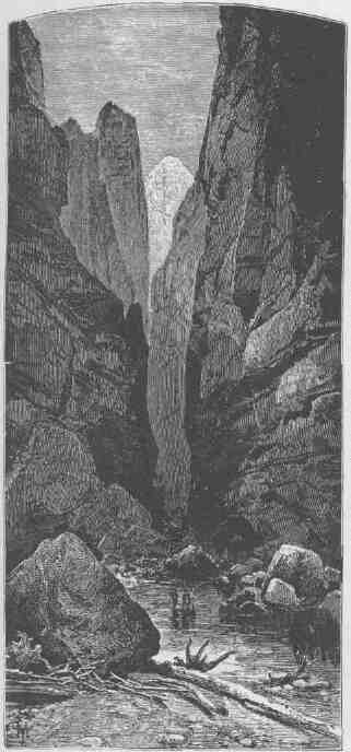
PA-RÚ-NU-WEAP CANYON.
the stream is about 2,000 miles. The region of country drained by the Colorado and its tributaries is about 800 miles in length and varies from 300 to 500 miles in width, containing about 300,000 square miles, an area larger than all the New England and Middle States with Maryland, Virginia and West Virginia added, or nearly as large as Minnesota, Wisconsin, Iowa, Illinois, and Missouri combined.
There are two distinct portions of the basin of the Colorado, a desert portion below and a plateau portion above. The lower third, or desert portion of the basin, is but little above the level of the sea, though here and there ranges of moun-
THE VALLEY OF THE COLORADO.
tains rise to an altitude of from 2,000 to 6,000 feet. This part of the valley is bounded on the northeast by a line of cliffs, which present a bold, often vertical step, hundreds or thousands of feet to the table-lands above. On the California side a vast desert stretches westward, past the head of the Gulf of California, nearly to the shore of the Pacific. Between the desert and the sea a narrow belt of valley, hill, and mountain of wonderful beauty is found. Over this coastal zone there falls a balm distilled from the great ocean, as gentle showers and refreshing dews bathe the land. When rains come the emerald hills laugh with delight as bourgeoning bloom is spread in the sunlight. When the rains have ceased all the verdure turns to gold. Then slowly the hills are brinded
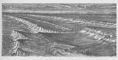
BIRD'S-EYE VIEW OF THE CLIFFS.
until the rains come again, when verdure and bloom again peer through the tawny wreck of the last year's greenery. North of the Gulf of California the desert is known as "Coahuila Valley," the most desolate region on the continent. At one time in the geologic history of this country the Gulf of California extended a long distance farther to the northwest, above the point where the Colorado River now enters it; but this stream brought its mud from the mountains and the hills above and poured it into the gulf and gradually erected a vast dam across it, until the waters above were separated from the waters below; then the Colorado cut a channel into the lower gulf. The upper waters, being cut off from the sea, gradually evaporated, and what is known as Coahuila Valley was the bottom of this ancient upper gulf,
CANYONS OF THE COLORADO.
and thus the land is now below the level of the sea. Between Coahuila Valley and the river there are many low, ashen-gray mountains standing in short ranges. The rainfall is so little that no perennial streams are formed. When a great rain comes it washes the mountain sides and gathers on its way a deluge of sand, which it spreads over the plain below, for the streams do not carry the sediment to the sea. So the mountains are washed down and the valleys are filled. On the Arizona side of the river desert plains are interrupted by desert mountains. Far to the eastward the country rises until the Sierra Madre are reached in New Mexico, where these mountains divide the waters of the Colorado from the Rio Grande del Norte. Here in New Mexico the Gila River has its source. Some of its tributaries rise in the mountains to the south, in the territory belonging to the republic of Mexico, but the Gila gathers the greater part of its waters from a great plateau on the northeast. Its sources are everywhere in pine-clad mountains and plateaus, but all of the affluents quickly descend into the desert valley below, through which the Gila winds its way westward to the Colorado. In times of continued drought the bed of the Gila is dry, but the region is subject to great and violent storms, and floods roll down from the heights with marvelous precipitation, carrying devastation on their way. Where the Colorado River forms the boundary between California and Arizona it cuts through a number of volcanic rocks by black, yawning canyons. Between these canyons the river has a low but rather narrow flood plain, with cottonwood groves scattered here and there, and a chaparral of mesquite bearing beans and thorns. Four hundred miles above its mouth and more than two hundred miles above the Gila, the Colorado has a second tributary--"Bill Williams' River" it is called by excessive courtesy. It is but a muddy creek. Two hundred miles above this the Rio Virgen joins the Colorado. This river heads in the Markagunt Plateau and the Pine Valley Mountains of Utah. Its sources are 7,000 or 8,000 feet above the sea, but from the beautiful course of the upper region it soon drops into a great sandy valley below and becomes a river of flowing sand. At ordinary stages it is very wide but very shallow, rippling over the quicksands in tawny waves. On its way it cuts through the Beaver Mountains by a weird canyon. On either side grease-wood plains stretch far away, interrupted here and there by bad-land hills.
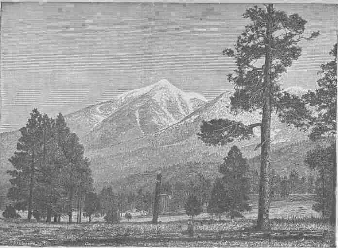
SAN FRANCISCO PEAK.
CANYONS OF THE COLORADO.
The region of country lying on either side of the Colorado for six hundred miles of its course above the gulf, stretching to Coahuila Valley below on the west and to the highlands where the Gila heads on the east, is one of singular characteristics. The plains and valleys are low, arid, hot, and naked, and the volcanic mountains scattered here and there are lone and desolate. During the long months the sun pours its heat upon the rocks and sands, untempered by clouds above or forest shades beneath. The springs are so few in number that their names are household words in every Indian rancheria and every
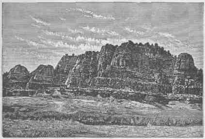
CLIFF NEAR FORT WINGATE.
settler's home; and there are no brooks, no creeks, and no rivers but the trunk of the Colorado and the trunk of the Gila. The few plants are strangers to the dwellers in the temperate zone. On the mountains a few junipers and piñons are found, and cactuses, agave, and yuccas, low, fleshy plants with bayonets and thorns. The landscape of vegetal life is weird--no forests, no meadows, no green hills, no foliage, but clublike stems of plants armed with stilettos. Many of the plants bear gorgeous flowers. The birds are few, but often of rich plumage. Hooded rattlesnakes, horned toads, and lizards crawl in the dust and among the rocks. One of these lizards, the "Gila monster," is
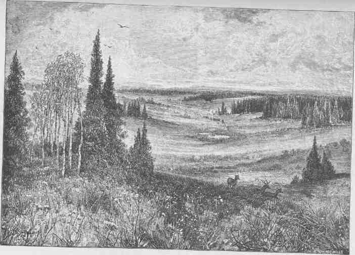
SCENERY ON THE HIGH PLATEAUS.
CANYONS OF THE COLORADO.
poisonous. Rarely antelopes are seen, but wolves, rabbits, and sundry ground squirrels abound.
The desert valley of the Colorado, which has been described as distinct from the plateau region above, is the home of many Indian tribes. Away up at the sources of the Gila, where the pines and cedars stand and where creeks and valleys are found, is a part of the Apache land. These tribes extend far south into the republic of Mexico. The Apaches are intruders in this country, having at some time, perhaps many centuries ago, migrated from British America. They speak an Athapascan language. The Apaches and Navajos are the American Bedouins. On their way from the far North they left several colonies in Washington, Oregon, and California. They came to the country on foot, but since the Spanish invasion they have become skilled horsemen. They are wily warriors and implacable enemies, feared by all other tribes. They are hunters, warriors, and priests, these professions not yet being differentiated. The cliffs of the region have many caves, in which these people perform their religious rites. The Sierra Madre formerly supported abundant game, and the little Sonora deer was common. Bears and mountain lions were once found in great numbers, and they put the courage and prowess of the Apaches to a severe test. Huge rattlesnakes are common, and the rattlesnake god is one of the deities of the tribes.
In the valley of the Gila and on its tributaries from the northeast are the Pimas, Maricopas, and Papagos. They are skilled agriculturists, cultivating lands by irrigation. In the same region many ruined villages are found. The dwellings of these towns in the valley were built chiefly of grout, and the fragments of the ancient pueblos still remaining have stood through centuries of storm. Other pueblos near the cliffs on the northeast were built of stone. The people who occupied them cultivated the soil by irrigation, and their hydraulic works were on an extensive scale. They built canals scores of miles in length and built reservoirs to store water. They were skilled workers in pottery. From the fibers of some of the desert plants they made fabrics with which to clothe themselves, and they cultivated cotton. They were deft artists in picture-writings, which they etched on the rocks. Many interesting vestiges of their ancient art remain, testifying to their skill as savage
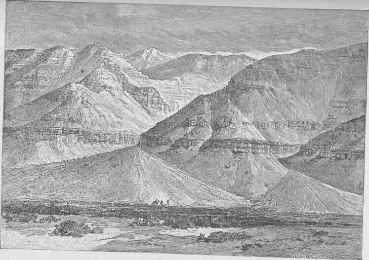
THE MOGOLLON ESCARPMENT.
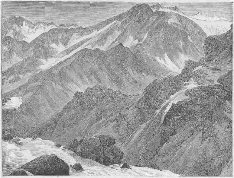
SNOW-CLAD MOUNTAINS ON THE RIVER.
THE VALLEY OF THE COLORADO.
artisans. It seems probable that the Pimas, Maricopas, and Papagos are the same people who built the pueblos and constructed the irrigation works; so their traditions state. It is also handed down that the pueblos were destroyed in wars with the Apaches. In these groves of the flood plain of the Colorado the Mojave and Yuma Indians once had their homes. They caught fish from the river and snared a few rabbits in the desert, but lived mainly on mesquite beans, the hearts of yucca plants, and the fruits of the cactus. They also gathered a harvest from the river reeds. To some slight extent they cultivated the soil by rude irrigation and raised corn and squashes. They lived almost naked, for the climate is warm and dry. Sometimes a year passes without a drop of rain. Still farther to the north the Chemehuevas lived, partly along the river and partly in the mountains to the west, where a few springs are found. They belong to the great Shoshonian family. On the Rio Virgen and in the mountains round about, a confederacy of tribes speaking the Ute language and belonging to the Shoshonian family have their homes. These people built their sheltering homes of boughs and the bast of the juniper. In such shelters, they lived in winter, but in summer they erected extensive booths of poles and willows, sometimes large enough for the accommodation of a tribe of 100 or 200 persons. A wide gap in culture separates the Pimas, Maricopas, and Papagos from the Chemehuevas. The first were among the most advanced tribes found in the United States; the last were among the very lowest; they are the original "Digger" Indians, called so by all the other tribes, but the name has gradually spread beyond its original denotation to many tribes of Utah, Nevada, and California.
The low desert, with its desolate mountains, which has thus been described is plainly separated from the upper region of plateau by the Mogollon Escarpment, which, beginning in the Sierra Madre of New Mexico, extends northwestward across the Colorado far into Utah, where it ends on the margin of the Great Basin. The rise by this escarpment varies from 3,000 to more than 4,000 feet. The step from the lowlands to the highlands which is here called the Mogollon Escarpment is not a simple line of cliffs, but is a complicated and irregular facade presented to the southwest. Its different portions have been named by the people living below as distinct mountains, as Shiwits Mountains, Mogollon
CANYONS OF THE COLORADO.
Mountains, Piñal Mountains, Sierra Calitro, etc., but they all rise to the summit of the same great plateau region.
The upper region, extending to the headwaters of the Grand and Green Rivers, constitutes the great Plateau Province. These plateaus are drained by the Colorado River and its tributaries; the eastern and
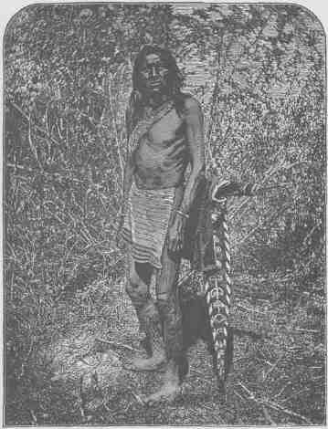
OUR MESSENGER.
southern margin by the Rio Grande and its tributaries, and the western by streams that flow into the Great Basin and are lost in the Great Salt Lake and other bodies of water that have no drainage to the sea. The general surface of this upper region is from 5,000 to 8,000 feet above sea level, though the channels of the streams are cut much lower.
THE VALLEY OF THE COLORADO.
This high region, on the east, north, and west, is set with ranges of snow-clad mountains attaining an altitude above the sea varying from 8,000 to 14,000 feet. All winter long snow falls on its mountain-crested rim, filling the gorges, half burying the forests, and covering the crags and peaks with a mantle woven by the winds from the waves of the sea. When the summer sun comes this snow melts and tumbles down the mountain sides in millions of cascades. A million cascade brooks unite to form a thousand torrent creeks; a thousand torrent creeks unite to form half a hundred rivers beset with cataracts; half a hundred roaring rivers unite to form the Colorado, which rolls, a mad, turbid stream, into the Gulf of California.
Consider the action of one of these streams. Its source is in the mountains, where the snows fall; its course, through the arid plains. Now, if at the river's flood storms were falling on the plains, its channel would be cut but little faster than the adjacent country would be washed, and the general level would thus be preserved; but under the conditions here mentioned, the river. continually deepens its beds; so all the streams cut deeper and still deeper, until their banks are towering cliffs of solid rock. These deep, narrow gorges are called canyons.
For more than a thousand miles along its course the Colorado has cut for itself such a canyon; but at some few points where lateral streams join it the canyon is broken, and these narrow, transverse valleys divide it into a series of canyons.
The Virgen, Kanab, Paria, Escalante, Fremont, San Rafael, Price, and Uinta on the west, the Grand, White, Yampa, San Juan, and Colorado Chiquito on the east, have also cut for themselves such narrow winding gorges, or deep canyons. Every river entering these has cut another canyon; every lateral creek has cut a canyon; every brook runs in a canyon; every rill born of a shower and born again of a shower and living only during these showers has cut for itself a canyon; so that
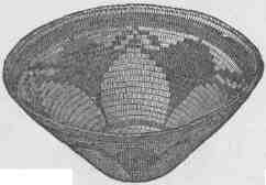
APACHE BASKET
CANYONS OF THE COLORADO.
the whole upper portion of the basin of the Colorado is traversed by a labyrinth of these deep gorges.
Owing to a great variety of geological conditions, these canyons differ much in general aspect. The Rio Virgen, between Long Valley and the Mormon town of Rockville, runs through Parunuweap Can-
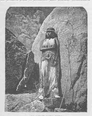
OUR MESSENGER'S WIFE.
yon, which is often not more than 20 or 30 feet in width and is from 600 to 1,500 feet deep. Away to the north the Yampa empties into the Green by a canyon that I essayed to cross in the fall of 1868, but was baffled from day to day, and the fourth day had nearly passed before I could find my way down to the river. But thirty miles above its mouth this canyon ends, and a narrow valley with a flood plain
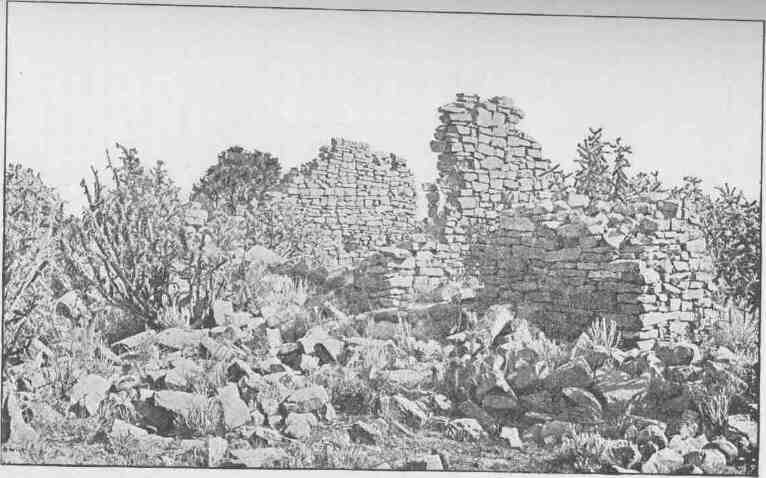
RUINS OF TOYALONE.
CANYONS OF THE COLORADO.
is found. Still farther up the stream the river comes down through another canyon, and beyond that a narrow valley is found, and its upper course is now through a canyon and now through a valley. All these canyons are alike changeable in their topographic characteristics.
The longest canyon through which the Colorado runs is that between the mouth of the Colorado Chiquito and the Grand Wash, a distance of 217 1/2 miles. But this is separated from another above, 65 1/2 miles in length, only by the narrow canyon valley of the Colorado Chiquito.
All the scenic features of this canyon land are on a giant scale, strange and weird. The streams run at depths almost inaccessible, lashing the rocks which beset their channels, rolling in rapids and plunging in falls, and making a wild music which but adds to the gloom of the solitude. The little valleys nestling along the streams are diversified by bordering willows, clumps of box elder, and small groves of cottonwood.
Low mesas, dry, treeless, stretch back from the brink of the canyon, often showing smooth surfaces of naked, solid rock. In some places the country rock is composed of marls, and here the surface is a bed of loose, disintegrated material through which one walks as in a bed of ashes. Often these marls are richly colored and variegated. In other places the country rock is a loose sandstone, the disintegration of which has left broad stretches of drifting sand, white, golden, and vermilion. Where this sandstone is a conglomerate, a paving of pebbles has been left,--a mosaic of many colors, polished by the drifting sands and glistening in the sunlight.
After the canyons, the most remarkable features of the country are the long lines of cliffs. These are bold escarpments scores or hundreds of miles in length,--great geographic steps, often hundreds or thousands of feet in altitude, presenting steep faces of rock, often vertical. Having climbed one of these steps, you may descend by a gentle, sometimes imperceptible, slope to the foot of another. They thus present a series of terraces, the steps of which are well-defined escarpments of rock. The lateral extension of such a line of cliffs is usually very irregular; sharp salients are projected on the plains below, and deep recesses are cut into the terraces above. Intermittent streams coming
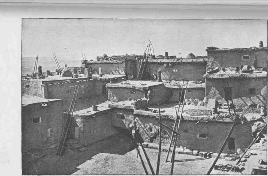
A ZUÑI COURT.
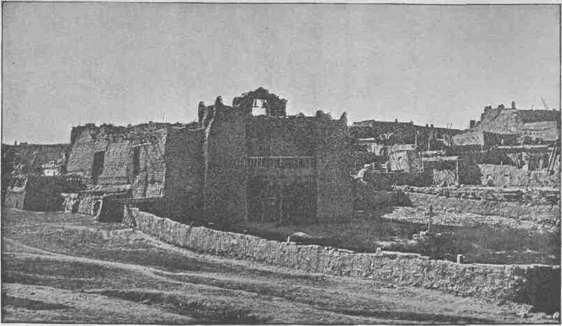
ADOBE CHURCH--ZUÑI.
THE VALLEY OF THE COLORADO.
down the cliffs have cut many canyons or canyon valleys, by which the traveler may pass from the plain below to the terrace above. By these gigantic stairways he may ascend to high plateaus, covered with forests of pine and fir.
The region is further diversified by short ranges of eruptive mountains. A vast system of fissures--huge cracks in the rocks to the depths below--extends across the country. From these crevices floods of lava have poured, covering mesas and table-lands with sheets of black basalt. The expiring energies of these volcanic agencies have piled up huge cinder cones that stand along the fissures, red, brown, and black, naked of vegetation, and conspicuous landmarks, set as they are in contrast to the bright, variegated rocks of sedimentary origin.
These canyon gorges, obstructing cliffs, and desert wastes have prevented the traveler from penetrating the country, so that until the Colorado River Exploring Expedition was organized it was almost unknown. In the early history of the country Spanish adventurers penetrated the region and told marvelous stories of its wonders. It was also traversed by priests who sought to convert the Indian tribes to Christianity. In later days, since the region has been under the control of the United States, various government expeditions have penetrated the land. Yet enough had been seen in the earlier days to foment rumor, and many wonderful stories were told in the hunter's cabin and the prospector's camp--stories of parties entering the gorge in boats and being carried down with fearful velocity into whirlpools where all were overwhelmed in the abyss of waters, and stories of underground passages for the great river into which boats had passed never to be seen again. It was currently believed that the river was lost under the rocks for several hundred miles. There were other accounts of great falls whose roaring music could be heard on the distant mountain summits; and there were stories current of parties wandering on the brink of the canyon and vainly endeavoring to reach the waters below, and perishing with thirst at last in sight of the river which was roaring its mockery into their dying ears.
The Indians, too, have woven the mysteries of the canyons into the myths of their religion. Long ago there was a great and wise chief who mourned the death of his wife and would not be comforted,
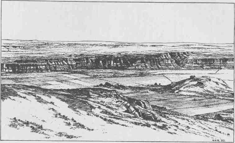
THE SITE OF MOENKOPI.
THE VALLEY OF THE COLORADO.
until Tavwoats, one of the Indian gods, came to him and told him his wife was in a happier land, and offered to take him there that he might see for himself, if, upon his return, he would cease to mourn. The great chief promised. Then Tavwoats made a trail through the mountains that intervene between that beautiful land, the balmy region of the great west, and this, the desert home of the poor Numa. This trail was the canyon gorge of the Colorado. Through it he led him; and when they had returned the deity exacted from the chief a promise that he would tell no one of the trail. Then he rolled a river into the gorge, a mad, raging stream, that should engulf any that might attempt to enter thereby.
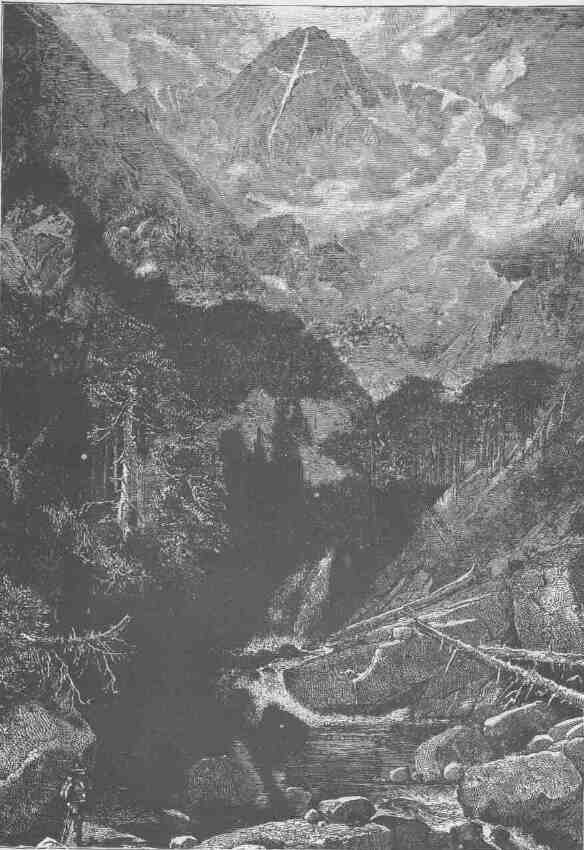
MOUNTAIN OF THE HOLY CROSS.
CHAPTER II.
MESAS AND BUTTES.
FROM the Grand Canyon of the Colorado a great plateau extends southeastward through Arizona nearly to the line of New Mexico, where this elevated land merges into the Sierra Madre. The general surface of this plateau is from 6,000 to 8,000 feet above the level of the sea. It is sharply defined from the lowlands of Arizona by the Mogollon Escarpment. On the northeast it gradually falls off into the valley of the Little Colorado, and on the north it terminates abruptly in the Grand Canyon.
Various tributaries of the Gila have their sources in this escarpment, and before entering the desolate valley below they run in beautiful canyons which they have carved for themselves in the margin of the plateau. Sometimes these canyons are in the sandstones and limestones which constitute the platform of the great elevated region called the San Francisco Plateau. The escarpment is caused by a fault, the great block of the upper side being lifted several thousand feet above the valley region. Through the fissure lavas poured out, and in many places the escarpment is concealed by sheets of lava. The canyons in these lava beds are often of great interest.
On the plateau a number of volcanic mountains are found, and black cinder cones are scattered in profusion. Through the forest lands are many beautiful prairies and glades that in midsummer are decked with gorgeous wild flowers. The rains of the region give source to few perennial streams, but intermittent streams have carved deep gorges in the plateau, so that it is divided into many blocks. The upper surface, although forest-clad and covered with beautiful grasses, is almost destitute of water. A few springs are found, but they are far apart, and some of the volcanic craters hold lakelets. The limestone and basaltic rocks sometimes hold pools of water; and where the basins
CANYONS OF THE COLORADO.
are deep the waters are perennial. Such pools are known as "water pockets."
This is the great timber region of Arizona. Not many years ago it was a vast park for elk, deer, and antelope, and bears and mountain lions were abundant. This is the last home of the wild turkey in the
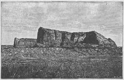
WINGATE CLIFF.
United States, for they are still found here in great numbers. San Francisco Peak is the highest of these volcanic mountains, and about it are grouped in an irregular way many volcanic cones, one of which presents some remarkable characteristics. A portion of the cone is of bright reddish cinders, while the adjacent rocks are of black basalt. The contrast in the colors is so great that on viewing the mountain from a distance the red cinders seem to be on fire. From this circumstance the cone has been named Sunset Peak. When distant from it ten or twenty miles it is hard to believe that the effect is produced by contrasting colors, for the peak seems to glow with a light of its own.
In centuries past the San Francisco Plateau was the home of pueblo-building tribes, and the ruins of their habitations are widely scattered over this elevated region. Thousands of little dwellings are found, usually built of blocks of basalt. In some cases they were clustered in little towns, and three of these deserve further mention.
MESAS AND BUTTES.
A few miles south of San Francisco Peak there is an intermittent stream known as Walnut Creek. This stream runs in a deep gorge 600 to 800 feet below the general surface. The stream has cut its way through the limestone and through series of sandstones, and bold walls of rock are presented on either side. In some places the softer sandstones lying between the harder limestones and sandstones have yielded to weathering agencies, so that there are caves running along the face of the wall, sometimes for hundreds or thousands of feet, but not very deep. These natural shelves in the rock were utilized by an ancient tribe of Indians for their homes. They built stairways to the waters below and to the hunting grounds above, and lived in the caves. They walled the fronts of the caves with rock, which they covered with plaster, and divided them into compartments or rooms; and now many hundreds of these dwellings are found. Such is the cliff village of
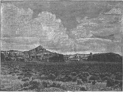
PYRAMID BUTTE NEAR FORT WINGATE.
Walnut Canyon. In the ruins of these cliff houses mortars and pestles are found in great profusion, and when first discovered many articles of pottery were found, and still many potsherds are seen. The people were
CANYONS OF THE COLORADO.
very skillful in the manufacture of stone implements, especially spears, knives, and arrows.
East of San Francisco Peak there is another low volcanic cone, composed of ashes which have been slightly cemented by the processes of time, but which can be worked with great ease. On this cone another tribe of Indians made its village, and for the purpose they sunk shafts into the easily worked but partially consolidated ashes, and after penetrating from the surface three or four feet they enlarged the chambers so as to make them ten or twelve feet in diameter. In such a chamber they made a little fireplace, its chimney running up on one side of the
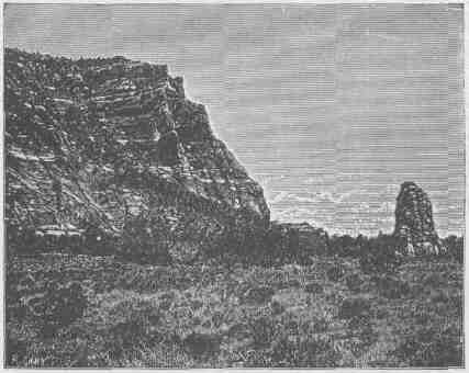
ZUÑI CLIFFS.
wellhole by which the chamber was entered. Often they excavated smaller chambers connected with the larger, so that sometimes two, three, four, or even five smaller connecting chambers are grouped about a large central room. The arts of these people resembled those of the people who dwelt in Walnut Canyon. One thing more is worthy of special notice. On the very top of the cone they cleared off a space for a courtyard, or assembly square, and about it they erected booths, and
MESAS AND BUTTES.
within the square a space of ground was prepared with a smooth floor, on which they performed the ceremonies of their religion and danced to the gods in prayer and praise.
Some twelve or fifteen miles farther east, in another volcanic cone, a rough crater is found, surrounded by piles of cinders and angular
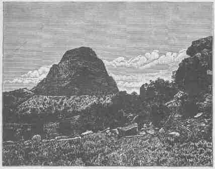
GREAT NECK NINE MILES SOUTH OF SALAZAR.
fragments of lava. In the walls of this crater many caves are found, and here again a village was established, the caves in the scoria being utilized as habitations of men. These little caves were fashioned into rooms of more symmetry and convenience than originally found, and the openings to the caves were walled. Nor did these people neglect the gods, for in this crater town, as in the cinder-cone town, a place of worship was prepared.
Many other caves opening into the canyon and craters of this plateau were utilized in like manner as homes for tribal people, and in one cave far to the south a fine collection of several hundred pieces of pottery has been made.
CANYONS OF THE COLORADO.
On the northeast of the San Francisco Plateau is the valley of the Little Colorado, a tributary of the Colorado River. This river is formed by streams that head chiefly on the San Francisco Plateau, but in part on the Zuñi Plateau. The Little Colorado is a marvelous river. In seasons of great rains it is a broad but shallow torrent of mud; in seasons of drought it dwindles and sometimes entirely disappears along portions of its course. The upper tributaries usually run in beautiful box canyons. Then the river flows through a low, desolate, bad-land valley, and the river of mud is broad but shallow, except in seasons of great floods. But fifty miles or more above the junction of this stream with the Colorado River proper, it plunges into a canyon
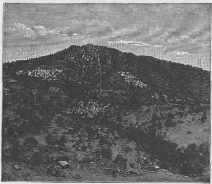
CINDER CONE AND NECK NORTHEAST OF GRANT STATION.
with limestone walls, and steadily this canyon increases in depth, until at the mouth of the stream it has walls more than 4,000 feet in height. The contrast between this canyon portion and the upper
MESAS AND BUTTES.
valley portion is very great. Above, the river ripples in a broad sheet of mud; below, it plunges with violence over great cataracts and rapids. Above, the bad lands stretch on either hand. This is
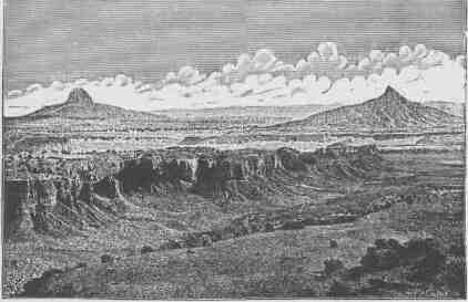
TWO LARGE NECKS, THE MORE DISTANT ONE BEING THE CABAZON. MESAS IN THE FOREGROUND.
the region of the Painted Desert, for the marls and soft rocks of which the hills are composed are of many colors--chocolate, red, vermilion, pink, buff, and gray; and the naked hills are carved in fantastic forms. Passing to the region below, suddenly the channel is narrowed and tumbles down into a deep, solemn gorge with towering limestone cliffs.
All round the margin of the valley of the Little Colorado, on the side next to the Zuñi Plateau and on the side next to the San Francisco Plateau, every creek and every brook runs in a beautiful canyon. Then down in the valley there are stretches of desert covered with sage and grease wood. Still farther down we come to the bad lands of the Painted Desert; and scattered through the entire region low mesas or smaller plateaus are everywhere found.
On the northeast side of the Little Colorado a great mesa country stretches far to the northward. These mesas are but minor plateaus that are separated by canyons and canyon valleys, and sometimes by
CANYONS OF THE COLORADO.
low sage plains. They rise from a few hundred to 2,000 or 3,000 feet above the lowlands on which they are founded. The distinction between plateaus and mesas is vague; in fact, in local usage the term mesa is usually applied to all of these tables which do not carry volcanic moun-
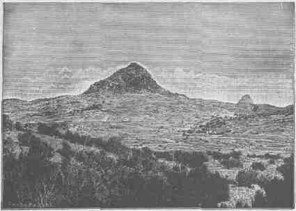
NECK SIX MILES NORTHEAST OF JUANTAFOYA.
tains. The mesas are carved out of platforms of horizontal or nearly horizontal rocks by perennial or intermittent streams, and as the climate is exceedingly arid most of the streams flow only during seasons of rain, and for the greater part of the year they are dry arroyos. Many of the longer channels are dry for long periods. Some of them are opened only by floods that come ten or twenty years apart.
The region is also characterized by many buttes. These are plateaus or mesas of still smaller dimensions in horizontal distance, though their altitude may be hundreds or thousands of feet. Like the mesas and plateaus, they sometimes form very conspicuous features of a landscape and are of marvelous beauty by reason of their sculptured escarpments. Below they are often buttressed on a magnificent scale. Softer beds give rise to a vertical structure of buttresses and columns, while the harder strata appear in great horizontal lines, suggesting
MESAS AND BUTTES.
architectural entablature. Then the strata of which these buttes are composed are of many vivid colors; so color and form unite in producing architectural effects, and the buttes often appear like Cyclopean temples.
There is yet one other peculiarity of this landscape deserving mention here. Before the present valleys and canyons were carved and the mesas lifted in relief, the region was one of great volcanic activity. In various places vents were formed and floods of lava poured in sheets over the land. Then for a time volcanic action ceased, and rains and rivers carved out the valleys and left the mesas and mountains standing. These same agencies carried away the lava beds that spread over the lands. But wherever there was a lava vent it was filled with molten matter, which on cooling was harder than the sandstones and marls through which it penetrated. The chimney to the region of fire below was thus filled with a black rock which yielded more
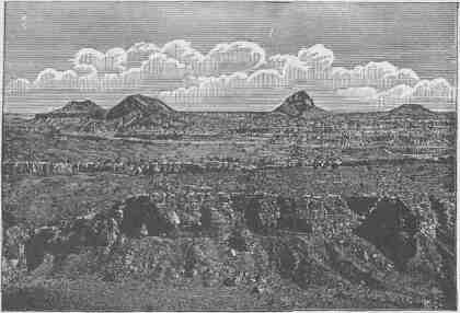
A GROUP OF NECKS NEAR MOUNT TAYLOR.
slowly to the disintegrating agencies of weather, and so black rocks rise up from mesas on every hand. These are known as volcanic necks, and, being of a somber color, in great contrast with the vividly colored rocks from which they rise and by which they are surrounded, they
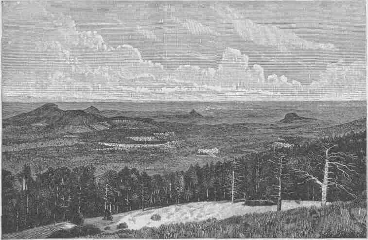
PANORAMA FROM THE EDGE OF MOUNT TAYLOR MESA.
MESAS AND BUTTES.
lend a strange aspect to the landscape. Besides these necks, there are a few volcanic mountains that tower over all the landscape and gather about themselves the clouds of heaven. Mount Taylor, which stands over the divide on the drainage of the Rio Grande del Norte, is one of the most imposing of the dead volcanoes of this region. Still later eruptions of lava are found here and there, and in the present valleys and canyons sheets of black basalt are often found. These are known as coulees, and sometimes from these coulees cinder cones arise.
This valley of the Little Colorado is also the site of many ruins, and the villages or towns found in such profusion were of mueh larger size than those on the San Francisco Plateau. Some of the pueblo-building peoples yet remain. The Zuñi Indians still occupy their homes, and they prove to be a most interesting people. They have cultivated the soil from time immemorial. They build their houses of stone and line them with plaster; and they have many interesting arts, being skilled potters and deft weavers. The seasons are about equally divided between labor, worship, and play.
A hundred miles to the northwest of the Zuñí pueblo are the seven pueblos of Tusayan: Oraibi, Shumopavi, Shupaulovi, Mashongnavi, Sichumovi, Walpi, and llano. These towns are built on high cliffs. The people speak a language radically different from that of the Zuñi, but, with the exception of that of the inhabitants of Hano, closely allied to that of the Utes. The people of Hano are Tewans, whose ancestors moved from the Rio Grande to Tusayan during the great Pueblo revolt against Spanish authority in 1680-96.
Between the Little Colorado and the Rio San Juan there is a vast system of plateaus, mesas, and buttes, volcanic mountains, volcanic cones, and volcanic cinder cones. Some of the plateaus are forest-clad and have perennial waters and are gemmed with lakelets. The mesas are sometimes treeless, but are often covered with low, straggling, gnarled cedars and pifions, trees that are intermediate in size between the bushes of sage in the desert and the forest trees of the elevated regions. On the western margin of this district the great Navajo Mountain stands, on the brink of Glen Canyon, and from its summit many of the stupendous gorges of the Colorado River can be seen. Central in the region stand the Carrizo Mountains, the Lukachukai
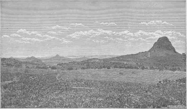
PANORAMA IN THE VALLEY OF THE PUERCO.
MESAS AND BUTTES.
Mountains, the Tunitcha Mountains, and the Chusca Mountains, which in fact constitute one system, extending from north to south in the order named. These are really plateaus crowned with volcanic peaks.
But the district we are now describing, which stretches from the Little Colorado to the San Juan, is best characterized by its canyons. The whole region is a labyrinth of gorges. On the west the Navajo Creek and its tributaries run in profound chasms. Farther south the Moencopie with its tributaries is a labyrinth of gorges; and all the streams that run west into the Colorado, south into the Little Colorado, or north into the San Juan have carved deep, wild, and romantic gorges. Immediately west of the Chusca Plateau the Canyon del Muerta and the Canyon de Chelly are especially noticeable. Many of these canyons are carved in a homogeneous red sandstone, and their walls are often vertical for hundreds of feet. Sometimes the canyons widen into narrow valleys, which are thus walled by impassable cliffs, except where lateral canyons cut their way through the battlements.
In these mountains, plateaus, mesas, and canyons the Navajo Indians have their home. The Navajos are intruders in this country. They belong to the Athapascan stock of British America and speak an Athapascan language, like the Apaches of the Sierra Madre country. They are a stately, athletic, and bold people. While yet this country was a part of Mexico they acquired great herds of horses and flocks of sheep, and lived in opulence compared with many of the other tribes of North America. After the acquisition of this territory by the United States they became disaffected by reason of encroaching civilization, and the petty wars between United States troops and the Navajos were in the main disastrous to our forces, due in part to the courage, skill, and superior numbers of the Navajos and in part to the character of the country, which is easily defended, as the routes of travel along the canyons present excellent opportunities for defense and ambuscade. But under the leadership and by the advice of Kit Carson these Indians were ultimately conquered. This wily but brave frontiersman recommended a new method of warfare, which was to destroy the herds and flocks of the Navajos; and this course was pursued. Regular troops with volunteers from California and New Mexico went into the Navajo country and shot down their herds of half-wild horses,
CANYONS OF THE COLORADO.
killed hundreds of thousands of sheep, cut down their peach orchards which were scattered about the springs and little streams, destroyed their irrigating works, and devastated their little patches of corn, squashes, and melons; and entirely neglected the Navajos themselves, who were concealed among the rocks of the canyons. Seeing the destruction wrought upon their means of livelihood, the Navajos at once yielded. More than 8,000 of them surrendered at one time, coming in in straggling bands. They were then removed far to the east, near to the Texas line, and established on a reservation at the Bosque Redondo. Here they engaged in civilized farming. A great system
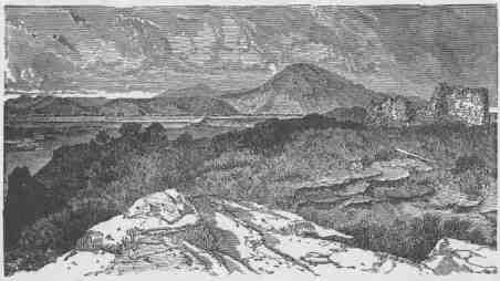
RUINS AT THE HEAD OF MCELMO CANYON.
of irrigation was developed; but the appropriations necessary for the maintenance of so large a body of people in the course of their passage from savagery to civilization seemed too great to those responsible for making grants from the national treasury, and just before 1870 the Navajos were permitted to break up their homes at the Bosque Redondo and return to the canyons and cliffs of their ancient land. Millions were spent in conquering them where thousands were used to civilize them, so that they were conquered but not civilized. Still, they are making good progress, and have once more acquired large flocks and herds. It is estimated that they now have more than a million sheep. Their experience in irrigation at the Bosque Redondo has
MESAS AND BUTTES.
not been wholly wasted, for they now cultivate the soil by methods of irrigation greatly improved over those used in the earlier time. Originally they dwelt in hogans, or houses made of poles arranged with much skill in conical form, the poles being covered with reeds and the reeds with earth; now they are copying the dwelling places of civilized men. They have also acquired great skill in the manufacture of silver ornaments, with which they decorate themselves and the trappings of their steeds.
Perhaps the most interesting ruins of America are found in this region. The ancient pueblos found here are of superior structure, but
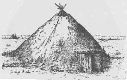
A NAVAJO HOGAN.
they were all built by a people whom the Navajos displaced when they migrated from the far North. Wherever there is water, near by an ancient ruin may be found; and these ruins are gathered about centers, the centers being larger pueblos and the scattered ruins representing single houses. The ancient people lived in villages, or pueblos, but during the growing season they scattered about by the springs and streams to cultivate the soil by irrigation, and wherever there was a little farm or garden patch, there was built a summer house of stone. When times of war came, especially when they were invaded by the Navajos, these ancient people left their homes in the pueblos and by the streams and constructed temporary homes in the cliffs and canyon
CANYONS OF THE COLORADO.
walls. Such cliff ruins are abundant throughout the region, intimately the ancient pueblo peoples succumbed to the prowess of the Navajos and were driven out. A part joined related tribes in the valley of the Bio Grande; others joined the Zuñi and the people of Tusayan; and stall others pushed on beyond the Little Colorado to the San Francisco Plateau and far down into the valley of the Gila.
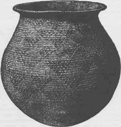
AN ANCIENT COILED VASE FROM TUSAYAN.
Farther to the east, on the border of the region which we have described, beyond the drainage of the Little Colorado and San Juan and within the drainage of the Rio Grande, there lies an interesting plateau region, which forms a part of the Plateau Province and which is worthy of description. This is the great Tewan Plateau, which carries several groups of mountains. The western edge of this plateau is known as the
MESAS AND BUTTES.
Nacimiento Mountain, a long north-and-south range of granite, which presents a bold facade to the valley of the Puerco on the west. Ascending to the summit of this granite range, there is presented to the eastward a plateau of vast proportions, which stretches far toward Santa Fe and is terminated by the canyon of the Rio Grande del Norte. The eastern flank of this range as it slowly rose was a gentle slope, but as it came up fissures were formed and volcanoes burst forth and poured out their floods of lava, and now many extinct volcanoes can be seen. The plateau was built by these volcanoes--sheets of lava piled on sheets of lava hundreds and even thousands of feet in thickness. But with the floods of lava came great explosions, like that of Krakatoa, by which the heavens were filled with volcanic dust. These explosions came at different times and at different places, but they were of enormous magnitude, and when the dust fell again from the clouds it piled up in beds scores and hundreds of feet in thickness. So the Tewan Plateau has a foundation of red sandstone; upon this are piled sheets of lava and sheets of dust in many alternating layers. It is estimated that there still remain more than two hundred cubic miles of this dust, now compacted into somewhat coherent rocks and interpolated between sheets of lava. Everywhere this dust-formed rock is exceedingly light. Much of it has a specific gravity so low that it will float on water. Above the sheets of lava and above the beds of volcanic dust great volcanic cones rise, and the whole upper region is covered with forests interspersed with beautiful prairies. The plateau itself is intersected with many deep, narrow canyons, having walls of lava, volcanic dust, or tufa, and red sandstone. It is a beautiful region. The low mesas on every side are almost treeless and are everywhere deserts, but the great Tewan Plateau is booned with abundant rains, and it is thus a region of forests and meadows, divided into blocks by deep, precipitous canyons and crowned with cones that rise to an altitude of from 10,000 to 12,000 feet.
For many centuries the Tewan Plateau, with its canyons below and its meadows and forests above, has been the home of tribes of Tewan Indians, who built pueblos, sometimes of the red sandstones in the canyons, but oftener of blocks of tufa, or volcanic dust. This light material can be worked with great ease, and with crude tools of the
CANYONS OF THE COLORADO.
harder lavas they cut out blocks of the tufa and with them built pueblos two or three stories high. The blocks are usually about twenty inches in length, eight inches in width, and six inches in thickness, though they vary somewhat in size. On the volcanic cones which dominate the country these people built shrines and worshiped their gods with offerings of meal and water and with prayer symbols made of the plumage of the birds of the air. When the Navajo invasion came, by which kindred tribes were displaced from the district farther west, these Tewan Indians left their pueblos on the plateau and their dwellings by the rivers below in the depths of the canyon and constructed cavate homes for themselves; that is, they excavated chambers in the cliffs where these cliffs were composed of soft, friable tufa. On the face of the cliff, hundreds of feet high and thousands of feet or even miles in length, they dug out chambers with stone tools, these chambers being little rooms eight or ten feet in diameter. Sometimes two or more such chambers connected. Then they constructed stairways in the soft rock, by which their cavate houses were reached; and in these rock shelters they lived during times
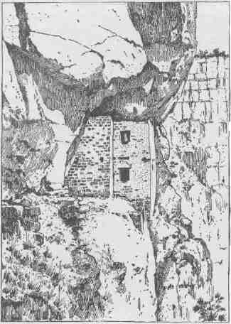
A TYPICAL CLIFF DWELLING.
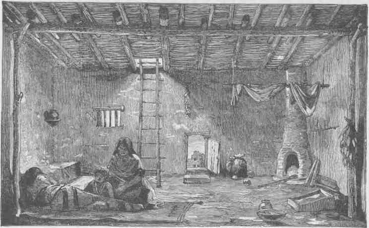
A ROOM IN A PUEBLO.
CANYONS OF THE COLORADO.
of war. When the Navajo invasion was long past, civilized men as Spanish adventurers entered this country from Mexico, and again the Tewan peoples left their homes on the mesas and by the canyons to find safety in the cavate dwellings of the cliffs; and now the archaeologist in the study of this country discovers these two periods of construction and occupation of the cavate dwellings of the Tewan Indians.
North of the Rio San Juan another vast plateau region is found, stretching to the Grand River. The mountains of this region are the La Plata Mountains, Bear River Mountains, and San Miguel Mountains on the east, and the Sierra El Late, the Sierra Abajo, and the Sierra La Sal on the west, the latter standing near the brink of Cataract Canyon, through which the Colorado flows immediately below the junction of the Grand and Green. Throughout the region mountains, volcanic cones, volcanic necks, and coulees are found, while the mountains themselves rise to great altitudes and are forest-clad. Some of the plateaus attain huge proportions, and between the plateaus labyrinthian mesas are found. Buttes, as stupendous cameos, are scattered everywhere, and the whole region is carved with canyons.
Grand River heads on the back of Long's Peak, in the Front Range of the Rocky Mountains of central Colorado. At the foot of the mountain lies Grand Lake, a sheet of emerald water that duplicates the forest standing on its brink. Out of the lake flows Grand River, gathering on
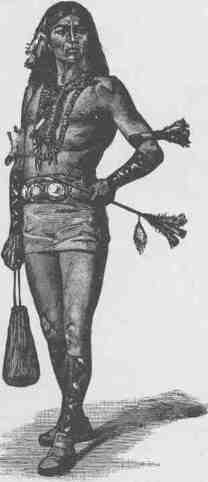
A NAVAJO READY FOR A JOURNEY.
MESAS AND BUTTES.
its way the many mountain streams whose waters fill the solitude with perennial music--a symphony of cascades. In Middle Park boiling springs issue from depths below and gather in pools covered with con-fervae. Leaving Middle Park the river goes through a great range known as the Gore's Pass Mountains; and still it flows on toward the Colorado, now through canyon and now through valley, until the last forty miles of its course it finds its way through a beautiful gorge known as Grand River Canyon. In its principal course this canyon is a bright red homogeneous sandstone, and the walls are often vertical and of great symmetry. Farther down, its walls are rugged and angular, being composed of limestones.
The principal tributaries from the south are the Blue, which heads in Mt. Lincoln, and the Gunnison, which heads in the Wasatch Mountains. These streams are also characterized by deep canyons and plateaus, and mesas abound on every hand. Between the Grand River and the White River, farther to the east, the Tavaputs Plateau is found. It begins at the foot of Gore's Pass Range and extends down between the rivers last mentioned to the very brink of Green River, which is in fact the upper Colorado. Between the Grand River and the
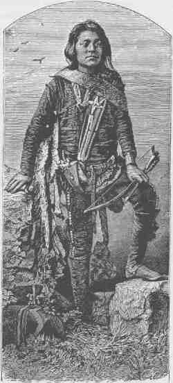
A NAVAJO BOY.
CANYONS OF THE COLORADO.
foot of this plateau there is a low, narrow valley with mesas and buttes. Then the country suddenly rises by a stupendous line of cliffs 2,000 or 3,000 feet high. These cliffs are composed of sand stones, limestones, and shales, of many colors. The stratification in many places is minute, so that they have been called the Book Cliffs.
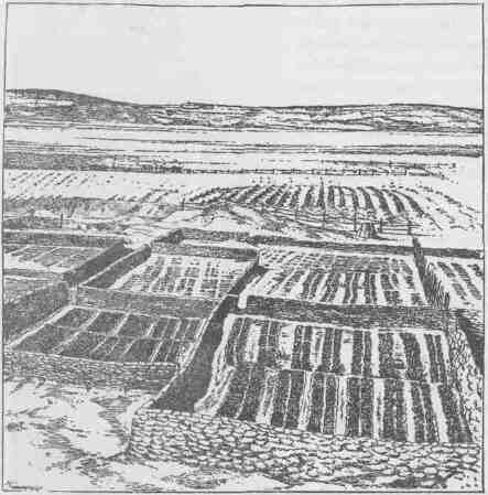
GARDENS OF ZUÑI.
From the cliffs many salients are projected into the valleys, and within deep re-entering angles vast amphitheaters appear. About the projected salients many towering buttes, with pinnacles and minarets, are found. The long, narrow plateau is covered with a forest along its summit, and, though it rises abruptly on the south side from Grand River Valley, it descends more gently toward the White River, and on
MESAS AND BUTTES.
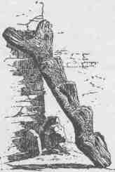
A TUSAYAN LADDER.
this slope many canyons of rare beauty are seen. Plateaus and mesas and canyons and buttes characterize the region north of White River and stretch out to the Yampa. The Yampa itself has an important tributary from the northwest, known as Snake River. Just below the affluence of the Snake with the Yampa a strange phenomenon is observed. Right athwart the course of the river rises a great dome-shaped mountain, with valley stretches on every side, and through this mountain the river runs, dividing it by a beautiful canyon, through which it flows to its junction with the Green. This canyon is in soft, white sandstone, usually with vertical walls varying from 500 to 2,000 feet in height, and the river flows in a gentle winding way through all this stretch. To the east of this plateau region, with its mesas and buttes and its volcanic mountains, stand the southern Rocky Mountains, or Park Mountains, a system of north-and-south ranges. These ranges are huge billows in the crust of the earth out of which mountains have been carved. The parks of Colorado are great valley basins enclosed by these ranges, and over their surfaces moss agates are scattered. The mountains are covered with dense forests and are rugged and wild. The higher peaks rise above the timber line and are naked gorges of rocks. In them the Platte and Arkansas rivers head and flow eastward to join the Missouri River. Here also heads the Rio Grande del Norte, which flows southward into the Gulf of Mexico, and still to the west head many streams which pour into the Colorado waters destined for the Gulf of California. Throughout all of this region drained by the Grand, White, and Yampa rivers, there are many beautiful parks. The great moun-
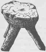
A ZUÑÍ STOOL.
CANYONS OF THE COLORADO.
tain slopes are still covered with primeval forests. Springs, brooks, rivers, and lakes abound, and the waters are filled with trout. Not many years ago the hills were covered with game--elk on the mountains, deer on the plateaus, antelope in the valleys, and beavers building their cities on the streams. The plateaus are covered with low, dwarf oaks and many shrubs bearing berries, and in the chaparral of this region cinnamon bears are still abundant.
From time immemorial the region drained by the Grand, White, and Yampa rivers has been the home of Ute tribes of the Shoshonean
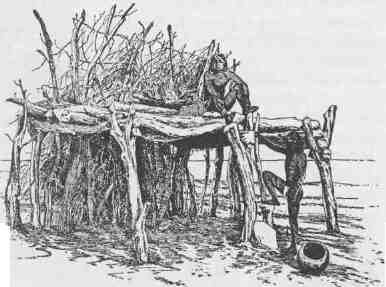
A TUSAYAN FIELD SHELTER.
family of Indians. These people built their shelters of boughs and bark, and to some extent lived in tents made of the skins of animals. They never cultivated the soil, but gathered wild seeds and roots and were famous hunters and fishermen. As the region abounds in game, these tribes have always been well clad in skins and furs. The men wore blouse, loincloth leggins, and moccasins, and the women dressed in short kilts. It is curious to notice the effect which the contact of civilization has had upon these women's dress. Even twenty years ago they had lengthened their skirts; and dresses, made of buckskin, fringed with furs, and beaded with elk teeth, were worn so long that they trailed
MESAS AND BUTTES.
on the ground. Neither men nor women wore any headdress except on festival occasions for decoration; then the women wore little basket bonnets decorated with feathers, and the men wore headdresses made of the skins of ducks, geese, eagles, and other large birds. Sometimes they would prepare the skin of the head of the elk or deer, or of a bear or mountain lion or wolf, for a headdress. For very cold weather both men and women were provided with togas for their protection. Sometimes the men would have a bearskin or elkskin for a toga; more
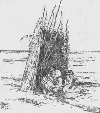
ANOTHER TUSAYAN FIELD SHELTER.
often they made their togas by piecing together the skins of wolves, mountain lions, wolverines, wild cats, beavers, and otters. The women sometimes made theirs of fawnskins, but rabbitskin r,obes were far more common. These rabbitskins were tanned with the fur on, and cut into strips; then cords were made of the fiber of wild flax or yucca plants, and round these cords the strips of rabbitskin were rolled, so that they made long ropes of rabbitskin coils with a central cord of vegetal fiber; then these coils were woven in parallel strings with cross
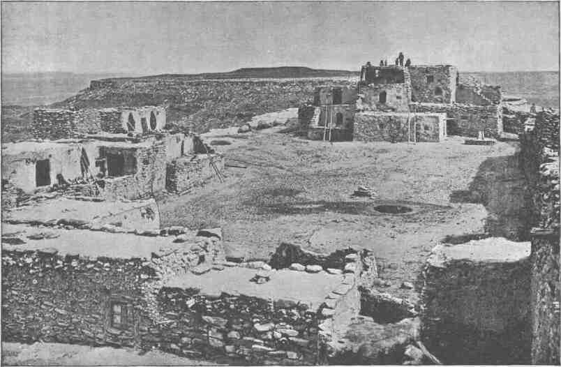
VIEW OF HANO, ONE OF THE SEVEN PUEBLOS OF TUSAYAN.
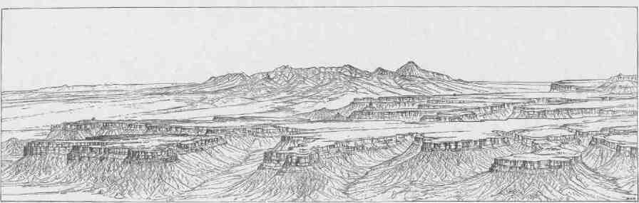
MESA VERDE.
MESAS AND BUTTES.
strands of fiber. The robe when finished was usually about five or six feet square, and it made a good toga for a cold day and a warm blanket for the night.
The Ute Indians, like all the Indians of North America, have a wealth of mythic stories. The heroes of these stories are the beasts, birds, and reptiles of the region, and the themes of the stories are the doings of these mythic beasts--the ancients from whom the present animals have descended and degenerated. The primeval animals were wonderful beings, as related in the lore of the Utes. They were the creators and controllers of all the phenomena of nature known to these simple-minded people. The Utes are zootheists. Each little tribe has its Shaman, or medicine man, who is historian, priest, and doctor. The lore of this Shaman is composed of mythic tales of ancient animals. The Indians are very skillful actors, and they represent the parts of beasts or reptiles, wearing masks and imitating the ancient zoic gods. In temples walled with gloom of night and illumed by torch fires the people gather about their Shaman, who tells and acts the stories of creation recorded in their traditional bible. When fever prostrates one of the tribe the Shaman gathers the actors about the stricken man, and with weird dancing, wild ululation, and ecstatic exhortation the evil spirit is driven from the body. Then they have their ceremonies to pray for the forest fruits, for abundant game, for successful hunting, and for prosperity in war.
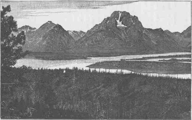
MOUNT MORAN, TETON RANGE, WYOMING.
CHAPTER III.
MOUNTAINS AND PLATEAUS.
GREEN RIVER has its source in Fremont's Peak, high up in the Wind River Mountains among glacial lakes and mountain cascades. This is the real source of the Colorado River, and it stands in strange contrast with the mouth of that stream where it pours into the Gulf of California. The general course of the river is from north to south and from great altitudes to the level of the sea. Thus it runs "from land of snow to land of sun." The Wind River Mountains constitute one of the most imposing ranges of the United States. Fremont's Peak, the culminating point, is 13,790 feet above the level of the sea. It stands in a wilderness of crags. Here at Fremont's Peak three great rivers have their sources: Wind River flows eastward into the Mississippi; Green River flows southward into the Colorado; and Gros Ventre River flows northwestward into the Columbia. From this dominating height many ranges can be seen on every hand. About the sources of the Platte and the Big Horn, that flow ultimately into the Gulf of Mexico, great ranges stand with their culminating peaks among the clouds; and the mountains that extend into Yellowstone Park, the land of geyser wonders, are seen. The Yellowstone Park is at the southern extremity of a great system of mountain ranges, the northern Rocky Mountains, sometimes called the Geyser Ranges. This geological province extends into British America, but its most wonderful scenery is in the upper Yellowstone basin, where geysers bombard the heavens with vapor distilled in subterranean depths. The springs which pour out their boiling waters are loaded with quartz, and the waters of the springs, flowing away over the rocks, slowly discharge their fluid magma, which crystallizes in beautiful forms and builds jeweled basins that hold pellucid waters.
CANYONS OF THE COLORADO.
To the north and west of Fremont's Peak are mountain ranges that give birth to rivers flowing into the great Columbia. Conspicuous among these from this point of view is the great Teton Range, with its towering facade of storm-carved rocks; then the Gros Ventre Mountains, the Snake River Range, the Wyoming Range, and, still beyond the latter, the Bear River Range, are seen. Far in the distant south, scarcely to be distinguished from the blue clouds on the horizon, stand the Uinta Mountains. On every hand are deep mountain gorges where snows accumulate to form glaciers. Below the glaciers throughout the entire Wind River Range great numbers of morainal lakes are found. These lakes are gems--deep sapphire waters fringed with emerald zones. From these lakes creeks and rivers flow, by cataracts and rapids, to form the Green. The mountain slopes below are covered with dense forests of pines and firs. The lakes are often fringed with beautiful aspens, and when the autumn winds come their golden leaves are carried over the landscape in clouds of resplendent sheen. The creeks descend from the mountains in wild rocky gorges, until they flow out into the valley. On the west side of the valley stand the Gros Ventre and the Wyoming mountains, low ranges of peaks, but picturesque in form and forest stretch. Leaving the mountain, the river meanders through the Green River Plains, a cold elevated district much like that of northern Norway, except that the humidity of Norway is replaced by the aridity of Wyoming. South of the plains the Big Sandy joins the Green from the east. South of the Big Sandy a long zone of sand-dunes stretches eastward. The western winds blowing up the valley drift these sands from hill to hill, so that the hills themselves are slowly journeying eastward on the wings of arid gales, and sand tempests may be encountered more terrible than storms of snow or hail. Here the northern boundary of the Plateau Province is found, for mesas and high table-lands are found on either side of the river.
On the east side of the Green, mesas and plateaus have irregular escarpments with points extending into the valleys, and between these points canyons come down that head in the highlands. Everywhere the escarpments are fringed with outlying buttes. Many portions of the region are characterized by bad lands. These are hills carved out of sandstone, shales, and easily disintegrated rocks, which present many
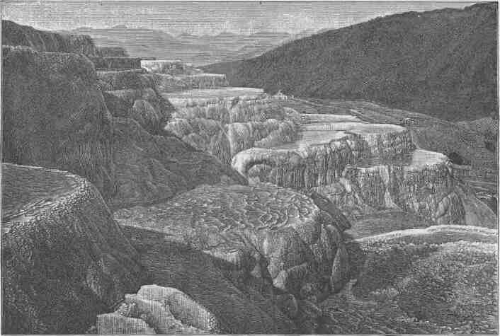
MARBLE BASINS, MAMMOTH HOT SPRINGS, YELLOWSTONE PARK.
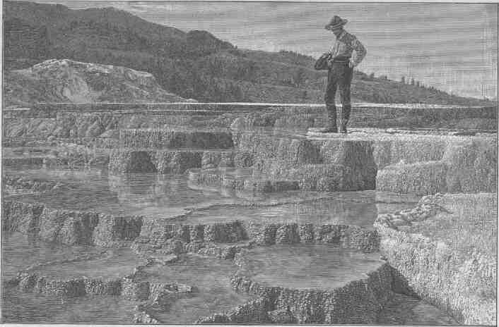
TERRACED BASINS, MAMMOTH HOT SPRINGS, YELLOWSTONE PABK.
MOUNTAINS AND PLATEAUS.
fantastic forms and are highly colored in a great variety of tint and tone, and everywhere they are naked of vegetation. Now and then low mountains crown the plateaus. Altogether it is a region of desolation. Through the midst of the country, from east to west, flows an intermittent stream known as Bitter Creek. In seasons of rain it carries floods; in seasons of drought it disappears in the sands, and its waters are alkaline and often poisonous. Stretches of bad-land desert are interrupted by other stretches of sage plain, and on the high lands gnarled and picturesque forests of juniper and piñón are found. On the west side of the river the mesas rise by grassy slopes to the westward into high plateaus that are forest-clad, first with juniper and piñon, and still higher with pines and firs. Some of the streams run in canyons and others have elevated valleys along their courses. On the south border of this mesa and plateau country are the Bridger Bad Lands, lying at the foot of the Uinta Mountains. These bad lands are of gray, green, and brown shales that are carved in picturesque forms--domes, towers, pinnacles, and minarets, and bold cliffs with deep alcoves; and all are naked rock, the sediments of an ancient lake. These lake beds are filled with fossils,--the preserved bones of fishes, reptiles, and mammals, of strange and often gigantic forms, no longer found living on the globe. It is a desert to the agriculturist, a mine to the paleontologist, and a paradise to the artist.
The region thus described, from Fremont's Peak to the Uinta Mountains, has been the home of tribes of Indians of the Shoshonean family from time immemorial. It is a great hunting and fishing region, and the vigorous Shoshones still obtain a part of their livelihood from mesa and plain and river and lake. The flesh of the animals killed in fall and winter was dried in the arid winds for summer use; the trout abounding in the streams and lakes were caught at all seasons of the year; and the seeds and fruits of harvest time were gathered and preserved for winter use. When the seeds were gathered they were winnowed by tossing them in trays so that the winds might carry away the chaff. Then they were roasted in the same trays. Burning coals and seeds were mixed in the basket trays and kept in motion by a tossing process which fanned the coals until the seeds were done; then they were separated from the coals by dexterous manipulation. Afterwards the seeds were ground on
CANYONS OF THE COLORADO.
mealing-stones and molded into cakes, often huge loaves, that were stored away for use in time of need. Raspberries, chokecherries, and buffalo berries are abundant, and these fruits were gathered and mixed with the bread. Such fruit cakes were great dainties among these people.
In this Shoshone land the long winter night is dedicated to worship and festival. About their camp fires scattered in forest glades by brooks and lakes, they assemble to dance and sing in honor of their gods--wonderful mythic animals, for they hold as divine the ancient of bears, the eagle of the lost centuries, the rattlesnake of primeval times, and a host of other zoic deities.
The Uinta Range stands across the course of Green River, which finds its way through it by series of stupendous canyons. The range has an east-and-west trend. The Wasatch Mountains, a long north-and-south range, here divide the Plateau Province from what is known among geologists as the Basin Range Province, on the west. The latter is the great interior basin whose waters run into salt lakes and sinks, there being no drainage to the sea. The Great Salt Lake is the most important of these interior bodies of water.
The Great Basin, which lies to the west of the Plateau Province, forms a part of the Basin Range Province. In past geological times it was the site of a vast system of lakes, but the climate has since changed and the water of most of these lakes has evaporated and the sediments of the old lake beds are now desert sands. The ancient lake shores are often represented by conspicuous terraces, each one marking a stage in the height of a dead lake. While these lakes existed the region was one of great volcanic activity and many eruptive mountains were formed. Some burst out beneath the waters; others were piled up on the dry land.
From the desert valleys below, the Wasatch Mountains rise abruptly and are crowned with craggy peaks. But on the east side of the mountains the descent to the plateau is comparatively slight. The Uinta Mountains are carved out of the great plateau which extends more than two hundred miles to the eastward of the summit of the Wasatch Range. Its mountain peaks are cameos, its upper valleys are meadows, its higher slopes are forest groves, and its streams run in deep, solemn, and majestic canyons. The snows never melt from its crowning heights, and an undying anthem is sung by its falling waters.
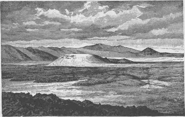
TABERNACLE CRATER AND LAVA BEDS OF THE BASIN PROVINCE.
VIEW ON GREAT SALT LAKE DESERT, SHOWING MOUNTAINS HALF BURIED BY LAKE SEDIMENTS.
MOUNTAINS AND PLATEAUS.
The Owiyukuts Plateau is situated at the northeastern end of the Uinta Mountains. It is a great integral block of the Uinta system. A beautiful creek heads in this plateau, near its center, and descends northward into the bad lands of Vermilion Creek, to which stream it is tributary. "Once upon a time" this creek, after descending from the plateau, turned east and then southward and found its way by a beautiful canyon into Brown's Park, where it joined the Green; but a great bend of the Vermilion, near the foot of the plateau, was gradually enlarged--the stream cutting away its banks--until it encroached upon the little valley of the creek born on the Owiyukuts Plateau. This encroachment continued until at last Vermilion Creek stole the Owiyukuts Creek and carried its waters away by its own channel. Then the canyon channel through which Owiyukuts Creek had previously run, no longer having a stream to flow through its deep gorge, gathered the waters of brooks flowing along its course into little lakelets, which are connected by a running stream only through seasons of great rainfall. These lakelets in the gorge of the dead creek are now favorite resorts of Ute Indians.
South of the Uinta Mountains is the Uinta River, a stream with many mountain tributaries, some heading in the Uinta Mountains, others in the Wasatch Mountains on the west, and still others in the western Tavaputs Plateau.
The Uinta Valley is the ancient and present home of the Uinta Indians, a tribe speaking the Uinta language of the Shoshonean family. Their habits, customs, institutions, and mythology are essentially the same as those of the Ute Indians of the Grand River country, already described. In this valley there are also found many ruins of ancient pueblo-building peoples--of what stock is not known.
The Tavaputs Plateau is one of the stupendous features of this country. On the west it merges into the Wasatch Mountains; on the north it descends by wooded slopes into the Uinta Valley. Its summit is forest-clad and among the forests are many beautiful parks. On the south it ends in a great escarpment which descends into Castle Valley. This southern escarpment presents one of the most wonderful facades of the world. It is from 2,000 to 4,000 feet high. The descent is not made by one bold step, for it is cut by canyons and cliffs. It is a zone several
CANYONS OF THE COLORADO.
miles in width which is a vast labyrinth of canyons, cliffs, buttes, pinnacles, minarets, and detached rocks of Cyclopean magnitude, the whole destitute of soil and vegetation, colored in many brilliant tones and tints, and carved in many weird forms,--a land of desolation, dedicated forever to the geologist and the artist, where civilization can find no resting-place.
Then comes Castle Valley, to describe which is to beggar language and pall imagination. On the north is the Tavaputs; on the west is the Wasatch Plateau, which lies to the south of the Wasatch Mountains and is here the west boundary of the Plateau Province; on the south are indescribable mesas and mountains; on the east is Grand River, a placid stream meandering through a valley of meadows. Within these boundaries there is a landscape of gigantic rock forms, interrupted here and there by bad-land hills, dominated with the towering cliffs of Tavaputs, the bold escarpment of the Wasatch Plateau, and the volcanic peaks of the Henry Mountains on the south. It is a vast forest of rock forms, and in its midst is San Rafael Swell, an elevation crowned with still more gigantic rock forms. Among the rocks pools and lakelets are found, and little streams run in canyons that seem like chasms cleft to nadir
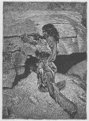
AN INDIAN HUNTER. ... ....
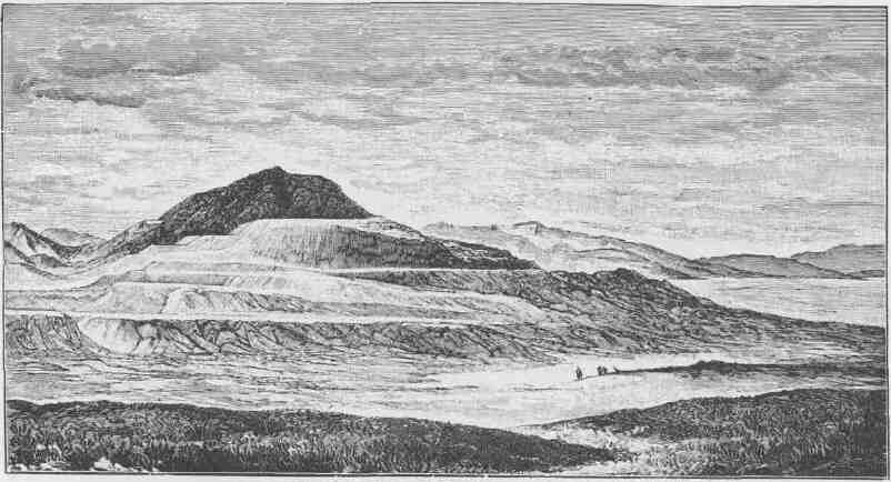
RESERVOIR BUTTE, SHOWING TERRACES OF THE ANCIENT LAKE BONNEVILLE SHORELINES.
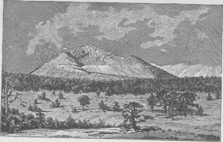
PAVANT BUTTE, OVER A SUBMARINE VOLCANO OF THE GREAT
BASIN.
MOUNTAINS AND PLATEAUS.
hell. San Rafael River and Fremont River drain this Castle land, heading in the Wasatch Plateau and flowing into the Grand River. Along these streams a few narrow canyon valleys are found, and in them Ute Indians make their winter homes. The bad lands are filled with agates, jaspers, and carnelians, which are gathered by the Indians and fashioned
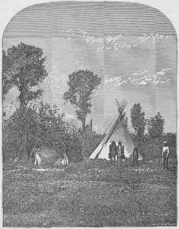
AN INDIAN CAMP.
into arrowheads and knives; along the foot of the canyon cliffs workshops can be discovered that have been occupied by generations from a time in the long past, and the chips of these workshops pave the valleys. South of the Wasatch Plateau we have the Fish Lake Plateau, the Awapa Plateau, and the Aquarius Plateau, which separate the waters flowing into the Great Basin from the waters of the Colorado, which
CANYONS OF THE COLORADO.
here constitute the boundary of the Plateau Province. Awapa is a Ute name signifying "Many waters."
All three of these plateaus are remarkable for the many lakelets found on them. To the east are the Henry Mountains, a group of volcanic domes that rise above the region. The rocks of the country
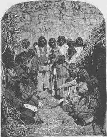
INDIANS GAMBLING.
are limestones, sandstones, and shales, originally lying in horizontal altitudes; but volcanic forces were generated under them and lavas boiled up. These lavas did not, however, come to the surface, but as they rose they lifted the sandstones, shales, and limestones, to a thickness of 2,000 or 3,000 feet or more, into great domes. Then the molten lavas cooled in great lenses of mountain magnitude, with the
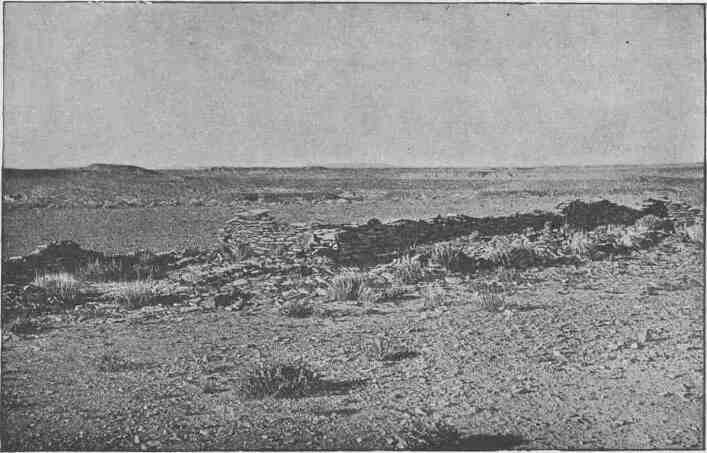
RUIN NEAR MOENKOPI.
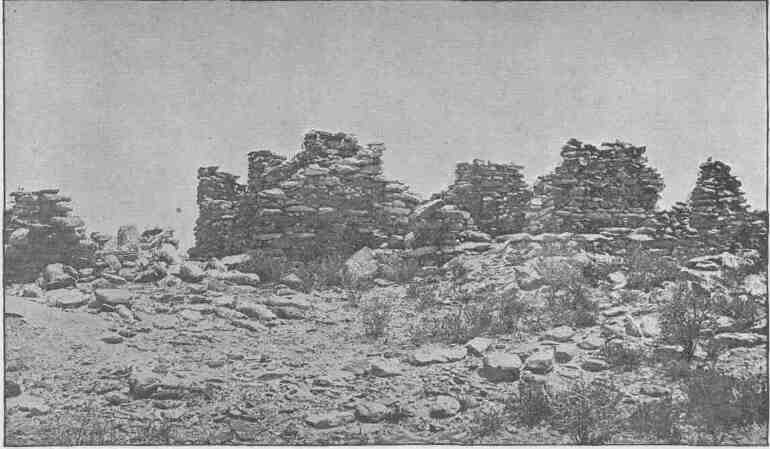
RUINS OF PAYUPKI, SIX MILES NORTHWEST OF MASHONGNAVI, TUSAYAN.
MOUNTAINS AND PLATEAUS.
sedimentary rocks domed above them. Then the clouds gathered over these domes and wept, and their tears were gathered in brooks, and the brooks carved canyons down the sides of the domes; and now in these deep clefts the structure of the mountains is revealed. The lenses of volcanic rocks by which the domes were upheaved are known as "laccolites," i. e., rock lakes.
Looking southwestward from the Henry Mountains the Circle Cliffs are seen. A great escarpment, several thousand feet in height and 70 or 80 miles in length, faces the mountain. It is the step to the long, narrow plateau. The streams that come down across these cliffs head in great symmetric amphitheaters, and when first seen from above they present a vast alignment of walled circles. The front of the cliffs, seen from below, is everywhere imposing. On the southwest the Escalante River holds its course. It heads in the Aquarius Plateau and flows into the Colorado. Its course, as well as that of all its many tributaries, is in deep box-canyons of homogeneous red sandstone, often with vertical walls that are broken by many beautiful alcoves and glens. Much of the region is of naked, smooth, red rock, but the alcoves and glens that break the canyon walls are the sites of perennial springs, about which patches of luxuriant verdure gather.
The Kaiparowits Plateau is an elevated table-land on the southwestern side of the Escalante River. It is long and narrow, extending from the northwest to the southeast approximately parallel with the Escalante. It rises above the red sandstone of the Escalante region from 2,000 to 4,000 feet by a front of storm-carved cliffs. From the southeastern extremity of this plateau, at an altitude of 7,500 feet, an instructive view is obtained. One of the great canyons of the Colorado River can be seen meandering its way through the red-rock landscape. In the distance, and to the north, the Henry Mountains are in view, and below, the canyons of the Escalante and the red-rock land are in sight. Across the Colorado are the canyons of the San Juan, and below the mouth of the San Juan is the great Navajo Mountain. Still to the south the Grand Canyon of the Colorado is in view, and in the west a vast mesa landscape is presented with its buttes and pinnacles. Still to the southward Paria River is seen heading in a plateau on the margin of the province and having a course a little east of south into the Colorado.
CANYONS OF THE COLORADO.
The region of country which has been thus described, from the Tava-puts Plateau to the Paria River, was the home of a few scattered Ute Indians, who lived in very small groups, and who hunted on the plateau, fished in the waters, and dwelt in the canyons. There was nominally but one tribe, but as the members of this tribe were in very small parties and separated by wide distances the tribal bonds were very weak and often unrecognized. The chief integrating agency was religion, for they worshiped the same gods and periodically joined in the same religious ceremonies and festivals. A country so destitute of animal and vegetal life would not support large numbers, and the few who dwelt here gained but a precarious and scant subsistence. To a large extent they lived on seeds and roots. The low, warm canyons furnished admirable shelter for the people, and their habitual costumes were loincloths, paints, and necklaces of tiny arrowheads made of the bright-colored agates and carnelians strung on snakeskins.
When the Mormon people encroached on this country from the west, and when the Navajos on the east surrendered to the United States, a few recalcitrant Navajos and the Utes of this region combined. They had long been more or less intimately associated, and a jargon speech had grown up by which they could communicate. Finally, the greater number of these Utes and renegade Navajos took up their homes permanently on the eastern bank of the Colorado River between the Grand and the San Juan rivers. The Navajos are the dominant race, yet they live on terms of practical equality and affiliate without feuds. These are the great Freebooters of the Plateau Province--the enemies of other tribes and of the white men. In their canyon fortresses they have been able to hold their ground in spite of their enemies on every hand.
Throughout the region and the plateaus by which it is surrounded and the mountains by which it is interrupted, everywhere ruins of pueblos and many cliff dwellings are found. None of these ancient pueblos are on a large scale. The houses were usually one or two stories high and the hamlets rarely provided shelter for more than two dozen people. Some of the houses are of rather superior architecture, having well-constructed walls with good geometric proportions. Their houses were plastered on the inside, and sometimes on the outside,
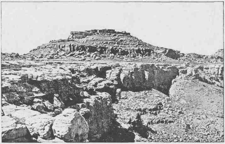
SHUPAULOVI.
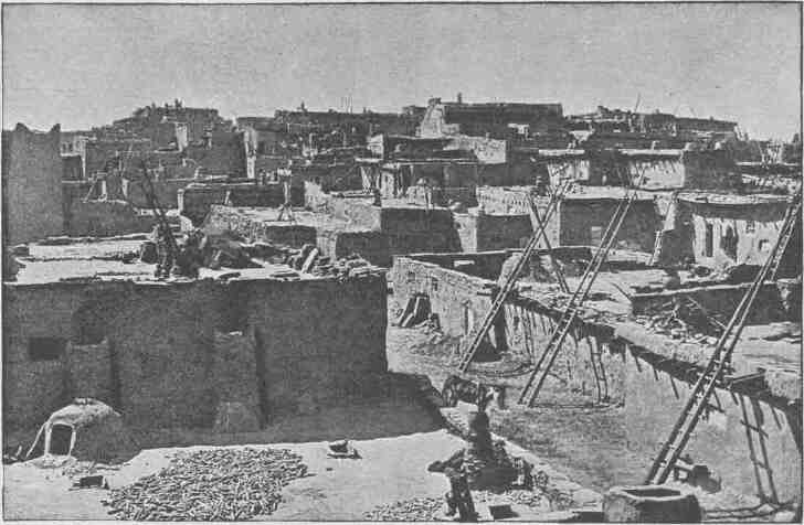
GENERAL VIEW OF ZUÑI, LOOKING WEST.
MOUNTAINS AND PLATEAUS.
and covered with flat roofs of sun-dried mud. The real home of the people in their waking hours was on their housetops.
The rocks of the mountain are etched with many picture-writings attesting the artistic skill of this people. The predominant form is the rattlesnake, which is found in the crevices of the rocks on every hand. It is inferred that the people worshiped the rattlesnake as one of their chief deities, a god who carried the spirit of death in his mouth.
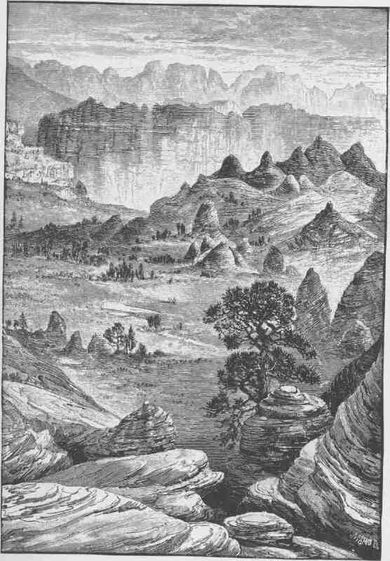
THE GRAY CLIFFS.
CHAPTER IV.
CLIFFS AND TERRACES.
THERE is a great group of table-lands constituting a geographic unit which have been named the Terrace Plateaus. They ex-tend from the Paria and Colorado on the east to the Grand Wash and Pine Mountains on the west, and they are bounded on the south by the Grand Canyon of the Colorado, and on the north they divide the waters of the Colorado from the waters of the Sevier, which flows northward and then westward until it is lost in the sands of the Great Desert. It is an irregular system of great plateaus with subordinate mesas and buttes separated by lines of cliffs and dissected by canyons.
In this region all of the features which have been described as found in other portions of the province are grouped except only the cliffs of volcanic ashes, the volcanic cones, and the volcanic domes. The volcanic mountains, cinder cones, and coulees, the majestic plateaus and elaborate mesas, the sculptured buttes and canyon gorges, are all found here, but on a more stupendous scale. The volcanic mountains are higher, the cinder cones are larger, the coulees are more extensive and are often sheets of naked, black rock, the plateaus are more lofty, the cliffs are on a grander scale, the canyons are of profounder depth; and the Grand Canyon of the Colorado, the most stupendous gorge known on the globe, with a great river surging through it, bounds it on the south.
The east-and-west cliffs are escarpments of degradation, the north-and-south cliffs are, in the main, though not always, escarpments of displacement. Let us understand what this means. Over the entire region limestones, shales, and sandstones were deposited through long periods of geologic time to the thickness of many thousands of feet; then the country was upheaved and tilted toward the north; but the Colorado
CANYONS OF THE COLORADO.
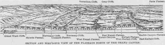
River was flowing when the tilting commenced, and the upheaval was very slow, so that the river cleared away the obstruction to its channel as fast as it was presented, and this is the Grand Canyon. The rocks above were carried away by rains and rivers, but not evenly all over the country; nor by washing out valleys and leaving hills, but by carving the country into terraces. The upper and later-formed rocks are found far to the north, their edges standing in cliffs; then still earlier rocks are found rising to the southward, until they terminate in cliffs; and then a third series rises to the southward and ends in cliffs, and finally a fourth series, the oldest rocks, terminating in the Grand Canyon wall, which is a line of cliffs. There are in a general way four great lines of cliffs extending from east to west across the district and presenting their faces, or escarpments, southward. If these cliffs are climbed it is found that each plateau or terrace dips gently to the northward until it meets with another line of cliffs, which must be ascended to reach the summit of another plateau. Place a book before you on a table with its front edge toward you, rest another book on the back of this, place a third on the back of the second, and in like manner a fourth on the third. Now the leaves of the books dip from you and the cut edges stand in tiny escarpments facing you. So the rock-formed leaves of
V
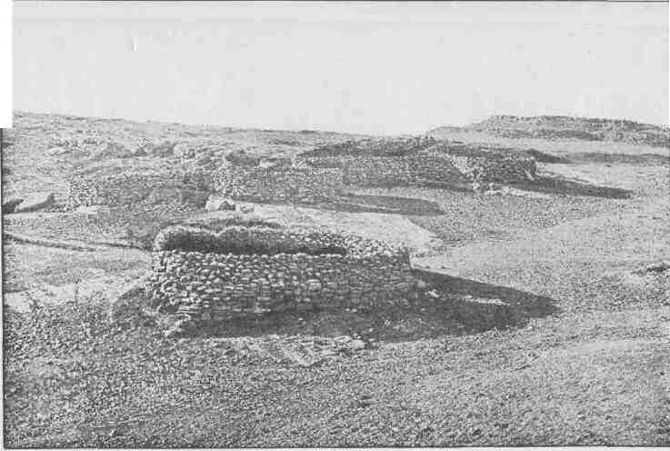
A GROUP OF STONE CORRALS.
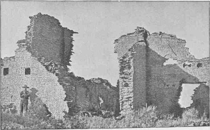
RUINS.
CLIFFS AND TERRACES.
these books of geology have the escarpment edges turned southward, while each book itself dips northward, and the crest of each plateau book is the summit of a line of cliffs. These cliffs of erosion have been described as running from east to west, but they diverge from that course in many ways. First, canyons run from north to south through them, and where these canyons are found deep angles occur; then sharp salients extend from the cliffs on the backs of the lower plateaus. Each great escarpment is made up more or less of minor terraces, or steps; and at the foot of each grand escarpment there is always a great talus, or sloping pile of rocks, and many marvelous buttes stand in front of the cliffs.
But these east-and-west cliffs and the plateaus which they form are divided by north-and-south lines in another manner. The country has been faulted along north-and-south lines or planes. These faults are breaks in the strata varying from 1,000 or 2,000 to 4,000 or 5,000 feet in verticality. On the very eastern margin the rocks are dropped down several thousand feet, or, which means the same thing, the rocks are upheaved on the west side; that is, the beds that were originally horizontal have been differentially displaced, so that on the west side of the fracture the strata are several thousand feet higher than they are on the east side of the fracture. The line of displacement is known as the Echo Cliff Fault. West of this about twenty-five miles, there is another fault with its throw to the east, the upheaved rocks being on the west. This fault varies from 1,500 to 2,500 feet in throw, and extends far to the northward. It is known as the East Kaibab Fault. Still going westward, another fault is found, known as the West Kaibab Fault. Here the throw is on the west side,--that is, the rocks are dropped down to the westward from 1,000 to 2,000 feet. This fault gradually becomes less to the northward and is flexed toward the east until it joins with the East Kaibab Fault. The block between the two faults is the Kaibab Plateau. Going westward from 60 to 70 miles, still another fault is found, known as the Hurricane Ledge Fault. The throw is again on the west side of the fracture and the rocks fall down some thousands of feet. This fault extends far northward into central Utah. To the west 25 or 30 miles is found a fault with the throw still on the west. It has a drop of several thousand feet and extends across the Rio Colorado far to
CANYONS OF THE COLORADO.
the southwest, probably beyond the Arizona-New Mexico line. It also extends far to the north, until it is buried and lost under the Pine Valley Mountains, which are of volcanic origin.
Now let us see what all this means. In order clearly to understand this explanation the reader is referred to the illustration designated "Section and Bird's-Eye View of the Plateaus North of the Grand Canyon." Starting at the Grand Wash on the west, the Grand Wash Cliffs, formed by the Grand Wash Fault, are scaled; and if we are but a few miles north of the Grand Canyon we are on the Shiwits Plateau. Its western boundary is the Grand Wash Cliffs, its southern boundary is the Grand Canyon, and its northern boundary is a line of cliffs of degradation, which will be described hereafter. Going eastward across the Shiwits Plateau the Hurricane Cliffs are reached, and climbing them we are on the Uinkaret Plateau, which is bounded on the south by the Grand Canyon and on the north by the Vermilion Cliffs, that rise above its northern foot. Still going eastward 30 or 40 miles to the brink of the Kanab Canyon, the West Kanab Plateau is crossed, which is bounded by the Toroweap Fault on the west, separating it from the Uinkaret Plateau, and by the Kanab Canyon on the east, with the Grand Canyon on the south and the Vermilion Cliffs on the north. Crossing the Kanab, we are on the East Kanab Plateau, which extends about 30 miles to the foot of the West Kaibab Cliffs, or the escarpment of the West Kaibab Fault. This canyon also has the Grand Canyon on the south and the Vermilion Cliffs on the north. Climbing the West Kaibab Fault, we are on the Kaibab Plateau. Now we have been climbing from west to east, and each ascent has been made at a line of cliffs. Crossing the Kaibab Plateau to the East Kaibab Cliffs; the country falls down once more to the top of Marble Canyon Plateau. Crossing this plateau to the eastward, we at last reach the Echo Cliff Fault, where the rocks fall down on the eastern side once more; but the surface of the country itself does not fall down--the later rocks still remain, and the general level of the country is preserved except in one feature of singular interest and beauty, to describe which a little further explanation is necessary.