XV. THE OLD BAY STATE. (continued 2)
Reading edition
The region beyond Lynn and Nahant is the famous Massachusetts "North Shore," stretching to the extremity of Cape Ann, a domain of villas and summer homes, pleasant sea-beaches, and brisk towns with interesting past history, now devoted largely to shoemaking and the fisheries. From Boston State House to the extremity of the Cape at Halibut Point, or the Land's End, is thirty-one miles, and Lucy Larcom thus attractively describes the route along the shore:
"You may ride in an hour or two, if you will, From Halibut Point to Beacon Hill, With the sea beside you all the way, Through pleasant places that skirt the bay; By Gloucester harbor and Beverley beach, Salem's old steeples, Nahant's long reach, Blue-bordered Swampscott, and Chelsea's wide Marshes laid bare to the drenching tide, With a glimpse of Saugus' spire in the west, And Malden Hills in their dreamy rest."
Saugus, Lynn, Nahant, Swampscott, Salem and Marblehead were originally the Indian domains of Saugus, Naumkeag and Massabequash. Beyond Lynn, most of the coast has undergone a modern evolution from fishery stations to smart summer resorts; and here, around the swamps and marshes, abounding crags protrude, with many fine villas in another fashionable Boston suburb, Swampscott, as populous and almost as famous as Nahant, with huge hotels down by the seaside. Swampscott merges into Clifton, and then an uneven backbone of granite covering about six square miles is thrust into the ocean in the direction of Cape Ann, and is hedged about with rocky islets. On one side this granite peninsula forms Salem harbor, while on the other a miniature haven is made by a craggy appendage to the southeastward, attached to the main peninsula by a ligature of sand and shingle. The quaint old town of Marblehead occupies most of the surface, and the appendage is the modern yachtsmen's headquarters, Marblehead Neck. This is a very ancient place, dating back to the early seventeenth century, and was once pre-eminently nautical and the second port in Massachusetts; but the sailors and fishermen are missing, excepting those who man the summer yacht fleets, and the people, like so many other Massachusetts communities, have gone largely into shoemaking, the big shoe-factories being scattered about. The crooked narrow streets run in all directions among and over the rocks, which appear everywhere and have gained the mastery. When George Whitefield, the preacher, visited Marblehead, he gazed in astonishment upon these superabundant rocks, and asked, in surprise, "Where do they bury their dead?" Out on the headland is the superannuated little Fort Sewall, once protecting the port and commanding both harbors, and though the walls are decaying, it is preserved as a memento of the past. Fine villas are all about, and the numerous islands add picturesqueness to the sea-view. Elbridge Gerry, of "Gerrymander" fame, was a native of Marblehead, and its hardy sailors formed most of the crew of the old ship "Constitution" when she fought and captured the "Guerriere," and afterwards the "Cyane" and "Levant." Marblehead was also the scene of "Skipper Ireson's Ride," which Whittier has made historic:
"Old Floyd Ireson, for his hard heart, Tarred and feathered and carried in a cart By the women of Marblehead!"
He had refused to take some of his townsmen off a drifting wreck, because it would cost too much to feed them on the way home.
SALEM AND THE WITCHES.
Westward of the Marblehead peninsula, there stretches into the mainland another noted haven of the olden time, Salem harbor, dividing it into two arms, the North and South Rivers, having between them the town, chiefly built upon a peninsula about two miles long. This was the Indian domain of Naumkeag, a name preserved in many titles there, and meaning the "Eel-Land." It was the mother-colony on Massachusetts Bay, the first house being built in 1626, and old John Endicott having got a grant from Plymouth for the colony, he came out and founded the town two years afterwards, calling it Salem, "from the peace which they had and hoped in it." But despite this peacefulness, the people soon developed warlike tendencies. They scourged Philip Ratcliffe, and cut off his ears and banished him soon after the founding, for "blasphemy against the First Church," and when the port had got well under way, an annual trade statement showed imports of $110,000 in arms and cannon, against $90,000 in everything else. The "First Church," formed in 1629, was the earliest church organization in New England, and it still exists. There were then ten houses in the town, besides the Governor's house, which the early history describes as "garnished with great ordnance;" adding, "thus we doubt not that God will be with us, and if God be with us, who can be against us?" John Winthrop was here as Governor, briefly, in 1630, soon migrating to Shawmut, to found Boston for the capital of the colony. After the Revolution, Salem was the leading seaport of New England; but its glory has departed, and the trade has gone to Boston. In 1785 it sent out the first American vessel that doubled the Cape of Good Hope, and during a half century afterwards it held almost a monopoly of the East India and China trade with the United States, having at one time fifty-four large ships thus engaged. The Salem ships also went to the Southern seas, Japan and Africa. This trade gave its people great wealth and influence, and it was said, about 1810, that a Salem merchant was then the largest shipowner in the world. But this has retired into the dim past, and now it is a restful city of about forty thousand people, its leading townsmen, the descendants of the merchants and captains, living in comfortable mansions surrounding the Common and along the quiet elm-shaded streets in the residential section. The rest of the population have gone into shoemaking and other manufactures.
George Peabody, the philanthropist, was the most noted citizen of Salem, born in the suburb of Danvers (since changed to Peabody) in 1795, and, dying in 1869, his remains rest in Harmony Grove Cemetery. In the Peabody Institute, which he founded in Danvers, is kept as a sacred relic Queen Victoria's portrait, her gift to him in recognition of his benefactions. General Putnam, Nathaniel Bowditch, William H. Prescott, the historian, W. W. Story, the sculptor, and Nathaniel Hawthorne, were natives of Salem. The East India Marine Hall is its most noted institution, a fine building filled with a remarkable Oriental collection, gathered in the many voyages made by Salem ships, and also having a valuable Natural History Museum, designed to show the development of animal life. In the Essex Institute are interesting historical paintings and relics, including the charter given by King Charles I. to the colony of Massachusetts Bay. Also, carefully kept near by, is the original "First Church," built in 1634 for the organization formed in 1629, and of which Roger Williams was the pastor before the Puritans banished him from the colony. When the enlarging congregation built a more spacious church, this quaint little house, with its high-pointed roof, diamond-paned windows and gallery, which is revered as the shrine of Salem, was removed to its present location. In Essex Street is also the old "Roger Williams House," a low-roofed structure with a little shop in front, his home for a brief period in 1635-36. This house has acquired additional fame as a relic of the witchcraft days, for in it was held the court trying some of the witches in 1692, who were afterwards taken to the gallows or Witch Hill, on the western verge of the town, to be put to death. The witchcraft delusion began in the Danvers suburb and soon overran most of New England, the prosecutions continuing more than a year. Nineteen proven witches were executed, while one, under the ancient English law, was pressed to death for standing mute when told to plead. Old Cotton Mather, the historian and pastor, was a leader in the movement against the witches.
The North Shore, beyond Salem Harbor, stretches far along the rock-bound coast of Cape Ann. Here all the old fishing towns have become modern villa-studded summer resorts, picturesque and attractive in their newer development. Beverley, Manchester-by-the-Sea and Magnolia all have grand headlands and fine beaches. Beverley also has shoe-factories, and is proud of the memory of Nathan Dane, the eminent jurist, who named Dane Hall, the Harvard Law School. Manchester has the "Singing Beach," where the white sand, when stirred, emits a musical sound. Magnolia, on a rocky bluff, is adjoined by the attractive Crescent Beach, and has around it very fine woodland. To the eastward is Rafe's Chasm, sixty feet deep and only a few feet wide, and off shore, almost opposite, is the bleak reef of Norman's Woe. Inland is Wenham Lake, near Beverley, noted for its ice supply, upon which all these places depend, while beyond, the Ipswich River comes down through the pleasant town of Ipswich, covering both banks with houses, and flowing into Ipswich Bay north of the peninsula of Cape Ann. To the westward is Andover, where the thrifty Puritan Fathers, having bought the domain from the Indians "for twenty-six dollars and sixty-four cents and a coat," established the noted Andover Theological Seminary of the Congregational Church, where its ablest divines have been taught in what has been called "the school of the prophets." Here, on "Andover Hill," abstruse theology has been the ruling influence and intense religious controversies have been waged, over three thousand clergymen having been graduated. Mrs. Harriet Beecher Stowe lived here after publishing Uncle Tom's Cabin, and is buried here. Elizabeth Stuart Phelps was born here, and wrote Gates Ajar in the venerable "Phelps House." The Seminary buildings, the local guidebook tells us, cause visitors to wonder "if orthodox angels have not lifted up old Harvard and Massachusetts Halls and carried them by night from Cambridge to Andover Hill." Ipswich, too, has a famous Seminary, but it is for the opposite sex. We are told that one reason for the popularity of Ipswich Female Seminary is that its location tends to softening the rigors of study, as this is the place "where Andover theological students are wont to take unto themselves wives of the daughters of the Puritans." The indented shore of Ipswich Bay was ancient Agawam, of which Captain John Smith, coasting along in 1614, recorded in his narrative that he saw "the many cornfields and delightful groves of Agawam." The fertile valley of Ipswich River is a veritable oasis among the rocks, moors and salt-marshes that environ it.
THE MERRIMACK RIVER.
Near the northern boundary of Massachusetts is the famous Merrimack River, flowing northeastward into the Atlantic, and noted for the enormous water-powers it provides for the various mill-towns that line its banks. It is a vigorous stream, having frequent waterfalls and carrying a powerful current, the name appropriately meaning "the swift water." Oliver Wendell Holmes writes of it in The School Boy:
"Do pilgrims find their way to Indian Ridge, Or journey onward to the far-off bridge, And bring to younger ears the story back Of the broad stream, the mighty Merrimack?"
The Merrimack drains the southern slopes of the White Mountains, and takes the outflow of Lake Winnipesaukee, a vast reservoir, the waters being regulated at its outlet to suit the wants of the mills below. It flows southward through New Hampshire into Massachusetts, turning northeast to the ocean. The river passes near Salisbury, where Daniel Webster was born in 1782; then, seventy-five miles northwest of Boston, comes to Concord, the capital of New Hampshire, which has a fine Capitol building and quarries of excellent granite; and eighteen miles below, it reaches Manchester, the chief city of New Hampshire, having sixty thousand people and many large mills owned by wealthy corporations. Here are the Amoskeag Falls (the Indian name meaning the "fishing-place"), the largest on the Merrimack, having fifty-five feet descent, and their water-power being utilized through two canals. The chief products are textile goods, locomotives and steam fire-engines. Eighteen miles farther southward the Nashua River comes up from the southwest, having passed the industrial town of Fitchburg on the way, and here at its confluence with the Merrimack is Nashua, another busy factory town. At Amherst, not far away, Horace Greeley was born in 1811. Crossing the boundary into Massachusetts, the river comes to the Pawtucket Falls, having thirty-two feet descent, and furnishing the water-power, twenty-six miles northwest of Boston, for the great mills of Lowell, the third city of Massachusetts, having a hundred thousand people, and spreading along the Merrimack at its confluence with Concord River, coming up from Concord Bridge of Revolutionary fame. The first mill was built at Lowell in 1823, and its industries have assumed a wide range and enormous output, though the operatives are nearly all French Canadians, and the language heard in this once Yankee mill-town is now mainly French. The Merrimack, having turned northeast, next comes to Lawrence, where it descends rapids of twenty-eight feet in the course of a half-mile. Here the Lawrence family, of which the noted Abbott Lawrence was the chief, established a town of cotton and woollen mills, utilizing the rapids by constructing a huge dam nine hundred feet long and thirty feet high, in 1845, at a cost of $250,000. Here are the great Pacific Mills, among the largest textile works in the world, and the city has over sixty thousand inhabitants. Nine miles farther down the river is Haverhill, another manufacturing town, with forty thousand people, largely engaged in shoemaking. The poet John G. Whittier was born in 1807 near Lake Kenoza, the scene of his Snowbound, on the northeastern verge of Haverhill.
Below Haverhill the Merrimack is a navigable, tidal stream, broadening into a spacious harbor at its mouth in the town of Newbury, where the "ancient sea-blown city" of Newburyport is built on the southern shore, while five miles to the westward, on the Pow-wow River, is Amesbury, long the home of Whittier, who died in 1892, after having celebrated this whole region in his poems. His house is maintained as a memorial. Newburyport long since turned its attention from commerce to making shoes and other manufactures, and it now has about eighteen thousand population. Its splendid High Street, upon the crest of the ridge, one of the noted tree-embowered highways of New England, stretches several miles parallel to the river, down towards the sea, bordered by the stately mansions of the olden time. The Merrimack sweeps grandly along in front of them with a broad curve to the ocean, three miles below. The Newburyport Marine Museum contains foreign curiosities brought home by the old-time sea captains, and the Public Library, endowed by George Peabody, occupies an impressive colonial mansion, which has been flavored by the entertainment of Generals Washington and Lafayette. The Old South Presbyterian Church has the body of the famous preacher George Whitefield, who died in Newburyport in 1770, interred in a vault under the pulpit. In a little wooden house behind this church, William Lloyd Garrison, the Abolitionist, was born in 1805. Caleb Cushing the jurist and John B. Gough the temperance lecturer lived in Newburyport; but its resident who probably achieved the greatest notoriety in his day was "Lord" Timothy Dexter, an eccentric merchant of the eighteenth century, who made a large fortune by singular ventures, among them shipping a cargo of warming-pans to the West Indies, where they were sold to the planters at a stiff profit for boiling sugar.
Whittier's home was on the Merrimack, and he has written for the river a noble invocation:
"Stream of my fathers! sweetly still The sunset rays thy valley fill; Poured slantwise down the long defile, Wave, wood, and spire beneath them smile. "Centuries ago, that harbor bar, Stretching its length of foam afar, And Salisbury's beach of shining sand, And yonder island's wave-smoothed strand, Saw the adventurer's tiny sail Flit, stooping from the eastern gale; And o'er these woods and waters broke The cheer from Britain's hearts of oak, As, brightly on the voyager's eye, Weary of forest, sea and sky, Breaking the dull continuous wood, The Merrimack rolled down his flood. "Home of my fathers! I have stood Where Hudson rolled his lordly flood: Seen sunrise rest and sunset fade Along his frowning Palisade; Looked down the Appalachian peak, On Juniata's silver streak; Have seen along his valley gleam The Mohawk's softly winding stream; The level light of sunset shine Through broad Potomac's hem of pine; And autumn's rainbow-tinted banner Hang lightly o'er the Susquehanna; Yet wheresoe'er his step might be, Thy wandering child looked back to thee: Heard in his dreams thy river's sound Of murmuring on its pebbly bound, The unforgotten swell and roar Of waves on thy familiar shore."
THE BRIDAL OF PENNACOOK.
It was in the valley of the Merrimack that Whittier located the scene of his famous poem, the "Bridal of Pennacook." This American epic tells—
"A story of the marriage of the chief Of Saugus to the dusky Weetamoo, Daughter of Passaconaway, who dwelt In the old time upon the Merrimack."
Winnepurkit was the son of Nanapashemet, or the New Moon, and was the Sagamore of Saugus, Naumkeag, and the adjoining domain. He was of noble blood and valor, and for his bride chose the daughter of Passaconaway, the great chief, ruling all the tribes in the Merrimack Valley, who lived at Pennacook, now Concord. Not only was Passaconaway a mighty chief, but he was also the greatest Powah or wizard of his time, the colonial annalists gravely telling that he could make trees dance, waters burn, and green leaves grow in winter, through his necromancy. When Winnepurkit married this wizard's daughter, great was the feasting at this "Bridal of Pennacook." Then Passaconaway caused a select party of warriors to escort his daughter to her husband's home at Saugus, where they received princely entertainment. Not long afterwards the bride expressed a wish to again see her father and her home at Pennacook, whereupon her husband sent her thither, escorted by a trusty band, who were graciously received and rewarded. After some time Weetamoo desired to return to Saugus, and her father sent word of this to his son-in-law by messengers, requesting that a suitable guard be provided to escort her down. But Winnepurkit liked not this method, and bade the messengers return with this reply, "That when his wife departed from him he caused his own men to wait upon her to her father's territories, as did become him; but now that she had an intent to return, it did become her father to send her back with a convoy of his own people, and that it stood not with Winnepurkit's reputation either to make himself or his men so servile as to fetch her again." This reply, as may be imagined, ruffled the old chief, and he sent a sharp answer "That his daughter's blood and birth deserved more respect than to be slighted in such a manner, and therefore, if Winnepurkit would have her company, he were best to send or come for her." Neither would yield the point of Indian etiquette, and the colonial narrator leaves it to be inferred that she then remained with her father, though it is supposed she subsequently rejoined her husband. The poet has made good use of the story, illustrating the scenery of the region with great felicity, but giving the tale a highly dramatic ending. Whittier makes the heart-broken bride, in her effort to return to her husband, launch her canoe upon the swollen Merrimack above the falls at Amoskeag when a spring freshet was bringing down masses of ice:
"Down the vexed centre of that rushing tide, The thick, huge ice-blocks threatening either side, The foam-white rocks of Amoskeag in view, With arrowy swiftness sped that light canoe. "Sick and aweary of her lonely life, Heedless of peril, the still faithful wife Had left her mother's grave, her father's door, To seek the wigwam of her chief once more! "Down the white rapids, like a sere leaf whirled, On the sharp rocks and piled-up ices hurled, Empty and broken, circled the canoe, In the vexed pool below—but where was Weetamoo?"
CAPE ANN.
Out in front of the region we have been describing projects the famous "ridge of rocks and roses," the gaunt headland of Cape Ann. This is a ponderous mass of hornblende granite, advanced forward twelve to fifteen miles into the ocean, with Thatcher's Island beyond, on which are the twin lighthouses that guard the mariner, forty-two miles north of the Highland Light on Cape Cod. The granite hills of the iron-bound headland are fringed with forests, while jagged reefs and rocky islets surround it, against which the sea beats in perpetual warfare. The surface is strewn with boulders, many of large size, and beds of the finest white sand are interspersed. The Indians called this promontory Wingaersheek, and when Captain John Smith came along he named it Cape Tragabizonda, in memory of a Moslem princess who had befriended him when a prisoner in Constantinople, also calling three small islands off the cape the "Three Turks' Heads." But King Charles I. would have none of this, however, and called the headland Cape Ann, after his royal mother, and thus it has remained. The haven on the southern side, Gloucester harbor, was early sought as a fishing station, being known in 1624, and it received its name in 1642, most of the early settlers coming from Gloucester in England. Champlain found it a safe harbor when in peril, and writes of it as "Le Beau Port." In August, 1892, this famous fishery port celebrated its two hundred and fiftieth anniversary with great fervor.
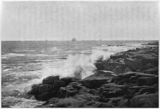
Along the Shore, Cape Anne, Gloucester, Mass.
The prosperity of Gloucester has come from the fisheries, it being the greatest cod and mackerel port in America, and having the most extensive fleet of fishing-boats in the world, exceeding six hundred, employing over six thousand men. The population approximates thirty thousand, and it is said their earnings on the fishery product are over $4,000,000 annually. The earliest form of the Cape Ann fishing-smack was known as the "Chebacco," two-masted, cat-rigged, and of ten or twelve tons, made sharp at both ends, and getting the name from the first place of building, Chebacco Parish, in Ipswich, adjoining the Cape. From this was developed the popular American build of vessel known as the schooner, the first one being launched at Gloucester in 1713. After sliding down the launching-ways, she so gracefully glided out upon the water that a bystander exclaimed in admiration, "See how she schoons!" and thus was she unexpectedly named, for a "schooner" has that style of vessel been ever since called. Gloucester surrounds its spacious harbor as a broad crescent, having Ten Pound Island in front sentinelling the entrance to the inner haven, so named because that was the price said to have been paid the Indians for it. The deeply indented harbor opens towards the southwest, being protected from the ocean by the long peninsula of Eastern Point, having a fort and lighthouse on its extremity. Some seventy wharves jut out from the circular head of the bay, with granite hills rising behind, up which the town is terraced. Shipping of all kinds are scattered about, including large salt-laden ships, while fishermen and sailors wander through the streets and assemble around the docks, spinning yarns and preparing for fishing ventures out to the "Banks." The odd old town around the harbor has seen little change for years, but the newer portions are greatly improved, having many imposing buildings, including a fine City Hall. The numerous churches have gained for it the title of "Many-spired Gloucester," and no place could disclose more picturesque sea views.
But the fishery interest pervades the whole town, dwarfing everything else. The main street winds about the head of the harbor, bending with the sinuosities of the shore, and from it other streets, without much regularity, go down to the wharves. Fishing-boats are everywhere, with new ones building, and on most of the open spaces are "cod-flakes," or drying-places, where the fish are piled when first landed, preparatory to being cut up and packed in the extensive packing-houses adjoining the wharves. Here many hundreds are employed in preparing the fish for market, both men and women working. The best fish are either packed whole or cut into squares, so they may be pressed by machinery into what are known as "cod-bricks," one and two-pound bricks being put into forty-pound boxes for shipment. When packed whole, the best fish are known as "white clover," in this stage of what is called the fishery "haymaking." This fish-packing is an enormous industry, and the Gloucester product goes to all parts of the world. But the fishery has its sombre side; the vessels are small, rarely over one hundred tons, and the crews are numerous, so that wrecks and loss of life are frequent. Often a tremendous storm will destroy a whole fleet on the "Banks," with no tidings ever received; and scarcely a family exists in Gloucester or its neighborhood that has not lost a member at sea. Sometimes the badges of mourning are universal.
An enormous development of rocks and boulders is seen everywhere in and around Gloucester. The houses are built upon rocks, the sea beats against rocks; but though excellent building-material is here, the houses are mostly of wood throughout the whole Cape Ann district. There is almost universally an ocean outlook over a sea of deepest blue. The outer extremity of the harbor to the westward is a long granite ridge ending in the popular watering-place of Magnolia Point. Down on the Eastern Point, alongside its terminating lighthouse, is a curious granitic formation, the rocks reproducing an elderly dame with muffled form and apron, known as "Mother Ann," this rude image being locally regarded as representing, in the eternal granite, the lady who named the Cape, the royal mother of King Charles I. The white flashing light upon Ten Pound Island between them is said to have for one of its chief duties the guiding of the mariner past the treacherous reefs of Norman's Woe, just west of the harbor entrance, which Longfellow has immortalized in his poem The Wreck of the Hesperus. One "Goodman Norman" and his son were among the first settlers near there, and hence the name, but no record is found as to the "Woe" he may have had. Neither is it known that any wreck ever occurred on this famous reef. In the winter of 1839 a terrific storm caused many disasters around Cape Ann, and forty dead bodies, one being a woman lashed to a spar, were washed on the Gloucester shore. Longfellow read in a newspaper the story of these wrecks and the horrible details, one of the vessels being named the "Hesperus," and he somewhere saw a reference to "Norman's Woe." This name so impressed him that he determined to write a ballad on the wrecks. Late one night, as he sat by the fireside smoking his pipe, he conjured up the vivid scene and wrote the ballad. He retired to bed, but, as he relates, it was not to sleep; new thoughts crowded his mind, and he rose and added them to the ballad, and at three o'clock in the morning had finished his immortal poem. There was no such wreck at the place, but his genius has associated it with the iron-bound coast of Cape Ann, and Norman's Woe is a monument consecrated to one of America's greatest poets.
"It was the schooner Hesperus That sailed the wintry sea; And the skipper had taken his little daughter To bear him company. "And fast through the midnight dark and drear, Through the whistling sleet and snow, Like a sheeted ghost the vessel swept Towards the reef of Norman's Woe. "She struck where the white and fleecy waves Looked soft as carded wool, But the cruel rocks they gored her sides Like the horns of an angry bull. "Her rattling shrouds, all sheathed in ice, With the masts went by the board; Like a vessel of glass, she stove and sank, Ho! ho! the breakers roared! "At daybreak on the bleak sea-beach, A fisherman stood aghast, To see the form of a maiden fair, Lashed close to a drifting mast. "The salt sea was frozen on her breast, The salt tears in her eyes; And he saw her hair, like the brown sea-weed, On the billows fall and rise. "Such was the wreck of the Hesperus, In the midnight and the snow! Christ save us all from a death like this On the reef of Norman's Woe!"
THE LAND'S END.
The impressive scenery and bold picturesqueness all about attract many artists, who haunt the rocks and sea views of Cape Ann. The whole district is full of summer-homes, with flower-gardens and shrubbery amid the rocks and boulders, and the cliffs and ocean presenting an endless variety of changing scenery. The outer extremity of the Cape, long called Halibut Point, has been modernized into the Land's End, thus being rightly named as the termination of the great Massachusetts granite ridge, which falls away sharply into the sea. Upon the one hand Pigeon Cove, with its adjacent Sandy Bay, indents the rocky buttress, while upon the other side is Whale Cove. Just off the Land's End is the noted Thatcher's Island, low-lying on the sea, elongated, narrow and barren, with its tall twin lighthouses, and having nearby, in front of Whale Cove, the diminutive Milk Island. To the northward, off Pigeon Cove, is another barren rock surmounted by a lighthouse, Straitsmouth Island. These three outlying islands were the "Three Turks' Heads," as originally named by Captain John Smith. Thatcher's Island has about eighty acres of mainly gravelly surface strewn with boulders, being named from Anthony Thatcher's shipwreck there in 1635 in the most awful tempest known to colonial New England. Rockport is a town of quarries extended around Sandy Bay, protected by breakwaters, behind which vessels come to load stone almost alongside the quarry. Pigeon Cove is the port for shipping stone taken out of Pigeon Hill, where the granite ridge is humped up into a grand eminence. Lanesville, to the north, is another large exporter of paving-blocks and building-stone. Alongside is Folly Point, guarding Folly Cove, at the northeastern extremity of the Cape, and to the westward are the villages of Bay View and Annisquam, with more quarries, and having, not far away, flowing out to Ipswich Bay through a lovely valley in the very heart of the Cape, the attractive little Squam River. The people of Cape Ann outside of Gloucester are almost all quarrymen, their product, largely paving-blocks, being shipped to all the seaboard cities. So extensive is this trade that it is difficult to decide which now brings the district most profit, the granite or the fish. There is no doubt, however, that the greatest fame of this celebrated Cape comes from its fisheries and the venturesome men who make them so successful. Edmund Burke, in the British House of Commons, in 1774, thus spoke of these Massachusetts fishermen: "No sea but what is vexed by their fisheries; no climate that is not witness of their toils; neither the perseverance of Holland, nor the activity of France, nor the dexterous and firm sagacity of English enterprise, ever carried their most perilous mode of hardy industry to the extent to which it has been pursued by this recent people—a people who are yet in the gristle, and not yet hardened into manhood."
For three centuries, almost, this perilous trade has been carried on, and they are fully as daring and even more enterprising now than in the colonial days. Thus Whittier describes them:
"Wild are the waves which lash the reefs along St. George's Bank, Cold on the shore of Labrador the fog lies white and dank; Through storm and wave and blinding mist, stout are the hearts which man The fishing-smacks of Marblehead, the sea-boats of Cape Ann. "The cold North light and wintry sun glare on their icy forms Bent grimly o'er their straining lines, or wrestling with the storms; Free as the winds they drive before, rough as the waves they roam, They laugh to scorn the slaver's threat against their rocky home."