Note 1126 — Chapter X · THE ASTRONOMICAL GEOGRAPHY OF THE KNOWN WORLD
Reading edition
See J. K. Wright, op. cit., pp. 91–96, for discussion of the interpretation of these figures. In Figure 12 the circles show the relative positions of certain points in Europe as they actually are; the stars show them as given in the tables and referred to the meridian of Marseilles. It will readily be seen that the relative longitudes of all the points except London and Toledo are remarkably accurate when we consider the rough means of calculation at the disposal of twelfth- and thirteenth-century observers. London and Toledo are placed accurately in relation to each other though far astray in relation to Marseilles, probably as a result of a single initial error in the estimation of the number of degrees between the meridian of Toledo and that of some intermediate station (perhaps Marseilles) from which the positions of the remaining stations were calculated. The highly erroneous latitudes of Toulouse, Florence, and Naples are probably attributable to clerical errors. For a fuller discussion of this map see work cited, p. 95.
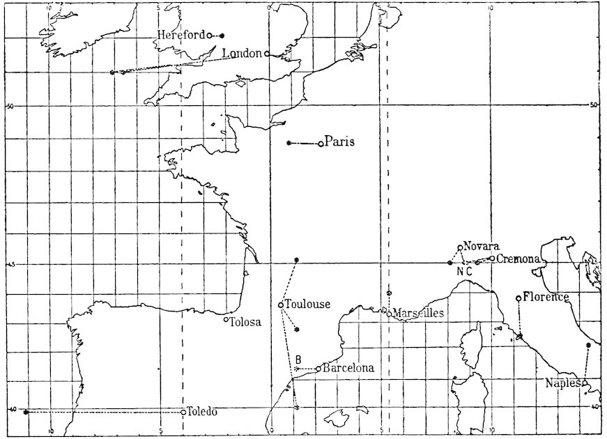
Fig. 12—Map showing the relative positions of certain points in Europe as indicated in astronomical tables of the twelfth and early thirteenth centuries. In the original tables a consistent error appears in the longitudes of all the cities in Italy. This has been corrected as discussed in the work cited in note 32 above.